Search Results for: troy pennsylvania

September 18, 2017 8 AM Update

Good morning. Still pretty foggy out but now we are up to 65 degrees on our way up to 82 degrees under ample sun. The dew point is expected to be quite sticky today so it really will feel like a mid July day. Cooler and possibly somewhat rainy and cloudy tomorrow but still above average temperatures around 72.

The sun will set at 6:58 pm with dusk around 7:26 pm, which is one minute and 47 seconds earlier than yesterday. At sunset, look for partly clear conditions and 79 degrees. The dew point will be 65 degrees. There will be a southeast breeze at 6 mph. Today will have 12 hours and 19 minutes of daytime, an decrease of 2 minutes and 51 seconds over yesterday.

Tonight will have a slight chance of showers after 4am. Mostly cloudy, with a low of 61 degrees at 5am. 11 degrees above normal. Maximum dew point of 65 at 6pm. Light southeast wind. Chance of precipitation is 20%. In 2016, we had mostly cloudy skies. It was sticky. It got down to 65 degrees. The record low of 32 occurred back in 1959.

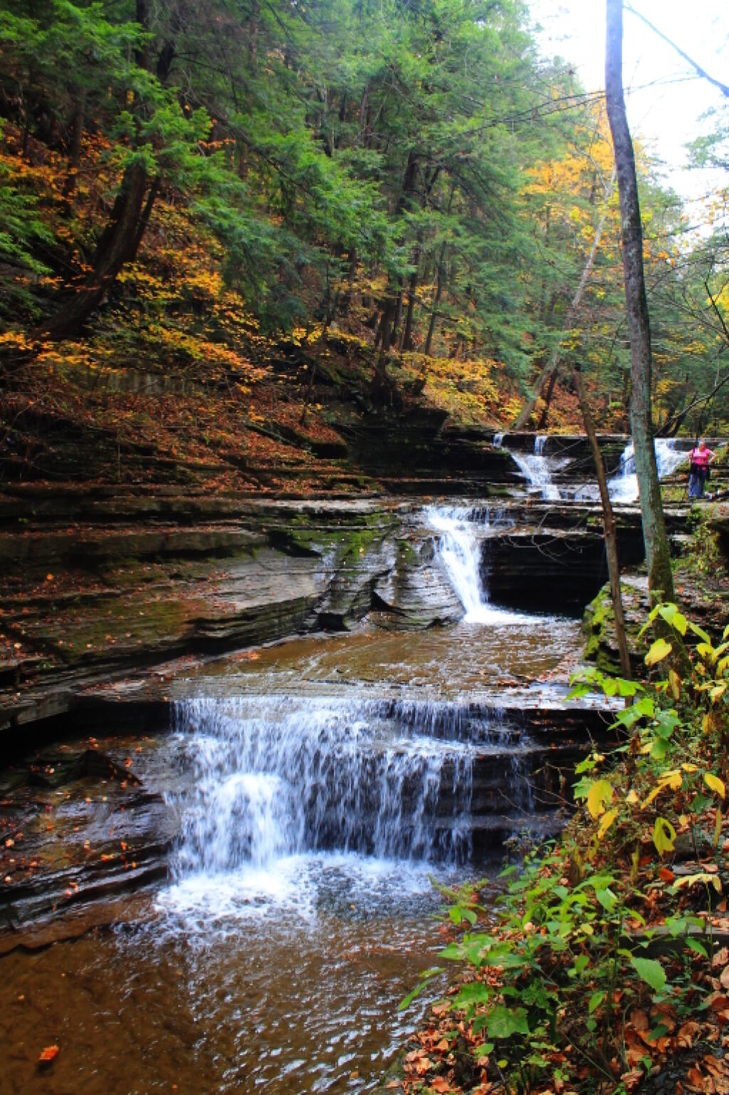
While Saturday I did not get locked through on Lock 17 — which admittedly is the biggest lock elevation wise on the Erie Canal — I did have a lot of fun paddling along the Mohawk River along the Moss Island and down the river a ways in search of the bridge foundation for the old bridge at Finks Basin along the river. I did find it it but first overlooked it because I was expecting more of a concrete foundation for the old bridge, not hand laid stone. But then again, the original bridge across the Mohawk River had to have been quite old, and I guess for the light traffic that the one lane bridge was expected to get it was decided a formal concrete foundation was not needed. Paddling along the Mohawk River there were some big carp that jumped up. Some had to have been two feet long, in the shallows of the river. I brought a fishing pole but I didn’t toss it in, partly because I doubt I could have caught any of them from a kayak with my 10 lb test on my fishing pole.

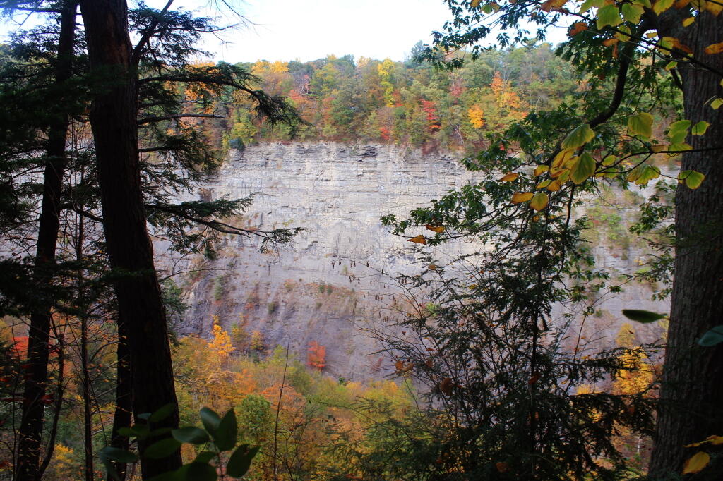
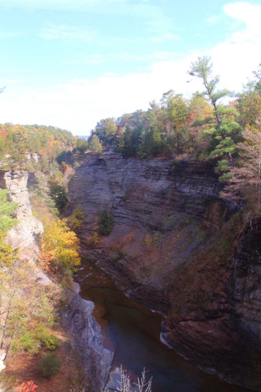
It’s really great that Moss Island was preserved and not used for a bridge abutment for the flyover ramp to the Thruway from Little Falls. What became the Thomas Wind Bridge really is quite a beautiful, graceful bridge, and it avoided damaging the natural history and geology of Moss Island. 45 years later, I think Moss Island has to be one of Little Falls’ greatest strengths, it’s protection made things like Canal Place possible. It draws rock climbers from across the region, to say those who are interested in the beauty of gracefully carved rocks. It apparently didn’t end up costing the city much more to build the bridge some 500 feet south of the original plan, and honestly, I think the bridge is straighter and probably less congested had it connected up exactly where the old river road is now, where the statute had originally required the Thruway Connection to terminate. It would have been tragic if the natural beauty of Moss Island had been destroyed. I’m really surprised the tourism bureau in Little Falls and Herkimer County don’t do more to promote this area. I guess more use would require further development of the facilities and designated trails for people to stay on, so the little known nature does make it a lot more wild.

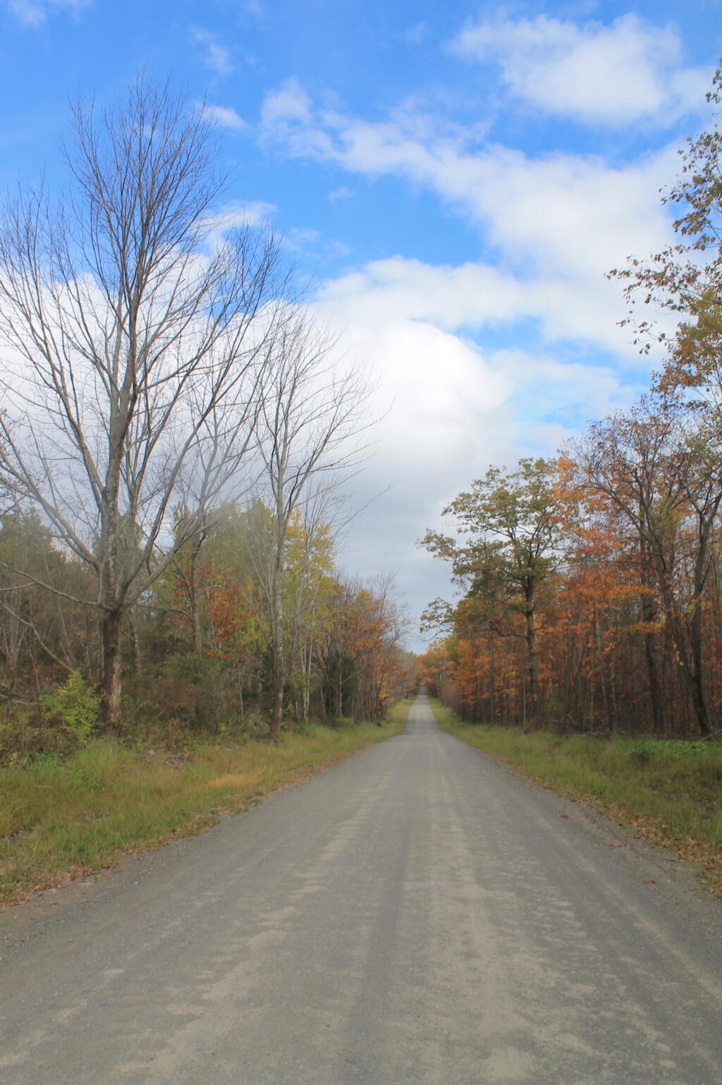
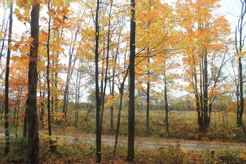
I was also struck by the beauty of the lands outside of Little Falls. You have the deep Mohawk Valley surrounded by the Adirondack Mountains and the Foothills. A lot of agriculture in the area just north of Little Falls, some amish, some conventional dairying, and a mix of rural households. Beautiful rolling country for sure. Lots of wind power too. Those big wind turbines not only generate renewable energy, but also jobs and revenue for farms that host them. I just love the beauty of the somewhat messy homesteads and farms, the junk people have in their yards, the rural freedom of not having a government tell rural people how they must keep their yard perfect — even if the radical environmentalist types have gotten the state to ban open burning of trash and other junk. It’s the kind of life I dream of, but obviously not in New York with the Sullivan Act (it shouldn’t be a priveledge,  approved by a judge, to own a hand gun), or the SAFE Act or the complete horseshit burn ban. I would love to live outside of a place like Little Falls in the future, but not in an obnoxiously liberal and New York City dominated state like New York. I like Pennsylvania a lot but I have some concerns about the direction of that state too. 

Saturday night was pretty decent, although dark without out the lights. Fortunately I had enough of a charge after hitting the low-voltage disconnect to have some light in the truck cap. After being disconnected from the load all day, the battery floated up to about 12.3 volts. Sunday afternoon, once I got home I just had to patch the exciter wire to the battery isolator — it had broken lose, and I was back in business. Things are charging once again. I also ran a switched wire — that is only hot when the engine is off to power the floor LEDs I installed in the truck cab. This way they shut off when I start the truck, so they aren’t distracting while driving at night but will come on automatically when I get to camp.

Despite not having any electric lights due to the issue with the accessory battery not charging, it was a nice with a good roaring campfire, candle light and the campfire. But it sure gets dark early in mid-September, and after a few drinks, one gets tired rather early this time of year compared to early to mid-summer when it’s really still somewhat light out until quarter to 10. I remember hiking back from Ice House Pond on the Forth of July Weekend and even though ten o’clock was rolling around it wasn’t pitch black. Mid-September is much different. And the days only get shorter going forward. The only good thing is it was so darn warm out, that it felt more summer time then September, and indeed by the campfire, even with a t-shirt just on it started to feel a bit too warm after a while.

Some high clouds meant the stars weren’t perfect when I walked out to Powley Bridge from my campsite, but I still enjoyed camping here for the first time and probably last time of the year. When I cam here in August, this site was taken, and in June the bugs were awful so I stayed away. Nice warm evening, so it was nice to just stand out on the bridge with a nice cold one. Maybe next summer it will be clearer camping at Powley Bridge.

I retired to bed around 10 pm last night but I worked on this blog post for a while. The coyotes were singing their song and I heard a screech owl a while during the night. The woods can be a bit errie at times. I’m a bit surprised that the coyote call wasn’t followed by gun fire but I guess nobody was out shooting yotes at 3 AM.

Woke up a bit hung over this morning, and it was foggy. But fortunately the orange juice helped on the hang over. I wasn’t going to have eggs this morning until I decided I’d rather have them instead of muffins, and I would avoid having to set up the Coleman Oven. Already a remarkably warm morning for mid-September — actually September 17th to be exact.

I knew I had to head back early to Albany today because I have a lot of things to do when I get back home. I thought about going for a paddle on the East Branch of the Canada Creek but decided against that so I would have time to visit the Potholers one more time on this warm day. I like paddling the East Canada Creek but it’s a pain to take down and retire up the kayak, and I’ve done the East Canada Creek many times in the past. Rather enjoy the East Canada Creek one more time while I’m still able to with the warm weather. I don’t expect to be back up here until the end June 2018 now, especially not swimming. So I figured enjoy the Potholers while I still can. They weren’t too cold, and the flow was nice, for mid-September. The horse flies though at times were pretty bad.

I left the Potholers at noon, drove back home by 1:30 PM via the Thruway and Johnstown/Amsterdam. Sunday afternoon was busy with a long list to do: unpack the truck, run into the city, buy stuff for Sunday dinner, figure out why the accessory battery is not charging and be out to my parents house by 5:30 PM. Cooked burgers with dad, they were good. It sure was a busy day, but it all got done. Sunday was nice late summer day, all things considered. Maybe even a bit hot back here in the city.

I am definitely really digging this Bluetooth keyboard. It just makes typing blog posts on my phone so much easier and natural, compared to hunting and pecking on the cellphone. I just set the phone in front of keyboard, laid up against something, and then type my post. I am actually thinking of looking on EBay for some kind of easy and inexpensive plastic cradle from China so I can prop up my phone where ever I go, in front of my Bluetooth keyboard for typing. Also thinking of getting an inexpensive Bluetooth mouse to use with my phone. After first I wasn’t that comfortable using the Bluetooth keyboard with my phone but once I got used to using the keyboard and doing a lot of typing on it, I’ve gotten quite proficient and fast typing it on it, and I think I much prefer typing blog posts using the keyboard then on the phone itself.

Looking ahead to autumn, next Monday is More Night Then Day in Albany when the sun will be setting at 6:46 pm with dusk at 7:14 pm. On that day in 2016, we had mostly sunny skies and temperatures between 67 and 38 degrees. Typically, the high temperature is 68 degrees. We hit a record high of 89 back in 1970.

Kiss your ash trees goodbye … unless you treat now

Kiss your ash trees goodbye … unless you treat now

"The emerald ash borer is an Asian native that likely rode wooden packing materials to America. It was first discovered destroying ash trees in Michigan in 2002. Since then, it's moved mostly south and east by firewood and flight, killing tens of millions of all species of ash trees in 20 states. The first ones showed up in central Pennsylvania in 2012. The alarming part is that the emerald ash borer is so devastating that it's expected to kill nearly 100 percent of ash trees within four to five years."

"Many municipalities, power companies and tree-owners already are cutting down ashes pre-emptively. It's too expensive to chemically protect masses of ash trees, and if you wait until they're failing, they became fall hazards and much more expensive to remove. (Brittle dead and dying ash trees are more hazardous for tree companies to work on than healthy, solid ones.)"

"Do you ignore the coming threat, figuring you'll pay later if necessary while hoping the tree doesn't fall down in the meantime? Do you bite the bullet and pay a few hundred dollars now to remove a tree that might look fine? Or do you invest hundreds or even thousands of dollars for unknown years of treatments to save your ash from the borers? The most effective treatment is an insecticide called emamectin benzoate, which tree companies can inject into the trunk of ash trees every two years."

The Inauguration Parade Almost Had Tanks And Missile Launchers

The Inauguration Parade Almost Had Tanks And Missile Launchers

The military, which traditionally works closely with the presidential inaugural committee, shot down the request, the source said. Their reason was twofold. Some were concerned about the optics of having tanks and missile launchers rolling down Pennsylvania Avenue. But they also worried that the tanks, which often weigh over 100,000 pounds, would destroy the roads.

“I could absolutely see structural support being a reason [not to use tanks],” a Department of Defense official said. “D.C. is built on a swamp to begin with.”

June 26, 2016 Afternoon

Good afternoon! Sunny and 86 degrees in Stratford. There is a south breeze at 9 mph. The dew point is 57 degrees. It needs to be 10 to 20 degrees warmer to be the perfect temperature for the Potholers. I would rank the weather as an 8 out of ten for the Potholers. I could have spent the rest of the afternoon at the Potholers if I didn’t have to head home unpack and clean up my truck.

I know as I head home, I’ll eventually close the windows then turn on the air conditioning. As I drive into the city, the air conditioner will automatically start ramping up and will be absurdly hot in the city.

This afternoon will be mostly sunny, with a high near 87. Six degrees above normal. Southwest wind 8 to 10 mph. The record high of 99 was set in 1952.

Tonight the sun will set at 8:42 pm with dusk around 9:17 pm, which is exactly the same as than yesterday. Today will have 15 hours and 21 minutes of daylight, a decrease of 25 seconds over yesterday.

Tonight will be partly cloudy, with a low around 60. Typical for tonight. South wind around 7 mph. The record low of 45 occured back in 1970.

On this day in 1963, U.S. President John F. Kennedy gave his “Ich bin ein Berliner” speech, underlining the support of the United States for democratic West Germany shortly after Soviet-supported East Germany erected the Berlin Wall. Also, The Universal Product Code is scanned for the first time in 1974 to sell a package of Wrigley’s chewing gum at the Marsh Supermarket in Troy, Ohio.

There are 11 weeks until September 11th when the sun will be setting at 7:14 pm with dusk at 7:42 pm. The average high temperature is 74 degrees, with a record high of 98 in 1931.

At the point you’re reading this, I’m on my way back to Albany. I have to get home fairly early today, so I can get unpacked and the inside of my truck cleaned in preparation for the work trip on Monday. And leaving Friday morning for Moose River Plains for Independence Day Weekend. Hah! Life sure is rough for me. Racking up the miles. But winter will soon be  here, and I’ll be driving only 30 miles a week, and bitching about the road salt. God, that is depressing. Maybe with global warming, it won’t ever get below freezing this winter. Last winter was nice, I was in a t-shirt camping on Christmas Day at Charles Baker State Forest in Madison County.

Last night I was lighting off fireworks at my campsite. Those $10 fountain packages at Shop-rite are kind of lame as the crappy fountains that are legal in New York. I think I’m going to have to buy some real fireworks like Roman Candles the next time I’m in Pennsylvania, and save them for some place like Moose River Plains or Powley Place, where I can light them off with nobody caring, and still have a good view of them. Haha. Hopefully it won’t be so dry that I accidentally burn down the area, although things are still pretty charred at Powley Place.

I’m shocked to see all that charred ground along the old East Branch of the Sacanadaga River at Powley Place, but I can imagine all those grasses get pretty dry in the spring. I think I vaguely remember reading about the wildfire in the newspapers a while back but I want to read up again after seeing the charred ground. It’s kind of shocking to see the black ground where normally tall green marsh grass. If the fire occurred before the road opened in late May, I wonder if anyone noticed the fire before it burned itself out. Probably wasn’t human caused with the road closed in the spring and three miles from the gate. I took some pic and will post them later.

Camping out on the sand plains means excellent views of the stars, especially when I dim the lights, as I  did as the evening progressed. With the low humidity and the remote location I’m in, I think the stars were about as beautiful as I ever remember them being in New York. The colors from my various light strings are pretty but so are the stars and they aren’t like that at home.  Somebody slowed down quite a bit when they saw the colorful blinking lights. A lot of time that surprises people although it shouldn’t with all the time I’ve camped here over the years. Spring peepers were singing their songs last night and an owl was doing a lot of hooting.

The evenings were fairly cool or maybe just pleasant but the overnights I had to really climb under the covers. Maybe not heater weather, but gawd, it’s only a week to Independence Day. You expect to be sleeping above the covers and not dealing with temperatures dropping down to the mid 40s each night. But with crystal clear skies and low humid the mercury dropped pretty low. The days were pretty nice – warm but not humid so very comfortable. Black flies were pretty bad around dusk each day. When I was sitting at Stewart Landing beach a horse fly got my back, and I was dripping in blood bad enough that some random person asked if I was okay. Later in the evening I went to the Potholers and those bubbly waters ensured I was quite clean.

The Potholers were as enjoyable as ever. The water was fairly warm but cold enough to be refreshing. The water levels in the potholes were just perfect. Enough water to give you a good scrubbing but not dangerously or obnoxiously high. Warmer weather would have been nice for the Potholers but it was cool enough in the days for paddling Stewart Landing to West Canada Lake. I should have hiked somewheres like back to House Pond.

Saw lots of wildlife. Sitting in camp, a ruffled grouse kind of flew through camp, as grouse often do. I saw a bunch of turkeys driving through but didn’t get a good look to see if they were bearded. A doe was in the road on Saturday and I watched as a trooper almost hit it. I had to hit my brakes too.
It was a good weekend but it’s coming to an end much too quickly. But next weekend is a long one…

March 28, 2016 Morning

I don’t know where I put my umbrella, but it was pouring rain when I left home for the bus stop. 41 degrees this morning, and it’s going to get up to 51 degrees with more rain, although somewhat tapering off this evening. Slept into to 8 AM this morning and caught the late bus in, because I didn’t get to bed until after midnight, as I didn’t get home until late because I went out to my parents house late on Sunday for Easter dinner and to do wash.

Happy Dyngus Day for those out in Buffalo and many Midwestern states where it’s a big holiday due to the large Polish populations and a need to celebrate something from the good old days as deindustrialization leaves mostly toxic brownfields and no jobs.

Sunset at 7:18 pm for 12 hours and 35 minutes of daylight, an increase of 2:35 over yesterday. Waning Gibbous Moon at 11:30 with 2/3rds illuminated. The new moon is Saturday April 9th.

Today in 1979 was the Three Mile Nuclear Disaster at the nuclear power plant outside of Harrisburg, Penna on the Susquehanna River in Pennsylvania farm country. Starting at 4 AM, a series of operator errors lead to Unit 2 to have an internal meltdown and the release of some radioactive gasses. Nearby residents reported having a burning metal taste in their mouths, and some cancers increased. Many people were evacuated around the plant. The many dairy farmers who came back daily to milk and feed their cows, have to viewed as heroes.  Official studies suggest that the amount of radioactivity released was relatively low, and while Unit 2 was forever destroyed, the Unit 1 plant was brought back online about a ten years later.

October 12, 2015 update

Monday, Columbus Day was my first full day in West Virginia. It was a beautiful day with deep blue skies throughout the day and pretty good colors, at least at the middle elevations. The valleys were still somewhat green and by the time I got up to Dolly Sods, it was well past peak – but still amazingly beautiful. Still no cellphone service, so all of the blog posts from my trip will be posted late. Made a good breakfast of scrambled eggs with Shantung (?) mushrooms that I bought on Saturday afternoon at the farm stand in Coudersport, PA. They were delicious. Sat back and enjoyed the beautiful morning up on the big open campsite at had on Forest Road 13.

I liked the campsite so much, I seriously thought about camping back up there again – although it was a bit far north from my tentatively planned route. I woke up early but didn’t really rush around. I probably should have stayed later in the bed, but I’ve gotten into the habit lately of getting up early. Which is not a good thing because at the same time I’ve been getting up early, I’ve been staying up late. So by evening I’ve been tired. But not having to travel a lot of miles today, I figured to take it easy.

West Virginia Roads are crazy. They are all so narrow, so steep, and so twisty. When people say roads in West Virginia wind and wind, it’s true. But it’s the with of the roads, the lack of guard rails, the speed of other local drivers, that make driving around here kind of hair raising. Most of the secondary roads are little more then a lane wide, and when two vehicles have to pass, they have to virtually come to a stop.

This one road I was on, Virginia Route 32/2 in Lanesville, was a crazy 13-15 feet wide road (about the size of a typical interstate lane), except with two lane traffic sharing that one lane. Virigina 32/4 road was so narrow – that while it had a guard rail – the guard rail was hanging off the edge of the cliff. Lot of traffic too. Both cars had to basically stop to pass each time. I don’t think I have ever driven so many miles with my truck locked into first gear, or smelled my brakes burning a couple of times. After getting down one mountain pass, I felt like a could cook a turkey by placing it next to my wheel well. I tried not to ride the brakes, but I had to control my speed on these steep, twisty, narrow decent. Roads labeled Main_Route/SubRoute are scariest to drive in West Virigina by far. If you want white knuckle driving in West Virginia look for a route labeled like West Virigina 32/4.

Driving up to Dolly Sods is another crazy climb. Again, your 15 feet wide typical West Virginia Road, with no guard rail and steep descent off the side. At least the Dolly Sods road is relatively straight, with some long mile long climbs, where you go up 1,000 feet every mile or so. Dolly Sods is about 3,000 or so feet above the valley, so three miles of craziness. Fortunately, not a lot of people coming in the opposite direction. Still, I was happy enough to drive off the mountain later in the afternoon, again in low gear, then eventually down-shifting into 4×4 low, because I didn’t want to overheat the brakes. Maybe my fear of destroying the brakes on these hills is not rational – the brakes just passed inspection and aren’t making any unusual noises or have any problems that I know of – but brakes are something that scare me a lot on cars.

Brakes are designed to turn forward motion into heat to slow the vehicle. They are designed to have a lot of stopping power in their lifetimes, and modern brakes don’t fade severely until they get very, very hot. I’ve had too many brake problems on old junky cars and trucks, so using the brakes extensively puts a lot of fear in me. And I’ve watched too many Wiley Coyote and Road-Runner shows as a kid, and movies where cars drive off the shoulder, and roll dozens of times, not to be found deep in the hollow for month later. Or as usually happens in movies in California, a big truck rear-ends you, pushing you off the side of the hill, leaving you for death. I think that happened in the movie the China syndrome. Fortunately, I did not any roadrunners along the way, nor any coyotes. I did have a deer run out in front of me on one of those insane decent, but I applied the brakes firmly and aimed the wheels away from the edge of the cliff of death. Plus crazy locals racing past in opposite directions, because the traveled lane in West Virigina primarily exists for one vehicle going in one direction, and the other vehicle takes half of the shoulder where it exists. Even in the valleys, on major arterials, most roads are like 10 feet wide with a gravel shoulder that often ends for narrow culverts or other inconveniences that the DOT couldn’t be bothered to re-engineer for safety. Probably the widest, most modern arterials I’ve been on West Virginia – like parts of US 219 and WV 32 have no more then two 11 feet lanes and a foot shoulder. Certainly not the modern NYSDOT standard of 13-14 foot lanes and 8 foot shoulder.

Freaking insane driving down here.

Despite the awful drive, Dolly Sods is stunningly beautiful. That’s the only way you can describe it. In the autumn the vast, lush fields of blueberries mixed with occasional deciduous trees and surrounding mountains is nothing short of stunning. I hope the pictures I took today came out, because it was a stunning place, from the narrow dirt road to the beauty in all directions.

Looking down off Dolly Sands, you could see the various Blue Ridges, with some color still on them. Their is a campground on top of Dolly Sands and some roadside campsites about a 1 mile below Dolly Sods, but I didn’t want to spend the night up there, with potentially bad weather coming with a front coming through. Those roads are insane enough without them being muddy. Ankle hurt a little bit after stepping funny up there. I have my ankle brace I may put on tomorrow before hiking.

After I made it down from Dolly Sods, the drive on WV 55/4 wasn’t that bad. It was blacktop and had two lanes of at least 10 feet wide. Some crazy curbs and decents, and no place to pull off, but at least I wasn’t sharing a lane. WV 55/4 even had guard rails when it climbed down a mountain. And WV 55 running through the valley actually had nice big lanes and you could go in the straightaways 55 miles per hour. Of course, there was heavy truck traffic on it, and people weren’t happy that I was going cautiously around the curbs and only speeding up to 55 on the straightaways.

Eventually I found a place I could pull off and let traffic go by. Drove down to Seneca Rocks Visitor Center, hoping to find a payphone to call my folks to let them I doing okay, despite the white knuckle driving and no cell service up here, anywheres that I’ve been in West Virigina or Western Maryland. The Seneca Rocks Visitor Center is only open Wednesday through Saturday after September, so it was all closed up. Seneca Rocks was stunning. No payphone to be found here, but then I found a payphone at a general store that looked like a store out of Deliverance or maybe the Easy Rider.

I should have gone in and bought some milk that couldn’t have been that old but I was cheesed off about a call being $1, so I decided to hold off on calling my parents. I would have been fascinated to hear the accents – would they be strong, would they be Mid-western or Southern Applachian sounding? They’ll be startled enough to get a call from me, rather then just seeing a Facebook update. Seneca Rocks is a stunning view, especially right now with color peaking around it. I almost want to hike up Seneca Rocks and look down from it, but I don’t know if I will be back up that way or if my ankle will tolerate it.

I decided in the evening to head over to Gandy River dispersed campsites as shown on the map. I decided to take Forest Route 7 over from WV Route 55. Forest Route 7 was a nice drive, actually fairly wide, following an old creek, until the valley got narrower and the road got steeper and started to drop down to 15 feet or less, with a steep embankment. But I made it up there.

Then to get to Gandy, I had to take WV 33/2,
which much like it’s name suggested it was about 13-15 foot wide for both directions with a steep drop off and no guard rail. I think it only dropped 1,500 feet in a mile or so heading into Gandy. I didn’t realize I was in Gandy or the road to the campsites and ended up going north for 5 miles until I found a place to safely pull off of WV 33 and study the map.

When I realized from the map that the road to campsites was relatively flat, I figured I would turn around and drive 5 miles back south and eventually to the campsites. I don’t mind driving in the valleys – the roads tend to be somewhat wider and less scary there, even if they still have crazy curves that you have to watch out. The campsite I got on Gandy River looked pretty nice but once I started to set up the trees didn’t really work for a tarp, so I decided against setting up a tarp.

Rain is expected later tonight, but not until late, so I don’t really need the tarp. I’ll just make sure anything that could be damaged by getting wet is put away. And make sure to retire to bed before it the rain comes. Right now, it’s just starry out so the front must be a ways away. It’s supposed to be a quick clipper with a burst of rain over night with clearing out by afternoon.

Tomorrow morning ain’t supposed to be nice,
but a good chance to catch up on sleep. The campsite is not totally out of ear shot of another campsite a ¼ mile down the road, so I’ve had to keep the music down. I like West Virginia just not the driving. The scenery is outstanding. But I’ve had an enough with the white knuckle driving. I need supplies and food, so I need to get to a city with a grocery store, if at all possible.

I’m seriously thinking of heading east tomorrow and if it’s decent getting out on the Blue Ridge Parkway.
The Blue Ridge Parkway is no expressway but it’s at least two lanes wide and probably not nearly as steep or narrow as so many of the roads in West Virginia. The state of Virigina is much wealthier then West Virginia, so I suspect their roads are much wider and less scary to drive, even if some of them climb right up mountains. I was planning on spending one more day in West Virigina, but if the weather is decent, I could really get into checking out the Parkway – possibly heading farther south then expected.

Thursday and Friday, heading north to Shenandoah National Park to do Skyline Drive. That said, I’m still kind of disappointed that West Virginia isn’t as wild or backwards as I expected. Honestly, at least the part of West Virginia I’ve been in is no different then most of rural Upstate NY. If anything, the houses are somewhat nicer down here. Probably money goes farther down here, and people can afford nicer cars and yards.

There are some shacks, but nothing like what you see in Western NY and other chronically depressed parts of New York. Maybe I’m just not in the right part of West Virginia, despite this portion of the state not having much in the way of gas stations, stores, or businesses. I think a lot of the houses in this part of West Virginia are second homes, and it’s more tourists from Virginia then real Appalachia.

Maybe I need to go farther south in the National Forest to see real Appalachia. I think I’ve seen far more rural poverty in parts of Pennsylvania then down here.

Gorging on Gorges, An Adventure, Day 2

I awoke for Day 2 of Gorging on Gorges, and it was a fairly warm morning, at least for the day before Columbus Day, in the back country of the Finger Lakes National Forest. I decided I wanted a full breakfast this morning, so I got some sausage frying up, the coffee peculator doing its thing, then scrambled some eggs with mushrooms and sweet peppers. It was a good breakfast. Packed up my gear, folded the flag, headed out on Potamac Road, and stopped grab a few pictures of the pastures along the road.

Potamac Road 2

Driving along all these back-country roads, I was amazed during most of my trip in New York State, on how many anti-SAFE Act signs there were in front of houses and farms along the way. If there ever was an issue that galvinized the backwoods of Upstate NY, it has to be that stupid gun law. I would reminded of the opposition to the SAFE Act all week, until I finally crossed into Pennsylvania state-line – the last SAFE Act sign ended a ¼ mile before I left the state. I bet you that poor dairy farmer, was awful pissed to live on the wrong side of an imaginary line, so they had to be subjected to stupid laws, high taxes, and anti-farm regulations.

Across the Gorge

Drove down to Trumansburg and then to Taughannock Falls State Park’s Gorge Overlook. The main overlook, next to the parking lot was a complete tourist trap, with dozens of tourists, many obviously traveling a long ways to get there, crowded around the overlook deck, as everyone – myself included – scrambled to get that one trademark photo of the falls. I was glad to get away from that overlook.

Started along the North Rim trail along the gorge. I was looking for secret places to find isolated, beautiful views of fall, and the hike did not disappoint. I found one perfectly shrouded in colorful fall leaves, but with a view of falls. I snapped a picture. I continued along, and found some good views in the gorge, showing the depth and width it below the falls. Then I ran into Robin Smith and his wife – Twitter and Facebook friend. Chatted for five minutes, then I proceeded on.

A Secret Spot for Observing the Falls

In part, I was in a bit of a rush, trying to find a place to take a piss. All that coffee plus maybe an eye-opener drink wasn’t great for the bladder. There also were a few to many people around to do it right on trail, especially being so close to the road most of way. But eventually I did it, and was on my way.

The North Rim trail runs into the Black Diamond Trail, which crosses an old railroad bridge, converted to a hiking trail via some concrete slaps and fence placed on it. The high, old railroad trestle provides views of a smaller, upper waterfalls and the little known, but quite impressive upper gorge. The upper gorge, above the falls, is a deep, narrow, but beautiful gorge where the Taughannock Creek runs, cutting deep into the valley. For the best views, you have to take the South Rim trail, which is what I took next.

Upper Gorge

The South Rim trail is impressive. There is the big parking lot from the Gorge Overlook on Taughannock Road, or you can alternatively take Gorge Road, and halfway down it, park in the smallish pull-off. Don’t miss it though. If you follow the South Rim Trail, there are some views of the gorge below the falls, and one view of the gorge, extending out to Seneca Lake.

I hiked back to my pickup truck, and then drove down to the main part of Taughannock Falls State Park. I parked in main portion of the park, rather then the always crowded and tight to park in lot next to the trail to Gorge Trail, which runs inside the gorge to below the falls. Not wanting my truck damaged by an overly excited tourist, I figured it’s always safer to park in an empty lot. Walked down to Seneca Lake, and noticed how green the trees were still on the lake shore. This contrasts to sections of US 20, the previous day, where the colors were burnt out to say the least. I was also surprised to see the AES Cayuga in Lansing, across the lake, burning coal today. They must keep in standby for when the line frequency drops to low locally. Stopped in the bathrooms at Taughannock Falls State Park, which were just very gross – clean, but rusty and in old shape – like so many state facilities.

AES Cayuga Coal Plant in Lansing

Then I hiked along the gorge trail to the fall, taking several moments to stop and take photos, and explore the river bed. I had previously been here, in mid-July, but it certainly was different now that fall was in full swing. The trail was popular, and in some places, downright crowded, but the riverbed, at least as far as one could hike, wasn’t nearly as crowded. The gorge walls were pretty with the fall leaves, although by the time I got the falls, the sun was right over the top of the waterfalls, so most of the pictures of the falls came out pretty poorly.

The Falls From Below

Headed back to the truck, then drove down to Ithaca. The traffic was as awful as always in that city. I had stop at the pharmacy, then it was off to Buttermilk Falls State Park. I was surprised they were still charging – the last day must be Columbus Day. By now, it was too late to keep Robert Treman State Park on my list; that will have to wait until tomorrow. This time, I intentionally hiked up the North Rim trail, up to West King Road, then down into the gorge. Last November, I hiked up the gorge, so I figured it would be interesting to go the other way this time.

North Rim Trail

Hiking down Buttermilk Falls was scenic, but not as a scenic as I remember it. Maybe after all this time hiking in gorges and exploring the gorges, they also start to look a bit alike – and we are only day two. It’s more scenic then most of other glens, besides Enfield Glen and Watkins Glen, but it’s still a step below them. The gorge swimming pool at the bottom of the gorge it was nice.

 An Autumn Afternoon at the Falls

It was a good hike, until descending the slippery stairs, I slipped, and dropped my camera, and it fell like 20 feet, hitting a dozen of the stone stairs before coming to a rest. The fall did some serious damage to the camera, as one might expect. The protective UV filter was shattered, the case was cracked up the lens. I was not pleased, to say the least. There may have been a few cuss words. But so be it. The camera was under a drop warranty that I bought when I got it, but I was more worried that the fall would damage the camera, so I would be out of luck for taking more pictures for the rest of the trip.

I might have been pissed at myself for my careless handling and missteps, for a little while, cussed myself out. I was less pissed when I discovered the lens wasn’t destroyed, only the $5 UV filter. The camera seemed to continue to work well, although the flash doesn’t always pop up – a feature I almost never use at any rate. The camera seemed to work okay, and I picked up a second UV filter at Walmart later in the evening. Later in the week, I noticed the automatic focus was sticking – fortunately I have a drop warranty on the lens too. One of these days, I will get around to sending the camera back to the factory for warranty repairs or replacement.

Nice Little Falls

Once I got over the shock, anger, and amusement of smashing up my camera, and got the shattered UV filter off the camera – it took a little fiddling, as the impact of the fall bent the ring – I enjoyed the remaining hike and vistas of falls. Snapped several other quite nice pictures. Went to Walmart to pick up a few supplies, then back to Finger Lakes National Forest, for another evening at camp.

When I drove up to the campsites on Chicken Coop Road, I was pleasantly surprised to find out the campsite I like was vacant. Whoever was the night before packed up, and there was no mess left over. Hung the flag up, set up the table, hung lights up, and gathered wood. Started a campfire, cracked open a beer, had soup and sandwitches for dinner. The colors in the woods were about peak here. Around 6:15 PM, walked across the road, to take a closer look at the cows grazing in the pasture.

Pasture View from Campsite

I stayed up until 8:15 PM, when it started to sprinkle, and quickly turned to a heavier rain, and decided it was time to seek shelter under the truck cap. Again a bit annoyed about the rain, and my stupidity about not setting up a tarp earlier in the evening. I listened to the radio for a bit, played on my cellphone, and retired for the night. The good news was that by morning, the rain would have passed, although the skies would be cloudy, damp, and the temperature only around 47 degrees.