Search Results for: map stone hill state forest

Snow flurries around this Tuesday morning 🌨

Up bright and early again this morning. Oatmeal Pancakes at five o’clock with cranberries, shredded oranges and bananas topped with maple syrup and cherries. A good sugar rush to start my day. It’s nice that with the new smoke detector it doesn’t set it off even when I send a big cloud of smoke up overheating the olive oil on griddle. Photo-electric detectors are good if you are annoyed about the alarm going off every time you cook. That and use avocado oil, you’ll produce a lot less smoke if you a bad cook like me.

Good morning! Happy Tuesday. Snow flurries glitter down from the sky as I sip my coffee ☕, its around 30 degrees in Delmar. ❄ There is a south breeze at 9 mph. 🍃. Things will start to thaw out at around 7 am. 🌡️ Going to be decently warm come mid-day, figuring we are in the second half of December. Going to ride to work 🚲, hopefully there won’t be a lot of damage to the rail trail from yesterday’s flooding.

Not a lot cooking up this morning 👨‍🍳 besides pancakes. Used up the last of the cranberries with a banana and a whole orange mixed with some whole-wheat flour, egg and some baking soda to make the pancakes, 🥞 topped with cherries and syrup. 🍒 Last night I enjoyed Cajun 15-bean soup, with lots of carrots and celery, and fresh rye bread, which actually is a mixture of rye and whole-wheat flour, as I don’t have white flour to use with the rye. 🍞 Came out pretty good, very dark in color and rich in flavor as I used red onions. Also some vital wheat gluten was added for texture, and obviously dill weed which is neccessary for rye bread. Maybe the next result is pumpernickel, although I guess in that case it would be truly whole-grain rye, which is pumpernickel not the blend between medium rye (partially refined rye) and whole-wheat. I am happy, and if you don’t like it, don’t break into my apartment and eat my bread.

Today will have a slight chance of snow showers, mixing with rain after 9am, then gradually ending. Partly sunny 🌞, with a high of 38 degrees at 10am. One degree above normal, which is similar to a typical day around December 17th. South wind 9 to 16 mph becoming northwest in the afternoon. Winds could gust as high as 26 mph. Chance of precipitation is 20%. A year ago, we had cloudy skies in the morning with more sun in the afternoon. The high last year was 36 degrees. The record high of 54 was set in 1895. 7.8 inches of snow fell back in 2008.❄

Solar noon 🌞 is at 11:53 am with sun having an altitude of 24° from the due south horizon (-46.8° vs. 6/21). A six foot person will cast a 13.5 foot shadow today compared to 2.2 feet on the first day of summer. The golden hour 🏅 starts at 3:39 pm with the sun in the southwest (230°). 📸 The sunset is in the west-southwest (238°) with the sun dropping below the horizon at 4:25 pm after setting for 3 minutes and 25 seconds with dusk around 4:56 pm, which is 24 seconds later than yesterday. 🌇 At dusk you’ll see the First Quarter 🌓 Moon in the south-southeast (157°) at an altitude of 43° from the horizon, 226,942 miles away. 🚀 The best time to look at the stars is after 5:32 pm. At sunset, look for partly cloudy skies 🌃 and temperatures around 34 degrees. Breezy, 16 mph breeze ⛅ from the northwest. Tomorrow will have 9 hours and 6 minutes of daytime, a decrease of 9 seconds over today.

Tonight will be partly cloudy 🌤, with a low of 24 degrees at 1am. Two degrees above normal, which is similar to a typical night around December 13th. Maximum wind chill around 21 at 6am; Northwest wind 7 to 13 mph. In 2022, we had mostly clear skies in the evening, which became partly cloudy by the early hours of the morning. It got down to 23 degrees. The record low of -19 occurred back in 1951.

Today in 1974, Nelson Rockefeller is sworn in as Vice President of the United States 👴🏼 under President Gerald Ford under the provisions of the 25th Amendment to the United States Constitution. 📜 His appointment was controversial, and what should have been a swift confirmation process turned into a protracted and grueling inquiry into the extent of the Rockefeller fortune and its hidden influence. 💵 Basically he handed a stack of cash to anybody who got in his way as Governor of New York over his 15-odd years in the position. Which is why he always got his way and built so many big things, including the Empire State Plaza and World Trade Center.

Looks like great weather leading up to Christmas 🤶. Saturday, partly sunny, with a high near 37. Sunday, mostly sunny, with a high near 41. Christmas Day — Monday, Partly sunny, with a high near 44. Typical average high for the weekend is 36 degrees. And the days running up to the Christmas holiday will be as follows — Thursday, mostly sunny, with a high near 36. North wind 10 to 13 mph. Friday, sunny, with a high near 33.

After chewing it over for a while, I decided to take off Thursday and Friday to head out to Madison County, likely for four days. 🏕 While I’ll need to camp in two different locations unless I go down to Sherburne to get a permit, I could either go out to Cazenovia or Brookfield or stay part of the week at Cherry Ridge and the rest at the horse camp. Got to watch out for snow, though it doesn’t look like it’s going to be much of a problem though there could be a dusting or even an inch or two after the snow showers come rumbling through today, and it’s not going to be much above freezing in coming week. 🌨 Going to work from home tomorrow I think so I can run to the store mid-day and fill the propane tank and get any other needed supplies for camping. Plan to drive home on Christmas Day for Christmas dinner with the family. 🎄 👪 🎅

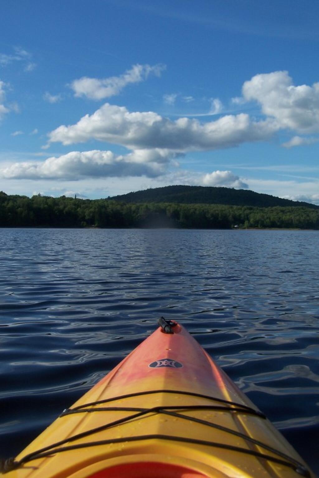
One option I’m seriously looking at is on Friday 🚲 riding more of the Canalway Trail, this time from Canastota up to the area around Rome, maybe Durhamsville depending on the time. I think the trail will be free of snow by then, though Friday might be a bit chilly though sunny and shouldn’t be so bad with gloves on. Or I could hike around Stoney Pond or if I decide to spend time at Charles Baker, then I could ride the roads there. 💭 Off-road bike riding isn’t permitted in the winter, but road-riding is okay per their website. The road up to Cherry Ridge could be icy, though it’s usually plowed but not sanded, except for the campground which isn’t plowed at all. But as of now, they don’t have any more then any dusting per the web cams and snowfall predictions.  ⛄ Thought about heading further south to Long Pond State Forest, but that’s quite a ways south and west. West Virginia is too far away for four nights, not to mention they have a ton of now.

I am dipping a bit into my time reserve for time next year, ⏲ not rolling over the maximum into 2024, but when I thought about it some more, it doesn’t matter as I don’t expect I’ll be taking much time off until late April, which will give me several pay periods to build time back up, plus I get 35 hours of personal time (5 days) on the first of the new year. Starting my new position as Director of Data Services, I am not going to want to miss much work 👔 as I have much to learn and I want to put in the long hours, to make a good impression in my new position. Not sure how much comp-time I’ll get to use next summer, 😎 though I think there is definitely a possibility of remote work with my new position that is more about working data and running reports ⌨ then working with people, or so I think. I don’t know, I haven’t started the training yet. 👨‍🏫 Things are getting wrapped up at Research it seems for the year, there is a handful of projects outstanding in the Production Book but I’m not worried as the year comes to close.

It will be four nights out camping this week leading into Christmas, 🏕 then I have off Christmas Day to visit with the families and Boxing Day is also a holiday at my company. 😀 Then it’s three days of work, but I”m thinking of potentially working from home that Friday leading into the New Years Weekend, so I can leave early and set up camp in Rensselaerville and do a three-night trip there through New Years Day. Depends on how much snow we get the second half of next week. ❄️ Really hard to say. Lots of winter camping this year, but it’s been so mild. Come January though I’m not planning anything until at least mid-month with Martin Luther King Day but even that’s uncertain — and as I noted, I’m not sure if I will take any time off from work for trips until April with my new position getting underway. Might be a busy summer too, but I’m thinking at least part of the time I will be able to remote work 👨‍💻 so I could extend trips by working part of the time from camp and/or the Speculator and other other libraries.

Looking ahead, next Tuesday is Boxing Day 🥊 when the sun will be setting at 4:29 pm with dusk at 4:59 pm. Days are getting longer. On that day in 2022, we had partly sunny and temperatures between 30 and 16 degrees. Typically, the high temperature is 35 degrees. We hit a record high of 59 back in 1895. Before my time, lol 😂.

Untitled

Totally agree that walking in that thunderstorm last night wasn’t a great idea ⛈

I didn’t think it would be nice enough to go out walking last night but then I stepped outside it seemed okay, the wind blowing the opposite direction of the clouds to the west. It risk of thunder seemed pretty low, and I wanted to get at least 8 miles in for the day. But the time I was farthest from home the lightening was too close for comfort and five minutes from home the sky opened up. Ultimately I did get in 8 miles for the day, not the ten I normally walk and didn’t make it to the park, but that’s fine.

Good morning! With a few loud cracks of rain and thunder it’s morning. The sun is is rising, the skies are clearing somewhat and let’s call it 66 ⅔ degrees at the 6:30 for the morning walk in the land of the Delmartian. ⛅ Calm wind. The dew point is 64 degrees.

Last night I got home 🏡 from work glad that I didn’t get soaked and figured that the evening walk 🚶 was off the agenda. Then at 6:30 I stepped outside and looked at the radar and decided it would be okay. And it was for a while until the wind shifted and thunder ⚡ pushed closer. In the end it was fine, though I got a bit wet and went to bed early. 🛏 Walked 8 miles for the day plus 39 flights of stairs up and down. I was asleep by around 8 pm and up around 5 am.

As it was still raining out when I awoke 🍳 I decided to have breakfast before walking which was cold black coffee ☕ with cold eggs and spinach from the other day. I also had a half of banana 🍌 from last night. At lunch time yesterday I walked up to Market 32 in Albany and got a bunch of bananas to hold my pantry over until Saturday when I can do a bigger shop 🏪. Cold lunch today with black beans, mushrooms, chopped farmers market tomatoes, peppers. Avoids the line for the microwave at work, though I’ve figured out the technique is to cook lunch at 12:50 PM before the 1 PM rush.

Today will have a chance of showers and thunderstorms, then showers likely and possibly a thunderstorm after 5pm. Some of the storms could produce heavy rain. Patchy fog before 7am. Otherwise, mostly cloudy 🌧, with a high of 83 degrees at 2pm. One degrees below normal, which is similar to a typical day around July 4th. Independence Day! Maximum dew point of 71 at 2pm. Calm wind becoming south around 6 mph in the morning. Chance of precipitation is 60%. New rainfall amounts between a half and three quarters of an inch possible. A year ago, we had partly cloudy skies. It was somewhat humid. The high last year was 85 degrees. The record high of 99 was set in 1995.

I’ll have to keep that Market 32 in Albany in mind 🛒 for when I need stocking up of a few ingredients downtown. Much better than the old Ghetto Chopper and really only a few blocks away from work if I take South Swan to Elm Street. They don’t have much in household supplies – I was hoping to get super glue to fix my boots 👢 – but the fresh fruits and vegetables looked good. It’s small so a fast shop. Probably can’t get frozen things there and I decided to skip getting plain non fat Greek yogurt just because of the hot day walking back to the office and the bus ride home but in the winter I think that’s an option.

Solar noon 🌞 is at 1:02 pm with sun having an altitude of 69.1° from the due south horizon (-1.7° vs. 6/21). A six foot person will cast a 2.3 foot shadow today compared to 2.2 feet on the first day of summer. The golden hour 🏅 starts at 7:51 pm with the sun in the west-northwest (294°). 📸 The sunset is in the west-northwest (301°) with the sun dropping below the horizon at 8:33 pm after setting for 3 minutes and 22 seconds with dusk around 9:06 pm, which is 36 seconds earlier than yesterday. 🌇 The best time to look at the stars is after 9:50 pm. At sunset, look for rain 🌧 and thunderstorms 🌩 and temperatures around 74 degrees. The dew point will be 70 degrees. There will be a south-southeast breeze at 6 mph. Today will have 15 hours and 5 minutes of daytime, a decrease of one minute and 25 seconds over yesterday.

Six months into healthy eating 🍎I am finally starting to notice how much thinner I am. I have a feeling that my BMI is now below 25 though I don’t have a scale so I don’t know but I know I have lost weight since the last time I visited the doctor at the end of May when I was 209 lb and needed to get to 194 lb to be a healthy weight at 6′ 2.5″ though most others say I’m 6′ 4″ or 6′ 5″ with the boots on. My love handles have virtually disappeared and my stomach is much smaller, and I’m pretty sure that size 36 pants 👖 are now the proper size, the smallest since probably I’ve been since elementary school. The problem is finding clothes in my closet that don’t make me look like a clown. 🤡 Still have a little more belly fat I’d look to loose, not just because of the look but because outer fat is associated with inner muscle fat, especially in the heart 💖 which is rather bad. But I feel like I am starting to get in great shape, mostly from eating a nutritious diet but also because I’ve kept up with the walking and stairs. And hopefully cycling too. Steiner, you are biting me with this bicycle thing. 😠

Tonight will have showers and thunderstorms likely, mainly before midnight. Mostly cloudy 🌧, with a low of 66 degrees at 5am. Three degrees above normal. Maximum dew point of 70 at 6pm. Southeast wind around 6 mph becoming calm in the evening. Chance of precipitation is 60%. New rainfall amounts between a quarter and half of an inch possible. In 2022, we had mostly clear skies. It got down to 57 degrees. The record low of 44 occurred back in 1950.

I need to think about getting new boots before vacation. 👟 Or at least rugged sneakers, something I can use for mountain biking and maybe jogging which I tell myself that I’m thinking 💭 about taking up 🏃 maybe half seriously since becoming thinner. Around camp and certainly st the swimming pools and holes the knock off crocks are fun but they’re not appropriate for much else. They have no ankle support, get my feet muddy, and worse of all let in any stones and sticks into my foot 👣 where I can step on them.

On this day in 1969, the $500, $1,000, $5,000 and $10,000 bills are officially withdrawn from circulation. 💵 After this date, if you wanted to buy a large purchase in cash, you needed a lot of hundred dollars in bills. 💰They had last been printed in 1945, and were finally dropped from circulation in 1969, in part as an effort to reduce corruption and money scams. Nowadays a hundred 💯 dollars seems almost a paltry amount with inflation not that I ever carry anything bigger than $5 bills because it’s just easier to use the credit card 💳 for anything bigger.

Tomorrow will have a chance of showers and thunderstorms, mainly after 3pm. Partly sunny 🌞, with a high of 87 degrees at 3pm. Three degrees above normal. Maximum dew point of 72 at 11am. Muggy, swamp weather. South wind 3 to 7 mph. Chance of precipitation is 30%. New rainfall amounts of less than a tenth of an inch, except higher amounts possible in thunderstorms. A year ago, we had partly cloudy skies. It was somewhat humid. The high last year was 86 degrees. The record high of 96 was set in 1997.

Tomorrow I will walk 🚶 early to best the heat. 😰 Then it’s those oatmeal banana pancakes 🍌 🥞 love with blueberries and maybe some sugar free maple syrup and cold black coffee. So good! Then it’s off to Steiners to check on the status of the bicycle 🚲 they promise to be assembling for me. They don’t have it, I’ll test ride the XXL of the Marlin 5 and order and pay for the Marlin 6 as long as they can give me a set date for delivery. 🚚 Otherwise I will order online with another shop. This purchase needs to be closed down this weekend.

Then the next thing to do is get grocery shopping 🛒. I want to get more red kidney beans for maple syrup 🍘 next week and get them soaking to be cooked come Sunday morning. Plus all the usual, more Greek yogurt, 🐮 frozen fruit 🍓, peppers 🫑🌶️, mushrooms 🍄 and the usuals. I also need shampoo and extra deodorant the later this keep in the office 🏢 after climbing the stairs. Then I’m not totally sure. 🏊 If it’s hot and looks like thunderstorms will stay away, maybe go to the town pool. I would have to register though to get a pool fob, maybe I should do that and it’s $5.25 to enter. 😕 And you have to do that in advance. Seems like a pain. If I get the bike, 🚵 
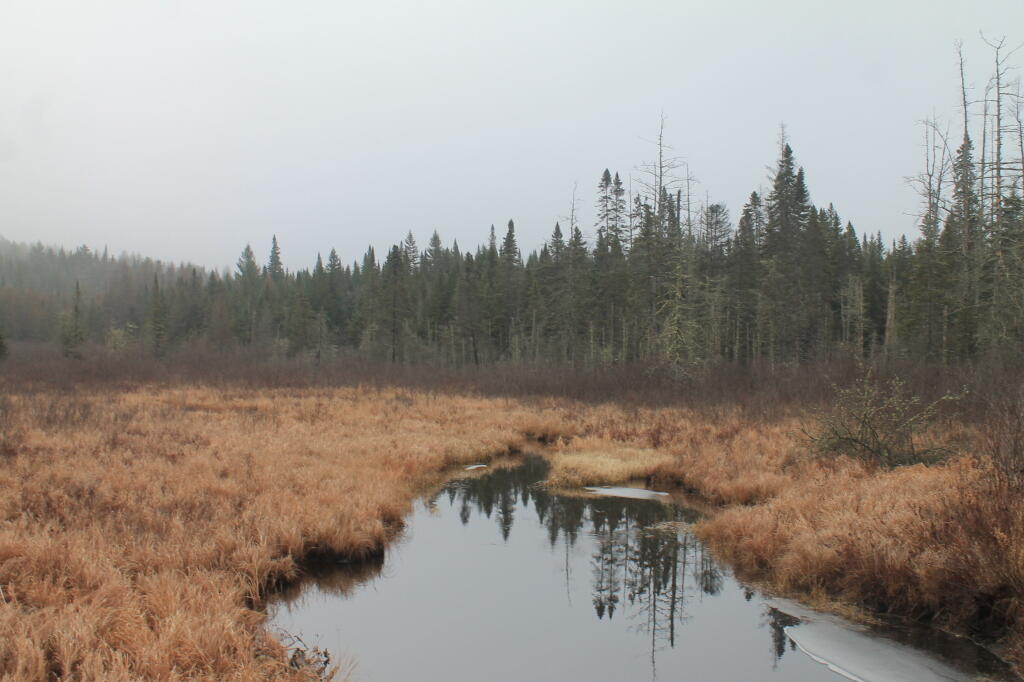
ride out to Voorheesville and probably the Black Creek Marsh. If it’s hot and I don’t want to spend money, go to the library for a while 💻 with my computer, then come home, sit by the fan and get through some more of the stack of library books I have at home. 📚

Looking ahead to Sunday, showers and possibly a thunderstorm. Some of the storms could produce heavy rain. High near 83. ⛈️ South wind around 10 mph. Chance of precipitation is 80%. New rainfall amounts between a half and three quarters of an inch possible. Not just a few passing showers. Maximum dew point of 74 at 12pm. Typical average high for the weekend is 84 degrees.

And so is the weekend forecast. 😖 But if I can get this damn bicycle 🚲 thing closed down, I’ll be happy. I am thinking about taking off at least one day next week, where and what to do is to be decided but I need to get a few things ready for my vacation, I’ve taken fewer days off this summer than expected. Maybe it will be to get the rack on the bicycle, break it in or pick it up. 🛠 Maybe the Potholers or Schoharie the second half of the week. 🏊

Two weeks from now, God willing, 🏖 I will be well on my way to the Finger Lakes. I really want to leave by eight AM on that Friday to get the campsite I want in the National Forest ⛺ and then have the afternoon to set up and relax. 🎣 Do some fishing, a nice bicycle 🚲 ride and maybe watch a Finger Lakes sunset 🌇 across a cow pasture in the National Forest.

After vacation, August 11th I have a dentist appointment at 10:15 AM 🦷 which I will follow up probably with a long weekend. Maybe Schoharie or the Adirondacks. Have to be strategic at this point as there are only three weeks left in August at that point before Labor Day Weekend, and I want to have at least a few more long weekends before summer is done. 🏊 🛶 That said, except for the Mine Kill Pool there is no reason I can’t take lots of long weekends come September and October. 🍁 I am not doing a West Virginia trip — or even a week-long trip at this point this autumn, so that leaves other days to allocate. I would like to do some kayaking, fishing, hunting, and bike riding this autumn. Charles Baker State Forest roads probably would be wonderful for autumn bike riding, as would the Chenango Canal Trail and others.

Looking ahead, there are 7 weeks until September 1st 🍂 when the sun will be setting at 7:31 pm with dusk at 7:59 pm. That’s the start of Labor Day Weekend. On that day in 2022, we had mostly sunny skies with rain showers and temperatures between 73 and 55 degrees. Cool day. The average high is 79 degrees. We hit a record high of 96 back in 1953. I might do Spectulator that weekend, especially if they have fire tower lighting that I could observe from I don’t know, Watch Hill (?). 🏕 Some of those truck trails through the Conservation Easement might be nice on the mountain bike, as would be camping up on Hardwood Hill, looking at the stars, lighting off ground fireworks and sparklers. 🎆

Back Out on Open Lake

The Catskill Wilderness Areas

Trees and Mountains

The text of today’s fodder is based on the Catskill Park State Lands Master Plan, as revised in 2008. Maps were rendered by myself, using Quantum GIS and DEC Lands and Forests data.

Big Indian Wilderness

(Formerly Big Indian – Beaverkill Range Wilderness Area)

This wilderness is located in the Towns of Hardenburgh, Denning and Shandaken in Ulster County. It lies generally west of Oliverea and the Frost Valley Road, south of Belleayre Ski Center, east of Seager and Hardenburgh and north of Willowemoc and Claryville. The area ranges in width from 1 to 5 miles, is about 19 miles long and contains approximately 33,500 acres of land. Elevations range from 1,500 feet in McKenley Hollow to 3,840 feet where the state boundary crosses Doubletop Mountain. The mountains in the northeastern portion of the area are quite rugged, while those to the south and west are more characteristic of high hills. Water from the area flows into three New York City water supply reservoirs and the Delaware River Basin. Nine mountains or ridges with elevations of over 3000 feet make up the area.

Peaks

Doubletop* 3,860′
Haynes 3,420′
Big Indian 3,700′
Spruce 3,380′
Fir 3,620′
Eagle 3,600′
Hemlock 3,240′
Balsam* 3,600′
Beaver Kill Range 3,377′

* Maximum elevations given are not necessarily located within the Wilderness Area.

The forest cover is predominantly hardwood mixtures in various associations. Spruce and fir, while present at some of the higher elevations, are less noticeable here than in other Catskill wilderness areas.

Interior facilities consisting of foot trails and lean-tos are generally considered adequate.

Area statistics:

Approximate Area 33,500 Acres
Roads (non conforming) 1.4 Miles
Foot Trails 29.4 Miles
Lean-tos 6
Designated Campsites 5
Parking Lots 5
Public Use (visitors/year) 4,500
Exterior Boundary Line 67 Miles
Minimum Elevation 1,500′
Maximum Elevation 3,840′

Non-conforming uses:

Motor vehicle use of Black Bear Road from the wilderness boundary to Fall Brook Lean-to.

A UMP for this area was completed in June of 1993.

Hunter – West Kill Wilderness

(Formerly West Kill – North Dome Wilderness, Ox Clove Wild Forest, and a portion of the former Hunter Mountain Wild Forest)

The unit generally lies within the following boundaries: New York State Route 42 on the west, the Shandakan Wild Forest and NYS Route 28 to the south, and NYS Route 214 on the east. The northern extent of the unit is County Route 6, and continues along a line 100′ parallel to, and south or east of, the edge of Spruceton trailhead parking area and the centerline of the Spruceton Truck Trail, to the junction of the Colonel’s Chair Trail. A corridor, 100 feet either side of the center line of the Spruceton Truck Trail, from the Colonel’s Chair Trail to the summit of Hunter Mountain, culminating in a circle 175′ in radius from the center of the chimney on the observer’s cabin shall be within the Rusk Mountain Wild Forest.

The unit contains approximately 27,000 acres of land, and inside it’s boundaries are found the named mountain peaks of Balsam, Sherrill, North Dome, West Kill, Sheridan, Hunter and Southwest Hunter. Hunter Mountain is the second highest peak in the Catskills at 4,040 feet, and portions of it’s summit, along with a fairly extensive area on the summits of West Kill, North Dome and Sherrill Mountains are within the Catskill High Peaks Bird Conservation Area, and are of special significance in that they provide habitat for high elevation spruce-fir inhabitants such as Bicknell’s Thrush and the Blackpoll Warbler, among others.

There are currently two lean-to’s on the unit, the Diamond Notch lean-to located just off the Diamond Notch Trail, and the Devil’s Acre Lean-to off of the Devil’s Path Trail. Waters from this unit drain into Schoharie and Esopus Creeks and then into the Schoharie and Ashokan Reservoirs, which are in the New York City water supply system.

Area statistics:

Approximate Area 27,000 Acres
Foot Trails 18 Miles
Lean-to’s 2
Parking Lots 5
Minimum Elevation 920′ Maximum Elevation 4,040′

Indian Head Wilderness

(Formerly Plateau Mountain – Indian Head Mountain Wilderness Area)

This wilderness is located in the Town of Hunter, Greene County and the Towns of Saugerties and Woodstock, Ulster County. It lies generally west of the east boundary of the Catskill Park, south of Platte Clove, east of Devil’s Tombstone Campground and north of Lake Hill and Shady. The area ranges from 1 ½ miles to 3 ½ miles in width, is eight miles long and contains approximately 16,800 acres.

Elevations range from 900 to 3840 feet and the four major mountains in the area are visible against the skyline from all directions. Echo Lake, the only natural lake in a Catskill wilderness, is located in the east-central portion of the area. Water from this eastern section flows into the Kingston and Saugerties water supply reservoirs, while drainage from the central and western section flows into two New York City water supply reservoirs. Six named mountain peaks over 3,000 feet in elevation dominate the area.

Peaks

Plateau 3,840′
Indian Head 3,573′
Sugarloaf 3,800′
Olderbark 3,440′
Twin 3,640′
Plattekill 3,100′

The forest cover varies from extensive oak stands on the eastern most slopes to mature spruce-fir on top of Plateau Mountain. An excellent mature stand of northern hardwood and hemlock occupies the slopes south of the Saw Kill.

Echo Lake, unique to the Catskill wilderness, is very popular for undeveloped camping. A small number of scattered primitive tent sites with fire rings have been established and public camping is limited to their capacities.

Public access is provided by several foot trails entering the area, including the old road from Meads to Overlook Mountain.

Area statistics:

Approximate Area 16,800 Acres
Roads 6.6 Miles
Foot Trails 24.1 Miles
Cross-country Ski Trails 5.6
Lean-tos 3
Designated Campsites 10
Parking Lots 1
Public Use (visitors/year) 8,000
Length of Boundary 33 Miles
Minimum Elevation 900′
Maximum Elevation 3,840′

A UMP for this area was completed in October of 1992.

Slide Mountain Wilderness

(Formerly Slide Mountain – Panther Mountain Wilderness Area)

This wilderness is located in the towns of Shandaken, Denning and Olive in Ulster County. It lies generally south of NYS Route 28, west of West Shokan, north of the Peekamoose Road (County Route 42) and east of the Frost Valley Road (County Route 47). It surrounds the Woodland Valley Campground and abuts the Sundown Wild Forest to its south. This area ranges from 1 to 10 miles in width, is about 13 miles long, and contains approximately 47,500 acres of land. The wilderness boundary is 118 miles long.

The terrain is rugged and steep with elevations ranging from 1,100 to 4,180 feet. All water draining from the area eventually reaches three New York City water supply reservoirs by way of the East and West Branches of the Neversink River, Rondout Creek and Esopus Creek. Twelve named mountain peaks with elevations over 3000 feet exist in the area. Of these, six may still be considered trail-less to the extent that they have no marked and maintained trails.

Peaks with Trails

Slide 4,180′
Peekamoose 3,843′
Cornell 3,860′
Wittenberg 3,780′
Table 3,847′
Panther 3,720′

Trail-less Peaks

Lone 3,721′
Rocky 3,508′
Friday 3,694′
Van Wyck 3,206′
Wildcat 3,340′
Balsam Cap 3,623′

The forest cover consists of nearly every possible mixture and association of hardwood and softwood trees native to the mountain region. While hardwoods predominate higher elevations are often covered with red spruce and balsam fir.

This area receives more public use than any other Catskill wilderness. Superb vistas are found on Slide, Wittenberg, Cornell, Giant Ledge and Panther Mountains. Access via foot trails is available from the north, south, east and west.

Area statistics:

Approximate Area 47,500 Acres
Foot Trails 35.3 Miles
Lean-tos 3
Parking Lots 10
Designated Campsites 29
Public Use (visitors/year) 23,000
Length of Boundary 118 Miles
Minimum Elevation 1,100′
Maximum Elevation 4,180′

A UMP for this area was completed in March of 1987 and revised in October of 1998.

Windham – Blackhead Range Wilderness

(Formerly Blackhead Range, and North Mountain Wild Forests, and portions of Windham High Peak, and Black Dome Valley Wild Forests)

The combination of these Wild Forest areas creates the Windham – Blackhead Range Wilderness Area, which lies within the Greene County towns of Cairo, Hunter, Jewett, Windham and Durham. The classification of these former Wild Forest areas was changed to Wilderness because their combined area comprises approximately 17,100 acres and contains rugged, high elevation land that clearly exhibits wilderness character. This newly classified area has seven named mountain peaks over 3,000 feet in elevation.

They are:

Peaks Black Dome 3,980′
Windham High Pk 3,520′
Blackhead 3,940′
Stoppel Point 3,420′
Thomas Cole 3,940′
Burnt Knob 3,180′
Acra Point 3,100′

The unit also contains six unnamed peaks over 3,000 feet, which range from 3,040 feet to 3,540 feet in elevation. Of the five highest peaks in the Catskills, three – Black Dome, Thomas Cole and Blackhead – are in this unit. This concentration of 13 peaks over 3,000 feet, within an area of approximately 28 square miles, with limited access, structures and improvements (30 miles of maintained foot trails and two lean-to’s) make the Windham – Blackhead Range Unit an area with excellent wilderness character.

A fairly extensive area of old growth forest can be found on this unit at the higher elevations, along the ridge stretching from an area west of Thomas Cole Mountain to Blackhead Mountain, and on Windham High Peak. The presence of this old growth forest, with its distinctive flora and fauna, add to the wilderness character of the unit. The unit also includes the headwaters of the Batavia Kill and, to the south over the Blackhead Range, the headwaters of the East Kill. Both of these rivers flow into Schoharie Creek, and are an integral part of the New York City Watershed system.

The western boundary of this unit shall be the east side of the Elm Ridge Trail, Black Dome Trail leaving it within the Elm Ridge Wild Forest, continuing north along the drainage to the Catskill Park boundary. The southern boundary of the unit shall be the Escarpment Trail approximately one half mile south of Stoppel Point to a point on the Escarpment Trail where it comes closest to the eastern Forest Preserve boundary. Both North Point and Stoppel Point will be within the Wilderness area. Lands to the south of the south edge of the Escarpment Trail in this area, will be in the Kaaterskill Wild Forest.

Because the Windham – Blackhead Range Wilderness surrounds the smaller Colgate Lake Wild Forest Unit, and because they are linked together by public use, the Unit Management Plans for the two units shall be contained in one document.

Area statistics:

Approximate Area 18,0000 Acres
Foot Trails 30 Miles
Lean-tos 2
Parking Lots 1
Minimum Elevation 980′
Maximum Elevation 3,980′

August 29, 2020 Night

Good evening! Cloudy and damp around 70 degrees on Delmar. ☁️ There is a west breeze at 13 mph. 🍃. The dew point is 67 degrees. The skies will clear around 9 pm.

Not a super nice day so I stayed home 🏡 and read and worked on a variety of little projects. I wanted to go for an evening walk 🚶🏻 but the threat of rain was much too high. Tomorrow I’ll get out hiking. Put together some new maps 🗺️and stuff for the blog, was reading another book 📙 about homesteading. 🐐 Cheeses and dairy science is fascinating stuff 🧀 – minor changes in processing milk 🥛 can create vastly different effects products or more likely ruin it entirely.

I finally baked up that cookie mix 🍪that expired in April. Good peanut 🥜 butter cookies that I bought last fall for my West Virginia trip but never eat. 😋 I figured I better eat it before the mice get in an chew holes in the packaging.🐁It’s been a bad year for mice in the woods – something people were talking about yesterday on Facebook and I noticed we’re bad both in the Finger Lakes and Piseco Powley Road.

Tonight will have a slight chance of showers before 11pm. Partly cloudy 🌧, with a low of 58 degrees at 5am. Typical for tonight. Maximum dew point of 67 at 9pm. West wind 10 to 13 mph. Chance of precipitation is 20%. In 2019, we had mostly clear skies in the evening, which became partly cloudy by the early hours of the morning. It got down to 57 degrees. The record low of 38 occurred back in 1982.

Tonight will have a Waxing Gibbous 🌔 Moon with 90% illuminated. At 9 PM, the moon was in the south-southeast (156°) at an altitude of 21° from the horizon, some 239,388 miles away from where you are looking up from the earth. 🚀 At the state speed limit of 55 mph, you’ll make it there by February 27th. Buckle up for safety! 💺 The darkest hour is at 12:57 am, followed by dawn at 5:49 am, and sun starting to rise at 6:19 am in the east-northeast (77°) and last for 2 minutes and 59 seconds. Sunrise is one minute and 4 seconds later than yesterday. 🌄 The golden hour ends at 6:56 am with sun in the east (83°). Tonight will have 10 hours and 44 minutes of darkness, an increase of 2 minutes and 44 seconds over last night.

Tomorrow will be mostly sunny 🌞, with a high of 72 degrees at 3pm. Six degrees below normal, which is similar to a typical day around September 16th. Maximum dew point of 58 at 7am. Northwest wind 13 to 15 mph. A year ago, we had partly cloudy skies in the morning with some clearing in the afternoon. The high last year was 82 degrees. The record high of 98 was set in 1953. The great Heat Wave of 1953.

Should be a nice autumn like day. 🍂 Nice change from the humidity and stormy weather today. I am thinking of doing some hiking and fishing 🎣 at Partridge Run tomorrow. Should be a great day to spend outdoors but maybe a bit chilly by the time I go out to my parents house for Sunday dinner. 🍲 But then again, Tuesday is September. Summer has quickly bit the dust.

I get so tired of hearing so many police 🚨 sirens lately. The past few months they really have been abusing them it seems. For a while they were relatively quiet, tapping the sirens only briefly at the traffic light 🚦 to warn motorists but lately it’s been non-stop and it’s annoying. That and the super throaty motorcycles and trucks 🏍. Maybe I’m noticing it more this year as I’m home all of the time I’m not in the woods enjoying the quiet. 🤫

I am planning my next trip after Labor Day Weekend. 🍂 I’ll have to get out my blaze orange and gun cleaned up at that point. I’m thinking the Spectulator Area most likely especially if I’m planning several weekdays because the library is a pleasant place to work for Zoom Meetings. After October 1st I might camp and work from a combination of Stoney Pond State Forest and Charles Baker. ⛺ I can probably get Wi-Fi at the Cazenovia and Hamilton libraries out there for Zoom. Remote work has its benefits. 💻No permit is needed for Stoney Pond State Forest after October 1st and it’s unlikely I’ll see anyone there except maybe a grizzled old hunter. 🎫 Fishing in Nelson Swamp is a lot of fun too.

I really enjoy reading and looking at pictures of folks off grid properties on the Facebook. 🏡 I just really like the simple and the small with lots of land in remote country. Some folks are really fancy or big builders but that certainly aint me. Some are into art work and making things pretty but I’m fine with chipboard for walls. The less you have, the less to spend money on, the less to break or have to throw away regularly. 🛠️

I’ve considered doing a trip in October to the Finger Lakes 💻 and remote working from there but I have concerns about the length of day and having enough sunlight then to keep things charged and the long trip back to Albany after hours should something break that I can’t continue to work from there likedead fuse, inverter or other problems with the solar system which I couldn’t fix in the field. ⬛ It would be fun though to enjoy the leaves, 🍁 hunt before 9 AM 🐿️🐰🦃and then work the rest of the day from camp but maybe exhausting to boot. At the National Forest you can camp for two weeks in one site, no permits required.

I also don’t want to put on too many miles or break shit in my truck 🔧before the state inspection in November. Since addressing the tire wear issue on the truck in June things have been a lot better at slowing the wear and I’m not concerned about this year’s inspection but I also don’t want to have any kind of costly repairs this autumn if possible. 🔩

In four weeks on September 26 the sun will be setting in the west (269°) at 6:45 pm,🌄 which is 49 minutes and 15 seconds earlier then tonight. In 2019 on that day, we had partly cloudy, rain showers and temperatures between 69 and 53 degrees. Typically, you have temperatures between 68 and 47 degrees. The record high of 90 degrees was set back in 2017.

Looking ahead, Northern Zone Regular Season 🦌 is in 7 weeks, Halloween 🛥️ and the Blue Moon 🌕 is in 9 weeks, Small Business Saturday 🛍️ is in 13 weeks, Repeal of Prohibition Day 🍺 is in 14 weeks, Boxing Day 🥊 is in 17 weeks, Cold Moon 🌕 is in 4 months, Static Electric Shock Day 🧼 is in 19 weeks, National Cheese Lovers Day 🧀 is in 21 weeks, 38th Birthday 🎉 is in 5 months, Save the Pine Bush Turns 43 🦋 is in 23 weeks, 5:30 PM Sunset 🌆 is in 25 weeks, Snow Moon 🌕 is in 26 weeks and Snow Moon 🌕 is in 26 weeks.

Schoharie Valley

Camping Areas in Central Adirondacks ⛺

Cascade Lake – Scenic lake known for Cascade Falls, about a 1/4 mile north of the lake outside of Big Moose and Inlet. Tent campsites that are about a mile back from the road.

Eatonville Road and Otter Creek Area – Otter Creek State Forest and the portion of Independence River Wild Forest that is home to Confusion Flats, is a popular place for equestrians, but the Eatonville Road area is set aside for those who don’t have horses but want to explore the mix of sandy hills that make up the Western Adirondacks.

Francis Lake – If your looking for a campsite you can paddle to on a lake that isn’t so choppy or large near Stillwater Reservoir, consider camping at Francis Lake. Parking is on the shoulder of Number 4 Road outside of Lowville, there also is two designated handicap sites here.

Lester Flow and Cheney Pond – Scenic lake that is popular for paddling. The 1/2 mile road down from Boreas Road as of June 2020 is closed due to washouts. Tent sites exist along the lake, along with one drive-to site on the road down there. No cell service.

Independence River Wild Forest – Not only is there dozens of boat-only sites along Stillwater Reservoir, consider camping on Smith Road or Basket Factory Road which have numerous sites. Cell services is limited, good at certain sites, especially Smith Road Number 1 (Old Firetower Site).

Mason Lake – Small lake located about 10 miles north of Speculator and 5 miles south of Lewey Lake that has several tent and drive-in campsites along it’s shore. Good to fair cell service here. Nice to hear loons, one of the best bass ponds in the area.

Moss Lake – Scenic sandy lake outside of Big Moose/Inlet in the Western Adirondacks. The lake is ringed by an old carriageway and is a popular place to camp and paddle. There is a sign in / peg board when you get to the lake’s parking area to know which sites are available.

Moose River Plains – The state’s largest wilderness drive-to camping area, with over 150 campsites spread out over 35 miles of dirt road.

Northwood Club Road – In Minerva, this road crosses the Boreas River and has several roadside campsites, and passes by Huntley Pond, the NL Tahawus Railroad (which can be hiked to the Boreas River at Hudson River), and the Blue Ledges on the Hudson trailhead. No cell service.

Vanderwhacker Road -Five or six campsites exist along Vanderwhacker Road, which can be muddy in the spring and icy in late autumn. Additional designates campsites exist near where NY 28N crosses the Vanderwhacker River. Near the trail to the Vanderwhacker Firetower, No cell service.

Woodhull Lake Reservoir – Off of NY 28 in McKeevers, about 10 miles south of Old Forge. Not only is this beautiful reservoir to paddle, there are some campsites along the shore, with drive-to campsites along Wolf Lake Landing Road which leads to it. Part of Wolf Lake Landing Road is erroded, but other parts are fresh stone-dust. It’s remote wilderness but there good cell service in mcuh of the area.

Camping Areas in Southern Adirondacks

Camping Areas in Southern Adirondacks ⛺

East Branch of Sacanadaga River, NY 8 – Roughly 10 campsites along NY 8. These are easily accessed throughout the year, as the road is plowed except when the snow banks are high during the winter. East Branch is not good for fishing due to wide variance in water levels, however there are some nice pools in sections of river for summer swimming. Lots of road noise. Some of the sites have cell service. Nearby locations include Cod Pond, East Branch Trail and Kibby Pond Trail.

Edick Road – There are a handful of very hidden campsites off of Edick Road. This road may be closed to vehicles due to wash outs autumn 2019, but worth a walk to explore this area.

Fawn Lake – A 1/2 mile hike back to a scenic lake ringed by primitive campsites outside of Lake Pleasant. Two miles beyond it is the scenic Willis Vly, which doesn’t have developed campsites but it’s remote wilderness where you might see a Moose or other wildlife.

Garnet LakeTent sites, some with drive-up access along the lake. No cell service, much of the upper road here is not maintained in the winter. Popular in the summer, no cell service.

Good Luck Lake – Scenic lake off of the West Branch Sacanadaga River that is ringed with tent sites that can be walked in from the Good Luck Lake parking area area or paddled in.

Hope Falls Road – Two or three campsites along the end of Hope Falls Road, some are drive-in only tent sites. Near the Tenant Creek Falls Trail. No cell service. Open June to autumn snowfall.

Harrisburg Road – There is a set of very rustic designated campsites along the rough Harrisburg Road past Harrisburg Lake. Somewhat near Crane Mountain, a couple mile hike to and Wilcox Lake. No cell service.

Lester Flow and Cheney Pond – Scenic lake that is popular for paddling. The 1/2 mile road down from Boreas Road as of June 2020 is closed due to washouts. Tent sites exist along the lake, along with one drive-to site on the road down there.

Mason Lake – Small lake located about 10 miles north of Speculator and 5 miles south of Lewey Lake that has several tent and drive-in campsites along it’s shore. Good to fair cell service here. Nice to hear loons, one of the best bass ponds in the area.

North Lake Reservoir – There are roughly 15 campsites on the east shore of North Lake Reservoir. Popular place in the summer, regularly staffed by conservation students. Noise from motorboats. No cell service. Nice if you want to camp right on water, hear loons at night..

Northwood Club Road – In Minerva, this road crosses the Boreas River and has several roadside campsites, and passes by Huntley Pond, the NL Tahawus Railroad (which can be hiked to the Boreas River at Hudson River), and the Blue Ledges on the Hudson tailhead.

Perkins Clearing – Conservation easement lands. Good to fair cell service here. Great place for hunting and wildlife observation as it’s mixed timber country. Near Mason Lake, Speculator, Pillsbury Mountain and Cedar Lakes.

Piseco-Powley Road – A dozen campsites along a 13 mile road with short hikes including Big Alderbed, House Pond, Sand Lake and the popular Potholers/Brayhouse Brook waterfall for swimming. As of June 2020, road is closed in Stratford/Fulton County portion, road is open north of Potholers/Brayhouse Brook (access via Piseco). Very limited cell service here.

Pumpkin Hollow Road – Three campsites above Willis Lake. Remote country except for the site on Willis Lake, no cell service. On the Willis – Wilcox Lake Trail. Very quiet area. Open June to autumn snowfall. No cell service here.

Rockwood State Forest – Three campsites along the end of Church Road which can be accessed by driving past the cemetery in the hamlet. Scenic lake, good fishing. Cell service available, but bring a trash bucket and gloves as litter can be a problem. Nice trails to stroll around in the old Rockwood Estate.

Stewart Landing – There are four campsites on a rough road that loops off of Stewart Landing Road. Popular area in the summer, Canada Lake is great for paddling and informal swimming. Also consider hiking back to Hilderbrandt Vly and Glassgow Lake from here. Moderate to poor cell service here.

Vanderwhacker Road -Five or six campsites exist along Vanderwhacker Road, which can be muddy in the spring and icy in late autumn. Additional designates campsites exist near where NY 28N crosses the Vanderwhacker River. Near the trail to the Vanderwhacker Firetower, No cell service.

White House, Wells – A grouping of 5 or 6 campsites at the end of White House in West River Road. Scenic area, old camp, with fields and a chimney. Campsites are kind of close together, not a wilderness experience. Near the North Country Placid Trail, lots of blueberries in mid-summer. No cell service. Open June to autumn snowfall.

Woodhull Lake Reservoir – Off of NY 28 in McKeevers, about 10 miles south of Old Forge. Not only is this beautiful reservoir to paddle, there are some campsites along the shore, with drive-to campsites along Wolf Lake Landing Road which leads to it. Part of Wolf Lake Landing Road is erroded, but other parts are fresh stone-dust. It’s remote wilderness but there good cell service in mcuh of the area.

List of Peaks in the Catskill Park

Below is a list of peaks within the Catskill Park that are on state land. This is based on the OpenStreetMap data combined with the DEC property data. Click location for a map of the property, or click State Land to get more information about the land the peak is located on.

Region 3 – Ulster County

Peak Name Elevation in Feet State Land Class UMP Region County Location
Balsam Cap 3621 Slide Mountain Wilderness Wilderness Slide Mountain 3 Ulster 41.9770369, -74.3573722
Balsam Lake Mountain 3726 Balsam Lake Mountain Wild Forest Wild Forest Balsam Lake Mountain 3 Ulster 42.0459236, -74.5940438
Balsam Mountain 3601 Big Indian Wilderness Wilderness Big Indian 3 Ulster 42.0909235, -74.4882082
Beaver Kill Range 3310 Big Indian Wilderness Wilderness Big Indian 3 Ulster 41.9903736, -74.5999302
Beaver Kill Range 3211 Big Indian Wilderness Wilderness Big Indian 3 Ulster 41.9937721, -74.5912442
Belleayre Mountain 3431 Belleayre Mountain Ski Center Intensive Use Belleayre Mountain Ski Center 3 Ulster 42.1287084, -74.5187223
Big Indian Mountain 3680 Big Indian Wilderness Wilderness Big Indian 3 Ulster 42.0349959, -74.4966494
Breath Hill 2568 Slide Mountain Wilderness Wilderness Slide Mountain 3 Ulster 41.9366557, -74.3493054
Carl Mountain 2883 Phoenicia – Mt. Tobias Wild Forest Wild Forest Phoenicia – Mt. Tobias 3 Ulster 42.0959235, -74.2482011
Cornell Mountain 3851 Slide Mountain Wilderness Wilderness Slide Mountain 3 Ulster 42.001553, -74.3569987
Cross Mountain 2503 Slide Mountain Wilderness Wilderness Slide Mountain 3 Ulster 42.0195363, -74.3165372
Dink 3641 Slide Mountain Wilderness Wilderness Slide Mountain 3 Ulster 41.9970242, -74.3629146
Eagle Mountain 3601 Big Indian Wilderness Wilderness Big Indian 3 Ulster 42.0620352, -74.50932
East Wildcat 3339 Slide Mountain Wilderness Wilderness Slide Mountain 3 Ulster 41.9877507, -74.4406309
Edgewood Mountain 2998 Phoenicia – Mt. Tobias Wild Forest Wild Forest Phoenicia – Mt. Tobias 3 Ulster 42.1206399, -74.2305807
Fir Mountain 3628 Big Indian Wilderness Wilderness Big Indian 3 Ulster 42.0275916, -74.4690414
Friday Mountain 3690 Slide Mountain Wilderness Wilderness Slide Mountain 3 Ulster 41.9875924, -74.3620944
Garfield Mountain 2581 Slide Mountain Wilderness Wilderness Slide Mountain 3 Ulster 42.0912014, -74.3665379
Haynes Mountain 3424 Big Indian Wilderness Wilderness Big Indian 3 Ulster 42.0792571, -74.5079309
Hemlock Mountain 3247 Big Indian Wilderness Wilderness Big Indian 3 Ulster 42.0128698, -74.4390407
High Falls Ridge 3198 Big Indian Wilderness Wilderness Big Indian 3 Ulster 41.9919309, -74.5454022
Hirams Knob 2883 Big Indian Wilderness Wilderness Big Indian 3 Ulster 42.0981453, -74.5418203
Lone Mountain 3720 Slide Mountain Wilderness Wilderness Slide Mountain 3 Ulster 41.9691794, -74.3900258
Millbrook Ridge 3542 Balsam Lake Mountain Wild Forest Wild Forest Balsam Lake Mountain 3 Ulster 42.0523606, -74.6329273
Mongaup Mountain 3175 Big Indian Wilderness Wilderness Big Indian 3 Ulster 41.9934945, -74.6993963
Mongaup Mountain 2762 Big Indian Wilderness Wilderness Big Indian 3 Ulster 41.9909235, -74.6840456
Mount Pleasant 2811 Slide Mountain Wilderness Wilderness Slide Mountain 3 Ulster 42.0342583, -74.3082035
Mount Tobias 2542 Phoenicia – Mt. Tobias Wild Forest Wild Forest Phoenicia – Mt. Tobias 3 Ulster 42.0584244, -74.2157003
Overlook Mountain 3136 Overlook Mountain Wild Forest Wild Forest Overlook Mountain 3 Ulster 42.0850905, -74.0931954
Panther Mountain 3723 Slide Mountain Wilderness Wilderness Slide Mountain 3 Ulster 42.0564799, -74.3945946
Peekamoose Mountain 3844 Slide Mountain Wilderness Wilderness Slide Mountain 3 Ulster 41.9531481, -74.398207
Red Hill 2985 Sundown Wild Forest Wild Forest Sundown 3 Ulster 41.9242591, -74.5176554
Rocky Mountain 3493 Slide Mountain Wilderness Wilderness Slide Mountain 3 Ulster 41.9728703, -74.3726505
Romer Mountain 1978 Slide Mountain Wilderness Wilderness Slide Mountain 3 Ulster 42.0581466, -74.3187592
Sand Pond Mountain 3060 Big Indian Wilderness Wilderness Big Indian 3 Ulster 41.9851406, -74.6483978
Silver Hollow Notch Mountain 3008 Phoenicia – Mt. Tobias Wild Forest Wild Forest Phoenicia – Mt. Tobias 3 Ulster 42.1228609, -74.2271869
Slide Mountain 4152 Slide Mountain Wilderness Wilderness Slide Mountain 3 Ulster 41.999065, -74.3854779
Spruce Mountain 3385 Big Indian Wilderness Wilderness Big Indian 3 Ulster 42.0175919, -74.4498744
Table Mountain 3847 Slide Mountain Wilderness Wilderness Slide Mountain 3 Ulster 41.958642, -74.4048687
Terrace Mountain 2365 Slide Mountain Wilderness Wilderness Slide Mountain 3 Ulster 42.0275917, -74.33626
Ticetonyk Mountain 2509 Phoenicia – Mt. Tobias Wild Forest Wild Forest Phoenicia – Mt. Tobias 3 Ulster 42.0029749, -74.2173846
Tremper Mountain 2719 Phoenicia – Mt. Tobias Wild Forest Wild Forest Phoenicia – Mt. Tobias 3 Ulster 42.0745351, -74.2782022
Unnamed Peak 1791 Shawangunk Ridge State Forest Shawangunk Ridge 3 Ulster 41.6558434, -74.4070089
Unnamed Peak 3109 Balsam Lake Mountain Wild Forest Wild Forest Balsam Lake Mountain 3 Ulster 42.0274543, -74.6670466
Unnamed Peak 3159 Balsam Lake Mountain Wild Forest Wild Forest Balsam Lake Mountain 3 Ulster 42.0368578, -74.661665
Unnamed Peak 3178 Balsam Lake Mountain Wild Forest Wild Forest Balsam Lake Mountain 3 Ulster 42.0635553, -74.6666829
Unnamed Peak 3218 Balsam Lake Mountain Wild Forest Wild Forest Balsam Lake Mountain 3 Ulster 42.0565122, -74.6545078
Unnamed Peak 3375 Belleayre Mountain Ski Center Intensive Use Belleayre Mountain Ski Center 3 Ulster 42.1157723, -74.4975655
Unnamed Peak 2217 Big Indian Wilderness Wilderness Big Indian 3 Ulster 41.9659811, -74.6257213
Unnamed Peak 2988 Big Indian Wilderness Wilderness Big Indian 3 Ulster 41.9883105, -74.6775609
Unnamed Peak 2863 Big Indian Wilderness Wilderness Big Indian 3 Ulster 41.9914939, -74.6886245
Unnamed Peak 2755 Big Indian Wilderness Wilderness Big Indian 3 Ulster 41.9683169, -74.6448015
Unnamed Peak Big Indian Wilderness Wilderness Big Indian 3 Ulster 41.9833327, -74.660781
Unnamed Peak 2266 Big Indian Wilderness Wilderness Big Indian 3 Ulster 41.9677074, -74.6112706
Unnamed Peak 2808 Big Indian Wilderness Wilderness Big Indian 3 Ulster 41.9631866, -74.5913118
Unnamed Peak 2863 Big Indian Wilderness Wilderness Big Indian 3 Ulster 41.9788505, -74.5846009
Unnamed Peak 3296 Big Indian Wilderness Wilderness Big Indian 3 Ulster 42.004323, -74.5252835
Unnamed Peak 3208 Big Indian Wilderness Wilderness Big Indian 3 Ulster 42.0100949, -74.4705858
Unnamed Peak 3369 Big Indian Wilderness Wilderness Big Indian 3 Ulster 42.0171511, -74.4968178
Unnamed Peak 695 Bluestone Wild Forest Wild Forest Bluestone 3 Ulster 41.9413993, -74.1495688
Unnamed Peak 1696 Phoenicia – Mt. Tobias Wild Forest Wild Forest Phoenicia – Mt. Tobias 3 Ulster 41.990803, -74.2432915
Unnamed Peak 2900 Shandaken Wild Forest Wild Forest Shandaken 3 Ulster 42.1378009, -74.4295925
Unnamed Peak 2900 Shandaken Wild Forest Wild Forest Shandaken 3 Ulster 42.1378167, -74.4295943
Unnamed Peak 3444 Slide Mountain Wilderness Wilderness Slide Mountain 3 Ulster 41.9689055, -74.3556714
Unnamed Peak 2873 Slide Mountain Wilderness Wilderness Slide Mountain 3 Ulster 41.9453545, -74.3403039
Unnamed Peak 3086 Slide Mountain Wilderness Wilderness Slide Mountain 3 Ulster 41.9624268, -74.3454966
Unnamed Peak 2378 Slide Mountain Wilderness Wilderness Slide Mountain 3 Ulster 42.0646385, -74.4489903
Unnamed Peak 2355 Slide Mountain Wilderness Wilderness Slide Mountain 3 Ulster 42.0942486, -74.4384674
Unnamed Peak 3437 Slide Mountain Wilderness Wilderness Slide Mountain 3 Ulster 42.0712077, -74.396964
Unnamed Peak 2840 Slide Mountain Wilderness Wilderness Slide Mountain 3 Ulster 42.0578201, -74.3757381
Unnamed Peak 2952 Slide Mountain Wilderness Wilderness Slide Mountain 3 Ulster 42.1006889, -74.4121968
Unnamed Peak 2558 Slide Mountain Wilderness Wilderness Slide Mountain 3 Ulster 42.0539223, -74.3536646
Unnamed Peak 2831 Sundown Wild Forest Wild Forest Sundown 3 Ulster 41.9544141, -74.5265058
Unnamed Peak 1269 Vernooy Kill State Forest Sundown 3 Ulster 41.7928566, -74.3930704
Unnamed Peak 1328 Vernooy Kill State Forest Sundown 3 Ulster 41.7926582, -74.3698082
Unnamed Peak 2552 Willowemoc Wild Forest Wild Forest Willowemoc 3 Ulster 41.9710083, -74.5595555
Van Wyck Mountain 3201 Slide Mountain Wilderness Wilderness Slide Mountain 3 Ulster 41.9523147, -74.4354304
Wildcat Mountain 3162 Slide Mountain Wilderness Wilderness Slide Mountain 3 Ulster 41.9775924, -74.4759867
Willowemoc Mountain 3224 Big Indian Wilderness Wilderness Big Indian 3 Ulster 41.9902739, -74.6285258
Winnisook Lake Mountain (Western Summit) Big Indian Wilderness Wilderness Big Indian 3 Ulster 42.0181188, -74.4269859
Wittenberg Mountain 3782 Slide Mountain Wilderness Wilderness Slide Mountain 3 Ulster 42.0083192, -74.3472214
Woodpecker Ridge 3467 Balsam Lake Mountain Wild Forest Wild Forest Balsam Lake Mountain 3 Ulster 42.0393575, -74.617348

Region 4 – Delaware County

Peak Name Elevation in Feet State Land Class UMP Region County Location
Barkaboom Mountain 3004 Dry Brook Ridge Wild Forest Wild Forest Dry Brook Ridge 4 Delaware 42.0717554, -74.7201571
Barkaboom Mountain 3100 Dry Brook Ridge Wild Forest Wild Forest Dry Brook Ridge 4 Delaware 42.0619162, -74.7025722
Beech Hill 2844 Delaware Wild Forest Wild Forest Delaware 4 Delaware 42.0456442, -74.7854363
Bouchoux Hill 1765 Hancock Fp Detached Parcel Wild Forest 4 Delaware 41.8806433, -75.1698924
Brock Mountain 2758 Delaware Wild Forest Wild Forest Delaware 4 Delaware 42.0439174, -74.8962771
Brock Mountain 2512 Delaware Wild Forest Wild Forest Delaware 4 Delaware 42.052135, -74.9032495
Brock Mountain 2503 Delaware Wild Forest Wild Forest Delaware 4 Delaware 42.0525879, -74.9032173
Cabot 2968 Delaware Wild Forest Wild Forest Delaware 4 Delaware 42.0535303, -74.7612944
Campbell Mountain 2352 Delaware Wild Forest Wild Forest Delaware 4 Delaware 42.0604872, -74.9595139
Campbell Mountain 2221 Delaware Wild Forest Wild Forest Delaware 4 Delaware 42.0567543, -74.9479407
Carroll Hill 2148 Steam Mill State Forest Treaty Line 4 Delaware 42.183417, -75.296841
Cherry Ridge 2601 Delaware Wild Forest Wild Forest Delaware 4 Delaware 42.0240696, -74.9710699
Cherry Ridge 2627 Delaware Wild Forest Wild Forest Delaware 4 Delaware 42.0127288, -74.9609419
Clabber Peak 2152 Tompkins Fp Detached Parcel Wild Forest 4 Delaware 42.1298068, -75.2787843
Cross Mountain 2342 Dry Brook Ridge Wild Forest Wild Forest Dry Brook Ridge 4 Delaware 42.080922, -74.6957121
Dry Brook Ridge 3470 Dry Brook Ridge Wild Forest Wild Forest Dry Brook Ridge 4 Delaware 42.1130364, -74.6041347
Fork Mountain 2430 Bear Spring Mountain WMA 4 Delaware 42.1009197, -75.0704441
Fuller Hill 2463 Delaware Wild Forest Wild Forest Delaware 4 Delaware 42.0203657, -74.9912753
Hunt Hill 2348 Delaware Wild Forest Wild Forest Delaware 4 Delaware 42.0746419, -74.803095
Mary Smith Hill 2775 Delaware Wild Forest Wild Forest Delaware 4 Delaware 42.0436995, -74.833771
Middle Mountain 2972 Delaware Wild Forest Wild Forest Delaware 4 Delaware 42.0403664, -74.7954366
Pakatakan Mountain 2437 Dry Brook Ridge Wild Forest Wild Forest Dry Brook Ridge 4 Delaware 42.1381438, -74.6409887
Rodgers Hill 2476 Delaware Wild Forest Wild Forest Delaware 4 Delaware 41.9817551, -74.9412742
Starkweather Hill 2545 Bear Spring Mountain WMA 0 4 Delaware 42.127864, -75.0509992
Sugarloaf Mountain 2125 Delaware Wild Forest Wild Forest Delaware 4 Delaware 42.0686987, -74.926829
Sugarloaf Mountain 2135 Delaware Wild Forest Wild Forest Delaware 4 Delaware 42.0619719, -74.9175266
Touchmenot Mountain 2762 Delaware Wild Forest Wild Forest Delaware 4 Delaware 42.0481444, -74.740713
Unnamed Peak 1673 Delaware Wild Forest Wild Forest Delaware 4 Delaware 41.9810251, -74.9580186
Unnamed Peak 2519 Delaware Wild Forest Wild Forest Delaware 4 Delaware 42.022626, -74.9451568
Unnamed Peak 2230 Delaware Wild Forest Wild Forest Delaware 4 Delaware 42.0556575, -74.969054
Unnamed Peak 2526 Delaware Wild Forest Wild Forest Delaware 4 Delaware 42.0354957, -74.9401226
Unnamed Peak 2460 Delaware Wild Forest Wild Forest Delaware 4 Delaware 42.0470575, -74.9330147
Unnamed Peak 2611 Delaware Wild Forest Wild Forest Delaware 4 Delaware 42.02054, -74.912359
Unnamed Peak 2549 Delaware Wild Forest Wild Forest Delaware 4 Delaware 42.0435821, -74.9242729
Unnamed Peak 2512 Delaware Wild Forest Wild Forest Delaware 4 Delaware 41.9925937, -74.8795669
Unnamed Peak 2485 Delaware Wild Forest Wild Forest Delaware 4 Delaware 41.9998257, -74.8803694
Unnamed Peak 2521 Delaware Wild Forest Wild Forest Delaware 4 Delaware 42.0060898, -74.8751327
Unnamed Peak 2483 Delaware Wild Forest Wild Forest Delaware 4 Delaware 42.0011803, -74.8576575
Unnamed Peak 2598 Delaware Wild Forest Wild Forest Delaware 4 Delaware 42.0111026, -74.8035778
Unnamed Peak 2670 Delaware Wild Forest Wild Forest Delaware 4 Delaware 42.0173224, -74.8650151
Unnamed Peak 2444 Delaware Wild Forest Wild Forest Delaware 4 Delaware 42.0139118, -74.8548144
Unnamed Peak 2435 Delaware Wild Forest Wild Forest Delaware 4 Delaware 42.0385161, -74.8801795
Unnamed Peak 2309 Delaware Wild Forest Wild Forest Delaware 4 Delaware 42.0173083, -74.8366494
Unnamed Peak 2974 Delaware Wild Forest Wild Forest Delaware 4 Delaware 42.0399261, -74.7949904
Unnamed Peak 2909 Delaware Wild Forest Wild Forest Delaware 4 Delaware 42.0581708, -74.7714717
Unnamed Peak 2831 Dry Brook Ridge Wild Forest Wild Forest Dry Brook Ridge 4 Delaware 42.09821, -74.6268576
Unnamed Peak 2768 Dry Brook Ridge Wild Forest Wild Forest Dry Brook Ridge 4 Delaware 42.1071828, -74.6752039

Region 4 – Greene County

Peak Name Elevation in Feet State Land Class UMP Region County Location
Acra Point 3109 Windham-Blackhead Range Wilderness Wilderness Windham-Blackhead Range 4 Greene 42.2964745, -74.0998591
Arizona Mountain 3405 Windham-Blackhead Range Wilderness Wilderness Windham-Blackhead Range 4 Greene 42.2589767, -74.0899676
Balsam Mountain 3352 Hunter-West Kill Wilderness Wilderness Hunter-West Kill 4 Greene 42.1836992, -74.387371
Black Dome 4006 Windham-Blackhead Range Wilderness Wilderness Windham-Blackhead Range 4 Greene 42.2701836, -74.122551
Blackhead 3963 Windham-Blackhead Range Wilderness Wilderness Windham-Blackhead Range 4 Greene 42.2677434, -74.104636
Burnt Knob 3188 Windham-Blackhead Range Wilderness Wilderness Windham-Blackhead Range 4 Greene 42.3020297, -74.1190264
Camel”s Hump 3593 Windham-Blackhead Range Wilderness Wilderness Windham-Blackhead Range 4 Greene 42.2713509, -74.1497955
Caudal 3319 Windham-Blackhead Range Wilderness Wilderness Windham-Blackhead Range 4 Greene 42.2690287, -74.1608906
Cave Mountain 3106 Elm Ridge Wild Forest Wild Forest Elm Ridge 4 Greene 42.2859185, -74.2462543
East Rusk 3311 Rusk Mountain Wild Forest Wild Forest Rusk Mountain 4 Greene 42.2006614, -74.2601981
Evergreen Mountain 3369 Rusk Mountain Wild Forest Wild Forest Rusk Mountain 4 Greene 42.2117542, -74.3079238
Halcott Mountain 3523 Halcott Mountain Wild Forest Wild Forest Halcott Mountain 4 Greene 42.1800882, -74.4379281
Hunter Mountain 4044 Hunter-West Kill Wilderness Wilderness Hunter-West Kill 4 Greene 42.1778662, -74.2304216
Indian Head Mountain 3552 Indian Head Wilderness Wilderness Indian Head 4 Greene 42.116201, -74.1145846
Kaaterskill High Peak 3644 Kaaterskill Wild Forest Wild Forest Kaaterskill 4 Greene 42.162055, -74.0805665
Little Rocky Mountain 3050 Indian Head Wilderness Wilderness Indian Head 4 Greene 42.1150898, -74.2040325
Mount Sherrill 3549 Hunter-West Kill Wilderness Wilderness Hunter-West Kill 4 Greene 42.1756439, -74.3729262
North Dome 3595 Hunter-West Kill Wilderness Wilderness Hunter-West Kill 4 Greene 42.1737318, -74.3490098
North Mountain 3185 Windham-Blackhead Range Wilderness Wilderness Windham-Blackhead Range 4 Greene 42.2175881, -74.0487469
Olderbark Mountain 3437 Indian Head Wilderness Wilderness Indian Head 4 Greene 42.1142565, -74.1909765
Plateau Mountain 3844 Indian Head Wilderness Wilderness Indian Head 4 Greene 42.1378671, -74.1743088
Plattekill Mountain 3090 Indian Head Wilderness Wilderness Indian Head 4 Greene 42.1073123, -74.0865281
Roundtop Mountain 3451 Kaaterskill Wild Forest Wild Forest Kaaterskill 4 Greene 42.1684222, -74.094583
Rusk Mountain 3677 Rusk Mountain Wild Forest Wild Forest Rusk Mountain 4 Greene 42.2006434, -74.2770897
Saint Anne”s Peak 0 Hunter-West Kill Wilderness Wilderness Hunter-West Kill 4 Greene 42.1714402, -74.3207927
Sheridan Mountain 2221 Hunter-West Kill Wilderness Wilderness Hunter-West Kill 4 Greene 42.1039789, -74.3279255
Sleeping Lion 3408 Halcott Mountain Wild Forest Wild Forest Halcott Mountain 4 Greene 42.1976194, -74.4168462
South Mountain 2467 North/South Lake Campground Intensive Use North/South Lake Camp 4 Greene 42.1892553, -74.0518031
Southwest Hunter Mountain 3739 Hunter-West Kill Wilderness Wilderness Hunter-West Kill 4 Greene 42.1623721, -74.2436771
Stoppel Point 3421 Windham-Blackhead Range Wilderness Wilderness Windham-Blackhead Range 4 Greene 42.2250879, -74.0651364
Sugarloaf Mountain 3805 Indian Head Wilderness Wilderness Indian Head 4 Greene 42.1312006, -74.1501414
Thomas Cole Mountain 3977 Windham-Blackhead Range Wilderness Wilderness Windham-Blackhead Range 4 Greene 42.270546, -74.1355667
Twin Mountain 3631 Indian Head Wilderness Wilderness Indian Head 4 Greene 42.1256453, -74.1290294
Unnamed Peak 2883 Hunter-West Kill Wilderness Wilderness Hunter-West Kill 4 Greene 42.1515598, -74.3900499
Unnamed Peak 2801 Hunter-West Kill Wilderness Wilderness Hunter-West Kill 4 Greene 42.1246724, -74.3256104
Unnamed Peak 2889 Indian Head Wilderness Wilderness Indian Head 4 Greene 42.1029236, -74.1373223
Unnamed Peak 3559 Indian Head Wilderness Wilderness Indian Head 4 Greene 42.1185867, -74.1254157
Unnamed Peak 2539 Kaaterskill Wild Forest Wild Forest Kaaterskill 4 Greene 42.1338082, -74.0630825
Vly Mountain 3529 Bearpen Mountain State Forest Mt. Pisgah 4 Greene 42.2453645, -74.4459834
West Kill Mountain 3890 Hunter-West Kill Wilderness Wilderness Hunter-West Kill 4 Greene 42.1678663, -74.2895904
Windham High Peak 3533 Windham-Blackhead Range Wilderness Wilderness Windham-Blackhead Range 4 Greene 42.3147961, -74.1432647

Ashokan Mountain