Search Results for: map ny 8 campsites map 3
North-South Lake Campground
An interactive map for exploring the campsites at this developed, pay campground.
Cod Pond Trailhead Camping Opporunities
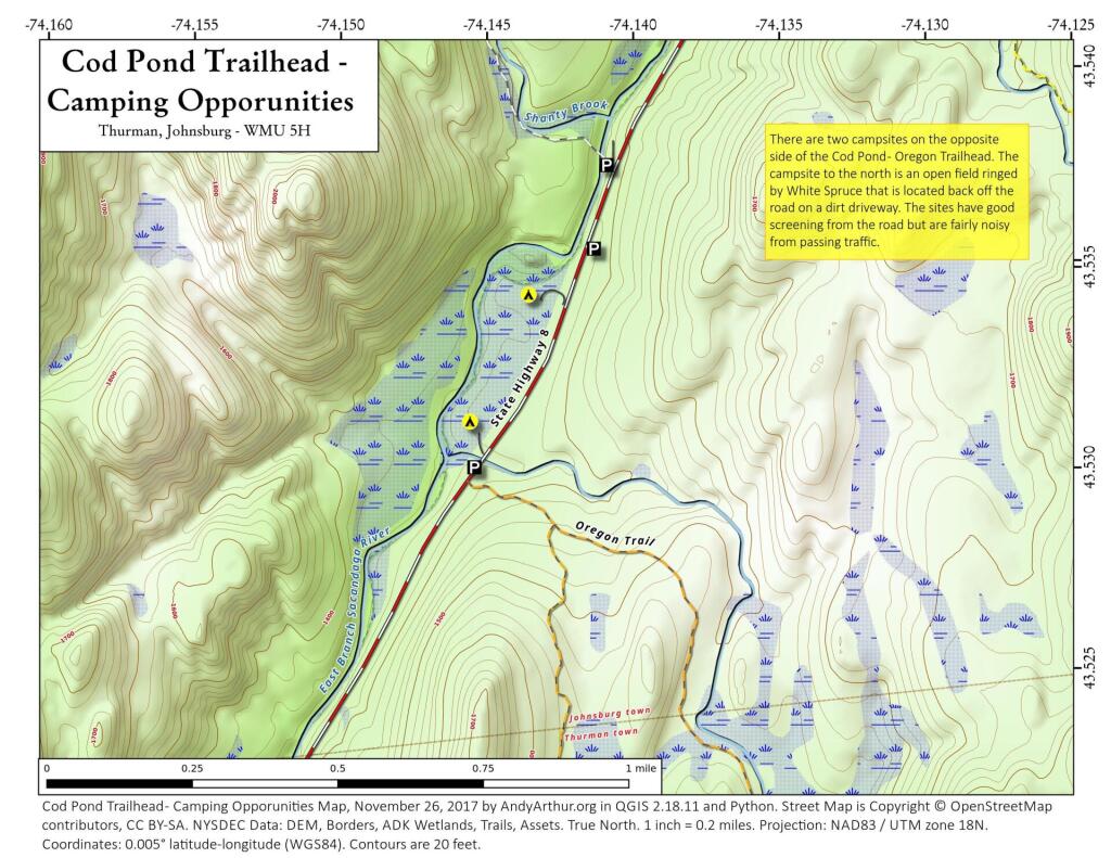
This past weekend I camped at the upper of these two campsites. It was a nice open field surrounded by white spruce. I hadn't ever been back to this campsite, but being sheltered from the wind with great views oft he stars, it is clearly now one of my favorite sites along NY 8. I have not explored the lower site but I confirmed it existed -- or at least the driveway exists to it -- when I was up that way this past weekend.
Michaux State Forest Campsites
Camping outside of Gettyburg Penna on the northern most part of the Blue Ridge. 23 campsites are designated.
You can now check availability of campsites and reserve online: https://maps.dcnr.pa.gov/bof/camping/
West River Road (Whitehouse) Campsites
This interactive map shows the West River Road Campsites at Whitehouse in the Silver Lake Wilderness outside of Wells, NY.
Loyalstock State Forest RV Campsites
I was looking at Loyalstock State Forest in Pennsylvania, possibly for an upcoming trip and was wondering if I could make a map of campsites that specifically can take an RV or camper to use my pickup cap camper on. It turns out I could do this by querying the description field with like %RV%.