Cheney Pond and Lester Flow
Interactive map showing the campsites and lean-tos along Cheney Pond and Lester Flow (Vanderwhacker Creek) in the Cental Adirondacks.
Interactive map showing the campsites and lean-tos along Cheney Pond and Lester Flow (Vanderwhacker Creek) in the Cental Adirondacks.
Interactive map of Giant Mountain in the High Peaks of the Adirondacks. Campsites are from the DEC, Scenic Vistas are from OpenStreetMap (CC-BY-SA).
Interactive map of various campsites, shelters, scenic vistas and observation towers that I created by a mix of heads up digitizing and querying the OpenStreetMap for West Virginia. The heads up digitizing is a bit rough as it is based on memory and I don't get to West Virginia all that often.
Some of this data is ©️ OpenStreet Map Contributors, Open Data Commons Open Database License (ODbL).
43.490132211131176,-73.5804143288084
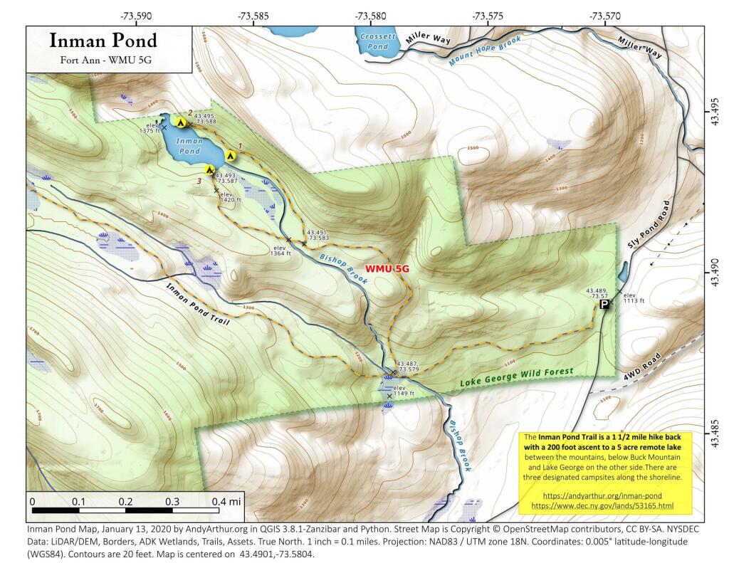
The Inman Pond Trail is a 1 1/2 mile hike back with a 200 foot ascent to a 5 acre remote lake between the mountains, below Buck Mountain and Lake George on the other side.There are three designated campsites along the shoreline.
https://andyarthur.org/inman-pond
https://www.dec.ny.gov/lands/53165.html
For years these have been on and off in the public GIS data from the DEC at Tomannex State Forest. I know the only access to the forest now is via East Branch and Harvard Road to the south so I've never explored it although I admit I am interested in what it's like on the other side of East Branch.
A map of campsites by paid permit in the Delaware State Forest in Milford, PA. You can get a permit and details here: https://www.dcnr.pa.gov/StateForests/FindAForest/Delaware/Pages/Camping.aspx
From the 1898 Thirteenth Lake and 1910 Stoney Creek topographic maps. Contemporary campsites are also shown on this map to see how they interact with old roads and homesteads.