Search Results for: map north south lake campground north

After a cloudy start the sun is out β›… πŸ‘‰ β˜€

Starting to finally get nice out this morning. Going to be a beautiful day.

Good morning! Happy Sunday from Vacationland 2023. Partly sunny and 60 degrees at the Finger Lakes National Forest. There is a north-northwest breeze at 8 mph. πŸƒ. The dew point is 57 degrees. Much cooler than before the front came through.

Woke up pretty early this morning, thinking that it would be a nice morning πŸŒ… and I could get up, use the bucket shitter 🚽 and they have coffee β˜•. I even thought πŸ’­ about taking a ride over to Searsburg Road and watching the sun rise. They promised it would be a beautiful day, and it probably will be but it didn’t clear out by nine o’clock last night as promised by the weathermen. ☁️ I looked to the sky this morning and all I saw was clouds. Maybe I should have pooped πŸ’© and gone back to bed but instead it was apple banana pancakes πŸ₯ž using the remainder of the pancake mix I bought last winter mixed with whole oatmeal, fried apples and mashed bananas. Through
In chia seeds 🌱 for an extra health punch πŸ‘Š.

Going forward I won’t buy any more pancake mix but instead use that whole grain oatmeal with water and bananas. πŸ₯ž I like the hardy more fiber rich oatmeal over the bleached flour, sugar and chemicals of Aunt Jamina’s pancake mix. Less garbage and cost too by using just simple oatmeal and bananas. Really don’t need to waste money πŸ’΅ on packaging to burn. Likewise I’m using real silverware and dishes now while camping as paper plates, and plastic silverware have gotten so expensive with inflation plus who wants to burn all that toxic plastic trash? πŸ—‘

Today will be sunny 🌞, with a high of 71 degrees at 3pm. 13 degrees below normal, which is similar to a typical day around September 24th. Maximum dew point of 57 at 8am. Northwest wind around 9 mph. A year ago, we had cloudy skies. The high last year was 82 degrees. The record high of 100 was set in 1933. Cool but getting sunny for sure.

Today I have a busy agenda planned. πŸ“œ But it’s going to be a great one. I plan to get a fairly early start, bike most of the Cayuta Valley Rail Trail. 🚲 Then swim at the Watkins Glen Pool, get ice cream at Glen Dairy Bar 🍦, ride along Rock Cabin Road, watch the sunset πŸŒ‡ on Seneca Lake. Then back to camp for some hammock time before bed. Greased my chain πŸ”— up well on my bike this morning, cleaned off the mud, and set up the GoPro mount on my bike πŸ“Έ so I can do some video today riding for the blog and YouTube and other social media. πŸ“Ή

Despite a fairly soggy day yesterday, 🌧️ I’ve been feeling great without the alcohol and calories 🀰 of years past, choosing healthier nutrient dense meals 🍴 and whole fruits and vegetables πŸ«‘up here at camp. β›Ί A healthy diet I believe really does improve ones mental health. ☺ While I’m not one to blame the chemicals in processed foods – most of them are relative safe, πŸ§ͺβš—οΈ most of them mask crap ingredients that are rich in low quality fats and sugars while providing not much vitamins, fiber or protein. Plus being skinner I feel great though I certainly have been stuffing myself this weekend πŸ‘ but with higher quality whole foods.

Solar noon 🌞 is at 1:14 pm with sun having an altitude of 66Β° from the due south horizon (-4.7Β° vs. 6/21). A six foot person will cast a 2.7 foot shadow today compared to 2.2 feet on the first day of summer. The golden hour πŸ… starts at 7:51 pm with the sun in the west-northwest (290Β°). πŸ“Έ The sunset is in the west-northwest (297Β°) with the sun dropping below the horizon at 8:31 pm after setting for 3 minutes and 14 seconds with dusk around 9:02 pm, which is one minute and 5 seconds earlier than yesterday. πŸŒ‡ At dusk you’ll see the Full 🌝 Moon in the southeast (146Β°) at an altitude of 11Β° from the horizon, 228,672 miles away. πŸš€ The best time to look at the stars is after 9:43 pm. At sunset, look for mostly clear skies πŸŒ„ and temperatures around 64 degrees. The dew point will be 53 degrees. There will be a northwest breeze at 5 mph. Today will have 14 hours and 35 minutes of daytime, a decrease of 2 minutes and 6 seconds over yesterday.

Yesterday became a wet day, though later then expected. Rochester got the rain early, we got it later in the Finger Lakes. 🌧️ Breakfast was eggs with tomatoes, onions and peppers with a side of old breakfast sausage I bought last winter. Rode Blackie 🚡 to the top of Hector Backbone though I admit I dismounted and pushed the bicycle part of the way. I had lower gears βš™ to drop it down to but I wasn’t feeling motivated. At the top by Blueberry Hill Campground 🫐 it started to rain – it was already one o’clock before that happened. More of a passing shower, waited waited it out under a tree. 🌳 Rode around the campground, the fee is now up to $15 a night though I can’t imagine camping so packed in with others. I like my fires πŸ”₯ and music 🎢, I would be a nuisance if I had to camp around others. 🀫

Tried to get good cell service up there πŸ“Ά without much luck. A few bars but it was slow, possibly due to the weather. β›ˆ Rode down the backbone to Potomac Road, much more fun going down then over to Potomac Ponds which I started back, started slinging mud 🐽 and decided to turn back when the trail got too muddy. I rode down old Chicken Co-op Road as my GPS calls it πŸ—Ί and the sky just opened up. β›ˆοΈ I wanted to see my favorite old campsite and see how the mud wallow was holding up after all the stone I dumped in it last year. Still quite muddy. Glad I got the site I like on Potomac instead. I headed back to camp, I didn’t mind being soaked as it was still quite warm. πŸ§… Fried up another delicious πŸ˜‹ Vadella onion on the griddle – sliced it into rings, put it on a cast iron skillet and added a little MSG to really make it pop. Dessert was red kidney beans with some maple syrup 🍁 and a beer 🍻. Had two beers yesterday between lunch and dinner which is my limit though the first day I had one and maybe none today.

As the front came through the rain picked up and the temperature dropped. 🌑️ I read for a while πŸ“– and listened to a podcast πŸ“» from Focus on Albany with Cynthia Pooler interviewing Leon Van Dyke. Interesting history about how the Democratic 🐴 machine worked and the $5 votes πŸ—³ and the fear people had about ever speaking up about the machine. Found out John Wolcott is returning home Monday for hospice care, πŸ§‘β€βš•οΈ but he’s still pretty much in his final hours, hope to visit him at least one more time when I get back from vacation. Had some great interviews with John Wolcott and Leon Van Dyke over the years though I wish we had started years earlier 🎀 before John lost much of his memory and became so frail after getting bit by a tick and collapsing one day in his bathtub πŸ›. Tick born illnesses are no joke. 🐜

After a while with the wind and the rain β˜” I started to get chilled through at camp and decided I needed to take off my wet clothes. πŸ‘š I got jeans and a hoodie on, bedded down in my truck with the remainder of the Boggleheads investing book πŸ“™ which I finally finished off before putting on a different podcast about the history of Mad Magazine before nodding off. 🀑 Got some shut eye πŸ‘οΈ for a few hours before dinner time.

Dinner was more salmon 🐠 with delicious pearl onions, mini red potato πŸ₯” , sweet corn and fried slices of tomato πŸ… – the second half of the big juicy one I got at the farm stand. I still have a full tomato left, it’s like heaven. Eating good. Rode up to Searsburg Road 🚲 hoping to catch the sunset but it was still gray last night but I do have good reception πŸ“Ά there. Maybe tonight though I think I’ll watch the sunset tonight from Seneca Lake πŸŒ‡. Decided I wanted to get some more miles in before bed πŸ› after a fairly lazy day 😴 so around dusk started over to Foster Pond on the bicycle but turned back as drizzle started. πŸ”™ Had a small campfire πŸ”₯ at warm myself and retired to bed around ten πŸ”Ÿ. Early by vacation standards when it’s not really dark out until around nine.

Tonight will have increasing clouds ☁, with a low of 56 degrees at 5am. Six degrees below normal, which is similar to a typical night around September 6th. Maximum dew point of 54 at 6pm. Northwest wind around 6 mph becoming southwest in the evening. In 2022, we had mostly clear skies in the evening, which became partly cloudy by the early hours of the morning. It got down to 60 degrees. The record low of 49 occurred back in 2021.

One month πŸ“… from now will the Average High Falls To 79 ️Degrees ⛱️️️ when the sun will be setting at 7:47 pm with dusk at 8:14 pm. As they say, all good things must come to an end, autumn leaves must fall. But first, summer vacation! πŸ–

Mud Lock In Cayuga Lake

State Truck Trails and Forest Preserve Roads Over A Half Mile

Looking for state land to wheel on? This list shows all of the conservation department-maintained DEC truck trails and public access roads that are more then a 1/2 mile long. This roads are varied, but most of them are dirt roads that take you through the back country. Town maintained roads through state forests are generally not shown on in this listing.

State Land Road Miles
Albert J. Woodford Memorial State Forest Truck Trail 0.7
Albert J. Woodford Memorial State Forest Janis Road 1.1
Aldrich Pond Wild Forest Powell Road 0.5
Aldrich Pond Wild Forest Mullins Flow Road 0.6
Aldrich Pond Wild Forest Little River Road 0.7
Aldrich Pond Wild Forest Silver Dawn Road 0.7
Aldrich Pond Wild Forest Jackworks Trail 1.1
Aldrich Pond Wild Forest South Creek Lake Road 1.6
Aldrich Pond Wild Forest Tyler Road 3.7
Aldrich Pond Wild Forest Streeter Lake Road 4.8
Allen Lake State Forest George Forest Road 1.5
Ambler State Forest Truck Trail 1.8
Ampersand Primitive Area Ampersand Park Road 3.2
Andersen Hill State Forest Big Pine Public Forest Acess Road 1.5
Arctic China State Forest China Public Forest Access Road 1.1
Arctic China State Forest Shears Public Forest Access Road 2
Arctic China State Forest Dunbar Public Forest Access Road 2.1
Armlin Hill State Forest Truck Trail 1.1
Arnold Lake State Forest Public Forest Access Road 0.9
Arnold Lake State Forest Hartwick Forest Access Road 1
Ashland Pinnacle State Forest Ashland Pinnacle Access Road #2 0.5
Ashland Pinnacle State Forest Haul Road #1/Long Path Hiking Trail 1.4
Avon Regional Office Goodlake Year Entrance Road 0.7
Baker School House State Forest Baker School House Public Forest Acess Road 1.8
Bald Mountain State Forest Howe Forest Road 2.4
Balsam Creek State Forest Briar Hill Road 1.5
Barbour Brook State Forest Barbour Brook Public Forest Access Road 2
Basswood State Forest Burlington Public Forest Access Road 0.5
Basswood State Forest Basswood Pond Public Forest Access Road 1
Basswood State Forest Dr. Crouch Truck Trail 1.3
Bates State Forest Pucker Street 1
Bates State Forest Bates Forest Road 2.6
Battle Hill State Forest Unnamed 1.3
Bear Pond Primitive Area Bear Pond Road 0.8
Bear Swamp State Forest Karsch Haul Road 0.5
Bear Swamp State Forest Joe Chamberlin Public Forest Access Road 1.6
Bear Swamp State Forest Roseboom Public Facility Truck Trail 1.8
Bear Swamp State Forest Snowmobile Trail 8.3
Bearpen Mountain State Forest Ski Run Road 2.1
Beartown State Forest Town Road 0.7
Beartown State Forest Cotton Road 0.8
Beartown State Forest Steam Mill Road 0.8
Beartown State Forest Aspen Hollow Road 2.4
Beaver Creek State Forest Public Forest Access Road 2, Madison 11 0.5
Beaver Creek State Forest Truck Trail -2-12 0.7
Beaver Creek State Forest Public Forest Access Road 1, Madison 11 1.3
Beaver Creek State Forest Truck Trail -1-12 3.6
Beaver Dam State Forest Sears Public Forest Acess Road 1.4
Beaver Meadow State Forest Weir Dam Truck Trail 0.5
Beebe Hill State Forest Barrett Pond Road 1.4
Beebe Hill State Forest Loop Road 2.3
Big Brook State Forest County Line Road Spur 0.6
Big Brook State Forest Walasek Mulcoy Road 0.8
Big Brook State Forest Hanifin Road 0.9
Big Brook State Forest County Line Road 1.4
Birdseye Hollow State Forest Sanford Lake Access Road 0.5
Black Creek State Forest Stanley Road 1.1
Black River Wild Forest Remsen Falls Trail 0.5
Black River Wild Forest Woods Lake Road 0.5
Black River Wild Forest Gull Lake Road 0.6
Black River Wild Forest Flansburg Road 0.7
Black River Wild Forest Party Road 0.7
Black River Wild Forest Black Creek Road 0.8
Black River Wild Forest Cohen Road 1.7
Black River Wild Forest Flansberg Road 2.6
Black River Wild Forest Black Creek Lake Road 3
Black River Wild Forest Haskell Road 3
Black River Wild Forest Mill Creek Road 3.4
Black River Wild Forest Nicks Lake Campground Roads 3.5
Black River Wild Forest Wolf Lake Landing Road 4.8
Black River Wild Forest West Creek Road 6.3
Blenheim Hill State Forest Ward Allen Road 1.1
Blenheim Hill State Forest Quarry Road 1.2
Blue Mountain Wild Forest Deer Pond Road 1.1
Blue Mountain Wild Forest Chain Lakes Road North 1.3
Blue Mountain Wild Forest Polaris Road 1.3
Bombay State Forest Cross Haul Road 0.7
Bombay State Forest Railroad Bed Public Forest Acess Road 1.2
Bombay State Forest Pike Brook Haul Road 3.1
Bonaparte’s Cave State Forest Corbine Road 0.8
Bonaparte’s Cave State Forest Mud Pond Road 0.8
Boutwell Hill State Forest Arab Hill Forest Road, Cha 1 Section 0.8
Boutwell Hill State Forest Arab Hill Forest Road, Cha 7 Section 2.1
Boyce Hill State Forest Jackson Forest Road 0.6
Brasher State Forest Route 53 Haul Road 0.5
Brasher State Forest Beaver Pond Trail 0.6
Brasher State Forest Kennehan Haul Road 0.8
Brasher State Forest Bush Road 1.1
Brasher State Forest Buckley Haul Road 1.2
Brasher State Forest Cc Dam Public Forest Access Road 1.2
Brasher State Forest Mccarthy Public Forest Access Road 1.6
Brasher State Forest Liberty Public Forest Access Road 1.7
Brasher State Forest Hastings Falls Haul Road 2.1
Brasher State Forest Wilson Public Forest Access Road 2.1
Brasher State Forest Camp / Larue Public Forest Access Road 2.2
Brasher State Forest Pascal Haul Road 2.4
Brasher State Forest Bush Public Forest Access Road 2.9
Brasher State Forest Railroad Bed Public Forest Access Road 3.6
Brokenstraw State Forest Brokenstraw Forest Road 1.7
Bryant Hill State Forest Hawk Forest Road 1.4
Buck Hill State Forest Hertz Road 0.7
Buck Hill State Forest Truck Trail 1.5
Buck Hill State Forest Buck Hill Road 3.1
Bucks Brook State Forest Access Trail 0.6
Buckton State Forest Buckton Haul Road 0.8
Bucktooth State Forest Baily Hollow Forest Road 0.6
Bucktooth State Forest Manley Hill Forest Road 1
Bully Hill State Forest Dixon Forest Road 1
Bully Hill State Forest Connection Forest Road 1.6
Bully Hill State Forest Stearns Forest Road 2.1
Burnt-Rossman Hills State Forest Koenig Road 0.5
Burnt-Rossman Hills State Forest Betty Brook Haul Road 0.6
Burnt-Rossman Hills State Forest Eminence Dead End Truck Trail 0.7
Burnt-Rossman Hills State Forest Duck Pond Road 1.2
Burnt-Rossman Hills State Forest Monkey Run Truck Trail East 1.3
Burnt-Rossman Hills State Forest Yankee Street Truck Trail 1.3
Burnt-Rossman Hills State Forest Betty Brook Road 1.4
Burnt-Rossman Hills State Forest Betty Brook Truck Trail 1.5
Burnt-Rossman Hills State Forest Duck Pond Truck Trail 1.5
Burnt-Rossman Hills State Forest Morey Road Truck Trail 1.7
Burnt-Rossman Hills State Forest Eminence Road Truck Trail 2.6
Burnt-Rossman Hills State Forest Burnt Hill Road 2.9
Bush Hill State Forest Fox Cross Forest Road 2
California Hill State Forest Wayawanda Road 0.7
Canacadea State Forest Macduff Road 2.3
Canadaway Creek Wma Dibble Hill Forest Road 2
Canaseraga State Forest Ringelberg Truck Trail 0.5
Canaseraga State Forest Right Fork Truck Trail 1
Canaseraga State Forest Stanley Road 1.1
Canaseraga State Forest Left Fork Truck Trail 1.4
Caroga Lake Campground Campground Road 2
Catherineville State Forest Santamont Access Trail 1.1
Catherineville State Forest Circle Public Forest Access Road 1.8
Charles E. Baker State Forest Truck Trail 5 0.6
Charles E. Baker State Forest Truck Trail 2 0.9
Charles E. Baker State Forest Truck Trail 6 0.9
Charles E. Baker State Forest Truck Trail 4 1.4
Charles E. Baker State Forest Truck Trail 12 1.5
Charles E. Baker State Forest Truck Trail 8 1.9
Charles E. Baker State Forest Truck Trail 7 2.1
Charles E. Baker State Forest Truck Trail 1 3
Charles E. Baker State Forest Truck Trail 13 3.2
Chazy Highlands State Forest Spring Road 0.6
Cherry Valley State Forest Kniskern Public Access Road 1.2
Cherry Valley State Forest Mosse Public Forest Access Road 1.9
Cinnamon Lake State Forest Hornby Road Haul Road 0.7
Clapper Hollow State Forest Clapper Hollow Truck Trail 1
Clark Hill State Forest Abandoned Town Road 0.8
Clark Hill State Forest Truck Trail 0.9
Clark Hill State Forest Access Road North Of Buck Hill Road 0.9
Clark Hill State Forest Class A Truck Trail 1.2
Clark Hill State Forest Haul Road 1.3
Cliffside State Forest Railroad Haul Road 1.3
Cobb Brook State Forest Unnamed Truck Trail 0.6
Cold Creek State Forest Headwaters Forest Road 1.4
Cold Spring Brook State Forest Cold Spring Brook Public Forest Access Road 1.9
Cole Hill State Forest Cr 2 Access Road 0.8
Coyle Hill State Forest Warner Spur Forest Road 0.5
Coyle Hill State Forest Slawson Forest Road 0.8
Coyle Hill State Forest Warner Forest Road 1.8
Cranberry Lake Campground Campground Road 2.5
Cranberry Lake Wild Forest Grass River Railroad 6.1
Cuyler Hill State Forest Jipson Hill Public Forest Acess Road 1.3
Cuyler Hill State Forest Cuyler Hill Public Forest Acess Road 5.1
David A. Sarnoff Preserve Field Access Road 0.8
Debar Mountain Wild Forest Debar Game Refuge Road 0.5
Debar Mountain Wild Forest Debar Meadow Road 0.6
Debar Mountain Wild Forest Vanderwalker Road 0.9
Debar Mountain Wild Forest 4 Mile Road Riffle Season Access Corridor 1.1
Debar Mountain Wild Forest Ny Centrail Railroad Bed 2.2
Deer River State Forest Ccc Road 0.6
Deer River State Forest Hogsback Road 0.6
Deer River State Forest Willow Road 0.6
Deer River State Forest Glaze Road 0.7
Deer River State Forest Avery Lot Road 0.9
Deer River State Forest Esseltine Hill Road 0.9
Deer River State Forest Ricky’s Number Trail 1
Deer River State Forest Horse Barn Road 1.2
Deer River State Forest Laramie Road 1.3
Deer River State Forest Beanville Road 1.4
Deer River State Forest Spruce Road 1.6
Deer River State Forest Loope Road 2
Deer River State Forest Firewood Road 2.6
Degrasse State Forest Burns Flats Road 0.5
Degrasse State Forest Loop Road 1.2
Deruyter State Forest Tromp Road 1.5
Dobbins Memorial State Forest Snowmobile Trail 3.5
Dog Hollow State Forest Brewer Public Forest Acess Road 0.9
Downerville State Forest River Public Forest Access Road 1
Dry Run State Forest Wildcat Hollow 0.8
Dunkin’s Reserve State Forest Access Road 3.5
Dutch Settlement State Forest Haul Road #1 0.6
Dutton Ridge State Forest Dutton Ridge Access Road 1.5
Earlville State Forest Mad 2 Forest Access Road 1.5
East Osceola State Forest Malloy Brook Road 1.1
East Otto State Forest Kriedeman Forest Road 1.7
Edgewood Oak Brush Plains Preserve Edgewood Oak Brush Plains Preserve 0.5
Edgewood Oak Brush Plains Preserve Unpaved Forest Road 0.5
Edgewood Oak Brush Plains Preserve Old Commack Road 1.6
English Hill State Forest Ricketts Forest Road 0.9
Exeter State Forest Exeter Public Forest Access Road 1.3
Fairfield State Forest Jenksville Hill Public Forest Acess Road 2
Fall Brook State Forest Gossner Road 0.6
Fall Brook State Forest Haul Road To B-45 Wetland 0.9
Fall Brook State Forest Access Road From Co. Rt 67A 1
Fall Brook State Forest Forest Access Roaad 1.2
Ferris Lake Wild Forest Meco Lake Trail 0.9
Ferris Lake Wild Forest Sheriff Lake Trail 0.9
Ferris Lake Wild Forest Mud Lake Road 5.5
Fish Creek State Forest Forward Road 0.5
Fish Creek State Forest Trestle Road 0.6
Fish Creek Wma State Highway 184 Access Road 0.9
Five Rivers Education Center Goose Lane 0.5
Flat Rock State Forest Pedobo Road 0.8
Flat Rock State Forest Karsch Haul Road 0.9
Flat Rock State Forest Ampersand Park Road 1.9
Florence Hill State Forest Florence Hill Road 1.9
Fort Jackson State Forest Sheldon Public Forest Access Road 0.5
Frank E. Jadwin Memorial State Forest Keesler Road 0.6
Frank E. Jadwin Memorial State Forest Old Croghan Road 0.7
Frank E. Jadwin Memorial State Forest Henry Road 0.8
Frank E. Jadwin Memorial State Forest Nelson Road 0.8
Frank E. Jadwin Memorial State Forest Wahalula Road 0.8
Frank E. Jadwin Memorial State Forest Q- Road 1.5
Frank E. Jadwin Memorial State Forest Patchin Road 1.7
Frank E. Jadwin Memorial State Forest Blanchard Creek Road 2.7
Frank E. Jadwin Memorial State Forest Wisner Road 2.7
Frank E. Jadwin Memorial State Forest Judy Cole Road 2.8
Frank E. Jadwin Memorial State Forest Loop Road 3.2
Fulton Chain Wild Forest Cary Lake Road 1.8
Furnace Creek State Forest Miller Road East 0.7
Furnace Creek State Forest Powerline Row 0.7
Furnace Creek State Forest Sheehan Road 1.2
Furnace Creek State Forest B-29 Road 1.4
Gates Hill State Forest Coons Den Truck Trail 0.6
Gates Hill State Forest Eviann Road 1.2
Genegantslet State Forest South Loomis Road 0.7
Gillies Hill State Forest Abbey Forest Road 0.9
Gillies Hill State Forest Pettit Forest Road 1.4
Golden Hill State Forest Firelane Forest Road 1.6
Goundry Hill State Forest Guiren Road 1
Goundry Hill State Forest Corbett Hollow Access Road 1.1
Grant Powell State Forest Huck Berry Road 2.1
Grass River Wild Forest Spruce Mountain Road 0.8
Grass River Wild Forest Hollywood Road 2.5
Grass River Wild Forest Railroad Grade Road 2.9
Greenwood Creek State Forest Grass Pond Public Forest Access Road 0.9
Grigg’s Gulf State Forest Grigg’s Gulf Public Forest Acess Road 1.5
Gulf Unique Area Gulf R.O.W. Road 0.5
Gulf Unique Area Old Skid Road 1.1
Hall Island State Forest Unnamed Public Forest Acess Road 0.7
Hammond Hill State Forest Redman Run Public Forest Acess Road 1.1
Hammond Hill State Forest Cannan Public Forest Acess Road 1.3
Hammond Pond Wild Forest Paynes Way 0.7
Harris Hill State Forest Sprague Forest Road 0.8
Harvey Mountain State Forest Harvey Mt Access Road 0.9
Harvey Mountain State Forest East Hill Access Road 2.4
Hatch Creek State Forest Hodge Forest Road 0.6
Hatch Creek State Forest North Forest Road 0.8
Hatch Creek State Forest South Forest Road 0.9
Hemlock-Canadice State Forest South Hemlock Access Road 0.7
Henderson Shores Unique Area Radar Road 0.8
Hewitt State Forest Hewitt Rd 1.1
Hickok Brook Multiple Use Area Spur Road 0.7
Hickok Brook Multiple Use Area Main Road 1.1
High Flats State Forest Chapel Hill Access Trail 0.5
High Flats State Forest Crowley Access Trail 0.5
High Flats State Forest Close Pond Access Trail 0.7
High Flats State Forest Donovan Public Forest Access Road 1.1
High Knob State Forest Shale Pit Road 1.9
High Peaks Wilderness Northville-Placid Trail-Northern Terminus 1.1
Hill Higher State Forest Hill Higher Forest Road 1.1
Hinckley State Forest Elm Flats Road 0.5
Hinckley State Forest Roberts Road 0.5
Hinckley State Forest Lanning Road 0.8
Hinckley State Forest Access Road 1.6
Hinckley State Forest Black Creek Road 2
Hogsback State Forest Forest Access Road 3
Honey Hill State Forest Edwards Public Forest Access Road 1.4
Hooker Mountain State Forest Norton Public Forest Access Road 0.8
Horseshoe Lake Wild Forest Cut Off Road 0.6
Horseshoe Lake Wild Forest Lower Dam Road 0.7
Horseshoe Lake Wild Forest Otter Brook Trail 0.9
Horseshoe Lake Wild Forest Grass River Railroad 1.7
Horseshoe Lake Wild Forest Otter Brook Road 2.2
Hoxie Gorge State Forest Russel Hill Public Forest Acess Road 2.5
Huntersfield State Forest Huntersfield Access Road #2 0.7
Huntersfield State Forest Huntersfield Access Road #1 1.9
Hunts Pond State Forest Truck Trail 1.7
Independence River State Forest Assembly Road 1
Independence River Wild Forest Blue Jog Road 0.5
Independence River Wild Forest Sunday Lake Road 0.5
Independence River Wild Forest Evies Pond Road 0.7
Independence River Wild Forest Burnt Creek Road 0.7
Independence River Wild Forest Elbow Rd 0.7
Independence River Wild Forest Shortcut Road 0.8
Independence River Wild Forest Fish Pond Road 1
Independence River Wild Forest Halfmoon Lake Rd 1
Independence River Wild Forest Little Otter Creek Road 1
Independence River Wild Forest Long Pond Spur 1
Independence River Wild Forest East Loop Road 1.1
Independence River Wild Forest Copper Lake Road 1.2
Independence River Wild Forest Necessary Dam Road 1.2
Independence River Wild Forest Pitcher Pond Road 1.3
Independence River Wild Forest Hinchings Pond Road 1.8
Independence River Wild Forest Basket Factory Road 2.1
Independence River Wild Forest Catspaw Lake Road 2.4
Independence River Wild Forest Confusion Flats Road 2.6
Independence River Wild Forest Big Otter Lake Road 3.1
Independence River Wild Forest Stony Lake Road 3.1
Independence River Wild Forest Florence Pond Road 3.1
Independence River Wild Forest Steam Mill Road 3.5
Independence River Wild Forest Smith Road 3.7
Indian Pipe State Forest Dunes Road 0.7
Indian River Wma Red Lake Road 2
Jackson Hill State Forest Forest Access Road 2.1
Jersey Hill State Forest Scholes Forest Road 1.6
Jessup River Wild Forest Lake Colby Camp Road 0.7
Karr Valley Creek State Forest Frungillo Forest Road 0.8
Karr Valley Creek State Forest Norton Forest Road 1.3
Karr Valley Creek State Forest Davison Forest Road 1.4
Keeney Swamp State Forest Fitch Hill Spur Forest Road 0.7
Keeney Swamp State Forest C3D 0.8
Keeney Swamp State Forest Fitch Hill Forest Road 1.2
Keeney Swamp State Forest Gordon Forest Road 1.4
Kennedy State Forest Courtney Hill Public Forest Acess Road 0.7
Kennedy State Forest Cotton-Hanlon Public Forest Acess Road 1
Kennedy State Forest Kennedy Public Forest Acess Road 2.5
Kenneth Wilson Campground Campground Road 9.7
Ketchumville State Forest Ketchumville Public Forest Acess Road 1
Keyserkill State Forest Guinea Road Truck Trail 1
Keyserkill State Forest Keyserkill Truck Trail #1 1.3
Klipnocky State Forest Emery Forest Road 1.2
Klipnocky State Forest Marble Forest Road 1.6
Klondike State Forest Klondike Public Forest Acess Road 1.7
Lafayetteville Multiple Use Area Wilbur Flats Road 0.9
Lake Durant Campground Scott Public Forest Acess Road 0.9
Lake George Wild Forest Jabe Pond Road 1
Lake George Wild Forest Dacy Clearing Road 1.6
Lake George Wild Forest Lily Pond Road 2.1
Lake George Wild Forest Gay Pond Road 4
Lake Harris Campground Campground Road 0.9
Lakeview Marsh Wma Skinner Road 0.7
Leonard Hill State Forest Leonard Hill Access Road #1 0.7
Leonard Hill State Forest Leonard Hill Access Road #3 1.2
Leonard Hill State Forest Leonard Hill Access Road #2 1.6
Lesser Wilderness State Forest Gomer Hill Road 0.5
Lesser Wilderness State Forest Toole Road 0.6
Lesser Wilderness State Forest Alguire Road 0.7
Lesser Wilderness State Forest Smith Road 0.8
Lesser Wilderness State Forest Nob Road 0.9
Lesser Wilderness State Forest Seelman Road 1.3
Lesser Wilderness State Forest Mcgoldrick Road 3
Lesser Wilderness State Forest #9 Road 4.7
Limekiln Lake Campground Lime Kiln Lake Campground Trails 3.9
Linda Gronlund Memorial At Barcelona Neck Trustee Road West 1
Linda Gronlund Memorial At Barcelona Neck Trustee Road East 1.7
Lonesome Bay State Forest Alamogin Public Forest Access Road 2.2
Long Pond State Forest Access Road 0.5
Long Pond State Forest Truck Trail 0.7
Long Pond State Forest Long Pond Snowmobile Trail 0.8
Lookout State Forest Ball Road 0.6
Lost Nation State Forest Brookdale Road / Jenkins Corners Rd / Red Barn Rd 2.5
Lost Valley State Forest Lost Valley Haul Road 1.2
Lowville Demonstration Area Dadville Road 0.6
Ludlow Creek State Forest Trail Road 1.3
Lutheranville State Forest Access Road #1 0.5
Lutheranville State Forest Access Road #2 1.2
Lyon Brook State Forest Lyon Brook Truck Trail 1.2
Mad River State Forest Thompson Corners Florence Road 0.5
Mad River State Forest Bartlett Road 0.6
Mad River State Forest Rehm Road 0.6
Mad River State Forest Phalen Road South 1.9
Mad River State Forest Mcspirit Road 2.1
Madawaska Flow – Quebec Brook Primitive Area Benz Pond Road 2.2
Mallet Pond State Forest Cemetery Road Truck Trail 2
Maxon Creek State Forest Pease Hill Public Forest Acess Road 1
Mccarthy Hill State Forest Main Access Road 0.5
Mccarty Hill State Forest Ccc Forest Road 1.5
Mccarty Hill State Forest Mccarty Hill East Forest Road 2
Mcdonough State Forest Ccc Trail 1
Mcdonough State Forest Truck Trail 4 1.1
Mcdonough State Forest Finger Lakes Trail 1.8
Mcdonough State Forest Truck Trail 3 2
Melondy Hill State Forest Public Forest Access Road 2.5
Montrose Point State Forest Through Trail 0.6
Moose River Plains Wild Forest Loop Road 1.2
Moose River Plains Wild Forest Indian Lake Road 3.4
Moose River Plains Wild Forest Otter Brook Road 3.4
Moose River Plains Wild Forest Rock Dam Road 4.2
Moose River Plains Wild Forest Lime Kiln Lake – Cedar River Road 16.9
Morgan Hill State Forest Herlihy Haul Road 0.6
Morgan Hill State Forest Keith Gutchess Haul Road 0.7
Morrow Mountain State Forest Mollie Road 2.8
Mount Hunger State Forest Whalen Road 0.6
Mount Pisgah State Forest Mt Pisgah Access Road #1 1.3
Mount Pleasant State Forest Beck Forest Road 0.6
Mount Pleasant State Forest Brumagin Forest Road 0.7
Mount Pleasant State Forest Spruce Forest Road 0.8
Mount Tom State Forest Notch Lane Access Road 1.4
Mount Tom State Forest Shaker Hollow Access Trail 1.4
Muller Hill State Forest Davenport Road 1.4
Muller Hill State Forest Bliss Road 1.5
New Forge State Forest New Forge Access Road #2 0.5
New Forge State Forest New Forge Access Road #3 0.6
New Forge State Forest New Forge Access Road 1.5
Newfield State Forest Irish Hill Haul Road 0.8
Nicks Lake Campground Nicks Lake Campground Roads 0.6
Nimham Mountain Multiple Use Area Coles Mills Road 0.7
Nimham Mountain Multiple Use Area Tower Road 0.7
Nine Mile Creek State Forest North Nine Mile Town Road 0.5
Nine Mile Creek State Forest Phearsdorf Forest Road 0.5
Nine Mile Creek State Forest North Nine Mile Forest Road 2.2
North Harmony State Forest Snake Forest Road 0.9
North South Lake Campground South Lake Road 1.3
North South Lake Campground North Lake Campground Road 1.8
Northhampton Beach Campground Campground Road 5.5
Oakley Corners State Forest Oakley Corners North Public Forest Acess Road 1.6
Ohissa State Forest Cramers Corner Road 0.8
Onjebonge State Forest Lime Quarry Road 1.3
Onjebonge State Forest Alice Coffey Road 2.5
Orebed Creek State Forest Ritz Road 1.3
Ossian State Forest Back Road To Rattlesnake 0.7
Ossian State Forest Scoville Access Road 1
Ossian State Forest Linzy Road Truck Trail 1.8
Otselic State Forest Truck Trail 3.1
Otsquago State Forest Wagner Hill Road 0.8
Otter Creek State Forest Eatonville Road 0.6
Otter Creek State Forest Mikes Road 1.2
Otter Creek State Forest Otter Creek Road 1.5
Palmer’s Pond State Forest Geitner Forest Road 0.7
Palmer’s Pond State Forest Palmer’s Pond Forest Road 1.5
Palmer’s Pond State Forest 6 2.4
Partridge Run Wma Boys Camp Road Ext 2
Patria State Forest Pleasant Valley Road 0.6
Patria State Forest Barkman Road Access 0.6
Patria State Forest Hardscrabble Road Access 0.8
Peck Hill State Forest Swamp Road 0.5
Peck Hill State Forest West Boundary Trail 0.6
Peck Hill State Forest Beaver Vly 0.7
Peck Hill State Forest Dam Road 0.7
Penn Mountain State Forest Star Hill Road 1
Penn Mountain State Forest West Gate Road 2.6
Penn Mountain State Forest South Gate Road 3.6
Penn Mountain State Forest East Gate Road 3.8
Perch River Wma Perch Lake Road 0.5
Perch River Wma Buckminster Road 0.9
Perch River Wma Cook Road 1.4
Perch River Wma Allen Road 2.1
Perch River Wma State Route 12 2.6
Perch River Wma Vaadi Road 3
Perch River Wma Dog Hill Road 4
Pharsalia Woods State Forest Nine Mile Truck Trail Snowmobile Trail 1.6
Piermont Marsh Tidal Wetland Piermont Pier Access Road 0.9
Pine Hill State Forest Bundy Hollow Public Forest Access Road 1
Pittstown State Forest State Fire Lane 2.2
Plainfield State Forest Hughes Public Forest Access Road 1.3
Plattekill State Forest Mountain Brook Road 1
Plumbottom State Forest Reddy Forest Road 3
Point Peninsula Wma Pine Woods Road 1.5
Point Peninsula Wma Beach Road 2.1
Point Peninsula Wma Shore Road 8
Point Rock State Forest Egger Brrok Raod 1.3
Popple Pond State Forest Smith Road 0.7
Popple Pond State Forest Haul Road Shared By Oneida 6 And County Forest 1.6
Popple Pond State Forest Truck Trail 3
Potato Hill State Forest Blackman Hill Rd 1.1
Potato Hill State Forest Level Green Rd 1.2
Pulpit Rock State Forest Watson Road 0.6
Punkeyville State Forest Irish Settlement Road 0.7
Punkeyville State Forest River Road 0.9
R Milton Hick Memorial State Forest Lafleuer Road 1.2
Relay State Forest Relay Public Forest Access Road 1.2
Rensselaerville State Forest Kenyon Road Access 2.4
Ridge Conservation Area And Maintenance Center Mid-Island Access Road 0.5
Rock City State Forest Salamanca Forest Road 0.8
Rock City State Forest Eckert Forest Road 0.9
Rock City State Forest Little Rock City Forest Road 2
Rock Creek State Forest Admin Access Road 1.3
Rockwood State Forest Spring Road 0.5
Rockwood State Forest B Road 0.6
Rocky Point Pine Barrens State Forest Accessible 0.5
Rocky Point Pine Barrens State Forest Firestone Road 1.7
Rural Grove State Forest Rural Grove Access Road (Shibley Road) 3.1
Rush Creek State Forest C2-C 1.2
Rush Creek State Forest Russell Forest Road 3
Sacandaga Campground Sacandaga Campground 1.4
Salmon River State Forest Harpers Ferry Public Forest Acess Road 0.9
Sand Flats State Forest Bucks Corners Road 0.9
Sand Flats State Forest Obrian Road 0.9
Sand Flats State Forest Water Hole Road 1
Sand Flats State Forest Y Road 1.5
Sand Flats State Forest Powell Road 1.7
Sand Flats State Forest Fall Brook Road 2.2
Saranac Lakes Wild Forest Horseshoe Pond Trail 0.5
Saranac Lakes Wild Forest Little Clear Pond Road 0.5
Saranac Lakes Wild Forest Connery Pond Road 0.6
Saranac Lakes Wild Forest Little Green Pond Road 0.6
Saranac Lakes Wild Forest Rollins Pond Access Road 0.8
Saranac Lakes Wild Forest Medow Pond Truck Trail 0.9
Saranac Lakes Wild Forest Bartlett Carry Road 1.2
Saranac Lakes Wild Forest Floodwood Mountain Road 1.2
Saranac Lakes Wild Forest Rat Pond Road 1.5
Saranac Lakes Wild Forest Sunday Pond Road 1.6
Scott Patent State Forest Scott Patent Access Road 1.4
Shawangunk Ridge State Forest Woods Road 1
Shindagin Hollow State Forest Ekroos Public Forest Acess Road 1.4
Skyline Drive State Forest Skyline Drive Public Forest Acess Road 2.2
Slader Creek State Forest Oberdorf Forest Road 2.1
Sonyea State Forest Shaker Access Road 1.9
South Bradford State Forest Ccc Road 1.6
South Hill State Forest South Hill Truck Trail 0.5
South Hill State Forest Public Forest Access Road Extension 0.9
South Hill State Forest South Hill Public Forest Access Road 0.9
South Hill State Forest Kotary Road Extension 1
South Hill State Forest Powerline Road 1
South Mountain State Forest Ashland Pinnacle Access Road #2 0.5
South Mountain State Forest South Mountain Access Road 0.9
South Mountain State Forest Bluebird Road 1.1
South Valley State Forest Phillips Brook Fr First Section 0.7
South Valley State Forest Phillips Brook Forest Road 1.2
St. Regis River State Forest Old Railroad Bed 1.6
Stammer Creek State Forest Sugar Bush Haul Road 1.1
Steam Mill State Forest Zion Public Forest Access Road #2 0.5
Steam Mill State Forest Glass House Hill Road 1
Steam Mill State Forest Assembly Road 1.1
Steam Mill State Forest Steammill Rd 1.4
Steam Mill State Forest Carroll Hill Public Forest Access Road #2 1.9
Steam Mill State Forest Zion Public Forest Access Road #1 2
Steam Mill State Forest Carroll Hill Public Forest Access Road #3 2.5
Stewart State Forest Great Swamp Road 0.5
Stewart State Forest Drakes Ln 0.6
Stewart State Forest Orlando Dr 0.6
Stewart State Forest Ridge Road South 0.6
Stewart State Forest Scofield Lane 0.7
Stewart State Forest Armstrong Lane Trail 0.9
Stewart State Forest Giles Road 0.9
Stewart State Forest Pittman Robertson Pond Road 0.9
Stewart State Forest Weed Road 1.2
Stewart State Forest Beaver Pond Road 1.3
Stewart State Forest Barron Road 1.8
Stewart State Forest Barron Road South 208 1.8
Stewart State Forest Ridge Road 2.8
Stewart State Forest Maple Ave 3.1
Stewart State Forest New Road 3.4
Stockton State Forest Blackman Forest Road 1.4
Stone Store State Forest Fawn Ridge Road 2.7
Sugar Hill State Forest Firetower Access Road 0.5
Sugar Hill State Forest Old Westerfield Road 0.5
Sugar Hill State Forest A Trail 1
Sugar Hill State Forest Pine Knob Road 1
Sugar Hill State Forest Maple Lane 2.1
Summer Hill State Forest Snowmobile Trail 5
Sundown Wild Forest South Mountain Extension 1
Swancott Hill State Forest Tower Road 2.3
Swancott Mill State Forest Swancott Mill Road 0.9
Taconic Hereford Multiple Use Area Pirate Crrek 0.5
Taconic Hereford Multiple Use Area Whatchamacallit 0.5
Taconic Hereford Multiple Use Area Camp 0.6
Taconic Hereford Multiple Use Area Mercury 0.6
Taconic Hereford Multiple Use Area Border Trail 0.8
Taconic Hereford Multiple Use Area Mustang 0.8
Taconic Hereford Multiple Use Area Outer Gut 0.8
Taconic Hereford Multiple Use Area Brockway Road 0.9
Taconic Hereford Multiple Use Area Green Acres 1.2
Taconic Hereford Multiple Use Area Tsp Road 1.2
Taconic Hereford Multiple Use Area Pond Gut Road 1.3
Taconic Hereford Multiple Use Area Timbuktu 1.3
Taconic Hereford Multiple Use Area Fong’s Way 1.4
Taconic Hereford Multiple Use Area Getaway 1.9
Taconic Hereford Multiple Use Area Upper Snowmobile Trail 1.9
Taconic Ridge State Forest Rounds Mountain Rd. 0.8
Taconic Ridge State Forest Robinson’s Hollow Road 0.9
Taconic Ridge State Forest Green Hollow Access Road 1.1
Taylor Creek State Forest T Road Public Forest Access Road 1
Taylor Valley State Forest Seacord Hill Spur Public Forest Acess Road 0.9
Taylor Valley State Forest Seacord Hill Public Forest Acess Road 2.1
Taylor Valley State Forest Mount Roderick Public Forest Acess Road 4.3
Terry Mountain State Forest Lynch Mt Road Trail 1
Terry Mountain State Forest Red Road 1.7
Terry Mountain State Forest Mud Pond Road Trail 2
Terry Mountain State Forest Tower Road 2
Texas Hill State Forest M8 Access Trail 0.6
Texas Hill State Forest Texas Hill Truck Trail 0.7
Texas School House State Forest New Lisbon Public Forest Access Road 1.2
Three Springs State Forest Three Springs Access Road 1.6
Tied Lake Primitive Area Tied Lake Road 1.2
Titusville Mountain State Forest Lee Road 2
Tomannex State Forest Tomannex Public Forest Access Road 1
Tomannex State Forest Haul Road #1 4.7
Toothaker Creek State Forest Garrison Access Trail 1.1
Tri-County State Forest Flanagan Road 0.5
Trout Lake State Forest Cedar Lake Public Forest Access Road 0.5
Tug Hill State Forest Home Run Road 0.6
Tug Hill State Forest Babbit Road 0.8
Tug Hill State Forest Gruntley Road 1.3
Tug Hill State Forest Mile Strip Road 2.5
Tug Hill State Forest Denning (West) Road 2.8
Tug Hill State Forest Willams Road 2.9
Tug Hill State Forest Horace Forward Road 3.3
Tug Hill Wma Alphabet Lane Road 0.8
Tug Hill Wma Runing George Road 1.3
Tug Hill Wma Beech Street Road 1.7
Tug Hill Wma Running George Road 3.8
Tuller Hill State Forest Snyder Hill Public Forest Acess Road 1.6
Tuller Hill State Forest Pipeline Public Forest Acess Road 1.6
Tuller Hill State Forest Vinnedge Public Forest Acess Road 1.7
Turkey Hill State Forest Turkey Hill Public Forest Acess Road 1.3
Turkey Ridge State Forest Turkey Road 0.7
Turnpike State Forest Turnpike Forest Road 2.2
Turnpike State Forest Stewart Forest Road 3.1
Upper And Lower Lakes Wma Canton Access Road 0.5
Upper And Lower Lakes Wma Logging Access Road 0.5
Upper And Lower Lakes Wma Corning Access Road 1
Upper And Lower Lakes Wma Middle Access Road 1.2
Vandermark State Forest Allen Forest Road 1.1
Vandermark State Forest Bird Forest Road 1.5
Vanderwhacker Mountain Wild Forest Cheney Pond Road 0.5
Vanderwhacker Mountain Wild Forest Thilo Road 1.7
Vanderwhacker Mountain Wild Forest Vanderwhacker Road 2.6
Watson’s East Triangle Wild Forest Wolf Creek Road West 0.5
Watson’s East Triangle Wild Forest Deep Cuts Road 0.6
Watson’s East Triangle Wild Forest Tunnel Road 0.7
Watson’s East Triangle Wild Forest Number 1 Road 2.1
Watson’s East Triangle Wild Forest Bear Pond Road 8.4
Webster Hill State Forest Webster Hill Forest Access Road 0.8
West Canada Lake Wilderness Northville-Placid Trail 2.2
West Parishville State Forest Scotch Pine Access Trail 0.5
West Parishville State Forest Red Pine Access Trail 0.7
West Parishville State Forest Kidney Killer Access Trail 0.9
Whalen Memorial State Forest Whalen Forest Road 1.6
Whaupaunaucau State Forest Haul Road #4 0.5
Whaupaunaucau State Forest Alguire Road 1
Whaupaunaucau State Forest C8 – B15 Road 1.3
Whippoorwill Corners State Forest Loop Access Road 1.3
Whiskey Flats State Forest Capell Access Road 0.5
Whiskey Flats State Forest Sochia Pond Public Forest Access Road 0.5
Whiskey Flats State Forest Sandy Public Forest Access Road 0.7
White Pond Multiple Use Area Farmers Mills Road 0.9
White Pond Multiple Use Area White Pond Road 1
Wilcox Lake Wild Forest Dorr Road 0.5
Wilcox Lake Wild Forest Lizard Pond Road 0.6
Wilcox Lake Wild Forest Mud Pond Road 0.7
Wilcox Lake Wild Forest Fish Ponds Road 0.8
Wilcox Lake Wild Forest Harrisburg Lake Road 1.5
Wilcox Lake Wild Forest Pumpkin Hollow Road 1.5
Wilcox Lake Wild Forest Oregon Road 1.7
Wilcox Lake Wild Forest West Stony Creek Road 5.4
Wiley Brook State Forest Finger Lakes Trail 0.7
William C. Whitney Wilderness Lake Lila Road 5.8
Wilson Hill Wma Sand Road 0.6
Wilson Hill Wma Northern Access Road 1.9
Winona State Forest Blood Road 0.7
Winona State Forest Hessel Road 0.9
Winona State Forest Remington 1.1
Winona State Forest Hawley Road 1.5
Winona State Forest Tucker Road 2.6
Winona State Forest Bargy (Main) Road 3.2
Wolf Lake State Forest Orbegezo Row 1.4
Woodland Valley Campground Woodland Valley Road 0.5
Woodland Valley Campground Camping Trail Road 0.8
Yatesville Falls State Forest Yatesville Falls Access Road 1.2

Along Pheasant Truck Trail

Looking for state land to wheel on? This list shows all of the conservation department-maintained DEC truck trails and public access roads that are more then a 1/2 mile long. This roads are varied, but most of them are dirt roads that take you through the back country. Town maintained roads through state forests are generally not shown on in this listing.

The Catskill Wilderness Areas

Trees and Mountains

The text of today’s fodder is based on the Catskill Park State Lands Master Plan, as revised in 2008. Maps were rendered by myself, using Quantum GIS and DEC Lands and Forests data.

Big Indian Wilderness

(Formerly Big Indian – Beaverkill Range Wilderness Area)

This wilderness is located in the Towns of Hardenburgh, Denning and Shandaken in Ulster County. It lies generally west of Oliverea and the Frost Valley Road, south of Belleayre Ski Center, east of Seager and Hardenburgh and north of Willowemoc and Claryville. The area ranges in width from 1 to 5 miles, is about 19 miles long and contains approximately 33,500 acres of land. Elevations range from 1,500 feet in McKenley Hollow to 3,840 feet where the state boundary crosses Doubletop Mountain. The mountains in the northeastern portion of the area are quite rugged, while those to the south and west are more characteristic of high hills. Water from the area flows into three New York City water supply reservoirs and the Delaware River Basin. Nine mountains or ridges with elevations of over 3000 feet make up the area.

Peaks

Doubletop* 3,860′
Haynes 3,420′
Big Indian 3,700′
Spruce 3,380′
Fir 3,620′
Eagle 3,600′
Hemlock 3,240′
Balsam* 3,600′
Beaver Kill Range 3,377′

* Maximum elevations given are not necessarily located within the Wilderness Area.

The forest cover is predominantly hardwood mixtures in various associations. Spruce and fir, while present at some of the higher elevations, are less noticeable here than in other Catskill wilderness areas.

Interior facilities consisting of foot trails and lean-tos are generally considered adequate.

Area statistics:

Approximate Area 33,500 Acres
Roads (non conforming) 1.4 Miles
Foot Trails 29.4 Miles
Lean-tos 6
Designated Campsites 5
Parking Lots 5
Public Use (visitors/year) 4,500
Exterior Boundary Line 67 Miles
Minimum Elevation 1,500′
Maximum Elevation 3,840′

Non-conforming uses:

Motor vehicle use of Black Bear Road from the wilderness boundary to Fall Brook Lean-to.

A UMP for this area was completed in June of 1993.

Hunter – West Kill Wilderness

(Formerly West Kill – North Dome Wilderness, Ox Clove Wild Forest, and a portion of the former Hunter Mountain Wild Forest)

The unit generally lies within the following boundaries: New York State Route 42 on the west, the Shandakan Wild Forest and NYS Route 28 to the south, and NYS Route 214 on the east. The northern extent of the unit is County Route 6, and continues along a line 100′ parallel to, and south or east of, the edge of Spruceton trailhead parking area and the centerline of the Spruceton Truck Trail, to the junction of the Colonel’s Chair Trail. A corridor, 100 feet either side of the center line of the Spruceton Truck Trail, from the Colonel’s Chair Trail to the summit of Hunter Mountain, culminating in a circle 175′ in radius from the center of the chimney on the observer’s cabin shall be within the Rusk Mountain Wild Forest.

The unit contains approximately 27,000 acres of land, and inside it’s boundaries are found the named mountain peaks of Balsam, Sherrill, North Dome, West Kill, Sheridan, Hunter and Southwest Hunter. Hunter Mountain is the second highest peak in the Catskills at 4,040 feet, and portions of it’s summit, along with a fairly extensive area on the summits of West Kill, North Dome and Sherrill Mountains are within the Catskill High Peaks Bird Conservation Area, and are of special significance in that they provide habitat for high elevation spruce-fir inhabitants such as Bicknell’s Thrush and the Blackpoll Warbler, among others.

There are currently two lean-to’s on the unit, the Diamond Notch lean-to located just off the Diamond Notch Trail, and the Devil’s Acre Lean-to off of the Devil’s Path Trail. Waters from this unit drain into Schoharie and Esopus Creeks and then into the Schoharie and Ashokan Reservoirs, which are in the New York City water supply system.

Area statistics:

Approximate Area 27,000 Acres
Foot Trails 18 Miles
Lean-to’s 2
Parking Lots 5
Minimum Elevation 920′ Maximum Elevation 4,040′

Indian Head Wilderness

(Formerly Plateau Mountain – Indian Head Mountain Wilderness Area)

This wilderness is located in the Town of Hunter, Greene County and the Towns of Saugerties and Woodstock, Ulster County. It lies generally west of the east boundary of the Catskill Park, south of Platte Clove, east of Devil’s Tombstone Campground and north of Lake Hill and Shady. The area ranges from 1 ½ miles to 3 ½ miles in width, is eight miles long and contains approximately 16,800 acres.

Elevations range from 900 to 3840 feet and the four major mountains in the area are visible against the skyline from all directions. Echo Lake, the only natural lake in a Catskill wilderness, is located in the east-central portion of the area. Water from this eastern section flows into the Kingston and Saugerties water supply reservoirs, while drainage from the central and western section flows into two New York City water supply reservoirs. Six named mountain peaks over 3,000 feet in elevation dominate the area.

Peaks

Plateau 3,840′
Indian Head 3,573′
Sugarloaf 3,800′
Olderbark 3,440′
Twin 3,640′
Plattekill 3,100′

The forest cover varies from extensive oak stands on the eastern most slopes to mature spruce-fir on top of Plateau Mountain. An excellent mature stand of northern hardwood and hemlock occupies the slopes south of the Saw Kill.

Echo Lake, unique to the Catskill wilderness, is very popular for undeveloped camping. A small number of scattered primitive tent sites with fire rings have been established and public camping is limited to their capacities.

Public access is provided by several foot trails entering the area, including the old road from Meads to Overlook Mountain.

Area statistics:

Approximate Area 16,800 Acres
Roads 6.6 Miles
Foot Trails 24.1 Miles
Cross-country Ski Trails 5.6
Lean-tos 3
Designated Campsites 10
Parking Lots 1
Public Use (visitors/year) 8,000
Length of Boundary 33 Miles
Minimum Elevation 900′
Maximum Elevation 3,840′

A UMP for this area was completed in October of 1992.

Slide Mountain Wilderness

(Formerly Slide Mountain – Panther Mountain Wilderness Area)

This wilderness is located in the towns of Shandaken, Denning and Olive in Ulster County. It lies generally south of NYS Route 28, west of West Shokan, north of the Peekamoose Road (County Route 42) and east of the Frost Valley Road (County Route 47). It surrounds the Woodland Valley Campground and abuts the Sundown Wild Forest to its south. This area ranges from 1 to 10 miles in width, is about 13 miles long, and contains approximately 47,500 acres of land. The wilderness boundary is 118 miles long.

The terrain is rugged and steep with elevations ranging from 1,100 to 4,180 feet. All water draining from the area eventually reaches three New York City water supply reservoirs by way of the East and West Branches of the Neversink River, Rondout Creek and Esopus Creek. Twelve named mountain peaks with elevations over 3000 feet exist in the area. Of these, six may still be considered trail-less to the extent that they have no marked and maintained trails.

Peaks with Trails

Slide 4,180′
Peekamoose 3,843′
Cornell 3,860′
Wittenberg 3,780′
Table 3,847′
Panther 3,720′

Trail-less Peaks

Lone 3,721′
Rocky 3,508′
Friday 3,694′
Van Wyck 3,206′
Wildcat 3,340′
Balsam Cap 3,623′

The forest cover consists of nearly every possible mixture and association of hardwood and softwood trees native to the mountain region. While hardwoods predominate higher elevations are often covered with red spruce and balsam fir.

This area receives more public use than any other Catskill wilderness. Superb vistas are found on Slide, Wittenberg, Cornell, Giant Ledge and Panther Mountains. Access via foot trails is available from the north, south, east and west.

Area statistics:

Approximate Area 47,500 Acres
Foot Trails 35.3 Miles
Lean-tos 3
Parking Lots 10
Designated Campsites 29
Public Use (visitors/year) 23,000
Length of Boundary 118 Miles
Minimum Elevation 1,100′
Maximum Elevation 4,180′

A UMP for this area was completed in March of 1987 and revised in October of 1998.

Windham – Blackhead Range Wilderness

(Formerly Blackhead Range, and North Mountain Wild Forests, and portions of Windham High Peak, and Black Dome Valley Wild Forests)

The combination of these Wild Forest areas creates the Windham – Blackhead Range Wilderness Area, which lies within the Greene County towns of Cairo, Hunter, Jewett, Windham and Durham. The classification of these former Wild Forest areas was changed to Wilderness because their combined area comprises approximately 17,100 acres and contains rugged, high elevation land that clearly exhibits wilderness character. This newly classified area has seven named mountain peaks over 3,000 feet in elevation.

They are:

Peaks Black Dome 3,980′
Windham High Pk 3,520′
Blackhead 3,940′
Stoppel Point 3,420′
Thomas Cole 3,940′
Burnt Knob 3,180′
Acra Point 3,100′

The unit also contains six unnamed peaks over 3,000 feet, which range from 3,040 feet to 3,540 feet in elevation. Of the five highest peaks in the Catskills, three – Black Dome, Thomas Cole and Blackhead – are in this unit. This concentration of 13 peaks over 3,000 feet, within an area of approximately 28 square miles, with limited access, structures and improvements (30 miles of maintained foot trails and two lean-to’s) make the Windham – Blackhead Range Unit an area with excellent wilderness character.

A fairly extensive area of old growth forest can be found on this unit at the higher elevations, along the ridge stretching from an area west of Thomas Cole Mountain to Blackhead Mountain, and on Windham High Peak. The presence of this old growth forest, with its distinctive flora and fauna, add to the wilderness character of the unit. The unit also includes the headwaters of the Batavia Kill and, to the south over the Blackhead Range, the headwaters of the East Kill. Both of these rivers flow into Schoharie Creek, and are an integral part of the New York City Watershed system.

The western boundary of this unit shall be the east side of the Elm Ridge Trail, Black Dome Trail leaving it within the Elm Ridge Wild Forest, continuing north along the drainage to the Catskill Park boundary. The southern boundary of the unit shall be the Escarpment Trail approximately one half mile south of Stoppel Point to a point on the Escarpment Trail where it comes closest to the eastern Forest Preserve boundary. Both North Point and Stoppel Point will be within the Wilderness area. Lands to the south of the south edge of the Escarpment Trail in this area, will be in the Kaaterskill Wild Forest.

Because the Windham – Blackhead Range Wilderness surrounds the smaller Colgate Lake Wild Forest Unit, and because they are linked together by public use, the Unit Management Plans for the two units shall be contained in one document.

Area statistics:

Approximate Area 18,0000 Acres
Foot Trails 30 Miles
Lean-tos 2
Parking Lots 1
Minimum Elevation 980′
Maximum Elevation 3,980′

May 17, 2021 Morning

Good morning! Happy Pack Rat Day πŸ€! It’s hard to argue with Texas ranchers with their burn pits. Pile it up and light a match. πŸ”₯ Backfill the dead pit hole with dirt. 🚜 Kind of like they do in the city without the fancy liners and shit. Remember Texas is nearly six times the size of New York, you can get away with shit out there unthinkable back east. Two weeks to Memorial Day πŸ‡ΊπŸ‡Έ . That officially is the kick off to summer. I think I will stay out of the Adirondacks that weekend because I don’t like crowds or black flies. I had my fill this weekend. Mostly sunny and 50 degrees at the Mason Lake. 😎 Calm wind. But so far that black flies 🐜 haven’t awoken but they are coming. πŸ™„

Yesterday, I hiked Watch Hill (again) πŸƒ then walked around Lewey Lake Campground 🐦 studying the birds, and taking some pictures of scenery. πŸ–Ό Still not sure what the hiking trails listed on the signs are from Lewey Lake are — I have some on my map, but I couldn’t find them. But I tell you they pack those campsites in. I drove down to Mason Lake, and while I didn’t get a campsite right on the lake like I had hoped, πŸ• I did find a campsite that I didn’t visit at all last year, and it was nice smaller site. The smaller sites are easier to light. The black flies were super bad all around Perkins Clearing, 🐜 but once I had the screen tent set up and I could hide out in there to dusk, it was bearable. πŸ“— Did some reading and scrolling through the phone for a while πŸ“± before doing a brief walk down to Mason Lake, which was about 3/4 mile down from the road where I camped. Virtually nobody up at Watch Hill, I passed a small group hiking up the mountain but after that I didn’t see a single other person. πŸ—» I didn’t dilly dally too much on Watch Hill as I heard some thunder and it looked like rain to south 🌩 but it tuned out to be nothing more then a handful of rain dops.

Taking down camp β›Ί and getting ready to head to Spectulator. I have a busy day ahead so I want to be there by nine πŸ•˜. I also want things taken down before the black flies are out in force. Made some eggs πŸ₯š and laying back in the hammock for a few minutes before I start on south. A pretty nice day, alas a work day so I’ll probably be spending most of the day at the Lake Pleasant Wi-Fi, but at least I won’t have to worry about having enough energy to keep everything charged. 😎 But alas, this evening after work I’m heading back home. I am running a bit low on supplies, and I want to work from home tomorrow so I can get ready for working in office come Wednesday. πŸ‘¨‍πŸ’Ό Pretty drive though down to Spectulator this morning.

Today will have a slight chance of showers after 1pm. Mostly sunny 🌞, with a high of 69 degrees at 1pm. Three degrees below normal, which is similar to a typical day around May 9th. But then again, we are comparing Speculator weather to Albany climate normals, and that’s not a perfect mix as it’s colder in mountains. Calm wind becoming southwest around 5 mph in the afternoon. Chance of precipitation is 20%. A year ago, we had partly cloudy skies. The high last year was 74 degrees. The record high of 92 was set in 2017.

The agenda today is pretty much work, πŸ’» although I hope at lunch time to have an hour to go for a walk along the Sacandaga River and maybe sit down by Lake Pleasant. At 5 PM or so I’ll head home and get unpacked. Maybe a make a few stops along away to toss in a fishing line. 🎣 J do like fishing below the dam in Wells, although with the warm weather they probably will have ramped the hydro dam up and the trout are probably hiding in deep due to the heat.

Solar noon 🌞 is at 12:55 pm with sun having an altitude of 65.8° from the due south horizon (-4° vs. 6/21). A six foot person will cast a 2.7 foot shadow today compared to 2.2 feet on the first day of summer. The golden hour πŸ… starts at 7:37 pm with the sun in the west-northwest (291°). πŸ“Έ The sunset is in the west-northwest (298°) with the sun dropping below the horizon at 8:19 pm after setting for 3 minutes and 20 seconds with dusk around 8:51 pm, which is one minute and 3 seconds later than yesterday. πŸŒ‡ At dusk you’ll see the First Quarter πŸŒ“ Moon in the west-southwest (254°) at an altitude of 49° from the horizon, 241,453 miles away. πŸš€ The best time to look at the stars is after 9:34 pm. At sunset, look for partly clear skies πŸŒ„ and temperatures around 60 degrees. There will be a calm wind. Today will have 14 hours and 48 minutes of daytime, an increase of 2 minutes and 3 seconds over yesterday.

Tonight will be partly cloudy πŸŒƒ , with a low of 47 degrees at 3am. Two degrees below normal, which is similar to a typical night around May 13th. Calm wind. In 2020, we had cloudy skies. It got down to 54 degrees. The record low of 29 occurred back in 1981.

This weekend will give us a hint of summer. πŸ– But not really muggy. Saturday, a chance of showers. Partly sunny, with a high near 77. Chance of precipitation is 40%. Maximum dew point of 57 at 8am. Sunday, a chance of showers. Mostly sunny, with a high near 78. Chance of precipitation is 30%. Maximum dew point of 56 at 8am. Typical average high for the weekend is 73 degrees. I’m considering Madison County, where there won’t be black flies, but two weekend in a row traveling can be a bit tired. I am not sure.

As previously noted, there are 2 weeks until Memorial Day πŸ‡ΊπŸ‡Έ when the sun will be setting at 8:31 pm with dusk at 9:06 pm. 🌺 Aren’t you looking forward to the unofficial kick-off for summer, although we get will get a taste of that this week. On that day in 2020, we had partly sunny and temperatures between 65 and 46 degrees. Typically, the high temperature is 75 degrees. We hit a record high of 92 back in 2013.

Purple on Red

Camping in Green Mountains National Forest

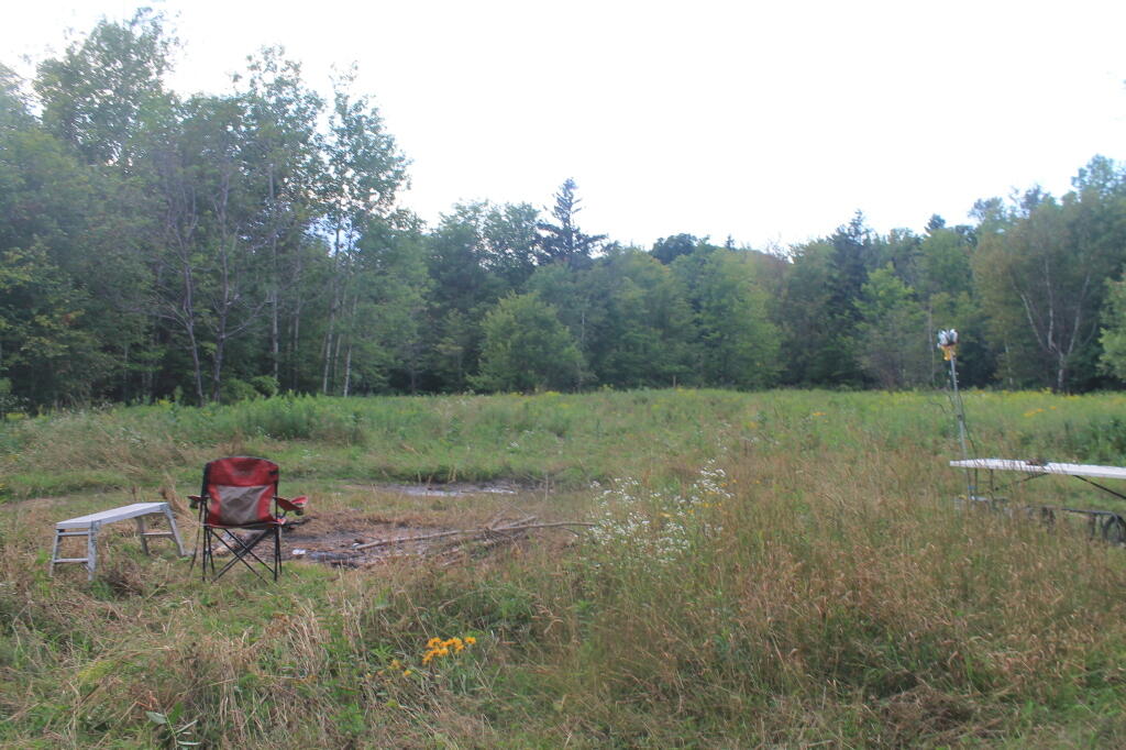
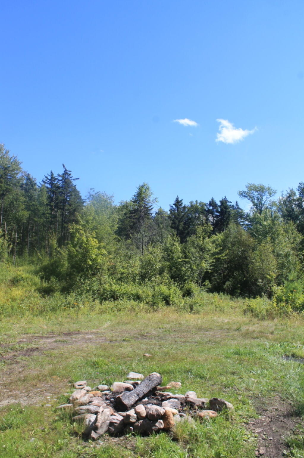
Green Mountain National Forest Camping πŸ•

Here is a full-screen interactive map, that uses the official forest service maps as a backdrop. You will need to zoom in to see the individual roads.

In the Green Mountain National Forest there are a variety of back country roads, offering primitive roadside camping.

  • Campsites are free to use, and have no facilities except for a fire ring and a pull-off from the road, and sometimes a site reinforced with gravel.
  • As noted below, some campsites have additional facilities.
  • Don’t make a mess of campsites, pack out any garbage left over.
  • Burn only dead and down trees, don’t bring in wood from out of state.
  • You can camp up to 14 days per 30 day period in Green Mountain National Forest — no permits are required.

Here is a listing of the campsite coordinates in a spreadsheet (Green Mountain tab). Please note, these coordinates are not exact as they are drawn based on memory.

Please see also information on dispersed, roadside and back-country camping in New York State, Pennsylvania and West Virginia.

The below descriptions of camping areas from the Green Mountain National Forest’s webpage, General Forest Camping.

 North Half of the Green Mountain National Forest

Note: You must zoom in to see individual roads on above interactive map. Campsite locations were added by hand-digitizing and are not exact.

Austin Brook Road: There are three easily accessible campsites by Austin Brook on Forest Road 25 in Warren. They are all within 0.25 mile of State Route 100.

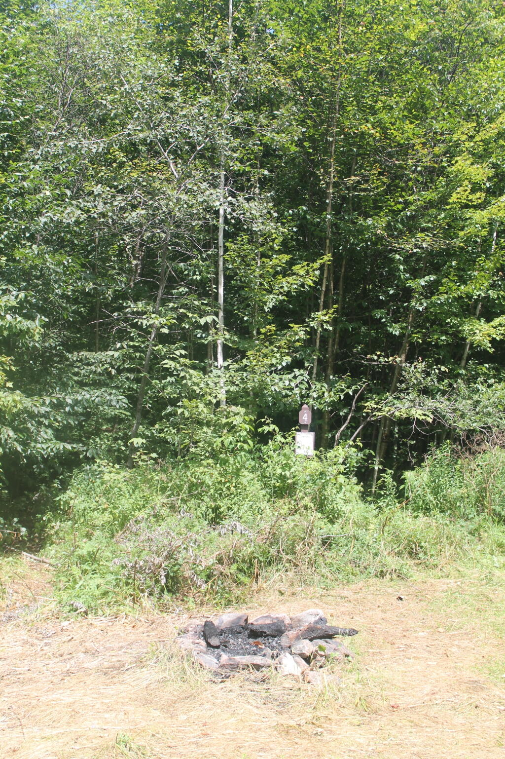
Campsite 4

Bingo: Forest Road 42 in Rochester runs alongside a mountain stream; camping is allowed at designated sites only. These 10 campsites are available on a first-come, first-served basis. There is a limit of 10 people per site. Check the Bingo Brook bulletin board for designated site locations and other site limitations.

Downingville: There is one secluded site in a small clearing near a mountain stream on Forest Road 291 in Lincoln.

Fay’s Meadow: There are a few sites in an open meadow in Forest Dale. Please do not drive on the meadow because a farmer mows the hay from it. There is a stream for wading and fishing at the north end of the meadow.

Goshen Brook Road: There are a few campsites in and around an open area just beyond the turnaround at the very end of Forest Road 67 in Ripton.

Kettle Brook: A small meadow site at the end of Furnace Brook Road in Pittsford.

Michigan Brook Road: Forest Road 35 in Pittsfield provides many camping opportunities in the woods and along Michigan Brook. The road is not recommended for low clearance vehicles.

New Haven River: There are a few campsites next to the New Haven River at Emily Proctor and Cooley Glen trailhead, on Forest Road 201 in Lincoln.

Field Camping at Romance Header Campsite

Romance Header: A large meadow campsite at the end of Forest Road 224 in Forest Dale. A stream lies to the southeast of the meadow.

Sparks Landing: There is one site in a small meadow on Forest Road 233 in Lincoln. There is good fishing in Sparks Brook, which lies just south of the meadow.

Steam Mill Clearing: There is a large open field on both sides of Forest Road 59 at the Skylight Pond Trailhead in Ripton.

Texas Falls Campsite

Texas Gap: These old fields and side roads on Forest Road 39 in Hancock offer many camping opportunities.

White River & Gulf Brook Roads: Secluded camping, open fields, and beautiful views are offered from the abundance of primitive campsites found along Forest Roads 55 & 101 in Granville.

South Half of the Green Mountain National Forest

Note: You must zoom in to see individual roads on above interactive map. Campsite locations were added by hand-digitizing and are not exact.

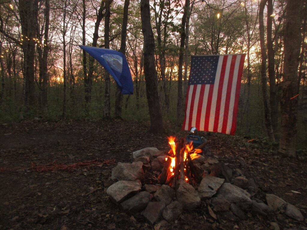
 Campfire

Branch Pond Road: Several sites on this road off of Kelley Stand offer good camping opportunities.

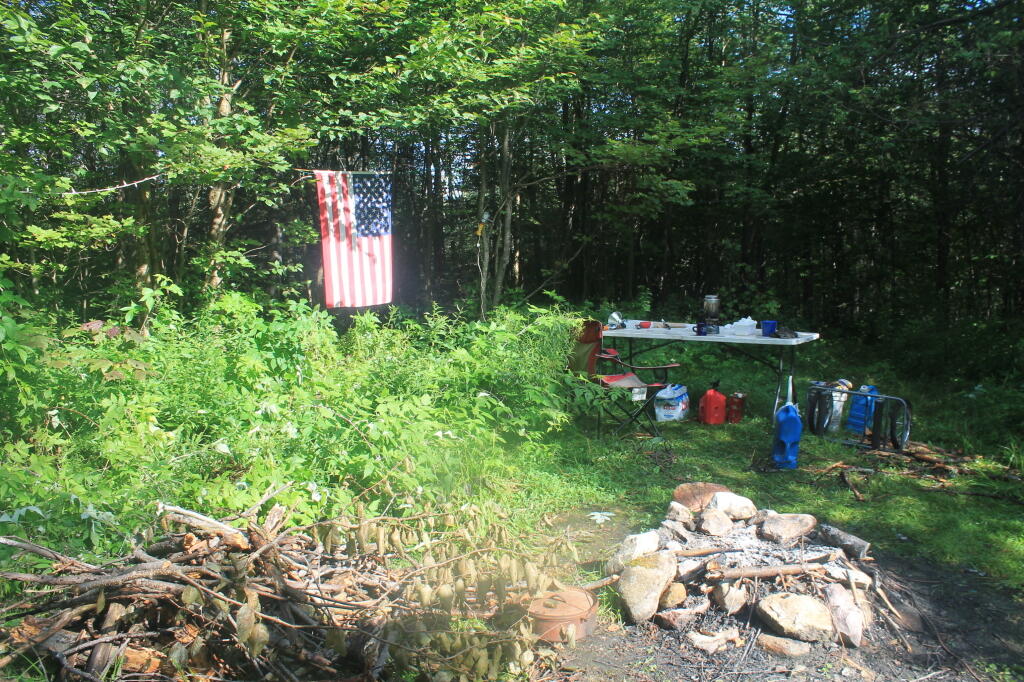
Making Breakfast at Camp

Forest Road 71: This forest road stretches from the old Somerset airfield to the Kelley Stand Road. Campsites can be found in various spots along the way, and along some of the forest roads leading off of Forest Road 71.

Forest Road 74: This forest road is a little less remote than other roadside camping opportunities. Off Vermont Route 9, it dead-ends a couple miles in. Campsites are found unevenly spaced along the way. This area fills up early as it’s one of most accessible.

Kelley Stand Road: Connects the towns of Arlington to West Wardsboro, traveling along an unpaved forest road. A handful of campsites are avaliable on this road, many of the sites along Roaring Brook are permanetly closed.

Morning

Old Job: Off Forest Road 30 there are a few camping opportunities; an open area along FR 30, and both an open field area and a site near Lake Brook at the end of FR 30.

Somerset Road Bridge

Somerset Airfield Campground is a small primitive campground along Forest Road 71. There is a pit-privy and fireplaces in this field camping area. Also popular is Castle Brook Road, near the Deerfield River. This area fills up early, and is known for rowdy crowds but is good if you have a big camper.

List of Peaks in the Catskill Park

Below is a list of peaks within the Catskill Park that are on state land. This is based on the OpenStreetMap data combined with the DEC property data. Click location for a map of the property, or click State Land to get more information about the land the peak is located on.

Region 3 – Ulster County

Peak Name Elevation in Feet State Land Class UMP Region County Location
Balsam Cap 3621 Slide Mountain Wilderness Wilderness Slide Mountain 3 Ulster 41.9770369, -74.3573722
Balsam Lake Mountain 3726 Balsam Lake Mountain Wild Forest Wild Forest Balsam Lake Mountain 3 Ulster 42.0459236, -74.5940438
Balsam Mountain 3601 Big Indian Wilderness Wilderness Big Indian 3 Ulster 42.0909235, -74.4882082
Beaver Kill Range 3310 Big Indian Wilderness Wilderness Big Indian 3 Ulster 41.9903736, -74.5999302
Beaver Kill Range 3211 Big Indian Wilderness Wilderness Big Indian 3 Ulster 41.9937721, -74.5912442
Belleayre Mountain 3431 Belleayre Mountain Ski Center Intensive Use Belleayre Mountain Ski Center 3 Ulster 42.1287084, -74.5187223
Big Indian Mountain 3680 Big Indian Wilderness Wilderness Big Indian 3 Ulster 42.0349959, -74.4966494
Breath Hill 2568 Slide Mountain Wilderness Wilderness Slide Mountain 3 Ulster 41.9366557, -74.3493054
Carl Mountain 2883 Phoenicia – Mt. Tobias Wild Forest Wild Forest Phoenicia – Mt. Tobias 3 Ulster 42.0959235, -74.2482011
Cornell Mountain 3851 Slide Mountain Wilderness Wilderness Slide Mountain 3 Ulster 42.001553, -74.3569987
Cross Mountain 2503 Slide Mountain Wilderness Wilderness Slide Mountain 3 Ulster 42.0195363, -74.3165372
Dink 3641 Slide Mountain Wilderness Wilderness Slide Mountain 3 Ulster 41.9970242, -74.3629146
Eagle Mountain 3601 Big Indian Wilderness Wilderness Big Indian 3 Ulster 42.0620352, -74.50932
East Wildcat 3339 Slide Mountain Wilderness Wilderness Slide Mountain 3 Ulster 41.9877507, -74.4406309
Edgewood Mountain 2998 Phoenicia – Mt. Tobias Wild Forest Wild Forest Phoenicia – Mt. Tobias 3 Ulster 42.1206399, -74.2305807
Fir Mountain 3628 Big Indian Wilderness Wilderness Big Indian 3 Ulster 42.0275916, -74.4690414
Friday Mountain 3690 Slide Mountain Wilderness Wilderness Slide Mountain 3 Ulster 41.9875924, -74.3620944
Garfield Mountain 2581 Slide Mountain Wilderness Wilderness Slide Mountain 3 Ulster 42.0912014, -74.3665379
Haynes Mountain 3424 Big Indian Wilderness Wilderness Big Indian 3 Ulster 42.0792571, -74.5079309
Hemlock Mountain 3247 Big Indian Wilderness Wilderness Big Indian 3 Ulster 42.0128698, -74.4390407
High Falls Ridge 3198 Big Indian Wilderness Wilderness Big Indian 3 Ulster 41.9919309, -74.5454022
Hirams Knob 2883 Big Indian Wilderness Wilderness Big Indian 3 Ulster 42.0981453, -74.5418203
Lone Mountain 3720 Slide Mountain Wilderness Wilderness Slide Mountain 3 Ulster 41.9691794, -74.3900258
Millbrook Ridge 3542 Balsam Lake Mountain Wild Forest Wild Forest Balsam Lake Mountain 3 Ulster 42.0523606, -74.6329273
Mongaup Mountain 3175 Big Indian Wilderness Wilderness Big Indian 3 Ulster 41.9934945, -74.6993963
Mongaup Mountain 2762 Big Indian Wilderness Wilderness Big Indian 3 Ulster 41.9909235, -74.6840456
Mount Pleasant 2811 Slide Mountain Wilderness Wilderness Slide Mountain 3 Ulster 42.0342583, -74.3082035
Mount Tobias 2542 Phoenicia – Mt. Tobias Wild Forest Wild Forest Phoenicia – Mt. Tobias 3 Ulster 42.0584244, -74.2157003
Overlook Mountain 3136 Overlook Mountain Wild Forest Wild Forest Overlook Mountain 3 Ulster 42.0850905, -74.0931954
Panther Mountain 3723 Slide Mountain Wilderness Wilderness Slide Mountain 3 Ulster 42.0564799, -74.3945946
Peekamoose Mountain 3844 Slide Mountain Wilderness Wilderness Slide Mountain 3 Ulster 41.9531481, -74.398207
Red Hill 2985 Sundown Wild Forest Wild Forest Sundown 3 Ulster 41.9242591, -74.5176554
Rocky Mountain 3493 Slide Mountain Wilderness Wilderness Slide Mountain 3 Ulster 41.9728703, -74.3726505
Romer Mountain 1978 Slide Mountain Wilderness Wilderness Slide Mountain 3 Ulster 42.0581466, -74.3187592
Sand Pond Mountain 3060 Big Indian Wilderness Wilderness Big Indian 3 Ulster 41.9851406, -74.6483978
Silver Hollow Notch Mountain 3008 Phoenicia – Mt. Tobias Wild Forest Wild Forest Phoenicia – Mt. Tobias 3 Ulster 42.1228609, -74.2271869
Slide Mountain 4152 Slide Mountain Wilderness Wilderness Slide Mountain 3 Ulster 41.999065, -74.3854779
Spruce Mountain 3385 Big Indian Wilderness Wilderness Big Indian 3 Ulster 42.0175919, -74.4498744
Table Mountain 3847 Slide Mountain Wilderness Wilderness Slide Mountain 3 Ulster 41.958642, -74.4048687
Terrace Mountain 2365 Slide Mountain Wilderness Wilderness Slide Mountain 3 Ulster 42.0275917, -74.33626
Ticetonyk Mountain 2509 Phoenicia – Mt. Tobias Wild Forest Wild Forest Phoenicia – Mt. Tobias 3 Ulster 42.0029749, -74.2173846
Tremper Mountain 2719 Phoenicia – Mt. Tobias Wild Forest Wild Forest Phoenicia – Mt. Tobias 3 Ulster 42.0745351, -74.2782022
Unnamed Peak 1791 Shawangunk Ridge State Forest Shawangunk Ridge 3 Ulster 41.6558434, -74.4070089
Unnamed Peak 3109 Balsam Lake Mountain Wild Forest Wild Forest Balsam Lake Mountain 3 Ulster 42.0274543, -74.6670466
Unnamed Peak 3159 Balsam Lake Mountain Wild Forest Wild Forest Balsam Lake Mountain 3 Ulster 42.0368578, -74.661665
Unnamed Peak 3178 Balsam Lake Mountain Wild Forest Wild Forest Balsam Lake Mountain 3 Ulster 42.0635553, -74.6666829
Unnamed Peak 3218 Balsam Lake Mountain Wild Forest Wild Forest Balsam Lake Mountain 3 Ulster 42.0565122, -74.6545078
Unnamed Peak 3375 Belleayre Mountain Ski Center Intensive Use Belleayre Mountain Ski Center 3 Ulster 42.1157723, -74.4975655
Unnamed Peak 2217 Big Indian Wilderness Wilderness Big Indian 3 Ulster 41.9659811, -74.6257213
Unnamed Peak 2988 Big Indian Wilderness Wilderness Big Indian 3 Ulster 41.9883105, -74.6775609
Unnamed Peak 2863 Big Indian Wilderness Wilderness Big Indian 3 Ulster 41.9914939, -74.6886245
Unnamed Peak 2755 Big Indian Wilderness Wilderness Big Indian 3 Ulster 41.9683169, -74.6448015
Unnamed Peak Big Indian Wilderness Wilderness Big Indian 3 Ulster 41.9833327, -74.660781
Unnamed Peak 2266 Big Indian Wilderness Wilderness Big Indian 3 Ulster 41.9677074, -74.6112706
Unnamed Peak 2808 Big Indian Wilderness Wilderness Big Indian 3 Ulster 41.9631866, -74.5913118
Unnamed Peak 2863 Big Indian Wilderness Wilderness Big Indian 3 Ulster 41.9788505, -74.5846009
Unnamed Peak 3296 Big Indian Wilderness Wilderness Big Indian 3 Ulster 42.004323, -74.5252835
Unnamed Peak 3208 Big Indian Wilderness Wilderness Big Indian 3 Ulster 42.0100949, -74.4705858
Unnamed Peak 3369 Big Indian Wilderness Wilderness Big Indian 3 Ulster 42.0171511, -74.4968178
Unnamed Peak 695 Bluestone Wild Forest Wild Forest Bluestone 3 Ulster 41.9413993, -74.1495688
Unnamed Peak 1696 Phoenicia – Mt. Tobias Wild Forest Wild Forest Phoenicia – Mt. Tobias 3 Ulster 41.990803, -74.2432915
Unnamed Peak 2900 Shandaken Wild Forest Wild Forest Shandaken 3 Ulster 42.1378009, -74.4295925
Unnamed Peak 2900 Shandaken Wild Forest Wild Forest Shandaken 3 Ulster 42.1378167, -74.4295943
Unnamed Peak 3444 Slide Mountain Wilderness Wilderness Slide Mountain 3 Ulster 41.9689055, -74.3556714
Unnamed Peak 2873 Slide Mountain Wilderness Wilderness Slide Mountain 3 Ulster 41.9453545, -74.3403039
Unnamed Peak 3086 Slide Mountain Wilderness Wilderness Slide Mountain 3 Ulster 41.9624268, -74.3454966
Unnamed Peak 2378 Slide Mountain Wilderness Wilderness Slide Mountain 3 Ulster 42.0646385, -74.4489903
Unnamed Peak 2355 Slide Mountain Wilderness Wilderness Slide Mountain 3 Ulster 42.0942486, -74.4384674
Unnamed Peak 3437 Slide Mountain Wilderness Wilderness Slide Mountain 3 Ulster 42.0712077, -74.396964
Unnamed Peak 2840 Slide Mountain Wilderness Wilderness Slide Mountain 3 Ulster 42.0578201, -74.3757381
Unnamed Peak 2952 Slide Mountain Wilderness Wilderness Slide Mountain 3 Ulster 42.1006889, -74.4121968
Unnamed Peak 2558 Slide Mountain Wilderness Wilderness Slide Mountain 3 Ulster 42.0539223, -74.3536646
Unnamed Peak 2831 Sundown Wild Forest Wild Forest Sundown 3 Ulster 41.9544141, -74.5265058
Unnamed Peak 1269 Vernooy Kill State Forest Sundown 3 Ulster 41.7928566, -74.3930704
Unnamed Peak 1328 Vernooy Kill State Forest Sundown 3 Ulster 41.7926582, -74.3698082
Unnamed Peak 2552 Willowemoc Wild Forest Wild Forest Willowemoc 3 Ulster 41.9710083, -74.5595555
Van Wyck Mountain 3201 Slide Mountain Wilderness Wilderness Slide Mountain 3 Ulster 41.9523147, -74.4354304
Wildcat Mountain 3162 Slide Mountain Wilderness Wilderness Slide Mountain 3 Ulster 41.9775924, -74.4759867
Willowemoc Mountain 3224 Big Indian Wilderness Wilderness Big Indian 3 Ulster 41.9902739, -74.6285258
Winnisook Lake Mountain (Western Summit) Big Indian Wilderness Wilderness Big Indian 3 Ulster 42.0181188, -74.4269859
Wittenberg Mountain 3782 Slide Mountain Wilderness Wilderness Slide Mountain 3 Ulster 42.0083192, -74.3472214
Woodpecker Ridge 3467 Balsam Lake Mountain Wild Forest Wild Forest Balsam Lake Mountain 3 Ulster 42.0393575, -74.617348

Region 4 – Delaware County

Peak Name Elevation in Feet State Land Class UMP Region County Location
Barkaboom Mountain 3004 Dry Brook Ridge Wild Forest Wild Forest Dry Brook Ridge 4 Delaware 42.0717554, -74.7201571
Barkaboom Mountain 3100 Dry Brook Ridge Wild Forest Wild Forest Dry Brook Ridge 4 Delaware 42.0619162, -74.7025722
Beech Hill 2844 Delaware Wild Forest Wild Forest Delaware 4 Delaware 42.0456442, -74.7854363
Bouchoux Hill 1765 Hancock Fp Detached Parcel Wild Forest 4 Delaware 41.8806433, -75.1698924
Brock Mountain 2758 Delaware Wild Forest Wild Forest Delaware 4 Delaware 42.0439174, -74.8962771
Brock Mountain 2512 Delaware Wild Forest Wild Forest Delaware 4 Delaware 42.052135, -74.9032495
Brock Mountain 2503 Delaware Wild Forest Wild Forest Delaware 4 Delaware 42.0525879, -74.9032173
Cabot 2968 Delaware Wild Forest Wild Forest Delaware 4 Delaware 42.0535303, -74.7612944
Campbell Mountain 2352 Delaware Wild Forest Wild Forest Delaware 4 Delaware 42.0604872, -74.9595139
Campbell Mountain 2221 Delaware Wild Forest Wild Forest Delaware 4 Delaware 42.0567543, -74.9479407
Carroll Hill 2148 Steam Mill State Forest Treaty Line 4 Delaware 42.183417, -75.296841
Cherry Ridge 2601 Delaware Wild Forest Wild Forest Delaware 4 Delaware 42.0240696, -74.9710699
Cherry Ridge 2627 Delaware Wild Forest Wild Forest Delaware 4 Delaware 42.0127288, -74.9609419
Clabber Peak 2152 Tompkins Fp Detached Parcel Wild Forest 4 Delaware 42.1298068, -75.2787843
Cross Mountain 2342 Dry Brook Ridge Wild Forest Wild Forest Dry Brook Ridge 4 Delaware 42.080922, -74.6957121
Dry Brook Ridge 3470 Dry Brook Ridge Wild Forest Wild Forest Dry Brook Ridge 4 Delaware 42.1130364, -74.6041347
Fork Mountain 2430 Bear Spring Mountain WMA 4 Delaware 42.1009197, -75.0704441
Fuller Hill 2463 Delaware Wild Forest Wild Forest Delaware 4 Delaware 42.0203657, -74.9912753
Hunt Hill 2348 Delaware Wild Forest Wild Forest Delaware 4 Delaware 42.0746419, -74.803095
Mary Smith Hill 2775 Delaware Wild Forest Wild Forest Delaware 4 Delaware 42.0436995, -74.833771
Middle Mountain 2972 Delaware Wild Forest Wild Forest Delaware 4 Delaware 42.0403664, -74.7954366
Pakatakan Mountain 2437 Dry Brook Ridge Wild Forest Wild Forest Dry Brook Ridge 4 Delaware 42.1381438, -74.6409887
Rodgers Hill 2476 Delaware Wild Forest Wild Forest Delaware 4 Delaware 41.9817551, -74.9412742
Starkweather Hill 2545 Bear Spring Mountain WMA 0 4 Delaware 42.127864, -75.0509992
Sugarloaf Mountain 2125 Delaware Wild Forest Wild Forest Delaware 4 Delaware 42.0686987, -74.926829
Sugarloaf Mountain 2135 Delaware Wild Forest Wild Forest Delaware 4 Delaware 42.0619719, -74.9175266
Touchmenot Mountain 2762 Delaware Wild Forest Wild Forest Delaware 4 Delaware 42.0481444, -74.740713
Unnamed Peak 1673 Delaware Wild Forest Wild Forest Delaware 4 Delaware 41.9810251, -74.9580186
Unnamed Peak 2519 Delaware Wild Forest Wild Forest Delaware 4 Delaware 42.022626, -74.9451568
Unnamed Peak 2230 Delaware Wild Forest Wild Forest Delaware 4 Delaware 42.0556575, -74.969054
Unnamed Peak 2526 Delaware Wild Forest Wild Forest Delaware 4 Delaware 42.0354957, -74.9401226
Unnamed Peak 2460 Delaware Wild Forest Wild Forest Delaware 4 Delaware 42.0470575, -74.9330147
Unnamed Peak 2611 Delaware Wild Forest Wild Forest Delaware 4 Delaware 42.02054, -74.912359
Unnamed Peak 2549 Delaware Wild Forest Wild Forest Delaware 4 Delaware 42.0435821, -74.9242729
Unnamed Peak 2512 Delaware Wild Forest Wild Forest Delaware 4 Delaware 41.9925937, -74.8795669
Unnamed Peak 2485 Delaware Wild Forest Wild Forest Delaware 4 Delaware 41.9998257, -74.8803694
Unnamed Peak 2521 Delaware Wild Forest Wild Forest Delaware 4 Delaware 42.0060898, -74.8751327
Unnamed Peak 2483 Delaware Wild Forest Wild Forest Delaware 4 Delaware 42.0011803, -74.8576575
Unnamed Peak 2598 Delaware Wild Forest Wild Forest Delaware 4 Delaware 42.0111026, -74.8035778
Unnamed Peak 2670 Delaware Wild Forest Wild Forest Delaware 4 Delaware 42.0173224, -74.8650151
Unnamed Peak 2444 Delaware Wild Forest Wild Forest Delaware 4 Delaware 42.0139118, -74.8548144
Unnamed Peak 2435 Delaware Wild Forest Wild Forest Delaware 4 Delaware 42.0385161, -74.8801795
Unnamed Peak 2309 Delaware Wild Forest Wild Forest Delaware 4 Delaware 42.0173083, -74.8366494
Unnamed Peak 2974 Delaware Wild Forest Wild Forest Delaware 4 Delaware 42.0399261, -74.7949904
Unnamed Peak 2909 Delaware Wild Forest Wild Forest Delaware 4 Delaware 42.0581708, -74.7714717
Unnamed Peak 2831 Dry Brook Ridge Wild Forest Wild Forest Dry Brook Ridge 4 Delaware 42.09821, -74.6268576
Unnamed Peak 2768 Dry Brook Ridge Wild Forest Wild Forest Dry Brook Ridge 4 Delaware 42.1071828, -74.6752039

Region 4 – Greene County

Peak Name Elevation in Feet State Land Class UMP Region County Location
Acra Point 3109 Windham-Blackhead Range Wilderness Wilderness Windham-Blackhead Range 4 Greene 42.2964745, -74.0998591
Arizona Mountain 3405 Windham-Blackhead Range Wilderness Wilderness Windham-Blackhead Range 4 Greene 42.2589767, -74.0899676
Balsam Mountain 3352 Hunter-West Kill Wilderness Wilderness Hunter-West Kill 4 Greene 42.1836992, -74.387371
Black Dome 4006 Windham-Blackhead Range Wilderness Wilderness Windham-Blackhead Range 4 Greene 42.2701836, -74.122551
Blackhead 3963 Windham-Blackhead Range Wilderness Wilderness Windham-Blackhead Range 4 Greene 42.2677434, -74.104636
Burnt Knob 3188 Windham-Blackhead Range Wilderness Wilderness Windham-Blackhead Range 4 Greene 42.3020297, -74.1190264
Camel”s Hump 3593 Windham-Blackhead Range Wilderness Wilderness Windham-Blackhead Range 4 Greene 42.2713509, -74.1497955
Caudal 3319 Windham-Blackhead Range Wilderness Wilderness Windham-Blackhead Range 4 Greene 42.2690287, -74.1608906
Cave Mountain 3106 Elm Ridge Wild Forest Wild Forest Elm Ridge 4 Greene 42.2859185, -74.2462543
East Rusk 3311 Rusk Mountain Wild Forest Wild Forest Rusk Mountain 4 Greene 42.2006614, -74.2601981
Evergreen Mountain 3369 Rusk Mountain Wild Forest Wild Forest Rusk Mountain 4 Greene 42.2117542, -74.3079238
Halcott Mountain 3523 Halcott Mountain Wild Forest Wild Forest Halcott Mountain 4 Greene 42.1800882, -74.4379281
Hunter Mountain 4044 Hunter-West Kill Wilderness Wilderness Hunter-West Kill 4 Greene 42.1778662, -74.2304216
Indian Head Mountain 3552 Indian Head Wilderness Wilderness Indian Head 4 Greene 42.116201, -74.1145846
Kaaterskill High Peak 3644 Kaaterskill Wild Forest Wild Forest Kaaterskill 4 Greene 42.162055, -74.0805665
Little Rocky Mountain 3050 Indian Head Wilderness Wilderness Indian Head 4 Greene 42.1150898, -74.2040325
Mount Sherrill 3549 Hunter-West Kill Wilderness Wilderness Hunter-West Kill 4 Greene 42.1756439, -74.3729262
North Dome 3595 Hunter-West Kill Wilderness Wilderness Hunter-West Kill 4 Greene 42.1737318, -74.3490098
North Mountain 3185 Windham-Blackhead Range Wilderness Wilderness Windham-Blackhead Range 4 Greene 42.2175881, -74.0487469
Olderbark Mountain 3437 Indian Head Wilderness Wilderness Indian Head 4 Greene 42.1142565, -74.1909765
Plateau Mountain 3844 Indian Head Wilderness Wilderness Indian Head 4 Greene 42.1378671, -74.1743088
Plattekill Mountain 3090 Indian Head Wilderness Wilderness Indian Head 4 Greene 42.1073123, -74.0865281
Roundtop Mountain 3451 Kaaterskill Wild Forest Wild Forest Kaaterskill 4 Greene 42.1684222, -74.094583
Rusk Mountain 3677 Rusk Mountain Wild Forest Wild Forest Rusk Mountain 4 Greene 42.2006434, -74.2770897
Saint Anne”s Peak 0 Hunter-West Kill Wilderness Wilderness Hunter-West Kill 4 Greene 42.1714402, -74.3207927
Sheridan Mountain 2221 Hunter-West Kill Wilderness Wilderness Hunter-West Kill 4 Greene 42.1039789, -74.3279255
Sleeping Lion 3408 Halcott Mountain Wild Forest Wild Forest Halcott Mountain 4 Greene 42.1976194, -74.4168462
South Mountain 2467 North/South Lake Campground Intensive Use North/South Lake Camp 4 Greene 42.1892553, -74.0518031
Southwest Hunter Mountain 3739 Hunter-West Kill Wilderness Wilderness Hunter-West Kill 4 Greene 42.1623721, -74.2436771
Stoppel Point 3421 Windham-Blackhead Range Wilderness Wilderness Windham-Blackhead Range 4 Greene 42.2250879, -74.0651364
Sugarloaf Mountain 3805 Indian Head Wilderness Wilderness Indian Head 4 Greene 42.1312006, -74.1501414
Thomas Cole Mountain 3977 Windham-Blackhead Range Wilderness Wilderness Windham-Blackhead Range 4 Greene 42.270546, -74.1355667
Twin Mountain 3631 Indian Head Wilderness Wilderness Indian Head 4 Greene 42.1256453, -74.1290294
Unnamed Peak 2883 Hunter-West Kill Wilderness Wilderness Hunter-West Kill 4 Greene 42.1515598, -74.3900499
Unnamed Peak 2801 Hunter-West Kill Wilderness Wilderness Hunter-West Kill 4 Greene 42.1246724, -74.3256104
Unnamed Peak 2889 Indian Head Wilderness Wilderness Indian Head 4 Greene 42.1029236, -74.1373223
Unnamed Peak 3559 Indian Head Wilderness Wilderness Indian Head 4 Greene 42.1185867, -74.1254157
Unnamed Peak 2539 Kaaterskill Wild Forest Wild Forest Kaaterskill 4 Greene 42.1338082, -74.0630825
Vly Mountain 3529 Bearpen Mountain State Forest Mt. Pisgah 4 Greene 42.2453645, -74.4459834
West Kill Mountain 3890 Hunter-West Kill Wilderness Wilderness Hunter-West Kill 4 Greene 42.1678663, -74.2895904
Windham High Peak 3533 Windham-Blackhead Range Wilderness Wilderness Windham-Blackhead Range 4 Greene 42.3147961, -74.1432647

Ashokan Mountain

Columbus Day Road Trip Ideas

Over the past couple of days I’ve been thinking about what I want do for my Columbus Day Week Road Trip. While it feels like I just got back from my five-day August eclipse trip, that is really a fading memory, and I’m ready for another big trip.

One option, mostly discounted would be a Vermont Northern New York trip. This would be good if I don’t think I could spend the full nine days on the road due to bad weather, some issue with the truck (unlikely), having to do work (also unlikely), or family needs.

That trip if I do it would consist of overnight in in Southern Green Mountain National Forest, then heading up to Mid-State outside of Middlebury then head north and drive through Smugglers Notch. I’ve never driven through Smuggler Notch and that would be interesting. From there head east to the Northern Adirondacks or maybe outside of Malone to the Deer River State Forest then to some of the state forests I’ve long wanted to explore in Saint Lawrence County, like Wolf Lake State Forest and Frank Jadwin State Forest. Then come down through the Tug Hill Plateau. That might be an interesting trip, but that’s not the one I really want to take.

The October trip I really want to do is the multi-state trip that I did to years ago to West Virginia and Virigina. But with some different destinations then two years ago. I think I want to actually see the Blackwater Falls in West Virigina, visit Ohiopyle State Park in Pennsylvania, drive through more of the farm country in the Shenandoah Valley and do more of the Blue Ridge Parkway in Virigina. This year, I’m much less interested in Shenandoah National Park and Skyline Drive, as I feel like I’ve done that before, and I’m not interested in the constrained forms of recreation that parks provide. I’d rather spend more time seeing the Blue Ridge Parkway, where the speed limit is 45 MPH and the curves in general are much less sharp and hills are smoother. The Blue Ridge Parkway is such a nice drive compared to so many other roads these days, especially the steep hills of West Virginia.

The one thing about this trip option is it will have me staying more in developed campgrounds then I would like. Yes, most of the $10 or even $20 fees are nuisance fees in the grand scheme of things, but I like having my space while camping. It’s just not the same to camp when you have somebody else 20 feet away and you have to keep the noise down. That said, showers are nice.

The places I would camp in West Virigina in the Mongehella National Forest, along with the George Washington National Forest are dispersed camping areas and are remote enough I probably wouldn’t see many people around except for a passing pickup. I like West VIrigina, but those roads sure are steep, twisty, and narrow. I don’t want to overheat my brakes again or worry about that.

One thing that Northern West Virginia has going for it this year with my new phone is that the AT&T GSM network has much better coverage up there, especially outside of the hollows. On the long autumn nights, I like to be connected to the Internet, surf the web, update my blog, and no I can summon emergency services should I run into mechanical problems. I’ll take a long gun and extra food but I don’t like having zero service for multiple days on end. I just hate being totally off grid, especially in such remote country. The lack of cell service with my Verizon network CDMA phone more then anything else bugged me a lot about camping in West Virigina.

This year though, if I go down, I probably won’t first visit the Alleghany National Forest but will instead stay at Asaph Run or more likely County Bridge Primitive Campgrounds. They are $10/night but they are worth it as they closer to being on the way, and I can then hop on US 15/US 220/Interstate 99 and head straighter for Cumberland, Maryland then West Virigina and either to Forest Road 13 outside of Thomas, WV or Camp Run in Fort Seybert, WV. I liked the dispersed camping a lot along the high-elevation swamps on Forest Road 13, although I always worry about their being enough campsites up there because it’s somewhat limited along the road. That would bring me close to Blackwater Falls for visiting the net day, and also along Corridor “H” which is a newer expressway to Thomas. It passes by a massive coal fired power plant, which might be interesting to drive by just to see what is like in person. Another option down in the corner of Pennsylvania by West Viriginia is the aforementioned Ohiopyle State Park, which I’ve been interested in a while but are more interested since that hunter last autumn that I ran into on the trail told me what beautiful country it is up there.

Dolly Sods Wilderness is quite scenic but it’s a way up and I’ve been there before so I may skip that. Same thing with Gandy Run Camping Area and Spruce Mountian, the highest elevation in the Mountain State. I’d rather hurry down to the Blue Ridge Parkway.

I would at some point crossover to Viriginia — I’m thinking US 250 — then drive down in the Shenandoah Valley for a bit before heading up to the Blue Ridge Parkway. I’ve seen the Shenandoah Valley from Shenandoah Parkway but never spent much time down in it.

The Blue Ridge Parkway is a nice drive. The North Creek Campground in Bucchan, VA is quite nice, for $10/night and even had a bit of CMDA cell service there. No showers though. The next overnight would be the Flat Rock or whatever the developed campground is on the Blue Ridge Parkway is south of Ronoake. I think that one is like $25/night but they they have showers and maybe even electricity at campsites.

At that point, I would almost be to the Tennessee line and I doubt I would go further south. I would probably come back part of the way I came, then more of the Shenandoah Valley, camping over again at North Creek Campground in Buchanan then probably heading up to West Virigina and camping over at Camp Run in Fort Seybert. I might then drive home from there or maybe overnight at County Bridge or Asaph Run in Wellsboro, because I really don’t like driving that much, and it gets dark so early in October.

I don’t have everything planned out and I need to study maps some more. But that’s fine. I’ll work on that tomorrow, and realize there is more to plan. That said, next Saturday, October 7th will be here before you know it.