Search Results for: photo photo 2014 11 10 16 12 52

September 27, 2020 Night

Good evening! Cloudy, humid and 67 degrees in Delmar, NY. ☁️There is a south-southeast breeze at 7 mph. πŸƒ. The dew point is 66 degrees. The skies will clear tomorrow around 2 pm. Yeah, I’m back home and I got the fan on.

Tonight will have a chance of showers, mainly after 2am. Mostly cloudy 🌧, with a low of 65 degrees at 6am. 19 degrees above normal. Maximum dew point of 66 at 11pm. South wind 5 to 7 mph. Chance of precipitation is 30%. New precipitation amounts of less than a tenth of an inch possible. In 2019, we had partly cloudy skies in the evening, which became mostly clear by the early hours of the morning. It got down to 54 degrees. The record low of 24 occurred back in 1947.

Tonight will have a Waxing Gibbous πŸŒ” Moon with 87% illuminated. At 11 PM, the moon was in the south-southwest (192Β°) at an altitude of 29Β° from the horizon, some 243,819 miles away from where you are looking up from the earth. πŸš€ At the state speed limit of 55 mph, you’ll make it there by March 31st. Buckle up for safety! πŸ’Ί The Hunter 🏹 Moon is on Thursday, October 1. The darkest hour is at 12:47 am, followed by dawn at 6:21 am, and sun starting to rise at 6:49 am in the east (92Β°) and last for 2 minutes and 54 seconds. Sunrise is one minute and 6 seconds later than yesterday. πŸŒ„ The golden hour ends at 7:27 am with sun in the east (98Β°). Tonight will have 12 hours and 6 minutes of darkness, an increase of 2 minutes and 52 seconds over last night.

Tomorrow will have a chance of showers. Mostly cloudy 🌦, with a high of 78 degrees at 2pm. 11 degrees above normal, which is similar to a typical day around August 31st. Maximum dew point of 68 at 11am. South wind 6 to 13 mph. Chance of precipitation is 30%. New precipitation amounts of less than a tenth of an inch possible. A year ago, we had partly cloudy skies in the morning with some clearing in the afternoon. The high last year was 82 degrees. The record high of 83 was set in 2014.

In four weeks on October 25 the sun will be setting in the west-southwest (254Β°) at 5:57 pm,πŸŒ„ which is 45 minutes and 56 seconds earlier then tonight. In 2019 on that day, we had partly cloudy, rain showers and temperatures between 58 and 48 degrees. Typically, you have temperatures between 56 and 37 degrees. The record high of 77 degrees was set back in 1963.

Looking ahead, Last Sunset After 6:30 PM πŸŒ† is in 1 weeks, November πŸ₯§ is in 5 weeks, Buy Nothing Day πŸ›οΈ is in 2 months, First Sunday of Advent ✝️ is in 10 weeks, Saint Nicholas Day πŸŽ… is in 10 weeks, Latest Sunrise of the Winter πŸŒ„οΈ is in 14 weeks, Valentines Day ❀️ is in 20 weeks, Snow Moon πŸŒ• is in 5 months and Snow Moon πŸŒ• is in 5 months.

Big Hollow and Burnt Knob

August 18, 2020 – Next Sixteen Weeks

If you don’t believe autumn is coming take a look at this chart.

Week Date Dawn Sun-
rise
Sun-
set
Dusk Day Noon Sun Angle Avg High Avg Low Record Hi Record Low
0 Aug 18 5:36 am 6:06 am 7:52 pm 8:22 pm 13:46 60.3° 80 60 95 (1913) 40 (1981)
1 Aug 25 5:44 am 6:13 am 7:41 pm 8:10 pm 13:27 57.9° 79 59 99 (1947) 35 (1940)
2 Sep 1 5:52 am 6:21 am 7:29 pm 7:58 pm 13:08 55.4° 77 57 96 (1953) 41 (1967)
3 Sep 8 6:00 am 6:28 am 7:17 pm 7:45 pm 12:48 52.9° 75 55 94 (2015) 34 (1978)
4 Sep 15 6:07 am 6:35 am 7:04 pm 7:32 pm 12:28 50.2° 73 52 92 (1915) 33 (1975)
5 Sep 22 6:15 am 6:43 am 6:52 pm 7:20 pm 12:08 47.5° 70 49 95 (1895) 31 (1962)
6 Sep 29 6:23 am 6:51 am 6:39 pm 7:07 pm 11:48 44.7° 67 46 86 (1921) 29 (2000)
7 Oct 6 6:30 am 6:58 am 6:27 pm 6:55 pm 11:28 42° 64 43 90 (1900) 24 (1965)
8 Oct 13 6:38 am 7:06 am 6:15 pm 6:44 pm 11:09 39.4° 61 40 81 (1930) 24 (1981)
9 Oct 20 6:46 am 7:15 am 6:04 pm 6:33 pm 10:49 36.8° 58 38 80 (1965) 18 (1972)
10 Oct 27 6:54 am 7:23 am 5:54 pm 6:23 pm 10:30 34.4° 56 36 79 (1963) 21 (1950)
11 Nov 3 6:03 am 6:32 am 4:45 pm 5:14 pm 10:12 32.1° 53 35 75 (1990) 20 (1980)
12 Nov 10 6:11 am 6:41 am 4:37 pm 5:07 pm 9:56 30.1° 50 33 72 (1931) 16 (1965)
13 Nov 17 6:19 am 6:50 am 4:30 pm 5:01 pm 9:40 28.3° 47 31 73 (1928) 7 (1972)
14 Nov 24 6:27 am 6:58 am 4:26 pm 4:56 pm 9:27 26.7° 44 29 70 (2014) 7 (2000)
15 Dec 1 6:34 am 7:06 am 4:23 pm 4:54 pm 9:16 25.5° 41 27 67 (1934) -5 (1875)
16 Dec 8 6:41 am 7:13 am 4:21 pm 4:53 pm 9:08 24.6° 38 24 58 (1927) -3 (1902)

Along the Edge of Lake

Fall Glow

 Colors Off Spruce Mountain

List of Peaks in the Catskill Park

Below is a list of peaks within the Catskill Park that are on state land. This is based on the OpenStreetMap data combined with the DEC property data. Click location for a map of the property, or click State Land to get more information about the land the peak is located on.

Region 3 – Ulster County

Peak Name Elevation in Feet State Land Class UMP Region County Location
Balsam Cap 3621 Slide Mountain Wilderness Wilderness Slide Mountain 3 Ulster 41.9770369, -74.3573722
Balsam Lake Mountain 3726 Balsam Lake Mountain Wild Forest Wild Forest Balsam Lake Mountain 3 Ulster 42.0459236, -74.5940438
Balsam Mountain 3601 Big Indian Wilderness Wilderness Big Indian 3 Ulster 42.0909235, -74.4882082
Beaver Kill Range 3310 Big Indian Wilderness Wilderness Big Indian 3 Ulster 41.9903736, -74.5999302
Beaver Kill Range 3211 Big Indian Wilderness Wilderness Big Indian 3 Ulster 41.9937721, -74.5912442
Belleayre Mountain 3431 Belleayre Mountain Ski Center Intensive Use Belleayre Mountain Ski Center 3 Ulster 42.1287084, -74.5187223
Big Indian Mountain 3680 Big Indian Wilderness Wilderness Big Indian 3 Ulster 42.0349959, -74.4966494
Breath Hill 2568 Slide Mountain Wilderness Wilderness Slide Mountain 3 Ulster 41.9366557, -74.3493054
Carl Mountain 2883 Phoenicia – Mt. Tobias Wild Forest Wild Forest Phoenicia – Mt. Tobias 3 Ulster 42.0959235, -74.2482011
Cornell Mountain 3851 Slide Mountain Wilderness Wilderness Slide Mountain 3 Ulster 42.001553, -74.3569987
Cross Mountain 2503 Slide Mountain Wilderness Wilderness Slide Mountain 3 Ulster 42.0195363, -74.3165372
Dink 3641 Slide Mountain Wilderness Wilderness Slide Mountain 3 Ulster 41.9970242, -74.3629146
Eagle Mountain 3601 Big Indian Wilderness Wilderness Big Indian 3 Ulster 42.0620352, -74.50932
East Wildcat 3339 Slide Mountain Wilderness Wilderness Slide Mountain 3 Ulster 41.9877507, -74.4406309
Edgewood Mountain 2998 Phoenicia – Mt. Tobias Wild Forest Wild Forest Phoenicia – Mt. Tobias 3 Ulster 42.1206399, -74.2305807
Fir Mountain 3628 Big Indian Wilderness Wilderness Big Indian 3 Ulster 42.0275916, -74.4690414
Friday Mountain 3690 Slide Mountain Wilderness Wilderness Slide Mountain 3 Ulster 41.9875924, -74.3620944
Garfield Mountain 2581 Slide Mountain Wilderness Wilderness Slide Mountain 3 Ulster 42.0912014, -74.3665379
Haynes Mountain 3424 Big Indian Wilderness Wilderness Big Indian 3 Ulster 42.0792571, -74.5079309
Hemlock Mountain 3247 Big Indian Wilderness Wilderness Big Indian 3 Ulster 42.0128698, -74.4390407
High Falls Ridge 3198 Big Indian Wilderness Wilderness Big Indian 3 Ulster 41.9919309, -74.5454022
Hirams Knob 2883 Big Indian Wilderness Wilderness Big Indian 3 Ulster 42.0981453, -74.5418203
Lone Mountain 3720 Slide Mountain Wilderness Wilderness Slide Mountain 3 Ulster 41.9691794, -74.3900258
Millbrook Ridge 3542 Balsam Lake Mountain Wild Forest Wild Forest Balsam Lake Mountain 3 Ulster 42.0523606, -74.6329273
Mongaup Mountain 3175 Big Indian Wilderness Wilderness Big Indian 3 Ulster 41.9934945, -74.6993963
Mongaup Mountain 2762 Big Indian Wilderness Wilderness Big Indian 3 Ulster 41.9909235, -74.6840456
Mount Pleasant 2811 Slide Mountain Wilderness Wilderness Slide Mountain 3 Ulster 42.0342583, -74.3082035
Mount Tobias 2542 Phoenicia – Mt. Tobias Wild Forest Wild Forest Phoenicia – Mt. Tobias 3 Ulster 42.0584244, -74.2157003
Overlook Mountain 3136 Overlook Mountain Wild Forest Wild Forest Overlook Mountain 3 Ulster 42.0850905, -74.0931954
Panther Mountain 3723 Slide Mountain Wilderness Wilderness Slide Mountain 3 Ulster 42.0564799, -74.3945946
Peekamoose Mountain 3844 Slide Mountain Wilderness Wilderness Slide Mountain 3 Ulster 41.9531481, -74.398207
Red Hill 2985 Sundown Wild Forest Wild Forest Sundown 3 Ulster 41.9242591, -74.5176554
Rocky Mountain 3493 Slide Mountain Wilderness Wilderness Slide Mountain 3 Ulster 41.9728703, -74.3726505
Romer Mountain 1978 Slide Mountain Wilderness Wilderness Slide Mountain 3 Ulster 42.0581466, -74.3187592
Sand Pond Mountain 3060 Big Indian Wilderness Wilderness Big Indian 3 Ulster 41.9851406, -74.6483978
Silver Hollow Notch Mountain 3008 Phoenicia – Mt. Tobias Wild Forest Wild Forest Phoenicia – Mt. Tobias 3 Ulster 42.1228609, -74.2271869
Slide Mountain 4152 Slide Mountain Wilderness Wilderness Slide Mountain 3 Ulster 41.999065, -74.3854779
Spruce Mountain 3385 Big Indian Wilderness Wilderness Big Indian 3 Ulster 42.0175919, -74.4498744
Table Mountain 3847 Slide Mountain Wilderness Wilderness Slide Mountain 3 Ulster 41.958642, -74.4048687
Terrace Mountain 2365 Slide Mountain Wilderness Wilderness Slide Mountain 3 Ulster 42.0275917, -74.33626
Ticetonyk Mountain 2509 Phoenicia – Mt. Tobias Wild Forest Wild Forest Phoenicia – Mt. Tobias 3 Ulster 42.0029749, -74.2173846
Tremper Mountain 2719 Phoenicia – Mt. Tobias Wild Forest Wild Forest Phoenicia – Mt. Tobias 3 Ulster 42.0745351, -74.2782022
Unnamed Peak 1791 Shawangunk Ridge State Forest Shawangunk Ridge 3 Ulster 41.6558434, -74.4070089
Unnamed Peak 3109 Balsam Lake Mountain Wild Forest Wild Forest Balsam Lake Mountain 3 Ulster 42.0274543, -74.6670466
Unnamed Peak 3159 Balsam Lake Mountain Wild Forest Wild Forest Balsam Lake Mountain 3 Ulster 42.0368578, -74.661665
Unnamed Peak 3178 Balsam Lake Mountain Wild Forest Wild Forest Balsam Lake Mountain 3 Ulster 42.0635553, -74.6666829
Unnamed Peak 3218 Balsam Lake Mountain Wild Forest Wild Forest Balsam Lake Mountain 3 Ulster 42.0565122, -74.6545078
Unnamed Peak 3375 Belleayre Mountain Ski Center Intensive Use Belleayre Mountain Ski Center 3 Ulster 42.1157723, -74.4975655
Unnamed Peak 2217 Big Indian Wilderness Wilderness Big Indian 3 Ulster 41.9659811, -74.6257213
Unnamed Peak 2988 Big Indian Wilderness Wilderness Big Indian 3 Ulster 41.9883105, -74.6775609
Unnamed Peak 2863 Big Indian Wilderness Wilderness Big Indian 3 Ulster 41.9914939, -74.6886245
Unnamed Peak 2755 Big Indian Wilderness Wilderness Big Indian 3 Ulster 41.9683169, -74.6448015
Unnamed Peak Big Indian Wilderness Wilderness Big Indian 3 Ulster 41.9833327, -74.660781
Unnamed Peak 2266 Big Indian Wilderness Wilderness Big Indian 3 Ulster 41.9677074, -74.6112706
Unnamed Peak 2808 Big Indian Wilderness Wilderness Big Indian 3 Ulster 41.9631866, -74.5913118
Unnamed Peak 2863 Big Indian Wilderness Wilderness Big Indian 3 Ulster 41.9788505, -74.5846009
Unnamed Peak 3296 Big Indian Wilderness Wilderness Big Indian 3 Ulster 42.004323, -74.5252835
Unnamed Peak 3208 Big Indian Wilderness Wilderness Big Indian 3 Ulster 42.0100949, -74.4705858
Unnamed Peak 3369 Big Indian Wilderness Wilderness Big Indian 3 Ulster 42.0171511, -74.4968178
Unnamed Peak 695 Bluestone Wild Forest Wild Forest Bluestone 3 Ulster 41.9413993, -74.1495688
Unnamed Peak 1696 Phoenicia – Mt. Tobias Wild Forest Wild Forest Phoenicia – Mt. Tobias 3 Ulster 41.990803, -74.2432915
Unnamed Peak 2900 Shandaken Wild Forest Wild Forest Shandaken 3 Ulster 42.1378009, -74.4295925
Unnamed Peak 2900 Shandaken Wild Forest Wild Forest Shandaken 3 Ulster 42.1378167, -74.4295943
Unnamed Peak 3444 Slide Mountain Wilderness Wilderness Slide Mountain 3 Ulster 41.9689055, -74.3556714
Unnamed Peak 2873 Slide Mountain Wilderness Wilderness Slide Mountain 3 Ulster 41.9453545, -74.3403039
Unnamed Peak 3086 Slide Mountain Wilderness Wilderness Slide Mountain 3 Ulster 41.9624268, -74.3454966
Unnamed Peak 2378 Slide Mountain Wilderness Wilderness Slide Mountain 3 Ulster 42.0646385, -74.4489903
Unnamed Peak 2355 Slide Mountain Wilderness Wilderness Slide Mountain 3 Ulster 42.0942486, -74.4384674
Unnamed Peak 3437 Slide Mountain Wilderness Wilderness Slide Mountain 3 Ulster 42.0712077, -74.396964
Unnamed Peak 2840 Slide Mountain Wilderness Wilderness Slide Mountain 3 Ulster 42.0578201, -74.3757381
Unnamed Peak 2952 Slide Mountain Wilderness Wilderness Slide Mountain 3 Ulster 42.1006889, -74.4121968
Unnamed Peak 2558 Slide Mountain Wilderness Wilderness Slide Mountain 3 Ulster 42.0539223, -74.3536646
Unnamed Peak 2831 Sundown Wild Forest Wild Forest Sundown 3 Ulster 41.9544141, -74.5265058
Unnamed Peak 1269 Vernooy Kill State Forest Sundown 3 Ulster 41.7928566, -74.3930704
Unnamed Peak 1328 Vernooy Kill State Forest Sundown 3 Ulster 41.7926582, -74.3698082
Unnamed Peak 2552 Willowemoc Wild Forest Wild Forest Willowemoc 3 Ulster 41.9710083, -74.5595555
Van Wyck Mountain 3201 Slide Mountain Wilderness Wilderness Slide Mountain 3 Ulster 41.9523147, -74.4354304
Wildcat Mountain 3162 Slide Mountain Wilderness Wilderness Slide Mountain 3 Ulster 41.9775924, -74.4759867
Willowemoc Mountain 3224 Big Indian Wilderness Wilderness Big Indian 3 Ulster 41.9902739, -74.6285258
Winnisook Lake Mountain (Western Summit) Big Indian Wilderness Wilderness Big Indian 3 Ulster 42.0181188, -74.4269859
Wittenberg Mountain 3782 Slide Mountain Wilderness Wilderness Slide Mountain 3 Ulster 42.0083192, -74.3472214
Woodpecker Ridge 3467 Balsam Lake Mountain Wild Forest Wild Forest Balsam Lake Mountain 3 Ulster 42.0393575, -74.617348

Region 4 – Delaware County

Peak Name Elevation in Feet State Land Class UMP Region County Location
Barkaboom Mountain 3004 Dry Brook Ridge Wild Forest Wild Forest Dry Brook Ridge 4 Delaware 42.0717554, -74.7201571
Barkaboom Mountain 3100 Dry Brook Ridge Wild Forest Wild Forest Dry Brook Ridge 4 Delaware 42.0619162, -74.7025722
Beech Hill 2844 Delaware Wild Forest Wild Forest Delaware 4 Delaware 42.0456442, -74.7854363
Bouchoux Hill 1765 Hancock Fp Detached Parcel Wild Forest 4 Delaware 41.8806433, -75.1698924
Brock Mountain 2758 Delaware Wild Forest Wild Forest Delaware 4 Delaware 42.0439174, -74.8962771
Brock Mountain 2512 Delaware Wild Forest Wild Forest Delaware 4 Delaware 42.052135, -74.9032495
Brock Mountain 2503 Delaware Wild Forest Wild Forest Delaware 4 Delaware 42.0525879, -74.9032173
Cabot 2968 Delaware Wild Forest Wild Forest Delaware 4 Delaware 42.0535303, -74.7612944
Campbell Mountain 2352 Delaware Wild Forest Wild Forest Delaware 4 Delaware 42.0604872, -74.9595139
Campbell Mountain 2221 Delaware Wild Forest Wild Forest Delaware 4 Delaware 42.0567543, -74.9479407
Carroll Hill 2148 Steam Mill State Forest Treaty Line 4 Delaware 42.183417, -75.296841
Cherry Ridge 2601 Delaware Wild Forest Wild Forest Delaware 4 Delaware 42.0240696, -74.9710699
Cherry Ridge 2627 Delaware Wild Forest Wild Forest Delaware 4 Delaware 42.0127288, -74.9609419
Clabber Peak 2152 Tompkins Fp Detached Parcel Wild Forest 4 Delaware 42.1298068, -75.2787843
Cross Mountain 2342 Dry Brook Ridge Wild Forest Wild Forest Dry Brook Ridge 4 Delaware 42.080922, -74.6957121
Dry Brook Ridge 3470 Dry Brook Ridge Wild Forest Wild Forest Dry Brook Ridge 4 Delaware 42.1130364, -74.6041347
Fork Mountain 2430 Bear Spring Mountain WMA 4 Delaware 42.1009197, -75.0704441
Fuller Hill 2463 Delaware Wild Forest Wild Forest Delaware 4 Delaware 42.0203657, -74.9912753
Hunt Hill 2348 Delaware Wild Forest Wild Forest Delaware 4 Delaware 42.0746419, -74.803095
Mary Smith Hill 2775 Delaware Wild Forest Wild Forest Delaware 4 Delaware 42.0436995, -74.833771
Middle Mountain 2972 Delaware Wild Forest Wild Forest Delaware 4 Delaware 42.0403664, -74.7954366
Pakatakan Mountain 2437 Dry Brook Ridge Wild Forest Wild Forest Dry Brook Ridge 4 Delaware 42.1381438, -74.6409887
Rodgers Hill 2476 Delaware Wild Forest Wild Forest Delaware 4 Delaware 41.9817551, -74.9412742
Starkweather Hill 2545 Bear Spring Mountain WMA 0 4 Delaware 42.127864, -75.0509992
Sugarloaf Mountain 2125 Delaware Wild Forest Wild Forest Delaware 4 Delaware 42.0686987, -74.926829
Sugarloaf Mountain 2135 Delaware Wild Forest Wild Forest Delaware 4 Delaware 42.0619719, -74.9175266
Touchmenot Mountain 2762 Delaware Wild Forest Wild Forest Delaware 4 Delaware 42.0481444, -74.740713
Unnamed Peak 1673 Delaware Wild Forest Wild Forest Delaware 4 Delaware 41.9810251, -74.9580186
Unnamed Peak 2519 Delaware Wild Forest Wild Forest Delaware 4 Delaware 42.022626, -74.9451568
Unnamed Peak 2230 Delaware Wild Forest Wild Forest Delaware 4 Delaware 42.0556575, -74.969054
Unnamed Peak 2526 Delaware Wild Forest Wild Forest Delaware 4 Delaware 42.0354957, -74.9401226
Unnamed Peak 2460 Delaware Wild Forest Wild Forest Delaware 4 Delaware 42.0470575, -74.9330147
Unnamed Peak 2611 Delaware Wild Forest Wild Forest Delaware 4 Delaware 42.02054, -74.912359
Unnamed Peak 2549 Delaware Wild Forest Wild Forest Delaware 4 Delaware 42.0435821, -74.9242729
Unnamed Peak 2512 Delaware Wild Forest Wild Forest Delaware 4 Delaware 41.9925937, -74.8795669
Unnamed Peak 2485 Delaware Wild Forest Wild Forest Delaware 4 Delaware 41.9998257, -74.8803694
Unnamed Peak 2521 Delaware Wild Forest Wild Forest Delaware 4 Delaware 42.0060898, -74.8751327
Unnamed Peak 2483 Delaware Wild Forest Wild Forest Delaware 4 Delaware 42.0011803, -74.8576575
Unnamed Peak 2598 Delaware Wild Forest Wild Forest Delaware 4 Delaware 42.0111026, -74.8035778
Unnamed Peak 2670 Delaware Wild Forest Wild Forest Delaware 4 Delaware 42.0173224, -74.8650151
Unnamed Peak 2444 Delaware Wild Forest Wild Forest Delaware 4 Delaware 42.0139118, -74.8548144
Unnamed Peak 2435 Delaware Wild Forest Wild Forest Delaware 4 Delaware 42.0385161, -74.8801795
Unnamed Peak 2309 Delaware Wild Forest Wild Forest Delaware 4 Delaware 42.0173083, -74.8366494
Unnamed Peak 2974 Delaware Wild Forest Wild Forest Delaware 4 Delaware 42.0399261, -74.7949904
Unnamed Peak 2909 Delaware Wild Forest Wild Forest Delaware 4 Delaware 42.0581708, -74.7714717
Unnamed Peak 2831 Dry Brook Ridge Wild Forest Wild Forest Dry Brook Ridge 4 Delaware 42.09821, -74.6268576
Unnamed Peak 2768 Dry Brook Ridge Wild Forest Wild Forest Dry Brook Ridge 4 Delaware 42.1071828, -74.6752039

Region 4 – Greene County

Peak Name Elevation in Feet State Land Class UMP Region County Location
Acra Point 3109 Windham-Blackhead Range Wilderness Wilderness Windham-Blackhead Range 4 Greene 42.2964745, -74.0998591
Arizona Mountain 3405 Windham-Blackhead Range Wilderness Wilderness Windham-Blackhead Range 4 Greene 42.2589767, -74.0899676
Balsam Mountain 3352 Hunter-West Kill Wilderness Wilderness Hunter-West Kill 4 Greene 42.1836992, -74.387371
Black Dome 4006 Windham-Blackhead Range Wilderness Wilderness Windham-Blackhead Range 4 Greene 42.2701836, -74.122551
Blackhead 3963 Windham-Blackhead Range Wilderness Wilderness Windham-Blackhead Range 4 Greene 42.2677434, -74.104636
Burnt Knob 3188 Windham-Blackhead Range Wilderness Wilderness Windham-Blackhead Range 4 Greene 42.3020297, -74.1190264
Camel”s Hump 3593 Windham-Blackhead Range Wilderness Wilderness Windham-Blackhead Range 4 Greene 42.2713509, -74.1497955
Caudal 3319 Windham-Blackhead Range Wilderness Wilderness Windham-Blackhead Range 4 Greene 42.2690287, -74.1608906
Cave Mountain 3106 Elm Ridge Wild Forest Wild Forest Elm Ridge 4 Greene 42.2859185, -74.2462543
East Rusk 3311 Rusk Mountain Wild Forest Wild Forest Rusk Mountain 4 Greene 42.2006614, -74.2601981
Evergreen Mountain 3369 Rusk Mountain Wild Forest Wild Forest Rusk Mountain 4 Greene 42.2117542, -74.3079238
Halcott Mountain 3523 Halcott Mountain Wild Forest Wild Forest Halcott Mountain 4 Greene 42.1800882, -74.4379281
Hunter Mountain 4044 Hunter-West Kill Wilderness Wilderness Hunter-West Kill 4 Greene 42.1778662, -74.2304216
Indian Head Mountain 3552 Indian Head Wilderness Wilderness Indian Head 4 Greene 42.116201, -74.1145846
Kaaterskill High Peak 3644 Kaaterskill Wild Forest Wild Forest Kaaterskill 4 Greene 42.162055, -74.0805665
Little Rocky Mountain 3050 Indian Head Wilderness Wilderness Indian Head 4 Greene 42.1150898, -74.2040325
Mount Sherrill 3549 Hunter-West Kill Wilderness Wilderness Hunter-West Kill 4 Greene 42.1756439, -74.3729262
North Dome 3595 Hunter-West Kill Wilderness Wilderness Hunter-West Kill 4 Greene 42.1737318, -74.3490098
North Mountain 3185 Windham-Blackhead Range Wilderness Wilderness Windham-Blackhead Range 4 Greene 42.2175881, -74.0487469
Olderbark Mountain 3437 Indian Head Wilderness Wilderness Indian Head 4 Greene 42.1142565, -74.1909765
Plateau Mountain 3844 Indian Head Wilderness Wilderness Indian Head 4 Greene 42.1378671, -74.1743088
Plattekill Mountain 3090 Indian Head Wilderness Wilderness Indian Head 4 Greene 42.1073123, -74.0865281
Roundtop Mountain 3451 Kaaterskill Wild Forest Wild Forest Kaaterskill 4 Greene 42.1684222, -74.094583
Rusk Mountain 3677 Rusk Mountain Wild Forest Wild Forest Rusk Mountain 4 Greene 42.2006434, -74.2770897
Saint Anne”s Peak 0 Hunter-West Kill Wilderness Wilderness Hunter-West Kill 4 Greene 42.1714402, -74.3207927
Sheridan Mountain 2221 Hunter-West Kill Wilderness Wilderness Hunter-West Kill 4 Greene 42.1039789, -74.3279255
Sleeping Lion 3408 Halcott Mountain Wild Forest Wild Forest Halcott Mountain 4 Greene 42.1976194, -74.4168462
South Mountain 2467 North/South Lake Campground Intensive Use North/South Lake Camp 4 Greene 42.1892553, -74.0518031
Southwest Hunter Mountain 3739 Hunter-West Kill Wilderness Wilderness Hunter-West Kill 4 Greene 42.1623721, -74.2436771
Stoppel Point 3421 Windham-Blackhead Range Wilderness Wilderness Windham-Blackhead Range 4 Greene 42.2250879, -74.0651364
Sugarloaf Mountain 3805 Indian Head Wilderness Wilderness Indian Head 4 Greene 42.1312006, -74.1501414
Thomas Cole Mountain 3977 Windham-Blackhead Range Wilderness Wilderness Windham-Blackhead Range 4 Greene 42.270546, -74.1355667
Twin Mountain 3631 Indian Head Wilderness Wilderness Indian Head 4 Greene 42.1256453, -74.1290294
Unnamed Peak 2883 Hunter-West Kill Wilderness Wilderness Hunter-West Kill 4 Greene 42.1515598, -74.3900499
Unnamed Peak 2801 Hunter-West Kill Wilderness Wilderness Hunter-West Kill 4 Greene 42.1246724, -74.3256104
Unnamed Peak 2889 Indian Head Wilderness Wilderness Indian Head 4 Greene 42.1029236, -74.1373223
Unnamed Peak 3559 Indian Head Wilderness Wilderness Indian Head 4 Greene 42.1185867, -74.1254157
Unnamed Peak 2539 Kaaterskill Wild Forest Wild Forest Kaaterskill 4 Greene 42.1338082, -74.0630825
Vly Mountain 3529 Bearpen Mountain State Forest Mt. Pisgah 4 Greene 42.2453645, -74.4459834
West Kill Mountain 3890 Hunter-West Kill Wilderness Wilderness Hunter-West Kill 4 Greene 42.1678663, -74.2895904
Windham High Peak 3533 Windham-Blackhead Range Wilderness Wilderness Windham-Blackhead Range 4 Greene 42.3147961, -74.1432647

Ashokan Mountain

January 1, 2020 Night

Good evening! Mostly cloudy and 33 degrees in Delmar, NY. ☁ There is a west breeze at 5 mph. 🍃. The skies will clear around 11 pm.

Not a half bad evening for early January, I went out for the evening walk and then laid back in my bed catching up on my YouTube. 📹Mostly just the latest kind of silly update from Keith Fink dairy farm and their silly Jersey cows 🐮.

I had a nice New Years Day fondue with the parents and did my wash out there before coming home. 🍲 There was a crash on Route 32 so it was closed and I ended up being detoured over through Clarksville on the way home. It was fine but the road was dark after my exhaustion from last night I found the driving hard 🚘. Since adjusting my headlights night driving isn’t as bad but I still don’t really enjoy it.

It’s nice to be back home but I did enjoy my night out during the first night of the new year. 🎇 Granted that I only stayed out by the fire until quarter to eleven, then retiring to the warmth of the tent until midnight. Still not sure if I dosed off a bit in the tent before waking up shortly before midnight but it was watching the clock flip over to midnight and then shut off the heater and lights and retire to bed just like I plan to do shortly.

Tonight will be mostly cloudy 🌥, with a low of 26 degrees at 5am. 10 degrees above normal, which is similar to a typical night around March 16th. West wind around 5 mph becoming calm in the evening. In 2019, we had mostly clear skies in the evening, which became mostly clear by the early hours of the morning. It got down to 20 degrees. The record low of -20 occurred back in 1970.

Tonight will have a Waxing Crescent 🌒 Moon with 40% illuminated. At dusk you’ll see the moon in the south (178Β°) at an altitude of 42Β° from the horizon, some 252,272 miles away from where you are looking up from the earth. 🚀 Keeps getting farther away. Before you know it, you’ll have to plan an extra vacation day to dance on the moon. 🌕 The moon will set in the west (264Β°) at 11:04 pm. The darkest hour is at 11:59 pm, followed by dawn at 6:54 am, and sun starting to rise at 7:26 am in the east-southeast (121Β°) and last for 3 minutes and 24 seconds. Sunrise is 7 seconds later than yesterday. 🌄 The golden hour ends at 8:12 am with sun in the southeast (129Β°) at an altitude of 6Β°. Tonight will have 14 hours and 53 minutes of darkness, a decrease of 46 seconds over last night.

Tomorrow will be mostly sunny 🌞, with a high of 43 degrees at 2pm. 12 degrees above normal, which is similar to a typical day around March 12th. I’ll take a sunny mid March like day in January. Too bad it couldn’t happen when I had it off. South wind 6 to 9 mph. A year ago, we had cloudy skies. The high last year was 34 degrees. The record high of 61 was set in 1890. 7.1 inches of snow fell back in 2014.❄

I am thinking about washing my truck 🚿 tomorrow and going to the store although maybe if it’s going to rain on Friday or Saturday those would be better days once the salt is off the roads. The truck is so muddy from Madison County and so salty from driving up to Cole Hill. It really was a fun trip between the two nights but certainly different than the Finger Lakes trip I had originally envisioned. β›Ί

Somehow that said, I really liked getting away to Madison County. 🐮 It was just so muddy and brown this time of year but I kind of liked the rural character and how different it is from Albany. I just like seeing all the run down houses and farms, they’re real compared to the city, even if the farm country did have a very distinctive barnyard and wood smoke smell this time of year. Plus I like having my truck for camping – it’s a lot of work to drag my gear back to camp that half mile back I was camping last night. πŸ’‘ Plus I like all the pretty Christmas lights although with my fully working gas lantern 🏮 it’s not that bad. That said camping last night was more fun than staying home. I really should think about getting back to Moscow Hill later in the winter, especially if they don’t have a ton of snow out there.

I did have quite a bit of trouble with the sled flipping hauling gear out. 💥Not sure the problem, I’m thinking I didn’t have the center of gravity low enough and the snow was cold and icy this morning unlike last night 🌃. Plus the tent poles were icy and I might have been a bit out of it from the previous late night. The propane tank is about half full now so it was sloshing around quite a bit. I got a late start too as I’ve been enjoying sleeping in lately.

I did notice some aching in my knee again today and my arm where I got the tick bite🙋. Mom thinks I should call 📞 the doctor 😷 and see about an appointment now and if I feel better before the visit cancel it. I’ve not been as sick as before I had the course of doxycycline but I do feel like at times I have the residuals of Lyme. I think I should make my health care a greater priority in the coming year – I really need to overcome the Lyme disease and start getting regular physicals and maybe start doing more high intensity exercises besides riding the exercise bike and walking. 🚲 I like the idea of doing more backpacking and back country camping β›Ί.

I’m also thinking about getting some mental healthcare this year. 💭 I’m learning more about how having good mental health can improve productivity and mood, plus it would be good to have somebody to bounce idea off of – what to do with my truck when tires wear out – do I keep having a truck, do I stay in Albany, do I go somewhere else and do something new in my life? My dreary basement office 🏢 is just so depressing. I keep learning about how many interesting opportunities there is out west, but am I too afraid to take the jump? 😐 People have told me that I have depression and some of my frustration with the way things are going are due to it. Plus if the Lyme gets worse, rather than better counseling may be helpful. Just a stupid tick bite. 🐜

In four weeks on January 29 the sun will be setting in the west-southwest (246Β°) at 5:04 pm,🌄 which is 31 minutes and 55 seconds later then tonight. That’s my 37th birthday. In 2019 on that day, we had snow and temperatures between 29 and 5 degrees. That was kind of busy, long day for me last year at work, hopefully now with my new 9-5 job it won’t be such a late night. Heck, maybe even get some of those drink specials after work. Typically, you have temperatures between 31 and 15 degrees. The record high of 54 degrees was set back in 2002.

Looking ahead, Bubble Bath Day 🧼 is in 1 week, 37th Birthday 🎉 is in 4 weeks, February 🌧 is a month away, March 🌨 is in 2 months, Average High is 40 β˜€οΈ is in 9 weeks, April Fools Day 🤡 is in 3 months, Pink Moon 🌕 is in 14 weeks, Tax Day 💰 is in 15 weeks, Earth Day 🌎 is in 16 weeks, May 🕊 is in 4 months, June 🍹 is in 5 months, Latest Sunset 🌆 is in 25 weeks and Inauguration Day 2021 👴🏻 is in 55 weeks.

Branch Light

August 10, 2019 – Next Sixteen Weeks

Here is a brief chart that shows the climate normals, sunset times, and length of day for next four months in 15 Elm Avenue…

Week Date Dawn Sun-
rise
Sun-
set
Dusk Day Avg High Avg Low Record Hi Record Low
0 Aug 10 5:26 am 5:57 am 8:03 pm 8:34 pm 14:06 81 61 96 (1949) 48 (1955)
1 Aug 17 5:34 am 6:04 am 7:53 pm 8:23 pm 13:48 81 60 97 (1913) 40 (1979)
2 Aug 24 5:42 am 6:12 am 7:42 pm 8:12 pm 13:30 79 59 95 (1947) 42 (1971)
3 Aug 31 5:50 am 6:19 am 7:31 pm 8:00 pm 13:11 78 57 93 (1953) 37 (1965)
4 Sep 7 5:58 am 6:27 am 7:19 pm 7:47 pm 12:51 76 55 96 (1945) 36 (1962)
5 Sep 14 6:06 am 6:34 am 7:06 pm 7:34 pm 12:31 73 52 93 (1931) 32 (1963)
6 Sep 21 6:14 am 6:42 am 6:54 pm 7:22 pm 12:11 70 50 95 (1895) 29 (1973)
7 Sep 28 6:21 am 6:49 am 6:41 pm 7:09 pm 11:51 67 46 83 (2014) 24 (1947)
8 Oct 5 6:29 am 6:57 am 6:29 pm 6:57 pm 11:31 64 43 91 (1941) 26 (1965)
9 Oct 12 6:37 am 7:05 am 6:17 pm 6:46 pm 11:12 61 41 85 (1954) 22 (1964)
10 Oct 19 6:45 am 7:13 am 6:06 pm 6:35 pm 10:52 59 38 79 (1963) 20 (1974)
11 Oct 26 6:53 am 7:22 am 5:56 pm 6:25 pm 10:33 56 37 78 (1963) 20 (1952)
12 Nov 2 7:01 am 7:31 am 5:46 pm 6:16 pm 10:15 53 35 82 (1950) 19 (2002)
13 Nov 9 6:10 am 6:40 am 4:38 pm 5:08 pm 9:58 51 33 71 (1975) 11 (1971)
14 Nov 16 6:18 am 6:48 am 4:31 pm 5:02 pm 9:42 48 32 71 (2006) 7 (1972)
15 Nov 23 6:26 am 6:57 am 4:26 pm 4:57 pm 9:29 45 30 72 (1931) 5 (1972)
16 Nov 30 6:33 am 7:05 am 4:23 pm 4:54 pm 9:18 42 27 67 (1933) -10 (1875)

Across Cedar River Flow

February 4, 2019 Morning

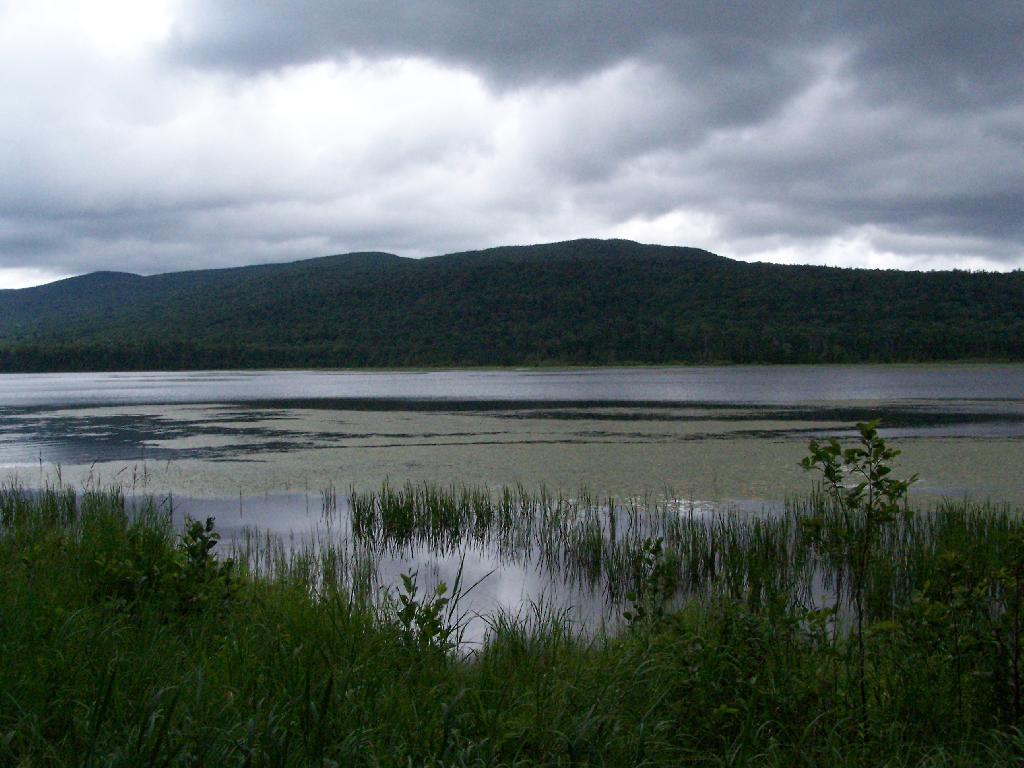
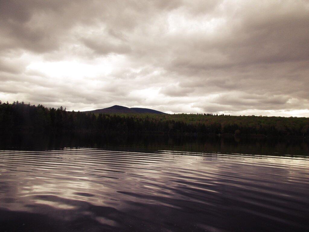
Good Monday Morning! Two weeks to Presidents Day πŸ‘΄. Or as the federal government calls it, Washington’s Birthday. Only New York celebrates president’s day in its laws. Partly cloudy and 40 degrees in Delmar. β›… There is a south-southeast breeze at 5 mph. πŸƒ. There are 4 inches of snow on the ground, melting fast with the warmer weather. β˜ƒ ️Temperatures will drop below freezing at tomorrow around 8 pm. β˜ƒοΈ Assuming the unlikely case I get out of work at a reasonable hour, it will be nice for my evening walk.

I was running a bit late this morning, 🚌 but I checked my phone and so was the bus. 🚏Worked out fine. I just fell behind a bit by the time I got out of bed and my shirt ironed. But it wasn’t too bad, and the bus driver made pretty good time, so I wasn’t in that late. All worked out on this increasingly sunny morning — it started out gray but is changing and is expected to be quite nice by afternoon.

Today will be mostly sunny 🌞, with a high of 52 degrees at 1pm. 20 degrees above normal, which is similar to a typical day around April 1st. No fooling around about today’s weather, for sure. Hazy though. South wind around 6 mph. A year ago, we had cloudy in the morning, which became snow by afternoon. The high last year was 34 degrees. The record high of 61 was set in 1991. 15.5 inches of snow fell back in 1926.❄

The sun will set at 5:13 pm with dusk around 5:42 pm, which is one minute and 19 seconds later than yesterday. πŸŒ‡ At sunset, look for partly clear skies πŸŒ„ and temperatures around 51 degrees. There will be a south breeze at 6 mph. Today will have 10 hours and 8 minutes of daytime, an increase of 2 minutes and 28 seconds over yesterday.

Tonight will be scattered showers, mainly after midnight. Increasing clouds 🌧, with a low of 40 degrees at 5am. 25 degrees above normal, which is similar to a typical night around April 22nd. South wind 5 to 9 mph. Chance of precipitation is 50%. New precipitation amounts of less than a tenth of an inch possible. In 2018, we had light freezing rain in the evening, which became cloudy by the early hours of the morning. It got down to 12 degrees. The record low of -15 occurred back in 1918.

Tomorrow will have isolated showers before 10am. Partly sunny 🌞, with a high of 50 degrees at 11am. 18 degrees above normal, which is similiar to a typical day around March 28th. South wind 8 to 15 mph becoming northwest in the afternoon. Winds could gust as high as 26 mph. Chance of precipitation is 20%. A year ago, we had cloudy in the morning, which became snow by afternoon. The high last year was 34 degrees. The record high of 59 was set in 1890. 10.4 inches of snow fell back in 2014.❄

Another weekend came and went. I’m a bit relaxed and caught up on sleep on Sunday morning but now it’s back to the grind on the Monday morning. πŸ’Ό Since it warmed up Big Red has worked well, although I wish I had given him a bath but I figured it would be covered with salt by the time I got home from my parents house after Sunday dinner.πŸš—

Did a bunch of cleaning yesterday, got the paper and scrap clothing to the recycling center at the park and ride, compacted the recycling and got that outside, bought some ant spray and sprayed down well where they are coming from.🐜 Didn’t see any ants this morning. I’m hoping with the spray, the bait, and my cleaner kitchen the ant problems will be done. It’s unusual that they became a problem mid winter, I must have tracked them in, maybe with a shopping bag or something. That’s were I first found them. I’m sure the spray is pretty toxic but I’m careful where I spray it, I followed the label and believe in science.

As previously noted, there are 2 weeks until Presidents Day πŸ‘΄ when the sun will be setting at 5:31 pm with dusk at 6:00 pm. On that day in 2018, we had partly sunny, snow showers and temperatures between 40 and 23 degrees. Typically, the high temperature is 35 degrees. We hit a record high of 63 back in 1981. I am hoping for a nice weekend, as that might be good for getting out and doing some camping and traveling.

Cool but sunny this weekend. 😎 Saturday, mostly sunny, with a high near 26. Sunday, mostly sunny, with a high near 30. Typical average high for the weekend is 33 degrees. Maybe I will get out and skiing. I might go up to the Adirondacks, although at this point, I am thinking more about doing a trip during the three-day weekend for Presidents Day two weekend out. I will re-evaluate as the weekend approaches.

In four weeks on March 4 the sun will be setting at 5:49 pm,πŸŒ„ which is 35 minutes and 45 seconds later then today. In 2018 on that day, we had snow showers, partly cloudy and temperatures between 38 and 32 degrees. Typically, you have temperatures between 40 and 22 degrees. The record high of 59 degrees was set back in 1919. Looking forward toΒ much warmer weather now that spring is only 45 days away.🌼🌺🌹🌷

Finally muted those obnoxious indicator lights in my bedroom. Painted the LEDs with black paint on the various development boardsΒ πŸ–Œ that I have strung in my bedroom powering the various lights I have around.πŸ’‘ I didn’t find the tiny red LED indicators to be that annoying but the blue LED power indicator on the buck converter was obnoxiously bright. The buck converter saves power but the blue light pollution it created in my bedroom was obnoxious. The black paint I got at the store made it much darker.πŸ”¦

I’m continuing to work on the code for my new LED light controller. The sunrise and sunset modes are working well, although I’m still trying to smooth the color transitions. 🌌 The hooks for firing automatically are basically done but I need to do some more debugging as things are not firing always correctly. Things would be much simpler if I had just used my old one source file code but I wanted to make the new system much more modular and object oriented code and make it possible to create many more color and light modes then was possible using an IR remote and the old 8 bit microprocessor of the Arduino Nano.β™‹

The other day I was thinking how nice it was to have that longer 6 ft micro USB cable to hook up to my development boards that I use for my projects. It means that I can leave my laptop in its normal place and just run a wire. But unfortunately a wire on that cable broke. πŸ”ŒΒ Then I accidentally bought a 6 foot USB C cable rather than a micro USB cable at the store.Β Before I realized my mistake, I had already disassembled the packaging for recycling, so I don’t think I can return it. But I don’t think it’s a big deal, because I’m sure a phone or some other technology I buy eventually will be USB C, as it’s the future.

Looking ahead, Presidents Day πŸ‘΄ is in 2 weeks, Average High is 40 β˜€οΈ is a month away, April Fools Day 🀑 is in 8 weeks, Tax Day πŸ’° is in 10 weeks, Earth Day 🌎 is in 11 weeks, 8 PM Sunset πŸŒ‡ is in 3 months, Memorial Day πŸ‡ΊπŸ‡Έ is in 16 weeks, July 🏊🏿 is in 21 weeks, Independence Day πŸ‡ΊπŸ‡Έ is in 5 months and Last Sunset After 8 PM πŸŒ† is in 27 weeks.

Adirondack X

A Look Back to Past Memorial Day Weekends

With only three weekends left to Memorial Day Weekend, I have to think about where I want to go camping during that long weekend. In recent years I’ve not gone so far from home, just because the black flies are often intense during Memorial Day Weekend, and it can be quite cold and rainy. Here is where I’ve gone in recent years.

2017 – Green Mountain National Forest

This year, I camped at Green Mountain National Forest. I ended up heading home on Sunday because it was increadibly wet and humid, 🌧 and the black flies were atrocious. πŸ› Went for a paddle on Grout Pond on Sunday.🐜

 Flags

 Hmm

 Stratton Mountain From Grout Pond

 Camp

2016 – Green Mountain National Forest

Hot but sunny this year. One morning was foggy. Did a fair bit of swimming at the beach on Grout Pond.πŸ˜… Bugs were bad but overall it was a pretty good trip, quiet because at this point Kelley Stand Road was still closed so I had to go via back way up to this campsite.πŸ‡ΊπŸ‡Έ

America

Camp. Not as messy as appears

Down by the Pond

Sure was foggy yesterday

2015 – North Lake in Atwell (Black River Wild Forest)

Camped on the North Lake Reservior this year.πŸ›₯ It was a bit crowded and hot, and the motor boats on the lake were a bit annoying at time. Met some interesting people from outside of Lowville, drunk beer with them late one evening.🍺

Towards Sugar Loaf

Sandy Beach

Flag

2014 – Cherry Ridge Campground in Brookfield

In 2014 I spent Memorial Day Weekend out in Madison County. 🎣I camped at the Cherry Ridge Campground at Charles Baker State Forest, hiked part of the Cazenovia-Canastota Trailway, and did some fishing down at Nelson swamp.πŸ•

Campsite 1 in the Morning

Old Railway Bed Cuts Through Gorge

Making Coffee

2013 – Moose River Plains

The first two days at Moose River Plains in Memorial Day Weekend 2013 was a frigid, cold rain. πŸ‘’It got better for the last two days, one of which I hiked up Black Bear Mountain and the other I hiked out to Ferg’s Bog. I also did some fishing in the Moose River.πŸ”

The Rain Lets Up

Cascade Lake

Wet

2012 – Piseco-Powley Road

In 2012, I spent Memorial Day Weekend camping at Piseco-Powley Road. 🌞 It was a nice weekend, not particularly muddy although hiking back to Big Alder Bed I decided to turn around, as it looked like a torrent trying to cross the East Branch right at the outflow of the Sacanadaga River.πŸ¦‹

Powley Place Bridge on a Sunny Day

West Branch of East Canada Creek