Search Results for: photo photo 2012 12 05 11 54 55

Site Map

🌲🌲 Our Public Lands 🌳🌲

Interactive maps with backcountry and roadside camping: New York, Pennsylvania, West Virginia & Vermont.
List of NYS DEC Lean-Tos with map coordinates. List of NYS DEC Firetowers with map coordinates and more information.
Google Spreadsheet with Roadside, Primitive and Pay Campsites

Explore the Finger Lakes Trail, Long Path, Northville-Placid Trail and Long Trail/Appalachian in Vermont.
Catskill Park Mountain Peaks, Hudson Valley & Long Island Peaks, Peaks Over 3000 ft Elevation, Highest Peaks in Adirondacks, Interactive Map of All Named Summits in NYS, Blaze Colors in Catskill Park, Trailhead Parking Coordinates and Addresses in the Catskills.

Browse USGS Topo Quads as PDF πŸ†• by State Lands or County. You can Bulk Download New & Old USGS Topograpic Maps.

Links to various NY State Land Websites πŸ†•. Get latest GIS Data from state Web Services.

β›ΊπŸŒ² Camp πŸŒ²πŸ•

Moose River PlainsCampsite Listing, Maps and photos of state’s largest free camping area.
Piseco-Powley RoadCampsite Listing, Maps and photos of 15 mile dirt road with camping.
Catskill Park Primitive CampsitesAn overview of free camping locations in Catskill Park.
Burnt-Rossman Forest, Cattaraugus County, East Branch Sacandaga River, Finger Lakes National Forest, Madison County, Pennsylvania, Vermont and West Virigina.

Campsite Coordinates for Bog River Flow / Lows Lake, Hudson River SMA (Buttermilk Falls), Lake Lila, Oswegathie River, Nine-Corner Lake, Pharaoh Lake Wilderness, Saranac River Campsites, Stillwater Lake, Schoharie County, and Sugar Hill State Forest.

Overview of Camping Areas in the Catskills, Green Mountains, Southern Adirondacks, Central Adirondacks, Northern Adirondacks, Allegheny National Forest and Penna. DCNR Motorized Campsites and the Monongahela National Forest West Virginia.

Free Campsite Overview Maps: Adirondack – North Country, Catskills, Central NY, Finger Lakes, Western NY. Interactive Map.

Places I camped in 2023, 2022, 2021 and 2020.

🏞 πŸ›Ή Bicycle Trails and “Blackie” My Mountain Bike 🚲 🚢

Finally bought a mountain bike, after chewing over a mountain vs commuter bike. Really enjoying riding my bike to work and when it rains there is always a bike rack to safely take it back home. One way to get to adventures at Thacher Park is the Nature Bus.

Empire Trail – KMZ and Interactive Map. Parking along it.

More Trailways with KMZ files including the Albany County Rail Trail, Black Diamond Trail, Catharine Valley Trail, Catskill Scenic Trail, Fonda, Johnstown & Gloversville Rail Trail, Genesee Valley Trail, Link Trail.

🦌🌲 Hunt πŸ¦ƒπŸΏ

Wildlife Management Units (Deer)KMZ Map shows the WMU boundaries.

Summer 2019 Aerial Photographs of WMUs

KMZ Maps of Deer Harvest Density by Town: 2019, 2018, 2017, 2016. By WMU 2017, 2016, 2015.

KMZ Maps of Buck Harvest Density by Town: 2019, 2018, 2017, 2016. By WMU 2017, 2016

2016 -2019 Deer and Buck Harvest by TownKMZ Spreadsheet with FIPS codes for making your own calculations.

🎣🐑 Fish 🐟🐠

Parking and Access to Trout StreamsAn interactive, downloadable KMZ Map.
Lakes with DEC Contour MapsA KMZ Map links to Contour Maps for Fishing.

πŸŒ¨πŸ” Sled & Wheel πŸš™β„

State Truck Trails Over A Half MileDirt roads to explore in the backcountry.
NYS Statewide Snowmobile Trail SystemState trails on public and private lands.

πŸ“‰πŸ“Š Learn πŸ’΅πŸ“ˆ

Interactive Maps of NY CensusExplore and download KML files.
Charts and Interactive DiagramsFrom population to pollution control.
Andy Arthur GitHubGit my R and Python scripts used to make maps and diagrams.
Use ArcPullR to Get Geospatial DataSuper easy way to connect to get GIS data in R from government servers.
GDAL Opens E00 FilesMost open source programs nowadays can open common geospatial formats.
NY Building FootprintsWhere to find on the internet for making maps.
WMS and ArcMap ServicesDownloadable CSV file listing services used on the blog.
2022 US Census Population EstimatesRed states, south continue to gain population.
2020 Cartogram of State Population

πŸ’³ πŸ› Property Taxes πŸ πŸ’Έ

Properties in Albany Pine Bush Study Area, Excel Files: Various Tax Rolls, Find coordinates and political districts, Look Up State Tax Records and a Script for Processing RPTL 1520 PDFs. Match NY SWIS Codes to FIPS Codes and GEOID

πŸš—πŸš— Big Red πŸš—πŸš—

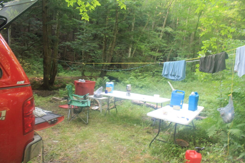
Big RedPhotos and Videos of my lifted truck with its camper shell. Big Red’s Dual Battery Setup for Camp Power, Video Tour and Diagram. Big Red is getting old. What is next? I’ve thought about going carless for a while to save money and reduce pollution. Or maybe going bigger? Or smaller? Five dollar gas sucks.

πŸ”₯🌲 Off-Grid Living 🏠🀠

I am seriously thinking about building an off-grid house. I have a first draft. I need to learn CAD! I have a road map towards buying land and building. I concede might have to live with long commute and give up traveling and camping. I need to be strong.

Why off grid? Well, I’m not into contemporary society. I want to own land, but not be called a landowner, and a cabin, not hooked to electrical grid, farm, raise pigs for food and burn my own trash. I’m saving for a better tomorrow, hoping to make the leap to another freer state. Having acreage is important. Cornfields aren’t bad neighbors. Maybe though my vision has grown smaller and more local. More on off-grid living.

I am 16 years into my career and have made some significant progress in my life. I love my job. But I do wonder on all the things I’m missing out but saving sure makes me high. Maybe it will be different when I own my own land — the end of goal of all this saving.

2020 into 2021 during the pandemic was a year of remote work. It was a struggle not having internet at home, worked a lot out of my truck. But I worked remotely from Horseshoe Lake which was super cool.

Generally I like the idea of owning land in a red state, particularly Idaho, Iowa, Pennsylvania, West Virginia, Wisconsin — and Midwest more generally. But I may settle for New York – it’s all about the f-ing money!

πŸ’»πŸ‘¨β€πŸ’» Open Source πŸ—ΊοΈπŸ“

I use open source software and public sources of data for the blog. Quantum GIS (QGIS), GDAL/ogr2ogr, PyQGIS, GeoPANDAS, R Studio and Leaflet for map making, Arduino and ESP32 microprocessors, Ubuntu Linux and XFCE Window Manager. I’ve recently gotten interested in machine learning.

I avoid using commercial software like Microsoft Windows and do not have home internet or television. If you don’t use commercial software and use your brain, fears of computer viruses are overblown. I deleted most of my social media accounts.

Creating Digital Surface Models using LiDAR Point Clouds.

πŸ“ŠπŸ—Ί R Statistical Programming πŸ“œπŸ‘¨β€πŸ«

The R programming language and RStudio are powerful tools for statistical analysis, making maps and charts. Many of the blog posts and analysis I do are in R, ggplot not only makes great charts but also maps using tidycensus. Generally, R is better then Python for geospatial work.

Use IDW Interpolation to fill in missing Census data, Zonal Histograms for land cover, load WMS Aerial Photography in R, find mountain peaks, save Census shapefiles using tigris quickly, pull NY Election Night Results using Selenium. Fast reverse Geocoding in PostGIS. Working with PDFs in R. Fix a common error starting rselenium/wdman. Make data-filled calendars. R is wonderful and weird, learn it!

πŸΌπŸ”’ Python and Pandas πŸ’»πŸ

Querying state property database, political enrollments, PL 94-171 Census files, calculating population statistics, what address is a district in, converting old districts to new districts, Shapefiles missing Projection information in QGIS.

Learn to code for free modern HTML, Javascript, Python and SQL at freeCodeCamp and web development at the Odin Project.

🐴 🐘 Politics 🦁 🐍

Crunched Election Results with Turnout for Albany County: November 2023, 2022, 2021, 2020, 2019 and Primaries June 2019, Pres/June 2020, June 2021, June 2022, Aug 2022, June 2023.

Albany County Races converted to the new 2023 EDs using Super EDs and Code: 2022, 2021, 2020, 2019 and Primaries June 2019, Pres/June 2020, June 2021, June 2022, Aug 2022.

Above Election Results as zipped Excel files.

Albany County Legislature Districts 2024 Maps

Maps Comparing 2017 and 2023 Albany County Election Districts and a Crosswalk Table Showing the Proposition of Voting Age Population in New and Old EDs

Maps of 2022 NYC Assembly Races, NYS Assembly Races, NY Senate Races, Governor’s Race in Erie County and Statewide. Partisan shift in governor race between 2010 and 2018.

A comparison of Democratic Performance 2022 Assembly Districts to those proposed in 2023 by the IRC. Here is latest 4/20/23 IRC Maps, showing ADP and how they change from existing Assembly districts. Most towns upstate, outside of cities, are quite red. Using LATFOR data with R to calculate Average Democratic Performance.

You can scrape employee salary data from SeeThroughNY using R. Other useful investigative resources.

I often think politics is for losers. I’m into the politics of statistical analysis and reading history books.

I believe strongly in the first amendment, second amendment, oppose gun restrictions and I support de-funding the police in favor of lower-cost technology and civilian employees. Maybe use red flag laws for voting to stop dangerous voters? And the media should stop promoting mass-shootings, even if it’s super profitable for all involved. They should tax the media when it promotes violence. I think some people are much too paranoid in politics. How elections are rigged under law to benefit incumbents. But vote, it’s the best option and inexpensive.

Yeah for the third parties! I voted for Larry Sharpe for Governor and Jo Jergenson for President but my views are complicated and often vote for Democrats, after voting Jill Stein Green Party in 2016.

Generally, I think Biden has been a good change over DJT and glad the Trump era is over and are glad prosecutors and grand jurors are holding him responsible by indicting him for many serious felonies. I don’t think Trump can win in 2024, as nothing has changed politically from 2020.

I think rural people should be left alone and not worship government workers or have parades for them. I am no fan of Donald Trump, his speeches are bad, I don’t like Trump’s embrace of radical environmentalists, but do admire the homemade roadside monuments to DJT.

I don’t toke. But whatever. There are too many transit authorities.

🌲🌳The Earth 🌎 🐸

Why I oppose wilderness areas and parks. It’s trendy to be green these days, but is eco-marketing good for the planet? I visited the Mount Storm Coal Plant and Corridor H.

I worry about a lot about overly-aggressive Climate Change Action, and Undermining Environment Laws for Climate Action. I think we should all admit we are Addicted to Fossil Fuels. These days, urban recycling has become a joke, when it’s still an option at all. It’s better to just buy less shit and avoid the alure of Costcos. I really don’t like how aging radicals have become industrial solar salespeople.

Big bucks are coming to state-designated disadvantaged communities under the CLCP. Which counties and political districts are in line for the the most pork? Interactive map.

I’m a big of farmers who are essentially Living Off the Earth and think Rednecks are Noble Savages. Dairy Farming are key to our rural landscape. I’d trust a farmer or a hunter in a pile of guts he’s butchered over any ivory-tower scientist.

πŸŒŽπŸ”† Industrial Solar 🌞 🏭

Hundreds of multi-acre industrial solar farms are being built in our state. How bad is solar for the environment? We should ask tough questions. Interactive of recently built solar farms, proposed facilities. List of proposed industrial solar facilities. See how the Greenville Solar Farm changed the landscape.

πŸ’³ πŸ’ΈSaving Money πŸ’° πŸ’·

I am not a fan of ESG Investing as it’s not well diversified. I prefer index-funds and other tax-advantaged ways of saving. Why I am concerned about saving enough for retirement, even though I’m in my late 30s. We as a nation should save more, consume less. I like the idea of carbon tax to replace capital gains taxes to discourage consumption.

πŸ₯¦ 🍎Mission Fifty & Being Healthier 🏠🧠

I am now officially in my 40s! I am building to a better life in my 50s, which means getting up early, walking a lot, saying no to cake and yes to more fruit. In many ways, the forties are an awesome time to be alive.

And eating healthy for less without losing sleep over arsenic. And I don’t think we should subsidize unhealthy habits. How I got started in eating healther. Meals are too focused on meat and carbs due to how we describe them, maybe I eat too many bananas in the office, what to eat while camping, worry more about salt then GMOs, eat more beans. Do spend extra for farmers market peaches, especially doughnut peaches and plums. Consider ethnic supermarkets. Thinking about how to make a healthier macaroni and cheese, spinach-mackeral-pasta salad, quick-cook biscuits and whole-wheat bread. That said, too many recipes are junk food crap. Okay in moderation is not okay. The fact that I’m thinner is not a sign I’m dying.

A few years back I decided to explore my mental illness with therapy, thinking about why I have so much anxiety and how many of my values are rational or just thinking too much rednecks’ burn barrels and how much of a throwaway society we live in. Do I want to change?

I’ve learned to care less about the world, and focus more on myself. Maybe I am happier as I am now, saving and investing a lot towards owning my own land, where I don’t have to deal with all the bullshit of modern life.

Mission Fifty: Getting to the point where I own my own land. 🚜
Healthy Eating 🍎 / Growing My Wealth πŸ’°
Healthy Thoughts πŸ’­ / Enjoying Life πŸ˜ƒ

Questions, comments? Feel free to email me at andy@andyarthur.org.

You do your thing, I’ll do mine.

I use GNU open source software.
Plus I like buck goats,
because they’re real macho men
spraying their beards with goat urine.

We made it to spring time. I bet the black flies and cows are super excited about that.” – Andy Arthur

Return to the Top

Laugh a bit and learn how your data is used on this blog: Privacy Policy

This blog is Β© Copyright 1997-2023 Andy Arthur.org, please share using the Creative Commons Attribution 3.0 License.

Categories:

Allegheny National Forest Dispersed Camping and Pennsylvania DNCR Motor Vehicle Camping

Allegheny National Forest Dispersed Camping and Pennsylvania DNCR Motor Vehicle Camping πŸ•

Please see also information on dispersed, roadside and back-country camping in New York State, Vermont and West Virginia.

Allegheny National Forest Dispersed Campsites (shown on this map with a round Yellow Camp logo) are free-to-use with a 14-day stay limit in any 30 day period. Many of these campsites are informal areas used for camping, others like along Forest Road 160 and 259 near Jake’s Rocks and along Lolita Grade have enhanced gravel pads/parking areas. Unlike New York State, they do not have formal markings at the sites. More detailed map.

PA DCNR Motor Vehicle Campsites (shown on this map with a Blue Camp logo) are free to stay at with a permit which can now be obtained online, 3 days in advance.

Download a spreadsheet with the coordinates of Allegheny National Forest Dispersed and Motor vehicle campsites.

More About Allegheny National Forest Camping …

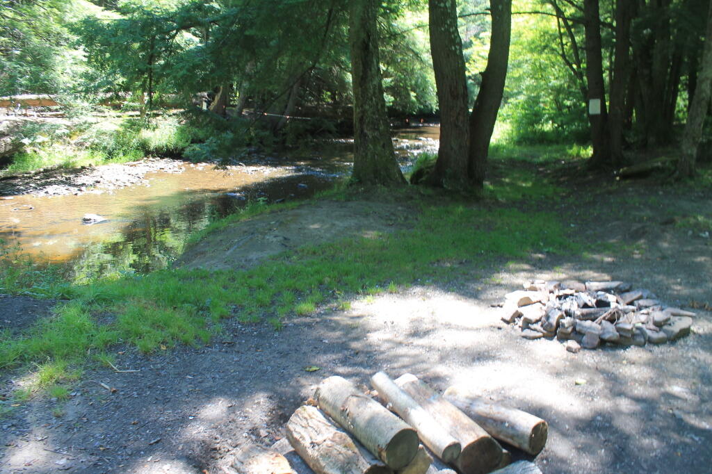
In the Allegheny National Forest there are a variety of back country roads, offering primitive roadside camping.

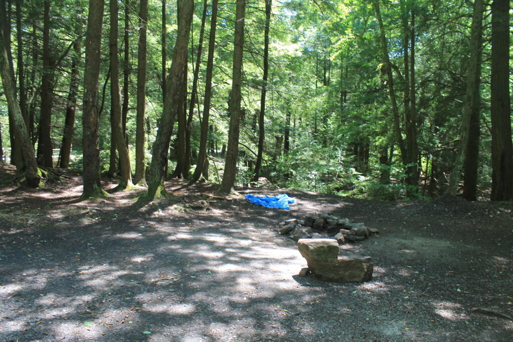
  • Campsites are free to use, and have no facilities except for a fire ring and a pull-off from the road, and sometimes a site reinforced with gravel.
  • As noted below, some campsites have additional facilities.
  • Don’t make a mess of campsites, pack out any garbage left over.
  • Burn only dead and down trees, don’t bring in wood from out of state.
  • You can camp up to 14 days per 30 day period in Allegheny National Forest — no permits are required.

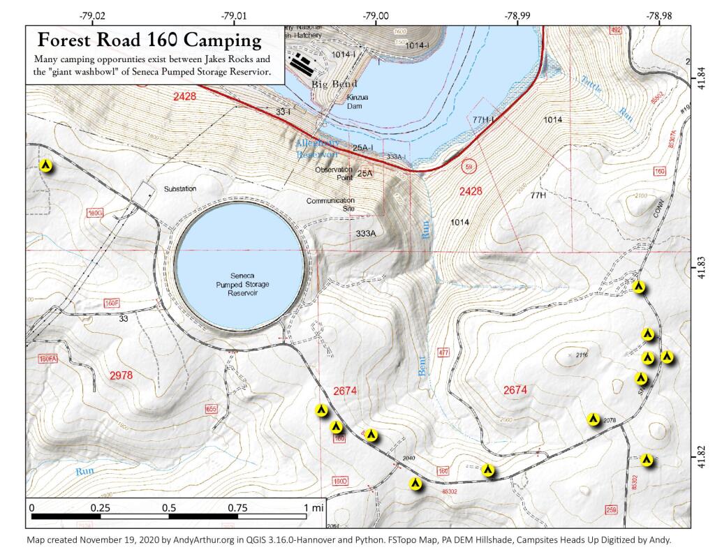
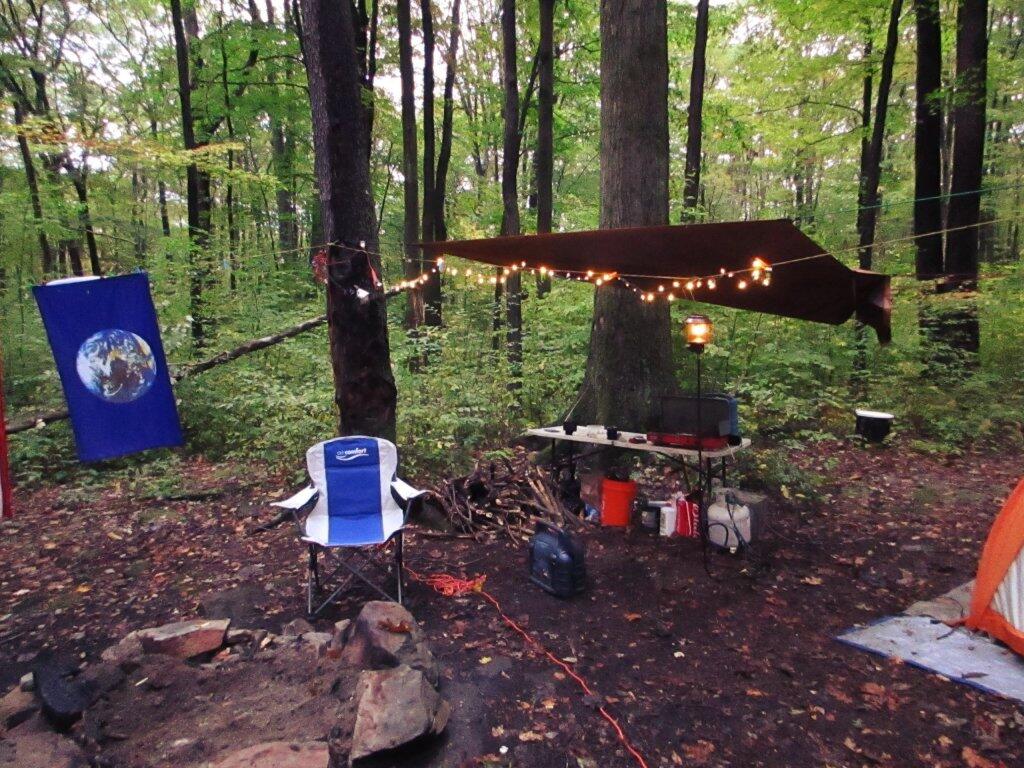
Forest Road 160/259 is the most popular dispersed camping area near Jakes Rocks and the Allegheny Reservior. Above are some campsites in this area. Many of these campsites have gravel parking areas and hardend campsites.

Forest Road 160 Camping

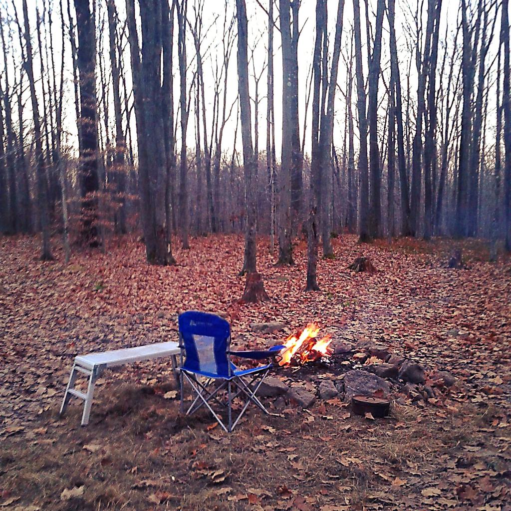
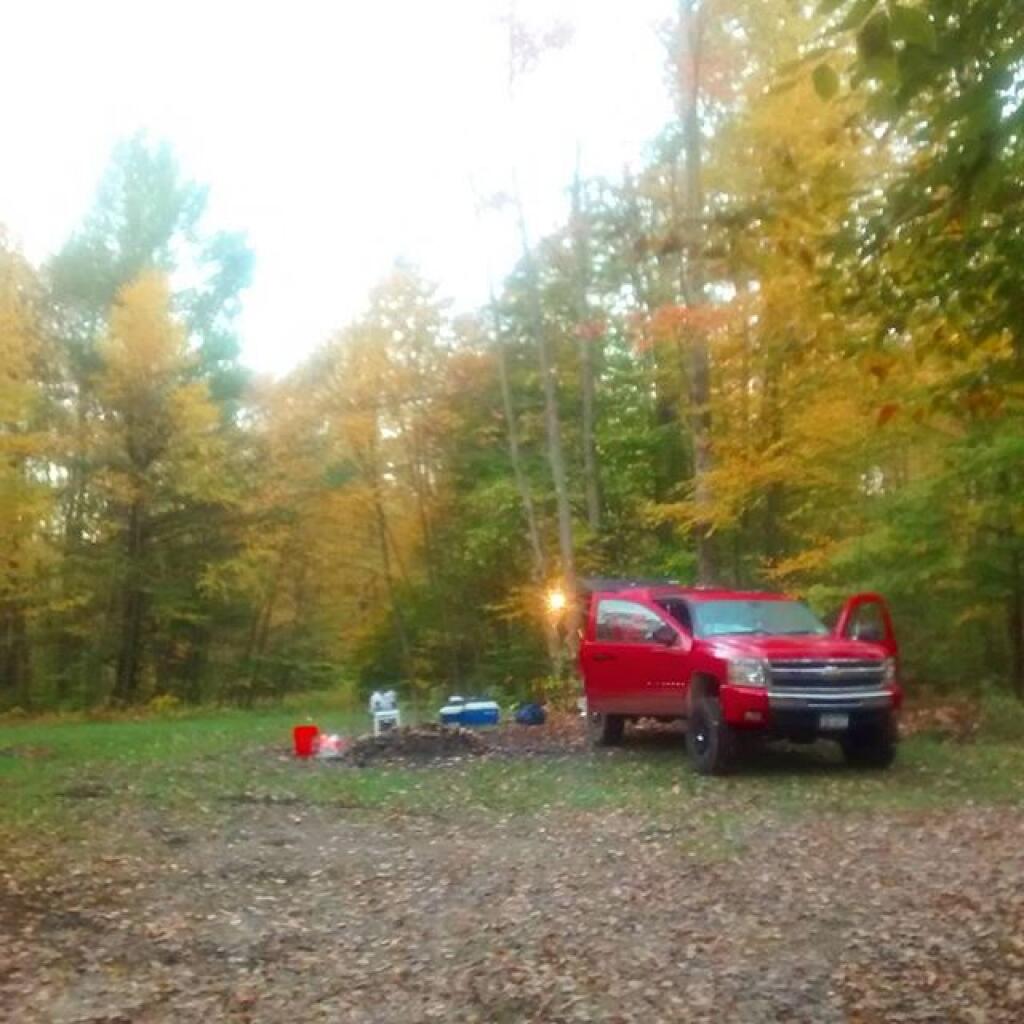
Before Dark

Sitting Next to the Campfire

There are several campsites along Loleta Grade, south of Lamonaville (FR 131).  This is on the backside of Buzzard Swamp Wildlife Refuge, and is a much more wilderness experience. Many of these campsites have gravel parking areas and hardened campsites. Some of the campsites along the Gurgling Run can be buggy during the summer month, but get much less use then the Jakes Rocks area. Be aware that Forest Road 131 from Loleta Recreation Area to Forest Road 288 is permanently closed due to damage after Superstorm Sandy.

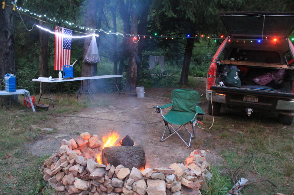
Camping with Lots of Light

Good morning from camp!

There is a handful of campsites along Fire Road FR 137 along the Dry Run and Whitney Creek near the Willow Creek ATV Area.

2020 State Population

Sitting Next to the Campfire

There are a handful of campsites along the East Tionesta Creek south of Kane/Shefield.

Another Campsite on Tionesta

Tionesta Creek Campsite

There are many other roads that have camping but these are some of my favorite locations.

More About DCNR Motor Vehicle Camping …

On Pennsylvania State Forests there are a variety of back country roads, offering primitive roadside camping.

Camping Down at the Painter Run

Camping at Painter Run

I have not done a lot of DCNR Motor Vehicle Camping, but above is a picture from 2012 when I spent half a week truck camping at Painter Run in the Tioga State Forest near the Pennsylvania Grand Canyon. There are many other opportunities as can be seen above, if you plan ahead and get your permit.

Also, see the DCNR Interactive Map if you are interested in fee campgrounds. They have several “rustic” campgrounds which are inexpensive at $10 night, and do not require reservation. These are traditional campgrounds with hand pump water, pit privies and no electricity but often are well maintained and quiet — although the campsites aren’t spread out like back country camping. Many of these campsites are lightly used off-season and are often a good place to spend a night when traveling. 

Allegheny National Forest Dispersed Campsites are free-to-use with a 14-day stay limit in any 30 day period. Many of these campsites are informal areas used for camping, others like along Forest Road 160 and 259 near Jake's Rocks and along Lolita Grade have enhanced gravel pads/parking areas. Unlike New York State, they do not have formal markings at the sites. More detailed map.

PA DCNR Motor Vehicle Campsites are free to stay at with a permit which can be obtained from the local DCNR Forestry office (click on the black dot) during ordinary business hours or by emailing/calling their office with your license plate and contact information.

March 11, 2021 – Next Sixteen Weeks

Here is a brief chart that shows the climate normals, sunset times, and length of day for next four months in Delmar, NY…

Week Date Dawn Sun-
rise
Sun-
set
Dusk Day Noon Sun Angle Avg High Avg Low Record Hi Record Low
0 Mar 11 5:45 am 6:13 am 5:57 pm 6:25 pm 11:44 43.8Β° 42 24 70 (1977) -10 (1939)
1 Mar 18 6:33 am 7:01 am 7:05 pm 7:33 pm 12:04 46.6Β° 45 26 69 (2012) -8 (1900)
2 Mar 25 6:20 am 6:48 am 7:13 pm 7:41 pm 12:24 49.3Β° 48 29 74 (1910) 0 (1875)
3 Apr 1 6:08 am 6:36 am 7:21 pm 7:49 pm 12:44 52.1Β° 52 32 77 (1986) 9 (1923)
4 Apr 8 5:55 am 6:24 am 7:29 pm 7:58 pm 13:04 54.7Β° 55 35 88 (1929) 19 (2018)
5 Apr 15 5:43 am 6:13 am 7:37 pm 8:06 pm 13:24 57.3Β° 58 37 86 (2003) 21 (1940)
6 Apr 22 5:32 am 6:02 am 7:45 pm 8:15 pm 13:43 59.7Β° 61 40 86 (1985) 20 (1947)
7 Apr 29 5:21 am 5:51 am 7:53 pm 8:24 pm 14:01 62Β° 64 42 88 (1888) 27 (1947)
8 May 6 5:11 am 5:42 am 8:01 pm 8:32 pm 14:18 64Β° 67 44 89 (1930) 29 (1969)
9 May 13 5:02 am 5:34 am 8:08 pm 8:40 pm 14:34 65.9Β° 69 46 86 (2004) 30 (2005)
10 May 20 4:55 am 5:27 am 8:16 pm 8:48 pm 14:48 67.4Β° 71 48 91 (1962) 29 (2002)
11 May 27 4:49 am 5:22 am 8:22 pm 8:56 pm 14:59 68.7Β° 73 51 94 (1914) 30 (1969)
12 Jun 3 4:44 am 5:19 am 8:28 pm 9:02 pm 15:09 69.7Β° 75 53 97 (1925) 36 (1986)
13 Jun 10 4:42 am 5:17 am 8:32 pm 9:07 pm 15:15 70.4Β° 77 55 96 (2008) 36 (1975)
14 Jun 17 4:42 am 5:17 am 8:35 pm 9:10 pm 15:18 70.8Β° 79 57 94 (1994) 44 (1954)
15 Jun 24 4:43 am 5:18 am 8:37 pm 9:12 pm 15:18 70.8Β° 80 59 96 (1943) 44 (1932)
16 Jul 1 4:47 am 5:21 am 8:37 pm 9:11 pm 15:15 70.5Β° 81 60 99 (1913) 45 (1978)

Harvey Mountain Truck Trail

January 29, 2021 Morning

Good morning! Happy 38th Birthday to Me πŸŽ‰ ! I honestly don’t care, I think birthdays are stupid and egotistical. πŸŽ‚ I am not gawd. Maybe I’ll celebrate my birthday of retirement, but even then I don’t care. Maybe I should be celebrating it more, I survived 2020, the year best described by a Phil Ochs lyrics in the Crucifixion, “It’s good to be alive when the eulogies are read.” It’s actually remarkable to think how many people I’ve known that over years died over the past year from the COVID. ⚰ God bless them. Doing a heck of a lot better then them, although I am feeling awful from allergies this morning. πŸ˜ƒ More antihistamine please. πŸ‘ƒ

Kind of a chilly one, although the wind hasn’t been as strong as it was earlier. Clear and 4 degrees in Delmar, NY. Breezy, ️17 mph breeze from the northwest 🌬 . The current wind chill is -18. There are 5 inches of snow on the ground. β˜ƒΒ  I still want to be brave and try to go for my morning walk, but only time will tell.️

Last night I felt terribly itchy and congested. 🀒 I think it is just allergies but I retired to bed early last night. This morning, after the walk I plan to take a shower before sitting down to work. I think while I was working on malfunctioning vacuum yesterday, it was blowing around a lot of dust and mold which triggered my allergies, making me absolutely miserable. πŸ‘ƒ The heat is kind of an all or nothing deal in my apartment.Β  ♨ At least my apartment is warm this morning, but I’m hopeful that soon I’ll be able to have the windows open or at least get out more and get more fresh air. Today though that will be tough. 🌬

Today will be mostly sunny 🌞, with a high of 14 degrees at 2pm. 17 degrees below normal. But it can be even colderMaximum wind chill around -18 at 6am; Blustery, with a northwest wind 17 to 21 mph, with gusts as high as 36 mph. A year ago, we had partly cloudy skies in the morning with sunny skies in the afternoon. The high last year was 35 degrees. The record high of 54 was set in 2002. 8.3 inches of snow fell back in 1990.❄

I had some stuff come up yesterday, and it was cold, 🌨 so I ended up not going to store at lunchtime.Β  Today I do plan to go to the store and maybe thereafter for a while at the library, but not long as it will be cold. It’s going to be tricky though if I want to go at lunchtime, because I have a 1 PM meeting. Maybe I’ll just take lunch after the meeting, in case I’m running a bit late from the store. Plus at 1 PM the stores are always so crowded. πŸ‘₯ I also need to drop off my stimulus check at the bank, as that’s been burning a hole in my pocket for some time now, and it would be nice to earn all 5 cents of interest and at some point I’ll loose the check. πŸ’΅ I am sure the bank will still be a zoo 🐘 as the inside teller is closed, so everybody will be trying to transact their business outside, and it will be difficult for my truck to make the turn.

Solar noon 🌞 is at 12:09 pm with sun having an altitude of 29.6Β° from the due south horizon (-41.3Β° vs. 6/21). A six foot person will cast a 10.6 foot shadow today compared to 2.2 feet on the first day of summer. The golden hour πŸ… starts at 4:24 pm with the sun in the west-southwest (239Β°). πŸ“Έ The sunset is in the west-southwest (246Β°) with the sun dropping below the horizon at 5:05 pm after setting for 3 minutes and 10 seconds with dusk around 5:35 pm, which is one minute and 18 seconds later than yesterday. πŸŒ‡ The best time to look at the stars is after 6:09 pm. At sunset, look for partly clear skies πŸŒ„ and temperatures around 12 degrees. The wind chill around sunset will be -5. β˜ƒοΈ Breezy, 17 mph breeze β›… from the northwest with gusts up to 28mph. Tomorrow will have 9 hours and 55 minutes of daytime, an increase of 2 minutes and 18 seconds over today.

Tonight will be mostly clear πŸŒƒ, with a low of 0 degrees at 6am. 15 degrees below normal. Maximum wind chill around -13 at 5am; Northwest wind 8 to 15 mph. In 2020, we had clear skies in the evening, which became partly cloudy by the early hours of the morning. It got down to 15 degrees. The record low of -12 occurred back in 1965.

Tomorrow will be sunny 🌞, with a high of 17 degrees at 2pm. 14 degrees below normal. Maximum wind chill around -13 at 6am; Northwest wind 8 to 13 mph. A year ago, we had partly cloudy skies in the morning with sunny skies in the afternoon. The high last year was 32 degrees. The record high of 56 was set in 2013. 11 inches of snow fell back in 1966.❄ Typical average high isΒ  is 32 degrees.

Looking ahead to Sunday, partly sunny, β˜€with a high near 20. Light north wind. No wind, that’s almost beach weather. Typical average high for Sunday is 32 degrees. And in a little over a week on the following Saturday February 6th, the average high is 33 — a typical day will be above freezing or maybe more then that as the climate normal are old at this point and the 1991-2020 normal won’t be out until July 1st, when everybody says aw shit. 5 weeks from now the average high is forty.

🌹🌻🌼Only 50 days remain until the first day of calendar spring!🌹🌻🌼 When there is no hope, there is spring. Or so I tell myself. I just hate not having the windows open, or having the heat on. Honestly, I just don’t like being home. Normal winters I’d be working downtown, have the Empire State Plaza to walk in, and could go to the library after work. This panademic, while fun during the summer months, sucks during the winter.

Looking ahead, there are 7 weeks until Last Day of Winter πŸ‚ when the sun will be setting at 7:06 pm with dusk at 7:34 pm (Daylight Savings Time). On that day in 2020, we had rain and temperatures between 51 and 38 degrees. Typically, the high temperature is 46 degrees. We hit a record high of 78 back in 2012.

North Harmony - Whalen Memorial State Forest

January 7, 2021 – Next Sixteen Weeks

Here is a brief chart that shows the climate normals, sunset times, and length of day for next four months in Delmar, NY…

Week Date Dawn Sun-
rise
Sun-
set
Dusk Day Noon Sun Angle Avg High Avg Low Record Hi Record Low
0 Jan 7 6:53 am 7:25 am 4:38 pm 5:10 pm 9:13 25.1Β° 31 15 56 (1915) -12 (1878)
1 Jan 14 6:51 am 7:22 am 4:46 pm 5:17 pm 9:23 26.1Β° 30 14 66 (1932) -24 (1957)
2 Jan 21 6:48 am 7:18 am 4:54 pm 5:25 pm 9:36 27.6Β° 30 14 61 (2006) -18 (1994)
3 Jan 28 6:42 am 7:12 am 5:03 pm 5:33 pm 9:51 29.3Β° 31 15 56 (1916) -16 (2005)
4 Feb 4 6:36 am 7:05 am 5:13 pm 5:42 pm 10:07 31.3Β° 32 15 61 (1991) -13 (1978)
5 Feb 11 6:27 am 6:56 am 5:22 pm 5:51 pm 10:25 33.5Β° 34 17 59 (1981) -18 (1962)
6 Feb 18 6:18 am 6:47 am 5:31 pm 6:00 pm 10:44 35.9Β° 35 18 63 (1981) -21 (1973)
7 Feb 25 6:08 am 6:36 am 5:40 pm 6:08 pm 11:03 38.4Β° 37 20 70 (2017) -14 (1914)
8 Mar 4 5:57 am 6:25 am 5:48 pm 6:16 pm 11:23 41.1Β° 40 22 59 (1919) -20 (1950)
9 Mar 11 5:45 am 6:13 am 5:57 pm 6:25 pm 11:44 43.8Β° 42 24 70 (1977) -10 (1939)
10 Mar 18 6:33 am 7:01 am 7:05 pm 7:33 pm 12:04 46.6Β° 45 26 69 (2012) -8 (1900)
11 Mar 25 6:20 am 6:48 am 7:13 pm 7:41 pm 12:24 49.3Β° 48 29 74 (1910) 0 (1875)
12 Apr 1 6:08 am 6:36 am 7:21 pm 7:49 pm 12:44 52.1Β° 52 32 77 (1986) 9 (1923)
13 Apr 8 5:55 am 6:24 am 7:29 pm 7:58 pm 13:04 54.7Β° 55 35 88 (1929) 19 (2018)
14 Apr 15 5:43 am 6:13 am 7:37 pm 8:06 pm 13:24 57.3Β° 58 37 86 (2003) 21 (1940)
15 Apr 22 5:32 am 6:02 am 7:45 pm 8:15 pm 13:43 59.7Β° 61 40 86 (1985) 20 (1947)
16 Apr 29 5:21 am 5:51 am 7:53 pm 8:24 pm 14:01 62Β° 64 42 88 (1888) 27 (1947)

Alfred H Smith Bridge and Thruway Bridge

 Thawed Lake

Middleburgh Round Top and Ecker Hollow

Lean-tos with Outhouses

A list of lean-tos on state lands with an outhouse within 150 feet.

Forest Lean-To Name Description Region Latitude Longtitude
Big Indian Wilderness Shandaken Brook Lean-To 3 42.0502743293466 -74.5106001666636
Big Indian Wilderness Biscuit Brook Lean-To 3 42.0091051509829 -74.4838519036791
Delaware Wild Forest Mud Pond Trail Lean-To 4 42.0116839995216 -74.9476810002715
Hunter-West Kill Wilderness Diamond Notch Lean-To 4 42.1694869998955 -74.2569359998362
Blue Mountain Wild Forest Tirrel Pond North Lean-To 5 43.8873444775573 -74.3788006260605
Blue Mountain Wild Forest O’Neill Flow Lean-To 5 43.8755968409362 -74.3664262369705
Blue Ridge Wilderness Wilson Pond Lean-To 5 43.8201917816146 -74.4686803224003
Blue Ridge Wilderness Cascade Pond Lean-To 5 43.8299374729896 -74.4366163022193
Blue Ridge Wilderness Stephens Pond Lean-To 5 43.818673668555 -74.4205248717271
Giant Mountain Wilderness Giant Mtn. Lean-To 5 44.1759172264724 -73.7215350426426
Hammond Pond Wild Forest Moose Mt Pond Lean-To 5 43.9655912049299 -73.6440374623141
High Peaks Wilderness Catlin Bay #2 Lean-To 5 43.9972143811434 -74.3959393656481
High Peaks Wilderness Catlin Bay #1 Lean-To 5 43.9980126926989 -74.3927845610842
High Peaks Wilderness Hidden Cove Lean-To 5 44.0026552881939 -74.3864802632516
High Peaks Wilderness Rodney Point #1 Lean-To 5 44.0414093848994 -74.3501490963956
High Peaks Wilderness Rodney Point #2 Lean-To 5 44.0429767454126 -74.3493346475314
High Peaks Wilderness Plumley Point #2 Lean-To 5 44.0655989161076 -74.32761224546
High Peaks Wilderness Cold River #3 Lean-To 5 44.0914592780512 -74.257641750845
High Peaks Wilderness Cold River #4 Lean-To 5 44.0913902533326 -74.2557348025251
High Peaks Wilderness Moose Pond Stream Lean-To #2 5 44.079553878647 -74.2391509433142
High Peaks Wilderness Moose Pond Stream Lean-To 5 44.079589788976 -74.2389368366902
High Peaks Wilderness Seward Lean-To 5 44.1062441376862 -74.2091536427719
High Peaks Wilderness Ouluska Pass Brook Lean-To 5 44.1202212816036 -74.1874471739093
High Peaks Wilderness Newcomb Lake Lean-To #1 5 44.0158171441475 -74.1523218842845
High Peaks Wilderness Newcomb Lake Lean-To #2 5 44.0205306743106 -74.1522782706761
High Peaks Wilderness Cold River #2 Lean-To 5 44.1425166431718 -74.1303582429155
High Peaks Wilderness Cold River Lean-To #1 Lean-To 5 44.1427273762849 -74.1298402106559
High Peaks Wilderness Duck Hole #1 Lean-To 5 44.1416268740099 -74.1069373467662
High Peaks Wilderness Duck Hole #2 Lean-To 5 44.1416768646683 -74.1065435467226
High Peaks Wilderness Moose Pond Lean-To 5 44.1828433824027 -74.07364102376
High Peaks Wilderness Henderson Lake Lean-To 5 44.104178442066 -74.066913293691
High Peaks Wilderness Beaver Point #1 5 44.1210154790382 -73.9821264349125
High Peaks Wilderness Beaver Point #2 5 44.1207874446534 -73.9817139903994
High Peaks Wilderness Kagel Lean-To 5 44.1494011459341 -73.9557902346565
High Peaks Wilderness Marcy Brook Lean-To 5 44.1469386474738 -73.9552287452665
High Peaks Wilderness Panther Gorge Lean-To 5 44.099635151426 -73.9133647612345
High Peaks Wilderness Lilian Brook Lean-To 5 44.0601596208968 -73.807816780134
High Peaks Wilderness Slide Brook Lean-To 5 44.0441261980002 -73.8058583966018
High Peaks Wilderness Bouquet Lean-To 5 44.1082054720282 -73.7738312580535
Hurricane Mountain Primitive Area Gulf Brook Lean-To 5 44.253019593455 -73.7180348153422
Hurricane Mountain Primitive Area Lost Pond/Biesemeyer Lean-To 5 44.2607301476158 -73.7100106668894
Lake George Wild Forest Black Mountain Ponds Lean-To Lean-To With Privy And Fire Ring 5 43.5996600138705 -73.5330643345846
Lake George Wild Forest Lapland Pond Lean-To Campsite With Lean-To 13-27 5 43.5958213340907 -73.5179510245416
Mckenzie Mountain Wilderness Placid Lean-To 5 44.3214560456649 -74.030786043903
Sentinel Range Wilderness Copperas Pond Lean-To 5 44.3317122951397 -73.8997103538312
Shaker Mountain Wild Forest Holmes Lake Lean-To 5 43.1885867657416 -74.4310218122738
Siamese Ponds Wilderness John Pond Lean-To 5 43.7278247361895 -74.2012685562129
Siamese Ponds Wilderness E. Sacandaga River Lean-To 5 43.6154338756917 -74.1499734599501
Silver Lake Wilderness Mud Lake Lean-To 5 43.342671073158 -74.4562907856386
Silver Lake Wilderness Hamilton Lake Stream #1 Lean-To 5 43.3974135951753 -74.4552975900222
Taylor Pond Wild Forest Poke-O-Moonshine Summit Lean-To 5 44.3997973548695 -73.5145569962096
Vanderwhacker Mountain Wild Forest Stony Pond Lean-To 5 43.8387348152587 -73.9856219153826
West Canada Lake Wilderness West Lake #1 Lean-To 5 43.5931622288498 -74.6268866843131
West Canada Lake Wilderness West Lake #2 Lean-To 5 43.5970642572198 -74.6231056495758
West Canada Lake Wilderness South Lake Lean-To 5 43.58724480971 -74.6215788383727
West Canada Lake Wilderness West Canada Creek Lean-To 5 43.5869876140516 -74.6139979710011
West Canada Lake Wilderness Spruce Lake #1 Lean-To 5 43.5272841125778 -74.6099246975027
West Canada Lake Wilderness Spruce Lake #3 Lean-To 5 43.5371297279245 -74.6082096280248
West Canada Lake Wilderness Spruce Lake #2 Lean-To 5 43.5346306298339 -74.608085803069
West Canada Lake Wilderness T Lake Lean-To 5 43.4527175891905 -74.5822815394449
West Canada Lake Wilderness Beaver Pond (AKA Cedar Lakes Lean-To #2) 5 43.6259693968044 -74.5492715037002
West Canada Lake Wilderness Cedar Lakes #1 Lean-To 5 43.6281256650379 -74.5404732399266
West Canada Lake Wilderness Pillsbury Lake Lean-To 5 43.5968984708902 -74.5316653645311
West Canada Lake Wilderness Carry Lean-To 5 43.6787448834709 -74.4954982187945
West Canada Lake Wilderness Colvin Brook Lean-To 5 43.6524139144065 -74.4903803529398
Black River Wild Forest Bear Lake Lean-To 6 43.6000735406502 -75.0530032053211
Black River Wild Forest Sand Lake Falls Lean-To 6 43.5589723655294 -75.0029762567594
Five Ponds Wilderness Griffin Rapids Lean-To Aka Oswegatchie River Campsite 38. With Full Sized Privy. Checked 05/2016. 6 44.0841653919081 -74.9687479733594
Five Ponds Wilderness High Falls No. 2 Lean-To Aka Oswegatchie River Campsite 13. With Full Sized Privy. 6 44.0689134869774 -74.9113129664397
Five Ponds Wilderness High Falls No. 1 Lean-To Aka Oswegatchie River Campsite 15. With Full Sized Privy. 6 44.0689098251132 -74.9093969117936
Pigeon Lake Wilderness Gull Lake Lean-To 6 43.8574321808094 -74.8250005772908
Wolf Lake State Forest Wolf Lake Lean-To 6 44.3363136708752 -75.3138633269515
Sugar Hill State Forest Parks Hollow Lean-To Log 8 42.3690917205455 -77.0130036276398
Sugar Hill State Forest The Twin Lean-To’s 2 Lean-To At This Location 8 42.3822533325968 -77.0026799994935
Sugar Hill State Forest Vanzandt Lean-To 8 42.3898077706314 -76.972589837336

Chance of Thunder Lean To

Last week I got an email requesting a list of lean-tos on state land that have full accomindations - that is an outhouse or pit privy. So I made up that list, and figured I'd share it as some might find it useful.

March 20, 2020 Morning

Good morning! Happy Spring 🌷! The sun passed the equator as the most direct spot its hitting the earth. 🌎 Three weeks to Good Friday ✝️. Rain showers and 47 degrees in Delmar, NY. β˜”March showers bring April mud. πŸ‘’ At least now I have good boots for that purpose. There is a south breeze at 11 mph. πŸƒ. Temperatures will drop below freezing at tomorrow around 5 am. β˜ƒοΈ

Today will have showers likely, with thunderstorms also possible after 5pm. ⚑ Cloudy 🌦, with a high of 71 degrees at 5pm. 25 degrees above normal, which is similar to a typical day around May 20th. Maximum dew point of 58 at 4pm. South wind 11 to 17 mph, with gusts as high as 31 mph. Chance of precipitation is 60%. New rainfall amounts between a tenth and quarter of an inch, except higher amounts possible in thunderstorms. Should be fun to watch from the Coronavirus office. πŸ’¦A year ago, we had mostly sunny skies. The high last year was 55 degrees. The record high of 78 was set in 2012. That would be nice. 7 inches of snow fell back in 1944.❄

With the lack of sun β˜€ might be another tight day for power to run my laptop for work πŸ’» but it worked out yesterday and should be okay today too. It turns out that my laptop draws less current than I originally expected, but I should fix the plug πŸ”Œ on my DC to DC car charger for my laptop this weekend to further improve efficiency by cutting out the inverter loses. I have a he adapter but I accidentally broke the plug on it. The main thing is figuring out which is the hot and ground on the plug when I splice on another plug. I might eventually be getting an assigned computer for work should the shutdown extend multiple weeks but I was told that the computers were back ordered.

Solar noon 🌞 is at 1:04 pm with sun having an altitude of 47.5Β° from the due south horizon (-23.4Β° vs. 6/21). A six foot person will cast a 5.5 foot shadow today compared to 2.2 feet on the first day of summer. Shorter than Mini Mike, a fact the folks slinging cow poop in their spreaders appreciate. πŸ’© Soil science is fascinating, been studying it lately, reading more about it online. Did you see that video that Our Wyoming Life posted about Mini Mike and agriculture a few weeks ago? The golden hour πŸ… starts at 6:31 pm with the sun in the west (265Β°). πŸ“Έ The sunset is in the west (271Β°) starting at 7:05 pm and lasts for 2 minutes and 54 seconds with dusk around 7:36 pm, which is one minute and 10 seconds later than yesterday. πŸŒ‡ The best time to look at the stars is after 8:09 pm. At sunset, look for rain showers 🌧 and temperatures around 64 degrees. The dew point will be 54 degrees. There will be a west breeze at 14 mph with gusts up to 25mph. Today will have 12 hours and 10 minutes of daytime, an increase of 2 minutes and 55 seconds over yesterday.

Tonight will have a chance of showers and thunderstorms before 7pm, then a slight chance of showers between 7pm and 9pm. Mostly cloudy 🌧, with a low of 31 degrees at 6am. Four degrees above normal, which is similar to a typical night around March 29th. Northwest wind 14 to 16 mph, with gusts as high as 29 mph. Chance of precipitation is 30%. New precipitation amounts of less than a tenth of an inch, except higher amounts possible in thunderstorms. In 2019, we had mostly clear skies in the evening, which became cloudy by the early hours of the morning. It got down to 38 degrees. The record low of -1 occurred back in 1956.

Tomorrow will be sunny 🌞, with a high of 44 degrees at 4pm. Two degrees below normal, which is similar to a typical day around March 16th. Northwest wind 9 to 11 mph. A year ago, we had mostly sunny skies. The high last year was 48 degrees. The record high of 78 was set in 1921. 6 inches of snow fell back in 1905.❄

So tomorrow I’m going to the recycling center β™» to get rid of my bottles and cans 🍢 and then finish going through my camping gear and getting ready for the upcoming season. β›Ί My sleeping bags have been hung up to air out, my camp stove cleaned. I thought about going to Aldi for groceries and Schodack Island for a walk 🚢 but I don’t know, it might be crowded.

Looking ahead to Sunday, sunny, with a high near 41. North wind 3 to 6 mph. β˜€ Typical average high for the weekend is 46 degrees. Assuming that I don’t have other things to do in the Pine Bush, I am thinking of hiking up at Partridge Run for the bulk of the day, probably mostly on the dirt roads because the trails will be muddy unless of course I wear my boots. I like doing more nature study and observation. 🐦

As previously noted, there are 3 weeks until Good Friday ✝️ when the sun will be setting at 7:32 pm with dusk at 8:01 pm. On that day in 2019, we had partly cloudy and temperatures between 50 and 32 degrees. Typically, the high temperature is 56 degrees. We hit a record high of 86 back in 1922.

In four weeks on April 17 the sun will be setting in the west-northwest (285Β°) at 7:40 pm,πŸŒ„ which is 31 minutes and 59 seconds later then today. In 2019 on that day, we had partly sunny and temperatures between 62 and 32 degrees. Typically, you have temperatures between 59 and 38 degrees. The record high of 91 degrees was set back in 2002. Nicer weather is just around the corner.

Looking ahead, Good Friday ✝️ is in 3 weeks, May πŸ•Š is in 6 weeks, 8:30 PM Sunset ️⛱️ is in 11 weeks, Last Day of Session πŸ› is in 3 months, Summer ️⛱️ is in 3 months and Inauguration Day 2021 πŸ‘΄πŸ» is in 10 months.

South