Search Results for: photo photo 2012 12 04 12 49 25

Allegheny National Forest Dispersed Camping and Pennsylvania DNCR Motor Vehicle Camping

Allegheny National Forest Dispersed Camping and Pennsylvania DNCR Motor Vehicle Camping πŸ•

Please see also information on dispersed, roadside and back-country camping in New York State, Vermont and West Virginia.

Allegheny National Forest Dispersed Campsites (shown on this map with a round Yellow Camp logo) are free-to-use with a 14-day stay limit in any 30 day period. Many of these campsites are informal areas used for camping, others like along Forest Road 160 and 259 near Jake’s Rocks and along Lolita Grade have enhanced gravel pads/parking areas. Unlike New York State, they do not have formal markings at the sites. More detailed map.

PA DCNR Motor Vehicle Campsites (shown on this map with a Blue Camp logo) are free to stay at with a permit which can now be obtained online, 3 days in advance.

Download a spreadsheet with the coordinates of Allegheny National Forest Dispersed and Motor vehicle campsites.

More About Allegheny National Forest Camping …

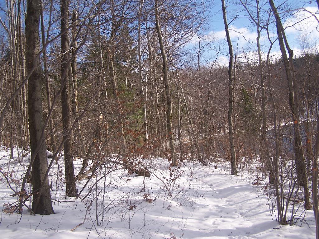
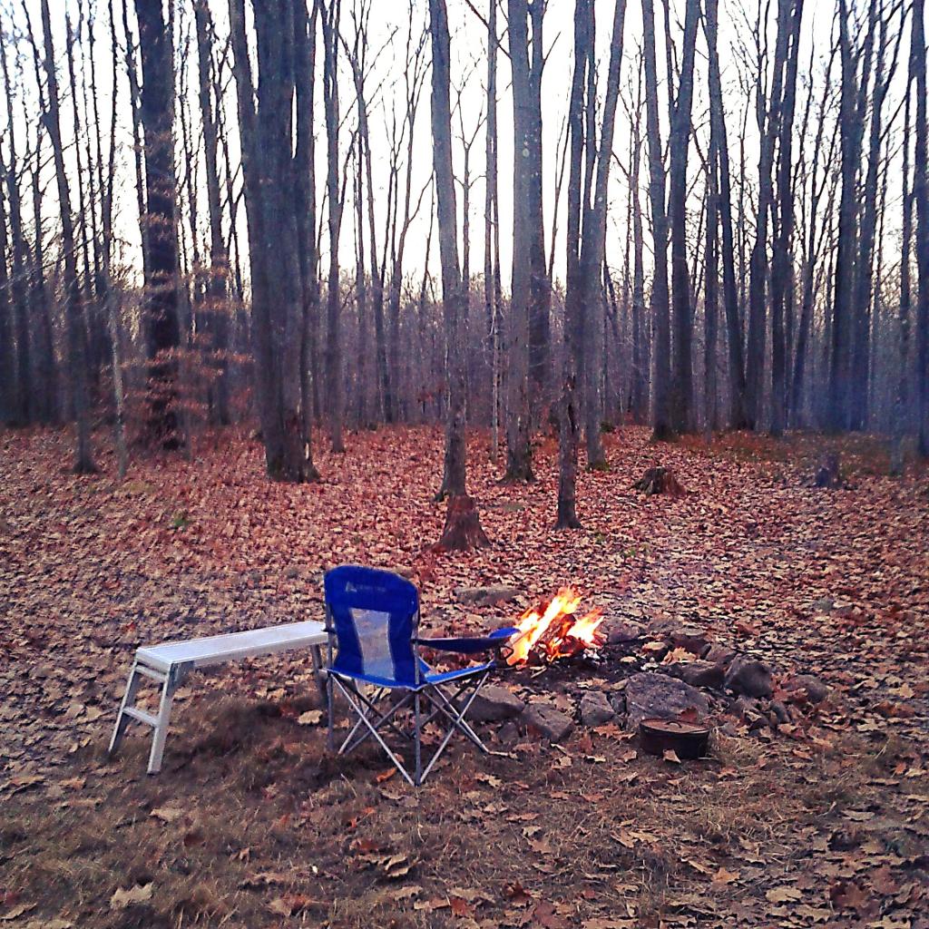
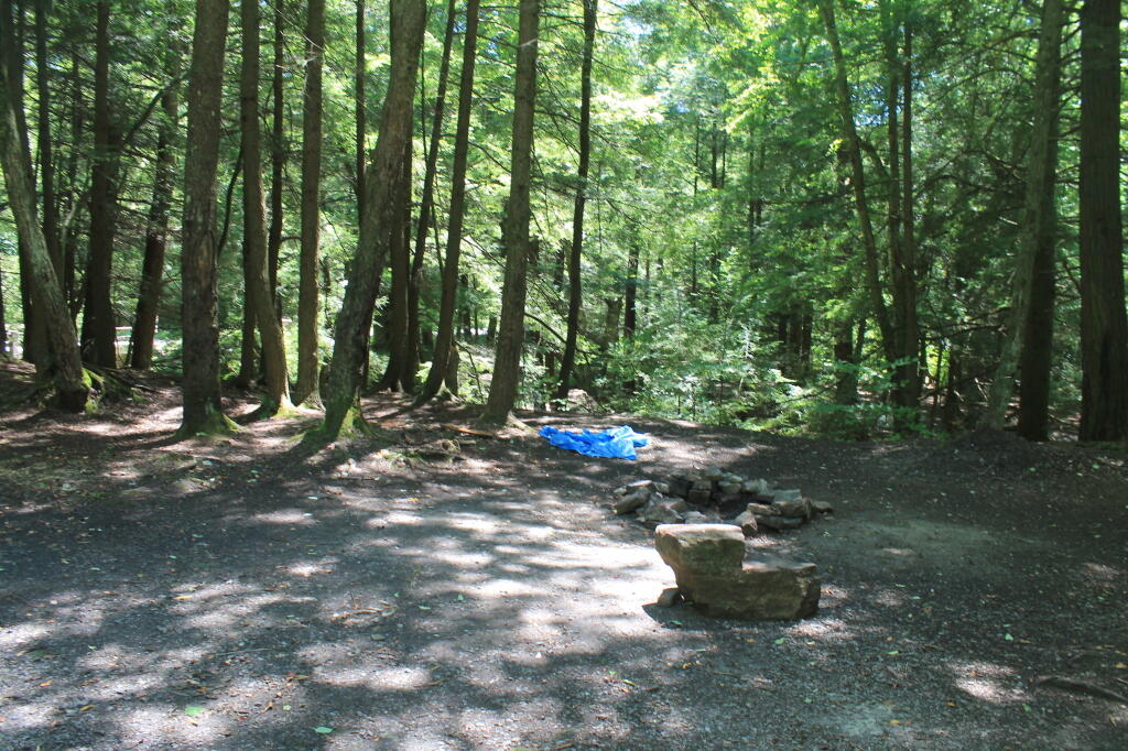
In the Allegheny National Forest there are a variety of back country roads, offering primitive roadside camping.

  • Campsites are free to use, and have no facilities except for a fire ring and a pull-off from the road, and sometimes a site reinforced with gravel.
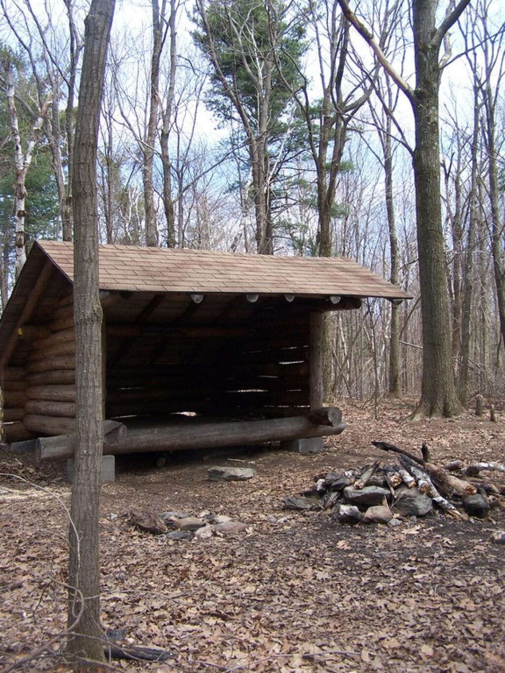
  • As noted below, some campsites have additional facilities.
  • Don’t make a mess of campsites, pack out any garbage left over.
  • Burn only dead and down trees, don’t bring in wood from out of state.
  • You can camp up to 14 days per 30 day period in Allegheny National Forest — no permits are required.

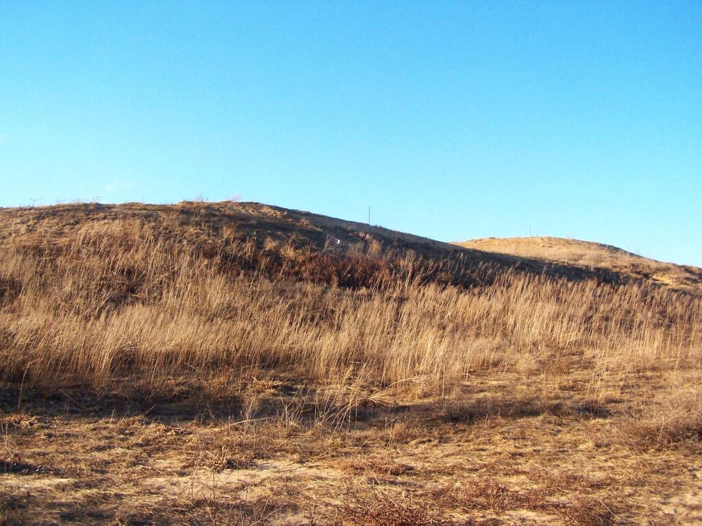
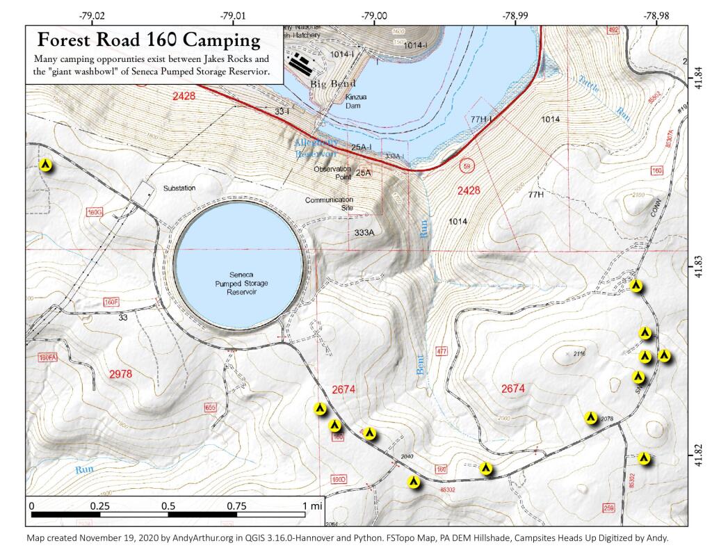
Forest Road 160/259 is the most popular dispersed camping area near Jakes Rocks and the Allegheny Reservior. Above are some campsites in this area. Many of these campsites have gravel parking areas and hardend campsites.

Forest Road 160 Camping

Before Dark

Sitting Next to the Campfire

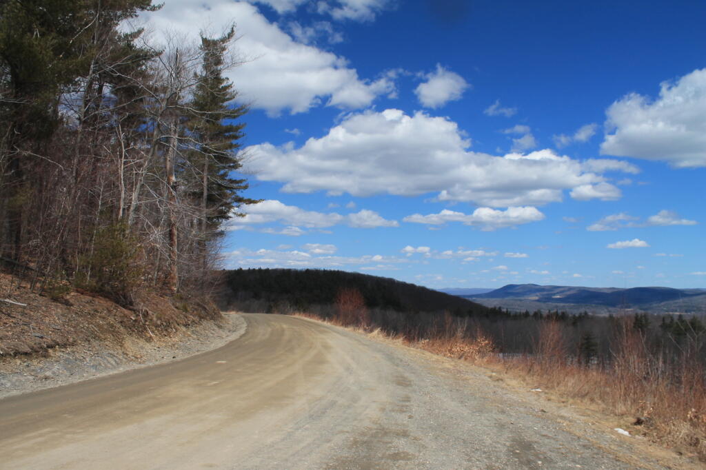
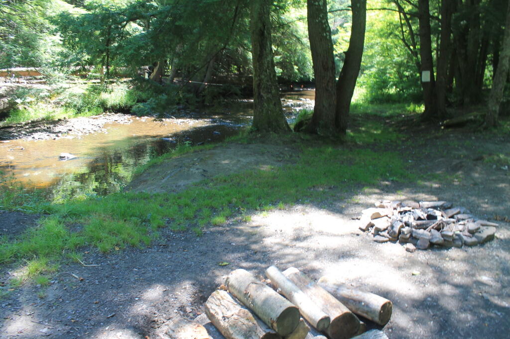
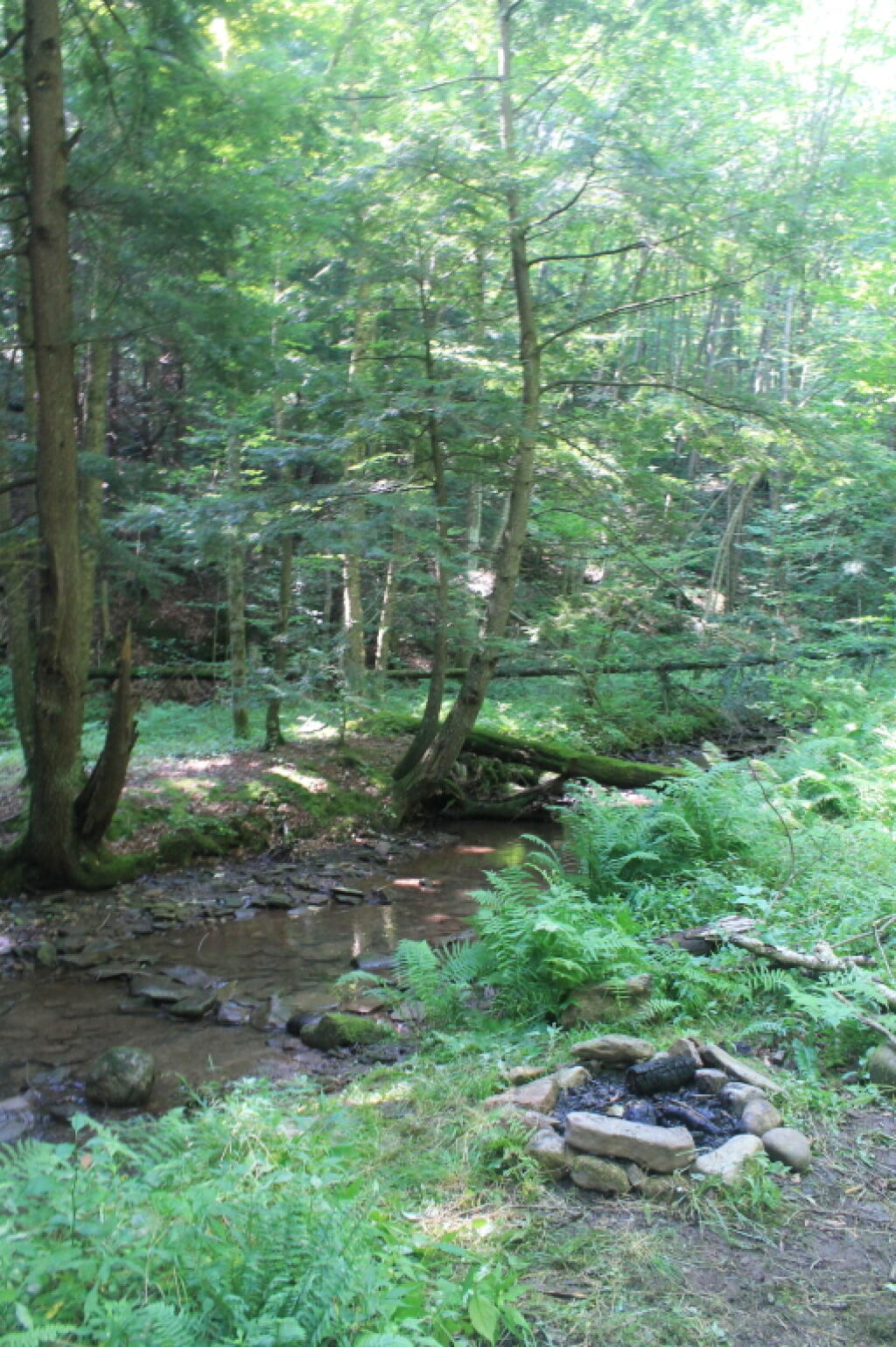
There are several campsites along Loleta Grade, south of Lamonaville (FR 131).  This is on the backside of Buzzard Swamp Wildlife Refuge, and is a much more wilderness experience. Many of these campsites have gravel parking areas and hardened campsites. Some of the campsites along the Gurgling Run can be buggy during the summer month, but get much less use then the Jakes Rocks area. Be aware that Forest Road 131 from Loleta Recreation Area to Forest Road 288 is permanently closed due to damage after Superstorm Sandy.

Camping with Lots of Light

Good morning from camp!

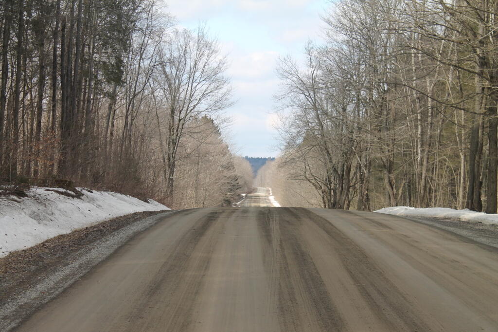
There is a handful of campsites along Fire Road FR 137 along the Dry Run and Whitney Creek near the Willow Creek ATV Area.

2020 State Population

Sitting Next to the Campfire

There are a handful of campsites along the East Tionesta Creek south of Kane/Shefield.

Another Campsite on Tionesta

Tionesta Creek Campsite

There are many other roads that have camping but these are some of my favorite locations.

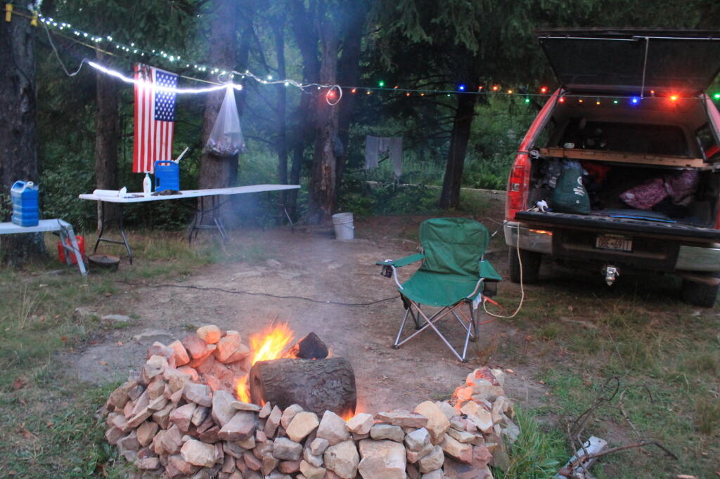
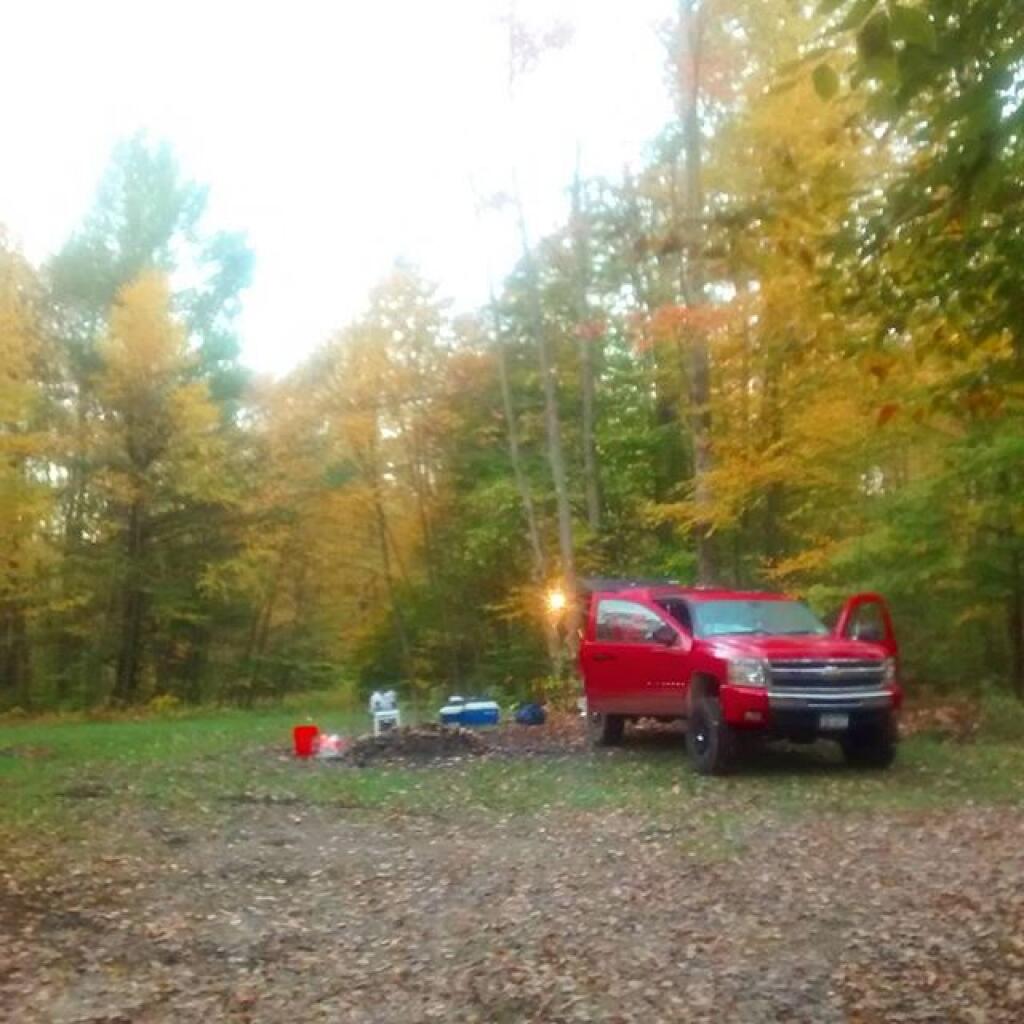
More About DCNR Motor Vehicle Camping …

On Pennsylvania State Forests there are a variety of back country roads, offering primitive roadside camping.

Camping Down at the Painter Run

Camping at Painter Run

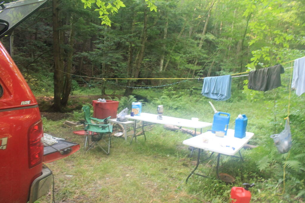
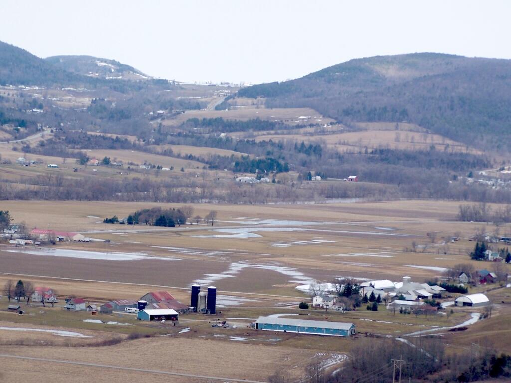
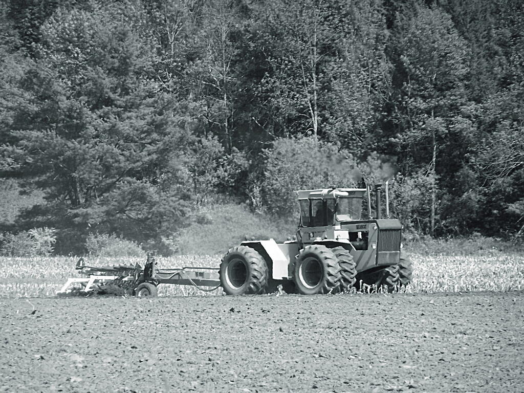
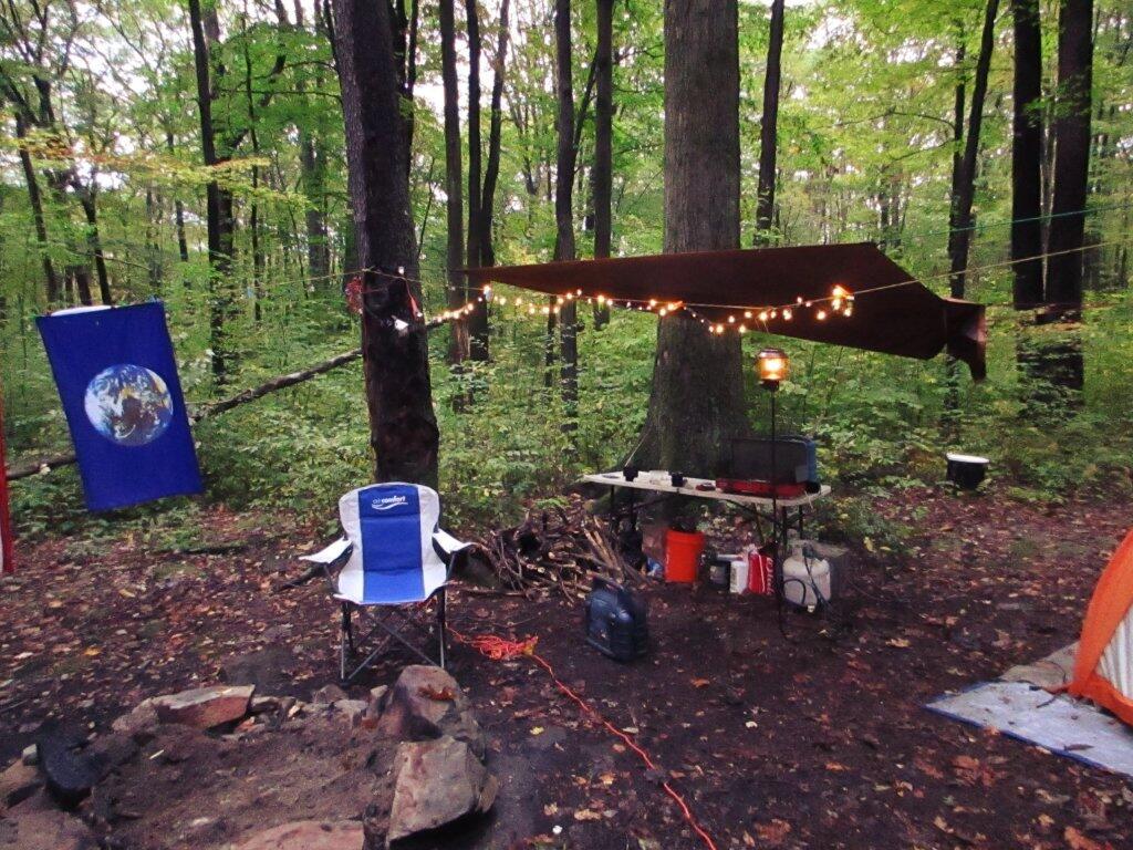
I have not done a lot of DCNR Motor Vehicle Camping, but above is a picture from 2012 when I spent half a week truck camping at Painter Run in the Tioga State Forest near the Pennsylvania Grand Canyon. There are many other opportunities as can be seen above, if you plan ahead and get your permit.

Also, see the DCNR Interactive Map if you are interested in fee campgrounds. They have several “rustic” campgrounds which are inexpensive at $10 night, and do not require reservation. These are traditional campgrounds with hand pump water, pit privies and no electricity but often are well maintained and quiet — although the campsites aren’t spread out like back country camping. Many of these campsites are lightly used off-season and are often a good place to spend a night when traveling. 

Allegheny National Forest Dispersed Campsites are free-to-use with a 14-day stay limit in any 30 day period. Many of these campsites are informal areas used for camping, others like along Forest Road 160 and 259 near Jake's Rocks and along Lolita Grade have enhanced gravel pads/parking areas. Unlike New York State, they do not have formal markings at the sites. More detailed map.

PA DCNR Motor Vehicle Campsites are free to stay at with a permit which can be obtained from the local DCNR Forestry office (click on the black dot) during ordinary business hours or by emailing/calling their office with your license plate and contact information.

March 20, 2021 – Next Sixteen Weeks

Here is a brief chart that shows the climate normals, sunset times, and length of day for next four months in Five Rivers Environmental Education Center…

WeekDateDawnSun-
rise
Sun-
set
DuskDayNoon Sun AngleAvg HighAvg LowRecord HiRecord Low
0Mar 206:29 am6:57 am7:07 pm7:36 pm12:1047.4°462778 (2012)2 (1967)
1Mar 276:17 am6:45 am7:16 pm7:44 pm12:3050.1°493078 (1998)11 (1975)
2Apr 36:04 am6:33 am7:24 pm7:52 pm12:5052.8°533379 (1981)16 (1954)
3Apr 105:52 am6:21 am7:31 pm8:00 pm13:1055.5°563586 (1922)21 (1974)
4Apr 175:40 am6:10 am7:39 pm8:09 pm13:2958°593891 (2002)21 (1971)
5Apr 245:29 am5:59 am7:47 pm8:18 pm13:4860.4°624081 (2001)25 (1965)
6May 15:18 am5:49 am7:55 pm8:26 pm14:0662.6°654386 (2001)28 (2008)
7May 85:08 am5:40 am8:03 pm8:35 pm14:2364.6°674591 (1936)26 (1968)
8May 155:00 am5:32 am8:11 pm8:43 pm14:3866.3°694793 (1900)31 (1977)
9May 224:53 am5:26 am8:18 pm8:51 pm14:5167.8°714997 (1911)33 (2002)
10May 294:47 am5:21 am8:24 pm8:58 pm15:0269.1°735193 (1931)34 (1956)
11Jun 54:44 am5:18 am8:29 pm9:04 pm15:1170°755397 (1925)39 (1990)
12Jun 124:42 am5:17 am8:33 pm9:08 pm15:1670.6°775695 (2017)38 (1972)
13Jun 194:42 am5:17 am8:36 pm9:11 pm15:1870.8°795894 (1995)38 (1950)
14Jun 264:44 am5:19 am8:37 pm9:12 pm15:1770.7°815999 (1952)39 (1979)
15Jul 34:48 am5:23 am8:36 pm9:11 pm15:1370.3°8261102 (1911)44 (1978)
16Jul 104:53 am5:27 am8:34 pm9:08 pm15:0669.6°8261100 (1936)47 (1963)

Sand Dunes

March 11, 2021 – Next Sixteen Weeks

Here is a brief chart that shows the climate normals, sunset times, and length of day for next four months in Delmar, NY…

Week Date Dawn Sun-
rise
Sun-
set
Dusk Day Noon Sun Angle Avg High Avg Low Record Hi Record Low
0 Mar 11 5:45 am 6:13 am 5:57 pm 6:25 pm 11:44 43.8Β° 42 24 70 (1977) -10 (1939)
1 Mar 18 6:33 am 7:01 am 7:05 pm 7:33 pm 12:04 46.6Β° 45 26 69 (2012) -8 (1900)
2 Mar 25 6:20 am 6:48 am 7:13 pm 7:41 pm 12:24 49.3Β° 48 29 74 (1910) 0 (1875)
3 Apr 1 6:08 am 6:36 am 7:21 pm 7:49 pm 12:44 52.1Β° 52 32 77 (1986) 9 (1923)
4 Apr 8 5:55 am 6:24 am 7:29 pm 7:58 pm 13:04 54.7Β° 55 35 88 (1929) 19 (2018)
5 Apr 15 5:43 am 6:13 am 7:37 pm 8:06 pm 13:24 57.3Β° 58 37 86 (2003) 21 (1940)
6 Apr 22 5:32 am 6:02 am 7:45 pm 8:15 pm 13:43 59.7Β° 61 40 86 (1985) 20 (1947)
7 Apr 29 5:21 am 5:51 am 7:53 pm 8:24 pm 14:01 62Β° 64 42 88 (1888) 27 (1947)
8 May 6 5:11 am 5:42 am 8:01 pm 8:32 pm 14:18 64Β° 67 44 89 (1930) 29 (1969)
9 May 13 5:02 am 5:34 am 8:08 pm 8:40 pm 14:34 65.9Β° 69 46 86 (2004) 30 (2005)
10 May 20 4:55 am 5:27 am 8:16 pm 8:48 pm 14:48 67.4Β° 71 48 91 (1962) 29 (2002)
11 May 27 4:49 am 5:22 am 8:22 pm 8:56 pm 14:59 68.7Β° 73 51 94 (1914) 30 (1969)
12 Jun 3 4:44 am 5:19 am 8:28 pm 9:02 pm 15:09 69.7Β° 75 53 97 (1925) 36 (1986)
13 Jun 10 4:42 am 5:17 am 8:32 pm 9:07 pm 15:15 70.4Β° 77 55 96 (2008) 36 (1975)
14 Jun 17 4:42 am 5:17 am 8:35 pm 9:10 pm 15:18 70.8Β° 79 57 94 (1994) 44 (1954)
15 Jun 24 4:43 am 5:18 am 8:37 pm 9:12 pm 15:18 70.8Β° 80 59 96 (1943) 44 (1932)
16 Jul 1 4:47 am 5:21 am 8:37 pm 9:11 pm 15:15 70.5Β° 81 60 99 (1913) 45 (1978)

Harvey Mountain Truck Trail

March 6, 2021 – Next Sixteen Weeks

Here is a brief chart that shows the climate normals, sunset times, and length of day for next four months in Delmar, NY…

Week Date Dawn Sun-
rise
Sun-
set
Dusk Day Noon Sun Angle Avg High Avg Low Record Hi Record Low
0 Mar 6 5:53 am 6:21 am 5:51 pm 6:19 pm 11:29 41.9Β° 40 22 63 (1974) -21 (1948)
1 Mar 13 5:41 am 6:09 am 5:59 pm 6:27 pm 11:49 44.6Β° 43 24 70 (2012) -6 (1885)
2 Mar 20 6:29 am 6:57 am 7:07 pm 7:35 pm 12:10 47.4Β° 46 27 78 (2012) 2 (1967)
3 Mar 27 6:17 am 6:45 am 7:15 pm 7:44 pm 12:30 50.1Β° 49 30 78 (1998) 11 (1975)
4 Apr 3 6:04 am 6:33 am 7:23 pm 7:52 pm 12:50 52.8Β° 53 33 79 (1981) 16 (1954)
5 Apr 10 5:52 am 6:21 am 7:31 pm 8:00 pm 13:10 55.5Β° 56 35 86 (1922) 21 (1974)
6 Apr 17 5:40 am 6:09 am 7:39 pm 8:09 pm 13:29 58Β° 59 38 91 (2002) 21 (1971)
7 Apr 24 5:29 am 5:59 am 7:47 pm 8:17 pm 13:48 60.4Β° 62 40 81 (2001) 25 (1965)
8 May 1 5:18 am 5:49 am 7:55 pm 8:26 pm 14:06 62.6Β° 65 43 86 (2001) 28 (2008)
9 May 8 5:08 am 5:40 am 8:03 pm 8:35 pm 14:23 64.6Β° 67 45 91 (1936) 26 (1968)
10 May 15 5:00 am 5:32 am 8:10 pm 8:43 pm 14:38 66.3Β° 69 47 93 (1900) 31 (1977)
11 May 22 4:53 am 5:26 am 8:17 pm 8:51 pm 14:51 67.8Β° 71 49 97 (1911) 33 (2002)
12 May 29 4:47 am 5:21 am 8:24 pm 8:58 pm 15:02 69.1Β° 73 51 93 (1931) 34 (1956)
13 Jun 5 4:44 am 5:18 am 8:29 pm 9:03 pm 15:11 70Β° 75 53 97 (1925) 39 (1990)
14 Jun 12 4:42 am 5:17 am 8:33 pm 9:08 pm 15:16 70.6Β° 77 56 95 (2017) 38 (1972)
15 Jun 19 4:42 am 5:17 am 8:36 pm 9:11 pm 15:18 70.8Β° 79 58 94 (1995) 38 (1950)
16 Jun 26 4:44 am 5:19 am 8:37 pm 9:12 pm 15:17 70.7Β° 81 59 99 (1952) 39 (1979)

Middleburgh Round Top and Ecker Hollow

Dirt Road

Plowing

Apple Blossoms

January 7, 2021 – Next Sixteen Weeks

Here is a brief chart that shows the climate normals, sunset times, and length of day for next four months in Delmar, NY…

Week Date Dawn Sun-
rise
Sun-
set
Dusk Day Noon Sun Angle Avg High Avg Low Record Hi Record Low
0 Jan 7 6:53 am 7:25 am 4:38 pm 5:10 pm 9:13 25.1Β° 31 15 56 (1915) -12 (1878)
1 Jan 14 6:51 am 7:22 am 4:46 pm 5:17 pm 9:23 26.1Β° 30 14 66 (1932) -24 (1957)
2 Jan 21 6:48 am 7:18 am 4:54 pm 5:25 pm 9:36 27.6Β° 30 14 61 (2006) -18 (1994)
3 Jan 28 6:42 am 7:12 am 5:03 pm 5:33 pm 9:51 29.3Β° 31 15 56 (1916) -16 (2005)
4 Feb 4 6:36 am 7:05 am 5:13 pm 5:42 pm 10:07 31.3Β° 32 15 61 (1991) -13 (1978)
5 Feb 11 6:27 am 6:56 am 5:22 pm 5:51 pm 10:25 33.5Β° 34 17 59 (1981) -18 (1962)
6 Feb 18 6:18 am 6:47 am 5:31 pm 6:00 pm 10:44 35.9Β° 35 18 63 (1981) -21 (1973)
7 Feb 25 6:08 am 6:36 am 5:40 pm 6:08 pm 11:03 38.4Β° 37 20 70 (2017) -14 (1914)
8 Mar 4 5:57 am 6:25 am 5:48 pm 6:16 pm 11:23 41.1Β° 40 22 59 (1919) -20 (1950)
9 Mar 11 5:45 am 6:13 am 5:57 pm 6:25 pm 11:44 43.8Β° 42 24 70 (1977) -10 (1939)
10 Mar 18 6:33 am 7:01 am 7:05 pm 7:33 pm 12:04 46.6Β° 45 26 69 (2012) -8 (1900)
11 Mar 25 6:20 am 6:48 am 7:13 pm 7:41 pm 12:24 49.3Β° 48 29 74 (1910) 0 (1875)
12 Apr 1 6:08 am 6:36 am 7:21 pm 7:49 pm 12:44 52.1Β° 52 32 77 (1986) 9 (1923)
13 Apr 8 5:55 am 6:24 am 7:29 pm 7:58 pm 13:04 54.7Β° 55 35 88 (1929) 19 (2018)
14 Apr 15 5:43 am 6:13 am 7:37 pm 8:06 pm 13:24 57.3Β° 58 37 86 (2003) 21 (1940)
15 Apr 22 5:32 am 6:02 am 7:45 pm 8:15 pm 13:43 59.7Β° 61 40 86 (1985) 20 (1947)
16 Apr 29 5:21 am 5:51 am 7:53 pm 8:24 pm 14:01 62Β° 64 42 88 (1888) 27 (1947)

Alfred H Smith Bridge and Thruway Bridge

 Thawed Lake

Middleburgh Round Top and Ecker Hollow

December 21, 2020 – Next Sixteen Weeks

Here is a brief chart that shows the climate normals, sunset times, and length of day for next four months in Delmar, NY…

Week Date Dawn Sun-
rise
Sun-
set
Dusk Day Noon Sun Angle Avg High Avg Low Record Hi Record Low
0 Dec 21 6:50 am 7:22 am 4:25 pm 4:57 pm 9:02 23.9° 34 19 62 (2018) -18 (1942)
1 Dec 28 6:52 am 7:24 am 4:29 pm 5:01 pm 9:04 24.1° 32 17 61 (1982) -14 (1951)
2 Jan 4 6:53 am 7:25 am 4:35 pm 5:07 pm 9:10 24.7° 31 15 64 (1950) -15 (1904)
3 Jan 11 6:52 am 7:24 am 4:43 pm 5:14 pm 9:19 25.6° 30 14 57 (1975) -25 (1968)
4 Jan 18 6:49 am 7:20 am 4:51 pm 5:22 pm 9:30 26.9° 30 14 59 (1973) -19 (1957)
5 Jan 25 6:45 am 7:15 am 5:00 pm 5:30 pm 9:44 28.5° 31 14 61 (1938) -12 (1963)
6 Feb 1 6:39 am 7:08 am 5:09 pm 5:38 pm 10:00 30.4° 32 15 65 (1989) -20 (1920)
7 Feb 8 6:31 am 7:00 am 5:18 pm 5:47 pm 10:17 32.5° 33 16 52 (1925) -16 (1950)
8 Feb 15 6:22 am 6:51 am 5:27 pm 5:56 pm 10:36 34.8° 35 17 55 (2006) -22 (1943)
9 Feb 22 6:12 am 6:41 am 5:36 pm 6:04 pm 10:55 37.3° 36 19 68 (1997) -08 (1963)
10 Mar 1 6:01 am 6:30 am 5:45 pm 6:13 pm 11:15 39.9° 39 21 66 (2017) -09 (1948)
11 Mar 8 5:50 am 6:18 am 5:53 pm 6:21 pm 11:35 42.6° 41 23 68 (2012) -02 (1989)
12 Mar 15 6:38 am 7:06 am 7:01 pm 7:29 pm 11:55 45.4° 44 25 72 (2019) 1 (1993)
13 Mar 22 6:26 am 6:54 am 7:10 pm 7:38 pm 12:15 48.2° 47 28 81 (2012) 2 (1875)
14 Mar 29 6:13 am 6:41 am 7:18 pm 7:46 pm 12:36 50.9° 50 31 85 (1946) 0 (1923)
15 Apr 5 6:01 am 6:29 am 7:26 pm 7:54 pm 12:56 53.6° 54 33 82 (1928) 14 (2016)
16 Apr 12 5:48 am 6:18 am 7:34 pm 8:03 pm 13:16 56.2° 57 36 84 (1977) 13 (1874)

 A Winter Walk

Lean-tos with Outhouses

A list of lean-tos on state lands with an outhouse within 150 feet.

Forest Lean-To Name Description Region Latitude Longtitude
Big Indian Wilderness Shandaken Brook Lean-To 3 42.0502743293466 -74.5106001666636
Big Indian Wilderness Biscuit Brook Lean-To 3 42.0091051509829 -74.4838519036791
Delaware Wild Forest Mud Pond Trail Lean-To 4 42.0116839995216 -74.9476810002715
Hunter-West Kill Wilderness Diamond Notch Lean-To 4 42.1694869998955 -74.2569359998362
Blue Mountain Wild Forest Tirrel Pond North Lean-To 5 43.8873444775573 -74.3788006260605
Blue Mountain Wild Forest O’Neill Flow Lean-To 5 43.8755968409362 -74.3664262369705
Blue Ridge Wilderness Wilson Pond Lean-To 5 43.8201917816146 -74.4686803224003
Blue Ridge Wilderness Cascade Pond Lean-To 5 43.8299374729896 -74.4366163022193
Blue Ridge Wilderness Stephens Pond Lean-To 5 43.818673668555 -74.4205248717271
Giant Mountain Wilderness Giant Mtn. Lean-To 5 44.1759172264724 -73.7215350426426
Hammond Pond Wild Forest Moose Mt Pond Lean-To 5 43.9655912049299 -73.6440374623141
High Peaks Wilderness Catlin Bay #2 Lean-To 5 43.9972143811434 -74.3959393656481
High Peaks Wilderness Catlin Bay #1 Lean-To 5 43.9980126926989 -74.3927845610842
High Peaks Wilderness Hidden Cove Lean-To 5 44.0026552881939 -74.3864802632516
High Peaks Wilderness Rodney Point #1 Lean-To 5 44.0414093848994 -74.3501490963956
High Peaks Wilderness Rodney Point #2 Lean-To 5 44.0429767454126 -74.3493346475314
High Peaks Wilderness Plumley Point #2 Lean-To 5 44.0655989161076 -74.32761224546
High Peaks Wilderness Cold River #3 Lean-To 5 44.0914592780512 -74.257641750845
High Peaks Wilderness Cold River #4 Lean-To 5 44.0913902533326 -74.2557348025251
High Peaks Wilderness Moose Pond Stream Lean-To #2 5 44.079553878647 -74.2391509433142
High Peaks Wilderness Moose Pond Stream Lean-To 5 44.079589788976 -74.2389368366902
High Peaks Wilderness Seward Lean-To 5 44.1062441376862 -74.2091536427719
High Peaks Wilderness Ouluska Pass Brook Lean-To 5 44.1202212816036 -74.1874471739093
High Peaks Wilderness Newcomb Lake Lean-To #1 5 44.0158171441475 -74.1523218842845
High Peaks Wilderness Newcomb Lake Lean-To #2 5 44.0205306743106 -74.1522782706761
High Peaks Wilderness Cold River #2 Lean-To 5 44.1425166431718 -74.1303582429155
High Peaks Wilderness Cold River Lean-To #1 Lean-To 5 44.1427273762849 -74.1298402106559
High Peaks Wilderness Duck Hole #1 Lean-To 5 44.1416268740099 -74.1069373467662
High Peaks Wilderness Duck Hole #2 Lean-To 5 44.1416768646683 -74.1065435467226
High Peaks Wilderness Moose Pond Lean-To 5 44.1828433824027 -74.07364102376
High Peaks Wilderness Henderson Lake Lean-To 5 44.104178442066 -74.066913293691
High Peaks Wilderness Beaver Point #1 5 44.1210154790382 -73.9821264349125
High Peaks Wilderness Beaver Point #2 5 44.1207874446534 -73.9817139903994
High Peaks Wilderness Kagel Lean-To 5 44.1494011459341 -73.9557902346565
High Peaks Wilderness Marcy Brook Lean-To 5 44.1469386474738 -73.9552287452665
High Peaks Wilderness Panther Gorge Lean-To 5 44.099635151426 -73.9133647612345
High Peaks Wilderness Lilian Brook Lean-To 5 44.0601596208968 -73.807816780134
High Peaks Wilderness Slide Brook Lean-To 5 44.0441261980002 -73.8058583966018
High Peaks Wilderness Bouquet Lean-To 5 44.1082054720282 -73.7738312580535
Hurricane Mountain Primitive Area Gulf Brook Lean-To 5 44.253019593455 -73.7180348153422
Hurricane Mountain Primitive Area Lost Pond/Biesemeyer Lean-To 5 44.2607301476158 -73.7100106668894
Lake George Wild Forest Black Mountain Ponds Lean-To Lean-To With Privy And Fire Ring 5 43.5996600138705 -73.5330643345846
Lake George Wild Forest Lapland Pond Lean-To Campsite With Lean-To 13-27 5 43.5958213340907 -73.5179510245416
Mckenzie Mountain Wilderness Placid Lean-To 5 44.3214560456649 -74.030786043903
Sentinel Range Wilderness Copperas Pond Lean-To 5 44.3317122951397 -73.8997103538312
Shaker Mountain Wild Forest Holmes Lake Lean-To 5 43.1885867657416 -74.4310218122738
Siamese Ponds Wilderness John Pond Lean-To 5 43.7278247361895 -74.2012685562129
Siamese Ponds Wilderness E. Sacandaga River Lean-To 5 43.6154338756917 -74.1499734599501
Silver Lake Wilderness Mud Lake Lean-To 5 43.342671073158 -74.4562907856386
Silver Lake Wilderness Hamilton Lake Stream #1 Lean-To 5 43.3974135951753 -74.4552975900222
Taylor Pond Wild Forest Poke-O-Moonshine Summit Lean-To 5 44.3997973548695 -73.5145569962096
Vanderwhacker Mountain Wild Forest Stony Pond Lean-To 5 43.8387348152587 -73.9856219153826
West Canada Lake Wilderness West Lake #1 Lean-To 5 43.5931622288498 -74.6268866843131
West Canada Lake Wilderness West Lake #2 Lean-To 5 43.5970642572198 -74.6231056495758
West Canada Lake Wilderness South Lake Lean-To 5 43.58724480971 -74.6215788383727
West Canada Lake Wilderness West Canada Creek Lean-To 5 43.5869876140516 -74.6139979710011
West Canada Lake Wilderness Spruce Lake #1 Lean-To 5 43.5272841125778 -74.6099246975027
West Canada Lake Wilderness Spruce Lake #3 Lean-To 5 43.5371297279245 -74.6082096280248
West Canada Lake Wilderness Spruce Lake #2 Lean-To 5 43.5346306298339 -74.608085803069
West Canada Lake Wilderness T Lake Lean-To 5 43.4527175891905 -74.5822815394449
West Canada Lake Wilderness Beaver Pond (AKA Cedar Lakes Lean-To #2) 5 43.6259693968044 -74.5492715037002
West Canada Lake Wilderness Cedar Lakes #1 Lean-To 5 43.6281256650379 -74.5404732399266
West Canada Lake Wilderness Pillsbury Lake Lean-To 5 43.5968984708902 -74.5316653645311
West Canada Lake Wilderness Carry Lean-To 5 43.6787448834709 -74.4954982187945
West Canada Lake Wilderness Colvin Brook Lean-To 5 43.6524139144065 -74.4903803529398
Black River Wild Forest Bear Lake Lean-To 6 43.6000735406502 -75.0530032053211
Black River Wild Forest Sand Lake Falls Lean-To 6 43.5589723655294 -75.0029762567594
Five Ponds Wilderness Griffin Rapids Lean-To Aka Oswegatchie River Campsite 38. With Full Sized Privy. Checked 05/2016. 6 44.0841653919081 -74.9687479733594
Five Ponds Wilderness High Falls No. 2 Lean-To Aka Oswegatchie River Campsite 13. With Full Sized Privy. 6 44.0689134869774 -74.9113129664397
Five Ponds Wilderness High Falls No. 1 Lean-To Aka Oswegatchie River Campsite 15. With Full Sized Privy. 6 44.0689098251132 -74.9093969117936
Pigeon Lake Wilderness Gull Lake Lean-To 6 43.8574321808094 -74.8250005772908
Wolf Lake State Forest Wolf Lake Lean-To 6 44.3363136708752 -75.3138633269515
Sugar Hill State Forest Parks Hollow Lean-To Log 8 42.3690917205455 -77.0130036276398
Sugar Hill State Forest The Twin Lean-To’s 2 Lean-To At This Location 8 42.3822533325968 -77.0026799994935
Sugar Hill State Forest Vanzandt Lean-To 8 42.3898077706314 -76.972589837336

Chance of Thunder Lean To

Last week I got an email requesting a list of lean-tos on state land that have full accomindations - that is an outhouse or pit privy. So I made up that list, and figured I'd share it as some might find it useful.