Search Results for: photo open to the public for now

Peaks Over 3,000 Feet Elevation in New York State

There are 229 summits in New York State greater then 3,000 feet elevation.

Tallest Peak Summit Name Elevation County USGS Topo Map Name State Land Trail Location
1 Mount Marcy 5,344 Essex Mount Marcy High Peaks Wilderness NA 44.112733,
-73.9237833
2 Algonquin Peak 5,105 Essex North Elba High Peaks Wilderness Algonquin Trail 44.1436636,
-73.9865357
3 Mount Haystack 4,924 Essex Mount Marcy High Peaks Wilderness Haystack Trail Via Barklet Ridge 44.1056093,
-73.9004196
4 Mount Skylight 4,908 Essex Mount Marcy High Peaks Wilderness Skylight Trail 44.0994987,
-73.9306986
5 Basin Mountain 4,852 Essex Mount Marcy High Peaks Wilderness State Range Trail 44.1211639,
-73.8862527
6 Iroquois Peak 4,829 Essex North Elba High Peaks Wilderness Iroquois Herd Path Via Boundary Peak 44.1369973,
-73.9982027
7 Boundary Peak 4,826 Essex North Elba High Peaks Wilderness Iroquois Herd Path Via Boundary Peak 44.1397749,
-73.9937582
8 Whiteface Mountain 4,816 Essex Lake Placid Whiteface Mountain Ski Center Whiteface Landing To Whiteface Mtn. Trail 44.3658804,
-73.9026456
9 Dix Mountain 4,813 Essex Dix Mountain High Peaks Wilderness Elk Lake To Dix Mountain Trail 44.0822756,
-73.7862471
10 Gray Peak 4,800 Essex Mount Marcy High Peaks Wilderness Mount Marcy Trail Via Opalescent River 44.1114427,
-73.9348658
11 Schofield Cobble 4,744 Essex Mount Marcy High Peaks Wilderness NA 44.1089427,
-73.9270876
12 Little Marcy 4,728 Essex Mount Marcy High Peaks Wilderness Van Hoevenberg Trail To Marcy 44.1197753,
-73.910976
13 Gothics 4,724 Essex Keene Valley High Peaks Wilderness Beaver Meadow Falls Trail 44.1281079,
-73.8570849
14 Mount Colden 4,708 Essex North Elba High Peaks Wilderness Mount Colden Via Lake Arnold 44.1269976,
-73.9598674
15 Beck-horn 4,695 Essex Dix Mountain High Peaks Wilderness Elk Lake To Dix Mountain Trail 44.0800534,
-73.7845802
16 Little Haystack 4,678 Essex Mount Marcy High Peaks Wilderness Haystack Trail Via Slant Rock 44.1103313,
-73.9004197
17 Giant Mountain 4,623 Essex Rocky Peak Ridge Giant Mountain Wilderness North Trail To Giant Mtn. 44.161165,
-73.720279
18 Mount Redfield 4,603 Essex Mount Marcy High Peaks Wilderness Mt Redfield Trail 44.094777,
-73.949866
19 Santanoni Peak 4,596 Essex Santanoni Peak High Peaks Wilderness Bradley Pond Trail 44.0822811,
-74.1309855
20 Wright Peak 4,564 Essex North Elba High Peaks Wilderness Wright Peak Spur Trail 44.1517187,
-73.9801468
21 Nippletop 4,554 Essex Dix Mountain High Peaks Wilderness Nipple Top Trail 44.0892202,
-73.8159708
22 Saddleback Mountain 4,534 Essex North Elba High Peaks Wilderness State Range Trail 44.1264414,
-73.8748634
23 Panther Peak 4,455 Essex Santanoni Peak High Peaks Wilderness Bradley Pond Trail 44.0983915,
-74.132097
24 Rocky Peak 4,403 Essex Rocky Peak Ridge Giant Mountain Wilderness East Trail To Giant Mtn. Via Rocky Peak Ridge 44.1542177,
-73.7051718
25 Macomb Mountain 4,396 Essex Dix Mountain High Peaks Wilderness Macomb-E. Dix Trail 44.0517211,
-73.7801349
26 Hough Peak 4,393 Essex Dix Mountain High Peaks Wilderness S. Dix-Hough Trail 44.0694981,
-73.7776352
27 Mount Marshall 4,380 Essex Street Mountain High Peaks Wilderness Mt Marshall Trail 44.1275538,
-74.0118142
28 Armstrong Mountain 4,360 Essex Keene Valley High Peaks Wilderness Adk Range Trail 44.1347741,
-73.8490291
29 Seward Mountain 4,327 Franklin Ampersand Lake High Peaks Wilderness Seymour Mountain Herd Path 44.1597799,
-74.1993239
30 Allen Mountain 4,321 Essex Mount Marcy High Peaks Wilderness Mt Redfield Trail 44.0708892,
-73.9395871
31 Table Top Mountain 4,295 Essex North Elba High Peaks Wilderness Table Top Mountain Trail 44.143663,
-73.9070876
32 Big Slide Mountain 4,232 Essex Keene Valley High Peaks Wilderness Big Slide Trail 44.1822721,
-73.8704202
33 Esther Mountain 4,232 Essex Franklin Falls Wilmington Wild Forest Esther Mt Trail 44.3869916,
-73.8898673
34 MacIntyre Mountains 4,193 Essex Street Mountain High Peaks Wilderness Mt Marshall Trail 44.1308868,
-74.008203
35 Lower Wolfjaw Mountain 4,190 Essex Keene Valley High Peaks Wilderness W.a. White Trail 44.1483845,
-73.8326399
36 Upper Wolfjaw Mountain 4,190 Essex Keene Valley High Peaks Wilderness Adk Range Trail 44.1406072,
-73.8451402
37 Slide Mountain 4,167 Ulster Peekamoose Mountain Slide Mountain Wilderness Burroughs Range Trail-Wittenberg-Cornell 41.9987034,
-74.3862617
38 Phelps Mountain 4,137 Essex North Elba High Peaks Wilderness Phelps Mtn. Trail 44.1569957,
-73.9209775
39 Cascade Mountain 4,094 Essex Keene Valley High Peaks Wilderness Casade Mountain Trail 44.2186594,
-73.860143
40 South Dix 4,088 Essex Dix Mountain High Peaks Wilderness Macomb-E. Dix Trail 44.060054,
-73.7743014
41 Lookout Mountain 4,078 Essex Franklin Falls Whiteface Mountain Ski Center Esther Mt Trail 44.3778249,
-73.887645
42 Donaldson Mountain 4,062 Franklin Ampersand Lake High Peaks Wilderness Seymour Mountain Herd Path 44.1539471,
-74.210991
43 Seymour Mountain 4,055 Franklin Ampersand Lake High Peaks Wilderness Seymour Mountain Herd Path 44.1578347,
-74.1721003
44 Colvin Range 4,049 Essex Dix Mountain High Peaks Wilderness Colvin Trail 44.0939424,
-73.8345829
45 Mount Colvin 4,049 Essex Dix Mountain High Peaks Wilderness Colvin Trail 44.0939424,
-73.8345829
46 Hunter Mountain 4,045 Greene Hunter Hunter-West Kill Wilderness Spruceton Trail 42.1778662,
-74.2304216
47 Mount Emmons 4,022 Franklin Ampersand Lake High Peaks Wilderness Northville-Placid Trail 44.1436698,
-74.2140464
48 Street Mountain 4,022 Essex Street Mountain High Peaks Wilderness Street Mountain Trail 44.1797741,
-74.0437616
49 Grace Peak 4,006 Essex Dix Mountain High Peaks Wilderness Macomb-E. Dix Trail 44.0653314,
-73.7573564
50 Yard Mountain 3,999 Essex North Elba High Peaks Wilderness Big Slide Trail Via Yard Mtn. 44.1747725,
-73.8845874
51 MacNaughton Mountain 3,983 Essex Street Mountain High Peaks Wilderness Wall Face Ponds Trail 44.1397768,
-74.064317
52 Dial Mountain 3,980 Essex Dix Mountain High Peaks Wilderness Leach Trail 44.1058859,
-73.7959703
53 Blake Peak 3,976 Essex Dix Mountain High Peaks Wilderness Pinnacle Trail 44.081443,
-73.844583
54 Green Mountain 3,976 Essex Rocky Peak Ridge Giant Mountain Wilderness North Trail To Giant Mtn. 44.182272,
-73.714858
55 Black Dome 3,973 Greene Freehold Windham-Blackhead Range Wilderness Blackhead Range Trail 42.2700864,
-74.1226382
56 Thomas Cole Mountain 3,944 Greene Hensonville Windham-Blackhead Range Wilderness Blackhead Range Trail 42.2709196,
-74.1365275
57 Cliff Mountain 3,940 Essex Mount Marcy High Peaks Wilderness Mount Marcy Trail Via Opalescent River 44.1031102,
-73.9751452
58 McDonnel Mountain 3,940 Essex Mount Marcy High Peaks Wilderness Mt Redfield Trail 44.0803332,
-73.9340315
59 Blackhead 3,930 Greene Freehold Windham-Blackhead Range Wilderness Blackhead Mountain Spur Trail 42.2678644,
-74.1045818
60 West Kill Mountain 3,891 Greene Lexington Hunter-West Kill Wilderness Devil’s Path 42.1678663,
-74.2895904
61 Doubletop Mountain 3,875 Ulster Seager NA Seager Big Indian Trail 42.0275913,
-74.5282095
62 Nye Mountain 3,871 Essex Street Mountain High Peaks Wilderness Nye Mountain Trail 44.1931062,
-74.0240387
63 Kilburn Mountain 3,868 Essex Lake Placid Sentinel Range Wilderness Copperas Owen Pond Trl 44.3028247,
-73.8818114
64 Moose Mountain 3,868 Essex McKenzie Mountain Mckenzie Mountain Wilderness Mckenzie Mtn. Trail 44.3506029,
-74.0032049
65 Howard Mountain 3,852 Essex North Elba High Peaks Wilderness Klondike Notch Trail 44.1583844,
-73.8912539
66 Cornell Mountain 3,848 Ulster Phoenicia Slide Mountain Wilderness Burroughs Range Trail-Wittenberg-Cornell 42.0014812,
-74.3568163
67 Graham Mountain 3,848 Ulster Seager NA Seager Big Indian Trail 42.0392576,
-74.5495986
68 Plateau Mountain 3,845 Greene Hunter Indian Head Wilderness Devil’s Path 42.1378671,
-74.1743088
69 McKenzie Mountain 3,842 Essex McKenzie Mountain Mckenzie Mountain Wilderness Mckenzie Mtn. Trail 44.3361593,
-74.0320951
70 Rist Mountain 3,839 Essex Mount Marcy High Peaks Wilderness Boreas Road 44.027559,
-73.987366
71 Sentinel Mountain 3,835 Essex Keene Sentinel Range Wilderness Winch Pond 44.3061581,
-73.8523658
72 Lyon Mountain 3,829 Clinton Moffitsville Chazy Highlands Wild Forest New Lyon Mountain Trail 44.7036537,
-73.8645877
73 T R Mountain 3,829 Essex North Elba High Peaks Wilderness Lake Arnold Crossover 44.143941,
-73.9354222
74 Snowy Mountain 3,825 Hamilton Snowy Mountain NA Snowy Mt 43.7003432,
-74.3859856
75 Table Mountain 3,819 Ulster Peekamoose Mountain Slide Mountain Wilderness Peekamoose-Table Trail 41.9587036,
-74.4048739
76 Peekamoose Mountain 3,812 Ulster Peekamoose Mountain Slide Mountain Wilderness Peekamoose-Table Trail 41.9531481,
-74.398207
77 Avalanche Mountain 3,809 Essex North Elba High Peaks Wilderness Avalanche Pass Trail 44.1361639,
-73.9695903
78 Averill Peak 3,806 Clinton Lyon Mountain Chazy Highlands Wild Forest New Lyon Mountain Trail 44.6928208,
-73.8809768
79 Sugarloaf Mountain 3,806 Greene Hunter Indian Head Wilderness Devil’s Path 42.1312006,
-74.1501414
80 Couchsachraga Peak 3,793 Essex Santanoni Peak High Peaks Wilderness Cold River Horse Trail 44.0956146,
-74.1601539
81 Boreas Mountain 3,779 Essex Mount Marcy NA Gulf Brook Road 44.0031138,
-73.8806937
82 Wittenberg Mountain 3,766 Ulster Phoenicia Slide Mountain Wilderness Burroughs Range Trail-Wittenberg-Cornell 42.0081478,
-74.3473716
83 Panther Mountain 3,763 Hamilton Snowy Mountain NA Snowy Mt 43.7367317,
-74.3907093
84 Burroughs Range 3,760 Ulster Phoenicia Slide Mountain Wilderness Burroughs Range Trail-Wittenberg-Cornell 42.0084255,
-74.3476494
85 Blue Mountain 3,750 Hamilton Blue Mountain Lake Blue Mountain Wild Forest Blue Mountain Trail 43.8725634,
-74.4009917
86 Porter Mountain 3,750 Essex Keene Valley High Peaks Wilderness Porter Mountain Trail Via Marcy Field 44.2153262,
-73.8434754
87 Wakely Mountain 3,750 Hamilton Wakely Mountain Wakely Mountain Primitive Area Wakely Mountain Trail 43.7358986,
-74.5151595
88 Little Nippletop 3,720 Essex Mount Marcy High Peaks Wilderness Elk Lake To Marcy Trail 44.0853327,
-73.9201422
89 Wallface Mountain 3,720 Essex Street Mountain High Peaks Wilderness Indian Pass Trail 44.1378317,
-74.0365378
90 Panther Mountain 3,714 Ulster Shandaken Slide Mountain Wilderness Giant Ledge-Panther Mountian-Fox Hollow Trail 42.0564799,
-74.3945946
91 Balsam Lake Mountain 3,707 Ulster Seager Balsam Lake Mountain Wild Forest Balsam Lake Mountain Trail 42.0459236,
-74.5940438
92 Henderson Mountain 3,707 Essex Mount Adams High Peaks Wilderness Bradley Pond Trail 44.0978353,
-74.0976509
93 Hoffman Mountain 3,701 Essex Blue Ridge Hoffman Notch Wilderness Hoffman Notch Trail 43.9114489,
-73.8168
94 Lone Mountain 3,697 Ulster Peekamoose Mountain Slide Mountain Wilderness Peekamoose-Table Trail 41.9692592,
-74.3893177
95 Big Indian Mountain 3,694 Ulster Shandaken Big Indian Wilderness Pine Hill West Branch Trail 42.0350915,
-74.4965421
96 Hurricane Mountain 3,688 Essex Rocky Peak Ridge Hurricane Mountain Wilderness East Hurricane Mtn Trial 44.235326,
-73.7106926
97 Friday Mountain 3,681 Ulster West Shokan Slide Mountain Wilderness Burroughs Range Trail-Wittenberg-Cornell 41.9875924,
-74.3620944
98 Rusk Mountain 3,678 Greene Lexington Rusk Mountain Wild Forest Spruceton Trail 42.2006434,
-74.2770897
99 Cheney Cobble 3,674 Essex Mount Marcy High Peaks Wilderness East River Trail 44.0445021,
-73.9648654
100 Lewey Mountain 3,665 Hamilton Snowy Mountain West Canada Lake Wilderness Sucker Brook Trail 43.6642328,
-74.4412649
101 Seward Mountains 3,665 Franklin Ampersand Lake High Peaks Wilderness Calkins Creek Truck Trail 44.1561694,
-74.2148801
102 Santanoni Mountains 3,661 Essex Santanoni Peak High Peaks Wilderness Bradley Pond Trail 44.0881144,
-74.138486
103 Buell Mountain 3,652 Hamilton Snowy Mountain NA Snowy Mt 43.7161764,
-74.4065426
104 High Peak 3,645 Greene Kaaterskill Clove Kaaterskill Wild Forest Kaaterskill High Peak Trail 42.1620334,
-74.0801381
105 Little Whiteface Mountain 3,638 Essex Lake Placid Whiteface Mountain Ski Center Whiteface Landing To Whiteface Mtn. Trail 44.3558804,
-73.891534
106 Burtons Peak 3,632 Essex Keene Valley NA The Brothers Trail 44.1925,
-73.8586111
107 Fir Mountain 3,629 Ulster Shandaken Big Indian Wilderness Pine Hill West Branch Trail 42.0275916,
-74.4690414
108 Twin Mountain 3,629 Greene Hunter Indian Head Wilderness Devil’s Path 42.1256453,
-74.1290294
109 Little Moose Mountain 3,609 Hamilton Wakely Mountain Little Moose Wilderness Otter Brook Trail 43.6700663,
-74.5707151
110 Balsam Mountain 3,606 Ulster Shandaken Big Indian Wilderness Pine Hill West Branch Trail 42.0909235,
-74.4882082
111 Calamity Mountain 3,606 Essex Mount Adams High Peaks Wilderness Calamity Brook Trail 44.1028328,
-74.0043132
112 Sunrise Mountain 3,606 Essex Dix Mountain High Peaks Wilderness Elk Lake To Dix Mountain Trail 44.0247778,
-73.7904124
113 Balsam Cap 3,602 Ulster West Shokan Slide Mountain Wilderness Burroughs Range Trail-Wittenberg-Cornell 41.9770369,
-74.3573722
114 Stewart Mountain 3,602 Essex Keene Sentinel Range Wilderness Winch Pond 44.3261581,
-73.8562549
115 North Dome 3,596 Greene Lexington Hunter-West Kill Wilderness Devil’s Path 42.1734217,
-74.3490366
116 Pillsbury Mountain 3,589 Hamilton Spruce Lake West Canada Lake Wilderness Pillsbury Mountain Trail 43.580901,
-74.5120992
117 Slide Mountain 3,586 Essex Lake Placid Sentinel Range Wilderness Barkeater Cliffs Campsite Trail 44.2767136,
-73.8862561
118 Eagle Mountain 3,573 Ulster Seager Big Indian Wilderness Pine Hill West Branch Trail 42.0620352,
-74.50932
119 Dun Brook Mountain 3,563 Hamilton Dun Brook Mountain NA Deer Pond Road 43.890897,
-74.3187666
120 Saddleback Mountain 3,560 Essex Jay Mountain Jay Mountain Wilderness Jay Mountain Trail 44.2953258,
-73.6676367
121 Indian Head Mountain 3,553 Greene Woodstock Indian Head Wilderness Devil’s Path 42.116201,
-74.1145846
122 Fishing Brook Mountain 3,550 Essex Dun Brook Mountain Blue Mountain Wild Forest Deer Pond Road 43.9342303,
-74.2946002
123 Mount Sherrill 3,550 Greene Lexington Hunter-West Kill Wilderness Devil’s Path 42.1756439,
-74.3729262
124 Gooseberry Mountain 3,540 Essex Keene Valley High Peaks Wilderness Orebed Brook Trail 44.1367187,
-73.8731969
125 Bearpen Mountain 3,530 Delaware Prattsville Bearpen Mountain State Forest Access Trail 42.2734189,
-74.4840396
126 Vly Mountain 3,530 Greene West Kill Bearpen Mountain State Forest Snowmobile Trail 42.2453645,
-74.4459834
127 Windham High Peak 3,527 Greene Hensonville Windham-Blackhead Range Wilderness Escarpment Trail 42.3148069,
-74.1434718
128 Halcott Mountain 3,524 Greene West Kill Halcott Mountain Wild Forest Condon Hollow Rd. 42.1800882,
-74.4379281
129 Mount Adams 3,520 Essex Mount Adams High Peaks Wilderness Mt Adams Trail 44.0867231,
-74.0257027
130 Pitchoff Mountain 3,501 Essex North Elba Sentinel Range Wilderness Pitchoff Mountain Trail 44.2375474,
-73.8776443
131 Noonmark Mountain 3,491 Essex Keene Valley High Peaks Wilderness Stimson Trail 44.1289404,
-73.7720809
132 Rocky Mountain 3,478 Ulster West Shokan Slide Mountain Wilderness Peekamoose-Table Trail 41.9728703,
-74.3726505
133 Little Santanoni Mountain 3,471 Essex Santanoni Peak High Peaks Wilderness Moose Pond Horse Trail 44.0731156,
-74.1670981
134 Spotted Mountain 3,461 Essex Underwood High Peaks Wilderness Macomb-E. Dix Trail 44.0769975,
-73.7440228
135 Manbury Mountain 3,455 Hamilton Wakely Mountain Little Moose Wilderness Otter Brook Trail 43.6653442,
-74.5532143
136 Blue Ridge Mountain 3,451 Essex Blue Ridge Hoffman Notch Wilderness Hoffman Notch Trail 43.9247817,
-73.8148558
137 Roundtop 3,451 Delaware Prattsville Bearpen Mountain State Forest Ski Run Road 42.2939737,
-74.4904283
138 Roundtop Mountain 3,451 Greene Kaaterskill Clove Kaaterskill Wild Forest Kaaterskill High Peak Trail 42.1684222,
-74.094583
139 Olderbark Mountain 3,438 Greene Bearsville Indian Head Wilderness Mink Hollow Trail 42.1142565,
-74.1909765
140 Puffer Mountain 3,438 Hamilton Bullhead Mountain Siamese Ponds Wilderness Puffer Pond Brook Trail 43.6617318,
-74.1993082
141 Morgan Mountain 3,432 Essex Wilmington Wilmington Wild Forest Cooper Kill Trail 44.4186582,
-73.8593108
142 Wolf Pond Mountain 3,425 Essex Cheney Pond NA Gulf Brook Road 43.9892253,
-73.8781933
143 Stoppel Point 3,422 Greene Kaaterskill Clove Windham-Blackhead Range Wilderness Escarpment Trail 42.2250879,
-74.0651364
144 Huntersfield Mountain 3,419 Greene Ashland Huntersfield State Forest Huntersfield Access Trail #8/Long Path Access 42.355638,
-74.3465339
145 Cellar Mountain 3,405 Hamilton Wakely Mountain Moose River Plains Wild Forest Cellar Pond Trail 43.7122879,
-74.5429375
146 Haynes Mountain 3,405 Ulster Seager Big Indian Wilderness Pine Hill West Branch Trail 42.0792571,
-74.5079309
147 Sawtooth Mountains 3,402 Franklin Street Mountain High Peaks Wilderness Northville-Placid Trail 44.1928314,
-74.1134874
148 Bear Den Mountain 3,389 Essex Dix Mountain High Peaks Wilderness Leach Trail 44.1194964,
-73.792915
149 Pinnacle 3,389 Essex Dix Mountain High Peaks Wilderness Pinnacle Trail Spur To Summit 44.0583887,
-73.8640277
150 Vanderwhacker Mountain 3,389 Essex Vanderwhacker Mountain Vanderwhacker Mountain Wild Forest Vanderwhacker Firetower Trail 43.8983963,
-74.0959781
151 Jay Mountain 3,379 Essex Jay Mountain Jay Mountain Wilderness Jay Mountain Trail 44.3125477,
-73.685693
152 Spruce Top 3,379 Greene Hunter NA Devil’s Path 42.1506447,
-74.1679195
153 Spruce Mountain 3,376 Ulster Shandaken Big Indian Wilderness Phoenicia East Branch Trail 42.0175919,
-74.4498744
154 Belle Ayr Mountain 3,373 Ulster Shandaken Belleayre Mountain Ski Center NA 42.1159229,
-74.4979304
155 Evergreen Mountain 3,369 Greene Lexington Rusk Mountain Wild Forest Devil’s Path 42.2117542,
-74.3079238
156 Hedgehog Mountain 3,366 Essex Keene Valley High Peaks Wilderness Rooster Comb And Hedgehog Trail 44.159495,
-73.8109724
157 Balsam Mountain 3,353 Greene West Kill Hunter-West Kill Wilderness Condon Hollow Rd. 42.1836992,
-74.387371
158 Kempshall Mountain 3,350 Hamilton Kempshall Mountain High Peaks Wilderness Northville-Placid Trail 44.0236734,
-74.3271041
159 Buck Mountain 3,346 Hamilton Snowy Mountain West Canada Lake Wilderness Snowy Mt 43.6947879,
-74.4368212
160 Mount Pisgah 3,340 Delaware Margaretville NA Mountain Brook Road 42.2211973,
-74.7357125
161 MacDonough Mountain 3,320 Essex Jay Mountain Jay Mountain Wilderness Jay Mountain Trail 44.3050482,
-73.644025
162 Debar Mountain 3,317 Franklin Debar Mountain Debar Mountain Wild Forest Debar Mountain Trail 44.6033852,
-74.2204351
163 Bullhead Mountain 3,314 Warren Bullhead Mountain Siamese Ponds Wilderness John Pond Crossover Trail 43.7017316,
-74.1804199
164 Laramore Mountain 3,314 Essex Keene Valley High Peaks Wilderness Casade Mountain Trail 44.2258813,
-73.8501427
165 Tripod Mountain 3,307 Essex Rocky Peak Ridge Giant Mountain Wilderness Hopkin Via Direct Trail 44.1983824,
-73.736248
166 Metcalf Mountain 3,304 Hamilton Blue Mountain Lake Blue Ridge Wilderness Gould Road 43.7522873,
-74.4957146
167 Wyman Mountain 3,304 Essex Underwood High Peaks Wilderness Macomb-E. Dix Trail 44.0581093,
-73.7445779
168 Jay Mountains 3,297 Essex Jay Mountain Jay Mountain Wilderness Jay Mountain Trail 44.308659,
-73.6704147
169 Eleventh Mountain 3,294 Warren Bakers Mills Siamese Ponds Wilderness Bog Meadow Trail 43.6142322,
-74.0720783
170 Schultice Mountain 3,284 Delaware Roxbury NA Ski Run Road 42.3186948,
-74.5157062
171 Cellar Mountain 3,281 Hamilton Snowy Mountain West Canada Lake Wilderness Sucker Brook Trail 43.6411776,
-74.4443199
172 Plattekill Mountain 3,268 Delaware Hobart Plattekill State Forest Mountain Brook/ Harold Roberts Access Trail 42.2667522,
-74.6482102
173 South Pond Mountain 3,258 Hamilton South Pond Mountain Siamese Ponds Wilderness County Line Brook Trail 43.5900656,
-74.2204175
174 Hemlock Mountain 3,248 Ulster Shandaken Big Indian Wilderness Phoenicia East Branch Trail 42.0128698,
-74.4390407
175 Peaked Mountain 3,235 Essex Jay Mountain Hurricane Mountain Wilderness Soda Range Trail 44.2656034,
-73.6993039
176 Onteora Mountain 3,232 Greene Hunter NA Blackhead Range Trail 42.2223098,
-74.1679184
177 Kitty Cobble 3,225 Hamilton Wakely Mountain West Canada Lake Wilderness Otter Brook Trail 43.6295111,
-74.6229377
178 Baldwin Hill 3,218 Essex Franklin Falls Mckenzie Mountain Wilderness Esther Mt Trail 44.3847694,
-73.9195905
179 Richmond Mountain 3,218 Greene Ashland Mount Pisgah State Forest Long Path Hiking Trail 42.367582,
-74.270976
180 Squaw Mountain 3,218 Hamilton Indian Lake NA Snowy Mt 43.7270094,
-74.3420956
181 Dug Mountain 3,215 Hamilton Kunjamuk River NA Long Pond Trail 43.583122,
-74.345146
182 Hamilton Mountain 3,215 Hamilton Wells Silver Lake Wilderness West River Road 43.412013,
-74.3673645
183 Mount Alton 3,212 Essex Lake Placid Mckenzie Mountain Wilderness Whiteface Mountain Trail 44.3717139,
-73.9662589
184 Utsayantha Mountain 3,209 Delaware Stamford NA Ward Allen Road 42.3992472,
-74.5895953
185 Van Wyck Mountain 3,202 Ulster Peekamoose Mountain Slide Mountain Wilderness Phoenicia East Branch Trail 41.9523147,
-74.4354304
186 Colonels Chair 3,199 Greene Hunter NA Colonel’s Chair Trail 42.2006434,
-74.2306991
187 Gore Mountain 3,199 Warren Gore Mountain Gore Mountain Ski Center Schaefer Trail 43.6764539,
-74.035134
188 Chase Mountain 3,192 Essex Rocky Peak Ridge Hurricane Mountain Wilderness North Hurricane Trail 44.2417145,
-73.7248599
189 Knob Lock Mountain 3,192 Essex Rocky Peak Ridge Giant Mountain Wilderness Hurricane Trail From 9n 44.2003271,
-73.7073583
190 McGregor Mountain 3,192 Delaware Stamford Stamford Fp Detached Parcel Relay Public Forest Access Road 42.3900808,
-74.5790396
191 Weston Mountain 3,192 Essex Jay Mountain Hurricane Mountain Wilderness Soda Range Trail 44.2642144,
-73.7079152
192 Burnt Knob 3,189 Greene Freehold Windham-Blackhead Range Wilderness Escarpment Trail 42.3020297,
-74.1190264
193 Burgess Mountain 3,189 Hamilton Rock Lake NA Bear Trap Brook Trail 43.7520092,
-74.3565416
194 North Mountain 3,186 Greene Kaaterskill Clove Windham-Blackhead Range Wilderness Escarpment Trail 42.2175881,
-74.0487469
195 Payne Mountain 3,182 Hamilton Snowy Mountain Moose River Plains Wild Forest Northville-Placid Trail 43.7231211,
-74.4951582
196 Hopkins Mountain 3,169 Essex Rocky Peak Ridge Giant Mountain Wilderness Hopkins Mtn. Via Spread Eagle Mtn. 44.1833828,
-73.7490257
197 Spruce Lake Mountain 3,163 Hamilton Spruce Lake Mountain West Canada Lake Wilderness Northville-Placid Trail 43.5120126,
-74.6532121
198 Tongue Mountain 3,159 Hamilton Dun Brook Mountain NA Northville-Placid Trail 43.9114522,
-74.3454349
199 Catamount Mountain 3,153 Clinton Wilmington Taylor Pond Wild Forest Catamount Trail 44.459214,
-73.8723668
200 Wildcat Mountain 3,153 Ulster Peekamoose Mountain Slide Mountain Wilderness Pine Hill West Branch Trail 41.9775924,
-74.4759867
201 White Man Mountain 3,146 Delaware Roxbury NA Access Trail 42.2845295,
-74.5340406
202 Bradley Mountain 3,140 Hamilton Wakely Mountain Blue Ridge Wilderness Cellar Pond Trail 43.7378431,
-74.5546055
203 Overlook Mountain 3,136 Ulster Woodstock Overlook Mountain Wild Forest Firetower Spur 42.0850905,
-74.0931954
204 Mount Tamarac 3,127 Essex McKenzie Mountain Mckenzie Mountain Wilderness Jackrabbit Trail 44.3267144,
-74.0204281
205 Mount Morris 3,117 Franklin Tupper Lake NA Goodman Mountain Trail 44.1595046,
-74.475168
206 Acra Point 3,110 Greene Freehold Windham-Blackhead Range Wilderness Escarpment Trail 42.2964745,
-74.0998591
207 Round Mountain 3,107 Essex Keene Valley High Peaks Wilderness Weston Trail Spur To Round Mt 44.1317179,
-73.7515245
208 Cave Mountain 3,104 Greene Hensonville Elm Ridge Wild Forest North Face Trail 42.2859185,
-74.2462543
209 Pete Gay Mountain 3,097 Warren Gore Mountain NA Schaefer Trail 43.6903427,
-74.0443015
210 Plattekill Mountain 3,091 Greene Woodstock Indian Head Wilderness Overlook Trail 42.1073123,
-74.0865281
211 Mount Andrew 3,081 Essex Mount Adams High Peaks Wilderness Bradley Pond Trail 44.0564482,
-74.093483
212 County Line Mountain 3,081 Hamilton South Pond Mountain Siamese Ponds Wilderness Siamese Ponds Trail 43.6114543,
-74.2006952
213 High Point 3,074 Ulster West Shokan Sundown Wild Forest Ashokan High Point 41.9248149,
-74.2879263
214 Rose Mountain 3,074 Ulster West Kill NA Rochester Hollow 42.1506445,
-74.4379284
215 Cowan Mountain 3,068 Delaware Hobart NA Relay Public Forest Access Road 42.3450825,
-74.6498756
216 Round Top 3,068 Delaware Hobart Plattekill State Forest Mountain Brook/ Harold Roberts Access Trail 42.2714741,
-74.6832109
217 Churchill Mountain 3,064 Delaware Stamford NA Relay Public Forest Access Road 42.388692,
-74.6098738
218 Irish Mountain 3,064 Delaware Roxbury NA Ski Run Road 42.3356386,
-74.5262617
219 Swart Mountain 3,061 Hamilton Lake Pleasant Silver Lake Wilderness West River Road 43.3967355,
-74.3815314
220 Scarface Mountain 3,058 Essex McKenzie Mountain Saranac Lakes Wild Forest Scarface Mountain Trail 44.2647717,
-74.0737646
221 T Lake Mountain 3,058 Hamilton Piseco Lake West Canada Lake Wilderness T Lake Trail 43.4470133,
-74.5770967
222 Bailey Hill 3,054 Essex Cheney Pond Hoffman Notch Wilderness Hoffman Notch Trail 43.9108943,
-73.9026366
223 Bald Peak 3,054 Essex Rocky Peak Ridge Giant Mountain Wilderness East Trail To Giant Mtn. Via Rocky Peak Ridge 44.1597731,
-73.6654114
224 Little Rocky Mountain 3,051 Greene Bearsville Indian Head Wilderness Warner Creek Trail 42.1150898,
-74.2040325
225 Denman Mountain 3,048 Sullivan Claryville NA Denman Mountain Snowmobile Trail 41.90287,
-74.5396005
226 Woodhull Mountain 3,045 Ulster Peekamoose Mountain NA Phoenicia East Branch Trail 41.9459259,
-74.4637647
227 Barkaboom Mountain 3,005 Delaware Arena Dry Brook Ridge Wild Forest Touch-Me-Not-Trail 42.0717554,
-74.7201571
228 Stony Creek Mountain 3,002 Franklin Stony Creek Mountain High Peaks Wilderness Ampersand Mountain Trail 44.222002,
-74.2659949
229 Van Dorrien Mountain 3,002 Franklin Ampersand Lake High Peaks Wilderness Ampersand Mountain Trail 44.2222766,
-74.1704351

Burnt Knob Overlook

An interactive map and listing of the 280 peaks over 3,000 feet elevation listed in the Open Street Map database for New York State.

March 23, 2023 Morning

Good morning! Happy Thursday. Clouds and 46 degrees for the morning walk here in Delmar, NY. ๐ŸŒฅ There is a south-southeast breeze at 9 mph. ๐Ÿƒ. Rsin maybe later or maybe not.

Oatmeal ๐Ÿฅฃ for breakfast and now out for the morning walk ๐Ÿšถ listening to that John Prine record. ๐Ÿ’ฟ Dark morning with rain pushing in โ˜” or maybe not. I still think there is a good chance I’ll get my steps ๐Ÿ‘ฃ in for the day. Warm enough this morning the joggers are out ๐Ÿƒ and the birds are singing. ๐Ÿฆ Looks like Saturday it might dip below freezing early but I’m not likely to need my heat until October or maybe November at this point.

Today will have showers likely, mainly between 2pm and 3pm. Cloudy ๐ŸŒฆ, with a high of 58 degrees at 5pm. 10 degrees above normal, which is similar to a typical day around April 12th. Maximum dew point of 49 at 3pm. South wind 8 to 10 mph. Chance of precipitation is 60%. New precipitation amounts between a tenth and quarter of an inch possible. A year ago, we had mostly sunny skies in the morning, remaining cloudy in the afternoon. The high last year was 47 degrees. The record high of 80 was set in 1938. 6.1 inches of snow fell back in 2020.โ„

It was nice yesterday to have the windows open ๐Ÿ”ฒ while I was at work to let the fresh air in though I closed them before bed ๐Ÿ› as it cooled down. That said warmer days aren’t far away. Once it warms up a bit more I might stop wearing the muzzle so much but the other day after I got on the elevator a Republican hopped on and was coughing and sounded quite sick. ๐Ÿ˜ท I’m sure he probably wasn’t vaccinated and at this point my COVID-19 booster is probably wearing down. But I figure with the warmer weather the risk of colds and the COVID-19 drop way down plus my muzzles are getting worn out and I’m sure I’ll want them come the autumn.

Solar noon ๐ŸŒž is at 1:03 pm with sun having an altitude of 48.3° from the due south horizon (-22.5° vs. 6/21). A six foot person will cast a 5.3 foot shadow today compared to 2.2 feet on the first day of summer. The golden hour ๐Ÿ… starts at 6:34 pm with the sun in the west (266°). ๐Ÿ“ธ

The sunset is in the west (272°) with the sun dropping below the horizon at 7:11 pm after setting for 2 minutes and 54 seconds with dusk around 7:38 pm, which is one minute and 10 seconds later than yesterday. ๐ŸŒ‡ At dusk you’ll see the Waxing Crescent ๐ŸŒ’ Moon in the west (266°) at an altitude of 22° from the horizon, 236,707 miles away. ๐Ÿš€ The best time to look at the stars is after 8:12 pm. At sunset, look for rain ๐ŸŒง and temperatures around 54 degrees. The dew point will be 49 degrees. There will be a northwest breeze at 14 mph. Today will have 12 hours and 23 minutes of daytime, an increase of 2 minutes and 54 seconds over yesterday.

Got down to the park ๐Ÿž after a quick dinner finishing off the remaining brown rice ๐Ÿš lentils and carrots ๐Ÿฅ• I had made up. It was early enough I was able add some extra steps by walking ๐Ÿšถ a few laps of the nature trail before it was getting dark and time to go home. In bed at 8 which is good because I woke up during the night for a while. ๐Ÿ› I really need a night or two in the wilderness with a rip roaring fire ๐Ÿ”ฅ to restore my sleep.

Tonight will have a chance of showers, mainly before 9pm. Cloudy, then gradually becoming partly cloudy ๐ŸŒง, with a low of 35 degrees at 6am. Six degrees above normal, which is similar to a typical night around April 10th. Northwest wind 15 to 17 mph. Chance of precipitation is 30%. New precipitation amounts of less than a tenth of an inch possible. In 2022, we had light rain in the evening, which became light drizzle by the early hours of the morning. It got down to 36 degrees. The record low of 0 occurred back in 1875.

I’ve been debugging the new style sheet with the blog, ๐Ÿ“ which the responsive design mode hasn’t been perfect on all displays. That said, I think I’ve mostly worked out the major bugs. One of the issues I’ve had with is caching of the styles which cause a mix of the old and new to display, but I figured out a way to force the browsers to refresh it every time I change stylesheet by including the version number in the fetch for the style sheet.

Saturday still looks rainy โ˜”. Saturday, rain showers and snow showers, possibly mixed with sleet, becoming all rain after 2pm. High near 41. Southeast wind 6 to 11 mph increasing to 12 to 17 mph in the afternoon. Chance of precipitation is 100%. New precipitation amounts between a quarter and half of an inch possible. Going to make the Saturday walk fun. Wear the rain coat I guess. Better Sunday, partly sunny, with a high near 49. โ˜€ Typical average high for the weekend is 49 degrees.

Looking ahead, there are 5 weeks until Arbor Day ๐ŸŒณ when the sun will be setting at 7:52 pm with dusk at 8:20 pm. On that day in 2022, we had mostly cloudy, rain showers and temperatures between 51 and 39 degrees. Typically, the high temperature is 65 degrees. We hit a record high of 91 back in 1962.

I am alone, but the woods is full of sounds of birds, geese, rumble of airlines and trucks and traffic

March 16, 2023 Morning

Good morning! Happy Thursday. Mostly clear and 25 degrees ๐ŸŒƒ at the in Delmar, NY for morning walk. There is a northwest breeze at 10 mph. ๐Ÿƒ. There are 4 inches of snow on the ground. โ˜ƒ ๏ธThings will start to thaw out at around 10 am. ๐ŸŒก๏ธ

Out for the morning walk ๐Ÿšถ before sunrise at 6:25. But already it’s not super dark or cold. At least in the evening there was some light for the walk then. I didn’t get out walking last night until 7:15 pm because session dragged a little beyond 5 pm and I ended up catching the local home at 5:45. But there was still daylight. Cold โ„ day yesterday with the wind but already this morning is much nicer. Ton of black ice on the sidewalks this morning, caught myself a few times starting to fall. Last night wasn’t so bad.

Today will be mostly sunny ๐ŸŒž, with a high of 45 degrees at 5pm. Seems warm and nice. Just typical for today. West wind 7 to 9 mph. A year ago, we had cloudy skies in the morning with more sun in the afternoon. The high last year was 60 degrees. The record high of 82 was set in 1990. 13.4 inches of snow fell back in 1956.โ„

While there is quite a bit of snow around โ˜บ it should be a good day. Probably won’t be able to go to the park this evening but I’m hoping to get out walking ๐Ÿšถ in the daylight hours. Session day ๐Ÿ•ด๏ธbut a get away day so hopefully they’ll bang through the budget reso and I’ll be able to take the express home. Then a quick dinner – I have several options I’ve frozen over the past few weeks. ๐Ÿฒ I actually did a small bowl of pasta last night because I wanted to finish off the open container of pasta sauce that was getting old and I didn’t want to go bad.

Solar noon ๐ŸŒž is at 1:05 pm with sun having an altitude of 45.6ยฐ from the due south horizon (-25.2ยฐ vs. 6/21). A six foot person will cast a 5.9 foot shadow today compared to 2.2 feet on the first day of summer. The golden hour ๐Ÿ… starts at 6:26 pm with the sun in the west (262ยฐ). ๐Ÿ“ธ The sunset is in the west (269ยฐ) with the sun dropping below the horizon at 7:03 pm after setting for 2 minutes and 54 seconds with dusk around 7:30 pm, which is one minute and 10 seconds later than yesterday. ๐ŸŒ‡ The best time to look at the stars is after 8:04 pm. At sunset, look for partly cloudy skies ๐ŸŒƒ and temperatures around 41 degrees. There will be a west breeze at 6 mph. Tomorrow will have 12 hours and 2 minutes of daytime, an increase of 2 minutes and 54 seconds over today.

Tonight will be mostly cloudy ๐ŸŒฅ, with a low of 32 degrees at 2am. Six degrees above normal, which is similar to a typical night around April 2nd. Northwest wind around 5 mph becoming calm in the evening. In 2022, we had partly cloudy skies in the evening, which became cloudy by the early hours of the morning. It got down to 43 degrees. The record low of -1 occurred back in 1916.

On the bus ride home I overheard somebody say one of my clients had passed ๐Ÿ‘ฅ, I was thinking not another one as I think half of my clients have come and gone over the years. He was one of the good ones not that I necessarily agree with his politics but he’s good for his district. The thing about it, it’s not true. ๐ŸคฅThe Republican who was talking had no idea what she was talking about. The buses ๐Ÿš are good place to hear rumors in Albany but not all of them are true. ๐Ÿ’ญ

Cool this weekend with temperatures running 9 degrees below normal but otherwise sunny. ๐Ÿ˜ƒ Saturday, mostly sunny, with a high near 41. West wind 10 to 13 mph. Sunday, partly sunny, with a high near 33. Breezy. Typical average high for the weekend is 46 degrees.

One month ๐Ÿ“… from now the Average High is 60 ๐ŸŒท when the sun will be setting at 7:39 pm with dusk at 8:07 pm.

Looking Up Cole Hill

How Much Recreational Development is Allowed in the Forest Preserve?

Most people probably agree it’s not the intent of the original drafters of the state consitution to allow totally unbridled development in the forest preserve. Article XIV Section 1 of the State Constitution states:

The lands of the state, now owned or hereafter acquired, constituting the forest preserve as now fixed by law, shall be forever kept as wild forest lands. They shall not be leased, sold or exchanged, or be taken by any corporation, public or private, nor shall the timber thereon be sold, removed or destroyed. [… exceptions removed]

It’s pretty clear that on Forest Preserve lands that the following is totally inappropriate:

  • Commerical facilities, such as shopping or amusements.
  • Government facilities that are not primarily rustic in character (i.e. wooden administrative cabins and barns that lack plumbing and electricity)
  • Highly developed recreation facilities, such as large metal or concrete luge tracks, ski slopes
  • Asphalt roads, and those roads designed for movement of vehicles not exclusively for the forest preserve use, or for speeds greater then 25 MPH.

Goodnight Mr Sun

Controlling Principles Of Recreation in the Forest Preserve.

I think most people can agree forest Preserve must have an essentially wild character. Indeed, that is what the Court of Appeals upheld in Association for Protection of Adirondacks v MacDonald (253 N.Y. 234, affg 228 App Div 73, 1930), as I shared earlier this week. If you missed this earlier in the week, this case’s essence is cited in Balsam Anglers Club v. DEC (153 Misc. 2d 606, 1991).

Respondents adopted the UMP in furtherance of the Catskill Park State Land Master Plan, which was adopted in order to provide classifications and guidelines for the uniform protection and management of State-owned lands within the Catskill Forest Preserve. Under the UMP, respondents intend to construct a number of small parking areas providing access to trails and primitive campsites, to relocate certain trails to avoid private lands and to construct new trails within the Balsam Lake Mountain Wild Forest area. Since respondents must necessarily cut a certain number of seedlings, saplings and trees to complete such projects, petitioner contends that the UMP is in violation of article XIV, § 1 of the New York State Constitution. p>The Constitution provides, “[t]he lands of the state, now owned or hereafter acquired, constituting the forest preserve as now fixed by law, shall be forever kept as wild forest lands. They shall not be leased, sold or exchanged, or be taken by any corporation, public or private, nor shall the timber thereon be sold, removed, or destroyed.” Petitioner contends that the cutting of as many as 2,000 “trees”, most of which are less than three inches diameter at breast height, constitutes the removal or destruction of timber.

This specific constitutional issue has rarely been litigated. The Court of Appeals and the Appellate Division in Association for Protection of Adirondacks v MacDonald (253 N.Y. 234, affg 228 App Div 73) addressed legislation authorizing the construction of a bobsled run within the Adirondack Forest Preserve for the 1932 Winter Olympics.

The Appellate Division addressed the legislative history of the New York State Constitution and found an intent to prevent any actions “which might convert this preserve into anything but a wilderness” (228 App Div, at 79). However, the Appellate Division found that the framers of the New York State Constitution obviously distinguished between “timber” and any form of tree or wood. They quoted the framers as stating, “[a]ny campers that cannot pick up something on the shores, that will not be timber, to warm themselves with, would better either carry in their fuel or stay out” (supra, at 78). (emphasis added)

The Appellate Division also discussed the 1915 Constitutional Convention which sought to change the wording of the New York State Constitution to “trees and timber” (supra, at 79). Thereafter, the Appellate Division found that the project involved “the cutting of 2,600 trees which must unquestionably be regarded as of `timber’ size” (supra, at 82).

Based upon an 609*609 agreed statement of facts, all 2,600 trees were in excess of 3 inches diameter at breast height, 480 trees were in excess of 8 inches and 33 trees were in excess of 20 inches. The project involved total clearing of between 4 and 5 acres, some of which constituted first growth hardwoods and involved the removal of some 60,000 board feet of timber. The Appellate Division held the legislation unconstitutional based both upon the substantial destruction of timber and the nature of the proposed project.

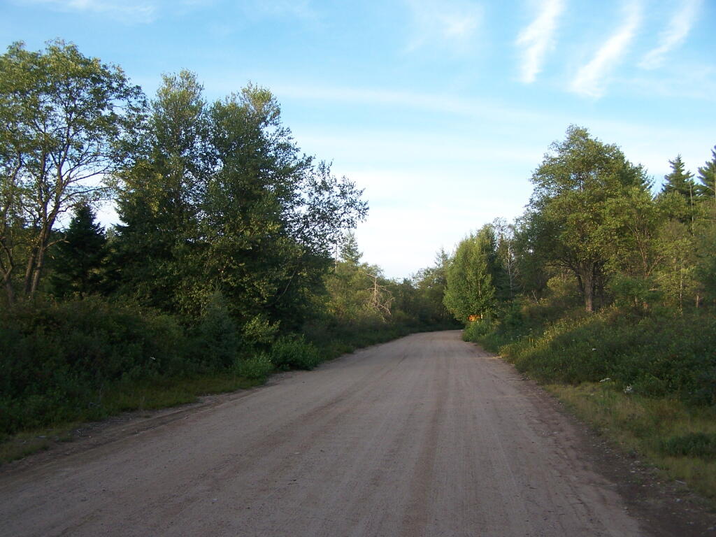
Moose River Plains Road

The citation of Helms v. Reid, 90 Misc. 2d 583 gives further incite into the Assocation for the Protection of Adirondacks vs McDonald case:

The major case interpreting the “forever wild” clause is Association for Protection of Adirondacks v MacDonald (228 App Div 73, supra). The question before that court was whether a statute passed by the Legislature providing for the construction of a bobsled run on forest preserve land and the necessary cutting of some 2,600 trees was violative of section 7 of article VII of the Constitution (presently art XIV, § 1). The Appellate Division had carefully traced the adoption of the forest preserve language and then made a careful inspection of the record from the 1894 Constitutional Convention where the “forever wild” clause language was adopted as a proposed amendment to the Constitution. The Appellate Divison concluded that the constitutional mandate was clear and in declaring the statute unconstitutional stated at page 81: “Giving to the phrase `forever kept as wild forest lands’ the significance which the term `wild forest’ bears, we must conclude that the idea intended was a health resort and playground with the attributes of a wild forest park as distinguished from other parks so common to our civilization. We must preserve it in its wild nature, its trees, its rocks, its streams. It was to be a great resort for the free use of all the people, but it was made a wild resort in which nature is given free rein. Its uses for health and pleasure must not be inconsistent 595*595 with its preservation as forest lands in a wild state. It must always retain the character of a wilderness. Hunting, fishing, tramping, mountain climbing, snowshoeing, skiing or skating find ideal setting in nature’s wilderness. It is essentially a quiet and healthful retreat from the turmoils and artificialities of a busy urban life. Breathing its pure air is invigorating to the sick. No artificial setting is required for any of these purposes. Sports which require a setting that is man-made are unmistakeably inconsistent with the preservation of these forest lands in the wild and natural state in which Providence has developed them.”

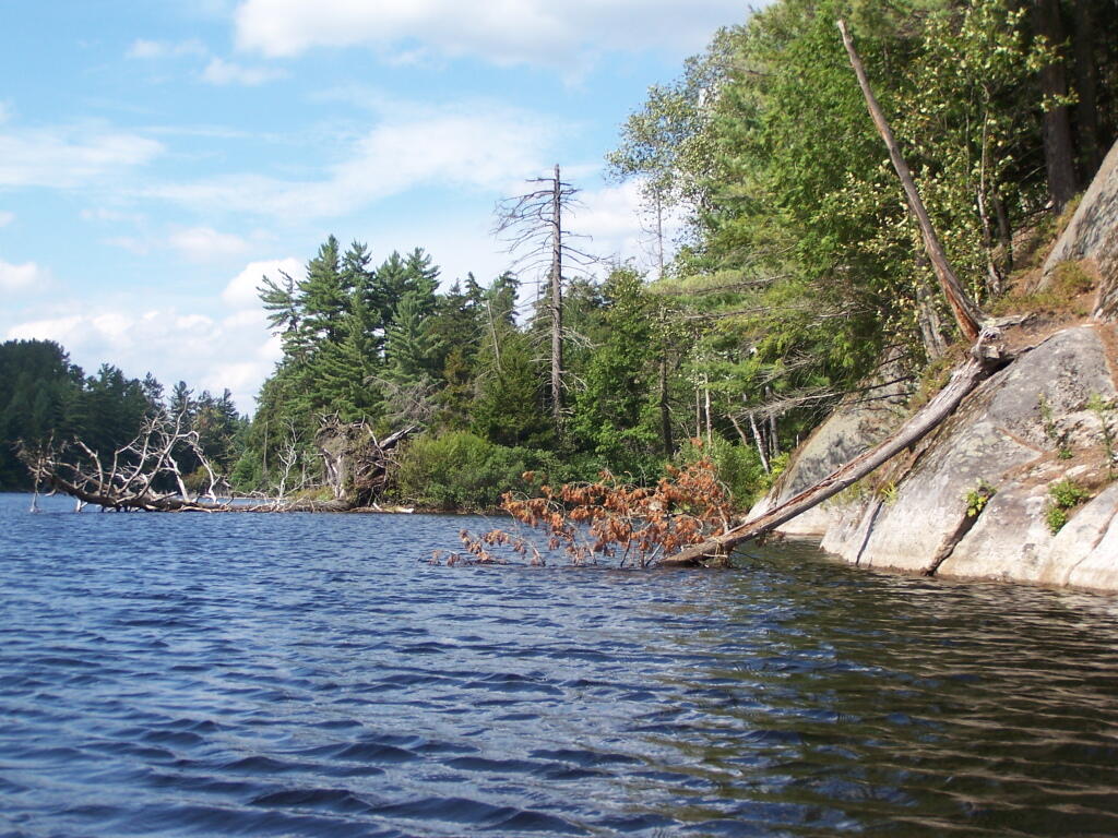
Many Downed Trees

What About Developing More Modest Recreation Facilities in Forest Preserve?

Certainly building a bob sled run would have been a massive project with visible impacts on the mountain vistas where the timber was removed, the steel infrastructure of the bob sled run, and the general changes the wild forest character. But what about more minor projects, e.g.

  • Scenic Vista Cut Along Trails
  • Primative tent campsites, along lakes, streams, or in the woods.
  • Roadside campsites with vehicular access.
  • State Campgrounds with Flush Toilets and Showers.
  • Horse stalls and horse barns.
  • Construction of hiking trails that require the cutting of brush or a de minis amount of timber.
  • Construction of snowmobile trails that potentially could involve cutting a larger amount of timber.
  • Horse trails that require the cutting of brush or a de minis amount of timber.

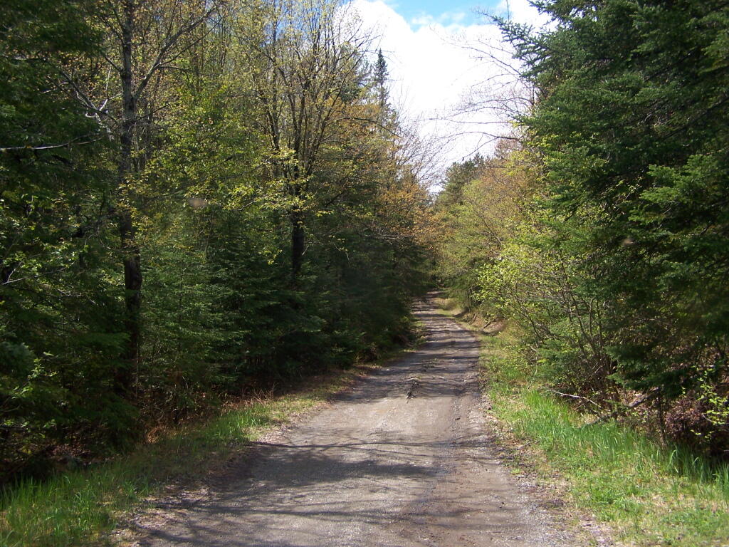
Moose Pond Way

The Case Law on Recreational Facilities in the Forest Preserve.

We learn in Helms v. Reid, 90 Misc. 2d 583 some of debates surrounding adoption of Article XIV Section 1 of the State Consitution, and how the Consitutional Convention of 1894 intended not to prohibit “all things necessary” to provide public access and not damage the forst preserve.

The Court of Appeals decision in MacDonald is of great importance and must necessarily be the guiding light in the analysis of the “forever wild” clause which this court must follow in rendering its opinion. At page 238 Judge CRANE states: “The words of the Constitution, like those of any other law, must receive a reasonable interpretation, considering the purpose and the object in view. (State of Ohio ex rel Popovici v. Agler, 280 U. S. 379.) Words are but symbols indicating ideas and are subject to contraction and expansion to meet the idea sought to be expressed; they register frequently according to association, or like the thermometer, by the atmosphere surrounding them. The purpose of the constitutional provision, as indicated by the debates in the Convention of 1894, was to prevent the cutting or destruction of the timber or the sale thereof, as had theretofore been permitted by legislation, to the injury and ruin of the Forest Preserve. To accomplish the end in view, it was thought necessary to close all gaps and openings in the law, and to prohibit any cutting or any removal of the trees and timber to a substantial extent.”

This language sets forth that the purpose of the “forever wild” clause was to prevent the commercial exploitation of the forest preserve which had previously been sanctioned by the Legislature, and it appears to be the court’s feeling that some cutting is permissible as long as it is not a substantial amount. Continuing on page 238: “The Adirondack Park was to be preserved, not destroyed. Therefore, all things necessary were permitted, such as measures to prevent forest fires, the repairs to roads and proper inspection, or the erection and maintenance of proper facilities for the use by the public which did not call for the removal of the timber to any material degree.”

This language indicates the court’s recognition of the fact that even though the Constitution was intended to protect and preserve our natural forest lands, such protection does not prohibit use and enjoyment of the areas by the people of the State. Such a principle is based upon the theory that the forest preserve was for the use and benefit of the people and was not to be an isolated area in which no man would wander. (People v Adirondack Ry. Co., 160 N.Y. 225, affd 176 US 335). (emphasis added)

While the Court never ruled on these matters in Helms, plantiff Herbert R. Helms cited that the State Conservation Department, made major changes and “man-made improvements” to the Adirondack Forest Preserve, over the past 50 years, many of them of questionable consitutional virtue under McDonald, abit never challenged in court.

The first cause of action in the complaint sets forth the “forever wild” clause and then lists various uses undertaken within the forest preserve in the past and present by the New York State Department of Environmental Conservation (ENCON), which the plaintiffs contend destroy the wild forest nature of the preserve because they all entail cutting significant amounts of timber and over use of the forest preserve area. The purported misuses are as follows: construction of 42 or more public campsites; dirt access roads to these campsites, along with various outbuildings, facilities, boat launchings, sewage disposal systems and the maintenance thereof; construction of hundreds of lean-tos, trails, jeep trails, fire roads 587*587 and paved roads other than those specifically authorized by the Constitution; construction and maintenance of ranger stations, fire watch towers, telephone and electrical transmission lines, as well as other utility lines; construction of boat launchings, parking lots and tent platforms; overuse and misuse of backwoods causing unreasonable widening of trails, littering and defoliation of areas, and finally allowing private individuals to adversely possess forest preserve lands to the preclusion of other citizens.

Helms cites McDonald in saying limited development and recreation is allowed in the park, as long as it’s primarily primative in nature:

“What may be done in these forest lands to preserve them or to open them up for the use of the public, or what reasonable cutting or removal of timber may be necessitated in order to properly preserve the State Park, we are not at this time called upon to determine. What regulations may reasonably be made by the Commission for the use of the park by campers and those who seek recreation and health in the quiet and solitude of the north woods is not before us in this case. The Forest Preserve and the Adirondack Park within it are for the reasonable use and benefit of the public, as heretofore stated. A very considerable use may be made by campers and others without in any way interfering with this purpose of preserving them as wild forest lands. (See `The Problem of the Wilderness’ by Robert Marshall in `The Scientific Monthly’, Feb. 1930, p. 141.)”

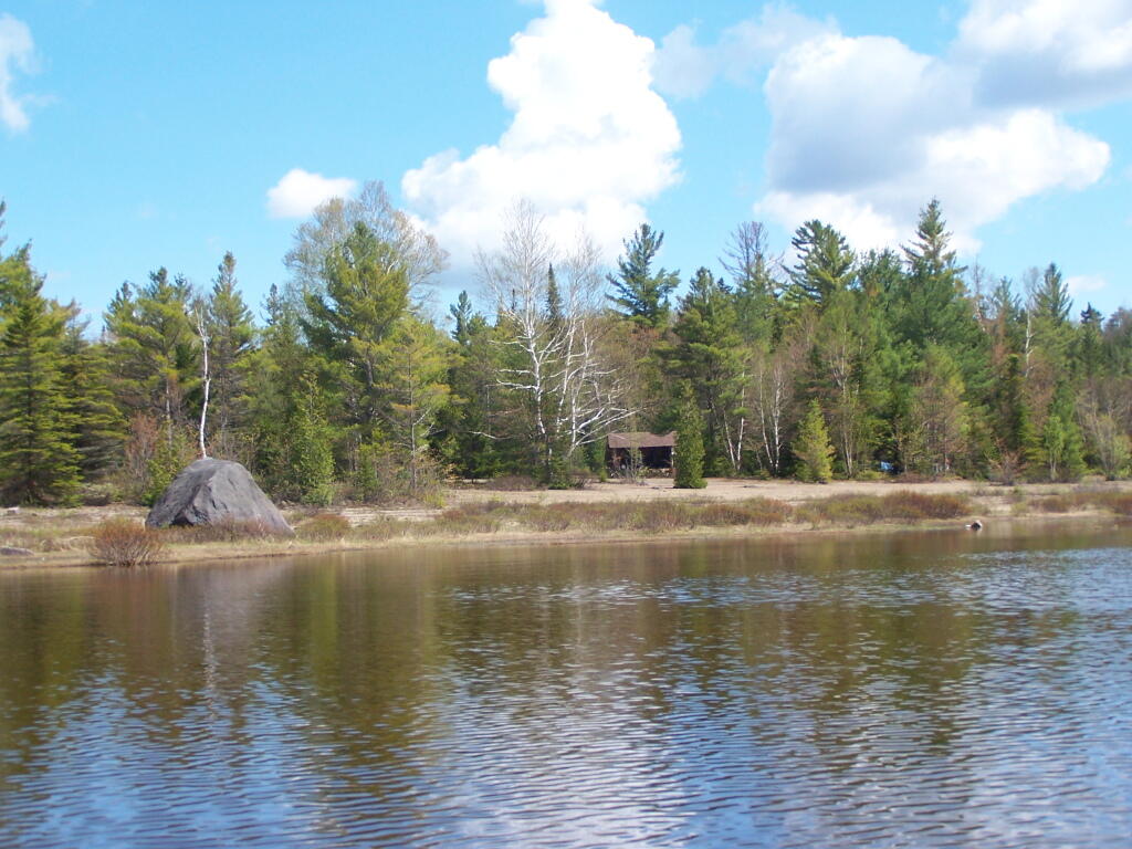
Cheney Pond Lean-To

Helms goes further to state:

If we assume that a constitutional amendment is not necessary for every use in the preserve which requires a cutting of timber, then we must apply our reasonableness standard to proposed uses. The question then becomes, who is to apply this standard?

It would appear that although the Constitution has deprived the Legislature of any power to authorize a cutting of timber in the forest preserve for commercial purposes, it has not deprived that body of its power with respect to public purposes. The MacDonald decision has allowed the Legislature the power to make reasonable regulations as to this public use and preservation, and such use and preservation must necessarily include some cutting of timber.

Since the Legislature still retains at least this limited authority, it may properly delegate this authority to the administrative agency best adapted to applying the principles heretofore enumerated. This is precisely what our Legislature has done by the creation of the Adirondack Park Agency. (emphasis added)

While ultimately Helms went on to decline an attempt to overturn float plane restrictions in newly designated “Wilderness” areas, first implemented by Governor Rockefeller’s Environmental Conservation Commissioner, Henry Diamond, it did include this important note:

In the discussion of the “forever wild” clause it was pointed out that the preserve was not to be closed to the public, but was to be held open for all of the public to enjoy in its natural wild state. Therefore, plaintiffs’ main theory is correct, and any regulation which arbitrarily restricts public access to or a reasonable public use of the lands in the preserve is violative of section 1 of article XIV.

Wakley Fire Tower

The principle of limited development of the Adirondack and Catskill Forest Preserve, to enhance public access was upheld most recently in Balsam Lake Anglers Club v Department of Environmental Conservation (upheld on Appeal to 2nd Appelate Division). It states:

Respondents adopted the UMP in furtherance of the Catskill Park State Land Master Plan, which was adopted in order to provide classifications and guidelines for the uniform protection and management of State-owned lands within the Catskill Forest Preserve. Under the UMP, respondents intend to construct a number of small parking areas providing access to trails and primitive campsites, to relocate certain trails to avoid private lands and to construct new trails within the Balsam Lake Mountain Wild Forest area. Since respondents must necessarily cut a certain number of seedlings, saplings and trees to complete such projects, petitioner contends that the UMP is in violation of article XIV, § 1 of the New York State Constitution.

The Constitution provides, “[t]he lands of the state, now owned or hereafter acquired, constituting the forest preserve as now fixed by law, shall be forever kept as wild forest lands. They shall not be leased, sold or exchanged, or be taken by any corporation, public or private, nor shall the timber thereon be sold, removed, or destroyed.” Petitioner contends that the cutting of as many as 2,000 “trees”, most of which are less than three inches diameter at breast height, constitutes the removal or destruction of timber.

This specific constitutional issue has rarely been litigated. The Court of Appeals and the Appellate Division in Association for Protection of Adirondacks v MacDonald (253 N.Y. 234, affg 228 App Div 73) addressed legislation authorizing the construction of a bobsled run within the Adirondack Forest Preserve for the 1932 Winter Olympics. The Appellate Division addressed the legislative history of the New York State Constitution and found an intent to prevent any actions “which might convert this preserve into anything but a wilderness” (228 App Div, at 79). However, the Appellate Division found that the framers of the New York State Constitution obviously distinguished between “timber” and any form of tree or wood. They quoted the framers as stating, “[a]ny campers that cannot pick up something on the shores, that will not be timber, to warm themselves with, would better either carry in their fuel or stay out” (supra, at 78). The Appellate Division also discussed the 1915 Constitutional Convention which sought to change the wording of the New York State Constitution to “trees and timber” (supra, at 79). Thereafter, the Appellate Division found that the project involved “the cutting of 2,600 trees which must unquestionably be regarded as of `timber’ size” (supra, at 82). Based upon an 609*609 agreed statement of facts, all 2,600 trees were in excess of 3 inches diameter at breast height, 480 trees were in excess of 8 inches and 33 trees were in excess of 20 inches. The project involved total clearing of between 4 and 5 acres, some of which constituted first growth hardwoods and involved the removal of some 60,000 board feet of timber. The Appellate Division held the legislation unconstitutional based both upon the substantial destruction of timber and the nature of the proposed project.

The Court of Appeals in affirming the Appellate Division determination rejected the absolutist argument that not even a single tree or even fallen timber or deadwood could be removed and stated that the constitutional provision must be interpreted reasonably. “[A]ll things necessary were permitted, such as measures to prevent forest fires, the repairs to roads and proper inspection, or the erection and maintenance of proper facilities for the use by the public which did not call for the removal of the timber to any material degree. The Forest Preserve is preserved for the public; its benefits are for the people of the State as a whole. Whatever the advantages may be of having wild forest lands preserved in their natural state, the advantages are for every one within the State and for the use of the people of the State. Unless prohibited by the constitutional provision, this use and preservation are subject to the reasonable regulations of the Legislature” (supra, 253 NY, at 238-239). It is thus clear that the Court of Appeals determined that insubstantial and immaterial cutting of timber-sized trees was constitutionally authorized in order to facilitate public use of the forest preserve so long as such use is consistent with wild forest lands.

With respect to the relocation of the Hardenberg Neversink Trail challenged herein, petitioner contends that the amount of cutting is of constitutional dimension. The relocated trail is in excess of two miles long and is approximately six feet wide. With the trail approximately 80% completed, 73 trees of timber size, that is three inches or more, have been cut, including one nine-inch tree and one six-inch tree which was dead. The remaining trees are three, four or five inches in diameter. It is estimated by the court that the entire cutting, including trees not of timber size, that is, less than three inches, amounts to little more than one cord of firewood. The great majority of such cutting will be completely decomposed within a few years leaving no trace of their existence but 610*610 providing increased growth opportunity for the remaining trees in the forest.

It is therefore determined the amount of vegetation, seedlings, saplings and timber-sized trees destroyed so far in the construction of the relocated Hardenberg Neversink Trail is not constitutionally prohibited, nor is the number of trees planned to be removed to complete such relocation. While the actual route for the Millbrook Ridge Trail has not been chosen and it is not known how many trees, saplings, seedlings and other vegetation must be destroyed, it may be presumed that the Department of Environmental Conservation, pursuant to its regulations concerning the construction of trails and the destruction of trees and timber, will comply with the provisions of the New York State Constitution. In the event that the Department of Environmental Conservation does not comply, petitioner could certainly challenge the specific trail route or construction techniques at an appropriate time.

Petitioner also contends that the construction of new trails in the Balsam Lake Mountain Wild Forest area violates that portion of the New York State Constitution which requires that forest preserve lands “be forever kept as wild forest lands”, arguing that new trails will increase human activity, thereby necessarily making such areas less wild. Based upon the decisions of the Appellate Division and Court of Appeals in Association for Protection of Adirondacks v MacDonald (supra), it appears that the framers of the New York State Constitution intended not to prevent or hinder public use of the forest, but to allow forested areas to revert to their natural or wild state without human interference with the natural succession of different types of trees, selective cutting or thinning to “improve” the timber, or the harvesting of any mature timber. There is no indication of any intent to maintain the forest in an “absolutely” wild state with no organized human alteration or intervention at all.

The Court of Appeals specifically held that facilities consistent with the nature of the forest preserve could be constructed for the use by the public, including camping and hiking. Such use facilitated by the construction of new trails or increasing parking and camping areas will almost certainly degrade the pristine quality of certain areas of the forest preserve. While it may be desirable to initiate a policy to refrain from actions which will have the effect of increasing human activity, such issues are not of constitutional dimension unless significant cutting of timber is involved. Accordingly, it is declared that the Unit Management Plan adopted for the Balsam Lake Mountain Wild Forest area does not violate the provisions of article XIV of the New York State Constitution.

Towards Indian Lake

What is the Standard Held This Cases?

Over the years, the courts have created a certain principles on recreation facilities in Adirondacks. Distilled down, one can probably agree that courts in NY State hold:

  • Any project to be constructed in forest preserve must cut as few trees as possible, particularly of timber-grade trees, those larger then 3″ in diameter. Any project requiring significant timber cuts are unconstitutional.
  • There is a clear preference towards development of facilities in natural meadows and brushy areas, locating paths, trails, and roads on existing old woods road rather then cutting new roadways or trails through the woods.
  • Limited timber cutting is allowed for essentially wild forest purposes, such as campsites and trail location. It must be as limited as practical.
  • Any developed facilities must be rustic in nature (wood, painted brown), and must exist solely to complement forest preserve uses such as primative camping, hiking, hunting and fishing.
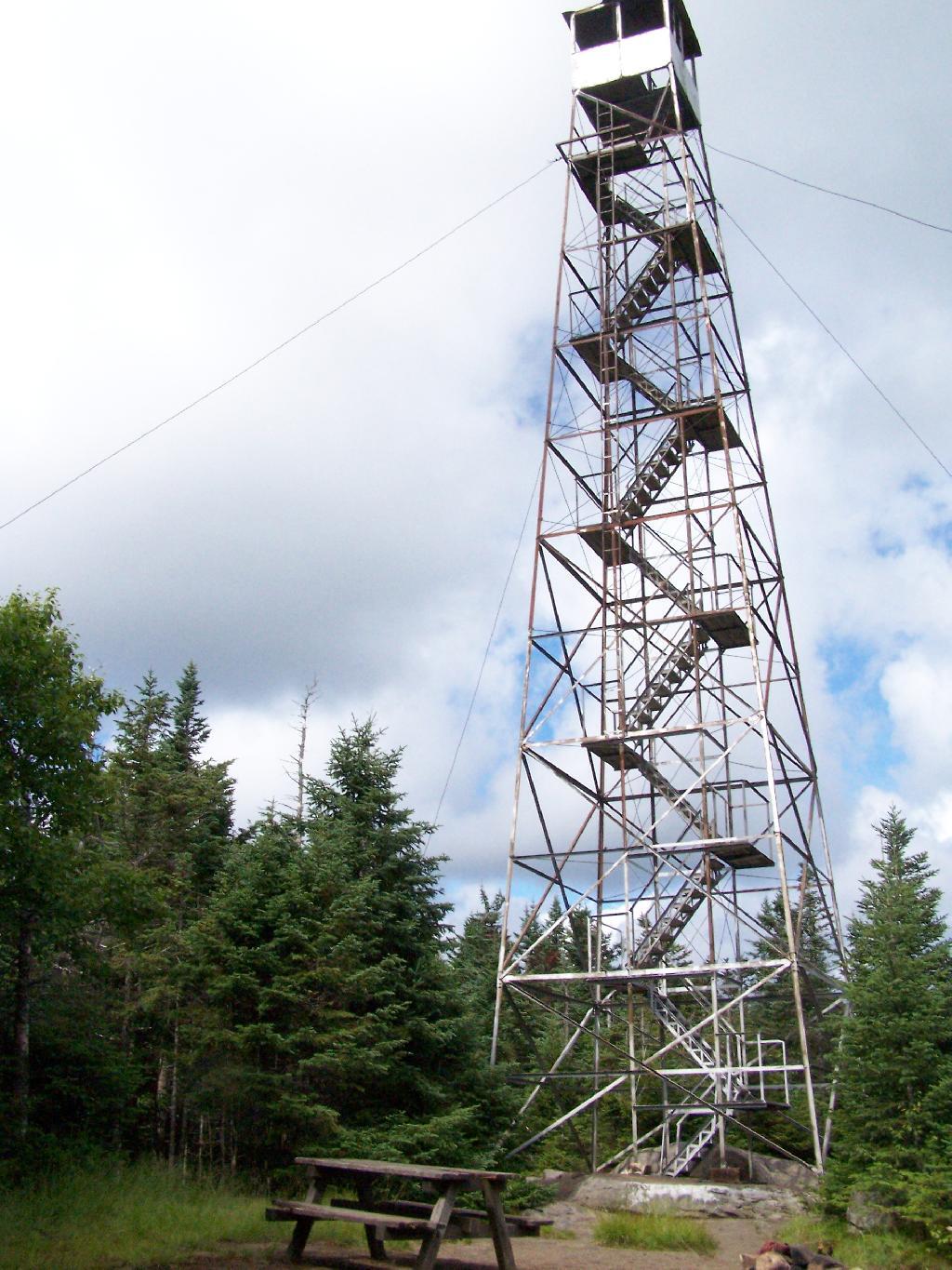
  • Intensive use areas are allowed, such as developed state campgrounds or firetowers, but they can not change the forest character or require the excessive removal of timber.

Tiny Roadside Campsite

… the courts have sought a balance between recreational demands and keeping the primarily wild nature of forests wild.

Corridor H

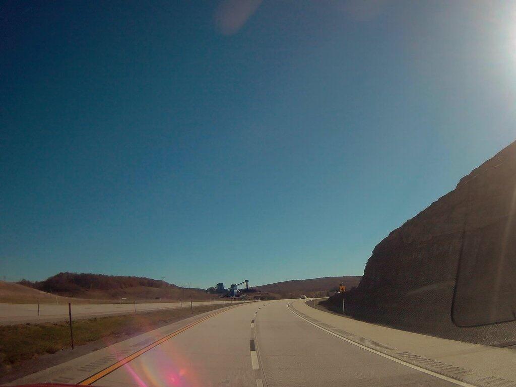
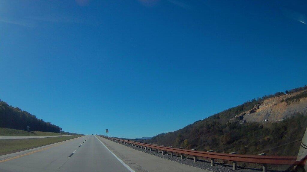
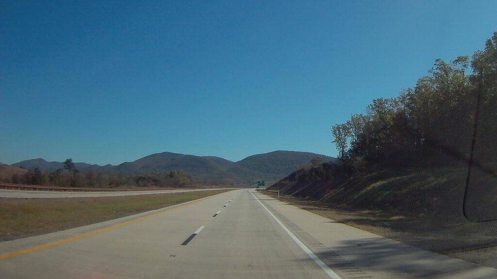
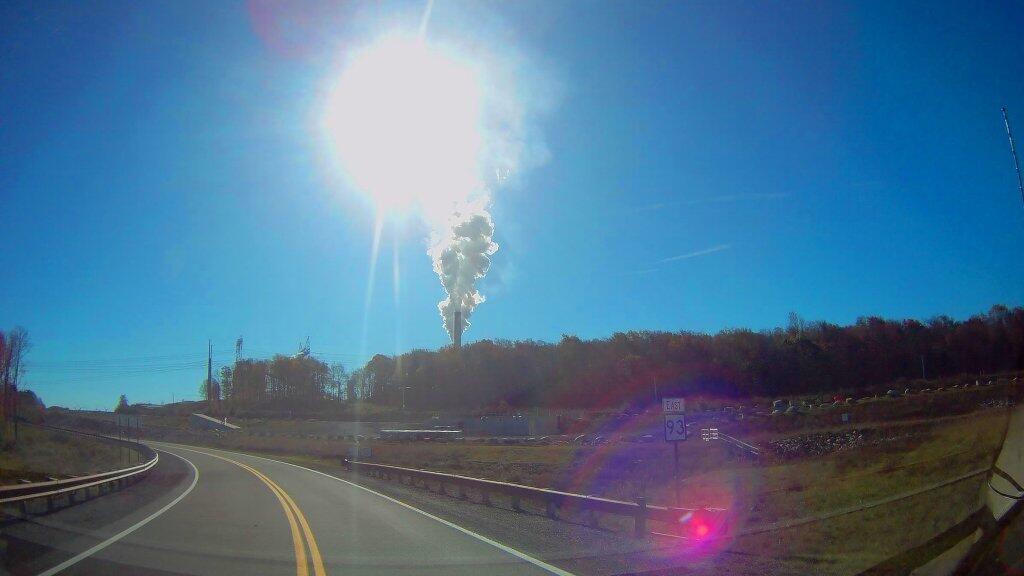
Driving along Corridor “H” the new limited access highway that runs in the Northern Tier of West Virginia from Davis to Morehead past the strip mined coal fields and the big Storm Mountain Coal-fired Power Plant, I was thinking what a truly nasty way to be making electricity, especially in the 21st century, when much cleaner fuels have long been on the market, and when renewables are a growing part of the electricity industry.

 Coal Strip Mine Along Corridor H

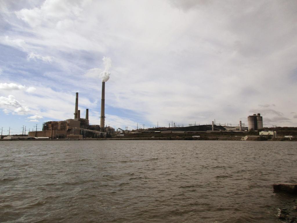
In the early days of the industrial revolution, coal was the only on-demand source of energy that could be used virtually everywhere. You haul coal somewhere, you get coal lit on fire, it burns hot, often with a thick black smoke, boils water into steam which turns a turbine. More advanced controls were invented which got more heat energy turned into steam, captured more of the soot and chemical byproducts of coal, and generally made coal a better fuel. But from a chemical standpoint, coal can not compete with oil or natural gas, which is much easier to burn and control the output of the furnace. As oil and gas have fewer contaminates it can be burned with much fewer pollution controls. Mount Storm is a large coal-fired generating station. It has what appears to be two active units from the two large currently operating smoke stacks, but there may be multiple units attached to one stack. It produces an enormous cloud of water vapor visible from miles around — including from the Dolly Sods Wilderness and most elevated locations within 30 miles. Water vapor is a nice way to put it — the smoke is mostly carbon dioxide and water but it’s mixed with a wide variety of heavy metals, mercury, sulfur dioxide, carbon monoxide, and nitrous oxides. Things that limit the amount of otherwise healthy fish they can safely consume out of streams even far away. It produces a steady output of “base-load” that lights wells over a million households, or a combination of households, factories, and commercial facilities. It’s one of the bigger power plants out there, but certainly not the biggest.

Mount Storm

Mount Storm a big industrial facility with a large cooling reservoir whose warm waters are popular for boating and fishing. The warm cooling water from the plant keeps the lake ice free for much of the year and provides good stable water temperature for fishing. It’s nice that they allow public access to the reservoir, one with impressive views of the plant from the boat launch. That’s great. But what’s no so great is the large open pit mines that surrounded the plant, laid bare for all to see by the construction of the Corridor H Expressway. Mountain top removal, and strip mining turn mountains into mounds that look like garbage dumps. Even “restored” landscapes make mountain look engineered, the hopes of getting new businesses in the area to locate in this remote area are slim — although somewhat improved by Corridor H. For every four tons of coal hauled to the plant, one tons of coal, limestone scrubber residue, and fly ash are landfilled near the plant. The coal fired plant itself is a small part of the landscape compared to the wastes that are disposed of at on-site landfills. You can only see some of the outer walls of the landfills from the WV 94 (the old road) and Corridor H. From satellite pictures you can see much more. Burning coal cuts enormous sections out of mountains, and creates new mountains of ash landfills.

 Coal Mine

Coal haters, myself included, will note that nothing is really clean about coal. Toxic coal air emissions, while a small part of what goes up the smoke stack, are enormous, because so much coal is burned every day, 365 days a year at Mount Storm and thousands of other coal fired plants across the country. The electricity produced lights millions of homes. Not only is mining ugly and restored landscapes are often just a glimmer of the once wild lands, cutting into the earth, especially in places where coal is common, release many toxic compounds.ย  Coal often is mixed with pyrite, commonly known as fools gold. You might get rich off the coal, but your still a fool. Pyrite when it’s exposed to water and rain releases it’s sulfuric compounds, the same ones that often go up the stack when coal is burned. The sulfuric compounds in pyrite mixed with water produce sulfuric acid mine discharge — sometimes as powerful as car battery acid and poison streams, especially hitting fish who are sensitive to even minor changes to pH levels in stream levels. To say nothing of the removed an rerouted streams, which bring sediment downstream, boost nutrient levels, and otherwise wreck formerly good trout streams. Of course if you read my blog, you probably are aware of all these things. That coal is a lot more evil then just the excess amounts of carbon dioxide it’s bleaching into air forever changing both our local and global climates, acidifying the oceans and lakes, changing the natural rhythms of moth earth. But seeing Mount Storm up close seemed to bring that all back home to me.

Mount Storm Lake

Now I also saw the nice rural houses in the neighborhoods, with the neatly maintained yards, beautiful 3/4 ton pickup trucks, a four wheeler or two, and maybe a horse, and a family cow or a hog. All most certainly paid by the good salaries for the engineers and technical people who use their advanced knowledge to keep Mount Storm humming along. Or they work with heavy equipment in the strip mines and below ground mines to feed the ever hungry coal furnaces at Mount Storm. They are doing what they need to do to feed their family and live the good life. I respect them, I might be even kind of jealous because I’d love to live in rural God’s country like this. West Virginia is a special place. Coal may be dirty and working with it may have life-long consequences, it’s a good source of jobs in these towns that don’t have much else to do — sure there are jobs in timber, road construction, local government, a few other industries, but the area is still incredibly rural, even if Corridor H is making it easier to get around. If Virginia finally agrees to extend Corridor H so it meets up with Interstate 81, this area will become even less remote. But even without the final extension, this superhighway — granted one that has grade intersections is making the whole area much better connected together and accessible. I can’t overstate how much Corridor H changes life in the Northern Tier of West Virginia, compared to the much inferior West Virigina 93.

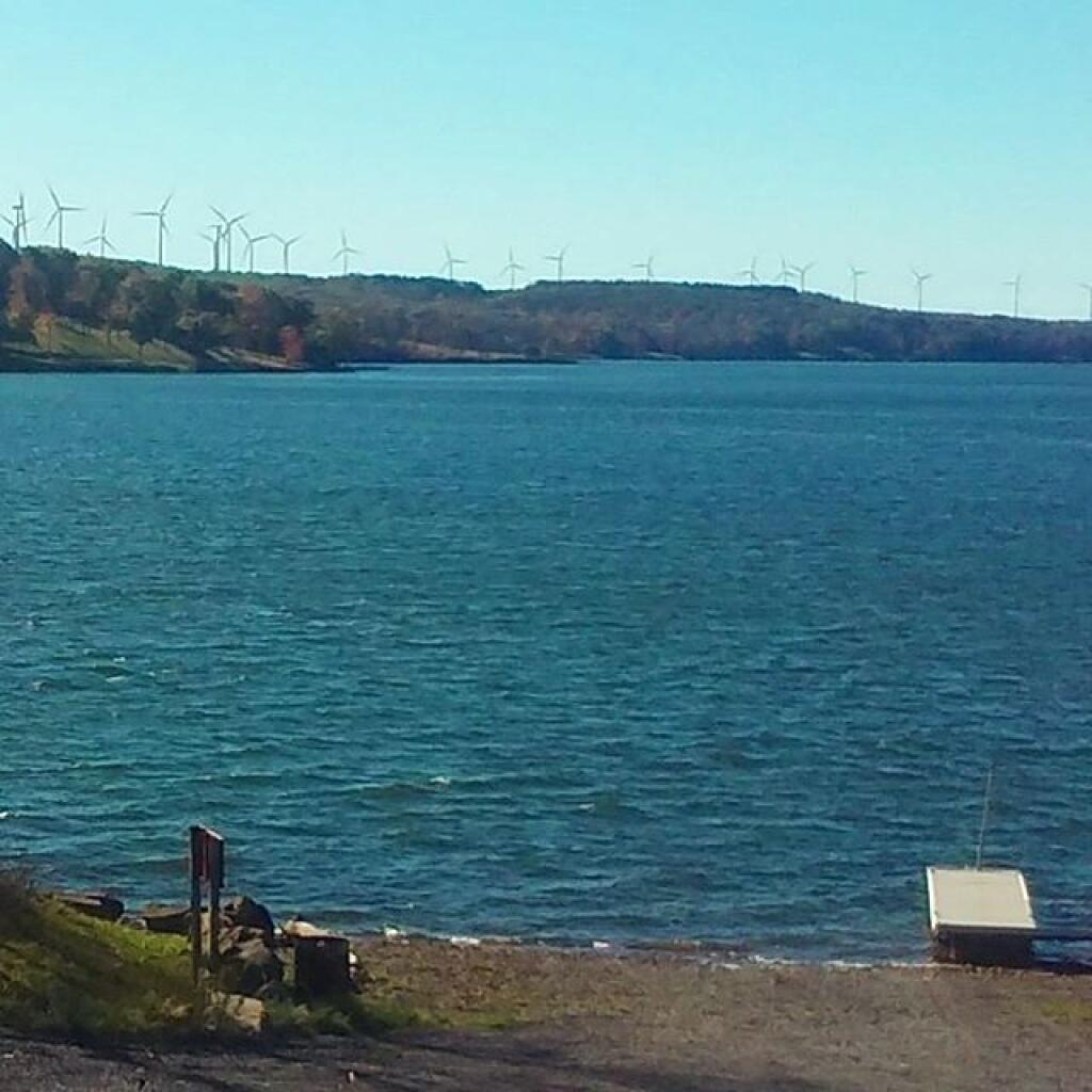
I think it’s fully reasonable to predict that Corridor H will eventually become an interstate highway, connecting with Interstate 81 heading west from Davis to Interstate 79 outside of Morganstown. Mount Storm will probably eventually close. President Donald Trump may say coal will be great again, but it’s a dying, nasty technology, that is long in the tooth, especially as renewables grow on the grid. Probably many of younger generation will move away, rather then struggle with the hard life of Rural Appalachia. Some people will stay and carry on the values, working in other industries or being part of the growing renewable energy industry. As Mount Storm and the coal industry is in it’s twilight years, making as much of a mess as usual, more and more wind turbines are going up on the remote ridges of the pan handle of West Virginia. Areas mined for coal might still be high enough to site new turbines — to say nothing of solar. People will still hunt deer and bear, raise a hog or beef in their backyard, live the good rural life. Mount Storm and the coal industry may be on it’s last horrific breath, but it doesn’t mean Appalachia and it’s beautiful landscape must come to an end.

 Expressway

Despite all the blasting, the large bridges, and forever changed landscape, I think Corridor H is great. It shows the beauty and ugliness of West Virginia. It will move the whole area forward, make it less remote, and allow it to transition to the industry of tomorrow. The sheer distance from other population centers will limit high-end residential and commercial development, to say nothing of the steep mountains slopes, the rough rocky terrain, even if the distances aren’t as far thanks to the safe, modern road. I think everybody should drive Corridor H at least once.

 Carbon

Why I Am Not a Libertarian or a Conservative

Many people I know giggle or maybe take a gasp when I tell them I am a liberal Democrat, or something like that. I mean, I voted for both Barack Obama in 2008 and 2012, and for Jill Stein in 2016. I did consider voting for Donald Trump in 2016, but ultimately went with Stein as protest vote against both Trump and Clinton. I voted for Senator Sanders in the Democratic primary, but honestly I wasnโ€™t thrilled about either candidate in the primary. I thought Donald Trump would be a change, much like Obama was a change, and a fresh voice in 2008. I was very impressed with Barack Obamaโ€™s work as president, even if many of his best ideas got held up by the Republican Congress. Iโ€™m mostly indifferent to all the candidates that run for office, not liking many of them.

Pride. It comes in all colors.

I believe itโ€™s important for government to regulate big corporations and big urban concerns, when we are talking about thousands or millions of people. As they used to say, individually people are really beautiful, but together there is a lot of collective ugliness. Most human impact is limited, but becomes more problematic when thousands or millions of humans act together โ€“ like driving automobiles in cities, generating solid waste, or using megawatts of electricity. Your 100 watt light bulb doesnโ€™t impact shit, but burning coal to power millions of homes and oil to power millions of automobiles is producing such an incredible amount of carbon dioxide, itโ€™s warming the planet.

I am not a believer in individual action or lifestyle statements, except for political lobbying. Replacing your incandescent bulbs with LED bulbs or buying a hybrid car is going to nothing to change the trajectory of our planet as it continues to warm. Neither will trading in your SUV for a hybrid or taking the bus is going to alone change a thing on the planet. But fuel economy standards can force manufacturers to make millions of more efficient cars, and investing in convenient transit options, can move millions in ways that reduce carbon emissions.

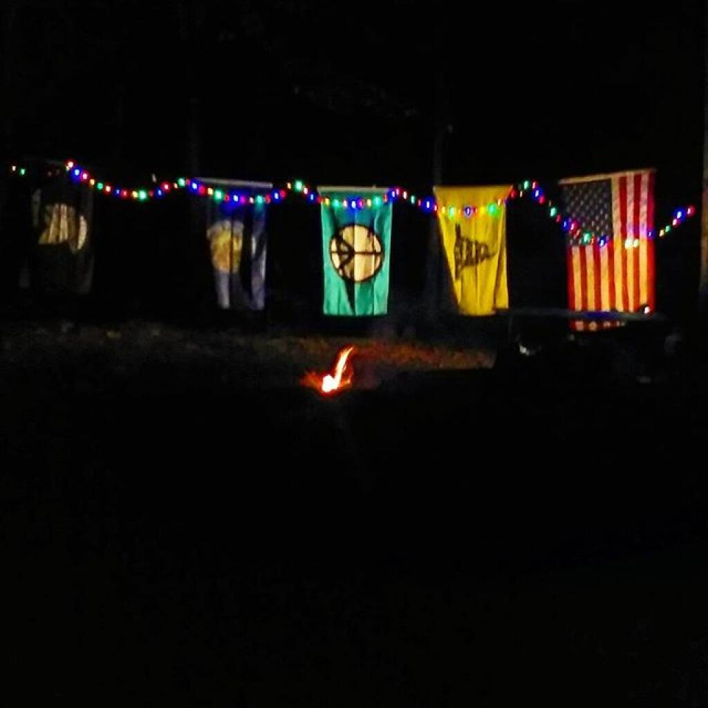
I promise I won't buy anymore flags

I am also not a believer in expanding social programs per se. I do see the need for universal healthcare, but it should be provided a mix of a public and private partnership. The government should be the insurer of expensive healthcare operations, while private insurers can cover ancillary needs like lost wages, premium parking, cable television or Internet at hospital rooms, or other non-essential benefits that will help to make health care pleasant. I also think college education should be highly subsidized, so students who work summer jobs and live conservatively, can afford it without going to debt.

I do not agree with welfare or providing certain individuals with special government subsidies just because they are poor โ€“ government shouldnโ€™t be providing the poor with vochures to buy food or rental assistance. But government should work to ensure that there is an adequate supply of affordable healthy food for all regardless of income, and same with safe, decent housing for all.

At the same, I am a believer in the government creating good public places for all to use, without consideration of income. Every community should have good public spaces where people can get together and work on issues of common interest. Public libraries, free and open to all, are important in every community, so people can learn and access the Internet. Learning shouldnโ€™t end just because you graduate from a publicly funded school. I also think parks that are free and open to all are important, as people need a chance to get some fresh air and enjoy healthy recreation. Public forest lands can provide numerous recreational opportunities from hunting to fishing to camping and hiking, and can also provide important products to industry like timber, oil, and coal โ€“ which in turn can fund their use for all.

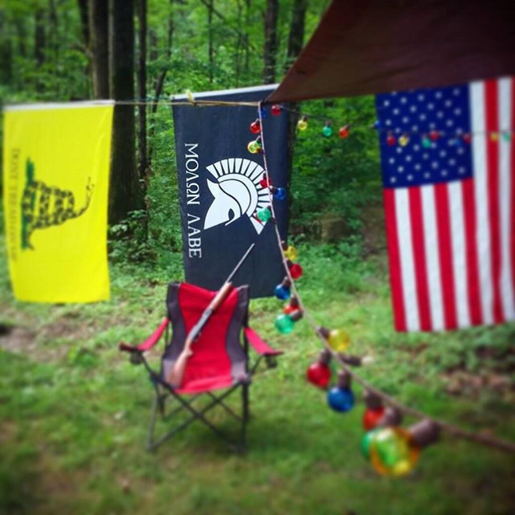
Molon Labe

I donโ€™t think government has much of a role regulating individual lives. I donโ€™t support gun control, instead I think government should be working to produce healthy communities that are largely free of violence, because people have other ways to work out problems. Strong communities have good jobs, good schools, good community centers, and a mix of people that always are keeping an eye on their street. Neighborhood watches, and local anti-crime citizen groups should always be the preference over more cops and government regulation.

In urbanized areas, there needs to more regulation of private property, to protect community character, but sometimes regulation gets a little out of hand. In rural areas, there can be more freedom, because there is less of a chance of conflict. But I think there should be more review of regulations, and repeal of outdated regulations, and implementing regular sunsets of laws. It seems like there too many laws, especially on the local level, that donโ€™t always make sense to continue.

Thatโ€™s my take on it.

Daily Update – March 14, 2022

Good morning! The Monday after daylight savings time has come back around again. ๐ŸŒ…

With the clouds it seems darker than yesterday. โ˜๏ธ But it’s nice with so much extra daylight in the evening. For a day supposed to reach the fifties by evening, the morning is awful cool. Not spring yet.

๐ŸŒน๐ŸŒป๐ŸŒผOnly 6 days remain until the first day of calendar spring!๐ŸŒน๐ŸŒป๐ŸŒผ

Overcast and 25 degrees in Delmar, NY. โ˜๏ธ There is a south breeze at 6 mph. ๐Ÿƒ. There are 4 inches of snow on the ground. โ˜ƒ ๏ธThings will start to thaw out at around 9 am. ๐ŸŒก๏ธ

Yesterday I went skiing ๐ŸŽฟ at Five Rivers Environmental Education Center for a while but by midday the snow wasn’t that great. Then I went out to the folks house ๐Ÿ‘ช for cabbage and corned beef ๐Ÿ€ and skied a bunch more with the dog ๐Ÿถ out back.

It’s nice having that extra sunlight in the evening. ๐ŸŒ‡ I went for the evening walk ๐Ÿšถ with still some daylight to spare and did not have to drive home in the dark. ๐ŸŒƒ Looking forward to when I can go down to the park ๐Ÿž again with a book ๐Ÿ“™. Had the library not been closed on Saturday due to the snow storm I probably would have gone there. I’ll probably go more now that they’ve dropped the muzzle mandate ๐Ÿ˜ท as I don’t mind wearing a mask but not when I’m sitting down and working.

I don’t mind wearing the muzzle in public places ๐Ÿ˜ท like crowded elevators or buses but not while sitting down and working. I’m so used to at this point just wearing the muzzle and boiling then in soapy water ๐Ÿ’ฆ every Sunday afternoon. It just becomes routine and if it keeps me from getting the COVID or a cold it’s worth it.

Besides the GIS class I’ve been taking ๐Ÿ—บ, I’ve been lately doing a map atlas a day I post on Facebook. It’s fun because it gets me looking for interesting sources of map data each day and new techniques for presenting information. ๐ŸŒŽ There is a lot you can do with a combination of R programming language and QGIS with a python thrown in. Using R often makes complicated map joins quick.

Replaced the Microsoft building footprints with a combination of the NYSERDA building footprints and the NYC planning department footprints on my PostGIS database on my laptop. ๐Ÿข The Microsoft building footprints aren’t bad and are far more extensive in rural areas than what was available in OpenStreetMap but had a lot of problems accurately displaying urban buildings. Then again, Microsoft building footprints was generated with machine learning while NYSERDA checked them against source photography. ๐Ÿ”Ž

Tomorrow I’ll probably wash my truck ๐Ÿ›ป and go store for suppliers. ๐Ÿ Lots of little things I need – shoe rubber cement for fixing my ski ๐ŸŽฟ boots again, and fixing the trash can lid, toilet ๐Ÿšฝ cleaner and drain solvent to improve the bath ๐Ÿ›€ drain. Cheese ๐Ÿง€ as I got to have my dairy ๐Ÿฎ and more frozen fruit. ๐Ÿ“ I have to work late tonight so it won’t happen today but going to be a mild week for a car wash. Then some point next month I’ll have to sand and paint over the rust again on Big Red.