Search Results for: photo east canada creek 10

Good Evening – August 15, 2021

Good evening! Sitting on the Kane Firetower waiting for the sun to set ๐Ÿ—ผ

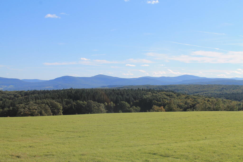
Partly clear and 69 degrees at the Kane Mountain Firetower. Light breeze. The dew point is 51 degrees. A very clear evening ๐ŸŒƒ for sure, good for watching the sunset. With the low dew point I can easily see the other side of the Mohawk Valley including some of the silos on the Schoharie side. Also the wind turbines on the ridge outside of the Adirondack Park.

It’s been a nice weekend up north, โ˜บ with way too many beer boiled clams, sausage and sweet corn ๐Ÿฆช๐Ÿป๐ŸŒฝ and swimming ๐ŸŠ๐Ÿป‍โ™‚๏ธ holes and about 25 miles of hiking – well over 15 miles was today alone. Camped at the House Pond Campsite 2 again. Today I hiked from Seeley Road in Knapville to Dexter Lake and then to Spectacle Lake and then to Waters Mill Pond. Then about two hours in the evening cooling off in the Potholers, followed by a sunset hike up Kane Mountain. Now to drive home by 10 pm.

Yesterday, I hiked back to House Pond which had a lot of blow down over parts of the trail. ๐ŸŽ‹ There was a bad thunderstorm โ›ˆ in July that I remember seeing on the news ๐Ÿ“ฐ that caused some big trees to come down, but at least it didn’t wash out the road much or if it did Stratford had already fixed it. Looks like they had to saw and remove multiple trees off Piseco-Powley Road that had came down it and I could hear them cutting downed trees at the hunting camp down the road and I saw them leaving with several pickup trucks full of wood.

Also yesterday I hiked along the Edick Road Snowmobile Trail and then back to Edick Road Campsite #1 out along the ledge overlooking the East Canada Creek, spotting a photographing a doe up close. ๐ŸฆŒ I climbed down the gorge wall and watched the various birds ๐Ÿฆ in the grass lands along that grassy part of the river. Then more clams, corn and sausage. And back to Potholers.

Friday was even more lazy — it was fairly hot. Many hours reading and learning more about Python, ๐Ÿ and then I hiked to Potholers. ๐ŸŠ‍โ™€๏ธ Then after I got back to camp, I swam at the swimming hole across the road from House Pond Campsite 2 until dusk, listening to a podcast, started a fire ๐Ÿ”ฅ had more clams, ๐Ÿ•น laid back in hammock until it started to pour ๐ŸŒง and then hung out under the tarp as it rained some more listening to podcasts until 11 PM.

Thursday, was a rather late start because it was so humid and I was on vacation and was lazy. I screwed up and didn’t get my turn signal on time for Sandell Farm’s to get sweet corn, and ended up going to Rogers Orchard to get sweet corn and blueberries. ๐ŸŽ Then I ended up running to Wally World and forgetting the main reason I wanted to go there — to get coffee. โ˜• I like the large coffee containers they have there not just because they are inexpensive on a per pound basis, they make great containers for making ice in for camping. Or “donating” to the state to put toilet paper in the outhouses, to keep the racoons from shredding it. ๐Ÿšฝ I was hoping to check out Willie Marsh ๐Ÿธ but I got on the wrong road, so I didn’t go by there. I finally got camp around 12:30, set things up, made my first batch of clams, ๐Ÿ•น and they were good. Swam in the swimming hole across the way from House Pond Campsite, ๐ŸŠ‍โ™€๏ธ which might not be the potholers, but it’s right next door. Sat back in the hammock for a while listening to some music ๐ŸŽผ and the news ๐Ÿ“ป, then had a fire. ๐Ÿ”ฅ The wood sure was wet that first night, and it was a bit smokey until I got it going well.

June 20, 2021 Evening

Good evening! Partly clear and 82 degrees in Delmar, NY. There is a south breeze at 8 mph. ๐Ÿƒ. The dew point is 62 degrees. Back home again, as John Denver once sung. ๐ŸŽถ Remarkably hot, especially now that I am back home after having a nice Sunday dinner at the folks house. ๐Ÿ‘• Slowly unpacking my gear from camping, taking steps to drink and cool down.

Well, happy summer folks. โ˜บ The next ten weeks through Labor Day Weekend are considered real summer when the state parks pools are open and the days are relatively long. ๐Ÿ– Nice hot summer days to spend at the pool or swimming hole. ๐ŸŠ๐Ÿป‍โ™‚๏ธ Do some fishing ๐ŸŽฃ late into the night.

It was a beautiful trip back across the Mohawk Valley and through the Schoharie Valley. Everything was very green and lush.  It was a nice weekend up north, although Friday night was very wet. โ˜” It drizzled for a while and then when I went for a good walk up to the Potholers it poured and I got completely soaked. ๐Ÿ’ฆ It was decent all three days up north although I have to say that today was the best of the week. That said, much too short. ๐Ÿ‡ Time flies, especially when it’s rare that I am not out of town for four or more nights, in the era of remote work. But I decided I should come home tonight, because I need to at minimum move to a new campsite.

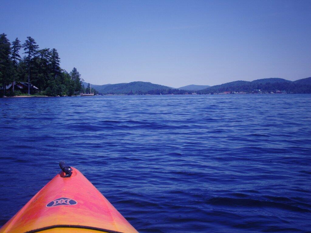
It was three nights up in the wilderness, ๐Ÿ• camping up at House Pond, spending much of Friday during the day drinking, ๐Ÿบ reading, ๐Ÿ“• writing, โœ and hanging down at the Swimming Hole by the House Pond Campsite. ๐ŸŠ‍โ™€๏ธ It was nice but the water was a bit cold to say the least. ๐Ÿ›ถ Saturday, was kayaking from Stewart Landing up to Lily Lake. I didn’t go much into West Lake because I wanted to be close to back to Stewart Landing by 2 pm as they were threatening severe storms by afternoon, which never materialized. Instead, I spent the evening reading, and then down at the same swimming hole on the East Canada Creek. ๐ŸŠ‍โ™€๏ธ Most of Sunday was spent slowly taking down camp after a nice breakfast ๐Ÿฅž then the majority of the day the Potholers. I forgot how much nicer the Potholers are with the flowing water and potholes compared to any ordinary swimming hole on a nice summer day. It’s good to be back there!

Tonight will be mostly cloudy ๐ŸŒฅ, with a low of 69 degrees at 5am. 10 degrees above normal. Maximum dew point of 66 at 3am. South wind around 8 mph. Probably need the fan on all evening. In 2020, we had mostly clear skies. It was somewhat humid. It got down to 69 degrees. The record low of 41 occurred back in 1970.

I thought about staying over the folks house, ๐Ÿ‘ช but I was tired and wanted to get home. It has been a nice weekend, but alas I should get ready for the work week and get my camping gear put away. I also want to get the volt meter out before dark, and try to figure out why the relay isn’t closing between the starting and accessory batteries when the engine is on or the solar is outputting enough to top off both batteries. ๐Ÿ”‹ That was annoying that wasn’t working this weekend.

Tonight will have a Waxing Gibbous ๐ŸŒ” Moon with 81% illuminated. At 7 PM, the moon was in the southeast (139°) at an altitude of 26° from the horizon, some 226,818 miles away from where you are looking up from the earth. ๐Ÿš€ At the state speed limit of 55 mph, you’ll make it there by December 9th. Buckle up for safety! ๐Ÿ’บ The Strawberry ๐Ÿ“ Moon is on Thursday, June 24. The darkest hour is at 12:58 am, followed by dawn at 4:43 am, and sun starting to rise at 5:18 am in the east-northeast (57°) and last for 3 minutes and 28 seconds. Sunrise is 11 seconds later than yesterday. ๐ŸŒ„ The golden hour ends at 6:01 am with sun in the east-northeast (64°). Tonight will have 8 hours and 41 minutes of darkness, a decrease of 2 seconds over last night.

Tomorrow will have a chance of showers and thunderstorms, mainly after 4pm. Some of the storms could produce small hail, gusty winds, and heavy rain. Mostly sunny ๐ŸŒž, with a high of 89 degrees at 3pm. Eight degrees above normal. Maximum dew point of 71 at 11am. South wind 10 to 17 mph, with gusts as high as 29 mph. Chance of precipitation is 30%. New rainfall amounts of less than a tenth of an inch, except higher amounts possible in thunderstorms. A year ago, we had partly cloudy skies in the morning with some clearing in the afternoon. It was somewhat humid. The high last year was 92 degrees. The record high of 97 was set in 1938.

Friday turned out to be a very late start heading north. ๐Ÿš I decided not to drive downtown as I’m out of practice with parallel parking and I hate dealing with rush hour traffic. ๐Ÿš™ So I took the bus home and packed the coolers but ended up having to run to the grocery store to get all the things I didn’t previously pack. But at least the nights are long, and I had plenty of time to get set up, gather some firewood ๐Ÿ”ฅ and get things going.

The relay that connects the alternator – starting battery ๐Ÿ”‹ to the accessory batteries quit working on the way up to camp. Not sure if it’s the exciter wire that broke or the relay is seized. It was fine, I had lots of sun โ˜€ for the solar so all was good. I stopped on Friday to try to get figure out the issue but nothing obvious. I’ll test this evening or tomorrow with the volt meter. โšก It’s possible that the big old can relay failed from the occasional clatter of the relay when clouds appear on a sunny day, although I think I have mostly arrested that by adjusting settings on the voltage control. I am betting the wire is just broken.

In four weeks on July 18 the sun will be setting in the west-northwest (300°) at 8:29 pm,๐ŸŒ„ which is 7 minutes and 24 seconds earlier then today. In 2020 on that day, we had hot and sunny weather with shallow fog in the morning and temperatures between 87 and 59 degrees. Typically, you have temperatures between 84 and 63 degrees. The record high of 100 degrees was set back in 1953.

By then, I hope to be on my summer vacation. ๐Ÿ˜Ž I am thinking the Finger Lakes National Forest and the state parks circuit I normally do, finding new places to hike or explore. I kind of like that campsite I stayed at last year without cell service, because I find do a lot more reading and thinking if I’m camping somewhere without cell service, ๐Ÿคซ the quiet with no Facebook quite nice. ๐Ÿ“ฑ I admit I am a bit of social media addict, even if my own postings to social media are a bit more asinine as I hate all the creepy commercial advertising that follows you around the internet, especially the green schemes.

Looking ahead, Independence Day ๐Ÿ‡บ๐Ÿ‡ธ is Next Sunday, World Population Day ๐Ÿ‘ฉ‍๐Ÿ‘ฉ‍๐Ÿ‘ง‍๐Ÿ‘ง is in 3 weeks, Ugly Truck Day ๐Ÿšš is a month away, August ๐ŸŒป is in 6 weeks, Buck Moon ๐ŸŒ• is in 9 weeks, Halloween ๐ŸŽƒ is in 19 weeks, Average High is 50 ๐Ÿ‚ is in 21 weeks, Regular Deer Season in Southern Zone ๐ŸฆŒ is in 5 months, Repeal of Prohibition Day ๐Ÿบ is in 24 weeks, Cold Moon ๐ŸŒ• is in 26 weeks and Boxing Day ๐ŸฅŠ is in 27 weeks.

 Yesterday On Lake Pleasant

August 16, 2020 Morning

Good morning! Happy Sunday. Final day of vacation, plan to make the most of it. ๐Ÿ–๏ธ Summer not expected to last. Five weeks to Average High 70 ๐ŸŽ‘ . Partly cloudy and 73 degrees at the Watkins Glen State Park. โ›… There is a south-southeast breeze at 6 mph. ๐Ÿƒ. The dew point is 62 degrees.

The morning started out chilly ๐ŸŒค๏ธ but the clouds parted. I made up coffee โ˜• and finished up the muffins. ๐Ÿช I am surprisingly less hung over then expected, I had a few Genesee’s with dinner last night and they’re the kind of beer ๐Ÿป you drink when you are having more than one. ๐Ÿคฎ

Sat back, paused briefly then made a final video ๐Ÿ“น of my campsite. ๐Ÿ•๏ธ I find it hard to believe that I’ve been camping here for 8 nights and nine 9โƒฃ days, it seems like I just set things up yesterday. โŒ›I think camping here in one site all week made the time go by faster.

All packed up, site is clean ๐Ÿก and after visiting a few more places in the Finger Lakes it will be back home. ๐Ÿ›ฃ๏ธMy goal is to be home by dusk ๐ŸŒ†. I am not terribly worried about getting unpacked ๐Ÿ’ผ tonight although I’ll need to grab the cooler and empty that out โ„, grab my clothes ๐Ÿ‘•๐Ÿ‘–and unpack things like razors and toothbrush.

I am going to go for a swim ๐ŸŠ๐Ÿปโ€โ™‚๏ธ once the pool opens. I wanted to be here early in case the lot filled up with social distancing. Seneca Lake looked so calm this morning, I was tempted to go for a paddle but with things heating up โ˜€ the wind ๐Ÿƒ is picking up. This afternoon I want to explore Catharine Creek Marsh ๐Ÿฆ†some more wildlife observation ๐Ÿ”ญ this time with binoculars. I could go for a paddle later. ๐Ÿ›ถ I don’t know though time is limited but I made sure to leave the sleeping pad so I could get the kayak off my truck if choose. Then starting to head home, I want to visit Danby State Forest ๐ŸŒฒand check the overlook out there.

Today will be partly sunny ๐ŸŒž, with a high of 81 degrees at 3pm. Typical for today. Maximum dew point of 62 at 10am. Southeast wind 6 to 8 mph. A year ago, we had partly cloudy skies in the morning, which became thunderstorm by afternoon. It became sticky as the day progressed. The high last year was 81 degrees. The record high of 97 was set in 1936.

Solar noon ๐ŸŒž is at 1:13 pm with sun having an altitude of 61.2ยฐ from the due south horizon (-9.7ยฐ vs. 6/21). A six foot person will cast a 3.3 foot shadow today compared to 2.2 feet on the first day of summer. The golden hour ๐Ÿ… starts at 7:30 pm with the sun in the west-northwest (283ยฐ). ๐Ÿ“ธ The sunset is in the west-northwest (289ยฐ) with the sun dropping below the horizon at 8:08 pm after setting for 3 minutes and 3 seconds with dusk around 8:36 pm, which is one minute and 28 seconds earlier than yesterday. ๐ŸŒ‡ The best time to look at the stars is after 9:15 pm. At sunset, look for partly cloudy skies ๐ŸŒƒ and temperatures around 74 degrees. The dew point will be 61 degrees. There will be a south-southeast breeze at 6 mph. Today will have 13 hours and 50 minutes of daytime, a decrease of 2 minutes and 32 seconds over yesterday.

I thought it was a pretty good week, โ˜บ with about the best weather one could hope for during these times. Everything was a bit off and the wood full of people during these times of social distancing. ๐Ÿ‘จโ€๐Ÿ‘จโ€๐Ÿ‘งโ€๐Ÿ‘ฆIt’s really good that people are getting outside and enjoying nature but I do miss the solitude especially around Foster Pond – the nights ๐ŸŒŒstar gazing with no one else around. While my campsite was far back from the road and quite remote, every time I hiked in the woods it didn’t seem quite as quiet ๐Ÿคซ as years past. While I’d be pressed to say that I couldn’t find solitude but things just weren’t like years past.

The Finger Lakes are a very different place than the Adirondacks. ๐Ÿฎ๐ŸŒฑ๐ŸŒพ๐ŸŒฟ๐Ÿ•ธ๏ธ๐Ÿฆ‹๐Ÿท I think it’s a fun summer place, a lot lighter and more relaxing than the Adirondacks. ๐Ÿ—ป Everything in the Adirondacks is much more touristy, while the Finger Lakes are more rural and the gas stations โ›ฝ and groceries ๐Ÿ›’ aren’t so overpriced as they are up north. ๐Ÿ‘ƒ๐Ÿป The smell of the silage and grass, the gentle mooing of the cows is a nice change.

There are definitely a lot of places on my ๐Ÿ…ฑ๏ธ list I’ve gotten to see this week and enjoy that would have otherwise been overlooked. I think it’s good to think outside of the box ๐Ÿ—ƒ and look for new places to visit in the same general area I’ve been before but previously overlooked. ๐Ÿฆ

One of my annoyances that seems to be a problem all over this year is the amount of litter ๐Ÿšฎ dumped in the woods. Seems like this week there is a growing pile of trash ๐Ÿ—‘ dumped at Foster Pond, the same is true for the campsite on Backbone Trail. Now I’m not calling for more jack booted thugs ๐Ÿ‘ข to unsuccessfully patrol the woods and stop dumping but folks should be more responsible. ๐Ÿ‘ฎ You can’t stop ๐Ÿ›‘ people who want to dump trash when no one is looking.

Bring your gawd damn deposit cans back for the nickle. ๐Ÿ’ต Bring your aluminum foil, cans and glass home for the recycling bin โ™ป, it’s not that much trash if you smash it. Chances are your having a fire ๐Ÿ”ฅ so you can burn the rest of the largely burnable packaging ๐Ÿ“ฆ, just make sure to pack out anything that doesn’t fully become smoke or water vapor. And bury your poop ๐Ÿ’ฉ and toilet paper ๐Ÿšฝ deep in the woods. โšฐ๏ธ Personal responsibility not jack booted thugs. โ˜ ๏ธ

If people want to drink ๐Ÿป and have a little fun in the woods ๐Ÿคฃ then good for them. Public lands are for the publics use but they shouldn’t trash them. ๐ŸŒฒ๐ŸŒณ๐Ÿง”๐Ÿง”๐Ÿผ๐Ÿ‘ฑ๐Ÿพโ€โ™€๏ธ๐Ÿ‘ฑ๐Ÿผโ€โ™€๏ธI had my fun but my campsite was cleaner than when I got there – I cleaned up abandoned fire pits, removed bottle caps and made sure things were generally more organized than when I got here.
โ€ผ๏ธ

I am hoping by next summer ๐Ÿ– things will be a bit quieter and back to normal. ๐Ÿ‘พ Been such an odd summer and while I’ve made the most of it I could see doing some things differently next year. ๐Ÿ’ญ I’d like to spend some time in Pennsylvania, maybe later this autumn. ๐Ÿ‚๐Ÿ Yeah, while New York rednecks are fun, Pennsylvania rednecks are more fun as they have more guns ๐Ÿ”ซ and everybody out in the country burns their trash and everything else that burns from brush piles to old mobile homes. ๐Ÿ”ฅ

Continuing to read that book about hog farming. ๐Ÿท There is a lot I didn’t know about pigs, ๐Ÿฝ they are kind of fascinating creatures. I figured start my summer reading program with cattle, then pigs and maybe then goats ๐Ÿ and chickens ๐Ÿ”. Pigs are a lot more accessible to a beginning homesteader than cattle ๐Ÿฎ plus they can do a lot to help restore rocky โ›ฐ๏ธ worn out soils as can often be found in areas with affordable acreage. ๐Ÿ’ฉ I’m sure that’s why North Country Off Grid makes pigs such a big part of his homestead in North Idaho. Plus bacon ๐Ÿฅ“.

I am thinking about getting a clip on telephoto lens ๐Ÿ”ญfor my smartphone ๐Ÿ“ฑ. I am quite happy with the quality of the photos ๐Ÿ“ธ my phone takes but I would like to be able to zoom ๐Ÿ”Ž in closer to wildlife. ๐Ÿฆ…๐Ÿฆ‰๐Ÿธ๐ŸฆThey aren’t really expensive either. ๐Ÿ–ผ

Tonight will have a chance of showers, mainly after midnight. Mostly cloudy ๐ŸŒง, with a low of 62 degrees at 5am. Two degrees above normal. Maximum dew point of 61 at 7pm. South wind around 6 mph. Chance of precipitation is 30%. New precipitation amounts of less than a tenth of an inch possible. In 2019, we had mostly clear skies in the evening, which became cloudy by the early hours of the morning. It became very sticky as the night progressed. It got down to 67 degrees. The record low of 40 occurred back in 1979.

Today in 1916, the Migratory Bird Treaty between Canada and the United States signed. ๐Ÿฆ It was designed to save Migratory Birds by giving them international protection for the first time by placing limits on hunting and other means of taking. Good day for walking in the marsh. ๐Ÿธ

In 1989, a solar flare from the Sun creates a geomagnetic storm that affects micro chips, ๐ŸŒžleading to a halt of all trading on Toronto’s stock market.๐Ÿ–ฅ๏ธ

Also, in 1993, Debian Linux is announced, ๐Ÿ’พit would become the basis of many forms of Linux like Ubuntu Linux, which is currently what I run on my home computer.

And in 1966, the House Un-American Activities Committee begins investigations of Americans who have aided the Viet Cong.๐Ÿ›๏ธ The committee intends to introduce legislation making these activities illegal. Anti-war demonstrators disrupt the meeting and 50 people are arrested.

Looking ahead, there are 5 weeks until Average High 70 ๐ŸŽ‘ when the sun will be setting at 7:07 pm with dusk at 7:35 pm. On that day in 2019, we had partly sunny, patches of fog and temperatures between 79 and 42 degrees. Typically, the high temperature is 71 degrees. We hit a record high of 90 back in 1946.

Almost hit a fawn descending Denton Summit. Pressure wave hit fawn, collapsed on shoulder of road.

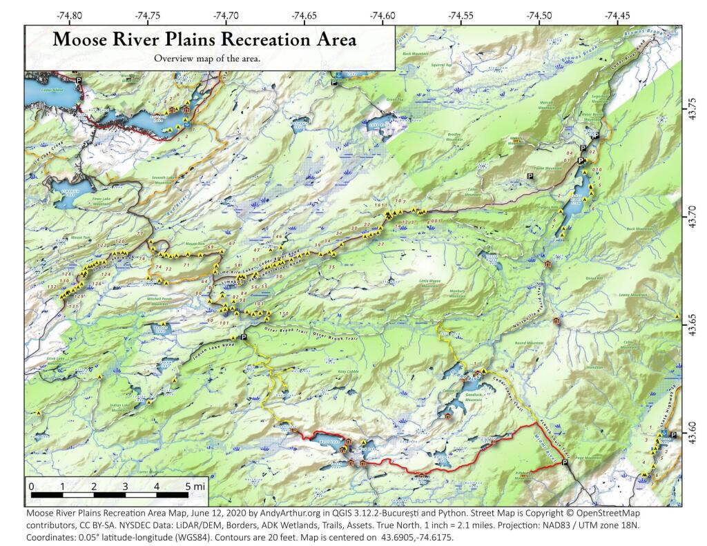
Moose River Plains Campsites

Interactive Map of Lean-Tos and Campsites

An overview map and list of campsites and their locations at the Moose River Recreation Area.

 Moose River Plains Recreation Area

Maps

Campsites

Milepoint Name Feature Notes Access Location
Cedar River Flow 1 Cedar River Flow Tent site on flow Boat 43.702924803151, -74.4871304116533
Cedar River Flow 2 Cedar River Flow Tent site on flow Boat 43.7104737708879, -74.4802343768254
Cedar River Flow 3 Cedar River Flow Tent site on flow Boat 43.7145237017622, -74.4679264444554
Cedar River Flow 5 Cedar River Flow Tent site on flow Boat 43.7111711590583, -74.4675178486588
Cedar River Flow 6 Cedar River Flow Tent site on flow Boat 43.7084767866376, -74.4717703157492
Beaver Lake Campsite Beaver Lake Site overlooks Beaver Lake Hike 43.6516613421651, -74.7407833400961
81 Icehouse Pond Accessible site at Icehouse Pond with privy Hike 43.6646602166505, -74.7029502913239
140A Indian Lake Campsite on Indian Lake, outhouse in bad condition Hike 43.6154753632731, -74.7499942080732
East of Muskrat Pond Indian Lake Trail Former roadside campsite, largely abandoned Hike 43.645116528704, -74.696221627206
46 Lost Ponds Trail Beyond the end of current Lost Ponds Road Hike 43.6868179572109, -74.6655581886723
47 Lost Ponds Trail Above Lost Ponds Hike 43.6859472953826, -74.6722052916864
Mitchell Pond 1 Mitchell Pond Tent site, bushwhack Hike 43.6729475881673, -74.7502538624373
Mitchell Pond 2 Mitchell Pond Tent site, bushwhack Hike 43.6716991892117, -74.7432124817486
64A Mitchell Pond (Accessible Campsite at End of Gravel Trail) Gravel path to site, wildrness privy Hike 43.6706136251028, -74.7387363015355
10 89 Beaver Lake Road Off Otter Brook Road, Sand Plains Vehicle 43.6583112347181, -74.7012491214803
11 90 Beaver Lake Road Off Otter Brook Road, Sand Plains Vehicle 43.6577446555162, -74.7038760912165
16 1 Cedar River – Limekiln Lake Road Driveway Along Tributary of Silver Run Vehicle 43.7033162602551, -74.5742148239156
16 3 Cedar River – Limekiln Lake Road Along Silver Run Vehicle 43.7027301523306, -74.5757742464803
16 4 Cedar River – Limekiln Lake Road Along Silver Run, driveway at Sharp S Turn Vehicle 43.7026421104662, -74.5769731929134
16 7 Cedar River – Limekiln Lake Road Along Silver Run Vehicle 43.7040070126376, -74.5809411044503
15 10 Cedar River – Limekiln Lake Road Old gravel pit, accessible Vehicle 43.7031498027862, -74.5893864145496
15 11 Cedar River – Limekiln Lake Road Across from 12 Vehicle 43.702458607149, -74.5926546451668
15 12 Cedar River – Limekiln Lake Road Across from 11 Vehicle 43.7028667147947, -74.5929833340894
15 13 Cedar River – Limekiln Lake Road Along Silver Run Vehicle 43.7010402113051, -74.5956355707995
15 14 Cedar River – Limekiln Lake Road Along Silver Run Vehicle 43.7010328498576, -74.597457469967
14 16 Cedar River – Limekiln Lake Road Access Road for 16/17/18 Group Vehicle 43.7025294616695, -74.5969885248639
14 17 Cedar River – Limekiln Lake Road Access Road for 16/17/18 Group Vehicle 43.7021028692463, -74.5966599329259
14 18 Cedar River – Limekiln Lake Road Access Road for 16/17/18 Group Vehicle 43.7023846304313, -74.5978818600647
14 19 Cedar River – Limekiln Lake Road Along Silver Run Vehicle 43.7003546491841, -74.5964872856253
14 21 Cedar River – Limekiln Lake Road Across road from Silver Run Vehicle 43.6957217888458, -74.6020563094081
13 22 Cedar River – Limekiln Lake Road Across road from Silver Run Vehicle 43.6935817523545, -74.6036764840587
13 27 Cedar River – Limekiln Lake Road Across road from Silver Run Vehicle 43.6926540634024, -74.6082201775478
13 30 Cedar River – Limekiln Lake Road Open Area in Woods Vehicle 43.6918525577623, -74.6118452191364
13 31 Cedar River – Limekiln Lake Road Near Marsh off Silver Run Vehicle 43.6881856235873, -74.6271629609656
12 34 Cedar River – Limekiln Lake Road Open Field Near Old Sly Pond Road Vehicle 43.6846954329325, -74.634678249126
12 35 Cedar River – Limekiln Lake Road Former Sly Pond Road Vehicle 43.6836690328942, -74.6318552827363
11 38 Cedar River – Limekiln Lake Road On Hill Overlooking Road, near start of Lost Ponds Area Vehicle 43.6836029270341, -74.6401393590772
11 39 Cedar River – Limekiln Lake Road Above CRLLR, start of Lost Ponds Area Vehicle 43.6841476346233, -74.6487511980121
11 40 Cedar River – Limekiln Lake Road Above CRLLR, start of Lost Ponds Area Vehicle 43.682942162164, -74.6537793571789
11 41 Cedar River – Limekiln Lake Road Above CRLLR, start of Lost Ponds Area Vehicle 43.681311345096, -74.6589116717693
10 42 Cedar River – Limekiln Lake Road Above CRLLR, start of Lost Ponds Area Vehicle 43.6799039050817, -74.6646031695507
10 43 Cedar River – Limekiln Lake Road Above CRLLR, start of Lost Ponds Area Vehicle 43.6793727911294, -74.6664156654099
10 44 Cedar River – Limekiln Lake Road West of Lost Ponds Road, Sand Plains Vehicle 43.678808787762, -74.6696555368193
10 50 Cedar River – Limekiln Lake Road West of Lost Ponds Road, Sand Plains Vehicle 43.677986610504, -74.6732025802129
10 51 Cedar River – Limekiln Lake Road Pull-Off, Small Site, Sand Plains Vehicle 43.6775108499728, -74.6750146421403
10 52 Cedar River – Limekiln Lake Road Old gravel pit, short loop below CRLLR Vehicle 43.6748840847288, -74.6815273754233
10 53 Cedar River – Limekiln Lake Road Access Road for 55/54/55 Group, Sand Plains Vehicle 43.6733317629897, -74.6820452615144
10 54 Cedar River – Limekiln Lake Road Access Road for 55/54/55 Group, Sand Plains Vehicle 43.673268538603, -74.6822820352903
9 55 Cedar River – Limekiln Lake Road Access Road for 55/54/55 Group, Sand Plains Vehicle 43.6733705968856, -74.6827076379887
9 56 Cedar River – Limekiln Lake Road Driveway, East of Former Dump, Sand Plains Vehicle 43.673126585883, -74.6891475571674
9 57 Cedar River – Limekiln Lake Road Has Trail to Moose River Vehicle 43.6736673106707, -74.6902687046523
8 64 Cedar River – Limekiln Lake Road Near Mitchell Pond Trail Vehicle 43.6757521870177, -74.707500815672
8 66 Cedar River – Limekiln Lake Road Near Pine Creek Vehicle 43.6784203854214, -74.7068492021325
7 67 Cedar River – Limekiln Lake Road Benedict Creek Road, Wooded Vehicle 43.6851041444828, -74.7031887110586
7 69 Cedar River – Limekiln Lake Road Remote site, perched over the road Vehicle 43.6834516958835, -74.7168906980223
6 70 Cedar River – Limekiln Lake Road Large loop off of CRLLR Vehicle 43.6839906014562, -74.7249870178447
6 71 Cedar River – Limekiln Lake Road Very sandy site near Mitchells Pond Upper Loop Vehicle 43.6833776353921, -74.7321947941391
5 72 Cedar River – Limekiln Lake Road At end of Bear Pond Loop Road (Accessable) Vehicle 43.6828956047277, -74.7359084701559
4 73 Cedar River – Limekiln Lake Road Very sandy site near Mitchells Pond Upper Loop Vehicle 43.6835777053685, -74.7387188889593
4 74 Cedar River – Limekiln Lake Road On a hill overlooking road and marshy area Vehicle 43.6839187521201, -74.742285779317
4 76 Cedar River – Limekiln Lake Road Very sandy site near Mitchells Pond Upper Loop Vehicle 43.6864452702399, -74.7471689344191
4 77 Cedar River – Limekiln Lake Road Near Red River, Bear Pond Loop, Sand Plains Vehicle 43.6897961458669, -74.7484803840413
10 58 Helldiver Pond Road Near Helldiver Pond Vehicle 43.6735979105991, -74.6920316000423
10 59 Helldiver Pond Road Near Helldiver Pond Vehicle 43.6723766419894, -74.6929318681131
10 60 Helldiver Pond Road Near Helldiver Pond Vehicle 43.6713193532923, -74.692758456613
10 61 Helldiver Pond Road Accessible site at end of Helldiver Pond Road Vehicle 43.6705019900204, -74.6921751440693
15 West of Brooktrout Trail Indian Lake Road Past Brooktrout Trail, on a hill over road Vehicle 43.6254538914434, -74.7337300739322
10 48 Lost Pond Road Sand Plains, Marshes Aroubnd Vehicle 43.6814268347573, -74.6667101324338
11 49 Lost Pond Road Sand Plains, Marshes Aroubnd Vehicle 43.6819456385478, -74.6670131106595
10 80 Otter Brook Road Has Trail to Moose River Vehicle 43.6620917920003, -74.7112181918076
11 98 Otter Brook Road Above Moose River on Hill Vehicle 43.6588725644731, -74.6966603409996
11 101 Otter Brook Road Sand Plains Vehicle 43.6564420559443, -74.6938956128147
11 103 Otter Brook Road Sand Plains Vehicle 43.657108724794, -74.6873446316172
12 104 Otter Brook Road Wooded Site Vehicle 43.6560617426567, -74.6832992891923
12 106 Otter Brook Road Wooded Site Vehicle 43.6565121581975, -74.6789913497265
13 110 Otter Brook Road Wooded Site Vehicle 43.6566072628101, -74.6733859460379
13 111 Otter Brook Road Near Otter Brook Bridge Vehicle 43.6539235327721, -74.6747718892435
23 1 Wakely Dam Camping Area Accessible site Vehicle (before gate) 43.7266767212397, -74.474100266424
23 2 Wakely Dam Camping Area Field Camping Vehicle (before gate) 43.7266515010084, -74.4733110730078
23 3 Wakely Dam Camping Area Field Camping Vehicle (before gate) 43.7259595122959, -74.473899965642
23 4 Wakely Dam Camping Area On Driveway to Lake Vehicle (before gate) 43.7260676922081, -74.4742326471903
23 5 Wakely Dam Camping Area On Driveway to Lake Vehicle (before gate) 43.7255637908987, -74.4741751228291
23 6 Wakely Dam Camping Area On Driveway to Lake Vehicle (before gate) 43.7252231337487, -74.4745830371916
23 9 Wakely Dam Camping Area Across bridge Vehicle (before gate) 43.726275356142, -74.4717840349063
23 10 Wakely Dam Camping Area Across bridge Vehicle (before gate) 43.7266308152758, -74.4712600272389
10 82 Otter Brook Road On Moose River Vehicle (driveway) 43.6603083771227, -74.7010353925305
11 84 Otter Brook Road On Moose River Vehicle (driveway) 43.6619962517853, -74.6957783254417
6 120 Natural Rock Dam Road Sand Plains near Red River Vehicle (Opens July) 43.6848543033273, -74.7664253595203
6 122 Natural Rock Dam Road Wooded Site Vehicle (Opens July) 43.684367353989, -74.7717171949716
6 123 Natural Rock Dam Road Wooded Site Vehicle (Opens July) 43.6804228755091, -74.7782951743141
6 124 Natural Rock Dam Road Wooded Site Vehicle (Opens July) 43.6792030487765, -74.7847972548314
7 125 Natural Rock Dam Road Wooded Site Vehicle (Opens July) 43.6783559964111, -74.7880327043169
7 126 Natural Rock Dam Road Wooded Site Vehicle (Opens July) 43.6748535298235, -74.790591643043
7 127 Natural Rock Dam Road Wooded Site Vehicle (Opens July) 43.6739776362472, -74.7910844137006
7 128 Natural Rock Dam Road Wooded Site Vehicle (Opens July) 43.6751413481917, -74.7924842843025
8 129 Natural Rock Dam Road Wooded Site Vehicle (Opens July) 43.6703784784539, -74.7926312803463
8 130 Natural Rock Dam Road Wooded Site Vehicle (Opens July) 43.6666270858056, -74.8019151989726
8 131 Natural Rock Dam Road Wooded Site Vehicle (Opens July) 43.6643581634434, -74.8054154753831
8 132 Natural Rock Dam Road Wooded Site Vehicle (Opens July) 43.6652083016168, -74.8036826184027
5 119A Natural Rock Dam Road Sand Plains near Red River Vehicle (Opens July) 43.6844716021433, -74.7646961785253
6 123A Natural Rock Dam Road Wooded Site Vehicle (Opens July) 43.6802422604152, -74.782965042166
6 124A Natural Rock Dam Road Wooded Site Vehicle (Opens July) 43.6785899888224, -74.7864319884685
6 125A Natural Rock Dam Road Wooded Site Vehicle (Opens July) 43.6776017274889, -74.7902229325712
7 126A Natural Rock Dam Road Wooded Site Vehicle (Opens July) 43.6756110574941, -74.7901645681643
8 129A Natural Rock Dam Road Wooded Site Vehicle (Opens July) 43.6689370211979, -74.7948887917477
8 129AA Natural Rock Dam Road Wooded Site Vehicle (Opens July) 43.6674497436753, -74.7980604042935
8 130A Natural Rock Dam Road Wooded Site Vehicle (Opens July) 43.6661052974262, -74.8016557609016
8 130AA Natural Rock Dam Road Wooded Site Vehicle (Opens July) 43.6669094078356, -74.8007390664074

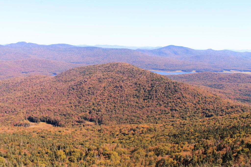
Payne Mountain with Cedar River Flow Beyond It

Camping Areas in Southern Adirondacks

Camping Areas in Southern Adirondacks โ›บ

East Branch of Sacanadaga River, NY 8 – Roughly 10 campsites along NY 8. These are easily accessed throughout the year, as the road is plowed except when the snow banks are high during the winter. East Branch is not good for fishing due to wide variance in water levels, however there are some nice pools in sections of river for summer swimming. Lots of road noise. Some of the sites have cell service. Nearby locations include Cod Pond, East Branch Trail and Kibby Pond Trail.

Edick Road – There are a handful of very hidden campsites off of Edick Road. This road may be closed to vehicles due to wash outs autumn 2019, but worth a walk to explore this area.

Fawn Lake – A 1/2 mile hike back to a scenic lake ringed by primitive campsites outside of Lake Pleasant. Two miles beyond it is the scenic Willis Vly, which doesn’t have developed campsites but it’s remote wilderness where you might see a Moose or other wildlife.

Garnet LakeTent sites, some with drive-up access along the lake. No cell service, much of the upper road here is not maintained in the winter. Popular in the summer, no cell service.

Good Luck Lake – Scenic lake off of the West Branch Sacanadaga River that is ringed with tent sites that can be walked in from the Good Luck Lake parking area area or paddled in.

Hope Falls Road – Two or three campsites along the end of Hope Falls Road, some are drive-in only tent sites. Near the Tenant Creek Falls Trail. No cell service. Open June to autumn snowfall.

Harrisburg Road – There is a set of very rustic designated campsites along the rough Harrisburg Road past Harrisburg Lake. Somewhat near Crane Mountain, a couple mile hike to and Wilcox Lake. No cell service.

Lester Flow and Cheney Pond – Scenic lake that is popular for paddling. The 1/2 mile road down from Boreas Road as of June 2020 is closed due to washouts. Tent sites exist along the lake, along with one drive-to site on the road down there.

Mason Lake – Small lake located about 10 miles north of Speculator and 5 miles south of Lewey Lake that has several tent and drive-in campsites along it’s shore. Good to fair cell service here. Nice to hear loons, one of the best bass ponds in the area.

North Lake Reservoir – There are roughly 15 campsites on the east shore of North Lake Reservoir. Popular place in the summer, regularly staffed by conservation students. Noise from motorboats. No cell service. Nice if you want to camp right on water, hear loons at night..

Northwood Club Road – In Minerva, this road crosses the Boreas River and has several roadside campsites, and passes by Huntley Pond, the NL Tahawus Railroad (which can be hiked to the Boreas River at Hudson River), and the Blue Ledges on the Hudson tailhead.

Perkins Clearing – Conservation easement lands. Good to fair cell service here. Great place for hunting and wildlife observation as it’s mixed timber country. Near Mason Lake, Speculator, Pillsbury Mountain and Cedar Lakes.

Piseco-Powley Road – A dozen campsites along a 13 mile road with short hikes including Big Alderbed, House Pond, Sand Lake and the popular Potholers/Brayhouse Brook waterfall for swimming. As of June 2020, road is closed in Stratford/Fulton County portion, road is open north of Potholers/Brayhouse Brook (access via Piseco). Very limited cell service here.

Pumpkin Hollow Road – Three campsites above Willis Lake. Remote country except for the site on Willis Lake, no cell service. On the Willis – Wilcox Lake Trail. Very quiet area. Open June to autumn snowfall. No cell service here.

Rockwood State Forest – Three campsites along the end of Church Road which can be accessed by driving past the cemetery in the hamlet. Scenic lake, good fishing. Cell service available, but bring a trash bucket and gloves as litter can be a problem. Nice trails to stroll around in the old Rockwood Estate.

Stewart Landing – There are four campsites on a rough road that loops off of Stewart Landing Road. Popular area in the summer, Canada Lake is great for paddling and informal swimming. Also consider hiking back to Hilderbrandt Vly and Glassgow Lake from here. Moderate to poor cell service here.

Vanderwhacker Road -Five or six campsites exist along Vanderwhacker Road, which can be muddy in the spring and icy in late autumn. Additional designates campsites exist near where NY 28N crosses the Vanderwhacker River. Near the trail to the Vanderwhacker Firetower, No cell service.

White House, Wells – A grouping of 5 or 6 campsites at the end of White House in West River Road. Scenic area, old camp, with fields and a chimney. Campsites are kind of close together, not a wilderness experience. Near the North Country Placid Trail, lots of blueberries in mid-summer. No cell service. Open June to autumn snowfall.

Woodhull Lake Reservoir – Off of NY 28 in McKeevers, about 10 miles south of Old Forge. Not only is this beautiful reservoir to paddle, there are some campsites along the shore, with drive-to campsites along Wolf Lake Landing Road which leads to it. Part of Wolf Lake Landing Road is erroded, but other parts are fresh stone-dust. It’s remote wilderness but there good cell service in mcuh of the area.

September 23, 2019 Morning

Good morning! Happy Autumn ๐Ÿ‚! Back to work, I have ethics training, lucky me. Whatever that advertising at the bus stop said. It’s important not to be indicted for a crime due to ethic violations, because it can be hard to buy guns for hunting when you have an outstanding warrant. Three weeks to Columbus Day ๐Ÿ›ฅ๏ธ. Partly sunny and 74 degrees in Delmar, NY. There is a south breeze at 9 mph. ๐Ÿƒ. The dew point is 64 degrees.

Today will be scattered showers and thunderstorms after noon. I brought my rain coat. Might be wet later and certainly warm. โ˜” Partly sunny ๐ŸŒž, with a high of 85 degrees at 1pm. 16 degrees above normal. Maximum dew point of 66 at 3pm. Southwest wind 9 to 13 mph, with gusts as high as 23 mph. Chance of precipitation is 40%. New rainfall amounts of less than a tenth of an inch, except higher amounts possible in thunderstorms. A year ago, we had mostly sunny skies in the morning with a few breaks of sun the afternoon. The high last year was 66 degrees. The record high of 97 was set in 1895.

The sun will set at 6:51 pm with dusk around 7:19 pm, which is one minute and 47 seconds earlier than yesterday. ๐ŸŒ‡ At sunset, look for rain showers ๐ŸŒง and thunderstorms ๐ŸŒฉ and temperatures around 73 degrees. The dew point will be 65 degrees. There will be a west-southwest breeze at 7 mph. Today will have 12 hours and 8 minutes of daytime, an increase of 2 minutes and 52 seconds over yesterday.

Tonight will have showers and thunderstorms likely before 1am, then a slight chance of showers between 1am and 2am. Mostly cloudy ๐ŸŒง, with a low of 58 degrees at 6am. 10 degrees above normal, which is similar to a typical night around August 30th. Maximum dew point of 65 at 6pm. West wind 6 to 8 mph. Chance of precipitation is 60%. New precipitation amounts between a tenth and quarter of an inch, except higher amounts possible in thunderstorms. In 2018, we had cloudy skies in the evening, which became mostly clear by the early hours of the morning. It got down to 46 degrees. The record low of 27 occurred back in 1963.

A picture perfect weekend on tap. ๐Ÿ˜Ž Saturday, mostly sunny, with a high near 77. Maximum dew point of 57 at 4pm. Sunday, partly sunny, with a high near 76. Maximum dew point of 58 at 1pm. Typical average high for the weekend is 67 degrees.

No camping this weekend. I want to get Mr. Sqweak checked out before I hrd back out to the wilderness. Plus I should save money, ๐Ÿ’ต get packed up and ready for vacation. I need to research camping opportunities in Jefferson National Forest in Southern West Virginia. I just need a week off before I spend nine or ten days traveling. ๐Ÿš™

Mr. Sqweak Sqweak. ๐Ÿ Big Red is getting looked at next Tuesday. The first appointment I could get at the dealership was Saturday and I doubt a local shop ๐Ÿช could work on it before then. Or they’d want to work on it Friday and it would get stuck in the shop all weekend. I haven’t heard back from shop yet about my online appointment but they’ll call ๐Ÿ“ž today. I did get an email from Onstar saying that the system detected a maintenance issue but I’m not sure if that was because I filed ๐Ÿ“‚ an online request for service. I expect that I’ll be able to pick it up the same day.

Price Chopper Garbage Bags. The other day when I went to the store I ended up buying black garbage bags at Price Chopper. ๐Ÿšฎ I’m quite happy with them. ๐Ÿ˜Š They don’t seem to rip as much as the cheaper bags when I smash down the garbage. As I either burn or it in the woods or pay two dollars ๐Ÿ’ต a bag at the transfer station, you really need to smash it down as much as possible. As I compost, and at left recycle the cans and glass (and paper separately), I can take the trash to the outside can once a month or less after compaction with my boots.

Litter in the back country. It seems like since they’ve added the picnic tables and outhouses to the campsites on Pisceo-Powley Road litter has become a bigger problem. ๐Ÿšฎ More cans and just miscellaneous stuff. I will burn and pack out what’s reasonable in my campsite but I’m not going clean the whole area up. This one campsite I visited putting my kayak in to the East Canada Creek somebody had left doughnuts and a fire smoldering full of debris. ๐Ÿ’ญ I don’t care if people burn packaging ๐Ÿ”ฅ but people should take home and recycle โ™ป what doesn’t burn.

Credit card and vacation. ๐Ÿ’ณ I figured out that the expenses I have for vacation will fall onto the November card payment so I’ll have a few paychecks before then to build up savings to pay it. And I don’t expect vacation to be more than $500 and probably less, depending on gas prices and how many nights I stay at developed campgrounds probably mostly just for a shower ๐Ÿšฟ.

As previously noted, there are 3 weeks until Columbus Day ๐Ÿ›ฅ๏ธ when the sun will be setting at 6:15 pm with dusk at 6:43 pm. On that day in 2018, we had mostly sunny and temperatures between 59 and 40 degrees. Typically, the high temperature is 61 degrees. We hit a record high of 81 back in 1920.

Helldiver 3

The Weekend that Was

Saturday was an action packed day but a good one. I started the day pretty early with the Save the Pine Bush Bird Hike and Neil Reilly did not disappoint. I wish I had some better glass. I got to invest in some binoculars. And a good bird book. ๐ŸฆNeil helped me learn a lot of birds but will I remember them all? I really need to learn more about the flora and fauna I’m observing in the wilderness. It would help with hunting too, especially if I eventually get into big game when I own my own land. ๐Ÿ”ญ

I bought a spatula at the Hannaford in Esperance. Forgot mine at home. $10 with tax seemed pricey but I figured hopefully this all metal one will hold up. ๐Ÿด Then I can keep the big camp spatula for my camping supply box and use the other one at home. Unlike some of the spatulas I’ve previously owned this one is a single piece of metal so it’s less likely to break at the weld like some of the other I own. I burn a lot of food so I break a lot of spatulas scraping pans. ๐Ÿณ But now I have a camp and a home one and hopefully the home one lasts a long time.

Moss Island was fun but the colors were just changing and it’s the third time I’ve been there so it’s less interesting now. Still a nice hike, as was doing some of the Erie Canal Trail through the deep railroad cut. ๐Ÿšถ Japanese Knotweed is really taking over part of the gorge though. That invasive species is everywhere these days it seems. ๐ŸŒพWent out for a short paddle on the Mohawk River from Little Falls past Moss Island to the old Fink Basin Bridge foundation. ๐ŸŒ‰ It’s hard to spot the foundation at this point because the Japanese Knotweed is all over it. Needless to say, I’m very concerned about the Japanese Knotweed taking over everything. When they were pumping out the lock, the water Goya bit choppy but I was far enough away not to be real impacted. That Lock 17 drops 40 feet so it’s a pretty big lock with a lot of water to move downstream.

Leaving the Pine Bush hike I was a bit concerned about the squeak that was coming from the rear wheel of my truck. ๐Ÿšš It sounded like a brake noise because it changed when I applied the brakes. But they’re working fine and after a few good hard applies of the brakes they’ve mostly gone away. Think it’s either mud or maybe just glaze that’s built up from last week overheating the brakes heading down through Durham. Should have used a lower gear heading down the hill. Heading towards Stratford I smelled somebody burning their garbage and thought it might be the brakes but the smell went away after driving past their farm. Hillbilly incense getting me all upset. If y’all going to burn your plastic garbage, at least burn it in a hot fire so it don’t stink. ๐Ÿ”ฅ I checked, rotators aren’t warm and aren’t dragging – and after a few hard braking the noise is mostly gone. But it’s concerning enough I scheduled an appointment to have it looked at. Pretty sure it’s just the drum brake mechanism is acting up.

Driving up to Pisceo-Powley Road from Little Falls I stopped and got some sweet corn ๐ŸŒฝ and tomatoes. ๐Ÿ… I then stopped at Green Acres Drive In and got Pumpkin Ice Cream ๐Ÿฆ๐ŸŽƒ which I swear the cream was a bit rancid. It was okay but I don’t think I’d get end of the season ice cream again from them.

I ended up camping at campsite five at Pisceo-Powley Road. โ›บ They cut up the tree that fell during that severe thunderstorm that came through โšก that mid August long weekend that I delayed my entry to avoid. I’m glad I missed that storm a lot of branches came down around this campsite but the DEC did a nice job cleaning up around the site. I like that campsite a lot because it’s remote and I can listen to music, ๐ŸŽถ shoot guns ๐Ÿ”ซ and burn whatever I want without bothering folks. ๐Ÿ”ฅJust like when I own my own land. No neighbors, no rules. ๐Ÿ“ But that doesn’t mean I’ll trash my own land. That said finding burnt out of aluminum cans wasn’t cool. I flattened them and will take home for recycling. It your going to burn stuff in the woods at least pack out what doesn’t burn completely. ๐Ÿšฏโ™ป Outhouse seat also seemed like somebody broke it. A shame, the outhouse is only a year old. Still works but the wood in the seat is cracked. ๐Ÿ’บ

The storm in August meant there was quite a bit of dead and down wood around camp. I had plenty for the fire. I always try to get wood a bit farther away from camp to save the close-by wood for other campers who get here late or myself for that matter. ๐ŸŒฒ

Setting up camp went well but I discovered that I spilled bleach and water in my truck bed. Ruined another pair of jeans ๐Ÿ‘–. Ducks but I needed more jeans to wear on casual days to work. I can wear the bleached pair of jeans at home. Made some sweet sausage ๐Ÿฃand mashed potatoes for dinner – along with sweet corn ๐ŸŒฝ. I wanted to make angel hair pasta ๐Ÿ˜‡ with dinner but I forgot to pack butter.

Sun sets early this time of year but I had the mess cleaned up in my truck, dinner cooked and the lights strung by dark which occurred relatively late in the woods on this very clear day. ๐ŸŒ‡ Still it was pitch black before 7:30 which made for a long night but with the two batteries powering the lights it wasn’t a big deal. I got things done that needed to be done by then including getting a fire going. ๐Ÿ”ฅ Got cold and put the hoodie and long pants on. Even with the warm weather it gets cold at night. With the long night, I was shocked ๐Ÿ˜ฒ how quickly I drank the six pack I brought. ๐Ÿป I wasn’t trying to get drunk but I made a lot of beer dissappear quickly. Oh well, I must have been thirsty and I slept it off. Minor hang over this morning.

This morning was quite nice I had eggs ๐Ÿณ and sausage along with coffee. โ˜• It was a cold start but it warmed up relatively quickly. I ended up hanging out in the warm sun for a while, listening to the radio ๐Ÿ“ป for a while and then swinging in the hammock while working on some blog posts.

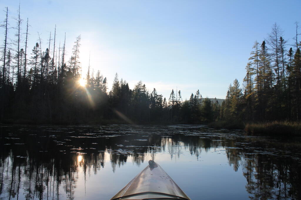
Midday I went for a kayak paddle down the East Canada Creek ๐Ÿšค and it was quite colorful and quiet out on the creek. Water levels were pretty low. But I made it over the beaver dam and the leaves were nice. ๐Ÿ Didn’t bother with the fishing pole as I’ve never had much luck fishing there. Spent a little time at the potholers but it was quite cold and the sky had clouded up and it was getting late.

I got home, unpacked and scheduled an appointment for next week to have my truck looked at.๐Ÿ”ง The noise seems to come and go but I think it’s getting worse so I should get it fixed. I’ll probably stay in town next week because I need to save money ๐Ÿ’ต and I also I don’t want something to break while I am out of town.

I’ll post more photos ๐Ÿ“ท and videos ๐ŸŽฅ throughout the week.

South Mountain