Search Results for: photo camp here sign

Camping Only At Designated Sites

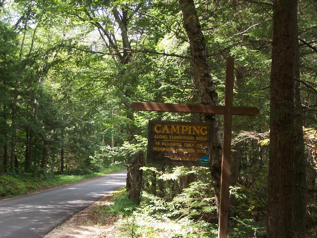
This sign is found along the beginning of Floodwood Road, prior to the blacktop running out. There are 15 sites, that appear not to be fully used, on this lake.

Taken on Saturday August 14, 2010 at Floodwood Road.

Lost Pond

Exploring Lost Pond at the Charles Baker State Forest off Truck Trail 4. There is a drive in campsite designated at the trailhead with a camp here logo. 

Taken on Monday January 16, 2023 at Charles Baker State Forest.

Campfire

While there are semi-developed, designated tent-campsites along the Evergreen Pond on Scoville Road Pond, I decided I wanted to get away from the road and camp more in the back country when I was hunting up at Rattlesnake WMA in 2016.

Taken on Wednesday November 16, 2016 at Ossian State Forest.

North Lake Reservoir Camping πŸ•

North Lake Reservoir Camping πŸ•

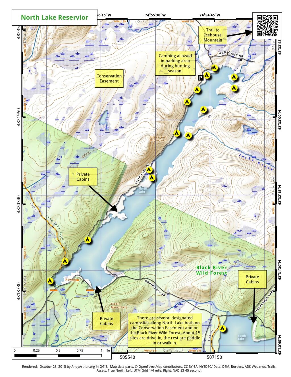
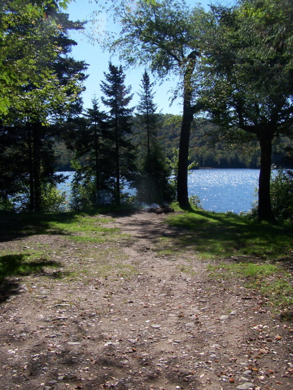
16 1/2 miles and 30 miles north of Forestport, the North Lake Reservoir serves as the headwaters to the Black River in a large reservoir maintained by the NYS Canal Authority for supplying a steady supply of water to Black River and Erie Canal via the former Black River Canal. Half of sites are on Black River Wild Forest, while most of the northernly sites are on a conservation easement. There is a sign-on booth for these campsites, permits are needed for stays over three nights. These are primitive campsites, though some of the sites along the eastern side, are accessible by a vehicle with a smaller camper on top. Boats with motors are allowed on this lake, so in summer months it may be not a quiet water. Most sites are on the water.

Interactive Map of North Lake Reservoir

Printable Map of North Lake Reservoir

 North Lake Reservior

Coordinates of North Lake Reservoir Campsites

Easement campsites are based on memory and were hand-drawn so they may be somewhat inaccurate.

Name Latitude Longitude
North Lake Designated Campsite #2 43.52293019 -74.94933889
North Lake Designated Campsite #3 43.52335381 -74.94934207
North Lake Designated Campsite #4 43.52506095 -74.94695943
North Lake Designated Campsite #6 43.52569387 -74.94579628
North Lake Designated Campsite #7 43.52600551 -74.94534407
North Lake Designated Campsite #8 43.52775406 -74.94410338
North Lake Designated Campsite #9 43.52800073 -74.94327684
North Lake Designated Campsite #10 43.52898888 -74.94247143
North Lake Designated Campsite #11 43.52977988 -74.9403576
Easement Campsite 43.61254681 -75.05263918
Easement Campsite 43.51529059 -74.90967
Easement Campsite 43.48088879 -75.01092893
Easement Campsite 43.54038222 -74.92580987
Easement Campsite 43.61805247 -75.03272826
Easement Campsite 43.61368033 -75.09087559
Easement Campsite 43.61053007 -75.02701572
Easement Campsite 43.58885404 -74.999126
Easement Campsite 43.59254977 -75.0887635
Easement Campsite 43.59171534 -75.00692959

Campsite on Pensuila


Loon with Chicks

Sugar Hill State Forest Campsite Coordinates πŸ• 🐎

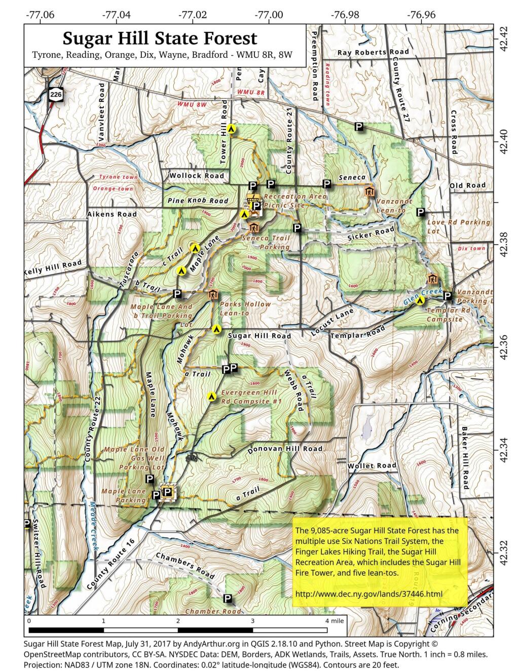
Explore this webpage for comprehensive maps and campsite listings within Sugar Hill State Forest, situated in the Finger Lakes region near Watkins Glen. Renowned for its equestrian trails and mountain biking possibilities, this forest also intersects with the Finger Lakes Trails.

Equipped with coordinates and interactive maps, this invaluable resource assists in pinpointing free camping sites within this area. Uncover more about the region to enhance your exploration, ensuring a memorable experience amid its natural beauty. From the allure of equestrian trails to the thrill of mountain biking routes and the Finger Lakes Trails, Sugar Hill State Forest offers a diverse range of outdoor activities for all to enjoy.

Free campsites are available for stays of up to 3 nights. Simply register on-site by signing the log book. For longer stays of 4 to 14 nights, contact the DEC Region 8 Bath Office during their operating hours (M-F, 8:30 AM – 4:30 PM) at (607) 622-8282 or region8@dec.ny.gov to request a free permit.

Here are the coordinates to the campsites.


NameDescriptionNotesLatitudeLongitude
1 Tower Area Campsite#1 42.3868508079723-77.0033564547783
2 Tower Area Campsite#2 42.3866442287727-77.0033822152506
3 Tower Area Campsite#3 42.3864639920396-77.0033635495228
4 Tower Area Campsite#4 42.3862833428498-77.0033685808509
6 Tower Area Campsite#6 42.386387348997-77.0029946864047
7 Tower Area Campsite#7Water Spigot42.3862370801033-77.0029985287376
8 Tower Area Campsite#8 42.3861734193137-77.003166784239
9 Tower Area Campsite#9 42.3865302803854-77.0027707543571
10 Tower Area Campsite#10 42.3861779212511-77.0028177471854
11 Tower Area Campsite#11 42.3864896808166-77.0025428626279
12 Tower Area Campsite#12 42.386122136377-77.0026163066674
13 Tower Area Campsite#13 42.3865438057378-77.0022831123144
14 Tower Area Campsite#14 42.386195258838-77.0023742768928
15 Tower Area Campsite#15 42.3860849947623-77.0021918714237
16 Tower Area Campsite#16 42.3860541128779-77.0019473250332
17 Tower Area Campsite#17 42.3860671182971-77.0017515936378
18 Tower Area Campsite#18Water Spigot42.386226464603-77.0016855292304
19 Tower Area Campsite#19Water Spigot42.3865569715304-77.0017003446791
20 Tower Area Campsite#20Water Spigot42.3866767087554-77.0017063052538
21 Tower Area Campsite#21Water Spigot42.3869433342594-77.0017190894415
22 Tower Area Campsite#22 42.3868316308635-77.0011615867452
23 Tower Area Campsite#23 42.3865865191587-77.001106379471
24 Tower Area Campsite#24 42.3863193084256-77.0012185947968
25 Tower Area Campsite#25 42.3861742601053-77.0012894260423
26 Tower Area Campsite#26 42.3860963967437-77.0015391367911
27 Tower Hill Cmpsite#27 42.3907655427657-76.9988721092714
28 Tower Hill Rd Campsite#28 42.3910797321534-76.9837920975243
29 Cr 23 Campsite#29 42.4023570878519-76.9758496629551
30 Tower Hill Rd Campsite#30 42.3902721886657-77.0028807356518
31 Tower Hill Rd Campsite#31 42.3904413584792-77.0036125118773
32 Seneca North Campsite#32 42.3847576397127-77.0052625526894
33 Maple Lane Campsite#33 42.3779066686613-77.0179033333715
34 Maple Lane Campsite#34 42.3734853366746-77.0214073314773
35 Maple Lane Campsite#35 42.3690875961503-77.0223501994882
36 Sugar Hill Road Campsite#36 42.3623013335723-77.0118293336207
37 Spencer Pond Campsite#37 42.4016911747852-77.0084235506782
38 Evergreen Hill Road Campsite#38 42.3547490565555-77.0073917279777
Cr 21 Campsite  42.3843480264464-76.9922894964248
Evergreen Hill Rd Campsite #1  42.3491716695934-77.0127316661659
Lower Evergreen Camping  42.3304466927625-77.0236097240433
Randall Road CampsiteLog Landing 42.3412383335045-77.0695449989935
Switzer Hill Road Campsite #2Log Landing 42.3406636026594-77.0649210396798
Templar Rd Campsite  42.3688377042101-76.9587191825894
Photo #21238
Photo #2241


North Up to Piseco-Powley

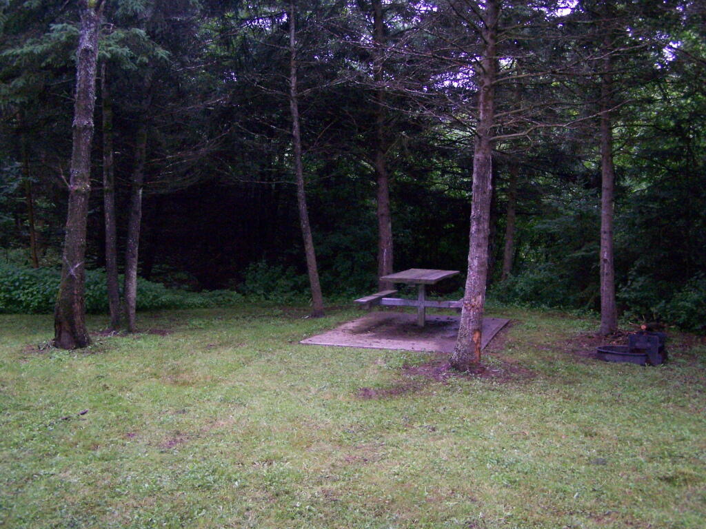
All along this area are designated campsite "pull-off" areas with little more then a stone fire rings cobbled together by previous users. Still, simple but beautiful. It's very flat around here.

Taken on Monday September 6, 2010 at Piseco-Powley Road.

Streeter Lake Road Campsites πŸ•

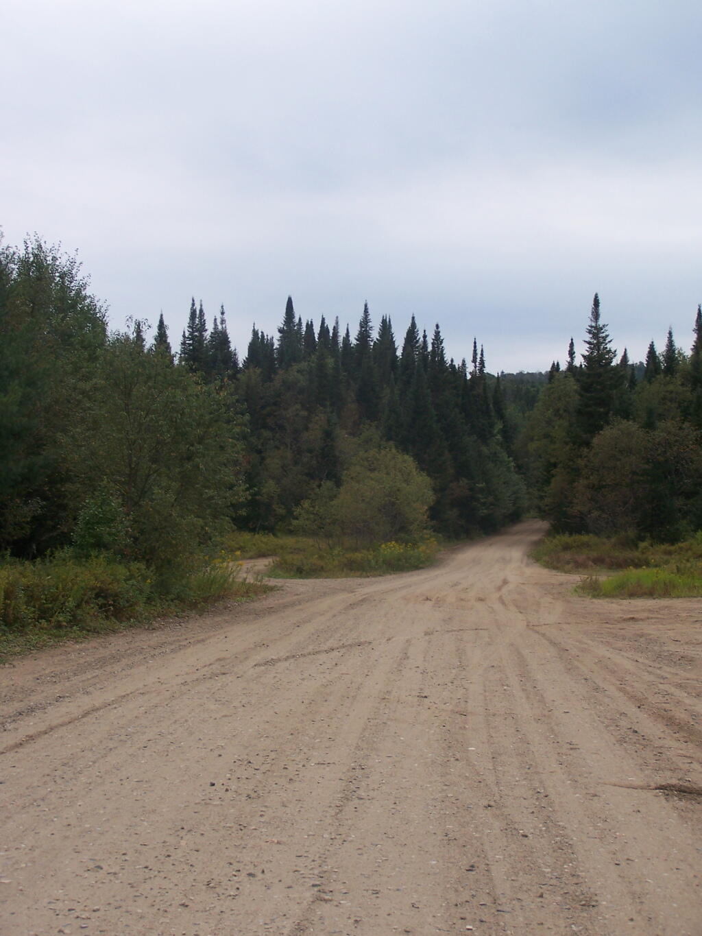
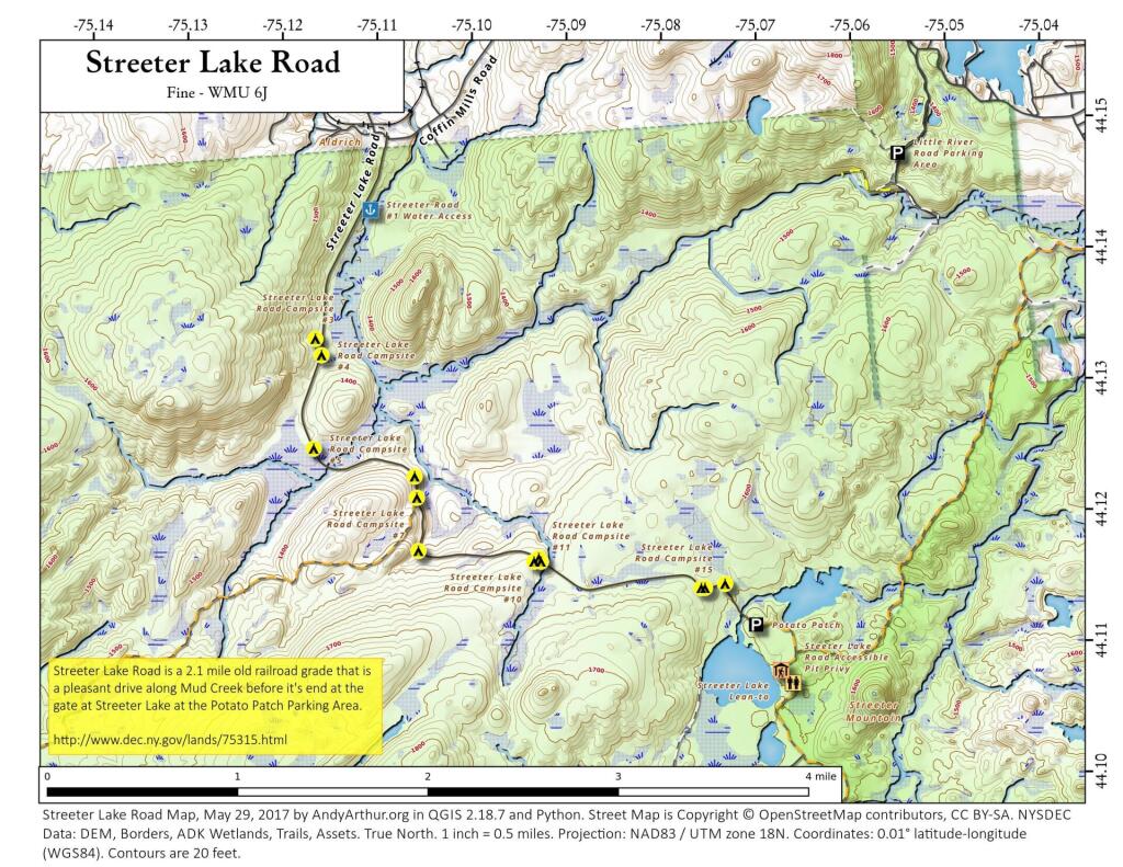
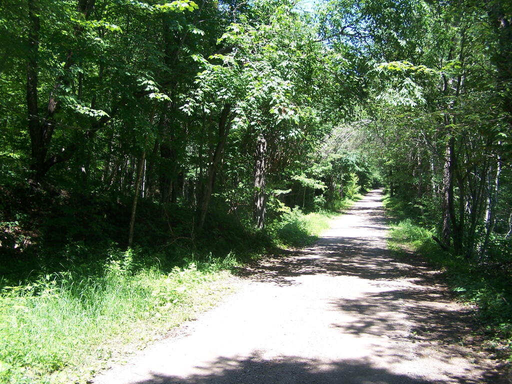
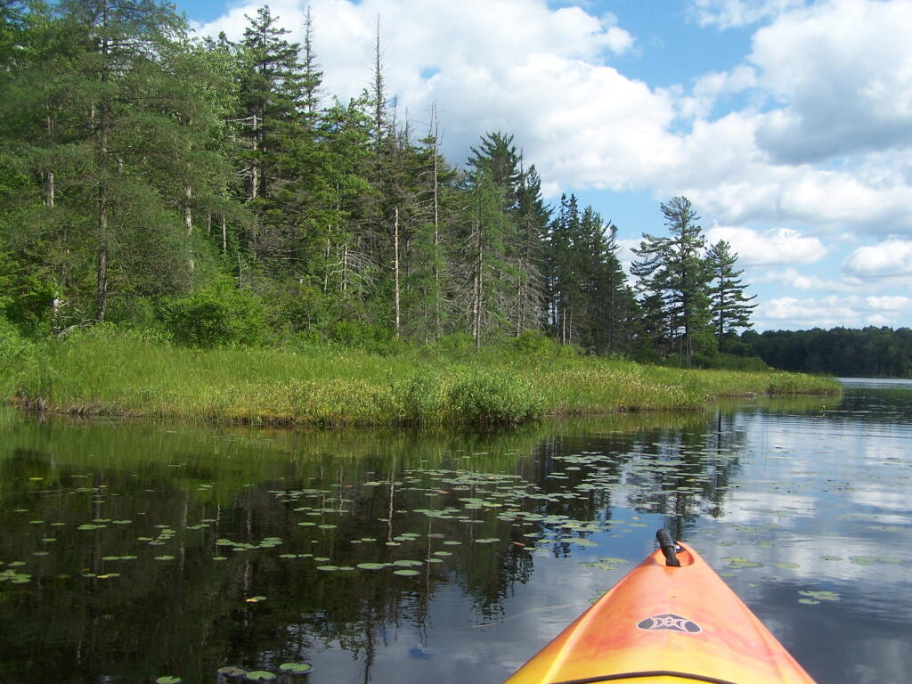
Outside of Aldrich on Streeter Lake Road – Coffin MIlls which is somewhat near Fine/Cranberry Lake in the Northwestern Adirondacks there is an old railroad grade, which has been converted to a seasonal use road that has designated campsites. Below is an interactive map, printable map and coordinates of campsites along Streeter Lake. There also is an accessible lean-to on Streeter Lake that can be accessed via an old woods road that is gated.

Interactive Map of Streeter Lake Campsites

Printable Map of Streeter Lake Campsites

 Streeter Lake Road

Coordinates of Streeter Lake Campsites

Site Name Latitude Longitude
South Creek Lake Campsite 44.11950576 -75.21758162
Streeter Lake Road Campsite #3 44.13290699 -75.11651895
Streeter Lake Road Campsite #4 44.13166278 -75.11586181
Streeter Lake Road Campsite #5 44.12453565 -75.11668416
Streeter Lake Road Campsite #6 44.12242374 -75.10600006
Streeter Lake Road Campsite #7 44.12080268 -75.1057593
Streeter Lake Road Campsite #8 44.11675172 -75.10559364
Streeter Lake Road Campsite #9 44.11621594 -75.09286154
Streeter Lake Road Campsite #10 44.11594906 -75.09336638
Streeter Lake Road Campsite #11 44.1159473 -75.09263011
Streeter Lake Road Campsite #12 44.11395065 -75.07568443
Streeter Lake Road Campsite #14 44.1139566 -75.0752919
Streeter Lake Road Campsite #15 44.11426673 -75.07316784

Streeter Lake Road

Heading Out on Streeter Lake