SUNY Plattsburgh 1995-2020
A series of aerial photos showing downtown Plattsburgh and college campus over the years.
A series of aerial photos showing downtown Plattsburgh and college campus over the years.
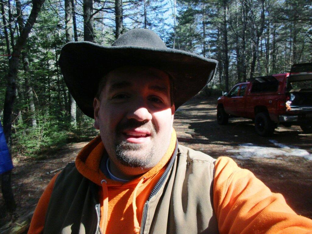
Two years ago, my first camping trip of the year was along the East Branch of the Sacanadaga River at an old house site that has been long used as a designated campsite. Even camping in late April, there was still a fair bit of ice and residual snow left.
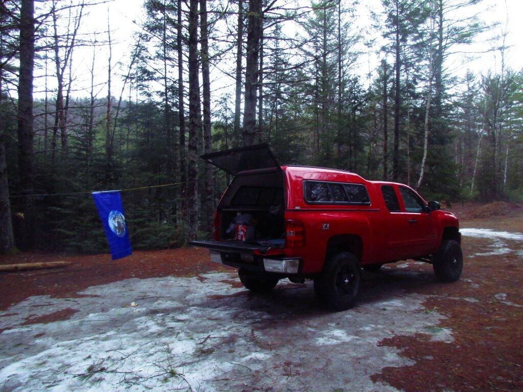
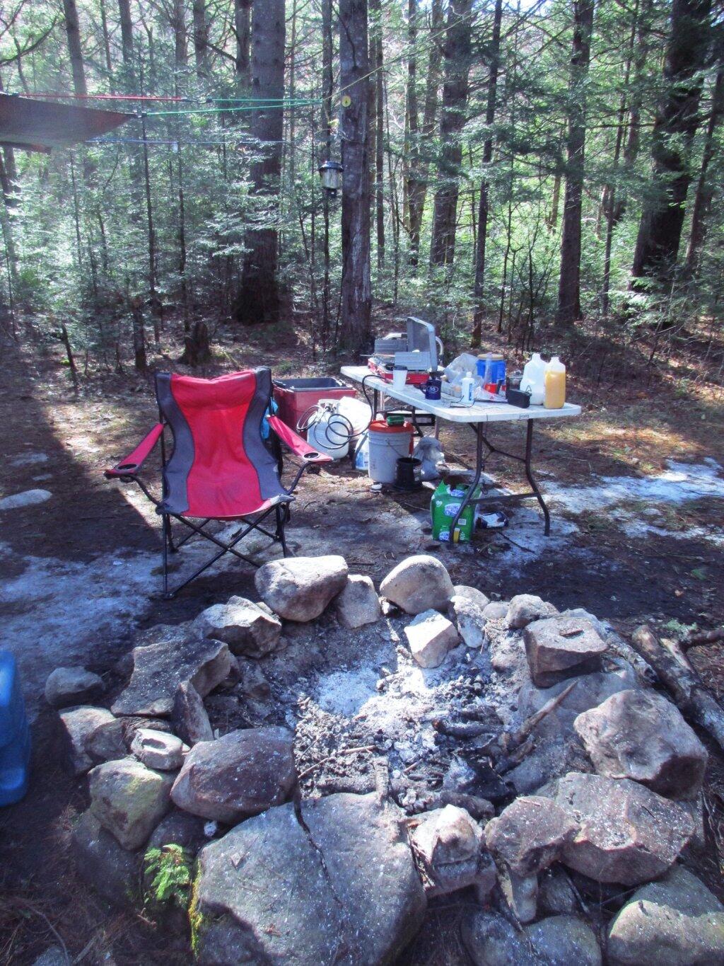
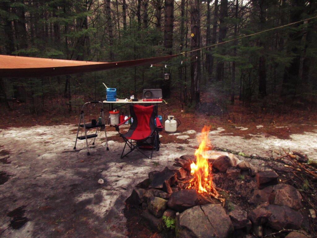
The first night it drizzled a bit, so I bought a tarp and strung it up. Later in the evening it tapered off. I brought some wood and starting fluid, so it got a good fire going quickly, and it wasn’t too bad.
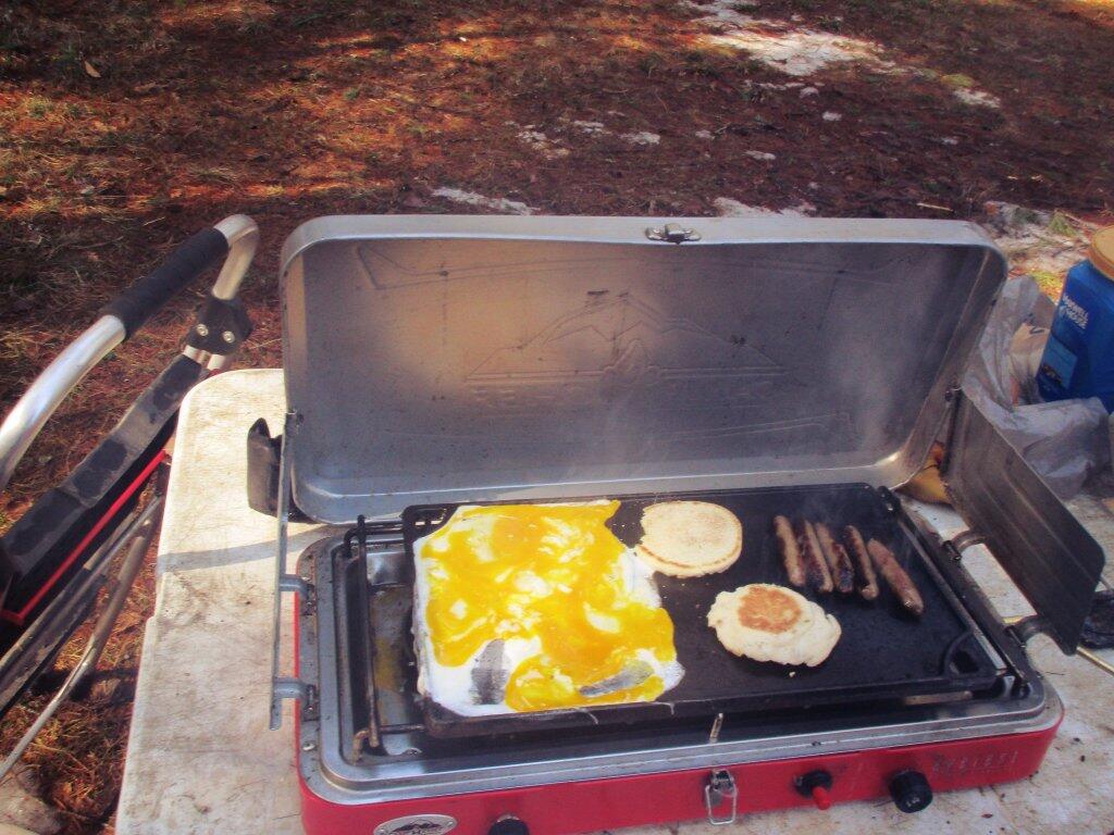
It got nice by morning, and I cooked up a pretty good breakfast on the griddle.
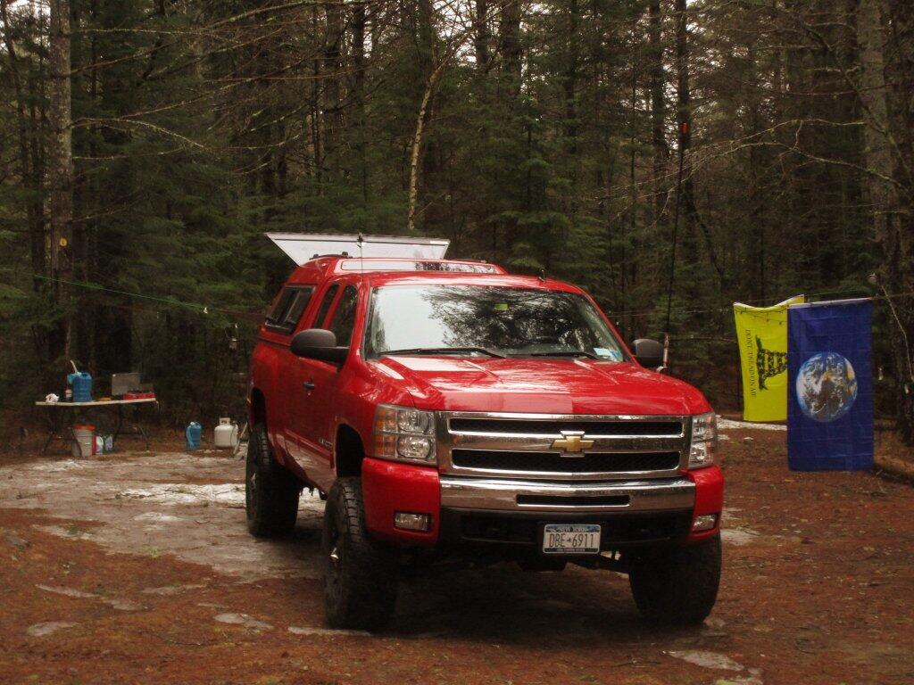
No complaints about the sun after all rain and dampness the previous night.
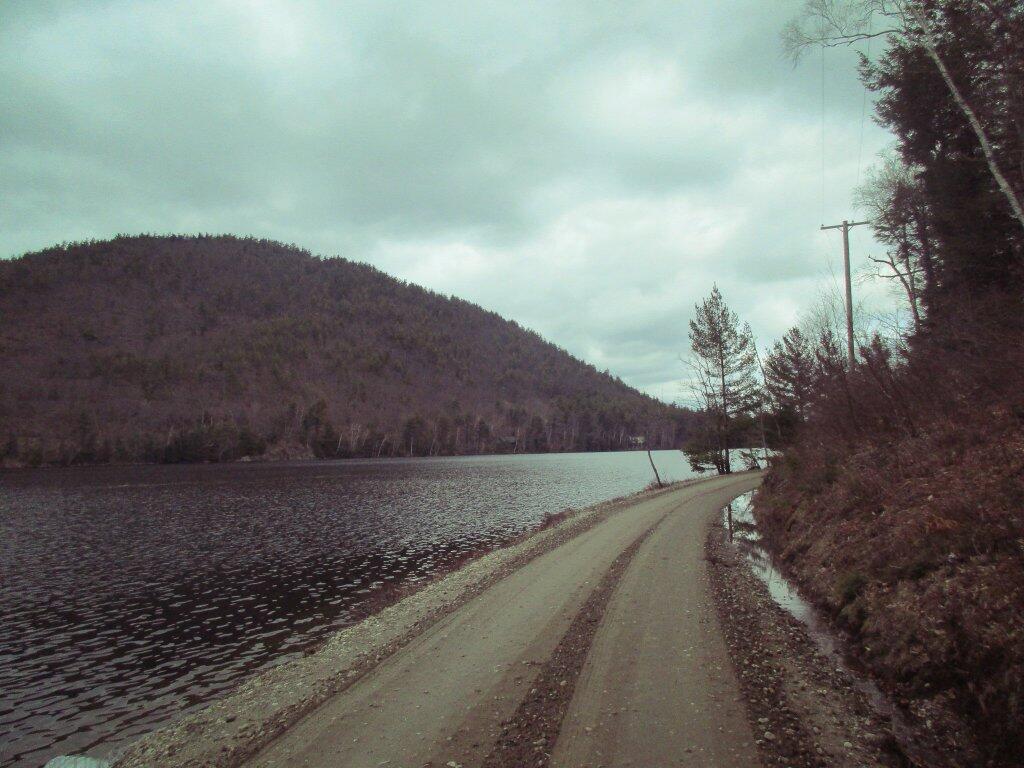
The first day, I drove over to Garnet Lake.
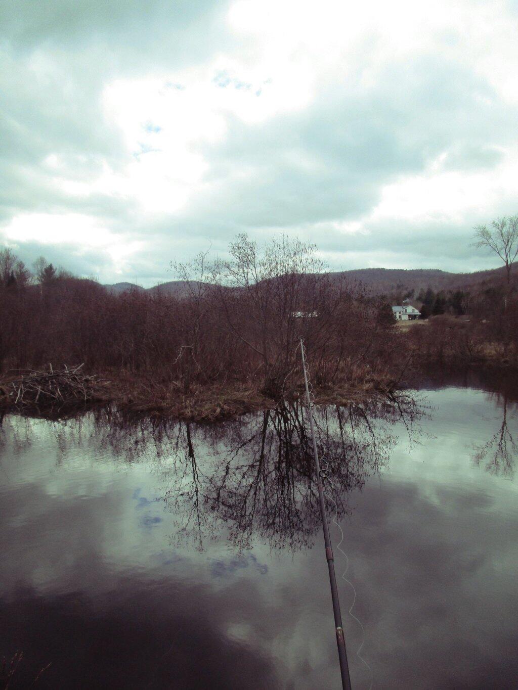
And did some fishing, without much luck in Mill Creek.
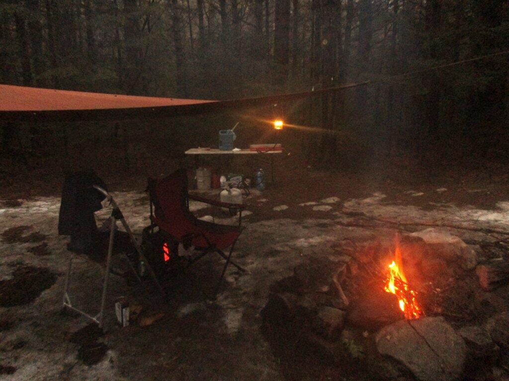
I got back to camp and cooked up some burgers.
The following night I had a nice little fire.
Then retired to my well lit truck cap.
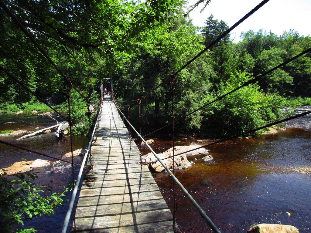
The next day, I hiked back to Auger Falls.
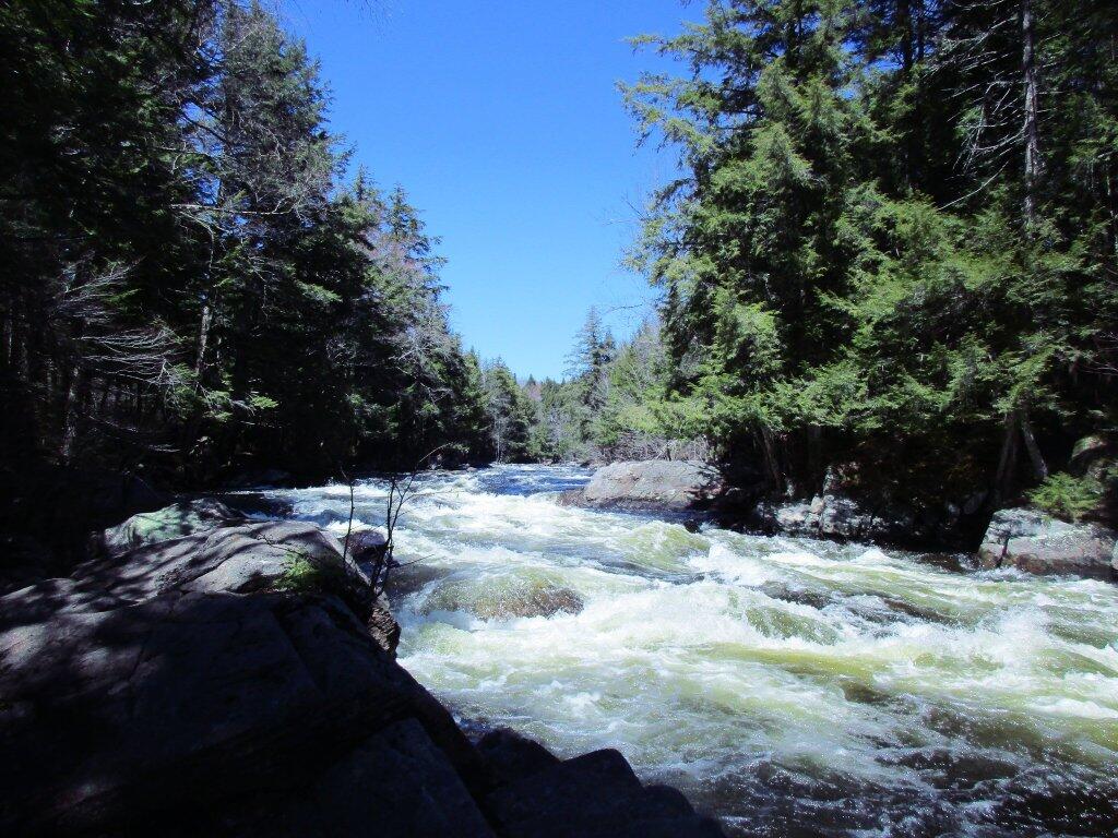
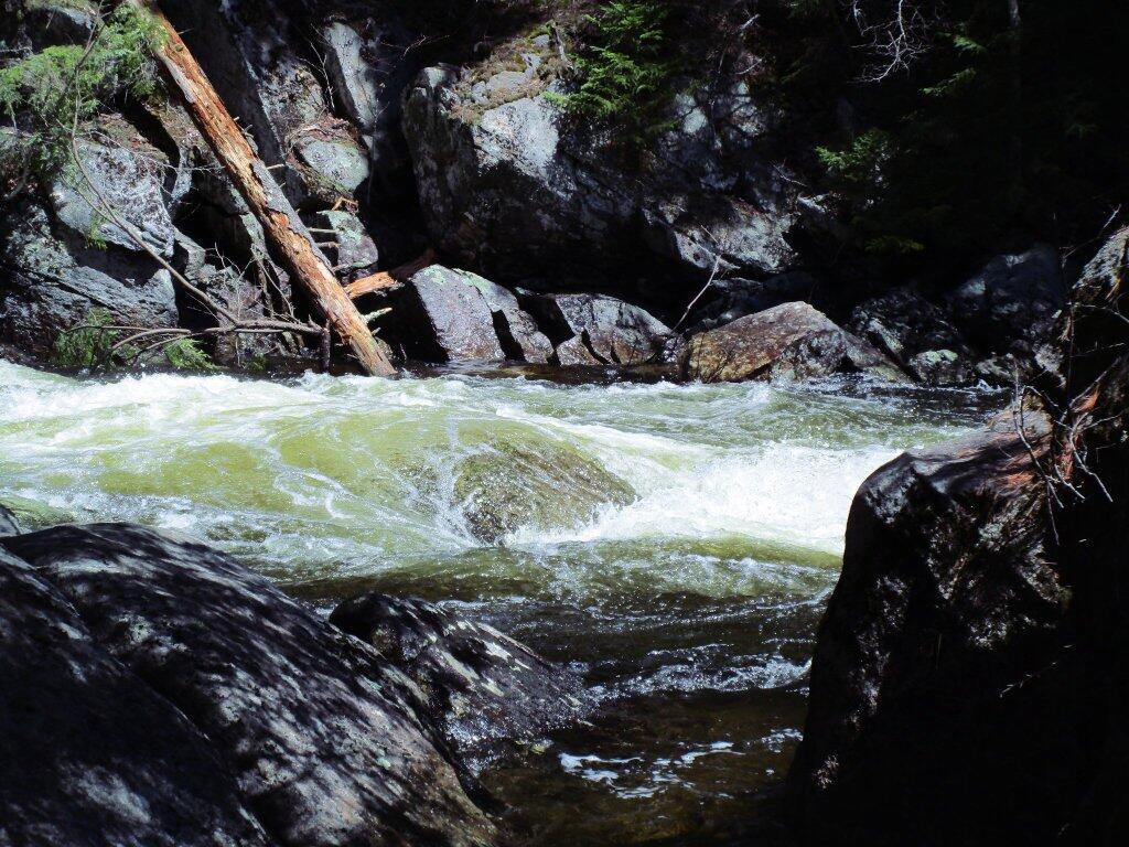
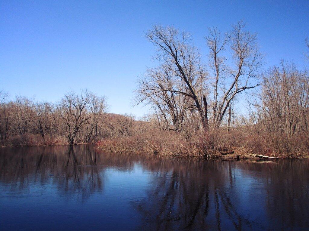
Above the falls, in the flats, the water was quiet, the birds were singing.
Link to an Interactive Map of the Northville Placid Trail.
| Type | Name | Description | Coordinates |
| Hand Launch | Ceder River Flow Boat Ramp | Hand Carry Launch, Ramp | 43.725826369700904, -74.47289916126694 |
| Lean-To | Beaver Pond (Aka Cedar Lakes Lean-To #2) | 43.625969396804386, -74.54927150370021 | |
| Lean-To | Carry Lean-To | 43.67874488347091, -74.49549821879448 | |
| Lean-To | Catlin Bay #1 Lean-To | 43.99801269269887, -74.39278456108421 | |
| Lean-To | Cedar Lakes #1 Lean-To | 43.628125665037935, -74.54047323992656 | |
| Lean-To | Cold River #2 Lean-To | 44.14251664317184, -74.13035824291548 | |
| Lean-To | Cold River #3 Lean-To | 44.091459278051204, -74.25764175084498 | |
| Lean-To | Cold River #4 Lean-To | 44.09139025333258, -74.25573480252505 | |
| Lean-To | Cold River Lean-To #1 Lean-To | 44.14272737628489, -74.12984021065587 | |
| Lean-To | Duck Hole #1 Lean-To | 44.14162687400988, -74.10693734676616 | |
| Lean-To | Duck Hole #2 Lean-To | 44.14167686466829, -74.10654354672256 | |
| Lean-To | Hamilton Lake Stream #1 Lean-To | 43.39741359517532, -74.45529759002217 | |
| Lean-To | Hidden Cove Lean-To | 44.00265528819394, -74.38648026325164 | |
| Lean-To | Kelly Point #1 Lean-To | 44.02880023617087, -74.36730798599064 | |
| Lean-To | Kelly Point #2 Lean-To | 44.02870256717196, -74.36713034867948 | |
| Lean-To | Moose Pond Lean-To | 44.182843382402666, -74.07364102375995 | |
| Lean-To | Mud Lake Lean-To | 43.342671073157994, -74.45629078563864 | |
| Lean-To | O’neill Flow Lean-To | 43.875596840936154, -74.36642623697053 | |
| Lean-To | Ouluska Pass Brook Lean-To | 44.120221281603584, -74.18744717390932 | |
| Lean-To | Plumley Point #2 Lean-To | 44.06559891610762, -74.32761224546002 | |
| Lean-To | Rodney Point #1 Lean-To | 44.04140938489936, -74.35014909639557 | |
| Lean-To | Rodney Point #2 Lean-To | 44.042976745412616, -74.34933464753136 | |
| Lean-To | Seward Lean-To | 44.106244137686204, -74.2091536427719 | |
| Lean-To | Silver Lake Lean-To | 43.29193545679836, -74.4237351676776 | |
| Lean-To | South Lake Lean-To | 43.58724480971, -74.62157883837274 | |
| Lean-To | Spruce Lake #1 Lean-To | 43.52728411257782, -74.6099246975027 | |
| Lean-To | Spruce Lake #2 Lean-To | 43.53463062983387, -74.60808580306896 | |
| Lean-To | Spruce Lake #3 Lean-To | 43.53712972792447, -74.60820962802477 | |
| Lean-To | Stephens Pond Lean-To | 43.818673668554965, -74.42052487172707 | |
| Lean-To | Tirrel Pond North Lean-To | 43.887344477557306, -74.37880062606054 | |
| Lean-To | West Canada Creek Lean-To | 43.58698761405157, -74.61399797100106 | |
| Lean-To | West Lake #1 Lean-To | 43.59316222884976, -74.62688668431306 | |
| Lean-To | West Stony Creek Lean-To | 43.22474428954461, -74.26933345717664 | |
| Paved Parking Lot | Lake Durant Northville Placid Trail Parking Lot | Paved, 12 Vehicle Capacity | 43.84219550506574, -74.3862742856788 |
| Paved Parking Lot | Northville Lake Placid Trail Parking Lot | Paved, Good Condition | 43.84213270187873, -74.38656792328511 |
| Primitive Tent Site | Canary Pond Campsite | 43.30513256312245, -74.4472062440692 | |
| Primitive Tent Site | Cedar Lake Dam 1 | 43.62894580965635, -74.53639939387939 | |
| Primitive Tent Site | Cedar Lake Dam Tentsite | 43.62937624507422, -74.53679785644344 | |
| Primitive Tent Site | Cedar River Flow Tentsite | 43.70292480315104, -74.48713041165333 | |
| Primitive Tent Site | Fall Stream Tentsites | 43.49661052800474, -74.53713112743992 | |
| Primitive Tent Site | Jessup River Tentsites | 43.51246207852797, -74.57229710138834 | |
| Primitive Tent Site | Kelly Point Tentsites | 44.02910364406153, -74.36670207204214 | |
| Primitive Tent Site | Moose Pond Tentsites | 44.18274441156179, -74.07408240028583 | |
| Primitive Tent Site | Moose River Plains Campsite 01 | Live | 43.72667672123972, -74.47410026642402 |
| Primitive Tent Site | Moose River Plains Campsite 02 | Live | 43.72665150100841, -74.47331107300782 |
| Primitive Tent Site | Moose River Plains Campsite 03 | Live | 43.725959512295866, -74.47389996564202 |
| Primitive Tent Site | Moose River Plains Campsite 04 | Live | 43.726067692208126, -74.47423264719026 |
| Primitive Tent Site | Moose River Plains Campsite 05 | Live | 43.725563790898704, -74.47417512282912 |
| Primitive Tent Site | Moose River Plains Campsite 06 | Live | 43.72522313374867, -74.47458303719159 |
| Primitive Tent Site | Mud Lake Tentsites | 43.59647433847274, -74.61354076182431 | |
| Primitive Tent Site | O’neill Flow Tentsite | 43.87567135918534, -74.3666467203306 | |
| Primitive Tent Site | Rock Lake Campsite | 43.265591839994535, -74.41543516012669 | |
| Primitive Tent Site | Salmon River Tentsites | 43.907925071619914, -74.38530801916977 | |
| Primitive Tent Site | Shattuck Clearing Tentsites | 44.08679657756681, -74.26368397541134 | |
| Primitive Tent Site | Silver Lake Tent Site | 43.29112770008321, -74.4240469986026 | |
| Primitive Tent Site | Spruce Lake Tentsite | 43.53695545329776, -74.60818912022354 | |
| Primitive Tent Site | Tirrell Pond North Tentsites | 43.88594343639596, -74.37834897628142 | |
| Primitive Tent Site | Trailside Campsite | 43.2716741112023, -74.43107546264162 | |
| Primitive Tent Site | Wanika Falls Tentsites | 44.19944690357389, -74.05663862305364 | |
| Primitive Tent Site | West Lake Former Caretaker Clearing Tentsites | 43.59389874347195, -74.62560220247346 | |
| Primitive Tent Site | Whitehouse Campsite | 43.373430193527696, -74.43578942968477 | |
| Primitive Tent Site | Whitehouse Campsite | 43.37406302094423, -74.43516794694158 | |
| Primitive Tent Site | Woods Lake Campsite #2 | Fire Pit, Water Front Campsite | 43.25071034607129, -74.31177480398298 |
| Primitive Tent Site | Woods Lake Campsite #3 | Fire Ring, Water Front Tentsite, Scenic View | 43.250888826581715, -74.31104030228295 |
| Primitive Tent Site | Woods Lake Campsite #4 | Fire Place, Water Front Campsite, Nice View | 43.251811433787196, -74.3092782205918 |
| Unpaved Parking Lot | Benson Road Parking Area | 8 Vehicle Capacity | 43.24745928673895, -74.31187044250609 |
| Unpaved Parking Lot | Chubb River Bridge | 44.2628824981147, -74.01364844250504 | |
| Unpaved Parking Lot | Moose River Recrieation Area | Northville-Placid And Cedar River Trails | 43.726457025366315, -74.47386984656715 |
| Unpaved Parking Lot | Norhtville Placid Parking-Haskells Rd | 43.45841038153893, -74.52201705350714 | |
| Unpaved Parking Lot | Northville Placid Trail Parking Area | 6 Car Interior Parking Area | 43.21330828950083, -74.2083824784703 |
| Unpaved Parking Lot | Northville Placid Trail Route 28n Parking Lot | 43.97584466308438, -74.39296138679799 | |
| Unpaved Parking Lot | Tarbell Road Shoulder Parking Lot | 43.984346733793245, -74.39813014848872 | |
| Unpaved Parking Lot | Wakely Dam | 43.72640808237045, -74.47425964611213 | |
| Unpaved Parking Lot | Wakely Mountain Trailhead Parking Lot | 1250 Sq Feet | 43.732197733217824, -74.47253968128065 |
| Unpaved Parking Lot | Wakely Pond Accessible Fishing Dock | 43.737643556916666, -74.46542853470272 | |
| Unpaved Parking Lot | Wakely Pond Accessible Launch | 43.738042554833534, -74.46399313053813 |
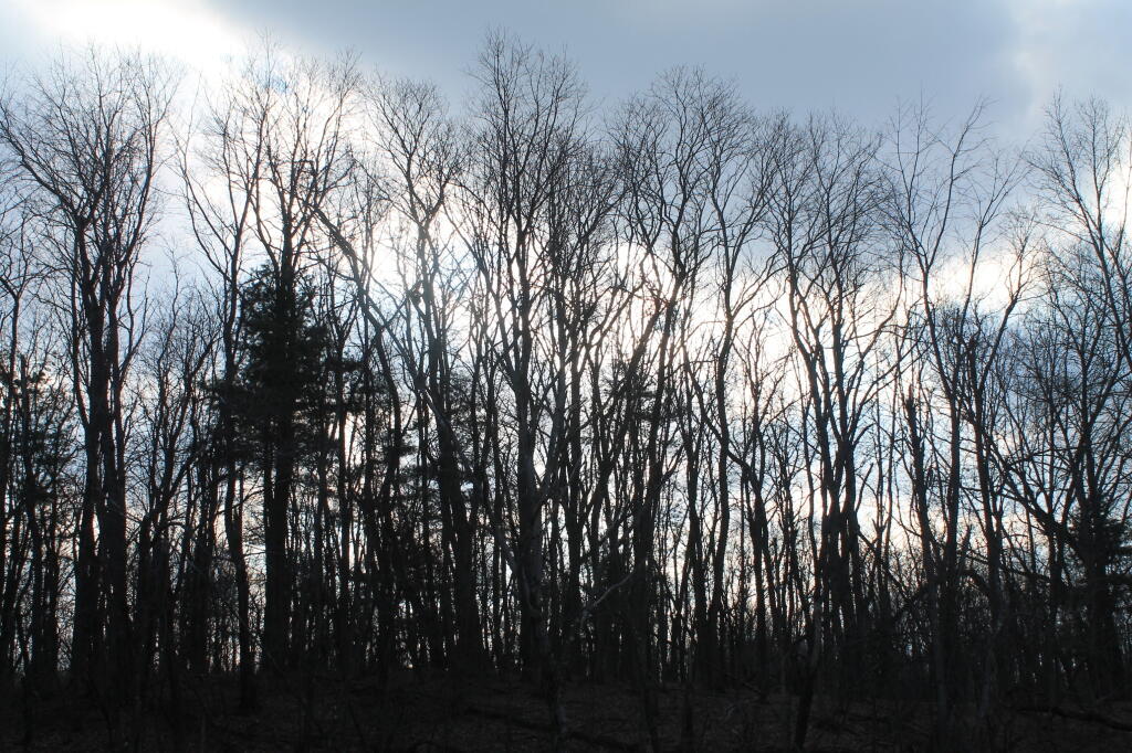
It was a pretty quiet weekend, 🏠 I saw a few people pass by on the Long Path but other then that I had the whole mountain top to myself.
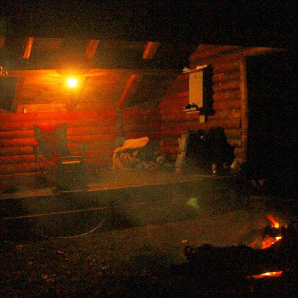
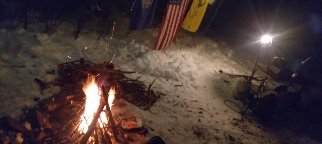
Carried the heater up the mountain, so I could warm my face in the morning. 🔥 It was mild, but still fairly cold being late March.
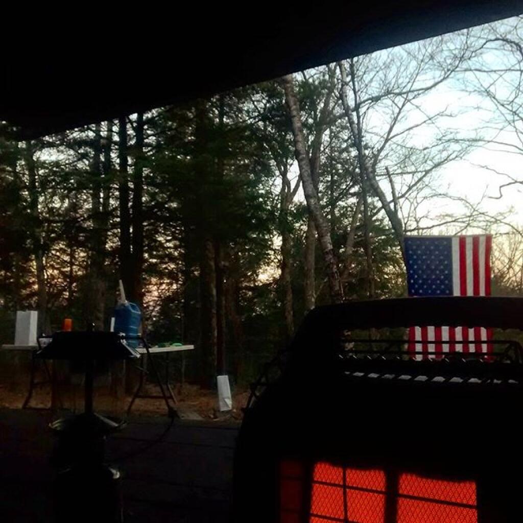
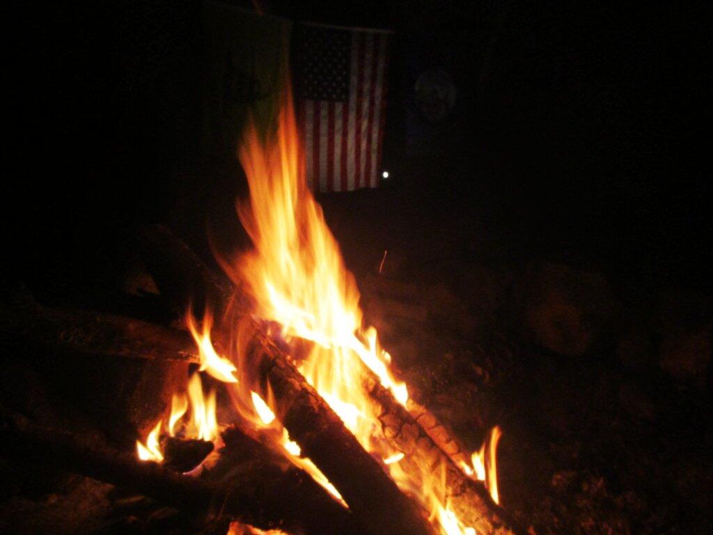
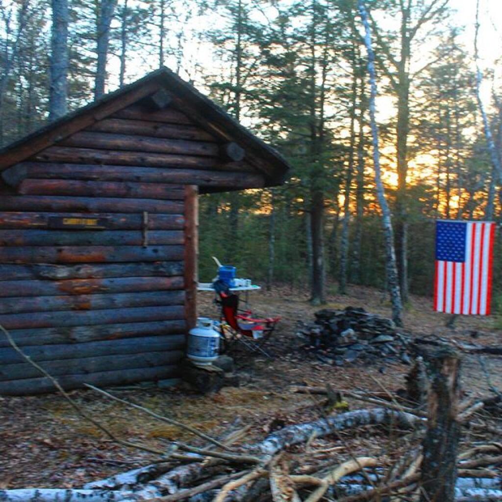
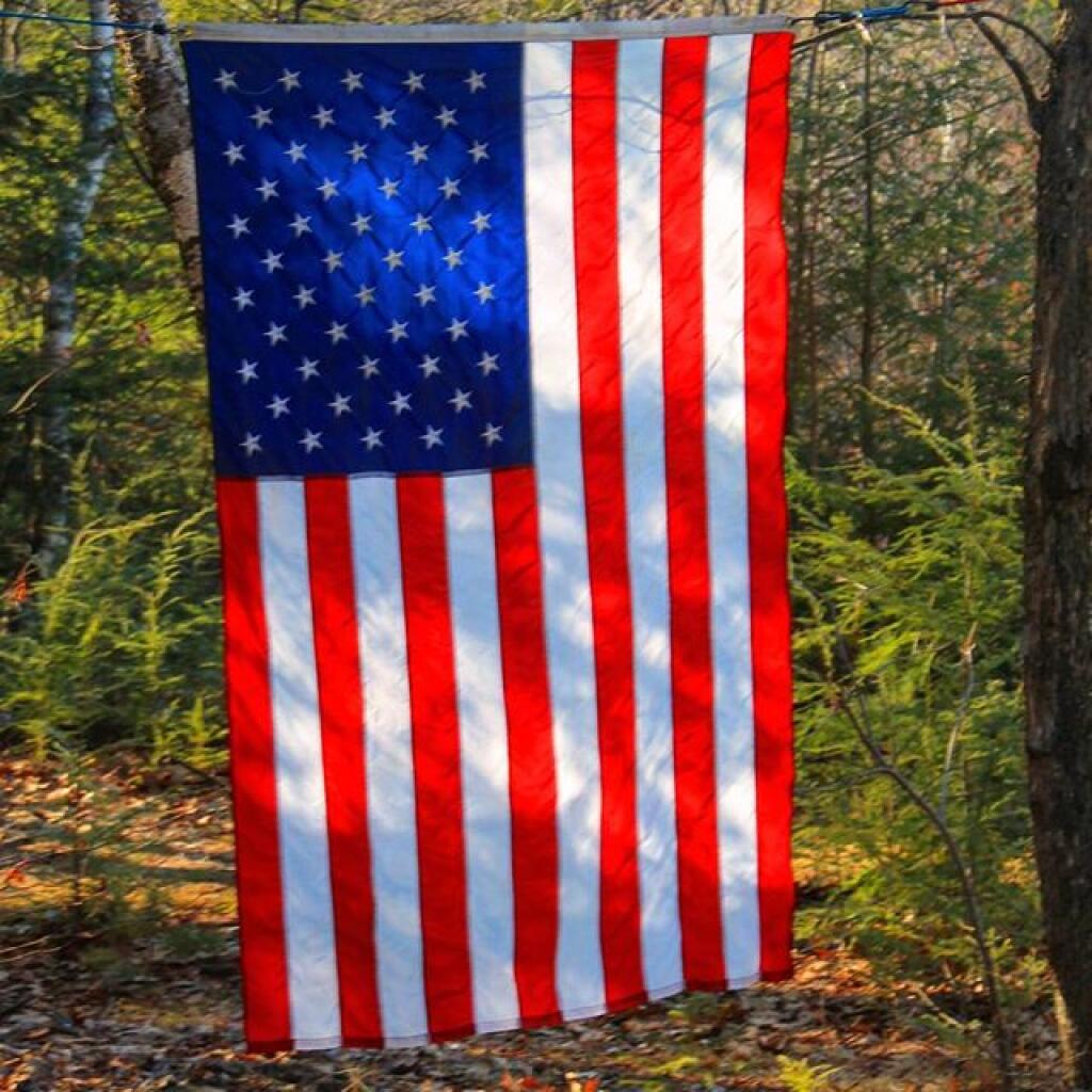
The American flag 🇺🇸 I had hung in front of the lean-to.
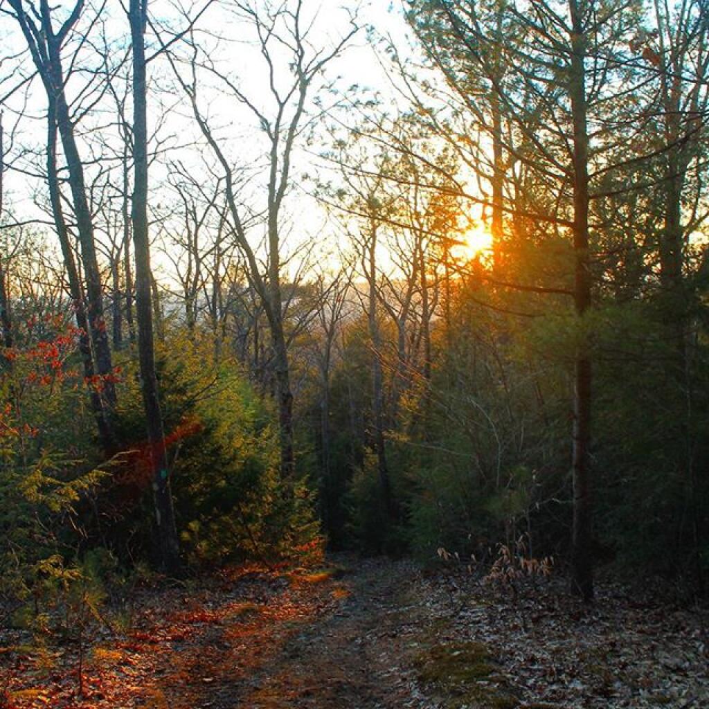
Nice sunset camping 🌆 up there.
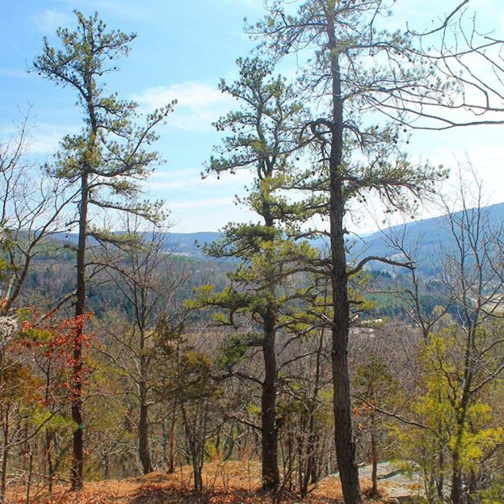
On Easter, I hiked over the Middleburgh Cliff. 😰 Nice day but rather hot.
I always like looking the Pitch Pines 🌲 up top there.
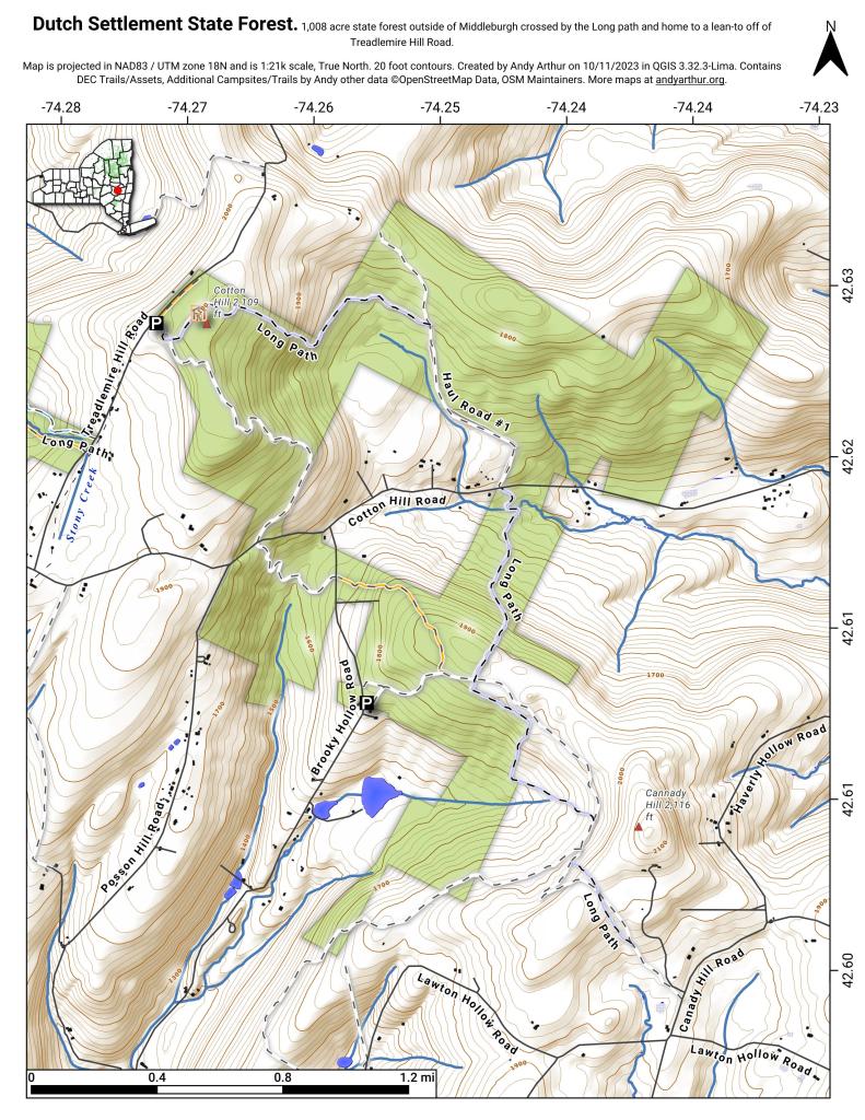
Map 🗺 of the Cotton Hill Lean-To at Dutch Settlement State Forest.
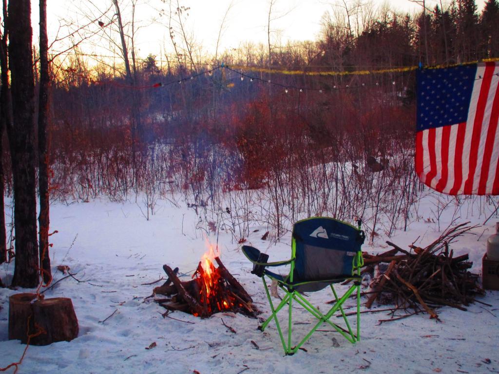
After an afternoon of hiking, I returned back to camp and started a campfire before starting to cook dinner. It was pleasant winter afternoon, not too cold.
Taken on Sunday February 20, 2022 at Rensselearville State Forest.It’s such a glistening and beautiful winter day here at the State Forest. I wish I had cross country skis after mine got worn out, snapped, then chopped up burnt last winter. So much fiberglass in those skis, and they held up for 20 years, but like all things, they don’t last forever.
Good afternoon! Partly cloudy and 26 degrees at the Rensselaerville State Forest. ⛅ There is a north breeze at 10 mph. 🍃. The trees are still covered with snow and there is something we haven’t seen in a long time — blue skies. There is a 6 inches of snow on the ground. ☃ ️Things will start to thaw out at Wednesday around 1 pm. 🌡️
It is remarkably beautiful out today. 😀 Cold but beautiful. Yet that’s to be expected camping in the winter up in the mountains. The good news is the road is nice and solid this time for camping, so not playing in the mud or getting wet. The snow is frozen fairly solid, but also is light in fluffy. If I had skis, this would be almost ideal weather for skiing. 🚲 After lunch and finishing setting up camp 🏕 and gathering firewood 🪵 I plan to ride some of CCC Road and maybe go down to the OSI Parcel 📸 to look at the snow covered mountains. Then come back to camp and have a good fire. 🔥
This afternoon will be mostly sunny 🌞, with a high of 29 degrees at 2pm. Four degrees below normal. North wind around 11 mph. A year ago, we had mostly sunny skies. The high last year was 33 degrees. The record high of 57 was set in 2016. 6.1 inches of snow fell back in 2004.❄
Solar noon 🌞 is at 12:11 pm with sun having an altitude of 30.8° from the due south horizon (-40.1° vs. 6/21). A six foot person will cast a 10 foot shadow today compared to 2.2 feet on the first day of summer. The golden hour 🏅 starts at 4:31 pm with the sun in the west-southwest (241°). 📸 The sunset is in the west-southwest (248°) with the sun dropping below the horizon at 5:13 pm after setting for 3 minutes and 8 seconds with dusk around 5:42 pm, which is one minute and 18 seconds later than yesterday. 🌇 The best time to look at the stars is after 6:16 pm. At sunset, look for mostly clear skies 🌄 and temperatures around 27 degrees. There will be a north-northwest breeze at 11 mph. Today will have 10 hours and 6 minutes of daytime, an increase of 2 minutes and 23 seconds over yesterday.
One thing that’s nice about this time of year 🌆 is we are definitely picking up more daylight in the evening, which makes it not as long at camp. That’s good as the nights can drag on. Going to be fairly cold but not super cold by the campfire for tonight, and I will have a nice fire.
Tonight will be mostly clear 🌃, with a low of 18 degrees at 4am. Three degrees above normal, which is similar to a typical night around February 15th. Maximum wind chill around 9 at 1am; Northwest wind 8 to 13 mph. In 2023, we had cloudy skies in the evening, which became mostly clear by the early hours of the morning. It got down to 13 degrees. The record low of -13 occurred back in 1978.
Looking ahead to next weekend, the following Saturday is Clean Your Computer Day 🧹 when the sun will be setting at 5:23 pm with dusk at 5:50 pm. On that day in 2023, we had mostly cloudy, mild, rain showers and temperatures between 51 and 34 degrees. Typically, the high temperature is 35 degrees. We hit a record high of 53 back in 1955.
For my 40th birthday, wilderness camping at the Rensselaerville State Forest.
Taken on Saturday January 28, 2023 at Rensselaerville State Forest.