Search Results for: map sly pond

Second half of August ๐ŸŽช

So it would seem as time marches on so quickly. Altamont Fair is underway. Tomorrow it’s off to the Adirondacks and it should be a nice day and hopefully Friday won’t be too cold and wet. Got some books to read on Friday, I’ll toss in the heater in case I want to warm my hands.

Good morning! What day is it? A a happy Pseudo Friday for Me Day, of course. Rain and 65 degrees in Delmar, NY. โ˜” There is a south-southeast breeze at 6 mph. ๐Ÿƒ. The dew point is 63 degrees. The skies will clear around 3 pm.

Out walking ๐Ÿšถ this morning, red kidney beans cooking down on the stove ๐Ÿฒ to enjoy with maple syrup up at camp this weekend. Thinking cold black coffee โ˜• this morning, cream of wheat with chia seeds, yogurt, lemon ๐Ÿ‹ maybe a touch of stevia and some cherries ๐Ÿ’ to get the day started. And maybe some of the red beans with maple syrup for protein. Save the rest for camp. ๐Ÿ•

Today will have patchy drizzle with a chance of showers before 10am, then a chance of showers between 10am and 2pm. Mostly cloudy ๐ŸŒฆ, with a high of 79 degrees at 4pm. Three degrees below normal, which is similar to a typical day around September 1st. Maximum dew point of 69 at 2pm. South wind around 7 mph. Chance of precipitation is 30%. New precipitation amounts of less than a tenth of an inch possible. A year ago, we had mostly sunny skies. The high last year was 87 degrees. The record high of 97 was set in 1936.

I’m on the fence about taking Blackie ๐Ÿšต to work today. I don’t think it’s going to rain but there is always the chance. On the other hand, I kind of like taking my bike to work, doesn’t add much time but it’s free exercise especially the ride back home ๐Ÿก and saves on the bus ๐Ÿš fare. Food Festival is today, so I’ll have to take Howard rather than ride across the Plaza at the end of the day and they’re a risk of thunderstorm โ›ˆ. Time wise it doesn’t make much difference, but I also don’t want to be too tired when I get packed tonight. Plan is to leave by around 8 AM or so tomorrow, though not too early as I’m not sure when Samdill Farm Stand opens, though I want to hit that on the way up. ๐ŸŒฝ ๐Ÿฅฆ

Solar noon ๐ŸŒž is at 1:01 pm with sun having an altitude of 61.2° from the due south horizon (-9.6° vs. 6/21). A six foot person will cast a 3.3 foot shadow today compared to 2.2 feet on the first day of summer. The golden hour ๐Ÿ… starts at 7:19 pm with the sun in the west-northwest (283°). ๐Ÿ“ธ The sunset is in the west-northwest (290°) with the sun dropping below the horizon at 7:58 pm after setting for 3 minutes and 4 seconds with dusk around 8:26 pm, which is one minute and 29 seconds earlier than yesterday. ๐ŸŒ‡ At dusk you’ll see the Waxing Crescent ๐ŸŒ’ Moon in the west-northwest (291°) at an altitude of 1° from the horizon, 252,188 miles away. ๐Ÿš€ The best time to look at the stars is after 9:05 pm. At sunset, look for partly clear skies ๐ŸŒ„ and temperatures around 77 degrees. The dew point will be 67 degrees. There will be a south breeze at 5 mph. Today will have 13 hours and 55 minutes of daytime, a decrease of 2 minutes and 33 seconds over yesterday.

Tonight will have patchy fog after 5am. Otherwise, mostly cloudy ๐ŸŒ†, with a low of 64 degrees at 5am. Three degrees above normal. Maximum dew point of 68 at 6pm. Light south wind. In 2022, we had cloudy skies in the evening, which became mostly clear by the early hours of the morning. It became somewhat humid as the night progressed. It got down to 62 degrees. The record low of 40 occurred back in 1979.

Tomorrow looks beautiful with only a slight chance of showers and thunderstorms after 4pm, as it’s summer. โ˜€๏ธ Partly sunny, with a high near 81. South wind 5 to 9 mph. Chance of precipitation is 20%. Then Thursday night it turns wetter with showers and thunderstorms likely. Hopefully late enough, it won’t impact my evening. Mostly cloudy, with a low around 66. Southeast wind 6 to 9 mph. Chance of precipitation is 60%. New rainfall amounts between a tenth and quarter of an inch possible.

Plan is to leave early ๐ŸŒ… hopefully around 8 AM or 9 AM, then head north with the first stop to top off my tank in Rotterdam, then Sandil’s Farm in Tribes Hill for veggies ๐Ÿฅฆ ๐ŸŒฝ then to Walmart in Johnstown for a few groceries and supplies ๐Ÿ›’, then maybe Rogers Orchards ๐ŸŽ for fresh apples, then up hopefully to the House Pond Campsite. By noontime, I want to get camp set up ๐Ÿ• , inflate the tube, and get floating in the East Branch, as it might be the warmest day. Then in the evening, ride up to Potholers and cool off in the Potholers. ๐Ÿ“ป I’ve downloaded several podcasts and Youtube videos to listen to while up at camp.

Come Friday, it’s a bit of a wet start. ๐ŸŒง Showers and thunderstorms likely before 2pm, then a chance of showers and thunderstorms between 2pm and 5pm, then a chance of showers and thunderstorms. Partly sunny, with a high near 78. Southwest wind 6 to 13 mph. Chance of precipitation is 60%. New rainfall amounts between a quarter and half of an inch possible. Maybe not a washout. Then Friday night, a chance of showers and thunderstorms before 8pm. Partly cloudy, with a low around 55. Chance of precipitation is 30%. New rainfall amounts less than a tenth of an inch possible.

I got from “Salt, fat, acid, heat : mastering the elements of good cooking” by Samin Nosrat from the library ๐Ÿ“š and plan on reading it on Friday morning. โ™จ I think I will pack the heater, so I can warm up next to it in case it’s cold. Also going to pack the screen tent, ๐ŸŽช as it’s been such a wet summer and I’m thinking it could be buggy. ๐Ÿœ By evening it shouldn’t be too bad, might go for a nice ride on Blackie ๐Ÿšฒ along Piseco-Powley Road with the headlight as I get back late, as sunset is around 8 PM. Maybe too cold to swim, but who knows. ๐ŸŒ†

A picture perfect weekend after we get past Friday on tap. ๐Ÿ˜Ž Cool but sunny. Saturday, mostly sunny, with a high near 74. Maximum dew point of 56 at 1pm. Sunday, sunny, with a high near 84. Maximum dew point of 64 at 7pm. Typical average high for the weekend is 82 degrees. I am thinking I want to ride most of Piseco-Powley Road and hike back to Goldmine Stream Falls or maybe Sand Like on Saturday. Sunday, maybe the Potholers and then end the day in Little Falls, exploring Moss Island and the Herkimer Home, and riding the Erie Canal Trail. I am not planning to get home until dusk, so I will have the full afternoon and evening. I am undecided if I’ll bring the kayak, I’m actually leaning against it at this point. ๐Ÿ›ถ Paddling the Mohawk River might be fun but I can see more on Blackie on the bike trail.

Today in 1916, the Migratory Bird Treaty between Canada and the United States signed. ๐Ÿฆ It was designed to save Migratory Birds by giving them international protection for the first time by placing limits on hunting and other means of taking. It became a center part of protecting the flock of birds, requiring duck stamps among other things.

In 1989, a solar flare from the Sun creates a geomagnetic storm that affects micro chips, ๐Ÿ˜Ž leading to a halt of all trading on Toronto’s stock market. Sometimes the sun isn’t so nice, not that we’ve had much of it recently but hopefully tomorrow and most of the weekend, bar maybe a few hours of showers on Friday morning. We are though overdue for a big solar storm, and that could be very disruptive to every day life across the world, as the power grid gets shutdown and radio networks go dead during the storm.

Also, in 1993, Debian Linux is announced, ๐Ÿง it would become the basis of many forms of Linux like Ubuntu Linux, which is currently what I run on my home computer. ๐Ÿ‘จ‍๐Ÿ’ป I’m not sure I love the direction Ubuntu has been going lately with the snaps, but I do like the XFCE window manager and I don’t know if I want to change over to a totally new distro, having to reinstall everything. Maybe eventually when I get a new laptop when my current one wears out — it’s now going on 7 years old, and while I don’t care it’s getting old but I do worry physical components wear out after a while. That said, I don’t carry it around as much now as I use my phone for most things.

And in 1966, the House Un-American Activities Committee begins investigations of Americans who have aided the Viet Cong. ๐Ÿต The committee stated to intended to introduce legislation making these activities illegal. Anti-war demonstrators disrupt the meeting and 50 people are arrested. A long time ago now — but it reminds me a bit of the War in Iraq when I was young with Bush as President.

As previously noted, there are 2 weeks until Average High Falls To 79 ๏ธDegrees โ›ฑ๏ธ๏ธ๏ธ when the sun will be setting at 7:35 pm with dusk at 8:03 pm. On that day in 2022, we had rain and temperatures between 90 and 66 degrees. We hit a record high of 98 back in 1953. The 1953 heat wave!
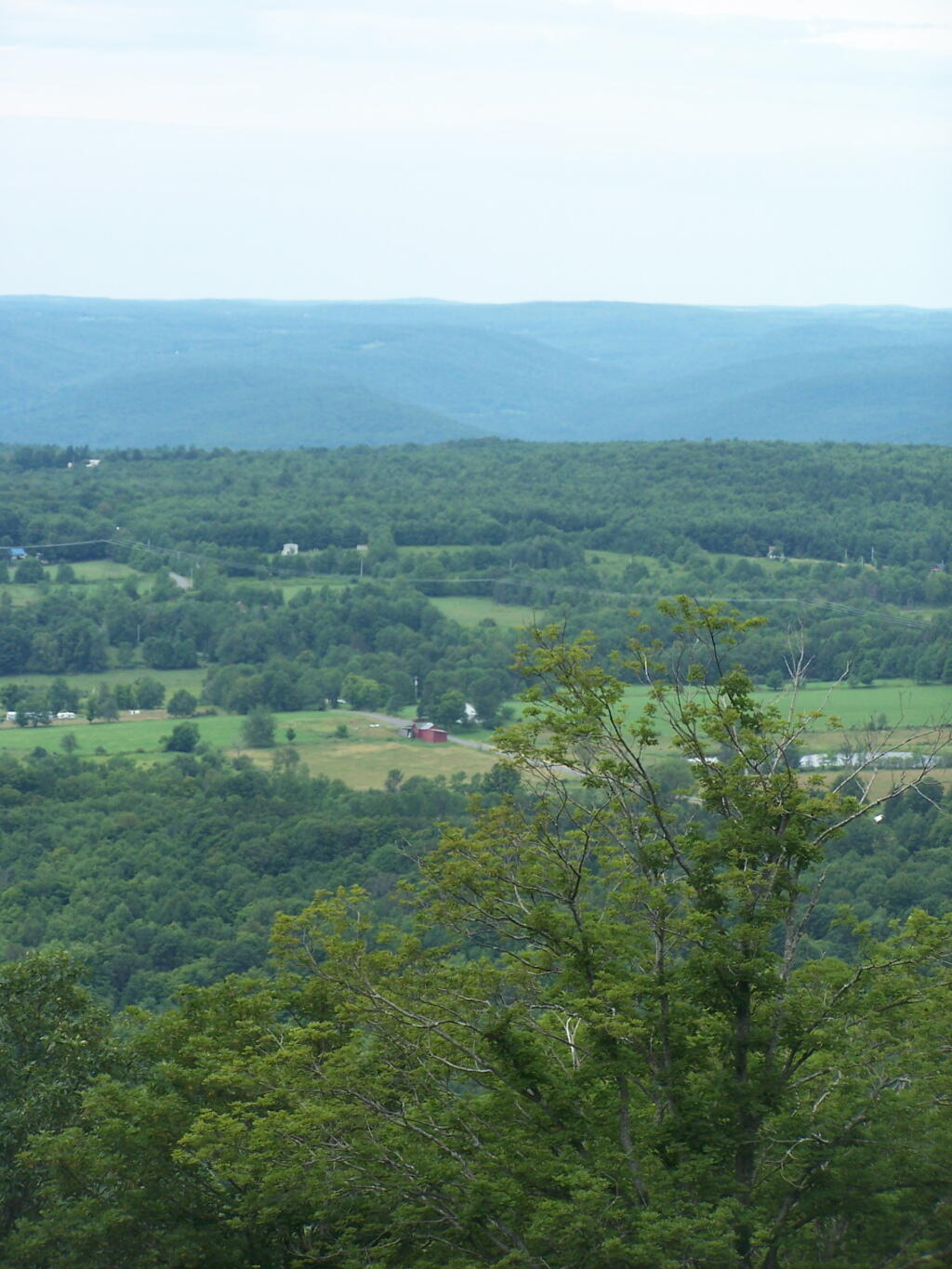
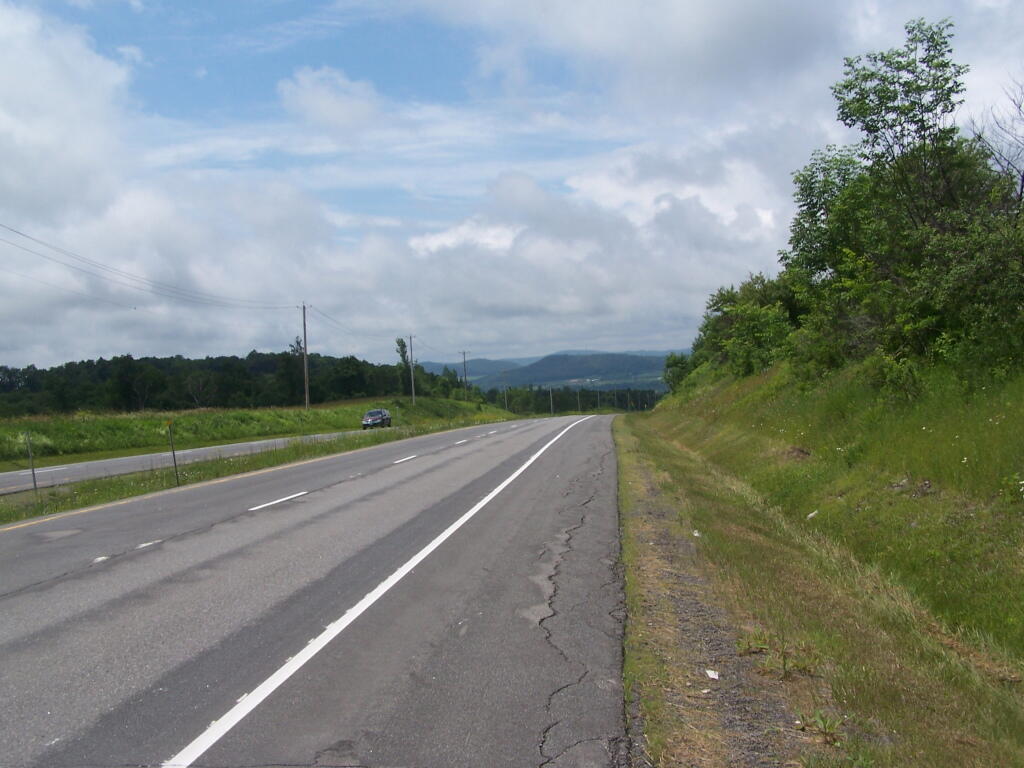
West Towards Burnt-Rossman Hills

Boards of Cooperative Education Services (BOCES)

Boards of Cooperative Education Services (BOCES)
BOCES Districts
Broome-Delaware-Tioga Binghamton City, Chenango Forks, Chenango Valley, Deposit, Harpursville, Johnson City, Maine-Endwell, Newark Valley, Owego-Apalachin, Susquehanna Valley, Tioga, Union-Endicott, Vestal, Whitney Point, Windsor
Capital Region Albany City, Berne-Knox-Westerlo, Bethlehem, Burnt Hills-Ballston Lake, Cobleskill-Richmondville, Cohoes City, Duanesburg, Green Island, Guilderland, Menands, Middleburgh, Niskayuna, North Colonie, Ravena-Coeymans-Selkirk, Rotterdam-Mohonasen, Schalmont, Schenectady City, Schoharie, Scotia-Glenville, Sharon Springs, Shenendehowa, South Colonie, Voorheesville, Watervliet City
Cattar-Allegany-Erie-Wyoming Allegany-Limestone, Andover, Belfast, Bolivar-Richburg, Cattaraugus-Little Valley, Cuba-Rushford, Ellicottville, Fillmore, Franklinville, Friendship, Genesee Valley, Hinsdale, Olean City, Portville, Randolph, Salamanca City, Scio, Wellsville, West Valley, Whitesville, Yorkshire-Pioneer
Cayuga-Onondaga Auburn City, Cato-Meridian, Jordan-Elbridge, Moravia, Port Byron, Skaneateles, Southern Cayuga, Union Springs, Weedsport
Clinton-Essex-Warren-Washing Ausable Valley, Beekmantown, Boquet Valley, Chazy, Crown Point, Keene, Moriah, Northeastern Clinton, Northern Adirondack, Peru, Plattsburgh City, Putnam, Saranac, Schroon Lake, Ticonderoga, Willsboro
Delaw-Chenango-Madison-Otsego Afton, Bainbridge-Guilford, Delaware Academy Csd At, Downsville, Franklin, Georgetown-South Otselic, Gilbertsville-Mount Upton, Greene, Hancock, Norwich City, Otego-Unadilla, Oxford Academy &, Sherburne-Earlville, Sidney, Unadilla Valley, Walton
Dutchess Arlington, Beacon City, Dover, Hyde Park, Millbrook, Northeast, Pawling, Pine Plains, Poughkeepsie City, Red Hook, Rhinebeck, Spackenkill, Wappingers
Eastern Suffolk Amagansett, Bay Shore, Bayport-Blue Point, Brentwood, Bridgehampton, Brookhaven-Comsewogue, Center Moriches, Central Islip, Connetquot, East Hampton, East Islip, East Moriches, East Quogue, Eastport-South Manor, Fire Island, Fishers Island, Greenport, Hampton Bays, Hauppauge, Islip, Longwood, Mattituck-Cutchogue, Middle Country, Miller Place, Montauk, Mt Sinai, New Suffolk Comn, Oysterponds, Patchogue-Medford, Port Jefferson, Quogue, Remsenburg-Speonk, Riverhead, Rocky Point, Sachem, Sag Harbor, Sagaponack Comn, Sayville, Shelter Island, Shoreham-Wading River, South Country, Southampton, Southold, Springs, Three Village, Tuckahoe Comn, Wainscott Comn, West Islip, Westhampton Beach, William Floyd
Erie 1 Akron, Alden, Amherst, Buffalo City, Cheektowaga, Cheektowaga-Maryvale, Clarence, Cleveland Hill, Depew, Frontier, Grand Island, Hamburg, Hopevale Ufsd At, Kenmore-Tonawanda, Lackawanna City, Lancaster, Sweet Home, Tonawanda City, West Seneca, Williamsville
Erie 2-Chautauqua-Cattaraugus Bemus Point, Brocton, Cassadaga Valley, Chautauqua Lake, Clymer, Dunkirk City, East Aurora, Eden, Evans-Brant Csd (Lake Shore), Falconer, Forestville, Fredonia, Frewsburg, Gowanda, Holland, Iroquois, Jamestown City, North Collins, Orchard Park, Panama, Pine Valley Csd (South Dayton), Ripley, Sherman, Silver Creek, Southwestern Csd At, Springville-Griffith Inst, Westfield
Franklin-Essex-Hamilton Brushton-Moira, Chateaugay, Lake Placid, Long Lake, Malone, Raquette Lake, Salmon River, Saranac Lake, St Regis Falls, Tupper Lake
Genesee Valley Alexander, Attica, Avon, Batavia City, Byron-Bergen, Caledonia-Mumford, Dalton-Nunda Csd (Keshequa), Dansville, Elba, Geneseo, Le Roy, Letchworth, Livonia, Mt Morris, Oakfield-Alabama, Pavilion, Pembroke, Perry, Warsaw, Wayland-Cohocton, Wyoming, York
Hamilton-Fulton-Montgomery Amsterdam City, Broadalbin-Perth, Canajoharie, Edinburg Common, Fonda-Fultonville, Fort Plain, Gloversville City, Johnstown City, Lake Pleasant, Mayfield, Northville, Oppenheim-Ephratah-St. Johnsville, Piseco Comn, Wells, Wheelerville
Herk-Fulton-Hamilton-Otsego Central Valley Csd At Ilion-, Dolgeville, Frankfort-Schuyler, Herkimer, Little Falls City, Mount Markham, Oppenheim-Ephratah-St. Johnsville, Poland, Richfield Springs, Van Hornesville-Owen D Young, West Canada Valley
Jeffer-Lewis-Hamil-Herk-Oneida Adirondack, Alexandria, Beaver River, Belleville-Henderson, Carthage, Copenhagen, General Brown, Indian River, Inlet Comn, La Fargeville, Lowville Academy &, Lyme, Sackets Harbor, South Jefferson, South Lewis, Thousand Islands, Town Of Webb, Watertown City
Madison-Oneida Camden, Canastota, Hamilton, Madison, Morrisville-Eaton, Oneida City, Rome City, Sherrill City, Stockbridge Valley
Monroe 1 Brighton, East Irondequoit, East Rochester, Fairport, Honeoye Falls-Lima, Penfield, Pittsford, Rochester City, Rush-Henrietta, Webster, West Irondequoit
Monroe 2-Orleans Brockport, Churchville-Chili, Gates-Chili, Greece, Hilton, Holley, Kendall, Spencerport, Wheatland-Chili
Nassau Baldwin, Bellmore, Bellmore-Merrick Central School, Bethpage, Carle Place, East Meadow, East Rockaway, East Williston, Elmont, Farmingdale, Floral Park-Bellerose, Franklin Square, Freeport, Garden City, Glen Cove City, Great Neck, Hempstead, Herricks, Hewlett-Woodmere, Hicksville, Island Park, Island Trees, Jericho, Lawrence, Levittown, Locust Valley, Long Beach City, Lynbrook, Malverne, Manhasset, Massapequa, Merrick, Mineola, New Hyde Park-Garden City Park, North Bellmore, North Merrick, North Shore, Oceanside, Oyster Bay-East Norwich, Plainedge, Plainview-Old Bethpage, Port Washington, Rockville Centre, Roosevelt, Roslyn, Seaford, Sewanhaka Central School, Syosset, Uniondale, Valley Stream 13, Valley Stream 24, Valley Stream 30, Valley Stream Central School, Wantagh, West Hempstead, Westbury
Oneida-Herkimer-Madison Brookfield, Clinton, Holland Patent, New Hartford, Ny Mills, Oriskany, Remsen, Sauquoit Valley, Utica City, Waterville, Westmoreland, Whitesboro
Onondaga-Cortland-Madison Baldwinsville, Cazenovia, Chittenango, Cincinnatus, Cortland City, Deruyter, East Syracuse Minoa, Fabius-Pompey, Fayetteville-Manlius, Homer, Jamesville-Dewitt, Lafayette, Liverpool, Lyncourt, Marathon, Marcellus, Mcgraw, North Syracuse, Onondaga, Solvay, Syracuse City, Tully, West Genesee, Westhill
Orange-Ulster Chester, Cornwall, Florida, Goshen, Greenwood Lake, Highland Falls, Kiryas Joel Village, Marlboro, Middletown City, Minisink Valley, Monroe-Woodbury, Newburgh City, Pine Bush, Port Jervis City, Tuxedo, Valley Csd (Montgomery), Warwick Valley, Washingtonville
Orleans-Niagara Albion, Barker, Lewiston-Porter, Lockport City, Lyndonville, Medina, Newfane, Niagara Falls City, Niagara-Wheatfield, North Tonawanda City, Royalton-Hartland, Starpoint, Wilson
Oswego Altmar-Parish-Williamstown, Central Square, Fulton City, Hannibal, Mexico, Oswego City, Phoenix, Pulaski, Sandy Creek
Otsego-Delaw-Schoharie-Greene Andes, Charlotte Valley, Cherry Valley-Springfield, Cooperstown, Edmeston, Gilboa-Conesville, Hunter-Tannersville, Jefferson, Laurens, Margaretville, Milford, Morris, Oneonta City, Roxbury, Schenevus, South Kortright, Stamford, Windham-Ashland-Jewett, Worcester
Putnam-Northern Westchester Bedford, Brewster, Briarcliff Manor, Carmel, Chappaqua, Croton-Harmon, Garrison, Haldane, Hendrick Hudson, Katonah-Lewisboro, Lakeland, Mahopac, North Salem, Ossining, Peekskill City, Putnam Valley, Somers, Yorktown
Questar Iii (R-C-G) Averill Park, Berkshire, Berlin, Brunswick Csd (Brittonkill), Cairo-Durham, Catskill, Chatham, Coxsackie-Athens, East Greenbush, Germantown, Greenville, Hoosic Valley, Hoosick Falls, Hudson City, Kinderhook, Lansingburgh, New Lebanon, North Greenbush Comn Sd (Williams), Rensselaer City, Schodack, Taconic Hills, Troy City, Wynantskill
Rockland Clarkstown, East Ramapo Csd (Spring Valley), Haverstraw-Stony Point Csd (North, Nanuet, Nyack, Pearl River, Ramapo Csd (Suffern), South Orangetown
Schuy-Steub-Chem-Tioga-Alleg Addison, Alfred-Almond, Arkport, Avoca, Bath, Bradford, Campbell-Savona, Canaseraga, Canisteo-Greenwood, Corning City, Elmira City, Elmira Heights, Hammondsport, Hornell City, Horseheads, Jasper-Troupsburg, Odessa-Montour, Prattsburgh, Spencer-Van Etten, Watkins Glen, Waverly
St Lawrence-Lewis Brasher Falls, Canton, Clifton-Fine, Colton-Pierrepont, Edwards-Knox, Gouverneur, Hammond, Harrisville, Hermon-Dekalb, Heuvelton, Lisbon, Madrid-Waddington, Massena, Morristown, Norwood-Norfolk, Ogdensburg City, Parishville-Hopkinton, Potsdam
Sullivan Eldred, Fallsburg, Liberty, Livingston Manor, Monticello, Roscoe, Sullivan West, Tri-Valley
Tompkins-Seneca-Tioga Candor, Dryden, Groton, Ithaca City, Lansing, Newfield, South Seneca, Trumansburg
Ulster Ellenville, Highland, Kingston City, New Paltz, Onteora, Rondout Valley, Saugerties, Wallkill
Washing-Sara-War-Hamltn-Essex Argyle, Ballston Spa, Bolton, Cambridge, Corinth, Fort Ann, Fort Edward, Galway, Glens Falls City, Glens Falls Comn, Granville, Greenwich, Hadley-Luzerne, Hartford, Hudson Falls, Indian Lake, Johnsburg, Lake George, Mechanicville City, Minerva, Newcomb, North Warren, Queensbury, Salem, Saratoga Springs City, Schuylerville, South Glens Falls, Stillwater, Warrensburg, Waterford-Halfmoon, Whitehall
Wayne-Finger Lakes Canandaigua City, Clyde-Savannah, Dundee, East Bloomfield, Gananda, Geneva City, Gorham-Middlesex Csd (Marcus, Honeoye, Lyons, Manchester-Shortsville Csd (Red, Marion, Naples, Newark, North Rose-Wolcott, Palmyra-Macedon, Penn Yan, Phelps-Clifton Springs, Red Creek, Romulus, Seneca Falls, Sodus, Victor, Waterloo, Wayne, Williamson
Westchester Ardsley, Blind Brook-Rye, Bronxville, Byram Hills, Dobbs Ferry, Eastchester, Edgemont, Elmsford, Greenburgh, Harrison, Hastings-On-Hudson, Irvington, Mamaroneck, Mt Pleasant, Mt Vernon School, New Rochelle City, Pelham, Pleasantville, Pocantico Hills, Port Chester-Rye, Rye City, Rye Neck, Scarsdale, Tuckahoe, Ufsd-, Valhalla, White Plains City, Yonkers City
Western Suffolk Amityville, Babylon, Cold Spring Harbor, Commack, Copiague, Deer Park, Elwood, Half Hollow Hills, Harborfields, Huntington, Kings Park, Lindenhurst, North Babylon, Northport-East Northport, Smithtown, South Huntington, West Babylon, Wyandanch
Andy Arthur, 3/31/23
Data Source: NYS Education Department.

Daily Update – August 3, 2022

Good evening! A nice evening after a hot day swimming. ๐ŸŠโ€โ™‚๏ธ

Sitting by Foster Pond for a while, saw two shooting stars but also a fair amount of haze around.

Partly clear and 77 degrees at the Town of Hector. โœจ Moderate breeze, sometimes humid sometimes cool and refreshing. Seems to be mixing of the air currents between the lakes. The dew point is 62 degrees.

Spent the bulk of the day at Enfield Glen ๐ŸŠโ€โ™‚๏ธ hiking in the morning through the Glen and the Lucifer Falls Loop and exploring the Grist Mill followed by spending the bulk of the day swimming in the gorge. Refilled my propane tank and camp back to camp, bought sweet corn ๐ŸŒฝ and made burgers ๐Ÿ” on the grill and then read ๐Ÿ“– until around 9:15.

It was kind of a nice day but hot by afternoon. ๐Ÿ– The swimming was nice but it was hot especially when I had to stay out of the water ๐Ÿ’ฆ for a while for a work conference call. ๐Ÿ“ž I think I might have picked up swimmers itch from the water but the stuff I use on my feet can be sprayed on my balls โšฝ to address that. ๐Ÿ˜‚

Yesterday was a quieter day at camp โ›บ, cloudy โ›… but rain free and quiet. Dusty though when cars went by from it being so dry. Got through two books, ๐Ÿ“š took a nice afternoon nap after some fishing ๐ŸŽฃ and wildlife observation at Potomac Ponds. Kind of hot and dry, did a fair bit of drinking ๐Ÿป. I kind of enjoy the more relaxed pace this year.

Somebody emailed ๐Ÿ“ง yesterday about making some KML Google Maps up and it sent me down the long journey of thinking ๐Ÿ’ญ how I could do it in R in an automated way. I had previously been doing it by exporting the geopackages from R into QGIS but I want more control and automation over the process.

June 17, 2021 Morning

Good morning! Happy Thursday. Next Thursday is the latest sunset ๐ŸŒ‡ of the year and the Strawberry Moon ๐Ÿ“ ๐ŸŒ• . Lots of things to keep the lights up late that day. Sunny and 57 degrees in Delmar, NY. ๐ŸŒž There is a west-southwest breeze at 5 mph. ๐Ÿƒ. The dew point is 44 degrees. Kind of a chilly start for a late June morning although the heat right now is lurking out on the west coast.

My bags are packed ๐Ÿ’ผ and I’m ready to head to the Adirondacks after work. I decided not to drive work because it’s just easier to leave from home and leaving a bit after 6 pm means I shouldn’t hit much traffic. The coolers will last longer with everything in the fridge or freezer today. ๐Ÿฅš I forgot to get eggs yesterday so I’ll have to stop at Stewart’s on the way up north. Not sure if the forecast is as nice as previously announced but I am glad to be gone this long weekend where I can enjoy the quiet. ๐Ÿคซ No cell service where I’m going, should be nice and quiet.

Bus reroute this morning ๐ŸšŒ due to a house fire ๐Ÿ”ฅ on Delaware Avenue. Been a while since a building burnt there but house fires ๐Ÿ”ฅ in the city seem to follow a trend – neighborhoods destabilize and then one building after another burns. It just seems like Albany is sliding down hill. The whole city after decades of improvement after pollution controls were implemented is just sliding backwards. It may be the pandemic but also foreign investment driving up the rents and driving out the tenants and businesses. All that money ๐Ÿ’ต from China purchases is being reinvested in our community by China slumlords looking for a place to park their cash.

Today will be sunny ๐ŸŒž, with a high of 75 degrees at 3pm. Five degrees below normal, which is similar to a typical day around May 31st. Northwest wind 5 to 10 mph. A year ago, we had mostly sunny skies in the morning with a few breaks of sun the afternoon. The high last year was 87 degrees. The record high of 94 was set in 1994.

Solar noon ๐ŸŒž is at 12:57 pm with sun having an altitude of 70.8° from the due south horizon (-0.1° vs. 6/21). A six foot person will cast a 2.1 foot shadow today compared to 2.2 feet on the first day of summer. The golden hour ๐Ÿ… starts at 7:53 pm with the sun in the west-northwest (297°). ๐Ÿ“ธ The sunset is in the west-northwest (304°) with the sun dropping below the horizon at 8:36 pm after setting for 3 minutes and 28 seconds with dusk around 9:10 pm, which is 21 seconds later than yesterday. ๐ŸŒ‡ At dusk you’ll see the First Quarter ๐ŸŒ“ Moon in the southwest (225°) at an altitude of 44° from the horizon, 231,723 miles away. ๐Ÿš€ The best time to look at the stars is after 9:57 pm. At sunset, look for mostly clear skies ๐ŸŒ„ and temperatures around 68 degrees. The dew point will be 46 degrees. There will be a west breeze at 6 mph. Today will have 15 hours and 18 minutes of daytime, an increase of 16 seconds over yesterday.

I can wait until the work day is over to head up north. I am thinking I also need maple syrup besides eggs for my pancakes. ๐Ÿฅž I might end up going to Price Chopper in Gloversville. I wish I had just skip the run to the store yesterday. That was dumb on my part. Well, I guess it is what is. I just got flustered over the stupid can return and then I couldn’t find what I needed in the store. I feel stupid but it ain’t the end of world. The days are long now, I don’t care if I get up to camp really late although I’d kind of like to get that House Pond Campsite if possible.

Tonight will be mostly clear ๐ŸŒƒ, with a low of 49 degrees at 5am. Nine degrees below normal, which is similar to a typical night around May 19th. West wind around 6 mph becoming calm in the evening. In 2020, we had partly cloudy skies in the evening, which became mostly clear by the early hours of the morning. It became somewhat humid as the night progressed. It got down to 62 degrees. The record low of 39 occurred back in 1958.

On this day in 1972, Five White House operatives are arrested for burgling the offices of the Democratic National Committee, ๐Ÿ‘ฎ๐Ÿผ‍โ™‚๏ธ ๐Ÿ‘ค in an attempt by some members of the Republican party to illegally wiretap the opposition. This would become the basis for the Watergate scandal.

The Juneteenth Weekend looks nice. ๐Ÿ– Friday, mostly sunny, with a high near 82. South wind 5 to 9 mph. Saturday, scattered showers, with thunderstorms also possible after 11am. Partly sunny, with a high near 82. South wind around 9 mph. Chance of precipitation is 50%. New rainfall amounts of less than a tenth of an inch, except higher amounts possible in thunderstorms. Maximum dew point of 65 at 10am. Sunday, sunny, with a high near 81. Maximum dew point of 61 at 8pm. Typical average high for the weekend is 80 degrees.

As previously noted, next Thursday is Latest Sunset of the year ๐ŸŒ† when the sun will be setting at 8:37 pm with dusk at 9:12 pm. On that day in 2020, we had humid weather and partly sunny skies, rain showers in the afternoon and temperatures between 85 and 65 degrees. Typically, the high temperature is 82 degrees. We hit a record high of 96 back in 1943.

Turnpike

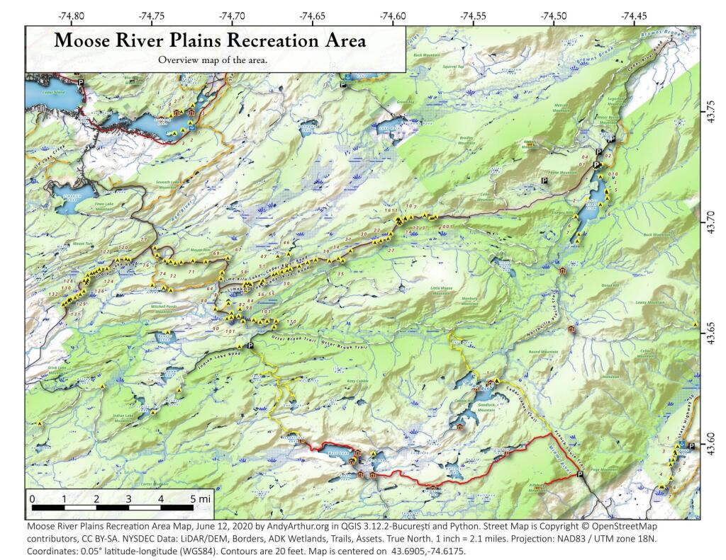
Moose River Plains Campsites

Interactive Map of Lean-Tos and Campsites

An overview map and list of campsites and their locations at the Moose River Recreation Area.

 Moose River Plains Recreation Area

Maps

Campsites

Milepoint Name Feature Notes Access Location
Cedar River Flow 1 Cedar River Flow Tent site on flow Boat 43.702924803151, -74.4871304116533
Cedar River Flow 2 Cedar River Flow Tent site on flow Boat 43.7104737708879, -74.4802343768254
Cedar River Flow 3 Cedar River Flow Tent site on flow Boat 43.7145237017622, -74.4679264444554
Cedar River Flow 5 Cedar River Flow Tent site on flow Boat 43.7111711590583, -74.4675178486588
Cedar River Flow 6 Cedar River Flow Tent site on flow Boat 43.7084767866376, -74.4717703157492
Beaver Lake Campsite Beaver Lake Site overlooks Beaver Lake Hike 43.6516613421651, -74.7407833400961
81 Icehouse Pond Accessible site at Icehouse Pond with privy Hike 43.6646602166505, -74.7029502913239
140A Indian Lake Campsite on Indian Lake, outhouse in bad condition Hike 43.6154753632731, -74.7499942080732
East of Muskrat Pond Indian Lake Trail Former roadside campsite, largely abandoned Hike 43.645116528704, -74.696221627206
46 Lost Ponds Trail Beyond the end of current Lost Ponds Road Hike 43.6868179572109, -74.6655581886723
47 Lost Ponds Trail Above Lost Ponds Hike 43.6859472953826, -74.6722052916864
Mitchell Pond 1 Mitchell Pond Tent site, bushwhack Hike 43.6729475881673, -74.7502538624373
Mitchell Pond 2 Mitchell Pond Tent site, bushwhack Hike 43.6716991892117, -74.7432124817486
64A Mitchell Pond (Accessible Campsite at End of Gravel Trail) Gravel path to site, wildrness privy Hike 43.6706136251028, -74.7387363015355
10 89 Beaver Lake Road Off Otter Brook Road, Sand Plains Vehicle 43.6583112347181, -74.7012491214803
11 90 Beaver Lake Road Off Otter Brook Road, Sand Plains Vehicle 43.6577446555162, -74.7038760912165
16 1 Cedar River – Limekiln Lake Road Driveway Along Tributary of Silver Run Vehicle 43.7033162602551, -74.5742148239156
16 3 Cedar River – Limekiln Lake Road Along Silver Run Vehicle 43.7027301523306, -74.5757742464803
16 4 Cedar River – Limekiln Lake Road Along Silver Run, driveway at Sharp S Turn Vehicle 43.7026421104662, -74.5769731929134
16 7 Cedar River – Limekiln Lake Road Along Silver Run Vehicle 43.7040070126376, -74.5809411044503
15 10 Cedar River – Limekiln Lake Road Old gravel pit, accessible Vehicle 43.7031498027862, -74.5893864145496
15 11 Cedar River – Limekiln Lake Road Across from 12 Vehicle 43.702458607149, -74.5926546451668
15 12 Cedar River – Limekiln Lake Road Across from 11 Vehicle 43.7028667147947, -74.5929833340894
15 13 Cedar River – Limekiln Lake Road Along Silver Run Vehicle 43.7010402113051, -74.5956355707995
15 14 Cedar River – Limekiln Lake Road Along Silver Run Vehicle 43.7010328498576, -74.597457469967
14 16 Cedar River – Limekiln Lake Road Access Road for 16/17/18 Group Vehicle 43.7025294616695, -74.5969885248639
14 17 Cedar River – Limekiln Lake Road Access Road for 16/17/18 Group Vehicle 43.7021028692463, -74.5966599329259
14 18 Cedar River – Limekiln Lake Road Access Road for 16/17/18 Group Vehicle 43.7023846304313, -74.5978818600647
14 19 Cedar River – Limekiln Lake Road Along Silver Run Vehicle 43.7003546491841, -74.5964872856253
14 21 Cedar River – Limekiln Lake Road Across road from Silver Run Vehicle 43.6957217888458, -74.6020563094081
13 22 Cedar River – Limekiln Lake Road Across road from Silver Run Vehicle 43.6935817523545, -74.6036764840587
13 27 Cedar River – Limekiln Lake Road Across road from Silver Run Vehicle 43.6926540634024, -74.6082201775478
13 30 Cedar River – Limekiln Lake Road Open Area in Woods Vehicle 43.6918525577623, -74.6118452191364
13 31 Cedar River – Limekiln Lake Road Near Marsh off Silver Run Vehicle 43.6881856235873, -74.6271629609656
12 34 Cedar River – Limekiln Lake Road Open Field Near Old Sly Pond Road Vehicle 43.6846954329325, -74.634678249126
12 35 Cedar River – Limekiln Lake Road Former Sly Pond Road Vehicle 43.6836690328942, -74.6318552827363
11 38 Cedar River – Limekiln Lake Road On Hill Overlooking Road, near start of Lost Ponds Area Vehicle 43.6836029270341, -74.6401393590772
11 39 Cedar River – Limekiln Lake Road Above CRLLR, start of Lost Ponds Area Vehicle 43.6841476346233, -74.6487511980121
11 40 Cedar River – Limekiln Lake Road Above CRLLR, start of Lost Ponds Area Vehicle 43.682942162164, -74.6537793571789
11 41 Cedar River – Limekiln Lake Road Above CRLLR, start of Lost Ponds Area Vehicle 43.681311345096, -74.6589116717693
10 42 Cedar River – Limekiln Lake Road Above CRLLR, start of Lost Ponds Area Vehicle 43.6799039050817, -74.6646031695507
10 43 Cedar River – Limekiln Lake Road Above CRLLR, start of Lost Ponds Area Vehicle 43.6793727911294, -74.6664156654099
10 44 Cedar River – Limekiln Lake Road West of Lost Ponds Road, Sand Plains Vehicle 43.678808787762, -74.6696555368193
10 50 Cedar River – Limekiln Lake Road West of Lost Ponds Road, Sand Plains Vehicle 43.677986610504, -74.6732025802129
10 51 Cedar River – Limekiln Lake Road Pull-Off, Small Site, Sand Plains Vehicle 43.6775108499728, -74.6750146421403
10 52 Cedar River – Limekiln Lake Road Old gravel pit, short loop below CRLLR Vehicle 43.6748840847288, -74.6815273754233
10 53 Cedar River – Limekiln Lake Road Access Road for 55/54/55 Group, Sand Plains Vehicle 43.6733317629897, -74.6820452615144
10 54 Cedar River – Limekiln Lake Road Access Road for 55/54/55 Group, Sand Plains Vehicle 43.673268538603, -74.6822820352903
9 55 Cedar River – Limekiln Lake Road Access Road for 55/54/55 Group, Sand Plains Vehicle 43.6733705968856, -74.6827076379887
9 56 Cedar River – Limekiln Lake Road Driveway, East of Former Dump, Sand Plains Vehicle 43.673126585883, -74.6891475571674
9 57 Cedar River – Limekiln Lake Road Has Trail to Moose River Vehicle 43.6736673106707, -74.6902687046523
8 64 Cedar River – Limekiln Lake Road Near Mitchell Pond Trail Vehicle 43.6757521870177, -74.707500815672
8 66 Cedar River – Limekiln Lake Road Near Pine Creek Vehicle 43.6784203854214, -74.7068492021325
7 67 Cedar River – Limekiln Lake Road Benedict Creek Road, Wooded Vehicle 43.6851041444828, -74.7031887110586
7 69 Cedar River – Limekiln Lake Road Remote site, perched over the road Vehicle 43.6834516958835, -74.7168906980223
6 70 Cedar River – Limekiln Lake Road Large loop off of CRLLR Vehicle 43.6839906014562, -74.7249870178447
6 71 Cedar River – Limekiln Lake Road Very sandy site near Mitchells Pond Upper Loop Vehicle 43.6833776353921, -74.7321947941391
5 72 Cedar River – Limekiln Lake Road At end of Bear Pond Loop Road (Accessable) Vehicle 43.6828956047277, -74.7359084701559
4 73 Cedar River – Limekiln Lake Road Very sandy site near Mitchells Pond Upper Loop Vehicle 43.6835777053685, -74.7387188889593
4 74 Cedar River – Limekiln Lake Road On a hill overlooking road and marshy area Vehicle 43.6839187521201, -74.742285779317
4 76 Cedar River – Limekiln Lake Road Very sandy site near Mitchells Pond Upper Loop Vehicle 43.6864452702399, -74.7471689344191
4 77 Cedar River – Limekiln Lake Road Near Red River, Bear Pond Loop, Sand Plains Vehicle 43.6897961458669, -74.7484803840413
10 58 Helldiver Pond Road Near Helldiver Pond Vehicle 43.6735979105991, -74.6920316000423
10 59 Helldiver Pond Road Near Helldiver Pond Vehicle 43.6723766419894, -74.6929318681131
10 60 Helldiver Pond Road Near Helldiver Pond Vehicle 43.6713193532923, -74.692758456613
10 61 Helldiver Pond Road Accessible site at end of Helldiver Pond Road Vehicle 43.6705019900204, -74.6921751440693
15 West of Brooktrout Trail Indian Lake Road Past Brooktrout Trail, on a hill over road Vehicle 43.6254538914434, -74.7337300739322
10 48 Lost Pond Road Sand Plains, Marshes Aroubnd Vehicle 43.6814268347573, -74.6667101324338
11 49 Lost Pond Road Sand Plains, Marshes Aroubnd Vehicle 43.6819456385478, -74.6670131106595
10 80 Otter Brook Road Has Trail to Moose River Vehicle 43.6620917920003, -74.7112181918076
11 98 Otter Brook Road Above Moose River on Hill Vehicle 43.6588725644731, -74.6966603409996
11 101 Otter Brook Road Sand Plains Vehicle 43.6564420559443, -74.6938956128147
11 103 Otter Brook Road Sand Plains Vehicle 43.657108724794, -74.6873446316172
12 104 Otter Brook Road Wooded Site Vehicle 43.6560617426567, -74.6832992891923
12 106 Otter Brook Road Wooded Site Vehicle 43.6565121581975, -74.6789913497265
13 110 Otter Brook Road Wooded Site Vehicle 43.6566072628101, -74.6733859460379
13 111 Otter Brook Road Near Otter Brook Bridge Vehicle 43.6539235327721, -74.6747718892435
23 1 Wakely Dam Camping Area Accessible site Vehicle (before gate) 43.7266767212397, -74.474100266424
23 2 Wakely Dam Camping Area Field Camping Vehicle (before gate) 43.7266515010084, -74.4733110730078
23 3 Wakely Dam Camping Area Field Camping Vehicle (before gate) 43.7259595122959, -74.473899965642
23 4 Wakely Dam Camping Area On Driveway to Lake Vehicle (before gate) 43.7260676922081, -74.4742326471903
23 5 Wakely Dam Camping Area On Driveway to Lake Vehicle (before gate) 43.7255637908987, -74.4741751228291
23 6 Wakely Dam Camping Area On Driveway to Lake Vehicle (before gate) 43.7252231337487, -74.4745830371916
23 9 Wakely Dam Camping Area Across bridge Vehicle (before gate) 43.726275356142, -74.4717840349063
23 10 Wakely Dam Camping Area Across bridge Vehicle (before gate) 43.7266308152758, -74.4712600272389
10 82 Otter Brook Road On Moose River Vehicle (driveway) 43.6603083771227, -74.7010353925305
11 84 Otter Brook Road On Moose River Vehicle (driveway) 43.6619962517853, -74.6957783254417
6 120 Natural Rock Dam Road Sand Plains near Red River Vehicle (Opens July) 43.6848543033273, -74.7664253595203
6 122 Natural Rock Dam Road Wooded Site Vehicle (Opens July) 43.684367353989, -74.7717171949716
6 123 Natural Rock Dam Road Wooded Site Vehicle (Opens July) 43.6804228755091, -74.7782951743141
6 124 Natural Rock Dam Road Wooded Site Vehicle (Opens July) 43.6792030487765, -74.7847972548314
7 125 Natural Rock Dam Road Wooded Site Vehicle (Opens July) 43.6783559964111, -74.7880327043169
7 126 Natural Rock Dam Road Wooded Site Vehicle (Opens July) 43.6748535298235, -74.790591643043
7 127 Natural Rock Dam Road Wooded Site Vehicle (Opens July) 43.6739776362472, -74.7910844137006
7 128 Natural Rock Dam Road Wooded Site Vehicle (Opens July) 43.6751413481917, -74.7924842843025
8 129 Natural Rock Dam Road Wooded Site Vehicle (Opens July) 43.6703784784539, -74.7926312803463
8 130 Natural Rock Dam Road Wooded Site Vehicle (Opens July) 43.6666270858056, -74.8019151989726
8 131 Natural Rock Dam Road Wooded Site Vehicle (Opens July) 43.6643581634434, -74.8054154753831
8 132 Natural Rock Dam Road Wooded Site Vehicle (Opens July) 43.6652083016168, -74.8036826184027
5 119A Natural Rock Dam Road Sand Plains near Red River Vehicle (Opens July) 43.6844716021433, -74.7646961785253
6 123A Natural Rock Dam Road Wooded Site Vehicle (Opens July) 43.6802422604152, -74.782965042166
6 124A Natural Rock Dam Road Wooded Site Vehicle (Opens July) 43.6785899888224, -74.7864319884685
6 125A Natural Rock Dam Road Wooded Site Vehicle (Opens July) 43.6776017274889, -74.7902229325712
7 126A Natural Rock Dam Road Wooded Site Vehicle (Opens July) 43.6756110574941, -74.7901645681643
8 129A Natural Rock Dam Road Wooded Site Vehicle (Opens July) 43.6689370211979, -74.7948887917477
8 129AA Natural Rock Dam Road Wooded Site Vehicle (Opens July) 43.6674497436753, -74.7980604042935
8 130A Natural Rock Dam Road Wooded Site Vehicle (Opens July) 43.6661052974262, -74.8016557609016
8 130AA Natural Rock Dam Road Wooded Site Vehicle (Opens July) 43.6669094078356, -74.8007390664074

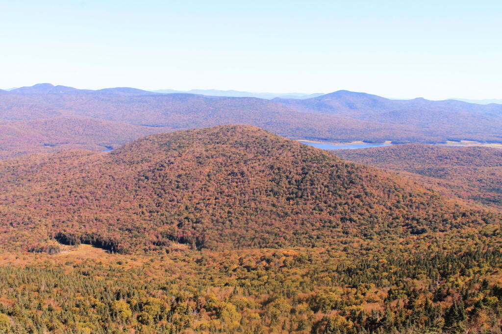
Payne Mountain with Cedar River Flow Beyond It

May 3, 2020 10 PM Update

Good evening! Partly clear and 64 degrees in Delmar, NY. There is a west breeze at 6 mph. ๐Ÿƒ. The dew point is 46 degrees. Nice evening, sat out back for a while. Not feeling terrible but still a little achy from the Lyme. I still need to take the doxycline I got from the doctor Friday. ๐Ÿ’Š

Sleeping with the windows open tonight โฌ› which is nice until I heard the sirens from the meat wagon ๐Ÿš‘go roaring by. I wonder if it’s somebody dying of Coronavirus? Hopefully nobody I know. It’s a question one always asks these days.

I thought about staying up north one more night and driving home early tomorrow ๐Ÿš˜ but I decided against that as I broke camp midday to go hiking. ๐Ÿšถ While hiking the remote section of the abandoned Dunning Pond Snowmobile Trail was quiet I eventually lost the trail as it got into dense woods with lots of trees down and few of the old markers. ๐Ÿ”ด Some nice views of the gorge and then a lot of it was an eroded mountain road until the trail left the road and disappeared into the woods. This wouldn’t have been a big problem if I had the GPS tracks from my Google County Maps part of the blog but of course I managed to somehow delete them off my phone. I got to make sure I have them on the phone along with USGS Topo maps saved. I would have also had a better chance of following the herd path up to Eagle Pond that I had lost on Saturday if I had that data saved. ๐ŸŒWell there always is future trips up north.

It was a pretty good weekend up north ๐Ÿ˜Ž with lots of sun and actually quite mild and warm most of the weekend except for brief rain shower around 10 pm Saturday night ๐Ÿ’ฆwhen I ended up retiring to my truck cap earlier than I had planned. Had a nice big fire ๐Ÿ”ฅ at the same campsite I’ve been at the past few times I’ve been up north on the East Branch Sacandaga River. โ›บ Some traffic ๐Ÿšฅ noise but pretty nice. Spent a lot of time laying back in the hammock, soaking up the sun. โ˜€ The sun felt good especially when I felt achy from the Lyme. Warm enough a good portion of the weekend I could just lay out with a t shirt ๐Ÿ‘š on.

Left my Bluetooth speaker ๐Ÿ”Š home which was annoying when I wanted to listen to podcasts and music ๐ŸŽถ. I’m going to start leaving that in the truck. Better to charge it there too – I don’t pay for the unused solar power the truck produces while parked with the solar controller in float mode. ๐Ÿ”‹ Also forgot ketchup for my hotdogs – ended up topping them with baked beans and cheese. ๐Ÿฃ

Explored more of the Fox Lair remains, I want to do one of those historical aerial photo comparisons, especially if I can find the 1942 aerial photo ๐Ÿ“ท. Not a lot left of the ruins, but I wonder if I can find more old pictures on the internet. ๐ŸฐDid some walking ๐Ÿšถ along NY 8 just for exercise too and to take in the scenery.

Came back relatively early, I was unpacked by about six. ๐Ÿก Laid back on my bed for a while before showering ๐Ÿšฟ and shaving. Got a nice tan. Those side burns I’ve grown are coming in nicely but I do need a hair cut ๐Ÿ’‡. I’m going to do some trimming myself in the morning as who knows when the barber ๐Ÿ’ˆ is going to be allowed to reopen. My barber is so elderly, I wonder if he will just hang up his hat ๐ŸŽฉ after the pandemic. I decided to avoid the expressway and cities home so I took NY 30 to Duanesburg Churches Road past the Mariaville Farm to US 20. Pretty drive with things greening up outside Amsterdam but I tell you there are some sharp curves on NY 30 south of Amsterdam. ๐Ÿ”ถ

Tonight will be partly cloudy ๐ŸŒค, with a low of 49 degrees at 6am. Five degrees above normal, which is similar to a typical night around May 21st. West wind 6 to 8 mph. In 2019, we had cloudy skies. It got down to 52 degrees. The record low of 28 occurred back in 1985.

Tonight will have a Waxing Gibbous ๐ŸŒ” Moon with 85% illuminated. At 10 PM, the moon was in the south (175ยฐ) at an altitude of 52ยฐ from the horizon, some 226,511 miles away from where you are looking up from the earth. ๐Ÿš€ At the state speed limit of 55 mph, you’ll make it there by October 22nd. Buckle up for safety! ๐Ÿ’บ The Flower ๐ŸŒท Moon is on Thursday, May 7. The darkest hour is at 12:53 am, followed by dawn at 5:16 am, and sun starting to rise at 5:48 am in the east-northeast (68ยฐ) and last for 3 minutes and 8 seconds. Sunrise is one minute and 19 seconds earlier than yesterday. ๐ŸŒ„ The golden hour ends at 6:27 am with sun in the east-northeast (74ยฐ). Tonight will have 9 hours and 46 minutes of darkness, a decrease of 2 minutes and 24 seconds over last night.

Tomorrow will have a slight chance of showers between 11am and 1pm. Partly sunny ๐ŸŒฆ, with a high of 57 degrees at 11am. Nine degrees below normal, which is similar to a typical day around April 13th. Northwest wind 9 to 18 mph, with gusts as high as 31 mph. Chance of precipitation is 20%. A year ago, we had light rain in the morning, which became light rain by afternoon. The high last year was 67 degrees. The record high of 91 was set in 1944. There was a dusting of snow in 1986.โ„

Tomorrow I probably should go to the laundromat ๐Ÿ‘–๐Ÿ‘• ๐Ÿ‘š and wash some clothes and probably my sheets too. I can probably bring my laptop there and work from there, uploading pictures from the weekend that was. I’m good on food but the two gallons of milk I bought last week is almost all drunk. I do like my cow ๐Ÿฎ beverages. Other than that I should be good on food until mid week.

As I noted previously, last weekend I got another tick bite. ๐ŸœI was sore found it on Tuesday. Its been weird – sometimes I feel fine other times terribly stiff and sore. No bulls eye though. Went to the doctor on Friday, she kind of thought I didn’t have Lyme but gave me doxycline. ๐Ÿ’Š I held off taking it as I went to the Adirondacks for the weekend and knew doxycline and sun don’t mix due to the risk of severe sunburn. I’m also a little mixed on my concern – it stings from time to time around where I was bit, I’ve been super sleepy at times. ๐Ÿ˜ด I don’t want to take an antibiotic I don’t need. But I guess the doctor while questioning ๐Ÿ™‹ me said I should take it. I don’t know what to think.

It was such a werid experience going to the doctors office during the pandemic. ๐Ÿ˜ซThe doors had big signs warning people that if they had cold or flu symptoms they aren’t welcome and that they did not offer Coronavirus testing there. The whole experience was kind of odd and frightening. ๐Ÿ‘พ

While I’m always cautious about social distancing and wearing a mask out in public places but between the limited vision under the banada, the empty doctors office, the hand sanitizer everywhere and all these things like a special Coronavirus questionnaire that I had to do on my phone before the doctor would see me. ๐Ÿ“ฑ I was so creeped out by the experience.

In four weeks on May 31 the sun will be setting in the west-northwest (301ยฐ) at 8:26 pm,๐ŸŒ„ which is 27 minutes and 53 seconds later then tonight. In 2019 on that day, we had partly cloudy, mist and temperatures between 76 and 55 degrees. Typically, you have temperatures between 74 and 52 degrees. The record high of 92 degrees was set back in 2013.

It looks like for Mothers Day it’s going to be cold and they might get snow in the Adirondacks. โ„ It does not look like a good weekend to get out of town. I’m still thinking about a mid May trip out to Schoharie County – maybe three nights with me working from my truck on a Monday. โ›บ I’m thinking the last week of May – the one after Memorial Day Weekend – to do a three night trip to Piseco Powley Road starting that Thursday night before the weekend if it is nice. I hope to have the screen house by then to avoid the bugs. Peak black fly season isn’t so bad if I have shelter during the day as black flies aren’t out after dark. Memorial Day Weekend proper I’ll stay home ๐Ÿก most likely to avoid the crowds especially if other developed campgrounds are closed forcing people into the back country taking up all the good sites. I’m also seriously thinking about planning my summer vacation up at Piseco Powley Road – and a week at the House Pond Swimming Hole could make up for all the state park pools being closed. ๐ŸŠ I’d have to see about getting a camping permit.

Looking ahead, Mothers Day ๐Ÿ‘ฉโ€ is in 1 week, Pack Rat Day ๐Ÿ€ is in 2 weeks, Strawberry Moon ๐ŸŒ• is in 5 weeks, Fathers Day ๐Ÿ‘จ is in 6 weeks, Election Day 2020 ๐Ÿ—ณ๏ธ is in 6 months and Election Day 2020 ๐Ÿ—ณ๏ธ is in 6 months.

๐Ÿ‡บ๐Ÿ‡ธ๐Ÿฆ…Only 19 days remain until the start of Memorial Day Weekend!๐Ÿฆ…๐Ÿ‡บ๐Ÿ‡ธ

Tulip Time!

August 10, 2019 Afternoon

Good afternoon! Clouds, a few sprinkles and a little sun and 60 degrees here on the Hunter Mountain overlook of the West Kill Valley. ๐ŸŒฆ There is a west-northwest breeze at 15 mph. ๐Ÿƒ. The dew point is 49 degrees. The skies will clear around 4 pm. I’m waiting for it, hoping to get better pictures and videos. ๐Ÿ˜ฉ

This afternoon will have a slight chance of showers. Partly sunny ๐ŸŒฆ, with a high of 60 degrees at 2pm. 21 degrees below normal, which is similar to a typical day around October 15th. Maximum dew point of 49 at 2pm. Northwest wind around 15 mph, with gusts as high as 25 mph. Chance of precipitation is 20%. A year ago, we had mostly sunny skies. It was humid. The high last year was 82 degrees. The record high of 96 was set in 1949.

I decided today to hike up to Hunter Mountain along the West Kill trail. ๐Ÿšถ Later on I plan to see Pratts Rocks in Prattsville and then head up to Burnt Rossman. โ›บ Tomorrow I’ll do some fishing ๐ŸŽฃ in Looking Glass Pond and hit up the farm stands in the Schoharie Valley and then swim ๐ŸŠ in Mine Kill State Park.

I fully admit if I was a responsible adult I would have gone to the Save the Pine Bush organizational meeting ๐ŸŒฒand stayed in town to save gas on my limited budget. But summer is rapidly fading away and I wanted to get out of town before its done and I’m sure rainy weekends aren’t that far off. โ˜” I don’t feel that guilty though, I’ve spent more time on that map and researching things over the past few weeks than anything else I’ve been doing.

The sun will set at 8:04 pm with dusk around 8:35 pm, which is one minute and 21 seconds earlier than yesterday. ๐ŸŒ‡ At sunset, look for partly clear skies ๐ŸŒ„ and temperatures around 54 degrees. The dew point will be 47 degrees. There will be a northwest breeze at 15 mph. Today will have 14 hours and 4 minutes of daytime, an increase of 2 minutes and 23 seconds over yesterday.

Tonight will be partly cloudy ๐ŸŒค, with a low of 47 degrees at 4am. 14 degrees below normal, which is similar to a typical night around September 26th. Northwest wind 10 to 15 mph. In 2018, we had partly cloudy skies in the evening, which became light rain by the early hours of the morning. It was somewhat humid. It got down to 64 degrees. The record low of 46 occurred back in 1941.

Driving through Greenville and stopping at the grocery store ๐Ÿฌ I had forgotten what a hick town I grew up in. Fun place although I don’t know if I’d ever want to go back now with all the gun restrictions ๐Ÿ”ซ and regulations today on open burning ๐Ÿ”ฅ – and I was surprised how expensive things were at the store. But then again in Albany I mostly shop for things on sale at Walmart. I do like the small towns and spend most of my vacation time there but its still cultural shock to go back to the community I haven’t been in regularly for going on two decades now. I’ve worked in other hick towns but the hometown is strange. The girls at the grocery store with their Irish red hair are very cute. ๐Ÿ˜ But as I like to say, their husbands own more guns than me. Fit in well with my big jacked up truck ๐Ÿšš though. That said, I can’t see moving back to the country until I can live in a place where I can have fires and burn whatever I want on my own land. ๐Ÿšœ More on that later.

I forgot how popular the Catskills are these days ๐Ÿ—ป but they sure are beautiful. I should do some more Catskill peaks this fall, maybe truck cap camping in Schoharie or just do day trips. I’ve been taking a lot of pictures but mostly on my 35mm camera ๐Ÿ“ท so it will have to wait for posting until Sunday or Monday. I’m also making a ton of videos. Fortunately, despite hitting a lot of traffic around the fire tower ๐Ÿ—ผ the ledge I’m on is relatively quiet and has nice views when you peer over the tree line. ๐ŸŒฒ๐ŸŒฒ๐ŸŒฒ๐ŸŒฒSun is coming out โ˜€ and I’m lazy so I’m procrastinating a bit but I should hurry up so I also have time to see Pratts Rocks.

As previously noted, there are 2 weeks until Average High Falls To 79 ๏ธDegrees โ›ฑ๏ธ๏ธ๏ธ when the sun will be setting at 7:43 pm with dusk at 8:12 pm. On that day in 2018, we had sunny and temperatures between 85 and 57 degrees. ๐ŸŒป We hit a record high of 95 back in 1947.

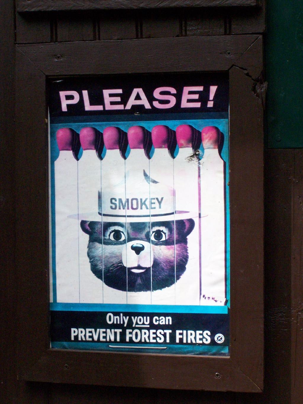
Only You Can Prevent Forest Fires