Counties: Albany to Delaware / Dutchess to Livingston / Madison to Otsego / Putnam to Suffolk / Sullivan to Yates
Browse Topographic Maps: Full State / Historical USGS Topographic Maps
Counties: Albany to Delaware / Dutchess to Livingston / Madison to Otsego / Putnam to Suffolk / Sullivan to Yates
Browse Topographic Maps: Full State / Historical USGS Topographic Maps
Counties: Albany to Delaware / Dutchess to Livingston / Madison to Otsego / Putnam to Suffolk / Sullivan to Yates
Browse Topographic Maps: Full State / Historical USGS Topographic Maps
Counties: Albany to Delaware / Dutchess to Livingston / Madison to Otsego / Putnam to Suffolk / Sullivan to Yates
Browse Topographic Maps: Full State / Historical USGS Topographic Maps
You can get a downloadable, more detailed map with campsites, lean-tos, scenic vistas and trails.
Note: This list is sorted from North to South, and West to East in New York, therefore the farthest North Lean-To in NY State is in the Debar Mountain Wild Forest, and the farthest south one is in David A. Sarnoff Pine Barrens Preserve in Long Island. Location links take you to aerial photos of the Lean-Tos on the free ACME Mapper.
Download or View this Chart on Google Sheets
| State Forest Land | Name | Type | Description | Location |
|---|---|---|---|---|
| Debar Mtn. Wild Forest | Debar Mountian Lean-To | Lean-To | 44.598926, -74.228592 | |
| Debar Mtn. Wild Forest | Grass Pond Lean-To | Lean-To | 44.493389, -74.251194 | |
| Taylor Pond Wild Forest | North Shore Taylor Pond Lean-To | Lean-To | Managed By Operations | 44.4897, -73.861427 |
| Taylor Pond Wild Forest | South East Taylor Pond Lean-To | Lean-To | Managed By Operations | 44.482888, -73.853777 |
| Taylor Pond Wild Forest | Northwest Shore Taylor Pond Lean-To | Lean-To | Managed By Operations | 44.477689, -73.881283 |
| Taylor Pond Wild Forest | Poke-O-Moonshine Summit Lean-To | Lean-To | 44.399797, -73.514557 | |
| Saint Regis Canoe Area | Fish Pond Campsite 2 | Lean-To | 44.396133, -74.370421 | |
| Saint Regis Canoe Area | Fish Pond Campsite 5 | Lean-To | 44.391301, -74.365807 | |
| Saint Regis Canoe Area | St. Regis Pond South Shore Lean-To | Lean-To | Within The Adopt A Lean-To System | 44.380642, -74.320299 |
| Saint Regis Canoe Area | St. Regis Pond Campsite 19 | Lean-To | 44.380626, -74.320423 | |
| Wolf Lake State Forest | Beaver Flow Lean-To | Lean-To | 44.357822, -75.316001 | |
| Mckenzie Mtn. Wilderness | Loch Bonnie Lean-To | Lean-To | 44.347347, -73.995669 | |
| Mckenzie Mtn. Wilderness | White Face Brook Lean-To | Lean-To | 44.344217, -73.928647 | |
| Wolf Lake State Forest | Wolf Lake Lean-To | Lean-To | 44.336323, -75.313886 | |
| Saranac Lakes Wild Forest | Lake Placid Campsite 3 | Lean-To | 44.332595, -73.95668 | |
| Saranac Lakes Wild Forest | Lake Placid Campsite 2 | Lean-To | 44.332296, -73.956626 | |
| Wolf Lake State Forest | Moon Pond Lean-To | Lean-To | 44.332276, -75.321172 | |
| Saranac Lakes Wild Forest | Follensby Clear | Lean-To | 44.325095, -74.349897 | |
| Wolf Lake State Forest | Huckleberry Lake Lean-To | Lean-To | 44.324272, -75.333738 | |
| Mckenzie Mtn. Wilderness | Placid Lean-To | Lean-To | 44.321456, -74.030786 | |
| Saranac Lakes Wild Forest | Lean-To | 44.309124, -74.18053 | ||
| Saranac Lakes Wild Forest | Lean-To | 44.302887, -74.302634 | ||
| Saranac Lakes Wild Forest | Lean-To | 44.289835, -74.216869 | ||
| Saranac Lakes Wild Forest | Lean-To | 44.286942, -74.289775 | ||
| Saranac Lakes Wild Forest | Lean-To | 44.286657, -74.162602 | ||
| Saranac Lakes Wild Forest | Lean-To | 44.271712, -74.273283 | ||
| Saranac Lakes Wild Forest | Lean-To | 44.265599, -74.24293 | ||
| Hurricane Mountain Primitive Area | Lost Pond/Biesemeyer | Lean-To | 44.26073, -73.710011 | |
| Hurricane Mountain Primitive Area | Gulf Brook Lean-To | Lean-To | 44.253097, -73.71796 | |
| Saranac Lakes Wild Forest | Lean-To | 44.228772, -74.375533 | ||
| High Peaks Wilderness | Lean-To | 44.198805, -74.31831 | ||
| Horseshoe Lake Wild Forest | Eagle Landing Lean-To | Lean-To | 44.19683, -74.512309 | |
| High Peaks Wilderness | Lean-To | 44.177317, -74.321808 | ||
| Giant Mountain Wilderness | Giant Mtn. Lean-To | Lean-To | 44.175641, -73.722171 | |
| Giant Mountain Wilderness | Giant Mtn. Lean-To | Lean-To | 44.175641, -73.722171 | |
| Horseshoe Lake Wild Forest | Lean-To | 44.158907, -74.560725 | ||
| High Peaks Wilderness | Lean-To | 44.15683, -74.313308 | ||
| Cranberry Lake Wild Forest | Lean-To | 44.1534, -74.884029 | ||
| High Peaks Wilderness | Lean-To | 44.147236, -74.318105 | ||
| Dix Mountain Wilderness | Bouquet Lean-To | Lean-To | 44.110904, -73.774043 | |
| High Peaks Wilderness | Lean-To | 44.105829, -74.312037 | ||
| Sargent Ponds Wild Forest | Lean-To | 44.102744, -74.321863 | ||
| Sargent Ponds Wild Forest | Lean-To | 44.082504, -74.333915 | ||
| Sargent Ponds Wild Forest | Lean-To | 44.081407, -74.335829 | ||
| High Peaks Wilderness | Lean-To | 44.065927, -74.326697 | ||
| Dix Mountain Wilderness | Lilian Brook Lean-To | Lean-To | 44.058989, -73.806533 | |
| Dix Mountain Wilderness | Slide Brook Lean-To | Lean-To | 44.044126, -73.805858 | |
| High Peaks Wilderness | Lean-To | 44.042977, -74.349335 | ||
| High Peaks Wilderness | Lean-To | 44.041409, -74.350149 | ||
| High Peaks Wilderness | Lean-To | 44.02862, -74.366763 | ||
| High Peaks Wilderness | Lean-To | 44.002655, -74.38648 | ||
| William C. Whitney Wilderness | Lake Lila # 7 | Lean-To | 44.002145, -74.775682 | |
| High Peaks Wilderness | Lean-To | 43.998164, -74.392741 | ||
| Independence River Wild Forest | Trout Pond Lean To | Lean-To | 43.928489, -74.94487 | |
| Independence River Wild Forest | Trout Pond Lean To | Lean-To | 43.928489, -74.94487 | |
| Sargent Ponds Wild Forest | Deerland Carry Lean-To 2 | Lean-To | Fair Condition | 43.926218, -74.475396 |
| Sargent Ponds Wild Forest | Deerland Carry Lean-To 1 | Lean-To | Fair Condition | 43.925781, -74.475846 |
| Sargent Ponds Wild Forest | Pinebrook Lean-To | Lean-To | Fair Condition | 43.906646, -74.50259 |
| Sargent Ponds Wild Forest | Lean-To | 43.902847, -74.548063 | ||
| Blue Mountain Wild Forest | North End Tirrel Pond Lean-To | Lean-To | 43.887378, -74.377739 | |
| Sargent Ponds Wild Forest | Lean-To | 43.879414, -74.606052 | ||
| Blue Mountain Wild Forest | O’neil Lean-To | Lean-To | 43.875096, -74.367316 | |
| Sargent Ponds Wild Forest | Lean-To | 43.871006, -74.628108 | ||
| Sargent Ponds Wild Forest | Lean-To | 43.870772, -74.628507 | ||
| Sargent Ponds Wild Forest | Lean-To | 43.87072, -74.629172 | ||
| Sargent Ponds Wild Forest | Lower Sargents Pond Lean-To | Lean-To | Fair Condition | 43.859331, -74.562695 |
| Blue Ridge Wilderness | Boulder | Lean-To | 43.841564, -74.472689 | |
| Sargent Ponds Wild Forest | Lean-To | 43.836898, -74.535266 | ||
| Moose River Plains Wild Forest | Lean-To | 43.831671, -74.661756 | ||
| Moose River Plains Wild Forest | Lean-To | 43.831605, -74.661511 | ||
| Moose River Plains Wild Forest | Lean-To | 43.831434, -74.660902 | ||
| Blue Ridge Wilderness | Cascade Pond Lean-To | Lean-To | 43.829744, -74.436618 | |
| Independence River Wild Forest | Panther Pond Lean-To | Lean-To | 43.823535, -75.169312 | |
| Blue Ridge Wilderness | Wilson Pond | Lean-To | 43.820192, -74.46868 | |
| Blue Ridge Wilderness | Stephens Pond | Lean-To | 43.818674, -74.420524 | |
| Blue Ridge Wilderness | Stephens Pond | Lean-To | 43.818674, -74.420524 | |
| Blue Ridge Wilderness | Stephens Pond | Lean-To | 43.818674, -74.420524 | |
| Blue Ridge Wilderness | Stephens Pond | Lean-To | 43.818674, -74.420524 | |
| Blue Ridge Wilderness | Stephens Pond | Lean-To | 43.818674, -74.420524 | |
| Blue Ridge Wilderness | Stephens Pond | Lean-To | 43.818674, -74.420525 | |
| Sargent Ponds Wild Forest | Lean-To | 43.817134, -74.64378 | ||
| Sargent Ponds Wild Forest | Lean-To | 43.81709, -74.643251 | ||
| Sargent Ponds Wild Forest | Lean-To | 43.8162, -74.644668 | ||
| Blue Ridge Wilderness | Blue Ridge Lean-To | Lean-To | 43.80014, -74.610139 | |
| Moose River Plains Wild Forest | 8thlake East Shore Lean-To | Lean-To | 43.789783, -74.698592 | |
| Moose River Plains Wild Forest | 8th Lake North Shore Lean-To | Lean-To | 43.780115, -74.704439 | |
| Moose River Plains Wild Forest | 8th Lake Island Lean-To | Lean-To | 43.779025, -74.704429 | |
| Moose River Plains Wild Forest | Lean-To | 43.75639, -74.717817 | ||
| Moose River Plains Wild Forest | Lean-To | 43.750767, -74.734643 | ||
| Moose River Plains Wild Forest | Lean-To | 43.747805, -74.744199 | ||
| Independence River Wild Forest | Pine Lake Lean-To | Lean-To | 43.708394, -75.146453 | |
| Haderondah | Middle Branch Lake | Lean-To | 43.702926, -75.096002 | |
| Siamese Ponds Wilderness | Hour Pond Lean-To | Lean-To | 43.70112, -74.158221 | |
| Haderondah | Cedar Pond Lean To | Lean-To | 43.69597, -75.082602 | |
| Haderondah | Middle Settlement Lake | Lean-To | 43.685949, -75.098614 | |
| West Canada Lakes Wilderness | Colvin Brook Lean-To | Lean-To | 43.652414, -74.49038 | |
| Lake George Wild Forest | Five Mile Mountain Lean-To | Lean-To | Lean-To W/ Privy And Firering | 43.647336, -73.574534 |
| Black River Wild Forest | Remsen Falls Lean-To | Lean-To | 43.629925, -75.036288 | |
| Lake George Wild Forest | Fifth Peak Lean-To | Lean-To | Lean-To W/ Privy And Firering | 43.619313, -73.584112 |
| Black River Wild Forest | Woodhull Lake Lean-To | Lean-To | 43.599885, -75.020382 | |
| Lake George Wild Forest | Black Mountain Ponds Lean-To | Lean-To | Lean-To With Privy And Firering | 43.59966, -73.533064 |
| West Canada Lakes Wilderness | Pillsbury Lake Lean-To | Lean-To | 43.596898, -74.531665 | |
| Lake George Wild Forest | Lean-To | Campsite With Lean-To 13-27 | 43.595821, -73.517951 | |
| Lake George Wild Forest | Lean-To | Campsite With Lean-To 5-10 | 43.587168, -73.527759 | |
| Lake George Wild Forest | Greenland Pond Leanto | Lean-To | Leanto With Privy, Picnic Table And Fire Ring | 43.577804, -73.51684 |
| Lake George Wild Forest | Fishbrook Pond North Leanto | Lean-To | Leanto With Privy, Picnic Table And Fire Ring | 43.576039, -73.536103 |
| Lake George Wild Forest | Fishbrook Pond South Leanto | Lean-To | Leanto With Privy, Picnic Table And Fire Ring | 43.573872, -73.538477 |
| Black River Wild Forest | Sand Lake Falls Lean-To | Lean-To | 43.558914, -75.003058 | |
| Black River Wild Forest | Gull Lake Lean-To | Lean-To | 43.553747, -75.059378 | |
| Black River Wild Forest | Chub Pond Lean-To #2 | Lean-To | 43.529823, -75.042494 | |
| Black River Wild Forest | Chub Pond Lean-To #1 | Lean-To | 43.524598, -75.043801 | |
| West Canada Lakes Wilderness | T Lake Leant-To | Lean-To | 43.452718, -74.582282 | |
| Silver Lake Wilderness | Hamilton Lake Stream Lean-To 1 | Lean-To | 43.39716, -74.455046 | |
| Silver Lake Wilderness | Hamilton Lake Stream Lean-To 2 | Lean-To | 43.397156, -74.455065 | |
| Cobb Brook State Forest | Leanto | Lean-To | 43.344545, -75.67222 | |
| Silver Lake Wilderness | Mud Lake Lean-To | Lean-To | 43.342671, -74.456291 | |
| Deruyter State Forest | Deruyter Lean-To | Lean-To | 42.820185, -75.859105 | |
| Morgan Hill State Forest | Morgan Hill Lean-To | Lean-To | 42.767202, -76.011256 | |
| Perkins Pond State Forest | Flt Lean-To | Lean-To | 42.642307, -75.743766 | |
| Dutch Settlement State Forest | Lean-To | Lean-To | 42.629438, -74.267543 | |
| Whaupaunaucau State | Leanto | Lean-To | 42.606063, -75.467114 | |
| Burnt-Rossman Hills State Forest | Eminence Lean-To | Lean-To | 42.543304, -74.488595 | |
| Clapper Hollow State Forest | Clapper Hollow Lean-To | Lean-To | 42.528201, -74.642004 | |
| Tuller Hill State Forest | Tuller Hill Lean-T0 | Lean-To | Rebuilt In 2002 From Local State Forest Red Pine, Built By Volunteers From Suny Cortland | 42.512201, -76.120824 |
| Kennedy State Forest | Foxfire Leanto | Lean-To | 42.472853, -76.178732 | |
| Ludlow Creek State Forest | Ludlow Creek Lean-To | Lean-To | 8′ X 10′ | 42.445802, -75.701507 |
| Genegantslet State Forest | Top Ten Lean-To | Lean-To | 20′ X 20′ | 42.422887, -75.767435 |
| Robinson Hollow State Forest | Kimme Lean-To | Lean-To | 42.390596, -76.271801 | |
| Sugar Hill State Forest | Vanzandt Lean-To | Lean-To | 42.389935, -76.972601 | |
| Sugar Hill State Forest | The Twin Lean-To’s | Lean-To | Two Lean-To At This Location | 42.382253, -77.00268 |
| Sugar Hill State Forest | Templar Rd Lean-To | Lean-To | 42.373082, -76.95548 | |
| Sugar Hill State Forest | Parks Hollow Lean-To | Lean-To | 42.369463, -77.012608 | |
| Huntersfield State Forest | Lean-To | Lean-To | 42.355041, -74.346067 | |
| Beebe Hill State Forest | Beebe Hill Lean-To | Lean-To | 42.335425, -73.484181 | |
| Shindagin Hollow State Forest | Shindagin Lean-T0 | Lean-To | Scheduled For Replacement In 2004 | 42.327644, -76.329036 |
| Danby State Forest | Bald Hill Lean-To | Lean-To | 42.327042, -76.490061 | |
| Danby State Forest | Travor Rd Lean-To | Lean-To | 42.317642, -76.422544 | |
| Harvey Mountain State Forest | Harvey Mountain Lean-To | Lean-To | 42.313988, -73.441495 | |
| Burt Hill State Forest | On Finger Lake Trail Lean-To | Lean-To | 42.313213, -77.566373 | |
| Elm Ridge Wild Forest | On Elm Ridge Trail Lean-To | Lean-To | 42.306134, -74.173598 | |
| South Bradford State Forest | Moss Hill Lean-To | Lean-To | 42.289116, -77.118881 | |
| Windham Blackhead Range Wilderness | Batavia Kill Lean-To | Lean-To | 42.278839, -74.102579 | |
| Rusk Mountain Wild Forest | John Robb Leanto Lean-To | Lean-To | 42.189374, -74.238696 | |
| Rusk Mountain Wild Forest | Diamond Notch Lean-To | Lean-To | 42.16917, -74.256848 | |
| Hunter-West Kill Mountain Wilderness | Devil’s Acre Lean-To | Lean-To | Good Condition | 42.165955, -74.229624 |
| Arctic China State Forest | A-40 Lean-To | Lean-To | 42.158491, -75.362027 | |
| Barbour Brook State Forest | A-41 Lean To | Lean-To | 42.152807, -75.31021 | |
| Lean-To | 42.135655, -74.16269 | |||
| Dry Brook Ridge Wild Forest | German Hollow Road Lean-To | Lean-To | 42.134527, -74.616198 | |
| Lean-To | 42.119518, -74.086575 | |||
| Lean-To | 42.117719, -74.503199 | |||
| Lean-To | 42.115031, -74.49075 | |||
| Lean-To | 42.102787, -74.394826 | |||
| Lean-To | 42.098467, -74.09079 | |||
| Big Indian Wildernes Area | Rider Hollow Lean-To | Lean-To | 42.092012, -74.505713 | |
| Lean-To | 42.082185, -74.586611 | |||
| Big Indian Wildernes Area | Mckinly Hollow Lean-To | Lean-To | 42.075339, -74.485857 | |
| Lean-To | 42.071935, -74.28035 | |||
| Lean-To | 42.069751, -74.287449 | |||
| Lean-To | 42.067368, -74.586988 | |||
| Lean-To | 42.066913, -74.654635 | |||
| Big Indian Wildernes Area | Shandaken Brook Lean-To | Lean-To | 42.050274, -74.5106 | |
| Delaware Wild Forest | Campbell Mountain Trail Lean-To | Lean-To | 42.048989, -74.927363 | |
| Lean-To | 42.048641, -74.645056 | |||
| Lean-To | 42.039437, -74.594017 | |||
| Lean-To | 42.027316, -74.335645 | |||
| Delaware Wild Forest | Trout Pond Trail North Lean-To | Lean-To | Built For Ada | 42.012942, -74.946392 |
| Delaware Wild Forest | Trout Pond Trail South Lean-To | Lean-To | Built For Ada | 42.011758, -74.947566 |
| Big Indian Wildernes Area | Biscuit Brook Lean-To | Lean-To | 42.009105, -74.483852 | |
| Delaware Wild Forest | Pelnor Hollow Trail Lean-To | Lean-To | 42.005744, -74.867403 | |
| Big Indian Wildernes Area | Fall Brook Lean-To | Lean-To | 41.998075, -74.560392 | |
| Lean-To | 41.959182, -74.406877 | |||
| Lean-To | 41.94006, -74.632055 | |||
| David A. Sarnoff Pine Barrens Preserve | Interior Lean- To | Lean-To | 40.89774, -72.660615 |

Looking for state land to wheel on? This list shows all of the conservation department-maintained DEC truck trails and public access roads that are more then a 1/2 mile long. This roads are varied, but most of them are dirt roads that take you through the back country. Town maintained roads through state forests are generally not shown on in this listing.
| State Land | Road | Miles |
|---|---|---|
| Albert J. Woodford Memorial State Forest | Truck Trail | 0.7 |
| Albert J. Woodford Memorial State Forest | Janis Road | 1.1 |
| Aldrich Pond Wild Forest | Powell Road | 0.5 |
| Aldrich Pond Wild Forest | Mullins Flow Road | 0.6 |
| Aldrich Pond Wild Forest | Little River Road | 0.7 |
| Aldrich Pond Wild Forest | Silver Dawn Road | 0.7 |
| Aldrich Pond Wild Forest | Jackworks Trail | 1.1 |
| Aldrich Pond Wild Forest | South Creek Lake Road | 1.6 |
| Aldrich Pond Wild Forest | Tyler Road | 3.7 |
| Aldrich Pond Wild Forest | Streeter Lake Road | 4.8 |
| Allen Lake State Forest | George Forest Road | 1.5 |
| Ambler State Forest | Truck Trail | 1.8 |
| Ampersand Primitive Area | Ampersand Park Road | 3.2 |
| Andersen Hill State Forest | Big Pine Public Forest Acess Road | 1.5 |
| Arctic China State Forest | China Public Forest Access Road | 1.1 |
| Arctic China State Forest | Shears Public Forest Access Road | 2 |
| Arctic China State Forest | Dunbar Public Forest Access Road | 2.1 |
| Armlin Hill State Forest | Truck Trail | 1.1 |
| Arnold Lake State Forest | Public Forest Access Road | 0.9 |
| Arnold Lake State Forest | Hartwick Forest Access Road | 1 |
| Ashland Pinnacle State Forest | Ashland Pinnacle Access Road #2 | 0.5 |
| Ashland Pinnacle State Forest | Haul Road #1/Long Path Hiking Trail | 1.4 |
| Avon Regional Office | Goodlake Year Entrance Road | 0.7 |
| Baker School House State Forest | Baker School House Public Forest Acess Road | 1.8 |
| Bald Mountain State Forest | Howe Forest Road | 2.4 |
| Balsam Creek State Forest | Briar Hill Road | 1.5 |
| Barbour Brook State Forest | Barbour Brook Public Forest Access Road | 2 |
| Basswood State Forest | Burlington Public Forest Access Road | 0.5 |
| Basswood State Forest | Basswood Pond Public Forest Access Road | 1 |
| Basswood State Forest | Dr. Crouch Truck Trail | 1.3 |
| Bates State Forest | Pucker Street | 1 |
| Bates State Forest | Bates Forest Road | 2.6 |
| Battle Hill State Forest | Unnamed | 1.3 |
| Bear Pond Primitive Area | Bear Pond Road | 0.8 |
| Bear Swamp State Forest | Karsch Haul Road | 0.5 |
| Bear Swamp State Forest | Joe Chamberlin Public Forest Access Road | 1.6 |
| Bear Swamp State Forest | Roseboom Public Facility Truck Trail | 1.8 |
| Bear Swamp State Forest | Snowmobile Trail | 8.3 |
| Bearpen Mountain State Forest | Ski Run Road | 2.1 |
| Beartown State Forest | Town Road | 0.7 |
| Beartown State Forest | Cotton Road | 0.8 |
| Beartown State Forest | Steam Mill Road | 0.8 |
| Beartown State Forest | Aspen Hollow Road | 2.4 |
| Beaver Creek State Forest | Public Forest Access Road 2, Madison 11 | 0.5 |
| Beaver Creek State Forest | Truck Trail -2-12 | 0.7 |
| Beaver Creek State Forest | Public Forest Access Road 1, Madison 11 | 1.3 |
| Beaver Creek State Forest | Truck Trail -1-12 | 3.6 |
| Beaver Dam State Forest | Sears Public Forest Acess Road | 1.4 |
| Beaver Meadow State Forest | Weir Dam Truck Trail | 0.5 |
| Beebe Hill State Forest | Barrett Pond Road | 1.4 |
| Beebe Hill State Forest | Loop Road | 2.3 |
| Big Brook State Forest | County Line Road Spur | 0.6 |
| Big Brook State Forest | Walasek Mulcoy Road | 0.8 |
| Big Brook State Forest | Hanifin Road | 0.9 |
| Big Brook State Forest | County Line Road | 1.4 |
| Birdseye Hollow State Forest | Sanford Lake Access Road | 0.5 |
| Black Creek State Forest | Stanley Road | 1.1 |
| Black River Wild Forest | Remsen Falls Trail | 0.5 |
| Black River Wild Forest | Woods Lake Road | 0.5 |
| Black River Wild Forest | Gull Lake Road | 0.6 |
| Black River Wild Forest | Flansburg Road | 0.7 |
| Black River Wild Forest | Party Road | 0.7 |
| Black River Wild Forest | Black Creek Road | 0.8 |
| Black River Wild Forest | Cohen Road | 1.7 |
| Black River Wild Forest | Flansberg Road | 2.6 |
| Black River Wild Forest | Black Creek Lake Road | 3 |
| Black River Wild Forest | Haskell Road | 3 |
| Black River Wild Forest | Mill Creek Road | 3.4 |
| Black River Wild Forest | Nicks Lake Campground Roads | 3.5 |
| Black River Wild Forest | Wolf Lake Landing Road | 4.8 |
| Black River Wild Forest | West Creek Road | 6.3 |
| Blenheim Hill State Forest | Ward Allen Road | 1.1 |
| Blenheim Hill State Forest | Quarry Road | 1.2 |
| Blue Mountain Wild Forest | Deer Pond Road | 1.1 |
| Blue Mountain Wild Forest | Chain Lakes Road North | 1.3 |
| Blue Mountain Wild Forest | Polaris Road | 1.3 |
| Bombay State Forest | Cross Haul Road | 0.7 |
| Bombay State Forest | Railroad Bed Public Forest Acess Road | 1.2 |
| Bombay State Forest | Pike Brook Haul Road | 3.1 |
| Bonaparte’s Cave State Forest | Corbine Road | 0.8 |
| Bonaparte’s Cave State Forest | Mud Pond Road | 0.8 |
| Boutwell Hill State Forest | Arab Hill Forest Road, Cha 1 Section | 0.8 |
| Boutwell Hill State Forest | Arab Hill Forest Road, Cha 7 Section | 2.1 |
| Boyce Hill State Forest | Jackson Forest Road | 0.6 |
| Brasher State Forest | Route 53 Haul Road | 0.5 |
| Brasher State Forest | Beaver Pond Trail | 0.6 |
| Brasher State Forest | Kennehan Haul Road | 0.8 |
| Brasher State Forest | Bush Road | 1.1 |
| Brasher State Forest | Buckley Haul Road | 1.2 |
| Brasher State Forest | Cc Dam Public Forest Access Road | 1.2 |
| Brasher State Forest | Mccarthy Public Forest Access Road | 1.6 |
| Brasher State Forest | Liberty Public Forest Access Road | 1.7 |
| Brasher State Forest | Hastings Falls Haul Road | 2.1 |
| Brasher State Forest | Wilson Public Forest Access Road | 2.1 |
| Brasher State Forest | Camp / Larue Public Forest Access Road | 2.2 |
| Brasher State Forest | Pascal Haul Road | 2.4 |
| Brasher State Forest | Bush Public Forest Access Road | 2.9 |
| Brasher State Forest | Railroad Bed Public Forest Access Road | 3.6 |
| Brokenstraw State Forest | Brokenstraw Forest Road | 1.7 |
| Bryant Hill State Forest | Hawk Forest Road | 1.4 |
| Buck Hill State Forest | Hertz Road | 0.7 |
| Buck Hill State Forest | Truck Trail | 1.5 |
| Buck Hill State Forest | Buck Hill Road | 3.1 |
| Bucks Brook State Forest | Access Trail | 0.6 |
| Buckton State Forest | Buckton Haul Road | 0.8 |
| Bucktooth State Forest | Baily Hollow Forest Road | 0.6 |
| Bucktooth State Forest | Manley Hill Forest Road | 1 |
| Bully Hill State Forest | Dixon Forest Road | 1 |
| Bully Hill State Forest | Connection Forest Road | 1.6 |
| Bully Hill State Forest | Stearns Forest Road | 2.1 |
| Burnt-Rossman Hills State Forest | Koenig Road | 0.5 |
| Burnt-Rossman Hills State Forest | Betty Brook Haul Road | 0.6 |
| Burnt-Rossman Hills State Forest | Eminence Dead End Truck Trail | 0.7 |
| Burnt-Rossman Hills State Forest | Duck Pond Road | 1.2 |
| Burnt-Rossman Hills State Forest | Monkey Run Truck Trail East | 1.3 |
| Burnt-Rossman Hills State Forest | Yankee Street Truck Trail | 1.3 |
| Burnt-Rossman Hills State Forest | Betty Brook Road | 1.4 |
| Burnt-Rossman Hills State Forest | Betty Brook Truck Trail | 1.5 |
| Burnt-Rossman Hills State Forest | Duck Pond Truck Trail | 1.5 |
| Burnt-Rossman Hills State Forest | Morey Road Truck Trail | 1.7 |
| Burnt-Rossman Hills State Forest | Eminence Road Truck Trail | 2.6 |
| Burnt-Rossman Hills State Forest | Burnt Hill Road | 2.9 |
| Bush Hill State Forest | Fox Cross Forest Road | 2 |
| California Hill State Forest | Wayawanda Road | 0.7 |
| Canacadea State Forest | Macduff Road | 2.3 |
| Canadaway Creek Wma | Dibble Hill Forest Road | 2 |
| Canaseraga State Forest | Ringelberg Truck Trail | 0.5 |
| Canaseraga State Forest | Right Fork Truck Trail | 1 |
| Canaseraga State Forest | Stanley Road | 1.1 |
| Canaseraga State Forest | Left Fork Truck Trail | 1.4 |
| Caroga Lake Campground | Campground Road | 2 |
| Catherineville State Forest | Santamont Access Trail | 1.1 |
| Catherineville State Forest | Circle Public Forest Access Road | 1.8 |
| Charles E. Baker State Forest | Truck Trail 5 | 0.6 |
| Charles E. Baker State Forest | Truck Trail 2 | 0.9 |
| Charles E. Baker State Forest | Truck Trail 6 | 0.9 |
| Charles E. Baker State Forest | Truck Trail 4 | 1.4 |
| Charles E. Baker State Forest | Truck Trail 12 | 1.5 |
| Charles E. Baker State Forest | Truck Trail 8 | 1.9 |
| Charles E. Baker State Forest | Truck Trail 7 | 2.1 |
| Charles E. Baker State Forest | Truck Trail 1 | 3 |
| Charles E. Baker State Forest | Truck Trail 13 | 3.2 |
| Chazy Highlands State Forest | Spring Road | 0.6 |
| Cherry Valley State Forest | Kniskern Public Access Road | 1.2 |
| Cherry Valley State Forest | Mosse Public Forest Access Road | 1.9 |
| Cinnamon Lake State Forest | Hornby Road Haul Road | 0.7 |
| Clapper Hollow State Forest | Clapper Hollow Truck Trail | 1 |
| Clark Hill State Forest | Abandoned Town Road | 0.8 |
| Clark Hill State Forest | Truck Trail | 0.9 |
| Clark Hill State Forest | Access Road North Of Buck Hill Road | 0.9 |
| Clark Hill State Forest | Class A Truck Trail | 1.2 |
| Clark Hill State Forest | Haul Road | 1.3 |
| Cliffside State Forest | Railroad Haul Road | 1.3 |
| Cobb Brook State Forest | Unnamed Truck Trail | 0.6 |
| Cold Creek State Forest | Headwaters Forest Road | 1.4 |
| Cold Spring Brook State Forest | Cold Spring Brook Public Forest Access Road | 1.9 |
| Cole Hill State Forest | Cr 2 Access Road | 0.8 |
| Coyle Hill State Forest | Warner Spur Forest Road | 0.5 |
| Coyle Hill State Forest | Slawson Forest Road | 0.8 |
| Coyle Hill State Forest | Warner Forest Road | 1.8 |
| Cranberry Lake Campground | Campground Road | 2.5 |
| Cranberry Lake Wild Forest | Grass River Railroad | 6.1 |
| Cuyler Hill State Forest | Jipson Hill Public Forest Acess Road | 1.3 |
| Cuyler Hill State Forest | Cuyler Hill Public Forest Acess Road | 5.1 |
| David A. Sarnoff Preserve | Field Access Road | 0.8 |
| Debar Mountain Wild Forest | Debar Game Refuge Road | 0.5 |
| Debar Mountain Wild Forest | Debar Meadow Road | 0.6 |
| Debar Mountain Wild Forest | Vanderwalker Road | 0.9 |
| Debar Mountain Wild Forest | 4 Mile Road Riffle Season Access Corridor | 1.1 |
| Debar Mountain Wild Forest | Ny Centrail Railroad Bed | 2.2 |
| Deer River State Forest | Ccc Road | 0.6 |
| Deer River State Forest | Hogsback Road | 0.6 |
| Deer River State Forest | Willow Road | 0.6 |
| Deer River State Forest | Glaze Road | 0.7 |
| Deer River State Forest | Avery Lot Road | 0.9 |
| Deer River State Forest | Esseltine Hill Road | 0.9 |
| Deer River State Forest | Ricky’s Number Trail | 1 |
| Deer River State Forest | Horse Barn Road | 1.2 |
| Deer River State Forest | Laramie Road | 1.3 |
| Deer River State Forest | Beanville Road | 1.4 |
| Deer River State Forest | Spruce Road | 1.6 |
| Deer River State Forest | Loope Road | 2 |
| Deer River State Forest | Firewood Road | 2.6 |
| Degrasse State Forest | Burns Flats Road | 0.5 |
| Degrasse State Forest | Loop Road | 1.2 |
| Deruyter State Forest | Tromp Road | 1.5 |
| Dobbins Memorial State Forest | Snowmobile Trail | 3.5 |
| Dog Hollow State Forest | Brewer Public Forest Acess Road | 0.9 |
| Downerville State Forest | River Public Forest Access Road | 1 |
| Dry Run State Forest | Wildcat Hollow | 0.8 |
| Dunkin’s Reserve State Forest | Access Road | 3.5 |
| Dutch Settlement State Forest | Haul Road #1 | 0.6 |
| Dutton Ridge State Forest | Dutton Ridge Access Road | 1.5 |
| Earlville State Forest | Mad 2 Forest Access Road | 1.5 |
| East Osceola State Forest | Malloy Brook Road | 1.1 |
| East Otto State Forest | Kriedeman Forest Road | 1.7 |
| Edgewood Oak Brush Plains Preserve | Edgewood Oak Brush Plains Preserve | 0.5 |
| Edgewood Oak Brush Plains Preserve | Unpaved Forest Road | 0.5 |
| Edgewood Oak Brush Plains Preserve | Old Commack Road | 1.6 |
| English Hill State Forest | Ricketts Forest Road | 0.9 |
| Exeter State Forest | Exeter Public Forest Access Road | 1.3 |
| Fairfield State Forest | Jenksville Hill Public Forest Acess Road | 2 |
| Fall Brook State Forest | Gossner Road | 0.6 |
| Fall Brook State Forest | Haul Road To B-45 Wetland | 0.9 |
| Fall Brook State Forest | Access Road From Co. Rt 67A | 1 |
| Fall Brook State Forest | Forest Access Roaad | 1.2 |
| Ferris Lake Wild Forest | Meco Lake Trail | 0.9 |
| Ferris Lake Wild Forest | Sheriff Lake Trail | 0.9 |
| Ferris Lake Wild Forest | Mud Lake Road | 5.5 |
| Fish Creek State Forest | Forward Road | 0.5 |
| Fish Creek State Forest | Trestle Road | 0.6 |
| Fish Creek Wma | State Highway 184 Access Road | 0.9 |
| Five Rivers Education Center | Goose Lane | 0.5 |
| Flat Rock State Forest | Pedobo Road | 0.8 |
| Flat Rock State Forest | Karsch Haul Road | 0.9 |
| Flat Rock State Forest | Ampersand Park Road | 1.9 |
| Florence Hill State Forest | Florence Hill Road | 1.9 |
| Fort Jackson State Forest | Sheldon Public Forest Access Road | 0.5 |
| Frank E. Jadwin Memorial State Forest | Keesler Road | 0.6 |
| Frank E. Jadwin Memorial State Forest | Old Croghan Road | 0.7 |
| Frank E. Jadwin Memorial State Forest | Henry Road | 0.8 |
| Frank E. Jadwin Memorial State Forest | Nelson Road | 0.8 |
| Frank E. Jadwin Memorial State Forest | Wahalula Road | 0.8 |
| Frank E. Jadwin Memorial State Forest | Q- Road | 1.5 |
| Frank E. Jadwin Memorial State Forest | Patchin Road | 1.7 |
| Frank E. Jadwin Memorial State Forest | Blanchard Creek Road | 2.7 |
| Frank E. Jadwin Memorial State Forest | Wisner Road | 2.7 |
| Frank E. Jadwin Memorial State Forest | Judy Cole Road | 2.8 |
| Frank E. Jadwin Memorial State Forest | Loop Road | 3.2 |
| Fulton Chain Wild Forest | Cary Lake Road | 1.8 |
| Furnace Creek State Forest | Miller Road East | 0.7 |
| Furnace Creek State Forest | Powerline Row | 0.7 |
| Furnace Creek State Forest | Sheehan Road | 1.2 |
| Furnace Creek State Forest | B-29 Road | 1.4 |
| Gates Hill State Forest | Coons Den Truck Trail | 0.6 |
| Gates Hill State Forest | Eviann Road | 1.2 |
| Genegantslet State Forest | South Loomis Road | 0.7 |
| Gillies Hill State Forest | Abbey Forest Road | 0.9 |
| Gillies Hill State Forest | Pettit Forest Road | 1.4 |
| Golden Hill State Forest | Firelane Forest Road | 1.6 |
| Goundry Hill State Forest | Guiren Road | 1 |
| Goundry Hill State Forest | Corbett Hollow Access Road | 1.1 |
| Grant Powell State Forest | Huck Berry Road | 2.1 |
| Grass River Wild Forest | Spruce Mountain Road | 0.8 |
| Grass River Wild Forest | Hollywood Road | 2.5 |
| Grass River Wild Forest | Railroad Grade Road | 2.9 |
| Greenwood Creek State Forest | Grass Pond Public Forest Access Road | 0.9 |
| Grigg’s Gulf State Forest | Grigg’s Gulf Public Forest Acess Road | 1.5 |
| Gulf Unique Area | Gulf R.O.W. Road | 0.5 |
| Gulf Unique Area | Old Skid Road | 1.1 |
| Hall Island State Forest | Unnamed Public Forest Acess Road | 0.7 |
| Hammond Hill State Forest | Redman Run Public Forest Acess Road | 1.1 |
| Hammond Hill State Forest | Cannan Public Forest Acess Road | 1.3 |
| Hammond Pond Wild Forest | Paynes Way | 0.7 |
| Harris Hill State Forest | Sprague Forest Road | 0.8 |
| Harvey Mountain State Forest | Harvey Mt Access Road | 0.9 |
| Harvey Mountain State Forest | East Hill Access Road | 2.4 |
| Hatch Creek State Forest | Hodge Forest Road | 0.6 |
| Hatch Creek State Forest | North Forest Road | 0.8 |
| Hatch Creek State Forest | South Forest Road | 0.9 |
| Hemlock-Canadice State Forest | South Hemlock Access Road | 0.7 |
| Henderson Shores Unique Area | Radar Road | 0.8 |
| Hewitt State Forest | Hewitt Rd | 1.1 |
| Hickok Brook Multiple Use Area | Spur Road | 0.7 |
| Hickok Brook Multiple Use Area | Main Road | 1.1 |
| High Flats State Forest | Chapel Hill Access Trail | 0.5 |
| High Flats State Forest | Crowley Access Trail | 0.5 |
| High Flats State Forest | Close Pond Access Trail | 0.7 |
| High Flats State Forest | Donovan Public Forest Access Road | 1.1 |
| High Knob State Forest | Shale Pit Road | 1.9 |
| High Peaks Wilderness | Northville-Placid Trail-Northern Terminus | 1.1 |
| Hill Higher State Forest | Hill Higher Forest Road | 1.1 |
| Hinckley State Forest | Elm Flats Road | 0.5 |
| Hinckley State Forest | Roberts Road | 0.5 |
| Hinckley State Forest | Lanning Road | 0.8 |
| Hinckley State Forest | Access Road | 1.6 |
| Hinckley State Forest | Black Creek Road | 2 |
| Hogsback State Forest | Forest Access Road | 3 |
| Honey Hill State Forest | Edwards Public Forest Access Road | 1.4 |
| Hooker Mountain State Forest | Norton Public Forest Access Road | 0.8 |
| Horseshoe Lake Wild Forest | Cut Off Road | 0.6 |
| Horseshoe Lake Wild Forest | Lower Dam Road | 0.7 |
| Horseshoe Lake Wild Forest | Otter Brook Trail | 0.9 |
| Horseshoe Lake Wild Forest | Grass River Railroad | 1.7 |
| Horseshoe Lake Wild Forest | Otter Brook Road | 2.2 |
| Hoxie Gorge State Forest | Russel Hill Public Forest Acess Road | 2.5 |
| Huntersfield State Forest | Huntersfield Access Road #2 | 0.7 |
| Huntersfield State Forest | Huntersfield Access Road #1 | 1.9 |
| Hunts Pond State Forest | Truck Trail | 1.7 |
| Independence River State Forest | Assembly Road | 1 |
| Independence River Wild Forest | Blue Jog Road | 0.5 |
| Independence River Wild Forest | Sunday Lake Road | 0.5 |
| Independence River Wild Forest | Evies Pond Road | 0.7 |
| Independence River Wild Forest | Burnt Creek Road | 0.7 |
| Independence River Wild Forest | Elbow Rd | 0.7 |
| Independence River Wild Forest | Shortcut Road | 0.8 |
| Independence River Wild Forest | Fish Pond Road | 1 |
| Independence River Wild Forest | Halfmoon Lake Rd | 1 |
| Independence River Wild Forest | Little Otter Creek Road | 1 |
| Independence River Wild Forest | Long Pond Spur | 1 |
| Independence River Wild Forest | East Loop Road | 1.1 |
| Independence River Wild Forest | Copper Lake Road | 1.2 |
| Independence River Wild Forest | Necessary Dam Road | 1.2 |
| Independence River Wild Forest | Pitcher Pond Road | 1.3 |
| Independence River Wild Forest | Hinchings Pond Road | 1.8 |
| Independence River Wild Forest | Basket Factory Road | 2.1 |
| Independence River Wild Forest | Catspaw Lake Road | 2.4 |
| Independence River Wild Forest | Confusion Flats Road | 2.6 |
| Independence River Wild Forest | Big Otter Lake Road | 3.1 |
| Independence River Wild Forest | Stony Lake Road | 3.1 |
| Independence River Wild Forest | Florence Pond Road | 3.1 |
| Independence River Wild Forest | Steam Mill Road | 3.5 |
| Independence River Wild Forest | Smith Road | 3.7 |
| Indian Pipe State Forest | Dunes Road | 0.7 |
| Indian River Wma | Red Lake Road | 2 |
| Jackson Hill State Forest | Forest Access Road | 2.1 |
| Jersey Hill State Forest | Scholes Forest Road | 1.6 |
| Jessup River Wild Forest | Lake Colby Camp Road | 0.7 |
| Karr Valley Creek State Forest | Frungillo Forest Road | 0.8 |
| Karr Valley Creek State Forest | Norton Forest Road | 1.3 |
| Karr Valley Creek State Forest | Davison Forest Road | 1.4 |
| Keeney Swamp State Forest | Fitch Hill Spur Forest Road | 0.7 |
| Keeney Swamp State Forest | C3D | 0.8 |
| Keeney Swamp State Forest | Fitch Hill Forest Road | 1.2 |
| Keeney Swamp State Forest | Gordon Forest Road | 1.4 |
| Kennedy State Forest | Courtney Hill Public Forest Acess Road | 0.7 |
| Kennedy State Forest | Cotton-Hanlon Public Forest Acess Road | 1 |
| Kennedy State Forest | Kennedy Public Forest Acess Road | 2.5 |
| Kenneth Wilson Campground | Campground Road | 9.7 |
| Ketchumville State Forest | Ketchumville Public Forest Acess Road | 1 |
| Keyserkill State Forest | Guinea Road Truck Trail | 1 |
| Keyserkill State Forest | Keyserkill Truck Trail #1 | 1.3 |
| Klipnocky State Forest | Emery Forest Road | 1.2 |
| Klipnocky State Forest | Marble Forest Road | 1.6 |
| Klondike State Forest | Klondike Public Forest Acess Road | 1.7 |
| Lafayetteville Multiple Use Area | Wilbur Flats Road | 0.9 |
| Lake Durant Campground | Scott Public Forest Acess Road | 0.9 |
| Lake George Wild Forest | Jabe Pond Road | 1 |
| Lake George Wild Forest | Dacy Clearing Road | 1.6 |
| Lake George Wild Forest | Lily Pond Road | 2.1 |
| Lake George Wild Forest | Gay Pond Road | 4 |
| Lake Harris Campground | Campground Road | 0.9 |
| Lakeview Marsh Wma | Skinner Road | 0.7 |
| Leonard Hill State Forest | Leonard Hill Access Road #1 | 0.7 |
| Leonard Hill State Forest | Leonard Hill Access Road #3 | 1.2 |
| Leonard Hill State Forest | Leonard Hill Access Road #2 | 1.6 |
| Lesser Wilderness State Forest | Gomer Hill Road | 0.5 |
| Lesser Wilderness State Forest | Toole Road | 0.6 |
| Lesser Wilderness State Forest | Alguire Road | 0.7 |
| Lesser Wilderness State Forest | Smith Road | 0.8 |
| Lesser Wilderness State Forest | Nob Road | 0.9 |
| Lesser Wilderness State Forest | Seelman Road | 1.3 |
| Lesser Wilderness State Forest | Mcgoldrick Road | 3 |
| Lesser Wilderness State Forest | #9 Road | 4.7 |
| Limekiln Lake Campground | Lime Kiln Lake Campground Trails | 3.9 |
| Linda Gronlund Memorial At Barcelona Neck | Trustee Road West | 1 |
| Linda Gronlund Memorial At Barcelona Neck | Trustee Road East | 1.7 |
| Lonesome Bay State Forest | Alamogin Public Forest Access Road | 2.2 |
| Long Pond State Forest | Access Road | 0.5 |
| Long Pond State Forest | Truck Trail | 0.7 |
| Long Pond State Forest | Long Pond Snowmobile Trail | 0.8 |
| Lookout State Forest | Ball Road | 0.6 |
| Lost Nation State Forest | Brookdale Road / Jenkins Corners Rd / Red Barn Rd | 2.5 |
| Lost Valley State Forest | Lost Valley Haul Road | 1.2 |
| Lowville Demonstration Area | Dadville Road | 0.6 |
| Ludlow Creek State Forest | Trail Road | 1.3 |
| Lutheranville State Forest | Access Road #1 | 0.5 |
| Lutheranville State Forest | Access Road #2 | 1.2 |
| Lyon Brook State Forest | Lyon Brook Truck Trail | 1.2 |
| Mad River State Forest | Thompson Corners Florence Road | 0.5 |
| Mad River State Forest | Bartlett Road | 0.6 |
| Mad River State Forest | Rehm Road | 0.6 |
| Mad River State Forest | Phalen Road South | 1.9 |
| Mad River State Forest | Mcspirit Road | 2.1 |
| Madawaska Flow – Quebec Brook Primitive Area | Benz Pond Road | 2.2 |
| Mallet Pond State Forest | Cemetery Road Truck Trail | 2 |
| Maxon Creek State Forest | Pease Hill Public Forest Acess Road | 1 |
| Mccarthy Hill State Forest | Main Access Road | 0.5 |
| Mccarty Hill State Forest | Ccc Forest Road | 1.5 |
| Mccarty Hill State Forest | Mccarty Hill East Forest Road | 2 |
| Mcdonough State Forest | Ccc Trail | 1 |
| Mcdonough State Forest | Truck Trail 4 | 1.1 |
| Mcdonough State Forest | Finger Lakes Trail | 1.8 |
| Mcdonough State Forest | Truck Trail 3 | 2 |
| Melondy Hill State Forest | Public Forest Access Road | 2.5 |
| Montrose Point State Forest | Through Trail | 0.6 |
| Moose River Plains Wild Forest | Loop Road | 1.2 |
| Moose River Plains Wild Forest | Indian Lake Road | 3.4 |
| Moose River Plains Wild Forest | Otter Brook Road | 3.4 |
| Moose River Plains Wild Forest | Rock Dam Road | 4.2 |
| Moose River Plains Wild Forest | Lime Kiln Lake – Cedar River Road | 16.9 |
| Morgan Hill State Forest | Herlihy Haul Road | 0.6 |
| Morgan Hill State Forest | Keith Gutchess Haul Road | 0.7 |
| Morrow Mountain State Forest | Mollie Road | 2.8 |
| Mount Hunger State Forest | Whalen Road | 0.6 |
| Mount Pisgah State Forest | Mt Pisgah Access Road #1 | 1.3 |
| Mount Pleasant State Forest | Beck Forest Road | 0.6 |
| Mount Pleasant State Forest | Brumagin Forest Road | 0.7 |
| Mount Pleasant State Forest | Spruce Forest Road | 0.8 |
| Mount Tom State Forest | Notch Lane Access Road | 1.4 |
| Mount Tom State Forest | Shaker Hollow Access Trail | 1.4 |
| Muller Hill State Forest | Davenport Road | 1.4 |
| Muller Hill State Forest | Bliss Road | 1.5 |
| New Forge State Forest | New Forge Access Road #2 | 0.5 |
| New Forge State Forest | New Forge Access Road #3 | 0.6 |
| New Forge State Forest | New Forge Access Road | 1.5 |
| Newfield State Forest | Irish Hill Haul Road | 0.8 |
| Nicks Lake Campground | Nicks Lake Campground Roads | 0.6 |
| Nimham Mountain Multiple Use Area | Coles Mills Road | 0.7 |
| Nimham Mountain Multiple Use Area | Tower Road | 0.7 |
| Nine Mile Creek State Forest | North Nine Mile Town Road | 0.5 |
| Nine Mile Creek State Forest | Phearsdorf Forest Road | 0.5 |
| Nine Mile Creek State Forest | North Nine Mile Forest Road | 2.2 |
| North Harmony State Forest | Snake Forest Road | 0.9 |
| North South Lake Campground | South Lake Road | 1.3 |
| North South Lake Campground | North Lake Campground Road | 1.8 |
| Northhampton Beach Campground | Campground Road | 5.5 |
| Oakley Corners State Forest | Oakley Corners North Public Forest Acess Road | 1.6 |
| Ohissa State Forest | Cramers Corner Road | 0.8 |
| Onjebonge State Forest | Lime Quarry Road | 1.3 |
| Onjebonge State Forest | Alice Coffey Road | 2.5 |
| Orebed Creek State Forest | Ritz Road | 1.3 |
| Ossian State Forest | Back Road To Rattlesnake | 0.7 |
| Ossian State Forest | Scoville Access Road | 1 |
| Ossian State Forest | Linzy Road Truck Trail | 1.8 |
| Otselic State Forest | Truck Trail | 3.1 |
| Otsquago State Forest | Wagner Hill Road | 0.8 |
| Otter Creek State Forest | Eatonville Road | 0.6 |
| Otter Creek State Forest | Mikes Road | 1.2 |
| Otter Creek State Forest | Otter Creek Road | 1.5 |
| Palmer’s Pond State Forest | Geitner Forest Road | 0.7 |
| Palmer’s Pond State Forest | Palmer’s Pond Forest Road | 1.5 |
| Palmer’s Pond State Forest | 6 | 2.4 |
| Partridge Run Wma | Boys Camp Road Ext | 2 |
| Patria State Forest | Pleasant Valley Road | 0.6 |
| Patria State Forest | Barkman Road Access | 0.6 |
| Patria State Forest | Hardscrabble Road Access | 0.8 |
| Peck Hill State Forest | Swamp Road | 0.5 |
| Peck Hill State Forest | West Boundary Trail | 0.6 |
| Peck Hill State Forest | Beaver Vly | 0.7 |
| Peck Hill State Forest | Dam Road | 0.7 |
| Penn Mountain State Forest | Star Hill Road | 1 |
| Penn Mountain State Forest | West Gate Road | 2.6 |
| Penn Mountain State Forest | South Gate Road | 3.6 |
| Penn Mountain State Forest | East Gate Road | 3.8 |
| Perch River Wma | Perch Lake Road | 0.5 |
| Perch River Wma | Buckminster Road | 0.9 |
| Perch River Wma | Cook Road | 1.4 |
| Perch River Wma | Allen Road | 2.1 |
| Perch River Wma | State Route 12 | 2.6 |
| Perch River Wma | Vaadi Road | 3 |
| Perch River Wma | Dog Hill Road | 4 |
| Pharsalia Woods State Forest | Nine Mile Truck Trail Snowmobile Trail | 1.6 |
| Piermont Marsh Tidal Wetland | Piermont Pier Access Road | 0.9 |
| Pine Hill State Forest | Bundy Hollow Public Forest Access Road | 1 |
| Pittstown State Forest | State Fire Lane | 2.2 |
| Plainfield State Forest | Hughes Public Forest Access Road | 1.3 |
| Plattekill State Forest | Mountain Brook Road | 1 |
| Plumbottom State Forest | Reddy Forest Road | 3 |
| Point Peninsula Wma | Pine Woods Road | 1.5 |
| Point Peninsula Wma | Beach Road | 2.1 |
| Point Peninsula Wma | Shore Road | 8 |
| Point Rock State Forest | Egger Brrok Raod | 1.3 |
| Popple Pond State Forest | Smith Road | 0.7 |
| Popple Pond State Forest | Haul Road Shared By Oneida 6 And County Forest | 1.6 |
| Popple Pond State Forest | Truck Trail | 3 |
| Potato Hill State Forest | Blackman Hill Rd | 1.1 |
| Potato Hill State Forest | Level Green Rd | 1.2 |
| Pulpit Rock State Forest | Watson Road | 0.6 |
| Punkeyville State Forest | Irish Settlement Road | 0.7 |
| Punkeyville State Forest | River Road | 0.9 |
| R Milton Hick Memorial State Forest | Lafleuer Road | 1.2 |
| Relay State Forest | Relay Public Forest Access Road | 1.2 |
| Rensselaerville State Forest | Kenyon Road Access | 2.4 |
| Ridge Conservation Area And Maintenance Center | Mid-Island Access Road | 0.5 |
| Rock City State Forest | Salamanca Forest Road | 0.8 |
| Rock City State Forest | Eckert Forest Road | 0.9 |
| Rock City State Forest | Little Rock City Forest Road | 2 |
| Rock Creek State Forest | Admin Access Road | 1.3 |
| Rockwood State Forest | Spring Road | 0.5 |
| Rockwood State Forest | B Road | 0.6 |
| Rocky Point Pine Barrens State Forest | Accessible | 0.5 |
| Rocky Point Pine Barrens State Forest | Firestone Road | 1.7 |
| Rural Grove State Forest | Rural Grove Access Road (Shibley Road) | 3.1 |
| Rush Creek State Forest | C2-C | 1.2 |
| Rush Creek State Forest | Russell Forest Road | 3 |
| Sacandaga Campground | Sacandaga Campground | 1.4 |
| Salmon River State Forest | Harpers Ferry Public Forest Acess Road | 0.9 |
| Sand Flats State Forest | Bucks Corners Road | 0.9 |
| Sand Flats State Forest | Obrian Road | 0.9 |
| Sand Flats State Forest | Water Hole Road | 1 |
| Sand Flats State Forest | Y Road | 1.5 |
| Sand Flats State Forest | Powell Road | 1.7 |
| Sand Flats State Forest | Fall Brook Road | 2.2 |
| Saranac Lakes Wild Forest | Horseshoe Pond Trail | 0.5 |
| Saranac Lakes Wild Forest | Little Clear Pond Road | 0.5 |
| Saranac Lakes Wild Forest | Connery Pond Road | 0.6 |
| Saranac Lakes Wild Forest | Little Green Pond Road | 0.6 |
| Saranac Lakes Wild Forest | Rollins Pond Access Road | 0.8 |
| Saranac Lakes Wild Forest | Medow Pond Truck Trail | 0.9 |
| Saranac Lakes Wild Forest | Bartlett Carry Road | 1.2 |
| Saranac Lakes Wild Forest | Floodwood Mountain Road | 1.2 |
| Saranac Lakes Wild Forest | Rat Pond Road | 1.5 |
| Saranac Lakes Wild Forest | Sunday Pond Road | 1.6 |
| Scott Patent State Forest | Scott Patent Access Road | 1.4 |
| Shawangunk Ridge State Forest | Woods Road | 1 |
| Shindagin Hollow State Forest | Ekroos Public Forest Acess Road | 1.4 |
| Skyline Drive State Forest | Skyline Drive Public Forest Acess Road | 2.2 |
| Slader Creek State Forest | Oberdorf Forest Road | 2.1 |
| Sonyea State Forest | Shaker Access Road | 1.9 |
| South Bradford State Forest | Ccc Road | 1.6 |
| South Hill State Forest | South Hill Truck Trail | 0.5 |
| South Hill State Forest | Public Forest Access Road Extension | 0.9 |
| South Hill State Forest | South Hill Public Forest Access Road | 0.9 |
| South Hill State Forest | Kotary Road Extension | 1 |
| South Hill State Forest | Powerline Road | 1 |
| South Mountain State Forest | Ashland Pinnacle Access Road #2 | 0.5 |
| South Mountain State Forest | South Mountain Access Road | 0.9 |
| South Mountain State Forest | Bluebird Road | 1.1 |
| South Valley State Forest | Phillips Brook Fr First Section | 0.7 |
| South Valley State Forest | Phillips Brook Forest Road | 1.2 |
| St. Regis River State Forest | Old Railroad Bed | 1.6 |
| Stammer Creek State Forest | Sugar Bush Haul Road | 1.1 |
| Steam Mill State Forest | Zion Public Forest Access Road #2 | 0.5 |
| Steam Mill State Forest | Glass House Hill Road | 1 |
| Steam Mill State Forest | Assembly Road | 1.1 |
| Steam Mill State Forest | Steammill Rd | 1.4 |
| Steam Mill State Forest | Carroll Hill Public Forest Access Road #2 | 1.9 |
| Steam Mill State Forest | Zion Public Forest Access Road #1 | 2 |
| Steam Mill State Forest | Carroll Hill Public Forest Access Road #3 | 2.5 |
| Stewart State Forest | Great Swamp Road | 0.5 |
| Stewart State Forest | Drakes Ln | 0.6 |
| Stewart State Forest | Orlando Dr | 0.6 |
| Stewart State Forest | Ridge Road South | 0.6 |
| Stewart State Forest | Scofield Lane | 0.7 |
| Stewart State Forest | Armstrong Lane Trail | 0.9 |
| Stewart State Forest | Giles Road | 0.9 |
| Stewart State Forest | Pittman Robertson Pond Road | 0.9 |
| Stewart State Forest | Weed Road | 1.2 |
| Stewart State Forest | Beaver Pond Road | 1.3 |
| Stewart State Forest | Barron Road | 1.8 |
| Stewart State Forest | Barron Road South 208 | 1.8 |
| Stewart State Forest | Ridge Road | 2.8 |
| Stewart State Forest | Maple Ave | 3.1 |
| Stewart State Forest | New Road | 3.4 |
| Stockton State Forest | Blackman Forest Road | 1.4 |
| Stone Store State Forest | Fawn Ridge Road | 2.7 |
| Sugar Hill State Forest | Firetower Access Road | 0.5 |
| Sugar Hill State Forest | Old Westerfield Road | 0.5 |
| Sugar Hill State Forest | A Trail | 1 |
| Sugar Hill State Forest | Pine Knob Road | 1 |
| Sugar Hill State Forest | Maple Lane | 2.1 |
| Summer Hill State Forest | Snowmobile Trail | 5 |
| Sundown Wild Forest | South Mountain Extension | 1 |
| Swancott Hill State Forest | Tower Road | 2.3 |
| Swancott Mill State Forest | Swancott Mill Road | 0.9 |
| Taconic Hereford Multiple Use Area | Pirate Crrek | 0.5 |
| Taconic Hereford Multiple Use Area | Whatchamacallit | 0.5 |
| Taconic Hereford Multiple Use Area | Camp | 0.6 |
| Taconic Hereford Multiple Use Area | Mercury | 0.6 |
| Taconic Hereford Multiple Use Area | Border Trail | 0.8 |
| Taconic Hereford Multiple Use Area | Mustang | 0.8 |
| Taconic Hereford Multiple Use Area | Outer Gut | 0.8 |
| Taconic Hereford Multiple Use Area | Brockway Road | 0.9 |
| Taconic Hereford Multiple Use Area | Green Acres | 1.2 |
| Taconic Hereford Multiple Use Area | Tsp Road | 1.2 |
| Taconic Hereford Multiple Use Area | Pond Gut Road | 1.3 |
| Taconic Hereford Multiple Use Area | Timbuktu | 1.3 |
| Taconic Hereford Multiple Use Area | Fong’s Way | 1.4 |
| Taconic Hereford Multiple Use Area | Getaway | 1.9 |
| Taconic Hereford Multiple Use Area | Upper Snowmobile Trail | 1.9 |
| Taconic Ridge State Forest | Rounds Mountain Rd. | 0.8 |
| Taconic Ridge State Forest | Robinson’s Hollow Road | 0.9 |
| Taconic Ridge State Forest | Green Hollow Access Road | 1.1 |
| Taylor Creek State Forest | T Road Public Forest Access Road | 1 |
| Taylor Valley State Forest | Seacord Hill Spur Public Forest Acess Road | 0.9 |
| Taylor Valley State Forest | Seacord Hill Public Forest Acess Road | 2.1 |
| Taylor Valley State Forest | Mount Roderick Public Forest Acess Road | 4.3 |
| Terry Mountain State Forest | Lynch Mt Road Trail | 1 |
| Terry Mountain State Forest | Red Road | 1.7 |
| Terry Mountain State Forest | Mud Pond Road Trail | 2 |
| Terry Mountain State Forest | Tower Road | 2 |
| Texas Hill State Forest | M8 Access Trail | 0.6 |
| Texas Hill State Forest | Texas Hill Truck Trail | 0.7 |
| Texas School House State Forest | New Lisbon Public Forest Access Road | 1.2 |
| Three Springs State Forest | Three Springs Access Road | 1.6 |
| Tied Lake Primitive Area | Tied Lake Road | 1.2 |
| Titusville Mountain State Forest | Lee Road | 2 |
| Tomannex State Forest | Tomannex Public Forest Access Road | 1 |
| Tomannex State Forest | Haul Road #1 | 4.7 |
| Toothaker Creek State Forest | Garrison Access Trail | 1.1 |
| Tri-County State Forest | Flanagan Road | 0.5 |
| Trout Lake State Forest | Cedar Lake Public Forest Access Road | 0.5 |
| Tug Hill State Forest | Home Run Road | 0.6 |
| Tug Hill State Forest | Babbit Road | 0.8 |
| Tug Hill State Forest | Gruntley Road | 1.3 |
| Tug Hill State Forest | Mile Strip Road | 2.5 |
| Tug Hill State Forest | Denning (West) Road | 2.8 |
| Tug Hill State Forest | Willams Road | 2.9 |
| Tug Hill State Forest | Horace Forward Road | 3.3 |
| Tug Hill Wma | Alphabet Lane Road | 0.8 |
| Tug Hill Wma | Runing George Road | 1.3 |
| Tug Hill Wma | Beech Street Road | 1.7 |
| Tug Hill Wma | Running George Road | 3.8 |
| Tuller Hill State Forest | Snyder Hill Public Forest Acess Road | 1.6 |
| Tuller Hill State Forest | Pipeline Public Forest Acess Road | 1.6 |
| Tuller Hill State Forest | Vinnedge Public Forest Acess Road | 1.7 |
| Turkey Hill State Forest | Turkey Hill Public Forest Acess Road | 1.3 |
| Turkey Ridge State Forest | Turkey Road | 0.7 |
| Turnpike State Forest | Turnpike Forest Road | 2.2 |
| Turnpike State Forest | Stewart Forest Road | 3.1 |
| Upper And Lower Lakes Wma | Canton Access Road | 0.5 |
| Upper And Lower Lakes Wma | Logging Access Road | 0.5 |
| Upper And Lower Lakes Wma | Corning Access Road | 1 |
| Upper And Lower Lakes Wma | Middle Access Road | 1.2 |
| Vandermark State Forest | Allen Forest Road | 1.1 |
| Vandermark State Forest | Bird Forest Road | 1.5 |
| Vanderwhacker Mountain Wild Forest | Cheney Pond Road | 0.5 |
| Vanderwhacker Mountain Wild Forest | Thilo Road | 1.7 |
| Vanderwhacker Mountain Wild Forest | Vanderwhacker Road | 2.6 |
| Watson’s East Triangle Wild Forest | Wolf Creek Road West | 0.5 |
| Watson’s East Triangle Wild Forest | Deep Cuts Road | 0.6 |
| Watson’s East Triangle Wild Forest | Tunnel Road | 0.7 |
| Watson’s East Triangle Wild Forest | Number 1 Road | 2.1 |
| Watson’s East Triangle Wild Forest | Bear Pond Road | 8.4 |
| Webster Hill State Forest | Webster Hill Forest Access Road | 0.8 |
| West Canada Lake Wilderness | Northville-Placid Trail | 2.2 |
| West Parishville State Forest | Scotch Pine Access Trail | 0.5 |
| West Parishville State Forest | Red Pine Access Trail | 0.7 |
| West Parishville State Forest | Kidney Killer Access Trail | 0.9 |
| Whalen Memorial State Forest | Whalen Forest Road | 1.6 |
| Whaupaunaucau State Forest | Haul Road #4 | 0.5 |
| Whaupaunaucau State Forest | Alguire Road | 1 |
| Whaupaunaucau State Forest | C8 – B15 Road | 1.3 |
| Whippoorwill Corners State Forest | Loop Access Road | 1.3 |
| Whiskey Flats State Forest | Capell Access Road | 0.5 |
| Whiskey Flats State Forest | Sochia Pond Public Forest Access Road | 0.5 |
| Whiskey Flats State Forest | Sandy Public Forest Access Road | 0.7 |
| White Pond Multiple Use Area | Farmers Mills Road | 0.9 |
| White Pond Multiple Use Area | White Pond Road | 1 |
| Wilcox Lake Wild Forest | Dorr Road | 0.5 |
| Wilcox Lake Wild Forest | Lizard Pond Road | 0.6 |
| Wilcox Lake Wild Forest | Mud Pond Road | 0.7 |
| Wilcox Lake Wild Forest | Fish Ponds Road | 0.8 |
| Wilcox Lake Wild Forest | Harrisburg Lake Road | 1.5 |
| Wilcox Lake Wild Forest | Pumpkin Hollow Road | 1.5 |
| Wilcox Lake Wild Forest | Oregon Road | 1.7 |
| Wilcox Lake Wild Forest | West Stony Creek Road | 5.4 |
| Wiley Brook State Forest | Finger Lakes Trail | 0.7 |
| William C. Whitney Wilderness | Lake Lila Road | 5.8 |
| Wilson Hill Wma | Sand Road | 0.6 |
| Wilson Hill Wma | Northern Access Road | 1.9 |
| Winona State Forest | Blood Road | 0.7 |
| Winona State Forest | Hessel Road | 0.9 |
| Winona State Forest | Remington | 1.1 |
| Winona State Forest | Hawley Road | 1.5 |
| Winona State Forest | Tucker Road | 2.6 |
| Winona State Forest | Bargy (Main) Road | 3.2 |
| Wolf Lake State Forest | Orbegezo Row | 1.4 |
| Woodland Valley Campground | Woodland Valley Road | 0.5 |
| Woodland Valley Campground | Camping Trail Road | 0.8 |
| Yatesville Falls State Forest | Yatesville Falls Access Road | 1.2 |
Looking for state land to wheel on? This list shows all of the conservation department-maintained DEC truck trails and public access roads that are more then a 1/2 mile long. This roads are varied, but most of them are dirt roads that take you through the back country. Town maintained roads through state forests are generally not shown on in this listing.
Below is a list of various Forest Routes designated in Green Mountain National Forest.
(Zoom in to see individual roads on the above map)
| Name | Route Number | Name | Route Number |
|
| Danby | 10 | Bacon Hollow | 254 | |
| Griffith Brook | 12 | Freezing Hole | 255 | |
| Powder House | 13 | Eddy Brook | 256 | |
| Anderson Place | 14 | Peru | 257 | |
| Fowler | 15 | Morris Brook | 258 | |
| Trout Club | 16 | East Dorset | 259 | |
| Jenny Coolidge | 17 | Catamount Cobble | 260 | |
| Greendale | 18 | Cole Brook | 261 | |
| Priory | 19 | Grout Pond | 262 | |
| Wallingford Pond | 20 | Bailey Hill | 263 | |
| Mad Tom | 21 | Roaring Brook | 264 | |
| North Road | 22 | Cardinal Brook | 265 | |
| Moosalamoo | 24 | Lamb Brook Road | 266 | |
| Austin Brook | 25 | Haystack | 267 | |
| Little Michigan Parking | 26 | Heather Brook | 268 | |
| Silver Lake | 27 | Medbury | 269 | |
| Sucker Brook | 28 | Medburyville | 270 | |
| Moses Pond | 29 | Route 9 At/Lt Parking | 271 | |
| Old Job | 30 | Pine Valley | 272 | |
| Ten Kiln | 31 | Prospect Mountain | 273 | |
| Goshen-Ripton | 32 | Turner Meadows | 274 | |
| Stoddard | 33 | Little Pond | 275 | |
| Crystal Brook | 34 | Dewey Access | 277 | |
| Michigan | 35 | Middle Ridge | 278 | |
| Brandon Gap Parking | 36 | Tabor Brook | 279 | |
| Chittenden Brook West | 38 | Castilano Road | 280 | |
| Texas Gap | 39 | Burnt Meadow | 281 | |
| Leicester Hollow | 40 | Mud Pond West | 282 | |
| Rochester West Hill | 41 | Mad Tom Brook North | 283 | |
| Bingo | 42 | Mad Tom Brook | 284 | |
| Stetson Hollow | 43 | Little Mad Tom | 285 | |
| Bear Wallow | 44 | Bromley Parking | 286 | |
| Chittenden Brook | 45 | Bickford | 287 | |
| Hapgood Pond | 46 | Bolles Brook | 288 | |
| Ccc’s Camp Parking | 47 | Pine Valley Parking | 290 | |
| Danby Depot | 48 | Downingville | 291 | |
| Boyden Brook | 49 | Mayo Hill | 292 | |
| Patterson Brook | 50 | St. Therese | 294 | |
| Stone Place Road | 51 | Center Turnpike | 296 | |
| White Rocks | 52 | Flood Brook | 297 | |
| Baker Brook | 53 | Notch | 298 | |
| Natural Turnpike | 54 | Weston | 299 | |
| Granville | 55 | Pete Parent Peak | 301 | |
| Deer Hollow | 56 | County Line | 303 | |
| Furnace Brook | 57 | Colburn | 304 | |
| Staples Brook | 58 | Landgrove School | 305 | |
| Steam Mill | 59 | French Hollow | 306 | |
| Black Branch | 60 | Fayville | 307 | |
| Smith Brook | 61 | City Stream | 308 | |
| Thresher Hill | 62 | Clark Lodge | 309 | |
| Maple Hill Rochester | 63 | Utley West | 310 | |
| Chamberlain Hill | 64 | Fayville North | 311 | |
| South Branch | 65 | Town Line | 312 | |
| Lincoln Brook | 66 | Fayville South | 313 | |
| Goshen Brook | 67 | Mill Brook North | 314 | |
| Cobb Hill | 68 | French Hollow South | 315 | |
| Pearl Lee | 69 | Lye Brook Access | 317 | |
| Branch Pond | 70 | Rootville | 319 | |
| Somerset | 71 | Winhall | 320 | |
| Red Mill | 72 | North Old Job | 322 | |
| West Branch | 73 | Glastenbury River | 324 | |
| Aiken Road | 74 | Castle Brook | 325 | |
| Dunville Hollow | 75 | Rake Branch | 326 | |
| Meadow Brook | 76 | Lyman Brook | 327 | |
| Old County | 78 | Short Stretch | 328 | |
| Hapgood Pumphouse | 79 | Pit Road | 330 | |
| Chandler Ridge South | 80 | Blue Road | 331 | |
| Gilmore | 81 | Billings Pond | 332 | |
| Flood Dam | 83 | Macintyre West | 335 | |
| Somerset South | 84 | South Alder | 336 | |
| Mac Intyre | 85 | Winhall North | 338 | |
| Smith Woods | 86 | Railroad Grade | 339 | |
| Water Tower | 89 | Shep Meadow | 340 | |
| Beaver Meadows | 90 | Stratton Mountain | 341 | |
| Fassett Hill | 91 | Little Pond South | 342 | |
| Hale Brook | 92 | Webster Shelter | 344 | |
| Tucker Brook | 93 | Shepardson | 345 | |
| Hewitt Brook | 94 | Stratton Pond West | 346 | |
| Dragon Brook | 95 | Shepardson North | 347 | |
| Gonya Brook | 96 | Cutts Peak | 348 | |
| Caryl Brook | 97 | Elk | 349 | |
| Tozier Hill | 98 | Ball Diamond | 350 | |
| New Boston | 99 | Osborne | 351 | |
| Taylor Brook | 100 | Hog Back | 352 | |
| Gulf Brook | 101 | Burgess | 363 | |
| Middlebury District Office | 102 | Bailey | 368 | |
| Horseshoe | 103 | Pike Hollow | 369 | |
| Dutton Brook | 104 | Hell Hollow | 370 | |
| Bryant Mountain | 105 | Deer Cabin Brook | 371 | |
| Dunmore North | 106 | Deer Lick Brook | 372 | |
| Smucker | 108 | Blind Brook | 373 | |
| Baslow | 111 | Nichols Camp | 374 | |
| Quaglino | 112 | Kid Gore | 375 | |
| West Hill Range | 113 | Castle Meadow | 376 | |
| West Hill School | 114 | Stratton Mountain Camp | 383 | |
| Little Pico | 115 | South Black Brook | 384 | |
| Satan’s Kingdom | 119 | Kelley Stand East Parking | 386 | |
| Silver Lake North Parking | 126 | Lower Michigan | 391 | |
| Silver Lake South Parking | 127 | Wilcox Peak | 392 | |
| Yellow Birch | 130 | Knight’s Hill | 393 | |
| Short Ridge | 131 | Townsend Brook | 394 | |
| Poet Road | 132 | Frost House | 396 | |
| Wright House | 133 | Frost Wayside | 397 | |
| Joe Smith | 142 | Robert Frost Interpretive Site | 398 | |
| Route 155 Parking | 145 | Rochester Administrative Site | 400 | |
| Middlebury Gap Parking | 148 | Moseley | 401 | |
| Pine Gap | 154 | Bert Green | 402 | |
| Perkins | 155 | Middle | 403 | |
| Leland Jones | 160 | York Parking | 404 | |
| Mills Brook Parking | 161 | Hooker | 406 | |
| Mad River Wayside Parking | 162 | At State Highway 12 Parking | 407 | |
| Pine Plantation Parking | 163 | Ripton Barracks | 408 | |
| Comes | 176 | Martin Farm Parking | 410 | |
| Tunnel Brook | 177 | Eaton Mill Parking | 411 | |
| Pitney | 195 | Lefferts Pond | 412 | |
| Olive School | 198 | Chittenden Reservoir East | 413 | |
| Lincoln Gap East Parking | 199 | Adams Parking | 427 | |
| Potato Hill | 200 | Snow Valley | 428 | |
| Big Basin | 201 | Bromley South | 429 | |
| French Settlement | 202 | Gulf Stream | 450 | |
| Cobb Hill East | 205 | |||
| Waterbury | 206 | |||
| Rob Ford | 207 | |||
| Bagley | 208 | |||
| Kelley Stand West Parking | 209 | |||
| Kelley St At/Lt Parking | 210 | |||
| Stratton Pond Parking | 211 | |||
| Hancock Branch | 212 | |||
| Mt. Horrid Overlook Parking | 213 | |||
| Brandon Brook East | 214 | |||
| Ash Hill | 216 | |||
| Souphouse Flat | 217 | |||
| Hawk Mountain | 218 | |||
| Mt. Horrid | 219 | |||
| Chittenden Brook East | 220 | |||
| Brandon Brook | 222 | |||
| Emerson | 223 | |||
| Romance Mountain | 224 | |||
| Corporation Brook | 226 | |||
| Wilcox | 227 | |||
| Guernsey Brook | 228 | |||
| Liberty Hill | 229 | |||
| Blue Ridge West | 232 | |||
| Sparks | 233 | |||
| Partridge | 234 | |||
| Huntley Brook | 235 | |||
| Oxbow | 236 | |||
| Dow Brook | 237 | |||
| Fay | 243 | |||
| Mount Holly | 244 | |||
| Mill River | 245 | |||
| Homerstone Mountain | 247 | |||
| Homerstone Brook | 248 | |||
| Emporium | 249 |
Interactive maps with backcountry and roadside camping: New York, Pennsylvania, West Virginia & Vermont.
List of NYS DEC Lean-Tos with map coordinates. List of NYS DEC Firetowers with map coordinates and more information.
Google Spreadsheet with Roadside, Primitive and Pay Campsites
Explore the Finger Lakes Trail, Long Path, Northville-Placid Trail and Long Trail/Appalachian in Vermont.
Catskill Park Mountain Peaks, Hudson Valley & Long Island Peaks, Peaks Over 3000 ft Elevation, Highest Peaks in Adirondacks, Interactive Map of All Named Summits in NYS, Blaze Colors in Catskill Park, Trailhead Parking Coordinates and Addresses in the Catskills.
Browse USGS Topo Quads as PDF 🆕 by State Lands or County. You can Bulk Download New & Old USGS Topograpic Maps.
Links to various NY State Land Websites 🆕. Get latest GIS Data from state Web Services.
Moose River Plains – Campsite Listing, Maps and photos of state’s largest free camping area.
Piseco-Powley Road – Campsite Listing, Maps and photos of 15 mile dirt road with camping.
Catskill Park Primitive Campsites – An overview of free camping locations in Catskill Park.
Burnt-Rossman Forest, Cattaraugus County, East Branch Sacandaga River, Finger Lakes National Forest, Madison County, Pennsylvania, Vermont and West Virigina.
Campsite Coordinates for Bog River Flow / Lows Lake, Hudson River SMA (Buttermilk Falls), Lake Lila, Oswegathie River, Nine-Corner Lake, Pharaoh Lake Wilderness, Saranac River Campsites, Stillwater Lake, Schoharie County, and Sugar Hill State Forest.
Overview of Camping Areas in the Catskills, Green Mountains, Southern Adirondacks, Central Adirondacks, Northern Adirondacks, Allegheny National Forest and Penna. DCNR Motorized Campsites and the Monongahela National Forest West Virginia.
Free Campsite Overview Maps: Adirondack – North Country, Catskills, Central NY, Finger Lakes, Western NY. Interactive Map.
Places I camped in 2023, 2022, 2021 and 2020.

 Bicycle Trails and “Blackie” My Mountain Bike

Finally bought a mountain bike, after chewing over a mountain vs commuter bike. Really enjoying riding my bike to work and when it rains there is always a bike rack to safely take it back home. One way to get to adventures at Thacher Park is the Nature Bus.
Empire Trail – KMZ and Interactive Map. Parking along it.
More Trailways with KMZ files including the Albany County Rail Trail, Black Diamond Trail, Catharine Valley Trail, Catskill Scenic Trail, Fonda, Johnstown & Gloversville Rail Trail, Genesee Valley Trail, Link Trail.
Wildlife Management Units (Deer) – KMZ Map shows the WMU boundaries.
Summer 2019 Aerial Photographs of WMUs
KMZ Maps of Deer Harvest Density by Town: 2019, 2018, 2017, 2016. By WMU 2017, 2016, 2015.
KMZ Maps of Buck Harvest Density by Town: 2019, 2018, 2017, 2016. By WMU 2017, 2016
2016 -2019 Deer and Buck Harvest by Town – KMZ Spreadsheet with FIPS codes for making your own calculations.
Parking and Access to Trout Streams – An interactive, downloadable KMZ Map.
Lakes with DEC Contour Maps – A KMZ Map links to Contour Maps for Fishing.
State Truck Trails Over A Half Mile – Dirt roads to explore in the backcountry.
NYS Statewide Snowmobile Trail System – State trails on public and private lands.
Interactive Maps of NY Census – Explore and download KML files.
Charts and Interactive Diagrams – From population to pollution control.
Andy Arthur GitHub – Git my R and Python scripts used to make maps and diagrams.
Use ArcPullR to Get Geospatial Data – Super easy way to connect to get GIS data in R from government servers.
GDAL Opens E00 Files – Most open source programs nowadays can open common geospatial formats.
NY Building Footprints – Where to find on the internet for making maps.
WMS and ArcMap Services – Downloadable CSV file listing services used on the blog.
2022 US Census Population Estimates – Red states, south continue to gain population.
2020 Cartogram of State Population
Properties in Albany Pine Bush Study Area, Excel Files: Various Tax Rolls, Find coordinates and political districts, Look Up State Tax Records and a Script for Processing RPTL 1520 PDFs. Match NY SWIS Codes to FIPS Codes and GEOID
Big Red – Photos and Videos of my lifted truck with its camper shell. Big Red’s Dual Battery Setup for Camp Power, Video Tour and Diagram. Big Red is getting old. What is next? I’ve thought about going carless for a while to save money and reduce pollution. Or maybe going bigger? Or smaller? Five dollar gas sucks.
I am seriously thinking about building an off-grid house. I have a first draft. I need to learn CAD! I have a road map towards buying land and building. I concede might have to live with long commute and give up traveling and camping. I need to be strong.
Why off grid? Well, I’m not into contemporary society. I want to own land, but not be called a landowner, and a cabin, not hooked to electrical grid, farm, raise pigs for food and burn my own trash. I’m saving for a better tomorrow, hoping to make the leap to another freer state. Having acreage is important. Cornfields aren’t bad neighbors. Maybe though my vision has grown smaller and more local. More on off-grid living.
I am 16 years into my career and have made some significant progress in my life. I love my job. But I do wonder on all the things I’m missing out but saving sure makes me high. Maybe it will be different when I own my own land — the end of goal of all this saving.
2020 into 2021 during the pandemic was a year of remote work. It was a struggle not having internet at home, worked a lot out of my truck. But I worked remotely from Horseshoe Lake which was super cool.
Generally I like the idea of owning land in a red state, particularly Idaho, Iowa, Pennsylvania, West Virginia, Wisconsin — and Midwest more generally. But I may settle for New York – it’s all about the f-ing money!
I use open source software and public sources of data for the blog. Quantum GIS (QGIS), GDAL/ogr2ogr, PyQGIS, GeoPANDAS, R Studio and Leaflet for map making, Arduino and ESP32 microprocessors, Ubuntu Linux and XFCE Window Manager. I’ve recently gotten interested in machine learning.
I avoid using commercial software like Microsoft Windows and do not have home internet or television. If you don’t use commercial software and use your brain, fears of computer viruses are overblown. I deleted most of my social media accounts.
Creating Digital Surface Models using LiDAR Point Clouds.

 R Statistical Programming

The R programming language and RStudio are powerful tools for statistical analysis, making maps and charts. Many of the blog posts and analysis I do are in R, ggplot not only makes great charts but also maps using tidycensus. Generally, R is better then Python for geospatial work.
Use IDW Interpolation to fill in missing Census data, Zonal Histograms for land cover, load WMS Aerial Photography in R, find mountain peaks, save Census shapefiles using tigris quickly, pull NY Election Night Results using Selenium. Fast reverse Geocoding in PostGIS. Working with PDFs in R. Fix a common error starting rselenium/wdman. Make data-filled calendars. R is wonderful and weird, learn it!

 Python and Pandas

Querying state property database, political enrollments, PL 94-171 Census files, calculating population statistics, what address is a district in, converting old districts to new districts, Shapefiles missing Projection information in QGIS.
Learn to code for free modern HTML, Javascript, Python and SQL at freeCodeCamp and web development at the Odin Project.

 Politics
Crunched Election Results with Turnout for Albany County: November 2023, 2022, 2021, 2020, 2019 and Primaries June 2019, Pres/June 2020, June 2021, June 2022, Aug 2022, June 2023.
Albany County Races converted to the new 2023 EDs using Super EDs and Code: 2022, 2021, 2020, 2019 and Primaries June 2019, Pres/June 2020, June 2021, June 2022, Aug 2022.
Above Election Results as zipped Excel files.
Albany County Legislature Districts 2024 Maps –
Maps Comparing 2017 and 2023 Albany County Election Districts and a Crosswalk Table Showing the Proposition of Voting Age Population in New and Old EDs
Maps of 2022 NYC Assembly Races, NYS Assembly Races, NY Senate Races, Governor’s Race in Erie County and Statewide. Partisan shift in governor race between 2010 and 2018.
A comparison of Democratic Performance 2022 Assembly Districts to those proposed in 2023 by the IRC. Here is latest 4/20/23 IRC Maps, showing ADP and how they change from existing Assembly districts. Most towns upstate, outside of cities, are quite red. Using LATFOR data with R to calculate Average Democratic Performance.
You can scrape employee salary data from SeeThroughNY using R. Other useful investigative resources.
I often think politics is for losers. I’m into the politics of statistical analysis and reading history books.
I believe strongly in the first amendment, second amendment, oppose gun restrictions and I support de-funding the police in favor of lower-cost technology and civilian employees. Maybe use red flag laws for voting to stop dangerous voters? And the media should stop promoting mass-shootings, even if it’s super profitable for all involved. They should tax the media when it promotes violence. I think some people are much too paranoid in politics. How elections are rigged under law to benefit incumbents. But vote, it’s the best option and inexpensive.
Yeah for the third parties! I voted for Larry Sharpe for Governor and Jo Jergenson for President but my views are complicated and often vote for Democrats, after voting Jill Stein Green Party in 2016.
Generally, I think Biden has been a good change over DJT and glad the Trump era is over and are glad prosecutors and grand jurors are holding him responsible by indicting him for many serious felonies. I don’t think Trump can win in 2024, as nothing has changed politically from 2020.
I think rural people should be left alone and not worship government workers or have parades for them. I am no fan of Donald Trump, his speeches are bad, I don’t like Trump’s embrace of radical environmentalists, but do admire the homemade roadside monuments to DJT.
I don’t toke. But whatever. There are too many transit authorities.

 The Earth

Why I oppose wilderness areas and parks. It’s trendy to be green these days, but is eco-marketing good for the planet? I visited the Mount Storm Coal Plant and Corridor H.
I worry about a lot about overly-aggressive Climate Change Action, and Undermining Environment Laws for Climate Action. I think we should all admit we are Addicted to Fossil Fuels. These days, urban recycling has become a joke, when it’s still an option at all. It’s better to just buy less shit and avoid the alure of Costcos. I really don’t like how aging radicals have become industrial solar salespeople.
Big bucks are coming to state-designated disadvantaged communities under the CLCP. Which counties and political districts are in line for the the most pork? Interactive map.
I’m a big of farmers who are essentially Living Off the Earth and think Rednecks are Noble Savages. Dairy Farming are key to our rural landscape. I’d trust a farmer or a hunter in a pile of guts he’s butchered over any ivory-tower scientist.
Hundreds of multi-acre industrial solar farms are being built in our state. How bad is solar for the environment? We should ask tough questions. Interactive of recently built solar farms, proposed facilities. List of proposed industrial solar facilities. See how the Greenville Solar Farm changed the landscape.

 Saving Money

I am not a fan of ESG Investing as it’s not well diversified. I prefer index-funds and other tax-advantaged ways of saving. Why I am concerned about saving enough for retirement, even though I’m in my late 30s. We as a nation should save more, consume less. I like the idea of carbon tax to replace capital gains taxes to discourage consumption.

 Mission Fifty & Being Healthier

I am now officially in my 40s! I am building to a better life in my 50s, which means getting up early, walking a lot, saying no to cake and yes to more fruit. In many ways, the forties are an awesome time to be alive.
And eating healthy for less without losing sleep over arsenic. And I don’t think we should subsidize unhealthy habits. How I got started in eating healther. Meals are too focused on meat and carbs due to how we describe them, maybe I eat too many bananas in the office, what to eat while camping, worry more about salt then GMOs, eat more beans. Do spend extra for farmers market peaches, especially doughnut peaches and plums. Consider ethnic supermarkets. Thinking about how to make a healthier macaroni and cheese, spinach-mackeral-pasta salad, quick-cook biscuits and whole-wheat bread. That said, too many recipes are junk food crap. Okay in moderation is not okay. The fact that I’m thinner is not a sign I’m dying.
A few years back I decided to explore my mental illness with therapy, thinking about why I have so much anxiety and how many of my values are rational or just thinking too much rednecks’ burn barrels and how much of a throwaway society we live in. Do I want to change?
I’ve learned to care less about the world, and focus more on myself. Maybe I am happier as I am now, saving and investing a lot towards owning my own land, where I don’t have to deal with all the bullshit of modern life.
Mission Fifty: Getting to the point where I own my own land. 
Healthy Eating / Growing My Wealth
Healthy Thoughts  / Enjoying Life
Questions, comments? Feel free to email me at andy@andyarthur.org.


I use GNU open source software.
Plus I like buck goats,
because they’re real macho men
spraying their beards with goat urine.

Laugh a bit and learn how your data is used on this blog: Privacy Policy
This blog is © Copyright 1997-2023 Andy Arthur.org, please share using the Creative Commons Attribution 3.0 License.


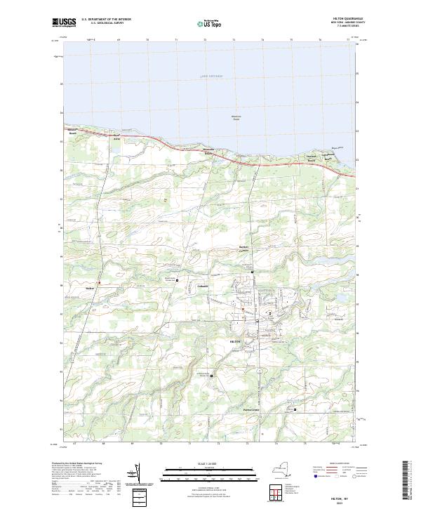


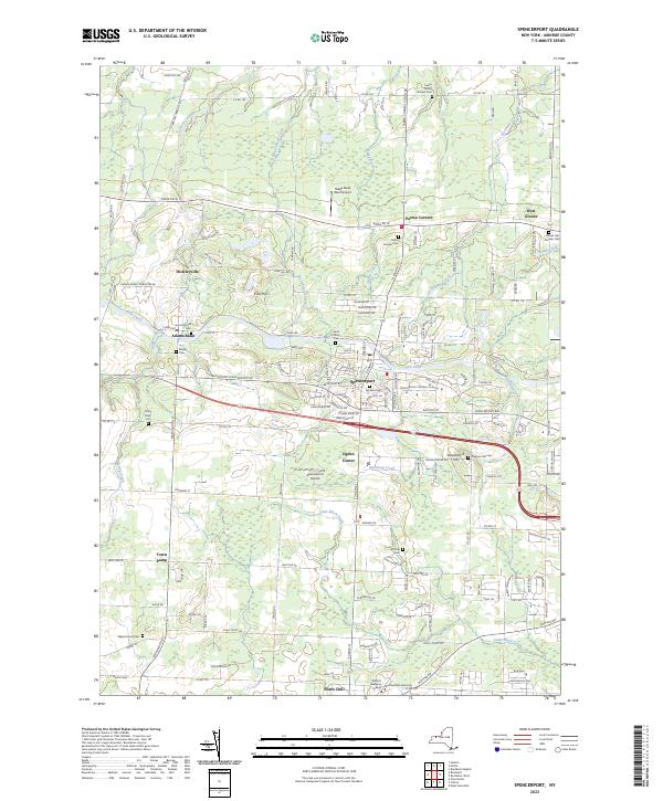


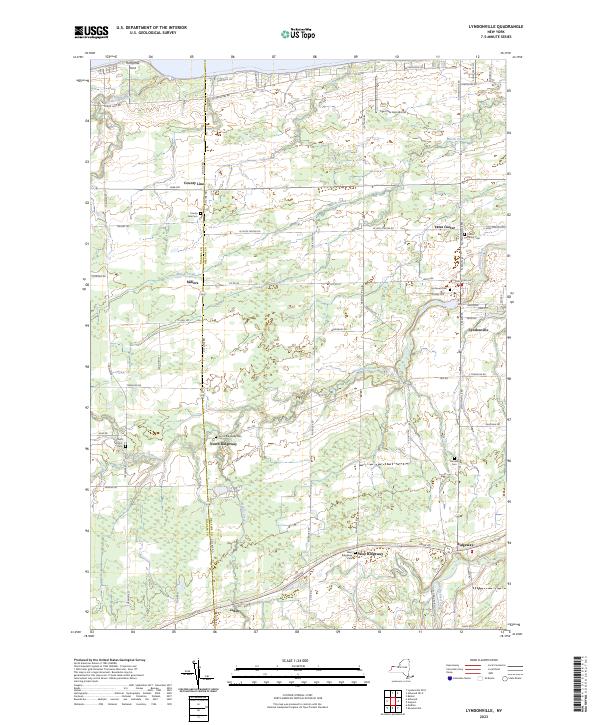

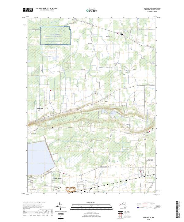


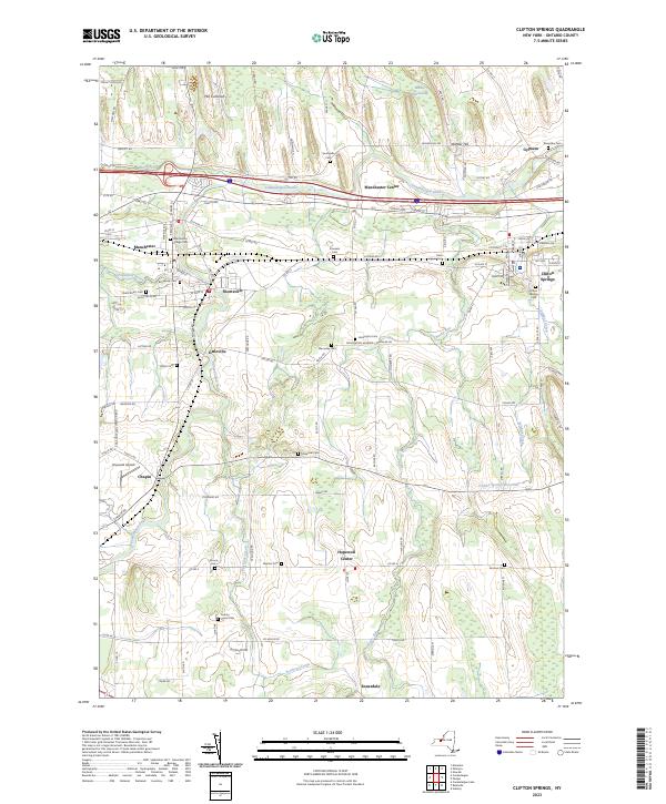


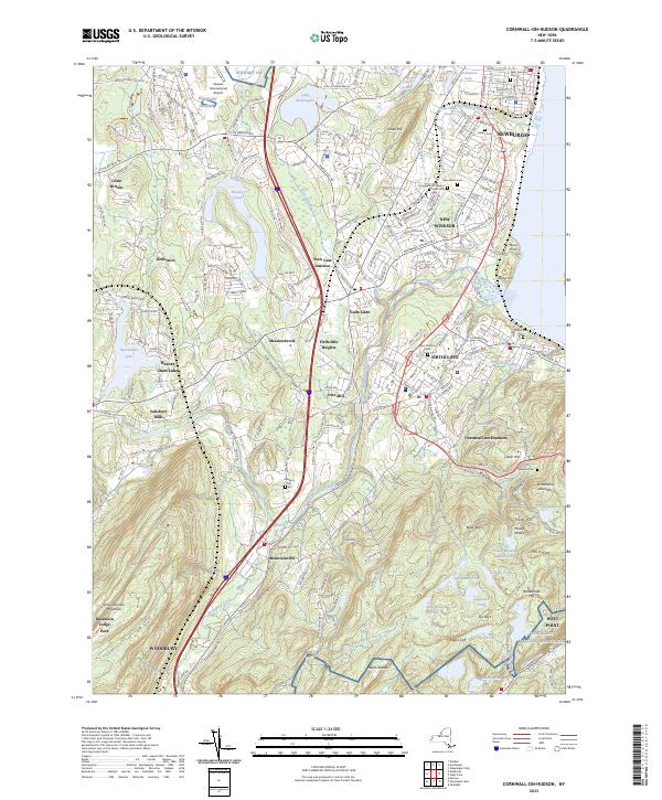


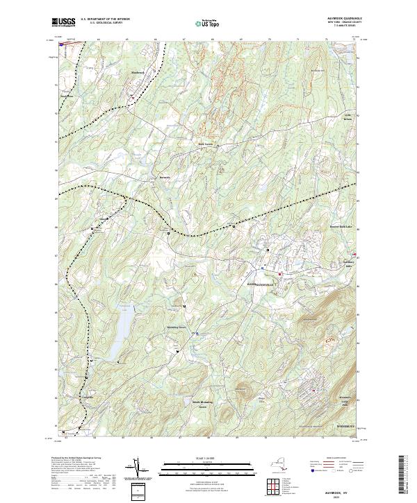
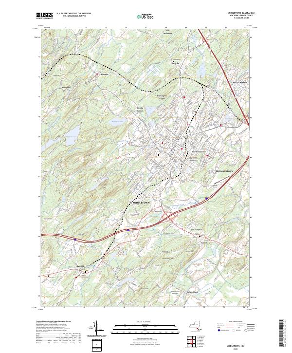


