Search Results for: map little trout lake

Catskill Trailhead Parking Coordinates πŸ…ΏοΈ πŸ” πŸ‘£

Below is a listing of DEC parking areas in the Catskill Park with coordinates and addresses, nearby trails and the roads they are located on.

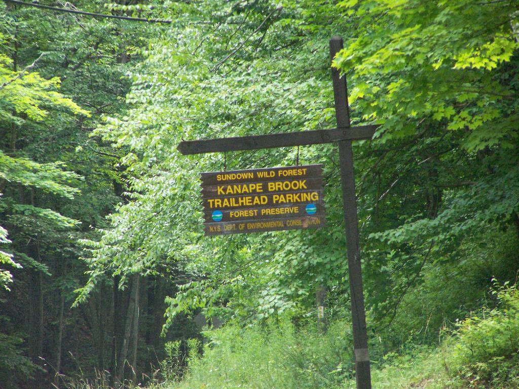
Trailhead Parking Lot Sign

TrailRoadNameNotesStreetCityStZIPLatitudeLongitude
Ashokan High PointWatson Hollow RoadKanape Valley Parking Lot 826 Watson Hollow RdWest ShokanNY1249441.9357923141228-74.3281141901214
Beaverkill RoadBeaverkill RoadBeaverkill Road Parking Lot 2795 Beaverkill RdLivingston ManorNY1275842.0117166110155-74.6223767934834
Beaverkill RoadTurnwood RoadBeaverkill Road Parking Lot 2952 Beaverkill RdLivingston ManorNY1275842.0233290355646-74.5995306115641
Becker Hollow TrailLane RoadBecker Hollow Parking Lot6 Vehicle Capacity3940 Route 214Elka ParkNY1242742.1816084527769-74.1969812784753
Bengle Hill TrailPeekamoose RoadEastern Upper Field Parking Lot 359 Peekamoose RdGrahamsvilleNY1274041.9166423616552-74.4377863112221
Bengle Hill TrailPeekamoose RoadLower Field Parking Lot 194 Peekamoose RdGrahamsvilleNY1274041.9101942400042-74.452852499381
Bengle Hill TrailPeekamoose RoadMiddle Field Parking Lot 304 Peekamoose RdGrahamsvilleNY1274041.9158997405029-74.443422031256
Bengle Hill TrailPeekamoose RoadNorth Middle Field Parking Lot 304 Peekamoose RdGrahamsvilleNY1274041.9164180048779-74.4416441135141
Bengle Hill TrailPeekamoose RoadTrailer Feild Parking Lot 359 Peekamoose RdGrahamsvilleNY1274041.9162603251141-74.4346555497984
Bengle Hill TrailPeekamoose RoadWestern Upper Field 359 Peekamoose RdGrahamsvilleNY1274041.9169982073948-74.4396463051141
Big Pond – Alder LakeBarkaboom RoadBarkaboom Road Parking LotLocated On Barkaboom Road, 6 Cars288 Barkaboom RdAndesNY1373142.0426860004001-74.7267519998891
Big Pond – Alder LakeCross Mountain RoadAlder Lake Parking Lot 2 Cross Mountain RdLivingston ManorNY1275842.0497953211373-74.6827571604492
Black Dome TrailBig Hollow RoadBig Hollow Road Parking Lot7 Vehicle Capacity947 Route 56MaplecrestNY1245442.2889033425096-74.1151262941519
Campbell Mountain TrailCat Hollow RoadRoute 206 Parking Lot5 Vehicle Capacity1611 County Road 7RoscoeNY1277642.051659649187-74.9147231839428
Cic – Esopus TrailState Route 28Parking Area For Esopus Creek Fishing AccessParking Area For Esopus Creek Fishing Access – Cic5067 Route 28Mount TremperNY1245742.0254799892217-74.2717292519349
Cic Hill TrailWittenberg RoadWittenberg Road Parking Lot 1298 Wittenberg RdMount TremperNY1245742.0279684988885-74.2620571929729
Colgate Lake Trail To Dutcher NotchColgate RoadColgate Lake Lower Parking Lot50 Vehicle Capacity525 Colgate RdEast JewettNY1242442.2384696568264-74.1233979344461
Colgate Lake Trail To Dutcher NotchColgate RoadColgate Lake Parking Lot2 Vehicle Capacity524 Colgate RdEast JewettNY1242442.2385040003097-74.1206960003026
Colgate Lake Trail To Dutcher NotchColgate RoadColgate Lake Trail Parking Lot8 Vehicle Capacity653 Colgate RdEast JewettNY1242442.2384599994304-74.1163269993959
Condon Hollow Rd.Condon Hollow RoadCondon Hollow Road Parking Lot3 Vehicle Capacity139 Condon Hollow RdWest KillNY1249242.2161010059593-74.4163349850283
Condon Hollow Rd.Elk Creek RoadElk Creek Road Parking Lot5 Vehicle Capacity734 Elk Creek RdFleischmannsNY1243042.1996047835286-74.4451315908425
Condon Hollow Rd.South Beech Ridge RoadBeech Road Parking Lot4 Vehicle Capacity291 S Beech Ridge RdWest KillNY1249242.2139020709257-74.4012095700882
Condon Hollow Rd.State Highway 42Rte 42 Parking Lot3 Vehicle Capacity1088 Route 42ShandakenNY1248042.1851525975488-74.4149115068685
Denman Mountain Snowmobile TrailGlade Hill RoadDenman Parking Lot 327 Glade Hill RdGrahamsvilleNY1274041.8853341886314-74.5320280123605
Denman Mountain Snowmobile TrailMoore Hill RoadHogs Roack Plot Parking Lot 578 Alpha RdGrahamsvilleNY1274041.9003387815796-74.5274487605523
Devil’s PathBroadstreet Hollow RoadBroadstreer Hollow Parking Lot2 Vehicle Capacity619 Broadstreet Hollow RdShandakenNY1248042.1394450770105-74.3308357356817
Devil’s PathSpruceton RoadSpruceton Road Parking Lot5 Vehicle Capacity1518 Spruceton RdWest KillNY1249242.1920191641918-74.3238474073796
Devil’s PathPrediger RoadPrediger Road 75 Prediger RdElka ParkNY1242742.1338909995054-74.1042720006852
Diamond Notch TrailDiamond Notch RoadSouth Diamond Notch Parking Lot2 Vehicle Capacity508 Diamond Notch RdWest KillNY1249242.147861770123-74.2646596008456
Diamond Notch TrailSpruceton RoadDiamond Notch Parking Lot8 Vehicle Capacity2778 Spruceton RdWest KillNY1249242.1823740001994-74.2695430002389
Dry Brook Ridge TrailMill Brook RoadDry Brook Ridge Parking Lot 12 Balsam Mountain Camp RdMargaretvilleNY1245542.0715022570921-74.5738756337513
Dry Brook Ridge TrailSouth Side SpurNorth End Of Dry Brook Ridge Parking Lot 301 Southside SpurMargaretvilleNY1245542.1446292458628-74.649333317932
Elm Ridge TrailPeck RoadPeck Road Parking Lot10 Vehicle Capacity189 Peck RdMaplecrestNY1245442.2965789997488-74.1693680002929
Fluggertown Road Long Pond TrailFluggertown RoadFlugertown Road Parking Lot 191 Flugertown RdLivingston ManorNY1275841.9347657909639-74.649696950272
Flynn TrailMongaup RoadMongaup Road Parking Lot 1 Beech Mountain RdLivingston ManorNY1275841.9467974587868-74.7052771774711
Giant Ledge-Panther Mountian-Fox Hollow TrailFox Hollow RoadFox Hollow Road Parking Lot 67 Mountain DrShandakenNY1248042.1008382907335-74.3904559601097
Giant Ledge-Panther Mountian-Fox Hollow TrailPeck Hollow RoadPeck Hollow Road Parking Lot 254 Peck Hollow RdShandakenNY1248042.1357649784827-74.3712920364471
Giant Ledge-Panther Mountian-Fox Hollow TrailPeck Hollow RoadEsopus Creek Fishing Access (Upper)Gravel7019 Route 28PheoniciaNY1246442.1065553340012-74.3519924442835
Giggle Hollow TrailNY 23 – BelleayrBelleayre Day Use Parking Lot 33 Friendship Manor RdPine HillNY1246542.1256810090987-74.4731178408634
Harding Road Spur TrailWhites RoadWhites Road Parking Lot4 Vehicle Capacity274 White RdPalenvilleNY1246342.1823951680298-74.0261906353256
Harding Road TrailHarding RoadHarding Road Parking Lot5 Vehicle Capacity3525 Route 23APalenvilleNY1246342.1762358120255-74.0304949714876
Huckleberry North TrailHill RoadHill Road Parking Lot4 Vehicle Capacity1209 Hill RdMargaretvilleNY1245542.1166129796449-74.6486105632054
Huckleberry North TrailHuckleberry Brook Spur RoadHuckleberry Brook Road Parking Lot6 Vehicle Capacity1613 Huckleberry Brook RdMargaretvilleNY1245542.1130238724914-74.6515523618233
Huckleberry South TrailHuckleberry Brook Spur RoadHuckleberry Road Parking Lot5 Vehicle Capacity1073 Huckleberry Brook RdMargaretvilleNY1245542.1152546105706-74.6636037740616
Huckleberry South TrailHull RoadPloutz Road4 Vehicle Capacity1634 Ploutz RdMargaretvilleNY1245542.0938719675255-74.6204457323272
Huggins Lake TrailBerry Brook RoadHuggins Lake Road Parking Lot4 Vehicle Capacity2414 Holiday And Berry Brook RdRoscoeNY1277642.0157959909969-74.8436914198853
Jockey Hill Bicycle TrailWood RoadWood Road Parking Lot 334 Woods RdKingstonNY1240141.9777439980953-74.0501113306995
Kaaterskill Falls TrailState Highway 23aMolly Smith Parking LotDot Facility, 20 Vehicles4729 Route 23AElka ParkNY1242742.1898508772368-74.074111945438
Kaaterskill Rail TrailLaurel House RdLaurel House Rd 103 Laurel House RdTannersvilleNY1248542.1956250050266-74.063093393786
Kelly Hollow Long Loop TrailMill Brook RoadEast Kelly Hollow Parking Lot 5163 Mill Brook RdMargaretvilleNY1245542.078800277463-74.6497556922038
Kelly Hollow Long Loop TrailMill Brook RoadWest Kelly Hollow Parking Lot 5163 Mill Brook RdMargaretvilleNY1245542.0795848697519-74.6545040693769
Long PathSteenburg RoadSteenburgh Road 2425 Platte Clove RdElka ParkNY1242742.1337889994516-74.0819709994867
Long PathRoute 23Route 23 Parking Lot20 Vehicle Capacity3 Cross RdWindhamNY1249642.312706999584-74.1904309994766
Long Pond South LoopWillowemock RoadWild Meadow Road Parking Lot 136 Round Pond RdClaryvilleNY1272541.9435338737706-74.5864488816452
Lost Clove TrailLost Clove RoadLost Clove Parking Lot 343 Lost Clove RdBig IndianNY1241042.1054379266455-74.4700849794812
Mary Smith TrailHolliday Brook RoadHoliday And Berry Brook Road Parking Lot5 Vehicle Capacity3851 Holiday And Berry Brook RdRoscoeNY1277642.0386999995498-74.8473909994493
Mckinley Hollow TrailMc Kinley Hollow RoadMckinly Hollow Parking Lot 200 McKinley Hollow RdBig IndianNY1241042.0704132895809-74.4740296153462
Mckinley Hollow TrailRider Hollow RoadRider Hollow Parking Lot 12 Warren Todd Subdivision DrArkvilleNY1240642.1018368545182-74.5170339246663
Mckinley Hollow TrailBurnham Hollow RoadBurnham Hollow Parking Lot 17 Sagmore TrlBig IndianNY1241042.05564157218-74.4669789486585
Middle Mountain TrailMary Smith Hill RoadMary Smith Hill Road Parking Lot3 Vehicle Capacity865 Mary Smith Hill RdAndesNY1373142.0401290003224-74.8089319993063
Mink Hollow TrailMink Hollow RoadLake Hill 599 Mink Hollow RdBearsvilleNY1244842.1051314008054-74.1735651990356
Mount Pleasant-Romer MountainState Highway 28Sawmill Lot50×50 Parking Area – Trailless6331 Route 28PhoeniciaNY1246442.1008585056075-74.3445327399439
Mud Pond TrailCounty Road 179aOld Rte 17 Fishing Access6 Vehicle Capacity6175 State Route 17 WRoscoeNY1277641.9497668355721-74.9281906252666
Mud Pond TrailHorton Brook RoadLittle Fuller Brook Parking Lot6 Vehicle Capacity845 Horton Brook RdRoscoeNY1277642.0159481159029-74.9790550095988
Onteora Lake Parking AccessState Highway 28Onteora Lake Trailhead Upper Lot 881 Route 28KingstonNY1240141.9807660434687-74.0853059041223
Onteora Lake Yellow TralNY 23Onteora Lake Parking 960 Route 28KingstonNY1240141.9840941553893-74.0827910535657
Overlook Spur Trail ExtensionMacdaniiel RoadMeads Meadow Parking Area 452 MacDaniel RdBearsvilleNY1240942.0756312690235-74.1276188121255
Overlook TrailMeads Mountain RoadOverlook Mountain Trailhead 334 Meads Mountain RdWoodstockNY1249842.0710794980857-74.1224765106456
Peekamoose-Table TrailPeekamoose RoadPeekamoose Road Parking Lot 415 Peekamoose RdGrahamsvilleNY1274041.9233895882109-74.4128616227944
Peekamoose-Table TrailPeekamoose RoadPeekamose Mountian Trail Head Parking Lot 415 Peekamoose RdGrahamsvilleNY1274041.9149365156904-74.4289858455429
Pelnor Hollow TrailBeaver Kill RoadWaneta Lake Parking Lot 732 Beaverkill RdLivingston ManorNY1275841.9676202925977-74.8292314401778
Phoenicia East Branch TrailDenning RoadDenning Road Parking Lot 3381 Denning RdClaryvilleNY1272541.9690314347788-74.4486958819482
Phoenicia East Branch TrailOliverea-Slide Mountain RoadOliverea Road North Parking Lot 1453 Oliverea RdBig IndianNY1241042.0265659167754-74.4038665935078
Phoenicia East Branch TrailOliverea-Slide Mountain RoadOliverea Road South Parking Lot 19 Shandaken Rod Gun ClbBig IndianNY1241042.0078280894865-74.4268762683237
Phoenicia TrailPlank RoadTremper Mountain Parking AreaGravel Lot5636 Route 28PhoeniciaNY1246442.0705625579484-74.3024012416267
Pine Hill West Branch TrailWest Branch RoadBiscuit Brook Parking Lot 1886 Frost Valley RdClaryvilleNY1272541.990833872737-74.4845571593918
PowerlineBeech Ridge Road 1Vinegar Hill Parking Area 1060 N Beech Ridge RdPrattsvilleNY1246842.2449000123037-74.4075985539776
Red Hill Fire Tower TrailRed Hill RoadRed Hill Fire Tower Parking Lot 129 Coons RdClaryvilleNY1272541.9302938486155-74.5073498606472
Roaring Kill TrailDale LaneRoaring Kill6 Vehicle Capacity155 Roaring Kill RdElka ParkNY1242742.1511360000949-74.1310779997324
Rochester HollowShaft RoadShaft 6 Parking20 Vehicle Capacity73 Shaft RdShandakenNY1248042.166173156258-74.4083342114093
Rochester HollowSpisak WayRochester Hollow Parking Lot 51 Matyas RdBig IndianNY1241042.1179698674129-74.4517651458059
Seager Big Indian TrailDry Brook RoadSeager Parking Lot 5672 Dry Brook RdArkvilleNY1240642.0578836653667-74.5396998623234
Spencer RoadTrails End RoadTrails End Parking Lot 197 Trails End RdKerhonksonNY1244641.8835868385135-74.3594081701432
Spruceton TrailSpruceton RoadSpruceton Trail Parking Lot20 Vehicle Capacity2628 Spruceton RdWest KillNY1249242.1846329998217-74.2719879999707
Touch-Me-Not-TrailBarkaboom RoadBig Pond Parking LotLocated Off Barkaboom Road, 6 Cars366 Barkaboom RdAndesNY1373142.0433679998314-74.7277000006876
Touch-Me-Not-TrailBeech Hill RoadBeech Hill Road Parking Lot3 Vehicle Capacity2054 Beech Hill RdAndesNY1373142.0506230001697-74.7789470006467
Touch-Me-Not-TrailDeerlick Brook RoadDeerlick Road Parking Lot3 Vehicle Capacity1553 Deerlick Brook RdAndesNY1373142.0814567992576-74.7365160981546
Touch-Me-Not-TrailBarkaboom RoadForest Preserve Access ParkingEast Of Barkaboom Road 3 Cars1954 Barkaboom RdAndesNY1373142.0655363440977-74.7284401046935
Trout Pond Access RouteRussell Brook RoadRussell Brook Road Parking Lot10 Vehicle Capacity4348 Russell Brook RdRoscoeNY1277641.9943949997582-74.941432999876
Trout Pond TrailCampbell Brook RoadCampbell Brook Road Parking Lot 4747 Campbell Brook RdDownsvilleNY1375542.0306374772623-74.9384473452279
Trout Pond TrailCampbell Mountain RoadCampbell Mountain Road Parking Lot5 Vehicle Capacity3693 Campbell Mountain RdDownsvilleNY1375542.0433291750688-74.9358959381363
Vernooy Kill Falls Snowmobile TrailDymond RoadDymond Road Parking Lot 498 Yeagerville RdNapanochNY1245841.8792625226568-74.4012606035291
Vernooy Kill Falls Snowmobile TrailUpper Cherrytown RoadUpper Cherry Town Road Trail Head Parking Lot 559 Upper Cherrytown RdKerhonksonNY1244641.8643822024537-74.3454535201223
Willow TrailAbbey RoadMount Toblas Parking Lot 439 Abbey RdMount TremperNY1245742.0537752508176-74.2306894602594
Willow TrailJessup RoadWillow Trailhead Parking6 Vehicle Capacity218 Jessop RdWillowNY1249542.078213053797-74.2442314353898

Forest Routes in Green Mountain National Forest 🌲🌲🌲🌲🌲

Forest Routes in Green Mountain National Forest 🌲🌲🌲🌲🌲

Below is a list of various Forest Routes designated in Green Mountain National Forest.

(Zoom in to see individual roads on the above map)

Name Route Number   Name Route Number
Danby 10   Bacon Hollow 254
Griffith Brook 12   Freezing Hole 255
Powder House 13   Eddy Brook 256
Anderson Place 14   Peru 257
Fowler 15   Morris Brook 258
Trout Club 16   East Dorset 259
Jenny Coolidge 17   Catamount Cobble 260
Greendale 18   Cole Brook 261
Priory 19   Grout Pond 262
Wallingford Pond 20   Bailey Hill 263
Mad Tom 21   Roaring Brook 264
North Road 22   Cardinal Brook 265
Moosalamoo 24   Lamb Brook Road 266
Austin Brook 25   Haystack 267
Little Michigan Parking 26   Heather Brook 268
Silver Lake 27   Medbury 269
Sucker Brook 28   Medburyville 270
Moses Pond 29   Route 9 At/Lt Parking 271
Old Job 30   Pine Valley 272
Ten Kiln 31   Prospect Mountain 273
Goshen-Ripton 32   Turner Meadows 274
Stoddard 33   Little Pond 275
Crystal Brook 34   Dewey Access 277
Michigan 35   Middle Ridge 278
Brandon Gap Parking 36   Tabor Brook 279
Chittenden Brook West 38   Castilano Road 280
Texas Gap 39   Burnt Meadow 281
Leicester Hollow 40   Mud Pond West 282
Rochester West Hill 41   Mad Tom Brook North 283
Bingo 42   Mad Tom Brook 284
Stetson Hollow 43   Little Mad Tom 285
Bear Wallow 44   Bromley Parking 286
Chittenden Brook 45   Bickford 287
Hapgood Pond 46   Bolles Brook 288
Ccc’s Camp Parking 47   Pine Valley Parking 290
Danby Depot 48   Downingville 291
Boyden Brook 49   Mayo Hill 292
Patterson Brook 50   St. Therese 294
Stone Place Road 51   Center Turnpike 296
White Rocks 52   Flood Brook 297
Baker Brook 53   Notch 298
Natural Turnpike 54   Weston 299
Granville 55   Pete Parent Peak 301
Deer Hollow 56   County Line 303
Furnace Brook 57   Colburn 304
Staples Brook 58   Landgrove School 305
Steam Mill 59   French Hollow 306
Black Branch 60   Fayville 307
Smith Brook 61   City Stream 308
Thresher Hill 62   Clark Lodge 309
Maple Hill Rochester 63   Utley West 310
Chamberlain Hill 64   Fayville North 311
South Branch 65   Town Line 312
Lincoln Brook 66   Fayville South 313
Goshen Brook 67   Mill Brook North 314
Cobb Hill 68   French Hollow South 315
Pearl Lee 69   Lye Brook Access 317
Branch Pond 70   Rootville 319
Somerset 71   Winhall 320
Red Mill 72   North Old Job 322
West Branch 73   Glastenbury River 324
Aiken Road 74   Castle Brook 325
Dunville Hollow 75   Rake Branch 326
Meadow Brook 76   Lyman Brook 327
Old County 78   Short Stretch 328
Hapgood Pumphouse 79   Pit Road 330
Chandler Ridge South 80   Blue Road 331
Gilmore 81   Billings Pond 332
Flood Dam 83   Macintyre West 335
Somerset South 84   South Alder 336
Mac Intyre 85   Winhall North 338
Smith Woods 86   Railroad Grade 339
Water Tower 89   Shep Meadow 340
Beaver Meadows 90   Stratton Mountain 341
Fassett Hill 91   Little Pond South 342
Hale Brook 92   Webster Shelter 344
Tucker Brook 93   Shepardson 345
Hewitt Brook 94   Stratton Pond West 346
Dragon Brook 95   Shepardson North 347
Gonya Brook 96   Cutts Peak 348
Caryl Brook 97   Elk 349
Tozier Hill 98   Ball Diamond 350
New Boston 99   Osborne 351
Taylor Brook 100   Hog Back 352
Gulf Brook 101   Burgess 363
Middlebury District Office 102   Bailey 368
Horseshoe 103   Pike Hollow 369
Dutton Brook 104   Hell Hollow 370
Bryant Mountain 105   Deer Cabin Brook 371
Dunmore North 106   Deer Lick Brook 372
Smucker 108   Blind Brook 373
Baslow 111   Nichols Camp 374
Quaglino 112   Kid Gore 375
West Hill Range 113   Castle Meadow 376
West Hill School 114   Stratton Mountain Camp 383
Little Pico 115   South Black Brook 384
Satan’s Kingdom 119   Kelley Stand East Parking 386
Silver Lake North Parking 126   Lower Michigan 391
Silver Lake South Parking 127   Wilcox Peak 392
Yellow Birch 130   Knight’s Hill 393
Short Ridge 131   Townsend Brook 394
Poet Road 132   Frost House 396
Wright House 133   Frost Wayside 397
Joe Smith 142   Robert Frost Interpretive Site 398
Route 155 Parking 145   Rochester Administrative Site 400
Middlebury Gap Parking 148   Moseley 401
Pine Gap 154   Bert Green 402
Perkins 155   Middle 403
Leland Jones 160   York Parking 404
Mills Brook Parking 161   Hooker 406
Mad River Wayside Parking 162   At State Highway 12 Parking 407
Pine Plantation Parking 163   Ripton Barracks 408
Comes 176   Martin Farm Parking 410
Tunnel Brook 177   Eaton Mill Parking 411
Pitney 195   Lefferts Pond 412
Olive School 198   Chittenden Reservoir East 413
Lincoln Gap East Parking 199   Adams Parking 427
Potato Hill 200   Snow Valley 428
Big Basin 201   Bromley South 429
French Settlement 202   Gulf Stream 450
Cobb Hill East 205      
Waterbury 206      
Rob Ford 207      
Bagley 208      
Kelley Stand West Parking 209      
Kelley St At/Lt Parking 210      
Stratton Pond Parking 211      
Hancock Branch 212      
Mt. Horrid Overlook Parking 213      
Brandon Brook East 214      
Ash Hill 216      
Souphouse Flat 217      
Hawk Mountain 218      
Mt. Horrid 219      
Chittenden Brook East 220      
Brandon Brook 222      
Emerson 223      
Romance Mountain 224      
Corporation Brook 226      
Wilcox 227      
Guernsey Brook 228      
Liberty Hill 229      
Blue Ridge West 232      
Sparks 233      
Partridge 234      
Huntley Brook 235      
Oxbow 236      
Dow Brook 237      
Fay 243      
Mount Holly 244      
Mill River 245      
Homerstone Mountain 247      
Homerstone Brook 248      
Emporium 249      

June 10, 2018 Evening

Good evening! Mostly cloudy to and 65 degrees in Westerlo, NY. There is a north-northeast breeze at 5 mph. 🍃. The dew point is 47 degrees. Another weekend comes to a close. It was a nice weekend but it sure went by quickly. Camped up at Pumpkin Hollow Road west of Willis Lake, hiked back to Wilcox Lake and on Sunday fished at Woods Lake in Benson.

Tonight will be partly cloudy ☁, with a low of 50 degrees at 4am. Four degrees below normal. Maximum dew point of 47it\’s a safe option where I can play on my phone while I wait – at 7pm. North wind around 5 mph. In 2017, we had partly cloudy skies. It was somewhat humid. It got down to 67 degrees. The record low of 36 occurred back in 1980.

Tonight will have a Waning Crescent Moon 🌘 with 10% illuminated. The moon will rise at 3:54 am. The New Moon is on Tuesday night with a chance of showers. The Strawberry Moon 🌝 is on Wednesday, June 27th. The sun will rise at 5:17 am with the first light at 4:42 am, which is 9 seconds earlier than yesterday. 🌄 Tonight will have 8 hours and 44 minutes of darkness, a decrease of 39 seconds over last night.

It wasn’t a half bad weekend camping at Pumpkin Hollow Road in the Adirondacks. 🎃 I haven’t camped up there in two years but it’s nice and quiet up there. Saw only one hiker while ca was quite surprised I didn’t see anybody at Wilcox Lake today,mping up there and maybe a few cars passing by to the hunting camp up there.

On Saturday I hiked back to Wilcox Lake via the Willis-Wilcox Lake trail. The hike from Pumpkin Hollow Road was nice in the sense that’s its very quiet and the trail is relatively flat and not-muddy. 🏃But there isn’t an awful lot to see besides a few glimpses of the marshy, flatwater stretch of Wilcox Outlet and the part where the bridge crosses Wilcox Outlet. Plus a handful of rather large old growth trees β€” some pines and some ash trees. A few of them are quite massive and probably date back to before the Industrial Revolution, if not before the Civil War.

I checked out the other lean-to at Wilcox Lake that I hadn’t seen before. Looks well used and abused, not a whole lot of wood left around there. That lean-to got a new roof put on it this past year. Unlike lean-tos in other parts of the state where they use wooden shingles, most of the Adirondack ones use asphalt, β›Ίwhich I think is quite tacky, and shorter lasting, but I guess it’s difficult to get heavy wooden shingles into the remote back country, and of course the hollier then holly Forest Preserve can never have a tree cut, even for enhancing recreational use.

I was quite surprised I didn’t see anybody at Wilcox Lake when I was there, although I was less surprised about passing nobody on Willis-Wilcox Lake Trail. While the trail gets enough use that it’s easy to follow, it’s obvious it’s not a popular hiking route. 🐻While Pumpkin Hollow Road is a still a designated snowmobile corridor, I don’t know if the Willis-Wilcox Lake Trail is used anymore for snomwobiling β€” I’d have to look at my map that I have on the blog. Pretty overgrown for that, although I don’t think it ever was a high speed corridoor.

I did like being able to camp in the same location for two days, keeping my truck off but keeping the accessory battery charged via the solar panel. The solar panel worked fine in the partial sun and hazy skies, after a full day outdoors, although I doubt it ever got enough sun to go over-voltage, but the charge controller was in float mode by the time I got back to my truck. 🔋As I leave the dome light turned off while I camp, I usually leave the doors open all of the time when I am at camp, to keep the computer from booting up and putting wear on the starting battery, to ensure I don’t have to start it up until I break camp β€” although I keep a careful eye on it to make sure it remains above 12.6 volts while parked β€” which so far it has. For safety I did start it briefly on Sunday morning as the resting voltage had dropped to 12.55 but I’m not sure it was necessary. 🚘It will start most likely at a much lower voltage, but I like to ensure the starting battery is as close as possible to 100% the whole time I’m at camp.

Both days I cooked up Eggs and Sausage over charcoal on the fire. 🍳 I forgot how good things taste when you cook over a fire. Nice smokey flavor. Hamburgers one night, Macoroni and Cheese the other night. Pretty good eating in the wilderness.

Both nights I was pretty tired, 💤and went to bed early after a short campfire. Been having more problems with migraines lately, and just a lot of exhaustion in the evening.

Sunday I hiked back to Woods Lake and fished there for a while. 🎣Kept catching pumpkin seed or whatever their called boney as shit pan fish and tossing them back in. Not surprising, it was a waste of time. But I hadn’t been back to that lake in a few years so I thought I might visit it but I really should have fished for trout in the Sacandaga River below the Lake Algonquin dam like I often do. 🐋 Totally my fault but I didn’t feel like back tracking to Wells.

Had Sunday dinner at my parents house, and now I’m sleeping out there in my truck.😴 A bit of a cool evening but it should make for good sleeping.

Tomorrow will be sunny 🌞 , with a high of 75 degrees at 4pm. Two degrees below normal. Maximum dew point of 50 at 6pm. North wind around 6 mph becoming light and variable in the afternoon. A year ago, we had mostly sunny skies. The high last year was 92 degrees. The record high of 94 was set in 1947.

Going to be a nice night tomorrow for the work picnic, which this year I’m going to take public transportation to get there rather than drive. 🚌 That way I can have a drink or two with dinner, as I no longer drive after having any alcohol as my vision is kind of poor, especially after dark.😎 I got to find a better I doctor when I get my eyes checked this summer. Plus I hate driving in the city, as I always worry that I will get in a wreck or a red light camera ticket.🚦 The bus may not be real fast but it’s a safe option where I can play on my phone while I wait – although I best make sure my phone is charged as the battery seems to be wearing out. 🔋

But other than that picnic, 🍔 I figure it will be a pretty ordinary week at work. Lots of memos to write, more mail to package and get out the door📩. I’m hoping that the week will go by quickly and will be followed by another fairly nice weekend. I will have to stare more at the countdown clock I built in the office.

In August my rent is going up $25 a month to $675 a month, another $300 yearly hit on my budget. 💸But then again it’s the first rent increase in five years and rent increases have been well below the rate of inflation over the past going on eleven years I’ve lived there. Landlord is a businessman, he has to make a little profit and inflation can’t eat it all away even if I do always pay my rent on time.

Sure I’d like to have the money to spend or invest but still I think my sometimes moldy, always grubby apartment is a good deal, especially being on the bus line and near the park and library where I can walk to and get on the internet for free. If I had to drive to work, pay for internet or any of the other costs of home ownership, 🏡especially in a high tax state like New York I’d probably come out behind compared to renting a cheap apartment plus investing and saving every month. Plus who would upkeep the building when I travel for work. Money is always tight for me but a lot is because I’m saving and investing a lot towards a better tomorrow.

Paying now for a big fancy house in the Albany area that I don’t really want, wouldn’t necessarily gain me much when you figure in all the interest and bank fees,🏪 especially because I don’t want to live in a suburb on New York State the whole rest of my life.

On this day in 1964, United States Senate breaks a 75-day filibuster against the Civil Rights Act of 1964, leading to the bill’s passage. That was a pretty big deal back then. 🏫

Next weekend looks like it might be perfect weather-wise. 😎 Next Saturday, sunny, with a high near 80. Maximum dew point of 54 at 7pm. Next Sunday, mostly sunny, with a high near 84. Maximum dew point of 57 at 1pm. Typical average high for the weekend is 78 degrees.

If that weather forecast remains true I will probably go to the Gas Up on Saturday and camp overnight in Schoharie County, do some fishingβ›Ί and hike the cliffs of Middleburgh.🗻 That I think would be a nice weekend 🐠and will enable me to be places where I have my phone in case I have to do work related tasks.

In four weeks on July 8 the sun will be setting at 8:34 pm,🌄 which is 2 minutes and one second later then today. In 2017 on that day, we had thunderstorm, thunderstorm rain, rain, drizzle, patches of fog, mist, in the vicinity there was thunderstorm, mostly cloudy skies and temperatures between 80 and 63 degrees. Typically, you have temperatures between 82 and 61 degrees. The record high of 100 degrees was set back in 1936.

Looking ahead, Fathers Day 👨 is in 1 week, Daylight Savings Time Ends 🛥️ is in 21 weeks, Veterans Day (Sunday) 🇺🇸 is in 22 weeks and First Sunday of Advent ✝️ is in 25 weeks.

An April North Country Trip, A Revised Plan for 2018

An April North Country Trip, A Revised Plan for 2018

A little over a year ago, I wrote a post about my plans for an April Road Trip to the North Country. For a number of reasons that trip never got off the ground, not the least being the wet and cold spring and the amount of things I had going on at work last year. This year though, I would like to try to make this trip, with the first few days spent taking NY 30 up to through the Adirondacks, maybe camping off of NY 8 one night then at Horseshoe Lake another night.

 Camping

When I reach the North Country, I would probably either camp on Conservation Road at Deer River State Forest or maybe the Walter Pratt Campground at Brasher Falls State Forest. The later is somewhat better, as it’s less likely to be muddy or snow covered in April, and it’s a fair bit closer to Massena. More cell service to keep me entertained at night. Deer River would be better in the sense that there are more areas near the campsites with hills and terrain that could be used as backstops while plinking. Maybe hit up some trout spots? It is April, after all.

Deer River off of Webster Mill Road

My April Road Trip would be quite similar to the trip I took in November 2015 to the Northern Adirondacks, probably fish in Deer River, go up to the Power Project in Massena, maybe do some short hikes in the Adirondacks. Drive back down through the Adirondacks or maybe via the Black River Valley.

Campsite

I would like to explore more of the state forests in St. Lawrence County. There is a lot of great land up that way that I’ve mapped and looked at the DEC websites for but have never explored myself. Many people might denounce the land is being flat with a lot of dairy farms – but I suspect it’s actually quite rolling in parts and many of the state forests are quite interesting. Wolf Lake State Forest seems to perk my interest.

It’s a bit farther then past April Road Trips I’ve done, but it would be fun to get back into this part of the state that I haven’t visited in a few years. I like getting around and seeing different parts of the state, as going to the same location, year after year, gets kind of boring. I’ve only really been up to the North Country (Franklin and St. Lawrence County) twice, so there are a lot left to explore.

The Final Day at Moose River Plains

I thought my Moose River Trip was a pretty good one, even if I ran into some minor issues along the way.

It was a pretty foggy start to my morning when I first woke up with the fog picking up right before eight AM then burning off a little while after the sun rose. While Friday and Saturday nights were fairly chilly the same could not be said about last night. Yesterday was pretty nice paddling along the Cedar River Flow then up on Cedar River to Carry Lean-To, which as the name suggests is close to the end of the navigable waters on the river. Maybe you can “carry” and get to another section of deep enough water but I have my doubts. The leaves along the flow were quite colorful, although the mountains surrounding the flow where already past peak and starting to turn quite brown and gray, with only some deep reds from the maples and greens from the evergreens remaining. It seems ironic that Moose River Plains is already looking like late fall, with the weather still in the 80s. Cool weather, some with a frost in early September made the leaves fall on many of the trees, despite the big warm up of this weekend.

While I don’t know how truly warm it got up here on Sunday — September 24th I should note — my phone said it was 87 degrees by mid afternoon, and the water in the Cedar River wasn’t super cold. I went swimming every day I was up here. The weather this weekend was warmer then it was when I camped up here over the Independence Day Weeekend. So be it.

I got lost in the muck and vegetation looking for the Cedar River, which if your inexperienced paddling or been a while since the last time on the Cedar River Flow can be quite difficult to find. Fortunately I saw a passing kayaker and he gave me verbal advice on how to find the river. I had a topographic map on my phone but it’s only of limited use, because topographic maps are old, and do not reflect the lower lake level since the DEC put in the modern dam in 1969.

There was a dreaded beaver dam on the Cedar River, only a short distance from the entrance from the flow. I am really quite surprised a beaver dam survived the boats crossing the area and the trappers seeking beaver pelts. I guess beaver pelts haven’t been fetching the price they once did, and with less human pressures, beavers are able to build an dam up whatever they want these days.

Coming back over the Beaver Dam the second time, I managed to flip my kayak getting back into it. My smartphone stayed plenty dry in it’s protective bag, but my camera and tackle box got soaked. Well, only briefly, but my camera is drying out and I assume in a day or two it will be fine to power back up again. So for the last day of my trip, I am limited to smartphone pictures.

I haven’t paddled the Cedar River Flow in a while because I have been spending more time up in the western end of Moose River Plains, and it’s a big haul back there. At 15 MPH speed limit, it takes almost an hour. From Wakely Dam to Carry Lean-to, it’s an hour and a half paddle, assuming you find the entrance to the river with ease and don’t stop for an hour for lunch, personal business on the smartphone, and of course updating social media. I know, hah. But there is good AT&T GSM access from the upper end of Cedar River Flow, especially near Campsite 6. That’s not as common in much of the Moose River Recreation Area.

Driving to the Cedar River Flow from the camping area in the western part of the Moose River Plains near Helldiver is an hour long proposition, which is why I haven’t spent much time there lately. I’ve also been spending more time exploring things around Inlet, in part because I like being able to check my phone to see if any family or work things come on up. I also get a bit tired of all those bumpy miles of 15 MPH road, especially now that I know Cedar River – Limekiln Lake Road like the back of my hand.

I cooked up some beef, cheese and chilies, and had some more burritos with Corona beer. After a few beers, with the hot sun all day, the five hours of paddling, I watched the fire for a bit then I retired for the night. I was probably in bed by nine. Which seems silly, as it was it was a pleasant evening with billions of stars above and temperatures in the 60s, but I felt like I needed toothpicks to keep my eyes open. I’ve also been trying to get more sleep these days.

In the past few years, I’ve camped up at Moose River Plains but it’s been at least two years since I camped in the plains formal — the area where the campsites are sand, the canopies are open and the surrounding area is quite swampy. The reason for not camping up here is quite simple — the bugs can be quite horrific during the spring and early summer — while the surrounding wooded sites tend to be bug free or have much fewer mosquitoes. It can be like night or day, especially in black fly season.

That said the “plains” campsites just are a special place to camp at with the big starry skies above in the remote country. I really enjoyed campsite 80, and should try to make sure to camp up here more often.

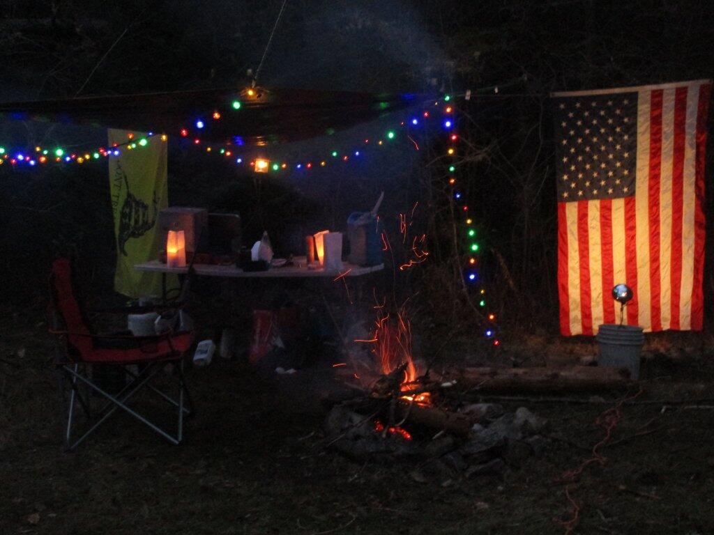
Broke camp before ten, walked down to the Moose River. Cooked up biscuits in the camp oven, took down the flags, put away the gear, hung out the wet stuff to dry, worked on the blog post, and once the fog burnt off it was a beautiful but rapidly warming morning as the leaves continued to fall.

First tried my hand at fishing the Moose River from the path behind my campsite, then I drove to the bridge over the Moose River and fished under there. Caught nothing. Hiked back from the Squaw Lake parking area first to Muskrat Pond and then to Indian Lake, that is the one in the southwestern most part of Moose River Plains. Nice hike, although at this point some of the colors are already done. Other places, less color. It varies a lot with elevation. But regardless the weather on this extended weekend has been amazing.

I tell you there aren’t many 80 degree days during the last week of September in the Adirondacks. It was nice sitting down by the lake with a fishing pole, even if I only caught a few bullheads. No mosquitoes which was nice too. And I almost slipped and fell in the lake which honestly today wouldn’t have been the worse thing. They’ve removed most of the signs and tables from the old campsites along the closed portion of Indian Lake Road, even if it’s in better condition than the open portion. The open portion of Indian Lake Road has been beat to shit by trucks and cars due to it being so wet and rainy this summer. Good colors along the road though. Definitely a beautiful day, not too humid with a lot of fair weather clouds.

Apparently I don’t have cell service up at Indian Lake or Muskrat Pond with my GSM phone like my old CDMA model. That’s fine but I do like to check in with the world from time to time. Oh well, by the time you read this I will be back in cellphone range.

I was looking at the map and thinking I have never hiked back to the Indian River. IΒ didn’t have time today but I should add that to my list for next summer. Also hiking back to Cellar Pond by Cellar Monument now that the DEC has a big sign announcing the trail and they’ve blocked off the old dirt track used by hunters to drive down that way. I always go to the same places at Moose River Plains, I should explore new places.

After visiting Muskrat Pond, Indian Lake, and Squaw Lake I made it back to my truck closer to four PM then three. And I was at the Inlet gate around five, when I stopped and put the front and back ropes back on the kayak, and headed back via Old Forge.I didn’t feel like driving all the way back through Moose River Plains to Indian Lake, and heck, I haven’t been back via NY 28 in a long time.

Driving back through Inlet and Old Forge was really quiet. It was nice to be on the nice smooth black top, after driving over Indian Lake Road, the little used and little maintained section between the Falls Pond and Squaw Lake Trailhead was particularly rough. The sound of windshield washer fluid hitting the kayak on NY 28 made me pull over, but it was just that noise, the kayak was riding fine. But in general it seemed like all of the roads at Moose River Plains were rougher then usual after such a wet summer, with some heavy rains eroding away the roads and vehicles giving the road a good pounding in spots.Β Β I thought there was a McDonalds in Old Forge where I could get a milk shake, but I couldn’t find it.

NY 28 except for the small towns is really a good road, if not boring. The DOT has straightened and improved much of the road except through the small towns. Without summer vacationer traffic and being a weekday, there was very little traffic. I always like that section of NY 28 when it meets up with NY 12 south of Alder Creek, and becomes a four lane, but I think people always seem to speed on it and there are always cops watching for speeders. But the scenery is nice along this section of the road, looking down at the Mohawk Valley and the rough farm country, and swamp land of the greater Remsen area. I always find the rocky, rough farms cut into the mountains to be much more interesting to look at then the lush, more heavily capitalized and better maintained farms of the lush alluvial valleys you see in some parts of the state. The Tug Hill, in it’s upper elevations is a rough country, with lots of snow, and very hardy people. A big black F-350 Harvey Davidson edition passed by with Agriculture plates, and I had to think, “he must do some good shit, “no pun intended”.

Drove down to Poland and Middleville via NY 28. I like this part of NY 28 even if the villages are pokey, just because it’s pretty along the East Canada Creek. I should try my hand trout fishing there one spring — I just got to find a good place to camp up that way — it’s a bit of a trip for a day trip from Albany in my opinion. Middleville is quite the quaint little town, reminding me of what America used to be like.

Then it was down to NY 169 to Little Falls from Herkimer. I like this section of road, even though it’s hilly, because it’s quite beautiful. I like seeing the farms and valleys, and a landscape that works but isn’t that perfect, and still somewhat rough. Drove through Little Falls, a nice little but struggling city that has much potential. Yeah, I was there last weekemd at Moss Island, then onwards toward the Thruway. Stopped at Fink Basin Road to tighten the kayak on the roof of my truck.

Right before getting on the Thruway, I decided to shun pike some more, and take NY 5S from the Little Falls exit to Canjahoharie. I don’t like having to drive through Fort Plain and then Canjahoharie before getting onto he Thruway, but so be it. I do like that section of NY 5S high above the valley though. Some farms in the valleys haven’t cut silage yet due to the high temperatures (more growing seasons, more yields) and lack of frost.

When I got to Fort Plain I almost stopped at the Red Dragon Chinese place. I like Chinese and they tend to be inexpensive. People always think small town Chinese places are bad, but actually some can be pretty good, especially if families are trying to make a living in a place with few other options. I liked the Chinese I got in Canastota when I was working there, but then again, I got awful tasting Chinese food in North Syracuse. I don’t know, I passed as it was getting dark and I wanted to get home.

When I got on the Thruway at Canjahoharie it was getting pretty dark. My eyes were watering up and I ended up stopping at the rest area outside of Amsterdam. Took a piss and washed my hands good — nice bathrooms — then went into my truck and cleaned off my contacts and reinstered them. That made the rest of the drive easier.

Got home around 8 PM and things unpacked, well mostly so, before the heat started to get to me. Then I took a shower, and finished up this blog post. And here we are now.

My current smartphone isn’t as good at picking up distant radio channels and I didn’t play with it much so I missed hearing the news during my extended weekend trip at Moose River Plains. I doubt I missed much, most of the things in the news don’t effect me much. I’m sure my political Facebook friends will post plenty of memes to fill me in on what I’ve been missing.

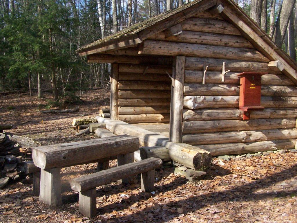
2017 NYSDEC Lean-To Listing

Location Region Facility Name Notes
40.8977396062,
-72.6606151038
1 David A. Sarnoff Pine Barrens Preserve Interior Lean- To
42.039846675,
-74.593646931
3 Balsam Lake Mountain Wild Forest Balsam Lake Mountain Lean-To
42.0821851976,
-74.5866114487
3 Balsam Lake Mountain Wild Forest Dry Brook Ridge Lean-To
42.0669125899,
-74.6546347244
3 Balsam Lake Mountain Wild Forest Kelly Hollow Lean-To
42.0673682324,
-74.5869876883
3 Balsam Lake Mountain Wild Forest Mill Brook Lean-To
42.0490509759,
-74.644686588
3 Balsam Lake Mountain Wild Forest Mill Brook Ridge Lean-To
42.1150311581,
-74.4907498238
3 Belleayre Mtn Ski Center East Ski Lean-To
42.1177186512,
-74.5031992126
3 Belleayre Mtn Ski Center West Ski Lean-To
42.009105151,
-74.4838519037
3 Big Indian Wildernes Area Biscuit Brook Lean-To
41.9980754336,
-74.5603918334
3 Big Indian Wildernes Area Fall Brook Lean-To
42.0753394054,
-74.4858565042
3 Big Indian Wildernes Area Mckinly Hollow Lean-To
42.0920121203,
-74.50571316
3 Big Indian Wildernes Area Rider Hollow Lean-To
42.0502743293,
-74.5106001667
3 Big Indian Wildernes Area Shandaken Brook Lean-To
42.0697505965,
-74.2874492999
3 Phoenicia – Mt. Tobias Wild Forest Tremper Mountain Lean-To 1
42.0719347774,
-74.280350018
3 Phoenicia – Mt. Tobias Wild Forest Tremper Mountain Lean-To 2
42.1388242073,
-74.4544191301
3 Shandaken Wild Forest Rochester Hollow Lean-To
42.1027865494,
-74.3948255307
3 Slide Mountain Wilderness Fox Hollow Lean-To
41.9591817103,
-74.4068771821
3 Slide Mountain Wilderness Table Mountain Lean-To
42.0273156785,
-74.3356447251
3 Slide Mountain Wilderness Terrace Mountain Lean-To
41.9400595492,
-74.6320548238
3 Willowemoc Wild Forest Long Pond Lean-To
42.1584913515,
-75.3620266032
4 Arctic China State Forest A-40 Lean-To
42.1528069973,
-75.3102096425
4 Barbour Brook State Forest A-41 Lean To
42.2276166115,
-75.3902198332
4 Beals Pond State Forest
42.3354251044,
-73.4841812463
4 Beebe Hill State Forest Beebe Hill Lean-To
42.543303724,
-74.4885945942
4 Burnt-Rossman Hills State Forest Eminence Lean-To
42.5282012278,
-74.6420043552
4 Clapper Hollow State Forest Clapper Hollow Lean-To
42.0491041533,
-74.9281738602
4 Delaware Wild Forest Cat Hollow Lean-To
42.0118726464,
-74.9483763817
4 Delaware Wild Forest Mud Pond Trail Lean-To
42.0058597072,
-74.8682131934
4 Delaware Wild Forest Pelnor Hollow Lean-To
42.0124988931,
-74.9472696156
4 Delaware Wild Forest Trout Pond Trail Lean-To Built For ADA
42.6294376039,
-74.2675434311
4 Dutch Settlement State Forest Lean-To
42.2197534864,
-74.4391024687
4 Halcott Mountain Wild Forest Halcott Lean-To
42.313988005,
-73.4414954693
4 Harvey Mountain State Forest Harvey Mountain Lean-To
42.1660752671,
-74.2304343401
4 Hunter-West Kill Wilderness Devil’s Acre Lean-To Good Condition
42.1692897833,
-74.2576582937
4 Hunter-West Kill Wilderness Diamond Notch Lean-To
42.3550413796,
-74.3460668476
4 Huntersfield State Forest Lean-To
42.1196391066,
-74.0873843029
4 Indian Head Wilderness Devils Kitchen Lean-To
42.0985881282,
-74.0915994051
4 Indian Head Wilderness Echo Lake Lean-To
42.1357750354,
-74.1634997793
4 Indian Head Wilderness Mink Hollow Lean-To
42.1894936316,
-74.239507302
4 Rusk Mountain Wild Forest John Robb Lean-To
42.2789596573,
-74.1033902943
4 Windham Blackhead Range Wilderness Batavia Kill Lean-To
42.3062546068,
-74.1744107284
4 Windham Blackhead Range Wilderness Elm Ridge Lean-To
43.8755968409,
-74.366426237
5 Blue Mountain Wild Forest O’neill Flow Lean-To
43.8873444776,
-74.3788006261
5 Blue Mountain Wild Forest Tirrel Pond North Lean-To
43.829937473,
-74.4366163022
5 Blue Ridge Wilderness Cascade Pond Lean-To Fair
43.8186736685,
-74.4205248717
5 Blue Ridge Wilderness Stephens Pond Lean-To Good
43.8201917816,
-74.4686803224
5 Blue Ridge Wilderness Wilson Pond Lean-To Fair
44.5989256982,
-74.2285921246
5 Debar Mtn. Wild Forest Debar Mountian Lean-To Debar Mtn Leanto
44.4918501724,
-74.2523227309
5 Debar Mtn. Wild Forest Grass Pond Lean-To
44.5192586399,
-74.2710522386
5 Debar Mtn. Wild Forest Sheep Meadow Lean-To #1
44.5193465505,
-74.2711670085
5 Debar Mtn. Wild Forest Sheep Meadow Lean-To #2
44.108205472,
-73.7738312581
5 Dix Mountain Wilderness Bouquet Lean-To
44.0601596209,
-73.8078167801
5 Dix Mountain Wilderness Lilian Brook Lean-To
44.044126198,
-73.8058583966
5 Dix Mountain Wilderness Slide Brook Lean-To
44.1759172265,
-73.7215350426
5 Giant Mountain Wilderness Giant Mtn. Lean-To
43.8863219437,
-73.5641701351
5 Hammond Pond Wild Forest Eagle Lake Lean-To
43.9655912049,
-73.6440374623
5 Hammond Pond Wild Forest Moose Mt Pond Lean-To
44.1447454969,
-73.9547665307
5 High Peaks Wilderness Avalanche
44.1809734501,
-73.8284043214
5 High Peaks Wilderness Bear Brook Lean-To
44.121015479,
-73.9821264349
5 High Peaks Wilderness Beaver Point #1
44.1207874446,
-73.9817139904
5 High Peaks Wilderness Beaver Point #2
44.1825279757,
-74.1805220238
5 High Peaks Wilderness Blueberry Lean-To
44.1449655863,
-73.8833895452
5 High Peaks Wilderness Bushnell Falls #1 Lean-To
44.1444007481,
-73.8834828976
5 High Peaks Wilderness Bushnell Falls #2 Lean-To
44.1129718174,
-73.9928913122
5 High Peaks Wilderness Calamity #1 Lean-To
44.1448580137,
-74.2751710479
5 High Peaks Wilderness Calkin’s Brook Lean-To
44.1058294131,
-74.3120366857
5 High Peaks Wilderness Calkin’s Creek Lean-To
43.9980126927,
-74.3927845611
5 High Peaks Wilderness Catlin Bay #1 Lean-To
43.9972143811,
-74.3959393656
5 High Peaks Wilderness Catlin Bay #2 Lean-To
44.1425166432,
-74.1303582429
5 High Peaks Wilderness Cold River #2 Lean-To
44.091459278,
-74.2576417508
5 High Peaks Wilderness Cold River #3 Lean-To
44.0913902533,
-74.2557348025
5 High Peaks Wilderness Cold River #4 Lean-To
44.1427273763,
-74.1298402107
5 High Peaks Wilderness Cold River Lean-To #1 Lean-To
44.1778467491,
-73.833854921
5 High Peaks Wilderness Deer Brook Lean-To
44.141626874,
-74.1069373468
5 High Peaks Wilderness Duck Hole #1 Lean-To
44.1416768647,
-74.1065435467
5 High Peaks Wilderness Duck Hole #2 Lean-To
44.1142099053,
-73.9556152329
5 High Peaks Wilderness Feldspar Lean-To
44.1186643668,
-73.9840090128
5 High Peaks Wilderness Flowed Lands #2 Lean-To
44.1077341951,
-73.9912056361
5 High Peaks Wilderness Griffin Lean-To
44.1773165403,
-74.3218077012
5 High Peaks Wilderness Hemlock Hill Lean-To
44.1041784421,
-74.0669132937
5 High Peaks Wilderness Henderson Lake Lean-To
44.1117549601,
-74.0592189223
5 High Peaks Wilderness Henderson Lean-To
44.1178828905,
-73.9873641274
5 High Peaks Wilderness Herbert Brook Lean-To
44.0026552882,
-74.3864802633
5 High Peaks Wilderness Hidden Cove Lean-To
44.0760291647,
-74.3235341651
5 High Peaks Wilderness Island House Lean-To
44.1494011459,
-73.9557902347
5 High Peaks Wilderness Kagel Lean-To
44.0288002362,
-74.367307986
5 High Peaks Wilderness Kelly Point #1 Lean-To
44.0287025672,
-74.3671303487
5 High Peaks Wilderness Kelly Point #2 Lean-To
44.1706807759,
-73.9050776091
5 High Peaks Wilderness Klondike Lean-To
44.1130126221,
-73.9888393806
5 High Peaks Wilderness Livingston Point Lean-To
44.1469386475,
-73.9552287453
5 High Peaks Wilderness Marcy Brook Lean-To
44.1579156535,
-73.953395811
5 High Peaks Wilderness Marcy Dam #1 Lean-To
44.1573119259,
-73.9533863686
5 High Peaks Wilderness Marcy Dam #2 Lean-To
44.1573817221,
-73.9512823564
5 High Peaks Wilderness Marcy Dam #3 Lean-To
44.158399029,
-73.9510719571
5 High Peaks Wilderness Marcy Dam #4 Lean-To
44.1586913289,
-73.9524288871
5 High Peaks Wilderness Marcy Dam #5 Lean-To
44.1828433824,
-74.0736410238
5 High Peaks Wilderness Moose Pond Lean-To
44.079589789,
-74.2389368367
5 High Peaks Wilderness Moose Pond Stream Lean-To
44.0795538786,
-74.2391509433
5 High Peaks Wilderness Moose Pond Stream Lean-To #2
44.1992083493,
-73.9059885406
5 High Peaks Wilderness Mr. Van Lean-To
44.0158171441,
-74.1523218843
5 High Peaks Wilderness Newcomb Lake Lean-To #1
44.0205306743,
-74.1522782707
5 High Peaks Wilderness Newcomb Lake Lean-To #2
44.1733720177,
-74.1571389816
5 High Peaks Wilderness Number Four #1 Lean-To
44.1733860424,
-74.1561240274
5 High Peaks Wilderness Number Four #2 Lean-To
44.1110695692,
-73.9924324205
5 High Peaks Wilderness Opalescent Lean-To
44.1466502842,
-73.8622440861
5 High Peaks Wilderness Ore Bed Brook Lean-To
44.1202212816,
-74.1874471739
5 High Peaks Wilderness Ouluska Pass Brook Lean-To
44.0996351514,
-73.9133647612
5 High Peaks Wilderness Panther Gorge Lean-To
44.0654422644,
-74.3285192442
5 High Peaks Wilderness Plumley Point #1 Lean-To
44.0655989161,
-74.3276122455
5 High Peaks Wilderness Plumley Point #2 Lean-To
44.1472355081,
-74.318105399
5 High Peaks Wilderness Raquette Falls #1 Lean-To
44.1568302695,
-74.3133083456
5 High Peaks Wilderness Raquette Falls #2 Lean-To
44.1710800022,
-73.9974911766
5 High Peaks Wilderness Rocky Falls Lean-To
44.0414093849,
-74.3501490964
5 High Peaks Wilderness Rodney Point #1 Lean-To
44.0429767454,
-74.3493346475
5 High Peaks Wilderness Rodney Point #2 Lean-To
44.099413657,
-74.1052871721
5 High Peaks Wilderness Santanoni Lean-To
44.159177638,
-74.013876769
5 High Peaks Wilderness Scott Clearing Lean-To
44.1062441377,
-74.2091536428
5 High Peaks Wilderness Seward Lean-To
44.1247329647,
-73.9010796778
5 High Peaks Wilderness Slant Rock Lean-To
44.1988046777,
-74.3183103111
5 High Peaks Wilderness Stony Creek Lean-To
44.1093110139,
-73.961729679
5 High Peaks Wilderness Uphill Lean-To
44.1191510722,
-73.9841831313
5 High Peaks Wilderness Walker Brook Lean-To
44.1221483174,
-74.0532242803
5 High Peaks Wilderness Wallface Lean-To
44.1784419747,
-74.1736369919
5 High Peaks Wilderness Ward Brook Lean-To
44.161824666,
-73.8555947195
5 High Peaks Wilderness Wm. G. Howard Lean-To
44.1538919753,
-73.8510077515
5 High Peaks Wilderness Wolf Jaw Lean-To
44.2530195934,
-73.7180348153
5 Hurricane Mountain Primitive Area Gulf Brook Lean-To Fair
44.2607301476,
-73.7100106669
5 Hurricane Mountain Primitive Area Lost Pond/Biesemeyer Lean-To Fair
43.5996600139,
-73.5330643346
5 Lake George Wild Forest Black Mountain Ponds Lean-To Lean-To With Privy And Fire Ring Black Mtn Pond Trail
43.6193129088,
-73.5841121844
5 Lake George Wild Forest Fifth Peak Lean-To Lean-To W/ Privy And Fire Ring Tongue Mtn Range Trail
43.5760391953,
-73.5361031163
5 Lake George Wild Forest Fishbrook Pond North Lean-To Leanto With Privy, Picnic Table And Fire Ring Fishbrook Pd-Lk Grg Shore Trl
43.5738720148,
-73.5384766731
5 Lake George Wild Forest Fishbrook Pond South Lean-To Leanto With Privy, Picnic Table And Fire Ring Fishbrook Pd E Shore Trl
43.6473357817,
-73.5745337831
5 Lake George Wild Forest Five Mile Mountain Lean-To Lean-To W/ Privy And Fire Ring Tongue Mtn Range Trail
43.5778037953,
-73.5168397538
5 Lake George Wild Forest Greenland Pond Lean-To Leanto With Privy, Picnic Table And Fire Ring Greenland Pd Shelter Spur
43.5958213341,
-73.5179510245
5 Lake George Wild Forest Lapland Pond Lean-To Campsite With Lean-To 13-27 Lapland Pond Lean-To Conector
43.5871682823,
-73.5277594231
5 Lake George Wild Forest Millman Pond Lean-To Campsite With Lean-To 5-10 Old Farm To Millman Pond Trl
44.3214560457,
-74.0307860439
5 Mckenzie Mtn. Wilderness Placid Lean-To
44.3442169075,
-73.9286469378
5 Mckenzie Mtn. Wilderness White Face Brook Lean-To
43.7790246336,
-74.7044289121
5 Moose River Plains Wild Forest 8th Lake Island Lean-To
43.7801152974,
-74.7044390115
5 Moose River Plains Wild Forest 8th Lake North Shore
43.7897826664,
-74.6985922707
5 Moose River Plains Wild Forest 8thlake East Shore Lean-To
43.8316711731,
-74.6617561796
5 Moose River Plains Wild Forest Beaver Bay Lean-To 1
43.8316049364,
-74.6615109228
5 Moose River Plains Wild Forest Beaver Bay Lean-To 2
43.8314336654,
-74.6609019165
5 Moose River Plains Wild Forest Beaver Bay Lean-To 3
43.7478050188,
-74.7441985068
5 Moose River Plains Wild Forest Seventh Lake Lean-To 1
43.7507665118,
-74.7346427944
5 Moose River Plains Wild Forest Seventh Lake Lean-To 2
43.7563901134,
-74.7178174969
5 Moose River Plains Wild Forest Seventh Lake Lean-To 3
43.8145480145,
-73.5808194792
5 Pharaoh Lake Wilderness Berrymill Pond Lean-To Digitized From National Geographic Map
43.8384100119,
-73.5916749102
5 Pharaoh Lake Wilderness Clear Pond Lean-To Digitized From National Geographic Map
43.8412911595,
-73.6316882519
5 Pharaoh Lake Wilderness Crab Pond Lean-To Digitized From National Geographic Map
43.8223693677,
-73.5906397879
5 Pharaoh Lake Wilderness Grizzle Ocean Lean-To Digitized From National Geographic Map
43.8492027141,
-73.6180024108
5 Pharaoh Lake Wilderness Lillypad Pond Lean-To Digitized From National Geographic Map
43.8500028762,
-73.5895397847
5 Pharaoh Lake Wilderness Little Rock Pond Lean-To Digitized From National Geographic Map
43.8405296779,
-73.6501782303
5 Pharaoh Lake Wilderness Oxshoe Pond Lean-To Digitized From National Geographic Map
43.7945783128,
-73.6458567831
5 Pharaoh Lake Wilderness Pharaoh Lake #1 Lean-To Digitized From National Geographic Map
43.7966550547,
-73.6403349616
5 Pharaoh Lake Wilderness Pharaoh Lake #2 Lean-To Digitized From National Geographic Map
43.8049450672,
-73.6240085371
5 Pharaoh Lake Wilderness Pharaoh Lake #3 Lean-To Digitized From National Geographic Map
43.8049450672,
-73.6240085371
5 Pharaoh Lake Wilderness Pharaoh Lake #3 Lean-To Digitized From National Geographic Map
43.8121074537,
-73.6282851829
5 Pharaoh Lake Wilderness Pharaoh Lake #4 Lean-To Digitized From National Geographic Map
43.8021964679,
-73.6391689125
5 Pharaoh Lake Wilderness Pharaoh Lake #5 Lean-To Digitized From National Geographic Map
43.8505590671,
-73.5922949091
5 Pharaoh Lake Wilderness Rock Pond Lean-To Digitized From National Geographic Map
43.8581713271,
-73.626483712
5 Pharaoh Lake Wilderness Tubmill Marsh Lean-To Digitized From National Geographic Map
44.3961331068,
-74.3704212658
5 Saint Regis Canoe Area Fish Pond Site 2 Lean-To Saint Regis Mountain
44.3913013571,
-74.3658071555
5 Saint Regis Canoe Area Fish Pond Site 5 Lean-To New Lean-To Built Sept. 2010,Relocated Further From Water
44.3808655111,
-74.3200340382
5 Saint Regis Canoe Area St. Regis Pond Site 3 Lean-To Lean-To Too Close To Water, Need To Move Back When Major Work Is Needed
44.3250945507,
-74.3498966646
5 Saranac Lakes Wild Forest Follensby Clear Lean-To
44.2866574735,
-74.1626018103
5 Saranac Lakes Wild Forest Kiwasa Lake Site 3 Lean-To
44.3322955804,
-73.9566258523
5 Saranac Lakes Wild Forest Lake Placid Site 2 Lean-To Lake Placid
44.3325954268,
-73.9566801194
5 Saranac Lakes Wild Forest Lake Placid Site 3 Lean-To Lake Placid
44.2253525405,
-74.3803783852
5 Saranac Lakes Wild Forest Raquette Lean-To Built In 2013 Relocated From Trombley Landing Site
44.3092299998,
-74.1801499997
5 Saranac Lakes Wild Forest Saranac Islands Site 2 Lean-To
44.2890999998,
-74.2172199999
5 Saranac Lakes Wild Forest Saranac Islands Site 45 Lean-To
44.2666999994,
-74.2447999995
5 Saranac Lakes Wild Forest Saranac Islands Site 63 Lean-To
44.2729500004,
-74.27398
5 Saranac Lakes Wild Forest Saranac Islands Site 81 Lean-To
44.2878799998,
-74.2885399997
5 Saranac Lakes Wild Forest Saranac Islands Site 87 Lean-To
44.2287716477,
-74.3755334312
5 Saranac Lakes Wild Forest Trombley Landing Lean-To
44.3028866826,
-74.3026336593
5 Saranac Lakes Wild Forest Upper Saranac Lake Lean-To
43.8161997506,
-74.6446678086
5 Sargent Ponds Wild Forest Big Island Lean-To 1
43.8170896757,
-74.6432509546
5 Sargent Ponds Wild Forest Big Island Lean-To 2
43.8171339137,
-74.6437800321
5 Sargent Ponds Wild Forest Big Island Lean-To 3
43.8707715776,
-74.6285067054
5 Sargent Ponds Wild Forest Boucher Point Lean-To #1
43.8710064606,
-74.6281079204
5 Sargent Ponds Wild Forest Boucher Point Lean-To #2
43.8707202965,
-74.629171869
5 Sargent Ponds Wild Forest Boucher Point Lean-To #3
44.1027442039,
-74.321862706
5 Sargent Ponds Wild Forest Deep Hole Lean-To
43.9262175397,
-74.4753958672
5 Sargent Ponds Wild Forest Deerland Carry # 2 Lean-To Fair Condition
43.9257807189,
-74.4758457554
5 Sargent Ponds Wild Forest Deerland Carry #1 Lean-To Fair Condition
43.9028470717,
-74.5480629364
5 Sargent Ponds Wild Forest Forked Lake Lean-To
44.0814068183,
-74.3358291461
5 Sargent Ponds Wild Forest Long Lake Nw Lean-To #1
44.0825043385,
-74.3339145725
5 Sargent Ponds Wild Forest Long Lake Nw Lean-To #2
43.8593314968,
-74.5626945075
5 Sargent Ponds Wild Forest Lower Sargents Pond Lean-To Fair Condition
43.8794136061,
-74.6060523536
5 Sargent Ponds Wild Forest Outlet Bay Lean-To Hit By Tree, 2011
43.9066458928,
-74.5025901551
5 Sargent Ponds Wild Forest Pinebrook Lean-To Fair Condition
43.8368984989,
-74.5352656022
5 Sargent Ponds Wild Forest Utowana Lake Lean-To
44.3317122951,
-73.8997103538
5 Sentinel Range Wilderness Copperas Pond Lean-To
43.2171873383,
-74.3641178087
5 Shaker Mountain Wild Forest Chase Lake Lean-To
43.1885867657,
-74.4310218123
5 Shaker Mountain Wild Forest Holmes Lake Lean-To
43.6161332228,
-74.1506253912
5 Siamese Ponds Wilderness E. Sacandaga River Lean-To
43.7007731961,
-74.1581732825
5 Siamese Ponds Wilderness Hour Pond Lean-To
43.7278247362,
-74.2012685562
5 Siamese Ponds Wilderness John Pond Lean-To
43.6775543215,
-74.1916025718
5 Siamese Ponds Wilderness Puffer Pond #1 Lean-To
43.6765395437,
-74.1997399401
5 Siamese Ponds Wilderness Puffer Pond #2 Lean-To
43.3974135952,
-74.45529759
5 Silver Lake Wilderness Hamilton Lake Stream #1 Lean-To
43.3426710732,
-74.4562907856
5 Silver Lake Wilderness Mud Lake Lean-To
43.2919354568,
-74.4237351677
5 Silver Lake Wilderness Silver Lake Lean-To
44.4897002134,
-73.8614267379
5 Taylor Pond Wild Forest North Shore Taylor Pond Lean-To Managed By Operations
44.4776887718,
-73.881283087
5 Taylor Pond Wild Forest Northwest Shore Taylor Pond Lean-To Managed By Operations
44.3997973549,
-73.5145569962
5 Taylor Pond Wild Forest Poke-O-Moonshine Summit Lean-To
44.4828880086,
-73.8537772441
5 Taylor Pond Wild Forest South East Taylor Pond Lean-To Managed By Operations
43.9326741166,
-73.9690844017
5 Vanderwhacker Mountain Wild Forest Cheney Pond Lean-To
43.8387348153,
-73.9856219154
5 Vanderwhacker Mountain Wild Forest Stony Pond Lean-To
43.6259693968,
-74.5492715037
5 West Canada Lake Wilderness Beaver Pond (AKA Cedar Lakes Lean-To #2)
43.6787448835,
-74.4954982188
5 West Canada Lake Wilderness Carry Lean-To
43.628125665,
-74.5404732399
5 West Canada Lake Wilderness Cedar Lakes #1 Lean-To
43.6084635843,
-74.559724172
5 West Canada Lake Wilderness Cedar Lakes #3 Lean-To
43.6524139144,
-74.4903803529
5 West Canada Lake Wilderness Colvin Brook Lean-To
43.5968984709,
-74.5316653645
5 West Canada Lake Wilderness Pillsbury Lake Lean-To
43.5807608964,
-74.576533363
5 West Canada Lake Wilderness Sampson Lake Lean-To
43.5872448097,
-74.6215788384
5 West Canada Lake Wilderness South Lake Lean-To
43.5272841126,
-74.6099246975
5 West Canada Lake Wilderness Spruce Lake #1 Lean-To
43.5346306298,
-74.6080858031
5 West Canada Lake Wilderness Spruce Lake #2 Lean-To
43.5371297279,
-74.608209628
5 West Canada Lake Wilderness Spruce Lake #3 Lean-To
43.4527175892,
-74.5822815394
5 West Canada Lake Wilderness T Lake Lean-To
43.586987614,
-74.613997971
5 West Canada Lake Wilderness West Canada Creek Lean-To
43.5931622288,
-74.6268866843
5 West Canada Lake Wilderness West Lake #1 Lean-To
43.5970642572,
-74.6231056496
5 West Canada Lake Wilderness West Lake #2 Lean-To
43.5102617091,
-74.0492883971
5 Wilcox Lake Wild Forest Lizard Pond Lean-To Digitized From National Geographic Map
43.3363734227,
-74.2173211966
5 Wilcox Lake Wild Forest Murphy Lake Lean-To Digitized From National Geographic Map
43.396075559,
-74.1532214824
5 Wilcox Lake Wild Forest Wilcox Lake #1 Lean-To Digitized From National Geographic Map
43.39859675,
-74.1554639493
5 Wilcox Lake Wild Forest Wilcox Lake #2 Lean-To Digitized From National Geographic Map
44.0021452737,
-74.7756817712
5 William C. Whitney Wilderness Lake Lila # 7 Lean-To
44.4244015852,
-73.8486868866
5 Wilmington Wild Forest Cooper Kill Lean-To Too Close To Water, Need To Replocate, Do Not Repair
44.1070894301,
-75.0674448544
6 Aldrich Pond Wild Forest Streeter Lake Lean-To Wood
43.7434886212,
-74.8776068003
6 Alger Island Campground Campsite # 01
43.7443528827,
-74.8771318496
6 Alger Island Campground Campsite # 02
43.7456011181,
-74.8768832894
6 Alger Island Campground Campsite # 03
43.7466942129,
-74.8745145576
6 Alger Island Campground Campsite # 04
43.746535972,
-74.8735980503
6 Alger Island Campground Campsite # 05
43.7467703384,
-74.8722666576
6 Alger Island Campground Campsite # 06
43.7465482669,
-74.8718037808
6 Alger Island Campground Campsite # 07
43.7458848539,
-74.8729191925
6 Alger Island Campground Campsite # 08
43.7454701717,
-74.8727721949
6 Alger Island Campground Campsite # 09
43.7450840439,
-74.8725955649
6 Alger Island Campground Campsite # 10
43.744783668,
-74.8724088972
6 Alger Island Campground Campsite # 11
43.7441622435,
-74.8727256743
6 Alger Island Campground Campsite # 12
43.7440135576,
-74.8739878218
6 Alger Island Campground Campsite # 13
43.7431429387,
-74.875172598
6 Alger Island Campground Campsite # 14
43.7428736074,
-74.8760835968
6 Alger Island Campground Campsite # 15
43.6000735406,
-75.0530032053
6 Black River Wild Forest Bear Lake Lean-To
43.5245079024,
-75.0409215605
6 Black River Wild Forest Chub Pond #1 Lean-To Rehabbed In 2008
43.5298225654,
-75.0424937056
6 Black River Wild Forest Chub Pond #2 Lean-To Built By Lean-To Permit 1963, Taken Care Of By Plumley Family
43.5537469236,
-75.059377614
6 Black River Wild Forest Gull Lake Lean-To
43.5341150034,
-74.9280935302
6 Black River Wild Forest Lean-To
43.6299248982,
-75.0362877527
6 Black River Wild Forest Remsen Falls Lean-To Rehabbed In 2008
43.5589136946,
-75.0030576033
6 Black River Wild Forest Sand Lake Falls Lean-To Rehabbed In 2008
43.5998849075,
-75.0203817469
6 Black River Wild Forest Woodhull Lake Lean-To Rehabbed In 2008, Double Sized Lean-To
43.6520754244,
-75.0592470923
6 Black River Wildforest Nelson Lake Trail Lean-To
43.3445446485,
-75.6722203255
6 Cobb Brook State Forest Leanto
44.1990987752,
-74.8148790735
6 Cranberry Lake Wild Forest Bear Mountain Lean-To
44.2105729246,
-74.7181527787
6 Cranberry Lake Wild Forest Burntbridge Pond Lean-To
44.1533999108,
-74.8840290725
6 Cranberry Lake Wild Forest Ranger School Lean-To Campsite 41 Aka Inlet Flow Lean-To
44.0529214425,
-74.9471939334
6 Five Ponds Wilderness Big Shallow Lean-To Cs 30
44.0528916324,
-75.0090580588
6 Five Ponds Wilderness Cage Lake Lean-To
44.0931113064,
-74.8498397365
6 Five Ponds Wilderness Cowhorn Pond Lean-To
44.1123581654,
-74.8914922468
6 Five Ponds Wilderness Janacks Landing Lean-To With Full Sized Privy
44.0474525004,
-74.9526919257
6 Five Ponds Wilderness Little Shallow Lean-To Cs 30
44.1198328093,
-74.8454890242
6 Five Ponds Wilderness Olmstead Pond Lean-To With Full Sized Privy
44.0689970407,
-74.9112845696
6 Five Ponds Wilderness Oswegatchie River Site 13 Lean-To Cs 13 Lt
44.0688665373,
-74.9093532798
6 Five Ponds Wilderness Oswegatchie River Site 15 Lean-To Cs 15 Lt
44.0746275016,
-74.9613775006
6 Five Ponds Wilderness Oswegatchie River Site 34 Lean-To Cs 34 Lt
44.0843538607,
-74.9687312803
6 Five Ponds Wilderness Oswegatchie River Site 38 Lean-To Cs 38 Lt
44.0154640897,
-75.0054753701
6 Five Ponds Wilderness Sand Lake Lean-To Cs 30
43.9284894776,
-74.9448704212
6 Five Ponds Wilderness Trout Pond Lean-To
43.9284894776,
-74.9448704212
6 Five Ponds Wilderness Trout Pond Lean-To
44.0299676783,
-74.9801386129
6 Five Ponds Wilderness Wolf Lake Lean-To Cs 30
43.7029255425,
-75.0960024266
6 Haderondah Middle Branch Lake Lean-To
43.6859486954,
-75.0986138399
6 Haderondah Middle Settlement Lake Lean-To
44.1511613292,
-74.5657606156
6 Horseshoe Lake Wild Forest Black Bay Lean-To Checked 11/2015
44.196860294,
-74.5121752893
6 Horseshoe Lake Wild Forest Eagle Landing Lean-To Tupper Lake Site #5
43.8235350455,
-75.1693122081
6 Independence River Wild Forest Panther Pond Lean-To
43.7083935125,
-75.14645298
6 Independence River Wild Forest Pine Lake Lean-To
43.8089062032,
-75.474955964
6 Lowville Demonstration Area Lowville Forestry Demonstration Area
43.8558345419,
-74.804220953
6 Pigeon Lake Wilderness Andes Creek Lean-To
43.8575116443,
-74.8252446695
6 Pigeon Lake Wilderness Gull Lake Lean-To
43.8764050748,
-74.7655286668
6 Pigeon Lake Wilderness Lower Sister Lake Lean-To
43.8421644493,
-74.8055993839
6 Pigeon Lake Wilderness Russian Lake Lean-To
43.8139160683,
-74.7983685471
6 Pigeon Lake Wilderness Area Queer Lake Lean-To Campsite With Lean-To
43.8348742486,
-75.8607286637
6 Tug Hill State Forest Electric Loop Lean-Too Wooden Lean-Too Built In 1982, By Steve Wood Troop 7
44.3578220602,
-75.3160008277
6 Wolf Lake State Forest Beaver Flow Lean-To Beaver Flow Leanto
44.3242717044,
-75.3337383742
6 Wolf Lake State Forest Huckleberry Lake Lean-To Huckleberry Lake Leanto
44.3322757137,
-75.3211717792
6 Wolf Lake State Forest Moon Pond Lean-To Moon Lake Leanto
44.3322757137,
-75.3211717792
6 Wolf Lake State Forest Moon Pond Lean-To Moon Lake Leanto
44.3322757137,
-75.3211717792
6 Wolf Lake State Forest Moon Pond Lean-To Moon Lake Leanto
44.3322757137,
-75.3211717792
6 Wolf Lake State Forest Moon Pond Lean-To Moon Lake Leanto
44.3363136709,
-75.313863327
6 Wolf Lake State Forest Wolf Lake Lean-To Wolf Lake Leanto
42.746653083,
-75.3797255193
7 Charles E. Baker State Forest Trail 17 Lean-To Primitive Campsite With Fire Pit
42.7627233838,
-75.379619514
7 Charles E. Baker State Forest Woodland Pond Lean-To Primitive Campsite With Hore Tie Rail And Fire Pit
42.3270424066,
-76.4900608723
7 Danby State Forest Chestnut Lean-To
42.3176423354,
-76.4225442513
7 Danby State Forest Tamarack Lean-To
42.8201846305,
-75.8591052772
7 Deruyter State Forest Deruyter Lean-To
42.4228873052,
-75.7674346807
7 Genegantslet State Forest Top Ten Lean-To 20′ X 20′ Log Cabin
42.4728525684,
-76.1787322193
7 Kennedy State Forest Foxfire Lean-To
42.4458019158,
-75.7015069607
7 Ludlow Creek State Forest Ludlow Creek Lean-To 8′ X 10′ Constructed 2002
42.723126977,
-75.8709545002
7 Mariposa State Forest Mariposa Finger Lakes Lean-To
42.7672022335,
-76.0112561891
7 Morgan Hill State Forest Morgan Hill Lean-To
42.6423073773,
-75.7437663179
7 Perkins Pond State Forest Flt Lean-To Lean-To
42.3905962266,
-76.2718006242
7 Robinson Hollow State Forest Kimme Lean-To
42.3276442724,
-76.3290355678
7 Shindagin Hollow State Forest Shindagin Lean-T0 Scheduled For Replacement In 2004
42.5122011517,
-76.1208238604
7 Tuller Hill State Forest Woodchuck Hollow Lean-To Rebuilt In 2002 From Local State Forest Red Pine, Built By Volunteers From Suny Cortland
42.6060629372,
-75.4671141039
7 Whaupaunaucau State Leanto
42.3132130609,
-77.5663734584
8 Burt Hill State Forest On Finger Lake Trail Lean-To
42.625051213,
-77.3586638233
8 High Tor Wma High Tor North Lean-To Campsite With Stone Firepit And Privy Updated By Emily Bonk Forest Tech
42.6146971076,
-77.3661109424
8 High Tor Wma High Tor South Lean-To Campsite With Firepit And Privy Updated By Emily Bonk Forest Tech
42.0965007548,
-77.1964378403
8 Mccarthy Hill State Forest Mccarthy Hill Leanto Built By Fltc 2012
42.2891155929,
-77.1188809327
8 South Bradford State Forest Moss Hill Lean-To
42.3730816642,
-76.9554800047
8 Sugar Hill State Forest Buck Settlement Lean-To Built 2006 By Fltc
42.369515888,
-77.0127591279
8 Sugar Hill State Forest Parks Hollow Lean-To
42.3690917205,
-77.0130036276
8 Sugar Hill State Forest Parks Hollow Lean-To Log Built 2011
42.3822533326,
-77.0026799995
8 Sugar Hill State Forest The Twin Lean-To’s 2 Lean-To At This Location
42.3898077706,
-76.9725898373
8 Sugar Hill State Forest Vanzandt Lean-To
42.3340314562,
-78.532889311
9 Boyce Hill State Forest Flt Lean To Log Lean To Built In 2012 By Flt Club
42.53472215,
-73.9623319605
Cabins
42.3492343019,
-77.8075299409
Flt

Lean-To Side

This lists out the 331 lean-tos with coordinates in the DEC's April 2017 release of Points of Interest Shapefile, that can be obtained from here: http://gis.ny.gov/gisdata/inventories/member.cfm?OrganizationID=529