Search Results for: map high tor 2
LANDSTAT 1 – January 8, 1973
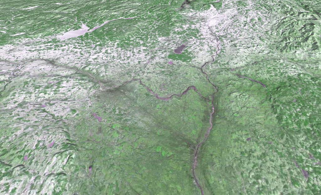
Monday, January 8, 1973 after a snow storm that most impacted the higher elevation areas south of Adirondacks. LANDSTAT 1 satellite photo shown in 3D mode -- the LANDSTAT data going back to 1972 is all geo-referenced so it's super easy to play with it.
2021 Combined Municipal and County Taxes Per $1,000 Assessed Value
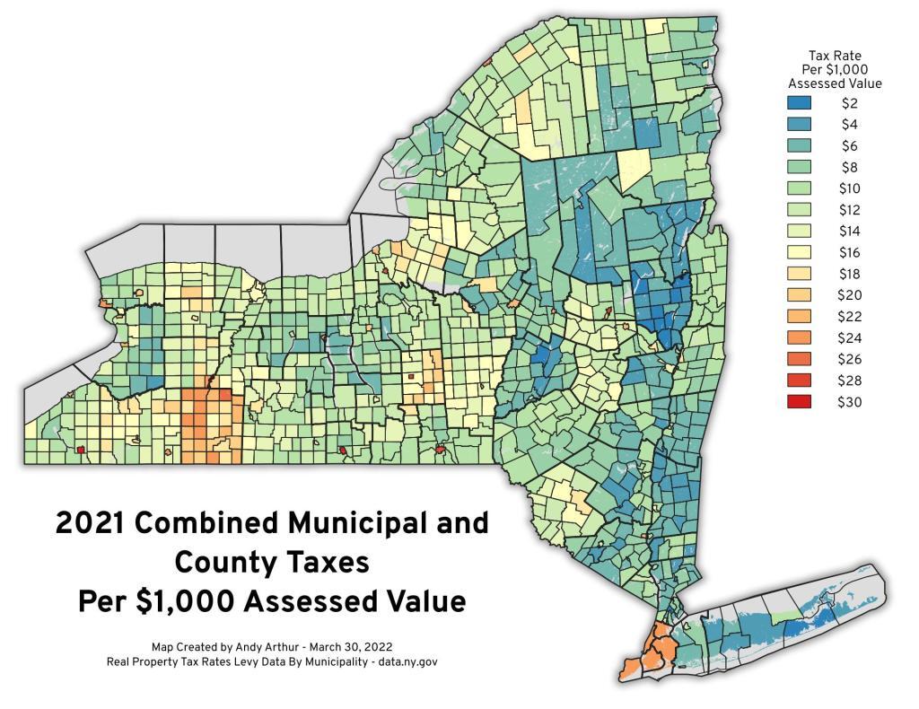
Allegany County is not a good value when it comes to county and local property taxes, with a county $13.17 per $1k assessment and many towns assessing an additional $10-12 per $1k. You might be able to score property cheaply there, but you'll pay some of the highest taxes in the state there on it.
You can get the data here: https://data.ny.gov/Government-Finance/Real-Property-Tax-Rates-Levy-Data-By-Municipality-/iq85-sdzs/data
You will need then to match it to SWIS code, which you can use this for: http://gis.ny.gov/gisdata/inventories/details.cfm?DSID=927
The Great Escape
Six Flags Great Escape and Hurricane Harbor, a theme and water park in Queensbury, New York, was originally Storytown USA in 1954. Renamed The Great Escape in 1983, it boasts roller coasters like the iconic Comet. In 1996, Premier Parks acquired it, and in 2006, the Six Flags Great Escape Lodge & Indoor Waterpark opened. The park offers diverse shows and attractions, including a unique high dive show. Despite ownership changes, it remained unbranded as Six Flags until 2022.
Red Horse Trail
![Red Horse Trail [Expires January 23 2024]](https://andyarthur.org//data/photo_007889_large.jpg)
Five Ponds Wilderness – The Red Horse Trail
The Red Horse Trail in the southern Five Ponds Wilderness of the Adirondacks is a historic, challenging trail dating back to 1922. Spanning five miles from Big Burnt Lake to Clear Lake, it features serene lakes, old-growth forests, and wetland boardwalks. Divided into three sections, the trail's remoteness and limited access, primarily by boat, preserve its wilderness character. Highlights include Salmon Lake, Witchhopple Lake, and Clear Lake, with a mix of challenging and level terrain. The trail offers opportunities for camping, canoeing, and kayaking, providing a genuine wilderness experience away from more frequented Adirondack trails.
Read more about it here: https://www.adirondackalmanack.com/2011/03/five-ponds-wilderness-the-red-horse-trail.html
LANDSTAT 1 – January 8, 1973
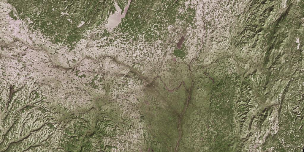
Monday, January 8, 1973 after a snow storm that most impacted the higher elevation areas south of Adirondacks. LANDSTAT 1. And yes, as you can see, the old LANDSTAT imagetry is geoReferenced. Neat!