Map: Gates Hill State Forest

Download a High Resolution JPEG Image of the Gates Hill State Forest or an Adobe Acrobat Printable PDF of the Gates Hill State Forest.
About Map: Gates Hill State Forest ....
42.51806216142867,-74.36477532632536
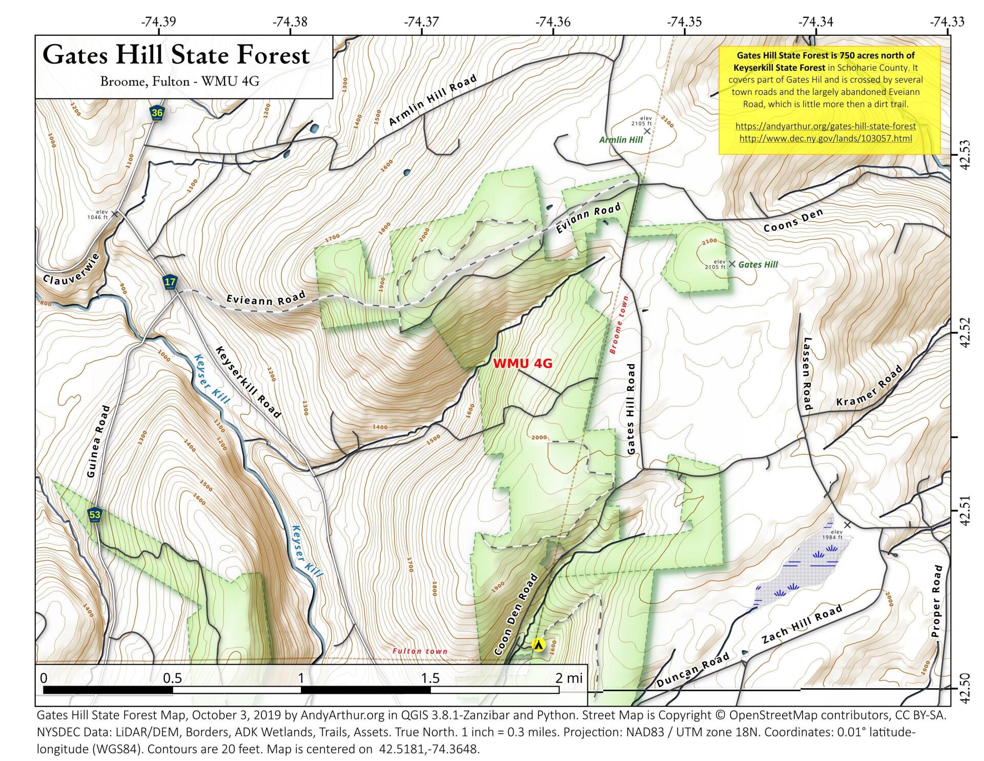
Gates Hill State Forest is 750 acres north of Keyserkill State Forest in Schoharie County. It covers part of Gates Hil and is crossed by several town roads and the largely abandoned Eveiann Road, which is little more then a dirt trail.
https://andyarthur.org/gates-hill-state-forest
http://www.dec.ny.gov/lands/103057.html

Bookmark my free Interactive GPS Map for your phone:
https://andyarthur.org/ny
... shows your location as a blue dot in relationship to campsites, trails, state land. This online map requires cell service, won't work in remote country, so also bring a paper map.
Free Download of New & Historical USGS 1:24k Topograpic Maps
Interactive maps with backcountry and roadside camping: New York, Pennsylvania, West Virginia & Vermont. List of NYS DEC Lean-Tos and Firetowers.
Google Spreadsheet with Roadside, Primitive and Pay Campsites
More about Keyserkill State Forest...
Keyserkill State Forest is located in the towns of Gilboa and Fulton in Southern Schoharie County. It is north of Leonard Hill State Forest and consists of the hills along the Keyser Kill.
Maps and Interactives
Keyserkill State Forest
Keyserkill And Gates Hill State Forests
Gates Hill State Forest
... photos, maps and other content from from Keyserkill State Forest.