![Troy Mayor - 2023 General Election [Expires November 1 2024]](https://andyarthur.org//data/photo_011792_large.jpg)
Troy, New York
Griswold Heights 1952
According to state tax records, Griswold Heights was constructed around 1950. By 1952, most of the projects were done and as you can see from the 1952 aerial, few things have change in Griswold Heights in the past 70 years.
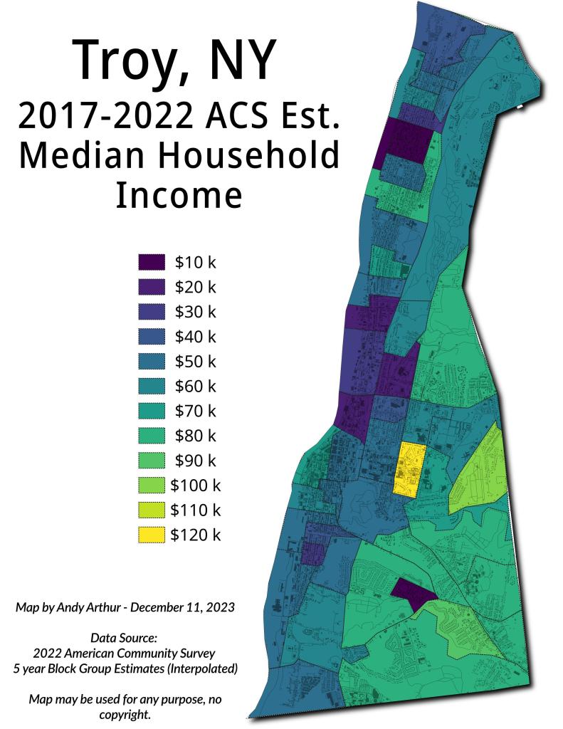
Troy – Median Household Incomne
Troy-Cohoes, A Racial Dot Map
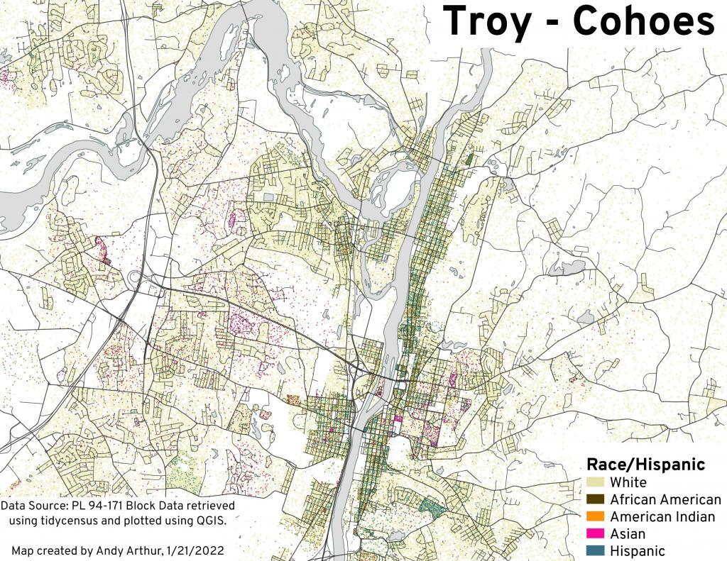
Dot density based on population of each race shown on this map.
South Troy 1873
Troy, NY 1873. From the City Directory. Downloaded from the Library of Congress
Troy, NY – 1995, 2000, 2004, 2007, 2011, 2014, 2017, 2021
Explore Troy over the past 25 years in a series of state-aerial photos.
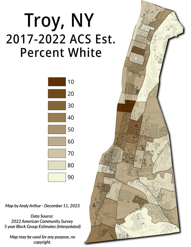
Troy – Percent White