Tug Hill 📍
🗺️ Maps

Tug Hill
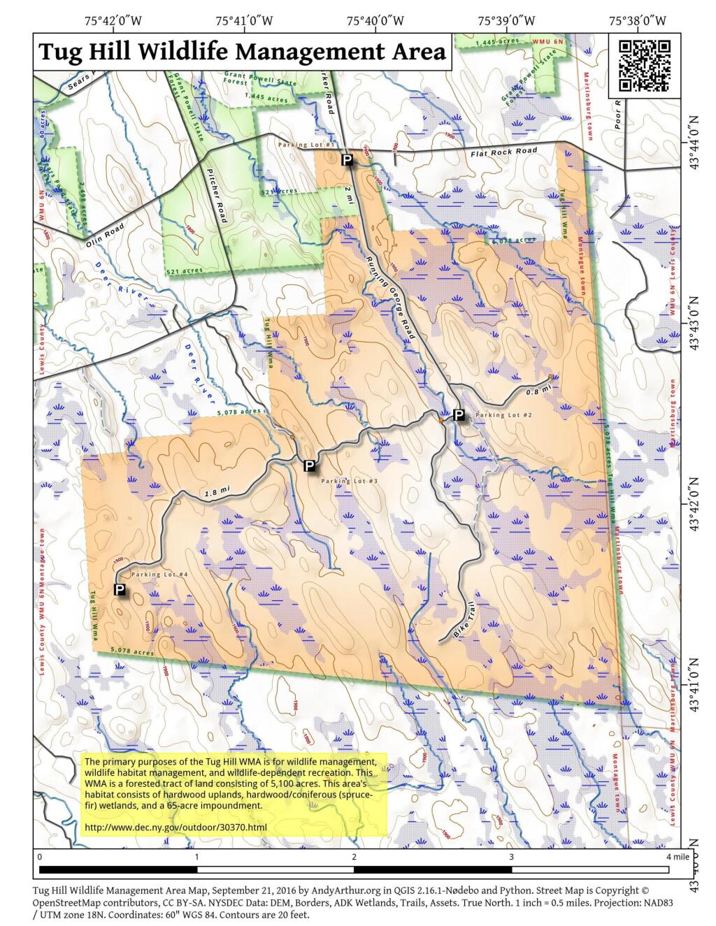
Here is an 250k or possibly more zoomed in Digital Raster Graphic old topographic map of the Tug Hill. Nothing that remarkable but I like looking at maps.

Tug Hill Valley
Between the Tug Hill Plateau and the Western Adirondacks runs a narrow band of excellent agricultural soils in the Black River Valley that produce many a bushel of corn 🌽 and silage. 🐮

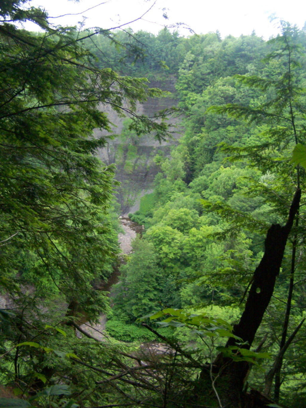
Gulf Below
So many darn trees made it hard to see well into the valley, and the skies where pretty gray and wet.
Wednesday June 29, 2011 — Tug Hill State Forest — Tug Hill State Forest (Inman Gulf Area) 🗺 — Tug Hill State Forest (North) 🗺— PDF with All Maps 📚