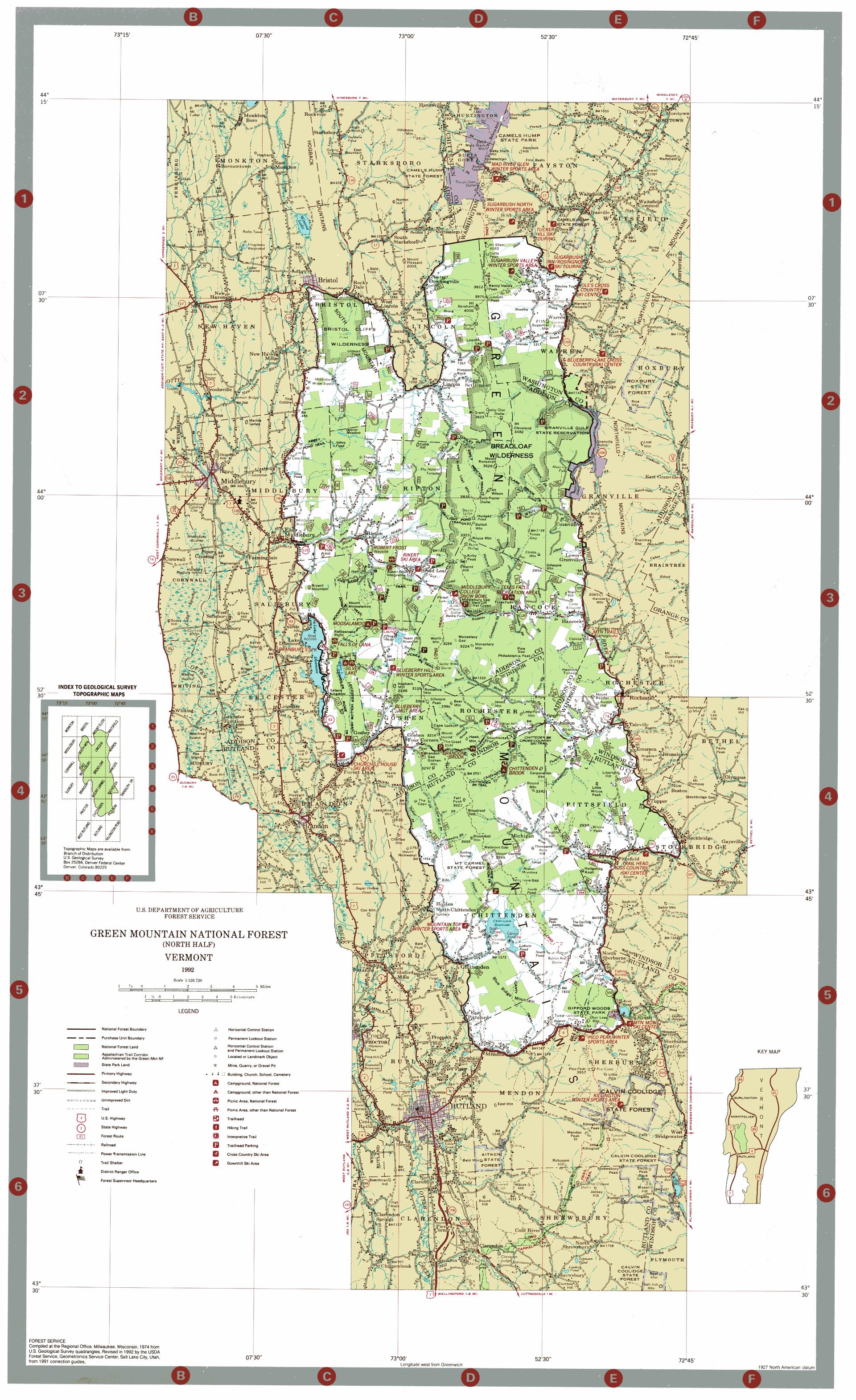
Green Mountain National Forest North
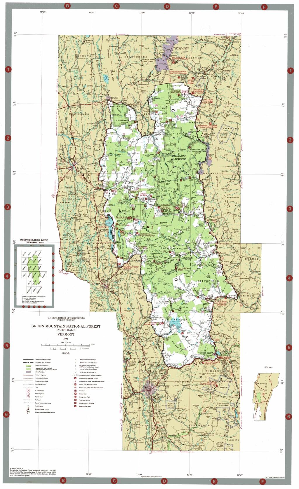
Download a High Resolution JPEG Image of the Green Mountain National Forest North or an Adobe Acrobat Printable PDF of the Green Mountain National Forest North.

Bookmark my free Interactive GPS Map for your phone:
https://andyarthur.org/ny
... shows your location as a blue dot in relationship to campsites, trails, state land. This online map requires cell service, won't work in remote country, so also bring a paper map.
Free Download of New & Historical USGS 1:24k Topograpic Maps
Interactive maps with backcountry and roadside camping: New York, Pennsylvania, West Virginia & Vermont. List of NYS DEC Lean-Tos and Firetowers.
Google Spreadsheet with Roadside, Primitive and Pay Campsites
More about Green Mountain National Forest...
Green Mountain National Forest is a national forest located in Vermont, a forest area typical of the New England/Acadian forests ecoregion. The forest supports a variety of wildlife, including beaver, moose, coyote, black bear, and white tailed deer. It also supports an abundant variety of bird species, such as wild turkey and ruffed grouse. The forest, being situated in Vermont's Green Mountains, has been referred to as the 'granite backbone' of the state.
The forest was established in 1932, as a result of uncontrolled overlogging, fire and flooding.[3] It consists of 399,151 acres (1,615.31 km2); and is the biggest contiguous land mass in the state. If Finger Lakes National Forest, which is managed as a unit of the Green Mountain National Forest, is included within it, GMNF is one of only two national forest northeast of the Pennsylvania-New Jersey barrier; the other being the White Mountain National Forest. Split into the southwest and central areas, GMNF has a total of eight wilderness areas. These were designated by Congress beginning with the Wilderness Act of 1964 to be areas off limits to mechanized gear down to and including bicycles.
http://en.wikipedia.org/wiki/Green_Mountain_National_Forest
http://www.fs.usda.gov/greenmountain
Download the PDF Map Pack with All Maps from Green Mountain National Forest.


