Severence Hill Trail

Download a High Resolution JPEG Image of the Severence Hill Trail or an Adobe Acrobat Printable PDF of the Severence Hill Trail.
About Map: Severence Hill Trail ....
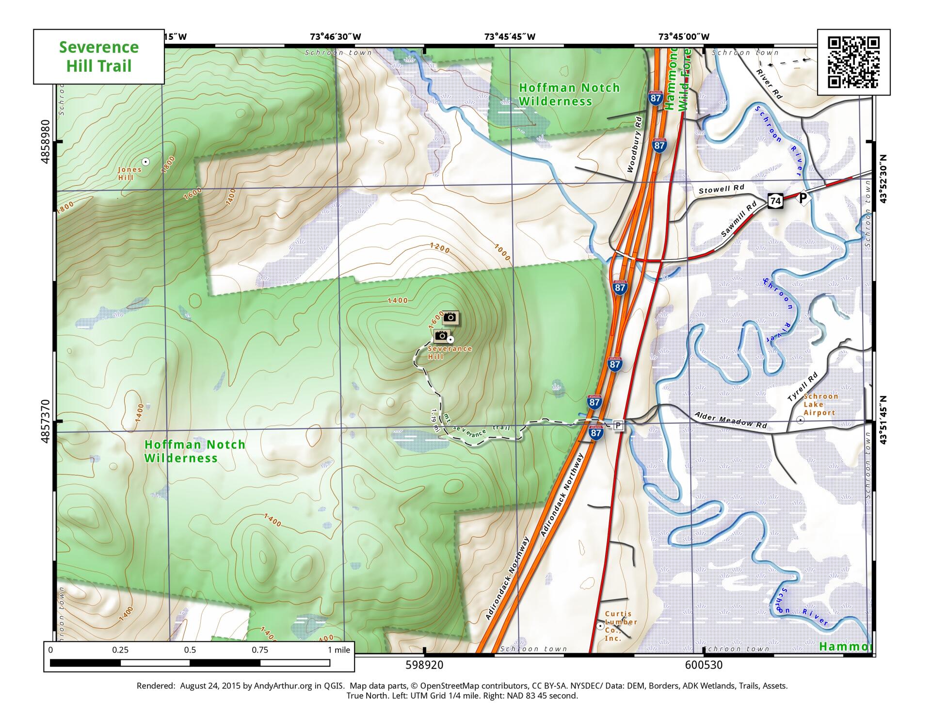
1.2 mile leg-stretcher hike, easily accessed from US 9, just south of Exit 28 Ticonderoga on the Adirondack Northway. Good views of Paradox Lake and Schroon Lake from this mountain. Trail goes under the Adirondack Northway in a culvert.

Bookmark my free Interactive GPS Map for your phone:
https://andyarthur.org/ny
... shows your location as a blue dot in relationship to campsites, trails, state land. This online map requires cell service, won't work in remote country, so also bring a paper map.
Free Download of New & Historical USGS 1:24k Topograpic Maps
Interactive maps with backcountry and roadside camping: New York, Pennsylvania, West Virginia & Vermont. List of NYS DEC Lean-Tos and Firetowers.
Google Spreadsheet with Roadside, Primitive and Pay Campsites
More about Severance Hill...
1.2 mile leg-stretcher hike, easily accessed from US 9, just south of Exit 28 Ticonderoga on the Adirondack Northway. Good views of Paradox Lake and Schroon Lake from this mountain. Trail goes under the Adirondack Northway in a culvert.


