Search Results for: west capital park
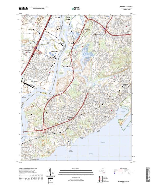
November 5, 2015 evening

Good evening. It’s after dark on the evening commute with the time change. Still despite the clouds this evening, it’s a very pleasant 70 degrees. You don’t often get 70 degree days on November 5th, the average high for today is 52 degrees. A few hours ago it was even warmer, with temperatures reaching 71 degrees.

I hope your headlights are working, as we commute home in this darkness. They did remember to turn the lights on at the West Capital Park and on South Swan Street, which makes waiting for the bus much more pleasant. Many years in November, they fail to adjust the timer so it comes on in time for darkness and the 5 PM commute home. Solar LED illumination also helps keeps the bus stop bright.

Traffic is moving well this evening, as construction is rapidly concluding on the I-787 Expressway, heading southbound out of the city. Some parts are still closed off, but for the most part things are moving along but with some residual delays.

Tonight I am going to do my wash and buy groceries. I think I will hold off on getting the propane tank for the heater until Friday night or Saturday. Not going to leave to go up north until Saturday morning. I also need to get some more ammo and replacement headphones as the left channel wire is dead.

Hoping this winter to get camping at least twice a month throughout the winter. With proper dress, sleeping bags, a roaring campfire, lantern, maybe some firewood, and the heater, lean-to camping will be a lot of fun in the winter. Might also do hot tenting locally up in one of the state forests. Load all that crap on a plastic sled and tow it back in the woods on skies or more likely on snowshoes. The cellphone and Bluetooth speaker can keep the podcasts and music going late into the evening. Maybe ring the new year in on that firetower and lean-to in Austerlitz.

The Cost of New York Being on the Cutting Edge

Lately there have been a lot of discussion on why New York State is such a high tax state compared to others, and why our state gets relatively little back in funding compared to other states.

The common refrains are that New York is a liberal state, so we invest a lot more in human services, healthcare, welfare and education. That is true to a certain extent. But it’s also not totally true either. Red states actually have a lot better public services then many blue staters want to believe. Another common refrain is that New York is a wealthy state, so we aren’t eligible for nearly the same amount of transfer payments are poorer states. That is also true, although New York also has plenty of pockets of poverty — but we are also the financial capital of the world and home to our nation’s biggest city. Some say corruption is worse in New York then other states. I’m a bit skeptical on that point, I think there are more watch dogs on government then other states — being a such a big state with well funded newspapers. Are Albany politicians really going to pull a fast one over on the New York Times and New York Post at the same time?

But there is another truth that is often ignored. New York often rejects a lot of federal funding. While contemporary reasons for rejecting federal funding may be ideological in nature, the original reason our state rejected federal funding was we chose to be out in front of the federal government — on canals, on highways, on parks, on forests, etc. New York chose to build a lot of it’s infrastructure without federal funding, because we built before the funding was avaliable. Being out front is good, but sometimes it’s really costly to taxpayers.

The New York State Thruway is a prime example of this. Why do people pay tolls to drive on the Thruway, while most other highways are free in New York? Because in early 1950s, the legislature decided our state needed a superhighway. Rather then wait to see if federal funding would become avaliable to build the highway, we decided to do it on our own. A cost bourne 100% by New York taxpayers. While the Adirondack Northway recieved 90% of it’s funding from the federal gas tax, the Thruway recieved 0% of it’s funding from the federal gas tax.

Now could the state have removed the toll booths and recieved federal funding for the highway for maintaince? Possiblity but not likely. The federal interstate act did not allow for grandfathering in existing routes, although some free routes did get upgrades to interstate standards under the act. Rather then eliminate the tolls and seek federal funding for the Thruway, our state has chosen to pay fror it upkeep 100% from state funding, namely tolls but also general fund revenue. If we made it eligable for federal funding, New York would also have to pick up the difference between federal funding and state funding, and it’s not always easy to find extra funding in the gas tax.

We are in the same boat with many of our state’s bridges and tunnels. Could the state have waited a few years and got funding for free crossing over the Hudson River and the New York City metropolitian crossings? Probably yes, as most of the Western States have no tolls, even on their biggest Interstate Bridges. Our state certainly could have gotten 50% of the cost of building and maintaining back on the Hudson River crossings, and 90% in some cases. But we chose to build them before federal funding was avaliable. Now we are stuck with the clunky Bridge Authorities and Triborough Authority, which pays 100% of the bridge expenses through local tolls. Even if we eliminated the tolls, it”s not clear we cold get federal funding at this point. Nor is it clear if we would want to — by refusing federal funding — our state has the “freedom” to set whatever standards it wants on the bridges, including advertising and geometery. Federal highway standards don’t apply to non-federally funded roads.

The federal government maintains locks and canals on most rivers. Our state doesn’t get to take advantage of federal maintaince to our canals. We have the Erie Canal, which is entirely paid again by state taxpayers and those who traverse the canal. We talk about Clinton’s Ditch as being a great advance for our state. It certainly was at it’s time. But we could have had the federal government build it for us had we waited a few years — and put up with the federal government’s dicates. Certainly the Army Corp or Engineers maintains a lot of the nation’s canals. But not in New York. We chose once again to go it alone on our canal system.

One could have imagined that New York City could have gotten the federal government to finance their drinking water reserviors, had that waited a little while longer, and been willing to put up with creation of a federal public authority like the Tennessee Valley Authority. Maybe New York City’s drinking water reserviors would have not only produced clean water, but also greater recreational opporunities and more hydropower had the federal government, not the city built them. But no, our state had go out in front of the federal government — a cost picked up federal government in other states.

No state in America has as big of a state operated wild forest or wilderness as New York does. That’s not saying other states don’t have great public lands that are a mixature of managed forest and wilderness, operated by the federal government. The Adirondack Park is tiny compared to some of the National Forests and Bureau of Public Lands out west. Other states also have developed parks and recreation areas, but many of them are funded and directly operated by the federal government. But not New York, bar a few small historic battle sites, and the relatively small Finger Lakes National Forest. Why not? Our state got out ahead of federal funding and furthermore rejected federal operation of our Adirondack and Catskill Parks.

New York State certainly could have been home to the Adirondack National Forest or the Adirondack National Park. But no, our state rejected that idea off-hand. Vermont decided to protect it’s wild upcountry and mountains with the Green Mountain National Forest, but not New York. Our state once again got out ahead of the federal government, and rather then create a managed forest, we were stuck in the mid-1800s line of thought that all logging was bad and we could only preserve the land by banning all timber cutting for any purposes.

By rejecting creation of a Adirondack National Forest or National Park, our state once again passed up on billions of federal funding. Rather then have the federal government pay for maintaining roads, parking areas, campsites and trails in Adirondack, New York taxpayers are 100% on the hook. The Green Mountain National Forest in contrast has federally funded forest rangers, federally funded maps and recreational facilities, federally funded campgrounds and much more. Instead, our state has chosen to take up this cost because we wanted ideological control over the land — rather let distant Washington politicians decide how to maintain the lands.

There is somewhat a myth that red states have awful public services, while blue states have a much better government. While blue states like New York are often on the cutting edge, getting out on cutting edge before the federal government means New York residents pay dearly. Forgoing federal funds by getting a decade out ahead of other states might have some short term advantages, but it often means our state residents ends up paying for a lot of other things that federal government would have otherwise paid for in coming years.

Boards of Cooperative Education Services (BOCES)

Boards of Cooperative Education Services (BOCES)
BOCES Districts
Broome-Delaware-Tioga Binghamton City, Chenango Forks, Chenango Valley, Deposit, Harpursville, Johnson City, Maine-Endwell, Newark Valley, Owego-Apalachin, Susquehanna Valley, Tioga, Union-Endicott, Vestal, Whitney Point, Windsor
Capital Region Albany City, Berne-Knox-Westerlo, Bethlehem, Burnt Hills-Ballston Lake, Cobleskill-Richmondville, Cohoes City, Duanesburg, Green Island, Guilderland, Menands, Middleburgh, Niskayuna, North Colonie, Ravena-Coeymans-Selkirk, Rotterdam-Mohonasen, Schalmont, Schenectady City, Schoharie, Scotia-Glenville, Sharon Springs, Shenendehowa, South Colonie, Voorheesville, Watervliet City
Cattar-Allegany-Erie-Wyoming Allegany-Limestone, Andover, Belfast, Bolivar-Richburg, Cattaraugus-Little Valley, Cuba-Rushford, Ellicottville, Fillmore, Franklinville, Friendship, Genesee Valley, Hinsdale, Olean City, Portville, Randolph, Salamanca City, Scio, Wellsville, West Valley, Whitesville, Yorkshire-Pioneer
Cayuga-Onondaga Auburn City, Cato-Meridian, Jordan-Elbridge, Moravia, Port Byron, Skaneateles, Southern Cayuga, Union Springs, Weedsport
Clinton-Essex-Warren-Washing Ausable Valley, Beekmantown, Boquet Valley, Chazy, Crown Point, Keene, Moriah, Northeastern Clinton, Northern Adirondack, Peru, Plattsburgh City, Putnam, Saranac, Schroon Lake, Ticonderoga, Willsboro
Delaw-Chenango-Madison-Otsego Afton, Bainbridge-Guilford, Delaware Academy Csd At, Downsville, Franklin, Georgetown-South Otselic, Gilbertsville-Mount Upton, Greene, Hancock, Norwich City, Otego-Unadilla, Oxford Academy &, Sherburne-Earlville, Sidney, Unadilla Valley, Walton
Dutchess Arlington, Beacon City, Dover, Hyde Park, Millbrook, Northeast, Pawling, Pine Plains, Poughkeepsie City, Red Hook, Rhinebeck, Spackenkill, Wappingers
Eastern Suffolk Amagansett, Bay Shore, Bayport-Blue Point, Brentwood, Bridgehampton, Brookhaven-Comsewogue, Center Moriches, Central Islip, Connetquot, East Hampton, East Islip, East Moriches, East Quogue, Eastport-South Manor, Fire Island, Fishers Island, Greenport, Hampton Bays, Hauppauge, Islip, Longwood, Mattituck-Cutchogue, Middle Country, Miller Place, Montauk, Mt Sinai, New Suffolk Comn, Oysterponds, Patchogue-Medford, Port Jefferson, Quogue, Remsenburg-Speonk, Riverhead, Rocky Point, Sachem, Sag Harbor, Sagaponack Comn, Sayville, Shelter Island, Shoreham-Wading River, South Country, Southampton, Southold, Springs, Three Village, Tuckahoe Comn, Wainscott Comn, West Islip, Westhampton Beach, William Floyd
Erie 1 Akron, Alden, Amherst, Buffalo City, Cheektowaga, Cheektowaga-Maryvale, Clarence, Cleveland Hill, Depew, Frontier, Grand Island, Hamburg, Hopevale Ufsd At, Kenmore-Tonawanda, Lackawanna City, Lancaster, Sweet Home, Tonawanda City, West Seneca, Williamsville
Erie 2-Chautauqua-Cattaraugus Bemus Point, Brocton, Cassadaga Valley, Chautauqua Lake, Clymer, Dunkirk City, East Aurora, Eden, Evans-Brant Csd (Lake Shore), Falconer, Forestville, Fredonia, Frewsburg, Gowanda, Holland, Iroquois, Jamestown City, North Collins, Orchard Park, Panama, Pine Valley Csd (South Dayton), Ripley, Sherman, Silver Creek, Southwestern Csd At, Springville-Griffith Inst, Westfield
Franklin-Essex-Hamilton Brushton-Moira, Chateaugay, Lake Placid, Long Lake, Malone, Raquette Lake, Salmon River, Saranac Lake, St Regis Falls, Tupper Lake
Genesee Valley Alexander, Attica, Avon, Batavia City, Byron-Bergen, Caledonia-Mumford, Dalton-Nunda Csd (Keshequa), Dansville, Elba, Geneseo, Le Roy, Letchworth, Livonia, Mt Morris, Oakfield-Alabama, Pavilion, Pembroke, Perry, Warsaw, Wayland-Cohocton, Wyoming, York
Hamilton-Fulton-Montgomery Amsterdam City, Broadalbin-Perth, Canajoharie, Edinburg Common, Fonda-Fultonville, Fort Plain, Gloversville City, Johnstown City, Lake Pleasant, Mayfield, Northville, Oppenheim-Ephratah-St. Johnsville, Piseco Comn, Wells, Wheelerville
Herk-Fulton-Hamilton-Otsego Central Valley Csd At Ilion-, Dolgeville, Frankfort-Schuyler, Herkimer, Little Falls City, Mount Markham, Oppenheim-Ephratah-St. Johnsville, Poland, Richfield Springs, Van Hornesville-Owen D Young, West Canada Valley
Jeffer-Lewis-Hamil-Herk-Oneida Adirondack, Alexandria, Beaver River, Belleville-Henderson, Carthage, Copenhagen, General Brown, Indian River, Inlet Comn, La Fargeville, Lowville Academy &, Lyme, Sackets Harbor, South Jefferson, South Lewis, Thousand Islands, Town Of Webb, Watertown City
Madison-Oneida Camden, Canastota, Hamilton, Madison, Morrisville-Eaton, Oneida City, Rome City, Sherrill City, Stockbridge Valley
Monroe 1 Brighton, East Irondequoit, East Rochester, Fairport, Honeoye Falls-Lima, Penfield, Pittsford, Rochester City, Rush-Henrietta, Webster, West Irondequoit
Monroe 2-Orleans Brockport, Churchville-Chili, Gates-Chili, Greece, Hilton, Holley, Kendall, Spencerport, Wheatland-Chili
Nassau Baldwin, Bellmore, Bellmore-Merrick Central School, Bethpage, Carle Place, East Meadow, East Rockaway, East Williston, Elmont, Farmingdale, Floral Park-Bellerose, Franklin Square, Freeport, Garden City, Glen Cove City, Great Neck, Hempstead, Herricks, Hewlett-Woodmere, Hicksville, Island Park, Island Trees, Jericho, Lawrence, Levittown, Locust Valley, Long Beach City, Lynbrook, Malverne, Manhasset, Massapequa, Merrick, Mineola, New Hyde Park-Garden City Park, North Bellmore, North Merrick, North Shore, Oceanside, Oyster Bay-East Norwich, Plainedge, Plainview-Old Bethpage, Port Washington, Rockville Centre, Roosevelt, Roslyn, Seaford, Sewanhaka Central School, Syosset, Uniondale, Valley Stream 13, Valley Stream 24, Valley Stream 30, Valley Stream Central School, Wantagh, West Hempstead, Westbury
Oneida-Herkimer-Madison Brookfield, Clinton, Holland Patent, New Hartford, Ny Mills, Oriskany, Remsen, Sauquoit Valley, Utica City, Waterville, Westmoreland, Whitesboro
Onondaga-Cortland-Madison Baldwinsville, Cazenovia, Chittenango, Cincinnatus, Cortland City, Deruyter, East Syracuse Minoa, Fabius-Pompey, Fayetteville-Manlius, Homer, Jamesville-Dewitt, Lafayette, Liverpool, Lyncourt, Marathon, Marcellus, Mcgraw, North Syracuse, Onondaga, Solvay, Syracuse City, Tully, West Genesee, Westhill
Orange-Ulster Chester, Cornwall, Florida, Goshen, Greenwood Lake, Highland Falls, Kiryas Joel Village, Marlboro, Middletown City, Minisink Valley, Monroe-Woodbury, Newburgh City, Pine Bush, Port Jervis City, Tuxedo, Valley Csd (Montgomery), Warwick Valley, Washingtonville
Orleans-Niagara Albion, Barker, Lewiston-Porter, Lockport City, Lyndonville, Medina, Newfane, Niagara Falls City, Niagara-Wheatfield, North Tonawanda City, Royalton-Hartland, Starpoint, Wilson
Oswego Altmar-Parish-Williamstown, Central Square, Fulton City, Hannibal, Mexico, Oswego City, Phoenix, Pulaski, Sandy Creek
Otsego-Delaw-Schoharie-Greene Andes, Charlotte Valley, Cherry Valley-Springfield, Cooperstown, Edmeston, Gilboa-Conesville, Hunter-Tannersville, Jefferson, Laurens, Margaretville, Milford, Morris, Oneonta City, Roxbury, Schenevus, South Kortright, Stamford, Windham-Ashland-Jewett, Worcester
Putnam-Northern Westchester Bedford, Brewster, Briarcliff Manor, Carmel, Chappaqua, Croton-Harmon, Garrison, Haldane, Hendrick Hudson, Katonah-Lewisboro, Lakeland, Mahopac, North Salem, Ossining, Peekskill City, Putnam Valley, Somers, Yorktown
Questar Iii (R-C-G) Averill Park, Berkshire, Berlin, Brunswick Csd (Brittonkill), Cairo-Durham, Catskill, Chatham, Coxsackie-Athens, East Greenbush, Germantown, Greenville, Hoosic Valley, Hoosick Falls, Hudson City, Kinderhook, Lansingburgh, New Lebanon, North Greenbush Comn Sd (Williams), Rensselaer City, Schodack, Taconic Hills, Troy City, Wynantskill
Rockland Clarkstown, East Ramapo Csd (Spring Valley), Haverstraw-Stony Point Csd (North, Nanuet, Nyack, Pearl River, Ramapo Csd (Suffern), South Orangetown
Schuy-Steub-Chem-Tioga-Alleg Addison, Alfred-Almond, Arkport, Avoca, Bath, Bradford, Campbell-Savona, Canaseraga, Canisteo-Greenwood, Corning City, Elmira City, Elmira Heights, Hammondsport, Hornell City, Horseheads, Jasper-Troupsburg, Odessa-Montour, Prattsburgh, Spencer-Van Etten, Watkins Glen, Waverly
St Lawrence-Lewis Brasher Falls, Canton, Clifton-Fine, Colton-Pierrepont, Edwards-Knox, Gouverneur, Hammond, Harrisville, Hermon-Dekalb, Heuvelton, Lisbon, Madrid-Waddington, Massena, Morristown, Norwood-Norfolk, Ogdensburg City, Parishville-Hopkinton, Potsdam
Sullivan Eldred, Fallsburg, Liberty, Livingston Manor, Monticello, Roscoe, Sullivan West, Tri-Valley
Tompkins-Seneca-Tioga Candor, Dryden, Groton, Ithaca City, Lansing, Newfield, South Seneca, Trumansburg
Ulster Ellenville, Highland, Kingston City, New Paltz, Onteora, Rondout Valley, Saugerties, Wallkill
Washing-Sara-War-Hamltn-Essex Argyle, Ballston Spa, Bolton, Cambridge, Corinth, Fort Ann, Fort Edward, Galway, Glens Falls City, Glens Falls Comn, Granville, Greenwich, Hadley-Luzerne, Hartford, Hudson Falls, Indian Lake, Johnsburg, Lake George, Mechanicville City, Minerva, Newcomb, North Warren, Queensbury, Salem, Saratoga Springs City, Schuylerville, South Glens Falls, Stillwater, Warrensburg, Waterford-Halfmoon, Whitehall
Wayne-Finger Lakes Canandaigua City, Clyde-Savannah, Dundee, East Bloomfield, Gananda, Geneva City, Gorham-Middlesex Csd (Marcus, Honeoye, Lyons, Manchester-Shortsville Csd (Red, Marion, Naples, Newark, North Rose-Wolcott, Palmyra-Macedon, Penn Yan, Phelps-Clifton Springs, Red Creek, Romulus, Seneca Falls, Sodus, Victor, Waterloo, Wayne, Williamson
Westchester Ardsley, Blind Brook-Rye, Bronxville, Byram Hills, Dobbs Ferry, Eastchester, Edgemont, Elmsford, Greenburgh, Harrison, Hastings-On-Hudson, Irvington, Mamaroneck, Mt Pleasant, Mt Vernon School, New Rochelle City, Pelham, Pleasantville, Pocantico Hills, Port Chester-Rye, Rye City, Rye Neck, Scarsdale, Tuckahoe, Ufsd-, Valhalla, White Plains City, Yonkers City
Western Suffolk Amityville, Babylon, Cold Spring Harbor, Commack, Copiague, Deer Park, Elwood, Half Hollow Hills, Harborfields, Huntington, Kings Park, Lindenhurst, North Babylon, Northport-East Northport, Smithtown, South Huntington, West Babylon, Wyandanch
Andy Arthur, 3/31/23
Data Source: NYS Education Department.

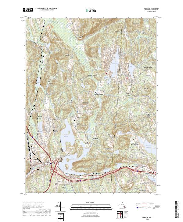
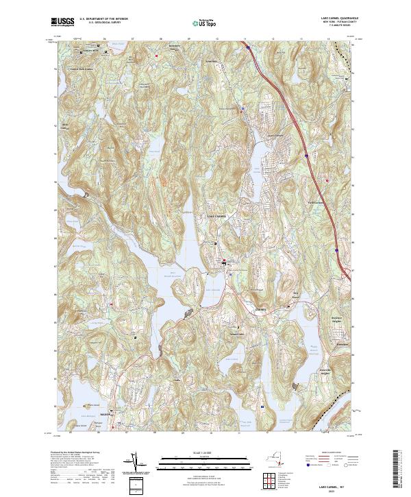
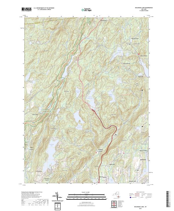
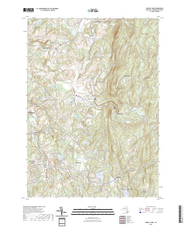
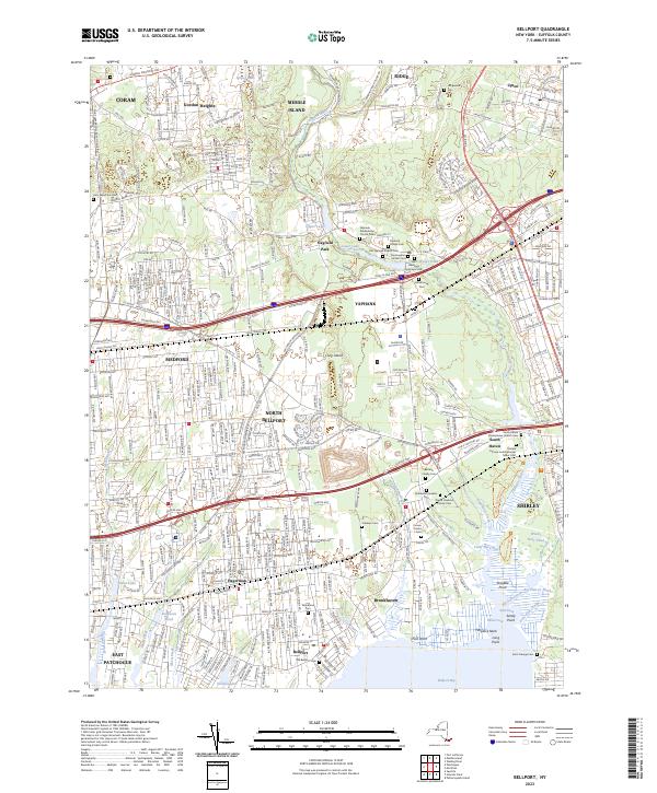
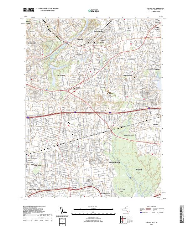
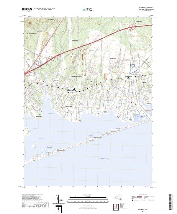
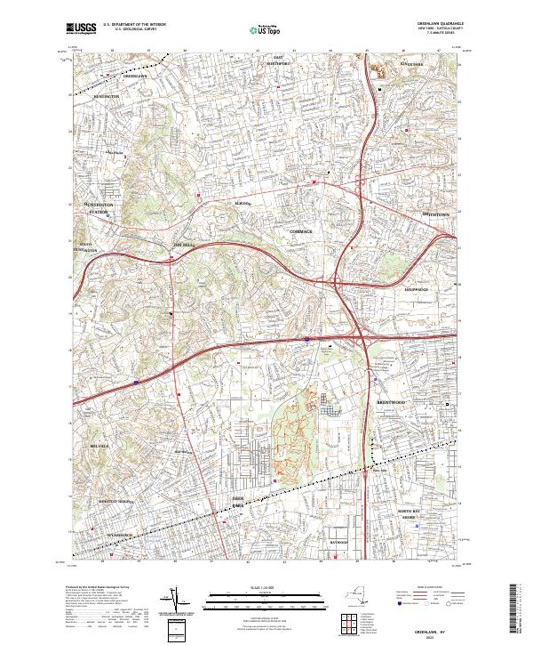
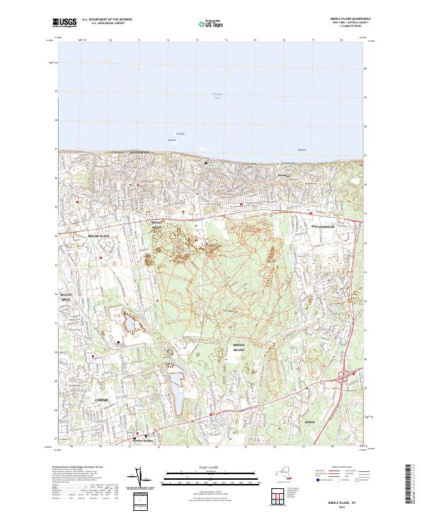
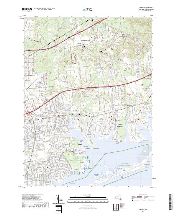
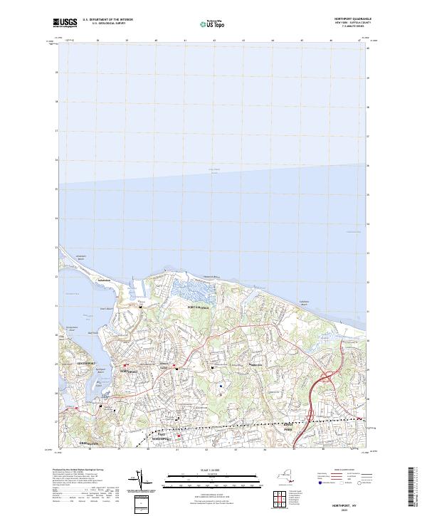
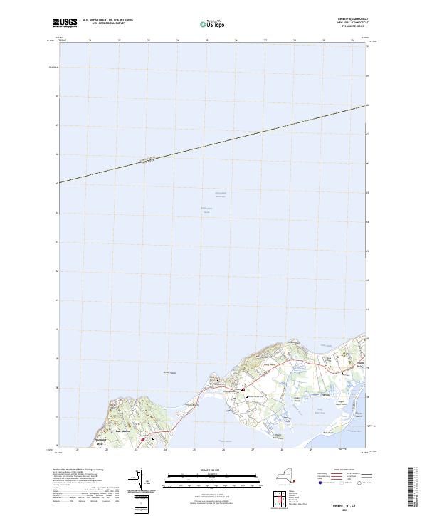
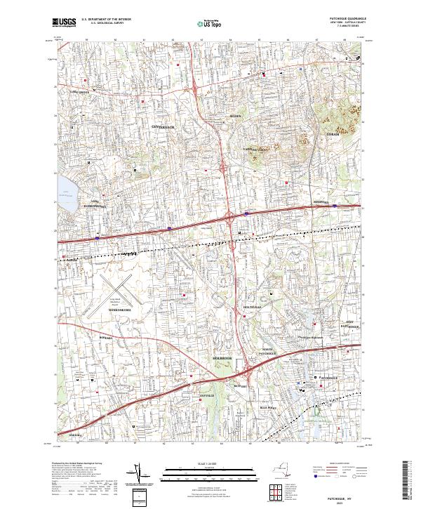
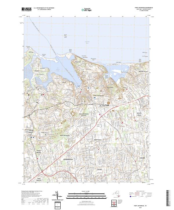
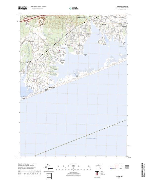
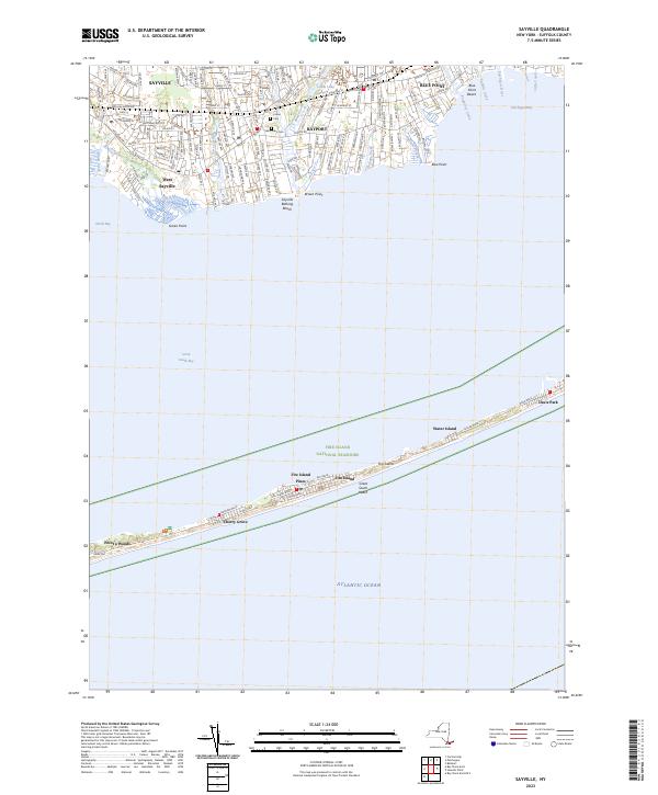
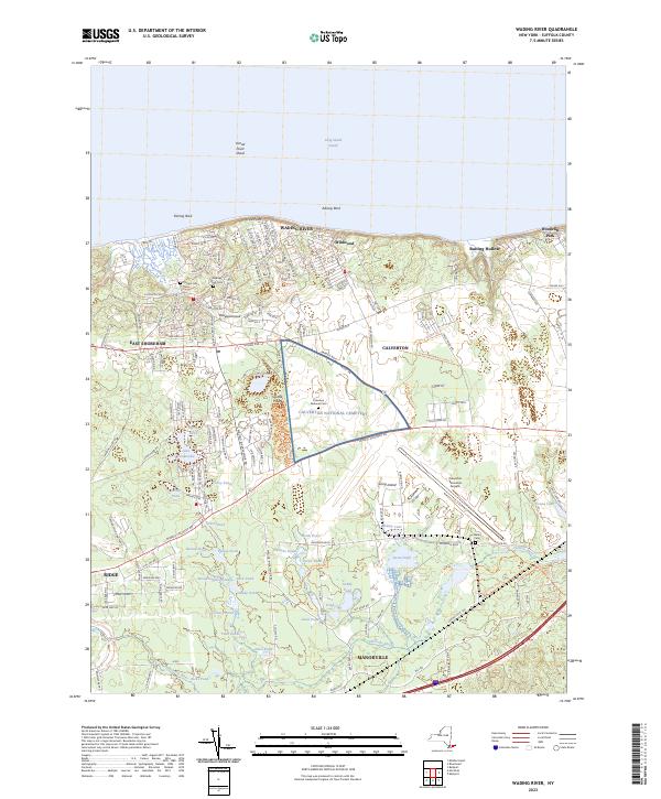
USGS Topographic Maps – Putnam to Suffolk

Counties: Albany to Delaware / Dutchess to Livingston / Madison to Otsego / Putnam to Suffolk / Sullivan to Yates

Browse Topographic Maps: Full State / Historical USGS Topographic Maps

Putnam County

PDF (50-60 MB Download) Historical USGS Topo Maps State Lands (Links to DEC Website) Towns (Percent of Town’s Area)
Current Brewster GeoPDF Map
1943 Map No. 123002, 1958 Map No. 123007, 1958 Map No. 123008, 1958 Map No. 123009, 1958 Map No. 137128, 1958 Map No. 137129 Great Swamp WMA, Bog Brook Unique Area, Cranberry Mountain WMA Patterson (52%), Southeast (62%)
Current Croton Falls GeoPDF Map
1944 Map No. 137748, 1960 Map No. 137197, 1960 Map No. 137749, 1960 Map No. 137750, 1960 Map No. 137751 NA Bedford (20%), Carmel (20%), Lewisboro (22%), North Salem (32%), Somers (74%), Southeast (6%)
Current Hopewell Junction GeoPDF Map
1957 Map No. 129768, 1957 Map No. 129769, 1957 Map No. 129770, 1981 Map No. 129767 NA Beekman (1%), East Fishkill (74%), Fishkill (14%), Kent (2%), Wappinger (27%)
Current Lake Carmel GeoPDF Map
1943 Map No. 130161, 1960 Map No. 130165, 1960 Map No. 130166, 1960 Map No. 130167, 1960 Map No. 130168 White Pond Multiple Use Area, Nimham Mountain Multiple Use Area, Big Buck Mountain Multiple Use Area Carmel (50%), Kent (53%), Patterson (17%), Southeast (21%)
Current Mohegan Lake GeoPDF Map
1956 Map No. 130593, 1956 Map No. 130594, 1956 Map No. 130595, 1956 Map No. 130596, 1956 Map No. 137454 Salt Hill State Forest Carmel (13%), Cortlandt (12%), Putnam Valley (25%), Somers (23%), Yorktown (67%)
Current Oscawana Lake GeoPDF Map
1956 Map No. 135907, 1956 Map No. 135908, 1956 Map No. 135909, 1956 Map No. 137493 California Hill State Forest Carmel (17%), East Fishkill (0%), Fishkill (1%), Kent (35%), Philipstown (13%), Putnam Valley (62%)
Current Pawling GeoPDF Map
1945 Map No. 135979, 1958 Map No. 135980, 1958 Map No. 135981, 1958 Map No. 135982, 1958 Map No. 136773, 1998 Map No. 136774 West Mountain State Forest, Great Swamp WMA, Cranberry Mountain WMA Dover (7%), Patterson (26%), Pawling (70%)
Current Peach Lake GeoPDF Map
1945 Map No. 135984, 1958 Map No. 135985, 1958 Map No. 135986, 1958 Map No. 135987, 1958 Map No. 135988, 1958 Map No. 135989, 1958 Map No. 136775, 1958 Map No. 136776, 1998 Map No. 136777 NA Bedford (1%), Lewisboro (56%), North Salem (68%), Pound Ridge (7%), Southeast (10%)
Current Peekskill GeoPDF Map
1947 Map No. 128944, 1957 Map No. 128946, 1957 Map No. 128948, 1957 Map No. 128949, 1957 Map No. 136783, 1957 Map No. 136784, 1957 Map No. 136785 NA Cortlandt (40%), Highlands (20%), Peekskill city (100%), Philipstown (24%), Putnam Valley (6%), Stony Point (28%)
Current Poughquag GeoPDF Map
1948 Map No. 129160, 1948 Map No. 129161, 1960 Map No. 129162, 1960 Map No. 129163, 1960 Map No. 129164, 1960 Map No. 136833 White Pond Multiple Use Area, Depot Hill Multiple Use Area, West Mountain State Forest, Big Buck Mountain Multiple Use Area, Sylvan Lake Waterway Access Beekman (72%), Dover (0%), East Fishkill (24%), Kent (10%), Patterson (5%), Pawling (30%)
Current West Point GeoPDF Map
1941 Map No. 140199, 1947 Map No. 140198, 1957 Map No. 137014, 1957 Map No. 140200, 1957 Map No. 140201, 1957 Map No. 140202 NA Beacon city (36%), Cornwall (8%), Fishkill (29%), Highlands (21%), New Windsor (0%), Newburgh city (4%), Philipstown (63%), Putnam Valley (7%)

Queens County

PDF (50-60 MB Download) Historical USGS Topo Maps State Lands (Links to DEC Website) Towns (Percent of Town’s Area)
Current Brooklyn GeoPDF Map
1947 Map No. 123124, 1956 Map No. 123127, 1956 Map No. 123128, 1967 Map No. 123129, 1967 Map No. 123130, 1967 Map No. 123131, 1967 Map No. 123132, 1995 Map No. 137132 NA Brooklyn borough (47%), Manhattan borough (18%), Queens borough (10%)
Current Central Park GeoPDF Map
1947 Map No. 122894, 1956 Map No. 122895, 1956 Map No. 122896, 1966 Map No. 122897, 1966 Map No. 122898, 1966 Map No. 122899, 1966 Map No. 122900, 1995 Map No. 137165 Bronx River Trail Bronx borough (31%), Manhattan borough (68%), Queens borough (7%)
Current Coney Island GeoPDF Map
1947 Map No. 137694, 1955 Map No. 137695, 1966 Map No. 137182, 1966 Map No. 137183, 1966 Map No. 137696, 1966 Map No. 137698, 1995 Map No. 137185 NA Brooklyn borough (29%), Queens borough (3%)
Current Far Rockaway GeoPDF Map
1947 Map No. 138136, 1954 Map No. 138137, 1969 Map No. 138139, 1969 Map No. 138140 Norton Basin Natural Resource Area Brooklyn borough (7%), Hempstead (1%), Queens borough (11%)
Current Flushing GeoPDF Map
1947 Map No. 138246, 1947 Map No. 138247, 1955 Map No. 138248, 1955 Map No. 138249, 1966 Map No. 137330, 1966 Map No. 138250, 1966 Map No. 138251, 1966 Map No. 138252, 1995 Map No. 137332 Bronx River Trail Bronx borough (42%), North Hempstead (2%), Queens borough (17%)
Current Jamaica GeoPDF Map
1947 Map No. 129963, 1957 Map No. 129966, 1966 Map No. 129967, 1966 Map No. 137279, 1979 Map No. 129968, 1994 Map No. 137282 NA Brooklyn borough (6%), Hempstead (0%), Queens borough (41%)
Current Lawrence GeoPDF Map
1947 Map No. 130229, 1954 Map No. 130230, 1966 Map No. 130231, 1966 Map No. 130232, 1966 Map No. 130233 NA Hempstead (11%), Long Beach city (100%), Queens borough (1%)
Current Lynbrook GeoPDF Map
1947 Map No. 130380, 1954 Map No. 130381, 1954 Map No. 130382, 1969 Map No. 130383, 1969 Map No. 191791 Oceanside Landing Waterway Access Site, Inwood Bay State Tidal Wetland Hempstead (30%), North Hempstead (7%), Queens borough (9%)
Current Sea Cliff GeoPDF Map
1947 Map No. 136120, 1954 Map No. 136115, 1954 Map No. 136116, 1968 Map No. 136117, 1968 Map No. 136118 Udall’s Cove And Ravine Natural Resource Area, Udall’s Cove And Ravine Natural Resource Area Glen Cove city (36%), North Hempstead (70%), Oyster Bay (2%), Queens borough (2%)

Rensselaer County

PDF (50-60 MB Download) Historical USGS Topo Maps State Lands (Links to DEC Website) Towns (Percent of Town’s Area)
Current Averill Park GeoPDF Map
1953 Map No. 136750, 1953 Map No. 136751, 1953 Map No. 136752, 1953 Map No. 136753 Poesten Kill Fishing Access Brunswick (30%), Grafton (10%), North Greenbush (9%), Poestenkill (65%), Sand Lake (39%)
Current Berlin GeoPDF Map
1944 Map No. 123255, 1960 Map No. 123261, 1960 Map No. 123262, 1973 Map No. 123263, 1973 Map No. 123264, 1973 Map No. 350003, 1997 Map No. 137103 Berlin State Forest, Taconic Ridge State Forest Berlin (46%), Petersburgh (27%)
Current Delmar GeoPDF Map
1953 Map No. 137861, 1953 Map No. 137862, 1953 Map No. 137863, 1953 Map No. 137865, 1953 Map No. 137866, 1978 Map No. 137864 Coeymans Creek WMA, Onesquethaw Creek Fishing Access Albany city (2%), Bethlehem (81%), Coeymans (19%), East Greenbush (5%), New Scotland (0%), Rensselaer city (8%), Schodack (4%)
Current Eagle Bridge GeoPDF Map
1944 Map No. 137939, 1944 Map No. 137940, 1944 Map No. 137987 Hoosick River Waterway Access Cambridge (46%), Easton (1%), Hoosick (25%), Pittstown (24%), Schaghticoke (2%), White Creek (10%)
Current East Chatham GeoPDF Map
1953 Map No. 137998, 1953 Map No. 137999, 1953 Map No. 138000 NA Canaan (13%), Chatham (76%), Nassau (12%), New Lebanon (11%), Schodack (0%), Stephentown (0%)
Current East Greenbush GeoPDF Map
1953 Map No. 138003, 1953 Map No. 138004, 1953 Map No. 138006, 1953 Map No. 138007, 1978 Map No. 138005 NA East Greenbush (67%), Rensselaer city (5%), Sand Lake (4%), Schodack (58%)
Current Grafton GeoPDF Map
1954 Map No. 129593, 1954 Map No. 129594, 1954 Map No. 129596, 1978 Map No. 129595 Pittstown State Forest Grafton (60%), Hoosick (13%), Petersburgh (6%), Pittstown (25%)
Current Hancock MA-NY GeoPDF Map
NA Taconic Ridge State Forest Berlin (4%), New Lebanon (2%), Stephentown (27%)
Current Hoosick Falls GeoPDF Map
1943 Map No. 129760, 1943 Map No. 129761, 1943 Map No. 129762, 1943 Map No. 129763, 1995 Map No. 137261 Chestnut Woods State Forest, Mount Tom State Forest Hoosick (38%), White Creek (42%)
Current Kinderhook GeoPDF Map
1953 Map No. 130032, 1953 Map No. 130033, 1980 Map No. 130034 NA Chatham (14%), Kinderhook (81%), Nassau (1%), Schodack (18%), Stuyvesant (37%)
Current Mechanicville GeoPDF Map
1954 Map No. 130513, 1954 Map No. 130514, 1954 Map No. 130515, 1954 Map No. 137440 NA Easton (1%), Halfmoon (27%), Malta (1%), Mechanicville city (100%), Schaghticoke (22%), Stillwater (75%)
Current Nassau GeoPDF Map
1953 Map No. 130763, 1953 Map No. 130764, 1953 Map No. 130765, 1953 Map No. 130766 Kinderhook Creek Fishing Access Nassau (76%), Sand Lake (33%), Schodack (13%), Stephentown (0%)
Current North Pownal GeoPDF Map
1954 Map No. 128766, 1954 Map No. 128767 Tibbitts State Forest, Taconic Ridge State Forest Grafton (0%), Hoosick (23%), Petersburgh (62%)
Current Ravena GeoPDF Map
1953 Map No. 136024, 1953 Map No. 136025, 1953 Map No. 136026 Bronck Island, Hannacroix Unique Area, Van Schaak Unique Area, New Baltimore FP Detached Parcel, Nutten Hook State Tidal Wetland, Coeymans Creek WMA Coeymans (25%), Coxsackie (3%), New Baltimore (61%), Schodack (7%), Stuyvesant (38%)
Current Schaghticoke GeoPDF Map
1954 Map No. 129418, 1954 Map No. 129419, 1954 Map No. 136897, 1954 Map No. 136898 NA Cambridge (5%), Easton (35%), Pittstown (15%), Schaghticoke (38%), Stillwater (3%)
Current Stephentown Center GeoPDF Map
1945 Map No. 136935, 1945 Map No. 136936, 1945 Map No. 139895, 1945 Map No. 139896 Capital District WMA Berlin (8%), Nassau (11%), New Lebanon (3%), Sand Lake (7%), Stephentown (72%)
Current Taborton GeoPDF Map
1946 Map No. 139966, 1946 Map No. 139967, 1946 Map No. 139968 Cowee State Forest, Capital District WMA Berlin (42%), Grafton (22%), Petersburgh (5%), Poestenkill (35%), Sand Lake (16%)
Current Tomhannock GeoPDF Map
1954 Map No. 139329, 1954 Map No. 139330 Pittstown State Forest Brunswick (45%), Grafton (8%), Pittstown (36%), Schaghticoke (15%)
Current Troy North GeoPDF Map
1954 Map No. 139377, 1954 Map No. 139378, 1954 Map No. 139379, 1954 Map No. 139381, 1978 Map No. 139380 NA Brunswick (12%), Cohoes city (100%), Colonie (12%), Green Island (42%), Halfmoon (45%), Schaghticoke (23%), Troy city (30%), Waterford (100%)
Current Troy South GeoPDF Map
1953 Map No. 139382, 1953 Map No. 139383, 1953 Map No. 139384, 1953 Map No. 139386, 1953 Map No. 139387, 1978 Map No. 139385 NA Albany city (8%), Brunswick (12%), Colonie (18%), East Greenbush (28%), Green Island (58%), North Greenbush (91%), Rensselaer city (84%), Sand Lake (1%), Troy city (70%), Watervliet city (100%)

Richmond County

Rockland County

PDF (50-60 MB Download) Historical USGS Topo Maps State Lands (Links to DEC Website) Towns (Percent of Town’s Area)
Current Haverstraw GeoPDF Map
1938 Map No. 139675, 1955 Map No. 129836, 1955 Map No. 129837, 1967 Map No. 129835, 1979 Map No. 129834 Minisceongo Creek Err, Montrose Point State Forest Clarkstown (45%), Cortlandt (36%), Haverstraw (31%), Mount Pleasant (0%), Ossining (20%), Stony Point (15%)
Current Nyack GeoPDF Map
1937 Map No. 128835, 1940 Map No. 128836, 1957 Map No. 128843, 1957 Map No. 128844, 1967 Map No. 128833, 1967 Map No. 128845, 1967 Map No. 128846 Piermont Marsh State Tidal Wetland Clarkstown (31%), Greenburgh (13%), Mount Pleasant (10%), Orangetown (87%)
Current Park Ridge GeoPDF Map
NA NA Clarkstown (13%), Orangetown (13%), Ramapo (25%)
Current Peekskill GeoPDF Map
1947 Map No. 128944, 1957 Map No. 128946, 1957 Map No. 128948, 1957 Map No. 128949, 1957 Map No. 136783, 1957 Map No. 136784, 1957 Map No. 136785 NA Cortlandt (40%), Highlands (20%), Peekskill city (100%), Philipstown (24%), Putnam Valley (6%), Stony Point (28%)
Current Popolopen Lake GeoPDF Map
1946 Map No. 129072, 1947 Map No. 129074, 1957 Map No. 129075, 1957 Map No. 129076, 1957 Map No. 129077, 1957 Map No. 129078, 1957 Map No. 129079, 1994 Map No. 136820 NA Cornwall (1%), Highlands (47%), Stony Point (30%), Tuxedo (11%), Woodbury (69%)
Current Ramsey GeoPDF Map
NA NA Ramapo (5%)
Current Sloatsburg GeoPDF Map
1955 Map No. 136181, 1955 Map No. 136182 NA Haverstraw (7%), Ramapo (31%), Tuxedo (62%), Warwick (1%)
Current Thiells GeoPDF Map
1955 Map No. 136954, 1955 Map No. 140002, 1955 Map No. 140003, 1955 Map No. 140004 NA Clarkstown (11%), Haverstraw (62%), Ramapo (38%), Stony Point (27%), Tuxedo (4%)

Saratoga County

PDF (50-60 MB Download) Historical USGS Topo Maps State Lands (Links to DEC Website) Towns (Percent of Town’s Area)
Current Burnt Hills GeoPDF Map
1954 Map No. 123058, 1954 Map No. 123059, 1954 Map No. 123060, 1954 Map No. 123061, 1954 Map No. 137138 Saratoga FP Detached Parcel Ballston (56%), Charlton (63%), Clifton Park (4%), Galway (4%), Glenville (24%), Milton (3%)
Current Conklingville GeoPDF Map
1966 Map No. 137186, 1966 Map No. 137699 Stewarts Bridge Reservoir Fishing Access, Wilcox Lake Wild Forest Corinth (14%), Day (30%), Edinburg (1%), Hadley (61%), Lake Luzerne (0%)
Current Corinth GeoPDF Map
1935 Map No. 137818, 1968 Map No. 137819 Hudson River Waterway Access, Saratoga FP Detached Parcel, Warren FP Detached Parcel, Daniels Road State Forest, Lincoln Mountain State Forest Corinth (37%), Greenfield (32%), Lake Luzerne (5%), Moreau (2%), Wilton (22%)
Current Edinburg GeoPDF Map
1945 Map No. 138037, 1946 Map No. 138038, 1970 Map No. 138039, 1970 Map No. 138040, 1997 Map No. 137350 Wilcox Lake Wild Forest Broadalbin (1%), Edinburg (59%), Northampton (0%), Providence (32%)
Current Fort Miller GeoPDF Map
1935 Map No. 139555 Washington County Grasslands Argyle (16%), Fort Edward (65%), Greenwich (23%), Moreau (10%), Northumberland (38%)
Current Galway GeoPDF Map
1945 Map No. 138100, 1970 Map No. 138101 Saratoga FP Detached Parcel, Wilcox Lake Wild Forest Broadalbin (15%), Galway (59%), Perth (3%), Providence (48%)
Current Gansevoort GeoPDF Map
1935 Map No. 138104, 1968 Map No. 137217, 1968 Map No. 137218, 1968 Map No. 138106 Saratoga Sand Plains State Forest, Saratoga Sand Plains WMA Corinth (0%), Lake Luzerne (0%), Moreau (44%), Northumberland (48%), Wilton (54%)
Current Glens Falls GeoPDF Map
1966 Map No. 129551 NA Glens Falls city (94%), Lake George (0%), Lake Luzerne (2%), Moreau (29%), Queensbury (54%)
Current Harrisburg GeoPDF Map
NA Wilcox Lake Wild Forest Day (4%), Hadley (0%), Stony Creek (44%), Thurman (17%)
Current Hope Falls GeoPDF Map
NA Silver Lake Wilderness, Shaker Mountain Wild Forest, Wilcox Lake Wild Forest Benson (3%), Day (9%), Edinburg (7%), Hope (83%), Northampton (1%), Stony Creek (0%), Wells (3%)
Current Hudson Falls GeoPDF Map
1966 Map No. 129932, 1966 Map No. 129933, 1966 Map No. 129934 Hudson River Boat Launch, Washington County Grasslands Argyle (9%), Fort Edward (35%), Glens Falls city (6%), Kingsbury (69%), Moreau (14%), Queensbury (8%)
Current Lake Luzerne GeoPDF Map
1968 Map No. 130177, 1968 Map No. 137309, 1968 Map No. 137310 Ralph Road State Forest, Wilcox Lake Wild Forest, Hudson River Special Management Area, Lake George Wild Forest, Upper Hudson River Boat Launch, Luzerne Campground Corinth (7%), Hadley (22%), Lake George (0%), Lake Luzerne (73%), Queensbury (3%)
Current Mechanicville GeoPDF Map
1954 Map No. 130513, 1954 Map No. 130514, 1954 Map No. 130515, 1954 Map No. 137440 NA Easton (1%), Halfmoon (27%), Malta (1%), Mechanicville city (100%), Schaghticoke (22%), Stillwater (75%)
Current Middle Grove GeoPDF Map
1935 Map No. 130544, 1967 Map No. 130545, 1967 Map No. 137443 Kayaderosseras Creek Fishing Access, Daketown State Forest, Middle Grove State Forest Galway (25%), Greenfield (20%), Milton (68%), Providence (12%)
Current Niskayuna GeoPDF Map
1954 Map No. 128733, 1954 Map No. 128734, 1954 Map No. 128735, 1954 Map No. 137464 NA Clifton Park (58%), Colonie (22%), Halfmoon (17%), Niskayuna (48%)
Current Northville GeoPDF Map
1945 Map No. 128798, 1946 Map No. 128799, 1970 Map No. 128800, 1970 Map No. 128801 Shaker Mountain Wild Forest, Wilcox Lake Wild Forest, Sacandaga River State Boat Launch, Northampton Beach Campground Benson (3%), Broadalbin (9%), Edinburg (3%), Hope (0%), Mayfield (18%), Northampton (99%)
Current Ohmer Mountain GeoPDF Map
NA Wilcox Lake Wild Forest, Great Sacandaga Lake Boat Launch Day (57%), Edinburg (22%), Stony Creek (0%)
Current Pattersonville GeoPDF Map
1954 Map No. 135974, 1954 Map No. 135975 NA Amsterdam (30%), Charlton (37%), Duanesburg (0%), Florida (5%), Galway (13%), Glenville (40%), Perth (6%), Princetown (7%), Rotterdam (5%)
Current Porter Corners GeoPDF Map
1968 Map No. 129132, 1968 Map No. 129133 Saratoga FP Detached Parcel, Lake Desolation State Forest, Wilcox Lake Wild Forest Corinth (43%), Edinburg (8%), Greenfield (30%), Providence (8%)
Current Quaker Springs GeoPDF Map
1934 Map No. 135998, 1967 Map No. 135999, 1967 Map No. 136000 Parcel 48 WMA, Saratoga Sand Plains Archery Range, Saratoga Sand Plains WMA Malta (5%), Northumberland (8%), Saratoga Springs city (30%), Saratoga (66%), Stillwater (16%), Wilton (18%)
Current Round Lake GeoPDF Map
1954 Map No. 129231, 1954 Map No. 129232, 1954 Map No. 129233 Ushers Road State Forest Ballston (43%), Clifton Park (34%), Halfmoon (11%), Malta (62%), Milton (0%), Stillwater (3%)
Current Saratoga Springs GeoPDF Map
1934 Map No. 129387, 1967 Map No. 129388, 1967 Map No. 129389 Saratoga Nursery, Kayaderosseras Creek Fishing Access, Daniels Road State Forest Ballston (0%), Greenfield (17%), Malta (32%), Milton (29%), Saratoga Springs city (70%), Stillwater (0%), Wilton (6%)
Current Schaghticoke GeoPDF Map
1954 Map No. 129418, 1954 Map No. 129419, 1954 Map No. 136897, 1954 Map No. 136898 NA Cambridge (5%), Easton (35%), Pittstown (15%), Schaghticoke (38%), Stillwater (3%)
Current Schenectady GeoPDF Map
1954 Map No. 129430, 1954 Map No. 129431, 1954 Map No. 129433, 1954 Map No. 129434 Albany Pine Bush Preserve Clifton Park (4%), Colonie (4%), Glenville (32%), Guilderland (3%), Niskayuna (52%), Princetown (0%), Rotterdam (36%), Schenectady city (100%)
Current Schuylerville GeoPDF Map
1935 Map No. 136111, 1967 Map No. 136112 Victory Mills Easton (50%), Greenwich (12%), Northumberland (6%), Saratoga (34%), Stillwater (3%)
Current Stony Creek GeoPDF Map
1968 Map No. 139902 Wilcox Lake Wild Forest, Hudson River Special Management Area, Lake George Wild Forest Day (0%), Hadley (18%), Lake Luzerne (0%), Stony Creek (41%), Thurman (13%), Warrensburg (1%)
Current Troy North GeoPDF Map
1954 Map No. 139377, 1954 Map No. 139378, 1954 Map No. 139379, 1954 Map No. 139381, 1978 Map No. 139380 NA Brunswick (12%), Cohoes city (100%), Colonie (12%), Green Island (42%), Halfmoon (45%), Schaghticoke (23%), Troy city (30%), Waterford (100%)

Schenectady County

PDF (50-60 MB Download) Historical USGS Topo Maps State Lands (Links to DEC Website) Towns (Percent of Town’s Area)
Current Altamont GeoPDF Map
1944 Map No. 136597, 1944 Map No. 136598, 1944 Map No. 136599, 1944 Map No. 136602 Margaret Burke WMA Berne (12%), Duanesburg (3%), Guilderland (30%), Knox (60%), New Scotland (4%), Princetown (1%)
Current Burnt Hills GeoPDF Map
1954 Map No. 123058, 1954 Map No. 123059, 1954 Map No. 123060, 1954 Map No. 123061, 1954 Map No. 137138 Saratoga FP Detached Parcel Ballston (56%), Charlton (63%), Clifton Park (4%), Galway (4%), Glenville (24%), Milton (3%)
Current Duanesburg GeoPDF Map
1954 Map No. 137906, 1954 Map No. 137907, 1954 Map No. 137909 Featherstonhaugh State Forest Duanesburg (59%), Esperance (0%), Florida (24%)
Current Esperance GeoPDF Map
1943 Map No. 138118, 1943 Map No. 138120 Lost Valley State Forest, Charleston State Forest Carlisle (9%), Charleston (72%), Duanesburg (3%), Esperance (54%), Florida (7%), Glen (11%)
Current Gallupville GeoPDF Map
1944 Map No. 137216, 1944 Map No. 138096, 1944 Map No. 138097 Dutch Settlement State Forest Berne (3%), Duanesburg (16%), Knox (40%), Schoharie (2%), Wright (83%)
Current Niskayuna GeoPDF Map
1954 Map No. 128733, 1954 Map No. 128734, 1954 Map No. 128735, 1954 Map No. 137464 NA Clifton Park (58%), Colonie (22%), Halfmoon (17%), Niskayuna (48%)
Current Pattersonville GeoPDF Map
1954 Map No. 135974, 1954 Map No. 135975 NA Amsterdam (30%), Charlton (37%), Duanesburg (0%), Florida (5%), Galway (13%), Glenville (40%), Perth (6%), Princetown (7%), Rotterdam (5%)
Current Rotterdam Junction GeoPDF Map
1954 Map No. 129227, 1954 Map No. 129228, 1954 Map No. 129229, 1954 Map No. 129230 Featherstonhaugh State Forest Duanesburg (12%), Glenville (5%), Guilderland (0%), Princetown (92%), Rotterdam (59%)
Current Schenectady GeoPDF Map
1954 Map No. 129430, 1954 Map No. 129431, 1954 Map No. 129433, 1954 Map No. 129434 Albany Pine Bush Preserve Clifton Park (4%), Colonie (4%), Glenville (32%), Guilderland (3%), Niskayuna (52%), Princetown (0%), Rotterdam (36%), Schenectady city (100%)
Current Schoharie GeoPDF Map
1943 Map No. 129442, 1943 Map No. 129443, 1943 Map No. 129452, 1943 Map No. 136900 Cotton Hill State Forest, Dutch Settlement State Forest, Schoharie Creek Parking Fishing Access Carlisle (4%), Cobleskill (1%), Duanesburg (7%), Esperance (46%), Middleburgh (15%), Schoharie (95%), Wright (12%)

Schoharie County

PDF (50-60 MB Download) Historical USGS Topo Maps State Lands (Links to DEC Website) Towns (Percent of Town’s Area)
Current Ashland GeoPDF Map
1945 Map No. 136704, 1945 Map No. 136705, 1945 Map No. 136707, 1946 Map No. 136706 Huntersfield State Forest, Ashland Pinnacle State Forest, South Mountain State Forest, Mount Pisgah State Forest Ashland (91%), Conesville (13%), Jewett (21%), Lexington (6%), Prattsville (7%), Windham (24%)
Current Breakabeen GeoPDF Map
1943 Map No. 122989, 1943 Map No. 122990, 1943 Map No. 122992, 1943 Map No. 137126, 1943 Map No. 137127 Gates Hill State Forest, Keyserkill State Forest, Patria State Forest, Petersburg State Forest, Mallet Pond State Forest, Burnt-Rossman Hills State Forest Blenheim (13%), Broome (0%), Fulton (73%), Gilboa (0%), Middleburgh (3%), Richmondville (4%)
Current Carlisle GeoPDF Map
1943 Map No. 122809, 1943 Map No. 122810 Rural Grove State Forest, Yatesville Falls State Forest Carlisle (36%), Charleston (28%), Glen (5%), Root (56%)
Current Charlotteville GeoPDF Map
1943 Map No. 122912, 1943 Map No. 122913, 1943 Map No. 122916, 1943 Map No. 137167 Schenevus Creek Fishing Access, Lutheranville State Forest, Clapper Hollow State Forest Decatur (1%), Harpersfield (6%), Jefferson (17%), Summit (38%), Worcester (65%)
Current Cobleskill GeoPDF Map
1943 Map No. 137179, 1943 Map No. 137794, 1943 Map No. 137795, 1943 Map No. 137798, 1996 Map No. 137181 Petersburg State Forest Carlisle (41%), Cobleskill (92%), Fulton (4%), Middleburgh (13%), Richmondville (10%), Schoharie (3%)
Current Durham GeoPDF Map
1945 Map No. 137938, 1946 Map No. 137933, 1946 Map No. 137934, 1967 Map No. 137937 Catskill Creek Fishing Access, Mount Hayden State Forest, Mount Pisgah State Forest, Scott Patent State Forest, Rensselaerville State Forest Broome (4%), Conesville (0%), Durham (36%), Rensselaerville (57%), Windham (0%)
Current Esperance GeoPDF Map
1943 Map No. 138118, 1943 Map No. 138120 Lost Valley State Forest, Charleston State Forest Carlisle (9%), Charleston (72%), Duanesburg (3%), Esperance (54%), Florida (7%), Glen (11%)
Current Gallupville GeoPDF Map
1944 Map No. 137216, 1944 Map No. 138096, 1944 Map No. 138097 Dutch Settlement State Forest Berne (3%), Duanesburg (16%), Knox (40%), Schoharie (2%), Wright (83%)
Current Gilboa GeoPDF Map
1945 Map No. 129526, 1945 Map No. 129527, 1945 Map No. 129530, 1945 Map No. 129532, 1945 Map No. 129533 Keyserkill State Forest, Blenheim Hill State Forest, Burnt-Rossman Hills State Forest Blenheim (47%), Broome (0%), Conesville (18%), Gilboa (54%), Roxbury (0%)
Current Harpersfield GeoPDF Map
1945 Map No. 129799, 1945 Map No. 129800, 1982 Map No. 129798 NA Harpersfield (81%), Jefferson (19%), Kortright (15%), Stamford (6%)
Current Livingstonville GeoPDF Map
1945 Map No. 130298, 1945 Map No. 130301, 1946 Map No. 130299, 1962 Map No. 130300 South Mountain State Forest, Mount Pisgah State Forest, Stone Store State Forest, Keyserkill State Forest, Scott Patent State Forest, High Knob State Forest, Leonard Hill State Forest, Dutton Ridge State Forest, Bates State Forest Broome (42%), Conesville (64%), Durham (0%), Gilboa (13%), Rensselaerville (2%), Windham (0%)
Current Middleburgh GeoPDF Map
1944 Map No. 130551, 1944 Map No. 130552, 1944 Map No. 130555, 1944 Map No. 137444 Vroman’s Nose Unique Area, Stone Store State Forest, Armlin Hill State Forest, Gates Hill State Forest, Keyserkill State Forest, Dutton Ridge State Forest, Cotton Hill State Forest, Dutch Settlement State Forest, Franklinton Vlaie WMA Broome (45%), Fulton (8%), Middleburgh (57%), Wright (0%)
Current Prattsville GeoPDF Map
1945 Map No. 129181, 1945 Map No. 129182, 1945 Map No. 129183, 1946 Map No. 129184 Huntersfield State Forest, Bearpen Mountain State Forest Ashland (9%), Conesville (5%), Gilboa (4%), Halcott (12%), Lexington (13%), Prattsville (93%), Roxbury (18%)
Current Rensselaerville GeoPDF Map
1946 Map No. 136056, 1946 Map No. 136057 Dutch Settlement State Forest, Rensselaerville State Forest, Partridge Run State Forest, Partridge Run WMA Berne (42%), Broome (9%), Middleburgh (12%), Rensselaerville (26%), Wright (5%)
Current Richmondville GeoPDF Map
1944 Map No. 136070, 1944 Map No. 136071, 1944 Map No. 136072, 1944 Map No. 136858 NA Carlisle (2%), Cobleskill (7%), Richmondville (62%), Seward (83%), Sharon (7%), Summit (0%)
Current Schoharie GeoPDF Map
1943 Map No. 129442, 1943 Map No. 129443, 1943 Map No. 129452, 1943 Map No. 136900 Cotton Hill State Forest, Dutch Settlement State Forest, Schoharie Creek Parking Fishing Access Carlisle (4%), Cobleskill (1%), Duanesburg (7%), Esperance (46%), Middleburgh (15%), Schoharie (95%), Wright (12%)
Current Sharon Springs GeoPDF Map
1943 Map No. 136148, 1943 Map No. 136149, 1943 Map No. 136150 NA Canajoharie (39%), Carlisle (8%), Root (23%), Seward (0%), Sharon (61%)
Current South Valley GeoPDF Map
1943 Map No. 136210, 1943 Map No. 136211, 1943 Map No. 136212, 1943 Map No. 136929 Bear Swamp State Forest, Cherry Valley State Forest, Decatur State Forest, Honey Hill State Forest, Maple Valley State Forest, R. Milton Hick Memorial State Forest Decatur (95%), Richmondville (4%), Roseboom (58%), Seward (17%), Sharon (6%), Summit (0%), Worcester (13%)
Current Sprout Brook GeoPDF Map
1943 Map No. 136932, 1943 Map No. 139853, 1943 Map No. 139854 Cherry Valley State Forest, Honey Hill State Forest Canajoharie (24%), Cherry Valley (66%), Minden (9%), Roseboom (9%), Sharon (26%)
Current Stamford GeoPDF Map
1945 Map No. 136933, 1945 Map No. 139862, 1945 Map No. 139863, 1945 Map No. 139864 Stamford Regional Sub-Office, Stamford FP Detached Parcel, Blenheim Hill State Forest, Burnt-Rossman Hills State Forest Blenheim (26%), Gilboa (30%), Harpersfield (1%), Jefferson (38%), Roxbury (4%), Stamford (16%)
Current Summit GeoPDF Map
1943 Map No. 136941, 1943 Map No. 136942, 1943 Map No. 139927, 1943 Map No. 139928 Lutheranville State Forest, Mallet Pond State Forest, Burnt-Rossman Hills State Forest Blenheim (15%), Fulton (15%), Jefferson (25%), Richmondville (20%), Summit (62%)

Schuyler County

PDF (50-60 MB Download) Historical USGS Topo Maps State Lands (Links to DEC Website) Towns (Percent of Town’s Area)
Current Alpine GeoPDF Map
1950 Map No. 136593, 1950 Map No. 136594, 1969 Map No. 136595, 1969 Map No. 136596, 1969 Map No. 137064 Newfield State Forest, Cliffside State Forest, Connecticut Hill WMA Catharine (45%), Cayuta (82%), Newfield (36%), Veteran (7%)
Current Beaver Dams GeoPDF Map
1953 Map No. 123229, 1953 Map No. 123230, 1953 Map No. 137095 Beaver Dams State Forest, Sugar Hill State Forest, Coon Hollow State Forest Catlin (33%), Dix (74%), Hornby (8%), Orange (22%)
Current Bradford GeoPDF Map
1953 Map No. 123380, 1953 Map No. 123381, 1953 Map No. 137123 Goundry Hill State Forest, Beaver Dams State Forest, Sugar Hill State Forest, South Bradford State Forest, Meads Creek State Forest, Birdseye Hollow State Forest, Cinnamon Lake State Forest, Dry Run State Forest, Coon Hollow State Forest Bradford (33%), Campbell (5%), Hornby (22%), Orange (66%)
Current Burdett GeoPDF Map
1950 Map No. 123054, 1950 Map No. 123055, 1950 Map No. 123056, 1950 Map No. 137136 Texas Hollow State Forest, Catharine Creek WMA Catharine (6%), Dix (3%), Hector (44%), Montour (10%), Reading (0%)
Current Dundee GeoPDF Map
1942 Map No. 137916, 1942 Map No. 137917, 1942 Map No. 137918 Seneca Lake Boat Launch Barrington (5%), Hector (3%), Lodi (14%), Milo (37%), Starkey (68%), Torrey (2%)
Current Erin GeoPDF Map
1954 Map No. 138116, 1969 Map No. 137327, 1969 Map No. 138117 NA Baldwin (5%), Cayuta (14%), Elmira (1%), Erin (91%), Horseheads (18%), Van Etten (2%), Veteran (9%)
Current Lodi GeoPDF Map
1942 Map No. 130322, 1942 Map No. 130323 NA Covert (10%), Hector (17%), Lodi (81%)
Current Mecklenburg GeoPDF Map
1950 Map No. 130516, 1950 Map No. 130517, 1950 Map No. 130518, 1969 Map No. 130519, 1969 Map No. 130520, 1969 Map No. 137441 Cayuta Lake Boat Launch, Connecticut Hill WMA Catharine (10%), Enfield (54%), Hector (21%), Newfield (6%), Ulysses (14%)
Current Montour Falls GeoPDF Map
1950 Map No. 130637, 1950 Map No. 130638, 1950 Map No. 130640, 1950 Map No. 130641, 1961 Map No. 130639 Catharine Creek Fishing Access, Catharine Creek WMA Catharine (39%), Catlin (11%), Dix (17%), Montour (90%), Veteran (40%)
Current Reading Center GeoPDF Map
1950 Map No. 136032, 1950 Map No. 136033, 1950 Map No. 136034, 1950 Map No. 136035 Sugar Hill State Forest Barrington (1%), Dix (6%), Hector (7%), Orange (2%), Reading (100%), Starkey (32%), Tyrone (11%)
Current Trumansburg GeoPDF Map
1942 Map No. 139388, 1970 Map No. 136969, 1970 Map No. 139391 NA Covert (79%), Genoa (0%), Hector (8%), Lansing (6%), Ulysses (32%)
Current Wayne GeoPDF Map
1953 Map No. 140089, 1953 Map No. 140090 Sugar Hill State Forest, Waneta Lamoka WMA Barrington (16%), Bradford (4%), Jerusalem (0%), Orange (10%), Tyrone (89%), Wayne (33%)
Current West Danby GeoPDF Map
1950 Map No. 140144, 1950 Map No. 140145, 1969 Map No. 140146, 1969 Map No. 140147 Danby State Forest Cayuta (3%), Danby (23%), Newfield (48%), Spencer (8%), Van Etten (23%)

Seneca County

PDF (50-60 MB Download) Historical USGS Topo Maps State Lands (Links to DEC Website) Towns (Percent of Town’s Area)
Current Cayuga GeoPDF Map
1954 Map No. 122871, 1954 Map No. 122872 Northern Montezuma WMA Aurelius (81%), Fayette (0%), Fleming (3%), Montezuma (40%), Seneca Falls (14%), Springport (26%), Throop (35%), Tyre (10%)
Current Dresden GeoPDF Map
1943 Map No. 137338, 1943 Map No. 137895, 1943 Map No. 137897 NA Benton (9%), Lodi (1%), Milo (5%), Ovid (10%), Romulus (28%), Torrey (90%), Varick (0%)
Current Dundee GeoPDF Map
1942 Map No. 137916, 1942 Map No. 137917, 1942 Map No. 137918 Seneca Lake Boat Launch Barrington (5%), Hector (3%), Lodi (14%), Milo (37%), Starkey (68%), Torrey (2%)
Current Geneva North GeoPDF Map
1953 Map No. 129490, 1953 Map No. 129491, 1953 Map No. 129492, 1953 Map No. 129493 Junius Pond Unique Area Fayette (6%), Geneva city (29%), Geneva (12%), Junius (65%), Phelps (19%), Waterloo (81%)
Current Geneva South GeoPDF Map
1953 Map No. 129495, 1953 Map No. 129496, 1953 Map No. 129497, 1953 Map No. 129498, 1953 Map No. 129499 NA Benton (6%), Fayette (34%), Geneva city (56%), Geneva city (100%), Geneva (36%), Romulus (0%), Varick (39%), Waterloo (1%)
Current Lodi GeoPDF Map
1942 Map No. 130322, 1942 Map No. 130323 NA Covert (10%), Hector (17%), Lodi (81%)
Current Ludlowville GeoPDF Map
1942 Map No. 130370, 1942 Map No. 130371, 1942 Map No. 130372, 1971 Map No. 130374, 1971 Map No. 137423 Myers Point Boat Launch Covert (4%), Genoa (1%), Lansing (57%), Ulysses (36%)
Current Lyons GeoPDF Map
1953 Map No. 130403, 1953 Map No. 130404, 1953 Map No. 130405 Galen WMA Galen (56%), Junius (18%), Lyons (38%), Phelps (3%), Rose (1%)
Current Montezuma GeoPDF Map
1954 Map No. 130619, 1954 Map No. 130620, 1954 Map No. 130621 Northern Montezuma WMA Conquest (41%), Mentz (61%), Montezuma (60%), Savannah (39%), Throop (7%), Tyre (8%)
Current Ovid GeoPDF Map
1942 Map No. 135941, 1942 Map No. 135942, 1970 Map No. 135943, 1970 Map No. 136762 Willard WMA Covert (1%), Lodi (4%), Ovid (59%), Romulus (59%)
Current Romulus GeoPDF Map
1953 Map No. 136106, 1953 Map No. 136107, 1953 Map No. 136871 NA Fayette (43%), Romulus (2%), Varick (55%)
Current Savannah GeoPDF Map
1953 Map No. 129406, 1953 Map No. 129407, 1953 Map No. 129408, 1953 Map No. 136895 Northern Montezuma WMA Galen (43%), Junius (4%), Savannah (55%), Tyre (24%)
Current Seneca Falls GeoPDF Map
1943 Map No. 136137, 1953 Map No. 136138, 1953 Map No. 136139, 1953 Map No. 136140, 1953 Map No. 136141 Northern Montezuma WMA Fayette (6%), Junius (13%), Seneca Falls (86%), Tyre (58%), Waterloo (18%)
Current Sheldrake GeoPDF Map
1942 Map No. 136151, 1971 Map No. 136152, 1971 Map No. 136912 NA Covert (7%), Genoa (23%), Ledyard (51%), Ovid (31%), Romulus (11%)
Current Trumansburg GeoPDF Map
1942 Map No. 139388, 1970 Map No. 136969, 1970 Map No. 139391 NA Covert (79%), Genoa (0%), Hector (8%), Lansing (6%), Ulysses (32%)
Current Union Springs GeoPDF Map
1955 Map No. 139440, 1955 Map No. 139441, 1955 Map No. 139442 Canoga Marsh WMA Fayette (10%), Fleming (4%), Ledyard (48%), Romulus (0%), Scipio (3%), Springport (74%), Varick (5%), Venice (0%)

St. Lawrence County

PDF (50-60 MB Download) Historical USGS Topo Maps State Lands (Links to DEC Website) Towns (Percent of Town’s Area)
Current Albert Marsh GeoPDF Map
1970 Map No. 136560 Grass River Wild Forest, Taylor Creek State Forest Clare (20%), Colton (11%), Pierrepont (11%)
Current Augerhole Falls GeoPDF Map
1970 Map No. 136744 Raquette-Jordan Boreal Primitive Area Hopkinton (13%), Tupper Lake (2%), Waverly (20%)
Current Bigelow GeoPDF Map
1956 Map No. 123289, 1956 Map No. 137106 Wolf Lake State Forest, Fire-Fall State Forest De Kalb (33%), Hermon (48%)
Current Brasher Falls GeoPDF Map
1946 Map No. 122986, 1964 Map No. 122987, 1964 Map No. 122988 Brasher State Forest, Buckton State Forest, Knapp Station State Forest, Lost Nation State Forest Brasher (19%), Lawrence (4%), Norfolk (7%), Stockholm (31%)
Current Brother Ponds GeoPDF Map
1970 Map No. 123133 Unclassified, Cranberry Lake Wild Forest, Grass River Wild Forest Clifton (13%), Colton (13%)
Current Brushton GeoPDF Map
1964 Map No. 123031, 1964 Map No. 123032 Deer River State Forest, Bombay State Forest Brasher (0%), Dickinson (26%), Lawrence (3%), Moira (89%)
Current Canton GeoPDF Map
1964 Map No. 122793, 1964 Map No. 122794 Upper And Lower Lakes WMA Canton (48%), De Kalb (0%), Russell (2%)
Current Carry Falls Reservoir GeoPDF Map
NA Raquette River Wild Forest, Raquette-Jordan Boreal Primitive Area, White Hill Wild Forest Colton (6%), Hopkinton (17%), Parishville (6%)
Current Chase Mills GeoPDF Map
1942 Map No. 122917, 1964 Map No. 122920 Sodom State Forest Louisville (16%), Madrid (44%), Norfolk (16%), Potsdam (4%), Waddington (10%)
Current Childwold GeoPDF Map
1968 Map No. 122976 Cranberry Lake Wild Forest, Grass River Wild Forest, Raquette River Wild Forest, Raquette-Jordan Boreal Primitive Area Colton (12%), Hopkinton (3%), Piercefield (15%)
Current Chippewa Bay GeoPDF Map
1948 Map No. 122977, 1948 Map No. 122978, 1958 Map No. 122980, 1958 Map No. 122981, 1958 Map No. 122982 NA Alexandria (6%), Hammond (38%)
Current Colton GeoPDF Map
1943 Map No. 137685, 1964 Map No. 137688, 1964 Map No. 137689 High Flats State Forest, West Parishville State Forest Colton (7%), Parishville (15%), Pierrepont (30%), Potsdam (1%)
Current Cranberry Lake GeoPDF Map
1968 Map No. 137741, 1968 Map No. 137742, 1999 Map No. 137195 Unclassified, Cranberry Lake Wild Forest, Five Ponds Wilderness, Grass River Wild Forest, Cranberry Lake Boat Launch, Cranberry Lake Campground Clifton (25%), Colton (6%)
Current Degrasse GeoPDF Map
1969 Map No. 137974, 1969 Map No. 137975, 1969 Map No. 137976 Grass River Wild Forest, Degrasse State Forest, Orebed Creek State Forest, Silver Hill State Forest Clare (25%), Clifton (1%), Fine (8%), Russell (15%)
Current Edwards GeoPDF Map
1956 Map No. 138048, 1956 Map No. 138050 Trout Lake State Forest, Wolf Lake State Forest, Fire-Fall State Forest Edwards (54%), Fowler (21%), Gouverneur (0%), Hermon (23%)
Current Edwardsville GeoPDF Map
1963 Map No. 137352, 1963 Map No. 138047 De Peyster FP Detached Parcel, Fish Creek WMA De Peyster (13%), Macomb (15%), Morristown (34%), Oswegatchie (24%)
Current Fine GeoPDF Map
1966 Map No. 138147, 1966 Map No. 138148, 1966 Map No. 138149 Cold Spring Brook State Forest, Grass River Wild Forest, Aldrich Pond Wild Forest, Sucker Lake Water Access, Greenwood Creek State Forest Diana (0%), Edwards (2%), Fine (18%), Pitcairn (38%)
Current Five Ponds GeoPDF Map
1969 Map No. 138155, 1969 Map No. 138156, 1999 Map No. 137329 Cranberry Lake Wild Forest, Buck Pond Primitive Area, Five Ponds Wilderness, Wanakena Primitive Area Clifton (2%), Fine (14%), Webb (6%)
Current Gouverneur GeoPDF Map
1956 Map No. 129586, 1956 Map No. 129587, 1982 Map No. 129588 Gouverneur FP Detached Parcel Fowler (52%), Gouverneur (29%), Hermon (2%)
Current Hammond GeoPDF Map
1951 Map No. 129700, 1951 Map No. 129701, 1961 Map No. 129702, 1961 Map No. 129703 South Hammond State Forest, Lonesome Bay State Forest, Black Lake Waterway Access Hammond (50%), Macomb (5%), Morristown (12%), Rossie (11%)
Current Harrisville GeoPDF Map
1951 Map No. 129808, 1951 Map No. 129809, 1951 Map No. 129810, 1951 Map No. 137245 Diana FP Detached Parcel, Pitcairn FP Detached Parcel, St. Lawrence FP Detached Parcel, Cold Spring Brook State Forest, Toothaker Creek State Forest, Aldrich Pond Wild Forest, Frank E. Jadwin Memorial State Forest, Bonaparte’s Cave State Forest, California Road State Forest Diana (10%), Edwards (6%), Fine (0%), Fowler (4%), Pitcairn (56%)
Current Hermon GeoPDF Map
1966 Map No. 129910, 1966 Map No. 137248 Whippoorwill Corners State Forest Canton (3%), De Kalb (1%), Hermon (23%), Russell (38%)
Current Heuvelton GeoPDF Map
1963 Map No. 129911, 1963 Map No. 129912 Beaver Creek State Forest, Fish Creek WMA De Kalb (7%), De Peyster (81%), Macomb (0%), Oswegatchie (15%)
Current Hogansburg GeoPDF Map
1964 Map No. 129877, 1964 Map No. 129878, 1964 Map No. 137253 Bombay State Forest, Brasher State Forest Bombay (17%), Brasher (32%), Massena (7%), Moira (0%), St. Regis Mohawk Reservation (61%)
Current Lake Bonaparte GeoPDF Map
1951 Map No. 130158, 1951 Map No. 130159, 1951 Map No. 130160, 1951 Map No. 137301, 1951 Map No. 137302 St. Lawrence FP Detached Parcel, Sand Bay State Forest, Bonaparte’s Cave State Forest, California Road State Forest Antwerp (7%), Diana (21%), Fowler (19%), Pitcairn (6%)
Current Lake Ozonia GeoPDF Map
1964 Map No. 130178, 1964 Map No. 130179 Debar Mountain Wild Forest, Lake Ozonia Fishing Access Site Hopkinton (9%), Waverly (29%)
Current Lisbon GeoPDF Map
1963 Map No. 130271, 1963 Map No. 130272 Lisbon FP Detached Parcel, Upper And Lower Lakes WMA Canton (1%), Lisbon (45%), Oswegatchie (0%)
Current Little Tupper Lake GeoPDF Map
NA Sargent Ponds Wild Forest, Horseshoe Lake Wild Forest, Round Lake Wilderness, William C. Whitney Wilderness, Winding Falls Primitive Area Long Lake (9%), Piercefield (8%), Tupper Lake (2%)
Current Long Tom Mountain GeoPDF Map
NA Dead Creek Primitive Area, Cranberry Lake Wild Forest, Eastern Five Ponds Access Primitive Area, Five Ponds Wilderness, Horseshoe Lake Wild Forest, Round Lake Wilderness Colton (15%), Piercefield (14%)
Current Louisville GeoPDF Map
1946 Map No. 130358, 1964 Map No. 130359 Wilson Hill WMA Louisville (39%), Waddington (1%)
Current Massena GeoPDF Map
1942 Map No. 130474, 1964 Map No. 130477, 1964 Map No. 130478, 1964 Map No. 130479 Louisville FP Detached Parcel, Grantville State Forest Brasher (0%), Louisville (42%), Massena (26%), Norfolk (10%)
Current Morley GeoPDF Map
1964 Map No. 130672, 1964 Map No. 130673 Lisbon FP Detached Parcel, Upper And Lower Lakes WMA Canton (15%), Lisbon (14%), Madrid (23%), Potsdam (9%)
Current Morrisburg GeoPDF Map
1964 Map No. 130678 NA Louisville (1%), Waddington (8%)
Current Morristown GeoPDF Map
1942 Map No. 130682, 1963 Map No. 130683, 1963 Map No. 130684, 1963 Map No. 130685 NA Hammond (6%), Morristown (47%)
Current Mount Matumbla GeoPDF Map
1968 Map No. 130710, 1968 Map No. 130711 Raquette-Jordan Boreal Primitive Area Hopkinton (3%), Piercefield (25%), Tupper Lake (16%)
Current Muskellunge Lake GeoPDF Map
1961 Map No. 130739, 1961 Map No. 130740 Lake Of The Woods Waterway Access, Moon Lake Fishing Access, South Hammond State Forest, Pulpit Rock State Forest, Indian River WMA, Grass Lake Fishing Access Antwerp (14%), Hammond (4%), Macomb (0%), Rossie (47%), Theresa (23%)
Current Natural Dam GeoPDF Map
1951 Map No. 130771, 1961 Map No. 130772, 1961 Map No. 130773, 1961 Map No. 130774 Pleasant Lake State Forest, Yellow Lake State Forest, Oswegatchie River At Oxbow Fishing Access, Yellow Lake Waterway Access Antwerp (8%), Fowler (3%), Gouverneur (30%), Macomb (8%), Rossie (42%)
Current Newton Falls GeoPDF Map
1968 Map No. 130853, 1968 Map No. 130854, 1999 Map No. 137415 Cranberry Lake Wild Forest, Alice Brook Primitive Area, Five Ponds Wilderness, Wanakena Primitive Area Clifton (28%), Fine (7%)
Current Nicholville GeoPDF Map
1964 Map No. 128721, 1964 Map No. 137421 Fort Jackson State Forest, Catherineville State Forest, Whiskey Flats State Forest Hopkinton (19%), Lawrence (33%), Stockholm (3%)
Current Norfolk GeoPDF Map
1942 Map No. 128736, 1964 Map No. 128738 Louisville FP Detached Parcel, Raymondville State Forest, Grantville State Forest, Knapp Station State Forest, Lost Nation State Forest Louisville (2%), Norfolk (66%), Potsdam (0%), Stockholm (14%)
Current North Lawrence GeoPDF Map
1964 Map No. 128754, 1964 Map No. 137467 Bombay State Forest, Brasher State Forest Brasher (29%), Lawrence (53%), Moira (1%), Stockholm (0%)
Current Ogdensburg East GeoPDF Map
1963 Map No. 128854, 1963 Map No. 128855 NA Lisbon (16%), Ogdensburg city (87%), Oswegatchie (33%)
Current Ogdensburg West GeoPDF Map
1963 Map No. 128857, 1963 Map No. 128858 NA Morristown (0%), Ogdensburg city (13%), Oswegatchie (21%)
Current Oswegatchie GeoPDF Map
1966 Map No. 135923, 1966 Map No. 137496, 1966 Map No. 137497 Alice Brook Primitive Area, Buck Pond Primitive Area, Five Ponds Wilderness, Aldrich Pond Wild Forest, Sucker Lake Water Access, Tamarack Creek Primitive Area Clifton (8%), Fine (24%)
Current Oswegatchie SE GeoPDF Map
1966 Map No. 135918, 1966 Map No. 135920 Buck Pond Primitive Area, Five Ponds Wilderness, Pepperbox Wilderness, Aldrich Pond Wild Forest, Watson’s East Triangle Wild Forest Fine (17%), Webb (5%)
Current Oswegatchie SW GeoPDF Map
1966 Map No. 135921 Five Ponds Wilderness, Aldrich Pond Wild Forest, Watson’s East Triangle Wild Forest Croghan (8%), Diana (13%), Fine (5%), Webb (2%)
Current Parishville GeoPDF Map
1943 Map No. 135966, 1964 Map No. 135967, 1964 Map No. 135968, 1964 Map No. 136772 Buckton State Forest, Fort Jackson State Forest, Southville State Forest, Whiskey Flats State Forest Hopkinton (5%), Parishville (15%), Stockholm (30%)
Current Piercefield GeoPDF Map
NA Dead Creek Primitive Area, Horseshoe Lake Wild Forest, Raquette-Jordan Boreal Primitive Area Piercefield (35%), Tupper Lake (11%)
Current Pierrepont GeoPDF Map
1964 Map No. 128994, 1964 Map No. 128995, 1964 Map No. 136800 Crary Mills State Forest, Glenmeal State Forest Canton (13%), Pierrepont (40%), Potsdam (11%), Russell (4%)
Current Pope Mills GeoPDF Map
1951 Map No. 129068, 1961 Map No. 129069, 1961 Map No. 129070, 1961 Map No. 129071 Hickory Lake State Forest, Pleasant Lake State Forest, Beaver Creek State Forest, Fish Creek WMA Gouverneur (8%), Macomb (68%), Morristown (7%)
Current Potsdam GeoPDF Map
1943 Map No. 129140, 1964 Map No. 129144, 1964 Map No. 129145, 1964 Map No. 129146 Southville State Forest Norfolk (0%), Parishville (6%), Pierrepont (0%), Potsdam (26%), Stockholm (22%)
Current Rainbow Falls GeoPDF Map
1964 Map No. 136005, 1964 Map No. 136006, 1964 Map No. 136844 High Flats State Forest, White Hill Wild Forest, Whiskey Flats State Forest Colton (4%), Hopkinton (3%), Parishville (37%)
Current Raquette River GeoPDF Map
1946 Map No. 136017, 1964 Map No. 136019, 1964 Map No. 136021 Indian Meadows FP Detached Parcel, Brasher State Forest Brasher (19%), Massena (67%), Norfolk (1%)
Current Red Mills GeoPDF Map
1963 Map No. 136038 NA Lisbon (4%)
Current Redwood GeoPDF Map
1958 Map No. 136044, 1958 Map No. 136045, 1958 Map No. 136046 Hyde Lake Fishing Access, Millsite Lake Fishing Access, Butterfield Lake Waterway Access, Sixberry Lake Fishing Access, Indian River WMA Alexandria (43%), Hammond (2%), Theresa (21%)
Current Rensselaer Falls GeoPDF Map
1963 Map No. 136055 Dekalb FP Detached Parcel, Upper And Lower Lakes WMA Canton (20%), De Kalb (30%), De Peyster (0%), Lisbon (3%), Oswegatchie (6%)
Current Richville GeoPDF Map
1956 Map No. 136073, 1956 Map No. 136074, 1956 Map No. 136859 Beaver Creek State Forest De Kalb (29%), De Peyster (6%), Gouverneur (32%), Hermon (1%), Macomb (4%)
Current Sabattis GeoPDF Map
NA Eastern Five Ponds Access Primitive Area, Five Ponds Wilderness, Horseshoe Lake Wild Forest, Nehasane Primitive Area, Round Lake Wilderness, William C. Whitney Wilderness Colton (5%), Long Lake (8%), Piercefield (3%)
Current Saint Regis Falls GeoPDF Map
NA Deer River State Forest, St. Regis River State Forest, Debar Mountain Wild Forest Dickinson (59%), Hopkinton (3%), Lawrence (7%), Waverly (15%)
Current South Edwards GeoPDF Map
1969 Map No. 136194, 1969 Map No. 136927 Trout Lake State Forest, Silver Hill State Forest, Stammer Creek State Forest, Bonner Lake State Forest Edwards (38%), Fine (7%), Hermon (2%), Russell (21%)
Current Sparrowhawk Point GeoPDF Map
1963 Map No. 139823, 1963 Map No. 139824 Swallow Bluffs WMA Lisbon (19%), Waddington (18%)
Current Stark GeoPDF Map
1968 Map No. 139876 Grass River Wild Forest, Raquette River Wild Forest, White Hill Wild Forest, Snow Bowl State Forest Colton (16%), Parishville (11%)
Current Sylvan Falls GeoPDF Map
1964 Map No. 139936 Lake Ozonia Fishing Access Site, White Hill Wild Forest, Catherineville State Forest Hopkinton (24%), Parishville (9%)
Current Tooley Pond GeoPDF Map
1969 Map No. 139349 Grass River Wild Forest Clare (31%), Clifton (10%), Colton (3%)
Current Waddington GeoPDF Map
1942 Map No. 139508, 1964 Map No. 139512, 1964 Map No. 139513 Waddington FP Detached Parcel Lisbon (0%), Madrid (28%), Waddington (63%)
Current West Pierrepont GeoPDF Map
1969 Map No. 137013, 1969 Map No. 140195 Grass River Wild Forest, Taylor Creek State Forest, Degrasse State Forest, Glenmeal State Forest, Downerville State Forest, Whippoorwill Corners State Forest Clare (24%), Pierrepont (18%), Russell (20%)
Current West Potsdam GeoPDF Map
1964 Map No. 140216 NA Canton (0%), Madrid (4%), Potsdam (49%)
Current Wolf Mountain GeoPDF Map
1968 Map No. 140367, 1968 Map No. 140368, 1999 Map No. 137042 Eastern Five Ponds Access Primitive Area, Five Ponds Wilderness, Partlow Lake Primitive Area, Nehasane Primitive Area, William C. Whitney Wilderness Clifton (12%), Colton (1%), Long Lake (6%), Webb (1%)

Steuben County

PDF (50-60 MB Download) Historical USGS Topo Maps State Lands (Links to DEC Website) Towns (Percent of Town’s Area)
Current Addison GeoPDF Map
1953 Map No. 136532, 1953 Map No. 136533, 1969 Map No. 136534, 1969 Map No. 136535, 1969 Map No. 137053 Mccarthy Hill State Forest, Erwin Mountain State Forest Addison (23%), Erwin (24%), Lindley (64%), Tuscarora (43%)
Current Arkport GeoPDF Map
1965 Map No. 136691, 1965 Map No. 136692, 1965 Map No. 136693 NA Almond (4%), Burns (22%), Dansville (62%), Fremont (24%), Hornell city (10%), Hornellsville (14%), Ossian (7%)
Current Avoca GeoPDF Map
1953 Map No. 136754, 1953 Map No. 136755, 1953 Map No. 136756, 1953 Map No. 136757 Cohocton River Fishing Access Avoca (86%), Bath (0%), Cohocton (15%), Howard (4%), Prattsburgh (3%), Wheeler (25%)
Current Bath GeoPDF Map
1953 Map No. 123205, 1953 Map No. 123206, 1953 Map No. 123207 Mount Washington Multiple Use Area, Moss Hill State Forest, Bath Fish Hatchery Bath (46%), Cameron (6%), Thurston (20%), Urbana (3%)
Current Beaver Dams GeoPDF Map
1953 Map No. 123229, 1953 Map No. 123230, 1953 Map No. 137095 Beaver Dams State Forest, Sugar Hill State Forest, Coon Hollow State Forest Catlin (33%), Dix (74%), Hornby (8%), Orange (22%)
Current Big Flats GeoPDF Map
1953 Map No. 123273, 1953 Map No. 123274, 1969 Map No. 123275, 1969 Map No. 123276, 1969 Map No. 123277 Catlin State Forest Big Flats (53%), Catlin (42%), Corning (24%), Hornby (16%)
Current Borden GeoPDF Map
1953 Map No. 123363, 1953 Map No. 123364, 1953 Map No. 123365 NA Addison (13%), Rathbone (31%), Tuscarora (57%), Woodhull (35%)
Current Bradford GeoPDF Map
1953 Map No. 123380, 1953 Map No. 123381, 1953 Map No. 137123 Goundry Hill State Forest, Beaver Dams State Forest, Sugar Hill State Forest, South Bradford State Forest, Meads Creek State Forest, Birdseye Hollow State Forest, Cinnamon Lake State Forest, Dry Run State Forest, Coon Hollow State Forest Bradford (33%), Campbell (5%), Hornby (22%), Orange (66%)
Current Cameron GeoPDF Map
1953 Map No. 123171, 1953 Map No. 123172, 1953 Map No. 137144 Cameron Mills State Forest, Cameron State Forest, West Cameron WMA Cameron (65%), Canisteo (15%), Jasper (20%), Rathbone (8%), Woodhull (6%)
Current Campbell GeoPDF Map
1953 Map No. 123071, 1953 Map No. 123072, 1969 Map No. 123073, 1969 Map No. 123074, 1969 Map No. 123075 Meads Creek State Forest, Erwin Mountain State Forest, Erwin WMA, NA Addison (39%), Campbell (59%), Erwin (40%), Thurston (15%)
Current Canisteo GeoPDF Map
1954 Map No. 122780, 1954 Map No. 122781, 1954 Map No. 122782 Burt Hill Multiple Use Area Canisteo (25%), Fremont (15%), Hartsville (0%), Hornellsville (11%), Howard (52%)
Current Caton GeoPDF Map
1953 Map No. 122853, 1953 Map No. 122854, 1969 Map No. 122855, 1969 Map No. 137159 NA Caton (71%), Corning (27%), Erwin (13%), Lindley (36%)
Current Corning GeoPDF Map
1953 Map No. 137825, 1953 Map No. 137826, 1969 Map No. 137827, 1969 Map No. 137828, 1969 Map No. 137829 West Hill State Forest, Meads Creek State Forest, Dry Run State Forest, Erwin Hollow State Forest, NA Campbell (16%), Corning city (100%), Corning (39%), Erwin (23%), Hornby (54%)
Current Dansville GeoPDF Map
1942 Map No. 137198, 1942 Map No. 137957, 1942 Map No. 137958, 1942 Map No. 137961 NA Dansville (20%), North Dansville (100%), Ossian (17%), Sparta (44%), Springwater (8%), Wayland (20%), West Sparta (13%)
Current Greenwood GeoPDF Map
1965 Map No. 129641, 1965 Map No. 129642, 1978 Map No. 129643 Rock Creek State Forest, Greenwood State Forest Alfred (6%), Andover (4%), Canisteo (0%), Greenwood (67%), Hartsville (66%)
Current Hammondsport GeoPDF Map
1953 Map No. 129688, 1953 Map No. 129689, 1953 Map No. 129690, 1953 Map No. 129691 Urbana State Forest, Mount Washington Multiple Use Area, Birdseye Hollow State Forest, Cold Brook WMA Bradford (8%), Jerusalem (1%), Prattsburgh (1%), Pulteney (30%), Urbana (60%), Wayne (66%)
Current Haskinville GeoPDF Map
1965 Map No. 129833, 1978 Map No. 129832 NA Avoca (7%), Cohocton (18%), Dansville (17%), Fremont (56%), Howard (13%), Wayland (21%)
Current Hornell GeoPDF Map
1965 Map No. 129772, 1965 Map No. 129773, 1978 Map No. 129771 Canacadea State Forest, Bully Hill State Forest Alfred (4%), Almond (11%), Fremont (4%), Hartsville (33%), Hornell city (90%), Hornellsville (75%)
Current Naples GeoPDF Map
1942 Map No. 130756, 1942 Map No. 130761, 1942 Map No. 137395 High Tor WMA Cohocton (47%), Naples (49%), Prattsburgh (15%), Springwater (3%)
Current Prattsburg GeoPDF Map
1942 Map No. 129177, 1942 Map No. 129178 Italy Hill State Forest, High Tor WMA – Parrish Gully, High Tor WMA Italy (50%), Naples (4%), Prattsburgh (65%)
Current Pulteney GeoPDF Map
1942 Map No. 129195, 1942 Map No. 129196 Italy Hill State Forest Italy (3%), Jerusalem (40%), Prattsburgh (4%), Pulteney (70%)
Current Rathbone GeoPDF Map
1953 Map No. 136022, 1953 Map No. 136023 Tracy Creek State Forest, Cameron Mills State Forest, Helmer Creek WMA Addison (24%), Cameron (16%), Rathbone (55%), Thurston (60%)
Current Rexville GeoPDF Map
1965 Map No. 136058, 1965 Map No. 136059 NA Andover (1%), Greenwood (25%), Independence (2%), Troupsburg (5%), West Union (100%)
Current Rheims GeoPDF Map
1953 Map No. 136060, 1953 Map No. 136061 Urbana State Forest, Pigtail Hollow State Forest, Keuka Lake Inlet Parking Area, Bath Fish Hatchery Avoca (0%), Bath (3%), Prattsburgh (12%), Urbana (26%), Wheeler (75%)
Current Savona GeoPDF Map
1953 Map No. 129409, 1953 Map No. 129410, 1953 Map No. 129411, 1953 Map No. 129412 South Bradford State Forest, Mount Washington Multiple Use Area, Moss Hill State Forest, Meads Creek State Forest, Birdseye Hollow State Forest Bath (27%), Bradford (56%), Campbell (20%), Thurston (5%), Urbana (12%)
Current Seeley Creek GeoPDF Map
1953 Map No. 136130, 1953 Map No. 136131, 1969 Map No. 136132, 1969 Map No. 136133, 1969 Map No. 136134 Big Flats WMA Big Flats (34%), Caton (29%), Corning (11%), Southport (52%)
Current South Canisteo GeoPDF Map
1954 Map No. 136193, 1954 Map No. 136926 Turkey Ridge State Forest Canisteo (51%), Greenwood (6%), Hartsville (0%), Jasper (48%)
Current Towlesville GeoPDF Map
1953 Map No. 139354, 1953 Map No. 139355 Cameron State Forest Avoca (7%), Bath (24%), Cameron (13%), Canisteo (9%), Howard (31%)
Current Troupsburg GeoPDF Map
1954 Map No. 139364, 1954 Map No. 139365, 1954 Map No. 139366 NA Greenwood (2%), Jasper (22%), Troupsburg (70%)
Current Wayland GeoPDF Map
1943 Map No. 140081, 1953 Map No. 140079 Mill Creek Fishing Access Cohocton (20%), Dansville (1%), Springwater (38%), Wayland (59%)
Current Wayne GeoPDF Map
1953 Map No. 140089, 1953 Map No. 140090 Sugar Hill State Forest, Waneta Lamoka WMA Barrington (16%), Bradford (4%), Jerusalem (0%), Orange (10%), Tyrone (89%), Wayne (33%)
Current Woodhull GeoPDF Map
1953 Map No. 140369, 1953 Map No. 140370 NA Jasper (10%), Rathbone (6%), Troupsburg (25%), Woodhull (60%)

Suffolk County

PDF (50-60 MB Download) Historical USGS Topo Maps State Lands (Links to DEC Website) Towns (Percent of Town’s Area)
Current Amityville GeoPDF Map
1947 Map No. 136609, 1954 Map No. 136610, 1969 Map No. 136611, 1969 Map No. 136612, 1994 Map No. 137067 Babylon Marsh-Elder And Petteanger Isl Stw Babylon (34%), Hempstead (4%), Oyster Bay (23%)
Current Bay Shore East GeoPDF Map
NA Ludlow Creek State Tidal Wetland, Pepperidge Hall Marsh State Tidal Wetland, Pickman-Rimmer State Tidal Wetland, Timber Point State Tidal Wetland Brookhaven (2%), Islip (34%)
Current Bay Shore West GeoPDF Map
NA Isbrandtsen Marsh State Tidal Wetland Babylon (51%), Islip (15%)
Current Bellport GeoPDF Map
1947 Map No. 123237, 1956 Map No. 123238, 1967 Map No. 123239, 1967 Map No. 137099, 1967 Map No. 137100 Carmans River Pine Barrens State Forest, East Bartlett Pine Barrens State Forest, Longwood Pine Barrens State Forest, Bellport Bay State Tidal Wetland, Fireplace Neck State Tidal Wetland Brookhaven (17%)
Current Central Islip GeoPDF Map
1947 Map No. 122885, 1956 Map No. 122886, 1956 Map No. 122887, 1967 Map No. 122888, 1967 Map No. 122889, 1967 Map No. 122890, 1967 Map No. 122892 Kings Park, Lake Ronkonkoma Boat Launch Brookhaven (0%), Islip (25%), Smithtown (40%)
Current East Hampton GeoPDF Map
1947 Map No. 138012, 1956 Map No. 138013, 1956 Map No. 138014, 1956 Map No. 138015, 1956 Map No. 138016 NA East Hampton (29%), Southampton (0%)
Current Eastport GeoPDF Map
1947 Map No. 138028, 1956 Map No. 138029, 1956 Map No. 138030 Eastport Pine Barrens State Forest, Westhampton Dwarf Pine Plains Pine Barrens State Forest, Otis Pike Pine Barrens State Forest – Toppings Path, Moriches Bay Marine Waterway Access, David A. Sarnoff Pine Barrens State Forest, Havens Point State Tidal Wetland, Moneyboque Bay State Tidal Wetland Brookhaven (3%), Southampton (16%)
Current Gardiners Island East GeoPDF Map
NA Napeague Harbor State Tidal Wetland East Hampton (12%)
Current Gardiners Island West GeoPDF Map
NA Accabonac Marsh State Tidal Wetland, Northwest Harbor State Tidal Wetland East Hampton (22%)
Current Greenlawn GeoPDF Map
1947 Map No. 129614, 1954 Map No. 129615, 1954 Map No. 129616, 1967 Map No. 129617, 1967 Map No. 137231, 1967 Map No. 137232, 1979 Map No. 129618 Edgewood Oak Brush Plains State Forest Babylon (10%), Huntington (31%), Islip (7%), Smithtown (19%)
Current Greenport GeoPDF Map
1947 Map No. 129619, 1956 Map No. 129620, 1956 Map No. 129622, 1956 Map No. 129623 Linda A. Gronlund Memorial Nature State Forest At Barcelona Neck, Little Northwest Creek State Tidal Wetland, North Haven State Tidal Wetland, Shelter Island State Tidal Wetland East Hampton (5%), Shelter Island (94%), Southampton (5%), Southold (5%)
Current Howells Point GeoPDF Map
1947 Map No. 129797, 1956 Map No. 129793, 1956 Map No. 129794, 1967 Map No. 129791, 1967 Map No. 129795, 1967 Map No. 129796 Lymans Marsh State Tidal Wetland Brookhaven (6%)
Current Huntington GeoPDF Map
1947 Map No. 129952, 1954 Map No. 129954, 1954 Map No. 129955, 1967 Map No. 130047, 1967 Map No. 137270 NA Babylon (3%), Huntington (33%), Oyster Bay (20%)
Current Lloyd Harbor GeoPDF Map
1954 Map No. 130306, 1954 Map No. 130307, 1967 Map No. 130308, 1967 Map No. 137367 NA Huntington (21%), Oyster Bay (1%)
Current Mattituck GeoPDF Map
1947 Map No. 130485, 1956 Map No. 130486, 1956 Map No. 130487, 1956 Map No. 130488, 1956 Map No. 130489 Henry’s Hollow Pine Barrens State Forest, David A. Sarnoff Pine Barrens State Forest, Laurel Lake Waterway Access Riverhead (22%), Southampton (12%), Southold (18%)
Current Mattituck Hills GeoPDF Map
1947 Map No. 130482, 1956 Map No. 130483, 1956 Map No. 130484 Mattituck Creek Waterway Access Site, Oregon Marsh State Tidal Wetland Southold (8%)
Current Middle Island GeoPDF Map
1947 Map No. 130546, 1947 Map No. 130547, 1956 Map No. 130548, 1967 Map No. 130550 East Bartlett Pine Barrens State Forest, Brookhaven Pine Barrens State Forest, Longwood Pine Barrens State Forest, Rocky Point Pine Barrens State Forest, Ridge Pine Barrens State Forest And Maintenance Center Brookhaven (12%)
Current Montauk Point GeoPDF Map
1942 Map No. 130612, 1956 Map No. 130613, 1956 Map No. 130614 NA East Hampton (20%)
Current Moriches GeoPDF Map
1957 Map No. 130668, 1967 Map No. 130669, 1967 Map No. 130671 Eastport Pine Barrens State Forest, Otis Pike Pine Barrens State Forest – West, Mastic-Shirley Conservation Area, Johns Neck State Tidal Wetland, Tuthill Cove State Tidal Wetland Brookhaven (17%), Poospatuck Reservation (100%)
Current Mystic GeoPDF Map
NA NA Southold (3%)
Current Napeague Beach GeoPDF Map
1947 Map No. 130747, 1956 Map No. 130748, 1956 Map No. 130749, 1956 Map No. 130750 Napeague Harbor State Tidal Wetland East Hampton (6%)
Current New London GeoPDF Map
NA NA Southold (2%)
Current Northport GeoPDF Map
1947 Map No. 128792, 1954 Map No. 128793, 1954 Map No. 128794, 1967 Map No. 128795, 1967 Map No. 128797 Kings Park Huntington (15%), Smithtown (12%)
Current Orient GeoPDF Map
1947 Map No. 135892, 1956 Map No. 135893, 1956 Map No. 135894, 1956 Map No. 137489 Oyster Ponds Waterway Access Site, Long Beach Bay State Tidal Wetland Southold (8%)
Current Patchogue GeoPDF Map
1947 Map No. 135969, 1956 Map No. 135970, 1956 Map No. 135971, 1967 Map No. 135972, 1967 Map No. 135973 NA Brookhaven (12%), Islip (14%), Smithtown (0%)
Current Pattersquash Island GeoPDF Map
1956 Map No. 135976, 1967 Map No. 135977, 1967 Map No. 135978 Johns Neck State Tidal Wetland Brookhaven (1%)
Current Plum Island GeoPDF Map
1947 Map No. 129053, 1954 Map No. 129055, 1954 Map No. 129056 Long Beach Bay State Tidal Wetland Southold (2%)
Current Port Jefferson GeoPDF Map
1947 Map No. 129090, 1955 Map No. 129091, 1955 Map No. 129092, 1967 Map No. 129093 Patriots Hollow State Forest, Little Bay State Tidal Wetland, Mount Sinai State Tidal Wetland Brookhaven (13%)
Current Quogue GeoPDF Map
1947 Map No. 136001, 1956 Map No. 136002, 1956 Map No. 136003 Henry’s Hollow Pine Barrens State Forest, Westhampton Dwarf Pine Plains Pine Barrens State Forest, David A. Sarnoff Pine Barrens State Forest Southampton (13%)
Current Riverhead GeoPDF Map
1947 Map No. 136077, 1956 Map No. 136078, 1956 Map No. 136079, 1956 Map No. 136080 Otis Pike Pine Barrens State Forest – Canoe Lake, Otis Pike Pine Barrens State Forest – East, Otis Pike Pine Barrens State Forest – Nugent Drive, Otis Pike Pine Barrens State Forest – South River Road, Otis Pike Pine Barrens State Forest – Toppings Path, David A. Sarnoff Pine Barrens State Forest, Wildwood Lake Waterway Access Brookhaven (2%), Riverhead (40%), Southampton (6%)
Current Sag Harbor GeoPDF Map
1946 Map No. 129284, 1956 Map No. 129285, 1956 Map No. 129286 Linda A. Gronlund Memorial Nature State Forest At Barcelona Neck, Little Northwest Creek State Tidal Wetland, Sag Harbor State Tidal Wetland East Hampton (6%), Southampton (21%)
Current Saint James GeoPDF Map
1955 Map No. 129287, 1967 Map No. 129288, 1967 Map No. 129289 Kings Park, Flax Pond State Tidal Wetland, Stony Brook Harbor State Tidal Wetland, Youngs Island State Tidal Wetland Brookhaven (2%), Smithtown (29%)
Current Sayville GeoPDF Map
1947 Map No. 129415, 1955 Map No. 129416, 1967 Map No. 129417, 1967 Map No. 136896 Browns River State Tidal Wetland, Ludlow Creek State Tidal Wetland, Namkee Creek State Tidal Wetland, Pepperidge Hall Marsh State Tidal Wetland, Stillman Creek State Tidal Wetland Brookhaven (9%), Islip (6%)
Current Shinnecock Inlet GeoPDF Map
1955 Map No. 136159, 1955 Map No. 136160, 1955 Map No. 136161 Shinnecock Bay State Tidal Wetland Shinnecock Reservation (56%), Southampton (5%)
Current Southampton GeoPDF Map
1947 Map No. 136213, 1956 Map No. 136214, 1956 Map No. 136215 NA Shinnecock Reservation (44%), Southampton (21%), Southold (16%)
Current Southold GeoPDF Map
1947 Map No. 136216, 1956 Map No. 136217, 1956 Map No. 136218, 1956 Map No. 136219 Hashamomuck Pond Waterway Access Shelter Island (6%), Southampton (1%), Southold (37%)
Current Wading River GeoPDF Map
1957 Map No. 139515, 1967 Map No. 139516 Panamoka Pine Barrens State Forest, Calverton Pine Barrens State Forest, Otis Pike Pine Barrens State Forest – Canoe Lake, Otis Pike Pine Barrens State Forest – East, Otis Pike Pine Barrens State Forest – Fresh Pond, Otis Pike Pine Barrens State Forest – Toppings Path, Otis Pike Pine Barrens State Forest – West, Baiting Hollow State Tidal Wetland Brookhaven (4%), Riverhead (38%)
Current West Gilgo Beach GeoPDF Map
NA Babylon Marsh-Elder And Petteanger Isl Stw Babylon (2%), Hempstead (1%), Oyster Bay (4%)