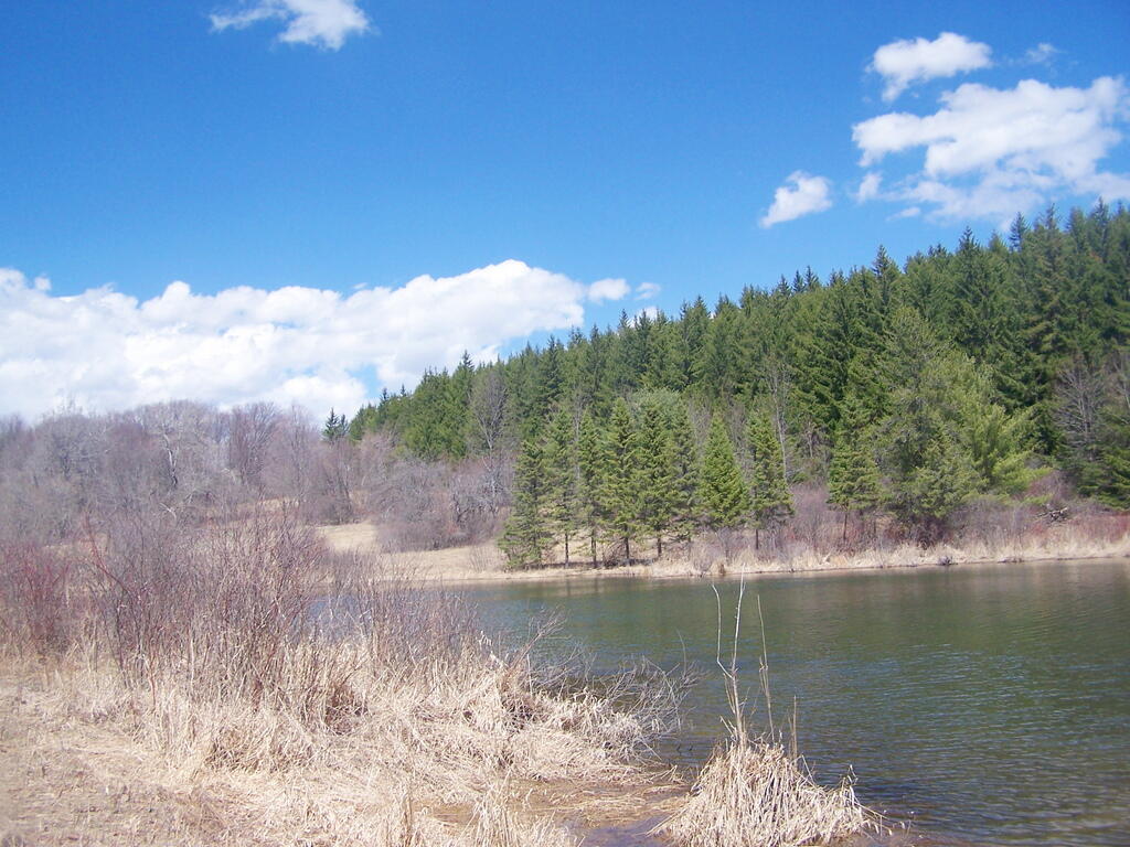
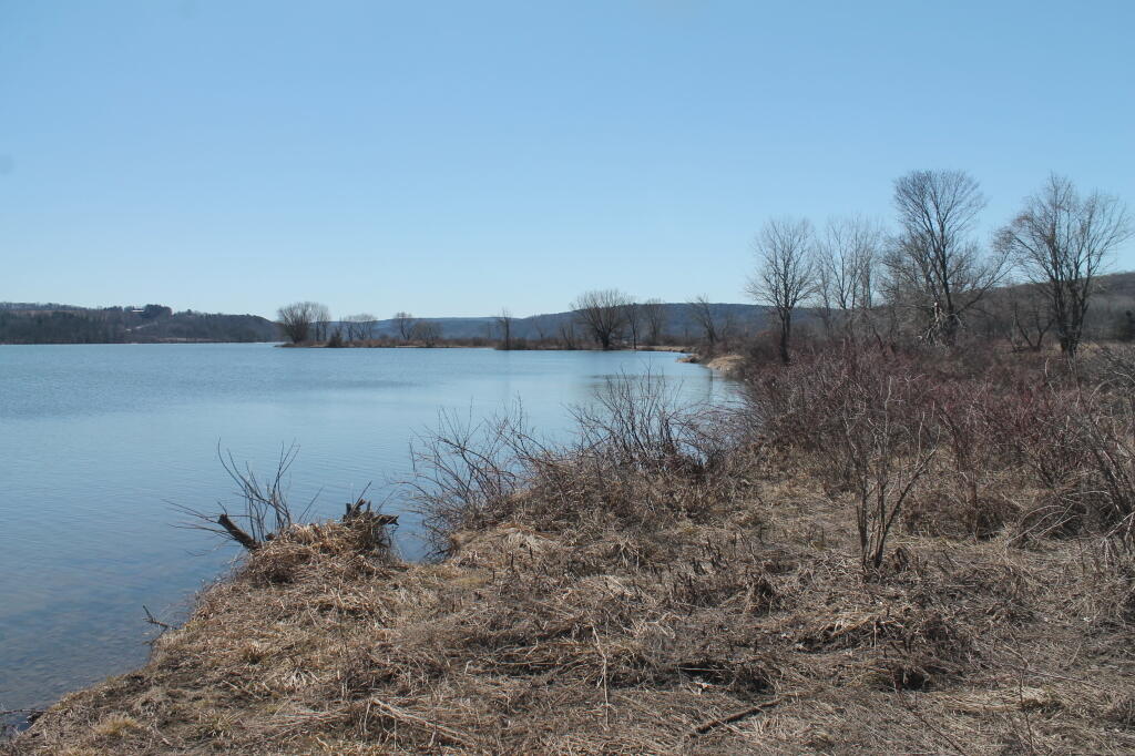
Downtown Schenectady 1995-2021
A series of aerial photos showing changes to downtown Schenectady over 8 different time periods.
A series of aerial photos showing changes to downtown Schenectady over 8 different time periods.
Well we know who is going to be living high on the hog today. Not me, but the government certainly will be as $1,600 is transferred from my bank account to the state and feds. I think I did end up overpaying the state due to a mistake on my tax returns, but alas either state tax and finance will catch my mistake or I’ll file an amended return and get like $400 back. With high interest rates and lots of dividends, it was a good year last one, and I ended up making more then I expected so I didn’t deduct enough from my paycheck.
Good morning on this Tax Day! You know how I feel about that. Cranky, especially as I think each year we get a little less and less out of government while it cost more and more, as it eats up more and more resources and demands more growth. 🐉 Fog and 44 degrees in Delmar, NY. 🌫️ Calm wind.The skies will clear around 6 am.
Yeah, I do need to adjust my paycheck deductions upwards further 💸 I think this year and I do need to plan on making an appointment to meet with an CPA to decide better ways to manage my taxes going forward, especially if I’m thinking of potentially buying land 🚜 later this year to build a cabin 🛖, that is if I decide to stay in New York. Last night I was actually watching a movie on Kanopy — the free library app for watching documentaries — on a 30-year old that went and built a Tiny Home on wheels. It was an interesting video 📺️ but really not for me. I like the idea of small but I would want something a little more permanent and long lasting, small but not tiny. Maybe modular or maybe stick built, with an actual foundation and complying with building codes for energy and fire safety. 🧯
Today will have patchy dense fog before 8am. Otherwise, partly sunny 🌞, with a high of 60 degrees at 5pm. One degree above normal, which is similar to a typical day around April 16th. Light northwest wind becoming west 11 to 16 mph in the afternoon. A year ago, we had mostly sunny skies. The high last year was 84 degrees. The record high of 86 was set in 2003. 2.4 inches of snow fell back in 2014.❄
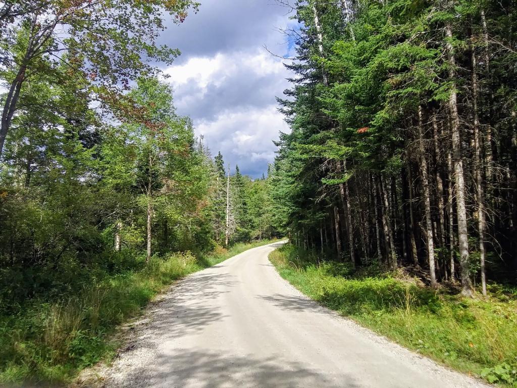
Going to be decent enough to ride to work, 🚴♂️ get some exercise and save on the bus fare. I know I can ride into today and tomorrow, but the second half of the week looks a bit dicey with the forecast. 🌲There is a Save the Pine Bush meeting tonight at 6 PM via the Zoom, but I should be able to ride and be home before then. Might do the meeting while I’m cooking dinner.
Around 7 AM the fire alarm went off again 🧑🚒 — first time that’s happened in a while which is surprising as I have most of my windows open but it’s pretty foggy and humid. I cleaned the smoke detector with canned air the other day which seemed to help somewhat. At least it hasn’t been going off at night. I made sure to open the remainder of the windows in my apartment and it should be good with plenty of fresh air once the fog burns off and things warm up.
Solar noon 🌞 is at 12:56 pm with sun having an altitude of 57.4° from the due south horizon (-13.5° vs. 6/21). A six foot person will cast a 3.8 foot shadow today compared to 2.2 feet on the first day of summer. The golden hour 🏅 starts at 7:00 pm with the sun in the west (278°). 📸 The sunset is in the west-northwest (285°) with the sun dropping below the horizon at 7:38 pm after setting for 2 minutes and 59 seconds with dusk around 8:07 pm, which is one minute and 8 seconds later than yesterday. 🌇 At dusk you’ll see the First Quarter 🌓 Moon in the south-southwest (211°) at an altitude of 71° from the horizon, 245,994 miles away. 🚀 The best time to look at the stars is after 8:43 pm. At sunset, look for mostly clear skies 🌄 and temperatures around 54 degrees. There will be a northwest breeze at 11 mph. Tomorrow will have 13 hours and 30 minutes of daytime, an increase of 2 minutes and 46 seconds over today.
Still having issues with my phone screen acting up. 📲 At some point I really do need to get a new phone and my boots have holes in them 🥾 but with inflation you know you gotta cut corners wherever you can.
Tonight will be mostly clear 🌃, with a low of 39 degrees at 6am. Two degrees above normal, which is similar to a typical night around April 20th. Northwest wind 5 to 10 mph becoming light west. In 2023, we had partly cloudy skies. It got down to 57 degrees. The record low of 22 occurred back in 1981.
I’d like to get out of town this weekend 🏕️ but it all comes down to the weather and whether or not not the state budget is done. Looks cool and maybe cloudy to start the way. Maybe take a three-day weekend if the state budget is done. Saturday, a chance of showers. Mostly cloudy, with a high near 55. Chance of precipitation is 40%. Sunday, partly sunny, with a high near 52. Monday, mostly sunny, with a high near 59. That’s actually kind of cold for the second half of April, at least by historic standards. Typical average high for the weekend is 62 degrees.
As previously noted, next Monday is Earth Day 🌎 when the sun will be setting at 7:47 pm with dusk at 8:15 pm. On that day in 2023, we had rain showers and temperatures between 68 and 53 degrees. Typically, the high temperature is 63 degrees. We hit a record high of 86 back in 1985.
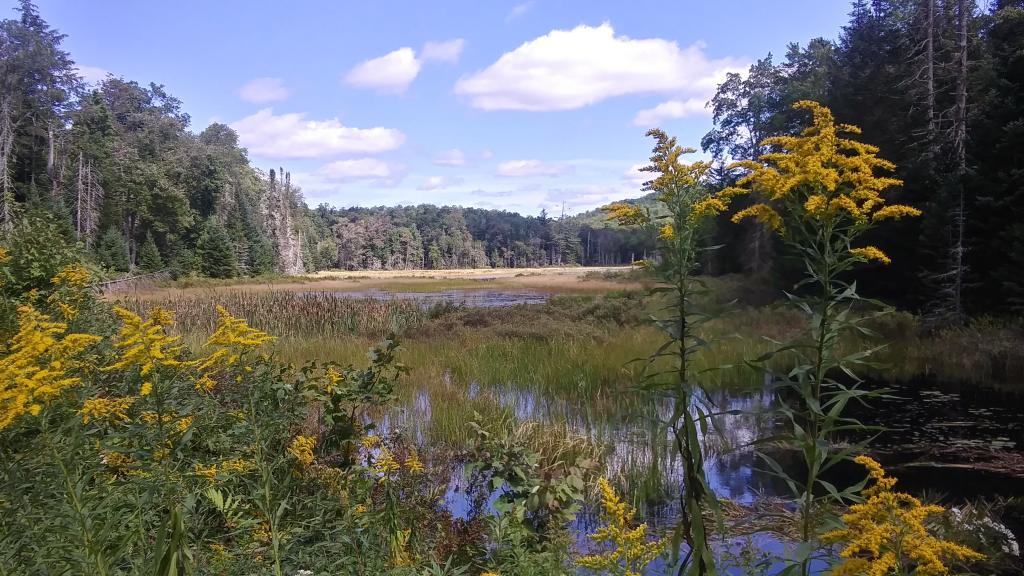
It was fun but I couldn’t get any traction at all climbing the hills. Granted I don’t have studded tires, but the hills were so slick with that mixture of sand and organic matter that is common on the hills around Delmar. After riding a short amount of trail I tossed my hands up and headed back for the road, and then rode out to Voorheesville. Road 15 miles today before coming home and having lunch — sweet potatoes fried up with peas and left rice-lentils from last week. Little bit of salt and turmeric, and some olive oil and pure delicious nature.
Good morning! Happy 7:15 AM Sunrise ⌛️ ! Not that you could tell this morning, it was cloudy. A few minutes ago the rain started — caught a few showers riding back from Voorheesville — with temperatures around 51 degrees. ☔ There is a south breeze at 13 mph. 🍃. Felt that wind really pushing in my face. The dew point is 49 degrees. It’s going to be a wet and windy next 24 hours, but maybe not too snowy locally — as temperatures aren’t expected to drop below freezing until Monday around 9 pm. ☃️
Breakfast started out closer to 6 am with coffee, fried kidney beans, onions, corn and spinach and eggs. 🍳A good protein rich breakfast. Lunch was fried sweet potato 🍠 with leftover brown rice-lentils. A good ride before the rain picked up. It will be nice this afternoon seeing the folks. 👪 Italian riggies for dinner.
Going to work on improving my bread 🍞 this coming week. With the whole wheat 🌾 flour I’ve been cooking healthy but the bread is often dense and crumbly after a few days. Buying some wheat gluten and xanthan gum to experiment with better bread including rye bread this week. 15 bean soup tomorrow then chicken 🐔 soup later in the week I plan to cook.
Today will rain, mainly after noon. 🌧 High of 52 degrees at 1pm. 14 degrees above normal, which is similar to a typical day around November 5th. Maximum dew point of 52 at 2pm. 🏖️ South wind 7 to 13 mph. Chance of precipitation is 100%. New precipitation amounts between a quarter and half of an inch possible. A year ago, we had mostly sunny skies in the morning with some clearing in the afternoon. The high last year was 31 degrees. The record high of 64 was set in 1966. 6.1 inches of snow fell back in 2014.❄
Doesn’t look like the worse weather really gets underway until relatively late. 🌧 🌨 It looks like if anything a lot of heavy rain and snow. I am going to try not to stay out at my parents house too late into the evening, lest I get caught driving home in really soaking wet weather. I do
Solar noon 🌞 is at 11:49 am with sun having an altitude of 24.5° from the due south horizon (-46.3° vs. 6/21). A six foot person will cast a 13.2 foot shadow today compared to 2.2 feet on the first day of summer. The golden hour 🏅 starts at 3:38 pm with the sun in the southwest (231°). 📸 The sunset is in the west-southwest (239°) with the sun dropping below the horizon at 4:23 pm after setting for 3 minutes and 24 seconds with dusk around 4:53 pm, which is one second later than yesterday. 🌇 The best time to look at the stars is after 5:30 pm. At sunset, look for rain 🌧 and temperatures around 51 degrees. The dew point will be 51 degrees. There will be a south breeze at 7 mph. Today will have 9 hours and 10 minutes of daytime, a decrease of 51 seconds over yesterday.
Tonight will rain before 3am, then rain and snow. 🌧 Low of 34 degrees at 4am. Nine degrees above normal, which is similar to a typical night around November 12th. Northwest wind 9 to 13 mph. Chance of precipitation is 100%. New snow accumulation of 1 to 2 inches possible. I guess but it’s really going to be too warm to accumulate a lot on the road. In 2022, we had cloudy skies in the evening, which became light snow by the early hours of the morning. It got down to 25 degrees. The record low of -8 occurred back in 1988.
Today in 1978, Prime Minister of Israel Menachem Begin and President of Egypt Anwar Sadat are jointly awarded the Nobel Peace Prize for their work ending the Arab-Isreali conflict. 🤝 Seems so quaint now, and insignificant with Isreal and Hamas back at war. Not the same characters but in many ways still kind of the same conflict. Also, in 1817 Mississippi becomes the 20th U.S. state, and was the last one to have the rebel flag on it’s state flag until a few years ago, when it became too embarassing with Black Lives Matters. 🏴 I always thought the rebel flag controversy was stupid, why can’t boys still watch the Dukes of Hazard? Being a rebel or proud of southern heritage is different form being a racist.
As previously noted, there are 2 weeks until Christmas Eve 🎅 when the sun will be setting at 4:28 pm with dusk at 4:58 pm. On that day in 2022, we had cold, partly cloudy, snow showers and temperatures between 15 and 7 degrees. Typically, the high temperature is 36 degrees. We hit a record high of 72 back in 2015.
With this morning's addition of the spring 2021 aerial photography by the state, I thought it be interesting to look at the site over the years.
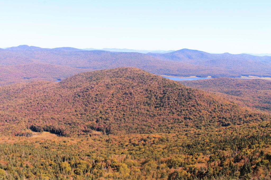
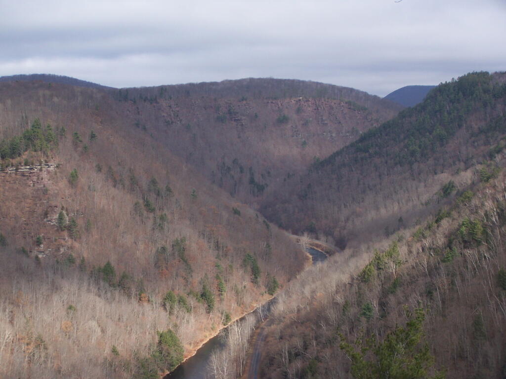
There are 229 summits in New York State greater then 3,000 feet elevation.
| Tallest Peak | Summit Name | Elevation | County | USGS Topo Map Name | State Land | Trail | Location |
|---|---|---|---|---|---|---|---|
| 1 | Mount Marcy | 5,344 | Essex | Mount Marcy | High Peaks Wilderness | NA | 44.112733, -73.9237833 |
| 2 | Algonquin Peak | 5,105 | Essex | North Elba | High Peaks Wilderness | Algonquin Trail | 44.1436636, -73.9865357 |
| 3 | Mount Haystack | 4,924 | Essex | Mount Marcy | High Peaks Wilderness | Haystack Trail Via Barklet Ridge | 44.1056093, -73.9004196 |
| 4 | Mount Skylight | 4,908 | Essex | Mount Marcy | High Peaks Wilderness | Skylight Trail | 44.0994987, -73.9306986 |
| 5 | Basin Mountain | 4,852 | Essex | Mount Marcy | High Peaks Wilderness | State Range Trail | 44.1211639, -73.8862527 |
| 6 | Iroquois Peak | 4,829 | Essex | North Elba | High Peaks Wilderness | Iroquois Herd Path Via Boundary Peak | 44.1369973, -73.9982027 |
| 7 | Boundary Peak | 4,826 | Essex | North Elba | High Peaks Wilderness | Iroquois Herd Path Via Boundary Peak | 44.1397749, -73.9937582 |
| 8 | Whiteface Mountain | 4,816 | Essex | Lake Placid | Whiteface Mountain Ski Center | Whiteface Landing To Whiteface Mtn. Trail | 44.3658804, -73.9026456 |
| 9 | Dix Mountain | 4,813 | Essex | Dix Mountain | High Peaks Wilderness | Elk Lake To Dix Mountain Trail | 44.0822756, -73.7862471 |
| 10 | Gray Peak | 4,800 | Essex | Mount Marcy | High Peaks Wilderness | Mount Marcy Trail Via Opalescent River | 44.1114427, -73.9348658 |
| 11 | Schofield Cobble | 4,744 | Essex | Mount Marcy | High Peaks Wilderness | NA | 44.1089427, -73.9270876 |
| 12 | Little Marcy | 4,728 | Essex | Mount Marcy | High Peaks Wilderness | Van Hoevenberg Trail To Marcy | 44.1197753, -73.910976 |
| 13 | Gothics | 4,724 | Essex | Keene Valley | High Peaks Wilderness | Beaver Meadow Falls Trail | 44.1281079, -73.8570849 |
| 14 | Mount Colden | 4,708 | Essex | North Elba | High Peaks Wilderness | Mount Colden Via Lake Arnold | 44.1269976, -73.9598674 |
| 15 | Beck-horn | 4,695 | Essex | Dix Mountain | High Peaks Wilderness | Elk Lake To Dix Mountain Trail | 44.0800534, -73.7845802 |
| 16 | Little Haystack | 4,678 | Essex | Mount Marcy | High Peaks Wilderness | Haystack Trail Via Slant Rock | 44.1103313, -73.9004197 |
| 17 | Giant Mountain | 4,623 | Essex | Rocky Peak Ridge | Giant Mountain Wilderness | North Trail To Giant Mtn. | 44.161165, -73.720279 |
| 18 | Mount Redfield | 4,603 | Essex | Mount Marcy | High Peaks Wilderness | Mt Redfield Trail | 44.094777, -73.949866 |
| 19 | Santanoni Peak | 4,596 | Essex | Santanoni Peak | High Peaks Wilderness | Bradley Pond Trail | 44.0822811, -74.1309855 |
| 20 | Wright Peak | 4,564 | Essex | North Elba | High Peaks Wilderness | Wright Peak Spur Trail | 44.1517187, -73.9801468 |
| 21 | Nippletop | 4,554 | Essex | Dix Mountain | High Peaks Wilderness | Nipple Top Trail | 44.0892202, -73.8159708 |
| 22 | Saddleback Mountain | 4,534 | Essex | North Elba | High Peaks Wilderness | State Range Trail | 44.1264414, -73.8748634 |
| 23 | Panther Peak | 4,455 | Essex | Santanoni Peak | High Peaks Wilderness | Bradley Pond Trail | 44.0983915, -74.132097 |
| 24 | Rocky Peak | 4,403 | Essex | Rocky Peak Ridge | Giant Mountain Wilderness | East Trail To Giant Mtn. Via Rocky Peak Ridge | 44.1542177, -73.7051718 |
| 25 | Macomb Mountain | 4,396 | Essex | Dix Mountain | High Peaks Wilderness | Macomb-E. Dix Trail | 44.0517211, -73.7801349 |
| 26 | Hough Peak | 4,393 | Essex | Dix Mountain | High Peaks Wilderness | S. Dix-Hough Trail | 44.0694981, -73.7776352 |
| 27 | Mount Marshall | 4,380 | Essex | Street Mountain | High Peaks Wilderness | Mt Marshall Trail | 44.1275538, -74.0118142 |
| 28 | Armstrong Mountain | 4,360 | Essex | Keene Valley | High Peaks Wilderness | Adk Range Trail | 44.1347741, -73.8490291 |
| 29 | Seward Mountain | 4,327 | Franklin | Ampersand Lake | High Peaks Wilderness | Seymour Mountain Herd Path | 44.1597799, -74.1993239 |
| 30 | Allen Mountain | 4,321 | Essex | Mount Marcy | High Peaks Wilderness | Mt Redfield Trail | 44.0708892, -73.9395871 |
| 31 | Table Top Mountain | 4,295 | Essex | North Elba | High Peaks Wilderness | Table Top Mountain Trail | 44.143663, -73.9070876 |
| 32 | Big Slide Mountain | 4,232 | Essex | Keene Valley | High Peaks Wilderness | Big Slide Trail | 44.1822721, -73.8704202 |
| 33 | Esther Mountain | 4,232 | Essex | Franklin Falls | Wilmington Wild Forest | Esther Mt Trail | 44.3869916, -73.8898673 |
| 34 | MacIntyre Mountains | 4,193 | Essex | Street Mountain | High Peaks Wilderness | Mt Marshall Trail | 44.1308868, -74.008203 |
| 35 | Lower Wolfjaw Mountain | 4,190 | Essex | Keene Valley | High Peaks Wilderness | W.a. White Trail | 44.1483845, -73.8326399 |
| 36 | Upper Wolfjaw Mountain | 4,190 | Essex | Keene Valley | High Peaks Wilderness | Adk Range Trail | 44.1406072, -73.8451402 |
| 37 | Slide Mountain | 4,167 | Ulster | Peekamoose Mountain | Slide Mountain Wilderness | Burroughs Range Trail-Wittenberg-Cornell | 41.9987034, -74.3862617 |
| 38 | Phelps Mountain | 4,137 | Essex | North Elba | High Peaks Wilderness | Phelps Mtn. Trail | 44.1569957, -73.9209775 |
| 39 | Cascade Mountain | 4,094 | Essex | Keene Valley | High Peaks Wilderness | Casade Mountain Trail | 44.2186594, -73.860143 |
| 40 | South Dix | 4,088 | Essex | Dix Mountain | High Peaks Wilderness | Macomb-E. Dix Trail | 44.060054, -73.7743014 |
| 41 | Lookout Mountain | 4,078 | Essex | Franklin Falls | Whiteface Mountain Ski Center | Esther Mt Trail | 44.3778249, -73.887645 |
| 42 | Donaldson Mountain | 4,062 | Franklin | Ampersand Lake | High Peaks Wilderness | Seymour Mountain Herd Path | 44.1539471, -74.210991 |
| 43 | Seymour Mountain | 4,055 | Franklin | Ampersand Lake | High Peaks Wilderness | Seymour Mountain Herd Path | 44.1578347, -74.1721003 |
| 44 | Colvin Range | 4,049 | Essex | Dix Mountain | High Peaks Wilderness | Colvin Trail | 44.0939424, -73.8345829 |
| 45 | Mount Colvin | 4,049 | Essex | Dix Mountain | High Peaks Wilderness | Colvin Trail | 44.0939424, -73.8345829 |
| 46 | Hunter Mountain | 4,045 | Greene | Hunter | Hunter-West Kill Wilderness | Spruceton Trail | 42.1778662, -74.2304216 |
| 47 | Mount Emmons | 4,022 | Franklin | Ampersand Lake | High Peaks Wilderness | Northville-Placid Trail | 44.1436698, -74.2140464 |
| 48 | Street Mountain | 4,022 | Essex | Street Mountain | High Peaks Wilderness | Street Mountain Trail | 44.1797741, -74.0437616 |
| 49 | Grace Peak | 4,006 | Essex | Dix Mountain | High Peaks Wilderness | Macomb-E. Dix Trail | 44.0653314, -73.7573564 |
| 50 | Yard Mountain | 3,999 | Essex | North Elba | High Peaks Wilderness | Big Slide Trail Via Yard Mtn. | 44.1747725, -73.8845874 |
| 51 | MacNaughton Mountain | 3,983 | Essex | Street Mountain | High Peaks Wilderness | Wall Face Ponds Trail | 44.1397768, -74.064317 |
| 52 | Dial Mountain | 3,980 | Essex | Dix Mountain | High Peaks Wilderness | Leach Trail | 44.1058859, -73.7959703 |
| 53 | Blake Peak | 3,976 | Essex | Dix Mountain | High Peaks Wilderness | Pinnacle Trail | 44.081443, -73.844583 |
| 54 | Green Mountain | 3,976 | Essex | Rocky Peak Ridge | Giant Mountain Wilderness | North Trail To Giant Mtn. | 44.182272, -73.714858 |
| 55 | Black Dome | 3,973 | Greene | Freehold | Windham-Blackhead Range Wilderness | Blackhead Range Trail | 42.2700864, -74.1226382 |
| 56 | Thomas Cole Mountain | 3,944 | Greene | Hensonville | Windham-Blackhead Range Wilderness | Blackhead Range Trail | 42.2709196, -74.1365275 |
| 57 | Cliff Mountain | 3,940 | Essex | Mount Marcy | High Peaks Wilderness | Mount Marcy Trail Via Opalescent River | 44.1031102, -73.9751452 |
| 58 | McDonnel Mountain | 3,940 | Essex | Mount Marcy | High Peaks Wilderness | Mt Redfield Trail | 44.0803332, -73.9340315 |
| 59 | Blackhead | 3,930 | Greene | Freehold | Windham-Blackhead Range Wilderness | Blackhead Mountain Spur Trail | 42.2678644, -74.1045818 |
| 60 | West Kill Mountain | 3,891 | Greene | Lexington | Hunter-West Kill Wilderness | Devil’s Path | 42.1678663, -74.2895904 |
| 61 | Doubletop Mountain | 3,875 | Ulster | Seager | NA | Seager Big Indian Trail | 42.0275913, -74.5282095 |
| 62 | Nye Mountain | 3,871 | Essex | Street Mountain | High Peaks Wilderness | Nye Mountain Trail | 44.1931062, -74.0240387 |
| 63 | Kilburn Mountain | 3,868 | Essex | Lake Placid | Sentinel Range Wilderness | Copperas Owen Pond Trl | 44.3028247, -73.8818114 |
| 64 | Moose Mountain | 3,868 | Essex | McKenzie Mountain | Mckenzie Mountain Wilderness | Mckenzie Mtn. Trail | 44.3506029, -74.0032049 |
| 65 | Howard Mountain | 3,852 | Essex | North Elba | High Peaks Wilderness | Klondike Notch Trail | 44.1583844, -73.8912539 |
| 66 | Cornell Mountain | 3,848 | Ulster | Phoenicia | Slide Mountain Wilderness | Burroughs Range Trail-Wittenberg-Cornell | 42.0014812, -74.3568163 |
| 67 | Graham Mountain | 3,848 | Ulster | Seager | NA | Seager Big Indian Trail | 42.0392576, -74.5495986 |
| 68 | Plateau Mountain | 3,845 | Greene | Hunter | Indian Head Wilderness | Devil’s Path | 42.1378671, -74.1743088 |
| 69 | McKenzie Mountain | 3,842 | Essex | McKenzie Mountain | Mckenzie Mountain Wilderness | Mckenzie Mtn. Trail | 44.3361593, -74.0320951 |
| 70 | Rist Mountain | 3,839 | Essex | Mount Marcy | High Peaks Wilderness | Boreas Road | 44.027559, -73.987366 |
| 71 | Sentinel Mountain | 3,835 | Essex | Keene | Sentinel Range Wilderness | Winch Pond | 44.3061581, -73.8523658 |
| 72 | Lyon Mountain | 3,829 | Clinton | Moffitsville | Chazy Highlands Wild Forest | New Lyon Mountain Trail | 44.7036537, -73.8645877 |
| 73 | T R Mountain | 3,829 | Essex | North Elba | High Peaks Wilderness | Lake Arnold Crossover | 44.143941, -73.9354222 |
| 74 | Snowy Mountain | 3,825 | Hamilton | Snowy Mountain | NA | Snowy Mt | 43.7003432, -74.3859856 |
| 75 | Table Mountain | 3,819 | Ulster | Peekamoose Mountain | Slide Mountain Wilderness | Peekamoose-Table Trail | 41.9587036, -74.4048739 |
| 76 | Peekamoose Mountain | 3,812 | Ulster | Peekamoose Mountain | Slide Mountain Wilderness | Peekamoose-Table Trail | 41.9531481, -74.398207 |
| 77 | Avalanche Mountain | 3,809 | Essex | North Elba | High Peaks Wilderness | Avalanche Pass Trail | 44.1361639, -73.9695903 |
| 78 | Averill Peak | 3,806 | Clinton | Lyon Mountain | Chazy Highlands Wild Forest | New Lyon Mountain Trail | 44.6928208, -73.8809768 |
| 79 | Sugarloaf Mountain | 3,806 | Greene | Hunter | Indian Head Wilderness | Devil’s Path | 42.1312006, -74.1501414 |
| 80 | Couchsachraga Peak | 3,793 | Essex | Santanoni Peak | High Peaks Wilderness | Cold River Horse Trail | 44.0956146, -74.1601539 |
| 81 | Boreas Mountain | 3,779 | Essex | Mount Marcy | NA | Gulf Brook Road | 44.0031138, -73.8806937 |
| 82 | Wittenberg Mountain | 3,766 | Ulster | Phoenicia | Slide Mountain Wilderness | Burroughs Range Trail-Wittenberg-Cornell | 42.0081478, -74.3473716 |
| 83 | Panther Mountain | 3,763 | Hamilton | Snowy Mountain | NA | Snowy Mt | 43.7367317, -74.3907093 |
| 84 | Burroughs Range | 3,760 | Ulster | Phoenicia | Slide Mountain Wilderness | Burroughs Range Trail-Wittenberg-Cornell | 42.0084255, -74.3476494 |
| 85 | Blue Mountain | 3,750 | Hamilton | Blue Mountain Lake | Blue Mountain Wild Forest | Blue Mountain Trail | 43.8725634, -74.4009917 |
| 86 | Porter Mountain | 3,750 | Essex | Keene Valley | High Peaks Wilderness | Porter Mountain Trail Via Marcy Field | 44.2153262, -73.8434754 |
| 87 | Wakely Mountain | 3,750 | Hamilton | Wakely Mountain | Wakely Mountain Primitive Area | Wakely Mountain Trail | 43.7358986, -74.5151595 |
| 88 | Little Nippletop | 3,720 | Essex | Mount Marcy | High Peaks Wilderness | Elk Lake To Marcy Trail | 44.0853327, -73.9201422 |
| 89 | Wallface Mountain | 3,720 | Essex | Street Mountain | High Peaks Wilderness | Indian Pass Trail | 44.1378317, -74.0365378 |
| 90 | Panther Mountain | 3,714 | Ulster | Shandaken | Slide Mountain Wilderness | Giant Ledge-Panther Mountian-Fox Hollow Trail | 42.0564799, -74.3945946 |
| 91 | Balsam Lake Mountain | 3,707 | Ulster | Seager | Balsam Lake Mountain Wild Forest | Balsam Lake Mountain Trail | 42.0459236, -74.5940438 |
| 92 | Henderson Mountain | 3,707 | Essex | Mount Adams | High Peaks Wilderness | Bradley Pond Trail | 44.0978353, -74.0976509 |
| 93 | Hoffman Mountain | 3,701 | Essex | Blue Ridge | Hoffman Notch Wilderness | Hoffman Notch Trail | 43.9114489, -73.8168 |
| 94 | Lone Mountain | 3,697 | Ulster | Peekamoose Mountain | Slide Mountain Wilderness | Peekamoose-Table Trail | 41.9692592, -74.3893177 |
| 95 | Big Indian Mountain | 3,694 | Ulster | Shandaken | Big Indian Wilderness | Pine Hill West Branch Trail | 42.0350915, -74.4965421 |
| 96 | Hurricane Mountain | 3,688 | Essex | Rocky Peak Ridge | Hurricane Mountain Wilderness | East Hurricane Mtn Trial | 44.235326, -73.7106926 |
| 97 | Friday Mountain | 3,681 | Ulster | West Shokan | Slide Mountain Wilderness | Burroughs Range Trail-Wittenberg-Cornell | 41.9875924, -74.3620944 |
| 98 | Rusk Mountain | 3,678 | Greene | Lexington | Rusk Mountain Wild Forest | Spruceton Trail | 42.2006434, -74.2770897 |
| 99 | Cheney Cobble | 3,674 | Essex | Mount Marcy | High Peaks Wilderness | East River Trail | 44.0445021, -73.9648654 |
| 100 | Lewey Mountain | 3,665 | Hamilton | Snowy Mountain | West Canada Lake Wilderness | Sucker Brook Trail | 43.6642328, -74.4412649 |
| 101 | Seward Mountains | 3,665 | Franklin | Ampersand Lake | High Peaks Wilderness | Calkins Creek Truck Trail | 44.1561694, -74.2148801 |
| 102 | Santanoni Mountains | 3,661 | Essex | Santanoni Peak | High Peaks Wilderness | Bradley Pond Trail | 44.0881144, -74.138486 |
| 103 | Buell Mountain | 3,652 | Hamilton | Snowy Mountain | NA | Snowy Mt | 43.7161764, -74.4065426 |
| 104 | High Peak | 3,645 | Greene | Kaaterskill Clove | Kaaterskill Wild Forest | Kaaterskill High Peak Trail | 42.1620334, -74.0801381 |
| 105 | Little Whiteface Mountain | 3,638 | Essex | Lake Placid | Whiteface Mountain Ski Center | Whiteface Landing To Whiteface Mtn. Trail | 44.3558804, -73.891534 |
| 106 | Burtons Peak | 3,632 | Essex | Keene Valley | NA | The Brothers Trail | 44.1925, -73.8586111 |
| 107 | Fir Mountain | 3,629 | Ulster | Shandaken | Big Indian Wilderness | Pine Hill West Branch Trail | 42.0275916, -74.4690414 |
| 108 | Twin Mountain | 3,629 | Greene | Hunter | Indian Head Wilderness | Devil’s Path | 42.1256453, -74.1290294 |
| 109 | Little Moose Mountain | 3,609 | Hamilton | Wakely Mountain | Little Moose Wilderness | Otter Brook Trail | 43.6700663, -74.5707151 |
| 110 | Balsam Mountain | 3,606 | Ulster | Shandaken | Big Indian Wilderness | Pine Hill West Branch Trail | 42.0909235, -74.4882082 |
| 111 | Calamity Mountain | 3,606 | Essex | Mount Adams | High Peaks Wilderness | Calamity Brook Trail | 44.1028328, -74.0043132 |
| 112 | Sunrise Mountain | 3,606 | Essex | Dix Mountain | High Peaks Wilderness | Elk Lake To Dix Mountain Trail | 44.0247778, -73.7904124 |
| 113 | Balsam Cap | 3,602 | Ulster | West Shokan | Slide Mountain Wilderness | Burroughs Range Trail-Wittenberg-Cornell | 41.9770369, -74.3573722 |
| 114 | Stewart Mountain | 3,602 | Essex | Keene | Sentinel Range Wilderness | Winch Pond | 44.3261581, -73.8562549 |
| 115 | North Dome | 3,596 | Greene | Lexington | Hunter-West Kill Wilderness | Devil’s Path | 42.1734217, -74.3490366 |
| 116 | Pillsbury Mountain | 3,589 | Hamilton | Spruce Lake | West Canada Lake Wilderness | Pillsbury Mountain Trail | 43.580901, -74.5120992 |
| 117 | Slide Mountain | 3,586 | Essex | Lake Placid | Sentinel Range Wilderness | Barkeater Cliffs Campsite Trail | 44.2767136, -73.8862561 |
| 118 | Eagle Mountain | 3,573 | Ulster | Seager | Big Indian Wilderness | Pine Hill West Branch Trail | 42.0620352, -74.50932 |
| 119 | Dun Brook Mountain | 3,563 | Hamilton | Dun Brook Mountain | NA | Deer Pond Road | 43.890897, -74.3187666 |
| 120 | Saddleback Mountain | 3,560 | Essex | Jay Mountain | Jay Mountain Wilderness | Jay Mountain Trail | 44.2953258, -73.6676367 |
| 121 | Indian Head Mountain | 3,553 | Greene | Woodstock | Indian Head Wilderness | Devil’s Path | 42.116201, -74.1145846 |
| 122 | Fishing Brook Mountain | 3,550 | Essex | Dun Brook Mountain | Blue Mountain Wild Forest | Deer Pond Road | 43.9342303, -74.2946002 |
| 123 | Mount Sherrill | 3,550 | Greene | Lexington | Hunter-West Kill Wilderness | Devil’s Path | 42.1756439, -74.3729262 |
| 124 | Gooseberry Mountain | 3,540 | Essex | Keene Valley | High Peaks Wilderness | Orebed Brook Trail | 44.1367187, -73.8731969 |
| 125 | Bearpen Mountain | 3,530 | Delaware | Prattsville | Bearpen Mountain State Forest | Access Trail | 42.2734189, -74.4840396 |
| 126 | Vly Mountain | 3,530 | Greene | West Kill | Bearpen Mountain State Forest | Snowmobile Trail | 42.2453645, -74.4459834 |
| 127 | Windham High Peak | 3,527 | Greene | Hensonville | Windham-Blackhead Range Wilderness | Escarpment Trail | 42.3148069, -74.1434718 |
| 128 | Halcott Mountain | 3,524 | Greene | West Kill | Halcott Mountain Wild Forest | Condon Hollow Rd. | 42.1800882, -74.4379281 |
| 129 | Mount Adams | 3,520 | Essex | Mount Adams | High Peaks Wilderness | Mt Adams Trail | 44.0867231, -74.0257027 |
| 130 | Pitchoff Mountain | 3,501 | Essex | North Elba | Sentinel Range Wilderness | Pitchoff Mountain Trail | 44.2375474, -73.8776443 |
| 131 | Noonmark Mountain | 3,491 | Essex | Keene Valley | High Peaks Wilderness | Stimson Trail | 44.1289404, -73.7720809 |
| 132 | Rocky Mountain | 3,478 | Ulster | West Shokan | Slide Mountain Wilderness | Peekamoose-Table Trail | 41.9728703, -74.3726505 |
| 133 | Little Santanoni Mountain | 3,471 | Essex | Santanoni Peak | High Peaks Wilderness | Moose Pond Horse Trail | 44.0731156, -74.1670981 |
| 134 | Spotted Mountain | 3,461 | Essex | Underwood | High Peaks Wilderness | Macomb-E. Dix Trail | 44.0769975, -73.7440228 |
| 135 | Manbury Mountain | 3,455 | Hamilton | Wakely Mountain | Little Moose Wilderness | Otter Brook Trail | 43.6653442, -74.5532143 |
| 136 | Blue Ridge Mountain | 3,451 | Essex | Blue Ridge | Hoffman Notch Wilderness | Hoffman Notch Trail | 43.9247817, -73.8148558 |
| 137 | Roundtop | 3,451 | Delaware | Prattsville | Bearpen Mountain State Forest | Ski Run Road | 42.2939737, -74.4904283 |
| 138 | Roundtop Mountain | 3,451 | Greene | Kaaterskill Clove | Kaaterskill Wild Forest | Kaaterskill High Peak Trail | 42.1684222, -74.094583 |
| 139 | Olderbark Mountain | 3,438 | Greene | Bearsville | Indian Head Wilderness | Mink Hollow Trail | 42.1142565, -74.1909765 |
| 140 | Puffer Mountain | 3,438 | Hamilton | Bullhead Mountain | Siamese Ponds Wilderness | Puffer Pond Brook Trail | 43.6617318, -74.1993082 |
| 141 | Morgan Mountain | 3,432 | Essex | Wilmington | Wilmington Wild Forest | Cooper Kill Trail | 44.4186582, -73.8593108 |
| 142 | Wolf Pond Mountain | 3,425 | Essex | Cheney Pond | NA | Gulf Brook Road | 43.9892253, -73.8781933 |
| 143 | Stoppel Point | 3,422 | Greene | Kaaterskill Clove | Windham-Blackhead Range Wilderness | Escarpment Trail | 42.2250879, -74.0651364 |
| 144 | Huntersfield Mountain | 3,419 | Greene | Ashland | Huntersfield State Forest | Huntersfield Access Trail #8/Long Path Access | 42.355638, -74.3465339 |
| 145 | Cellar Mountain | 3,405 | Hamilton | Wakely Mountain | Moose River Plains Wild Forest | Cellar Pond Trail | 43.7122879, -74.5429375 |
| 146 | Haynes Mountain | 3,405 | Ulster | Seager | Big Indian Wilderness | Pine Hill West Branch Trail | 42.0792571, -74.5079309 |
| 147 | Sawtooth Mountains | 3,402 | Franklin | Street Mountain | High Peaks Wilderness | Northville-Placid Trail | 44.1928314, -74.1134874 |
| 148 | Bear Den Mountain | 3,389 | Essex | Dix Mountain | High Peaks Wilderness | Leach Trail | 44.1194964, -73.792915 |
| 149 | Pinnacle | 3,389 | Essex | Dix Mountain | High Peaks Wilderness | Pinnacle Trail Spur To Summit | 44.0583887, -73.8640277 |
| 150 | Vanderwhacker Mountain | 3,389 | Essex | Vanderwhacker Mountain | Vanderwhacker Mountain Wild Forest | Vanderwhacker Firetower Trail | 43.8983963, -74.0959781 |
| 151 | Jay Mountain | 3,379 | Essex | Jay Mountain | Jay Mountain Wilderness | Jay Mountain Trail | 44.3125477, -73.685693 |
| 152 | Spruce Top | 3,379 | Greene | Hunter | NA | Devil’s Path | 42.1506447, -74.1679195 |
| 153 | Spruce Mountain | 3,376 | Ulster | Shandaken | Big Indian Wilderness | Phoenicia East Branch Trail | 42.0175919, -74.4498744 |
| 154 | Belle Ayr Mountain | 3,373 | Ulster | Shandaken | Belleayre Mountain Ski Center | NA | 42.1159229, -74.4979304 |
| 155 | Evergreen Mountain | 3,369 | Greene | Lexington | Rusk Mountain Wild Forest | Devil’s Path | 42.2117542, -74.3079238 |
| 156 | Hedgehog Mountain | 3,366 | Essex | Keene Valley | High Peaks Wilderness | Rooster Comb And Hedgehog Trail | 44.159495, -73.8109724 |
| 157 | Balsam Mountain | 3,353 | Greene | West Kill | Hunter-West Kill Wilderness | Condon Hollow Rd. | 42.1836992, -74.387371 |
| 158 | Kempshall Mountain | 3,350 | Hamilton | Kempshall Mountain | High Peaks Wilderness | Northville-Placid Trail | 44.0236734, -74.3271041 |
| 159 | Buck Mountain | 3,346 | Hamilton | Snowy Mountain | West Canada Lake Wilderness | Snowy Mt | 43.6947879, -74.4368212 |
| 160 | Mount Pisgah | 3,340 | Delaware | Margaretville | NA | Mountain Brook Road | 42.2211973, -74.7357125 |
| 161 | MacDonough Mountain | 3,320 | Essex | Jay Mountain | Jay Mountain Wilderness | Jay Mountain Trail | 44.3050482, -73.644025 |
| 162 | Debar Mountain | 3,317 | Franklin | Debar Mountain | Debar Mountain Wild Forest | Debar Mountain Trail | 44.6033852, -74.2204351 |
| 163 | Bullhead Mountain | 3,314 | Warren | Bullhead Mountain | Siamese Ponds Wilderness | John Pond Crossover Trail | 43.7017316, -74.1804199 |
| 164 | Laramore Mountain | 3,314 | Essex | Keene Valley | High Peaks Wilderness | Casade Mountain Trail | 44.2258813, -73.8501427 |
| 165 | Tripod Mountain | 3,307 | Essex | Rocky Peak Ridge | Giant Mountain Wilderness | Hopkin Via Direct Trail | 44.1983824, -73.736248 |
| 166 | Metcalf Mountain | 3,304 | Hamilton | Blue Mountain Lake | Blue Ridge Wilderness | Gould Road | 43.7522873, -74.4957146 |
| 167 | Wyman Mountain | 3,304 | Essex | Underwood | High Peaks Wilderness | Macomb-E. Dix Trail | 44.0581093, -73.7445779 |
| 168 | Jay Mountains | 3,297 | Essex | Jay Mountain | Jay Mountain Wilderness | Jay Mountain Trail | 44.308659, -73.6704147 |
| 169 | Eleventh Mountain | 3,294 | Warren | Bakers Mills | Siamese Ponds Wilderness | Bog Meadow Trail | 43.6142322, -74.0720783 |
| 170 | Schultice Mountain | 3,284 | Delaware | Roxbury | NA | Ski Run Road | 42.3186948, -74.5157062 |
| 171 | Cellar Mountain | 3,281 | Hamilton | Snowy Mountain | West Canada Lake Wilderness | Sucker Brook Trail | 43.6411776, -74.4443199 |
| 172 | Plattekill Mountain | 3,268 | Delaware | Hobart | Plattekill State Forest | Mountain Brook/ Harold Roberts Access Trail | 42.2667522, -74.6482102 |
| 173 | South Pond Mountain | 3,258 | Hamilton | South Pond Mountain | Siamese Ponds Wilderness | County Line Brook Trail | 43.5900656, -74.2204175 |
| 174 | Hemlock Mountain | 3,248 | Ulster | Shandaken | Big Indian Wilderness | Phoenicia East Branch Trail | 42.0128698, -74.4390407 |
| 175 | Peaked Mountain | 3,235 | Essex | Jay Mountain | Hurricane Mountain Wilderness | Soda Range Trail | 44.2656034, -73.6993039 |
| 176 | Onteora Mountain | 3,232 | Greene | Hunter | NA | Blackhead Range Trail | 42.2223098, -74.1679184 |
| 177 | Kitty Cobble | 3,225 | Hamilton | Wakely Mountain | West Canada Lake Wilderness | Otter Brook Trail | 43.6295111, -74.6229377 |
| 178 | Baldwin Hill | 3,218 | Essex | Franklin Falls | Mckenzie Mountain Wilderness | Esther Mt Trail | 44.3847694, -73.9195905 |
| 179 | Richmond Mountain | 3,218 | Greene | Ashland | Mount Pisgah State Forest | Long Path Hiking Trail | 42.367582, -74.270976 |
| 180 | Squaw Mountain | 3,218 | Hamilton | Indian Lake | NA | Snowy Mt | 43.7270094, -74.3420956 |
| 181 | Dug Mountain | 3,215 | Hamilton | Kunjamuk River | NA | Long Pond Trail | 43.583122, -74.345146 |
| 182 | Hamilton Mountain | 3,215 | Hamilton | Wells | Silver Lake Wilderness | West River Road | 43.412013, -74.3673645 |
| 183 | Mount Alton | 3,212 | Essex | Lake Placid | Mckenzie Mountain Wilderness | Whiteface Mountain Trail | 44.3717139, -73.9662589 |
| 184 | Utsayantha Mountain | 3,209 | Delaware | Stamford | NA | Ward Allen Road | 42.3992472, -74.5895953 |
| 185 | Van Wyck Mountain | 3,202 | Ulster | Peekamoose Mountain | Slide Mountain Wilderness | Phoenicia East Branch Trail | 41.9523147, -74.4354304 |
| 186 | Colonels Chair | 3,199 | Greene | Hunter | NA | Colonel’s Chair Trail | 42.2006434, -74.2306991 |
| 187 | Gore Mountain | 3,199 | Warren | Gore Mountain | Gore Mountain Ski Center | Schaefer Trail | 43.6764539, -74.035134 |
| 188 | Chase Mountain | 3,192 | Essex | Rocky Peak Ridge | Hurricane Mountain Wilderness | North Hurricane Trail | 44.2417145, -73.7248599 |
| 189 | Knob Lock Mountain | 3,192 | Essex | Rocky Peak Ridge | Giant Mountain Wilderness | Hurricane Trail From 9n | 44.2003271, -73.7073583 |
| 190 | McGregor Mountain | 3,192 | Delaware | Stamford | Stamford Fp Detached Parcel | Relay Public Forest Access Road | 42.3900808, -74.5790396 |
| 191 | Weston Mountain | 3,192 | Essex | Jay Mountain | Hurricane Mountain Wilderness | Soda Range Trail | 44.2642144, -73.7079152 |
| 192 | Burnt Knob | 3,189 | Greene | Freehold | Windham-Blackhead Range Wilderness | Escarpment Trail | 42.3020297, -74.1190264 |
| 193 | Burgess Mountain | 3,189 | Hamilton | Rock Lake | NA | Bear Trap Brook Trail | 43.7520092, -74.3565416 |
| 194 | North Mountain | 3,186 | Greene | Kaaterskill Clove | Windham-Blackhead Range Wilderness | Escarpment Trail | 42.2175881, -74.0487469 |
| 195 | Payne Mountain | 3,182 | Hamilton | Snowy Mountain | Moose River Plains Wild Forest | Northville-Placid Trail | 43.7231211, -74.4951582 |
| 196 | Hopkins Mountain | 3,169 | Essex | Rocky Peak Ridge | Giant Mountain Wilderness | Hopkins Mtn. Via Spread Eagle Mtn. | 44.1833828, -73.7490257 |
| 197 | Spruce Lake Mountain | 3,163 | Hamilton | Spruce Lake Mountain | West Canada Lake Wilderness | Northville-Placid Trail | 43.5120126, -74.6532121 |
| 198 | Tongue Mountain | 3,159 | Hamilton | Dun Brook Mountain | NA | Northville-Placid Trail | 43.9114522, -74.3454349 |
| 199 | Catamount Mountain | 3,153 | Clinton | Wilmington | Taylor Pond Wild Forest | Catamount Trail | 44.459214, -73.8723668 |
| 200 | Wildcat Mountain | 3,153 | Ulster | Peekamoose Mountain | Slide Mountain Wilderness | Pine Hill West Branch Trail | 41.9775924, -74.4759867 |
| 201 | White Man Mountain | 3,146 | Delaware | Roxbury | NA | Access Trail | 42.2845295, -74.5340406 |
| 202 | Bradley Mountain | 3,140 | Hamilton | Wakely Mountain | Blue Ridge Wilderness | Cellar Pond Trail | 43.7378431, -74.5546055 |
| 203 | Overlook Mountain | 3,136 | Ulster | Woodstock | Overlook Mountain Wild Forest | Firetower Spur | 42.0850905, -74.0931954 |
| 204 | Mount Tamarac | 3,127 | Essex | McKenzie Mountain | Mckenzie Mountain Wilderness | Jackrabbit Trail | 44.3267144, -74.0204281 |
| 205 | Mount Morris | 3,117 | Franklin | Tupper Lake | NA | Goodman Mountain Trail | 44.1595046, -74.475168 |
| 206 | Acra Point | 3,110 | Greene | Freehold | Windham-Blackhead Range Wilderness | Escarpment Trail | 42.2964745, -74.0998591 |
| 207 | Round Mountain | 3,107 | Essex | Keene Valley | High Peaks Wilderness | Weston Trail Spur To Round Mt | 44.1317179, -73.7515245 |
| 208 | Cave Mountain | 3,104 | Greene | Hensonville | Elm Ridge Wild Forest | North Face Trail | 42.2859185, -74.2462543 |
| 209 | Pete Gay Mountain | 3,097 | Warren | Gore Mountain | NA | Schaefer Trail | 43.6903427, -74.0443015 |
| 210 | Plattekill Mountain | 3,091 | Greene | Woodstock | Indian Head Wilderness | Overlook Trail | 42.1073123, -74.0865281 |
| 211 | Mount Andrew | 3,081 | Essex | Mount Adams | High Peaks Wilderness | Bradley Pond Trail | 44.0564482, -74.093483 |
| 212 | County Line Mountain | 3,081 | Hamilton | South Pond Mountain | Siamese Ponds Wilderness | Siamese Ponds Trail | 43.6114543, -74.2006952 |
| 213 | High Point | 3,074 | Ulster | West Shokan | Sundown Wild Forest | Ashokan High Point | 41.9248149, -74.2879263 |
| 214 | Rose Mountain | 3,074 | Ulster | West Kill | NA | Rochester Hollow | 42.1506445, -74.4379284 |
| 215 | Cowan Mountain | 3,068 | Delaware | Hobart | NA | Relay Public Forest Access Road | 42.3450825, -74.6498756 |
| 216 | Round Top | 3,068 | Delaware | Hobart | Plattekill State Forest | Mountain Brook/ Harold Roberts Access Trail | 42.2714741, -74.6832109 |
| 217 | Churchill Mountain | 3,064 | Delaware | Stamford | NA | Relay Public Forest Access Road | 42.388692, -74.6098738 |
| 218 | Irish Mountain | 3,064 | Delaware | Roxbury | NA | Ski Run Road | 42.3356386, -74.5262617 |
| 219 | Swart Mountain | 3,061 | Hamilton | Lake Pleasant | Silver Lake Wilderness | West River Road | 43.3967355, -74.3815314 |
| 220 | Scarface Mountain | 3,058 | Essex | McKenzie Mountain | Saranac Lakes Wild Forest | Scarface Mountain Trail | 44.2647717, -74.0737646 |
| 221 | T Lake Mountain | 3,058 | Hamilton | Piseco Lake | West Canada Lake Wilderness | T Lake Trail | 43.4470133, -74.5770967 |
| 222 | Bailey Hill | 3,054 | Essex | Cheney Pond | Hoffman Notch Wilderness | Hoffman Notch Trail | 43.9108943, -73.9026366 |
| 223 | Bald Peak | 3,054 | Essex | Rocky Peak Ridge | Giant Mountain Wilderness | East Trail To Giant Mtn. Via Rocky Peak Ridge | 44.1597731, -73.6654114 |
| 224 | Little Rocky Mountain | 3,051 | Greene | Bearsville | Indian Head Wilderness | Warner Creek Trail | 42.1150898, -74.2040325 |
| 225 | Denman Mountain | 3,048 | Sullivan | Claryville | NA | Denman Mountain Snowmobile Trail | 41.90287, -74.5396005 |
| 226 | Woodhull Mountain | 3,045 | Ulster | Peekamoose Mountain | NA | Phoenicia East Branch Trail | 41.9459259, -74.4637647 |
| 227 | Barkaboom Mountain | 3,005 | Delaware | Arena | Dry Brook Ridge Wild Forest | Touch-Me-Not-Trail | 42.0717554, -74.7201571 |
| 228 | Stony Creek Mountain | 3,002 | Franklin | Stony Creek Mountain | High Peaks Wilderness | Ampersand Mountain Trail | 44.222002, -74.2659949 |
| 229 | Van Dorrien Mountain | 3,002 | Franklin | Ampersand Lake | High Peaks Wilderness | Ampersand Mountain Trail | 44.2222766, -74.1704351 |
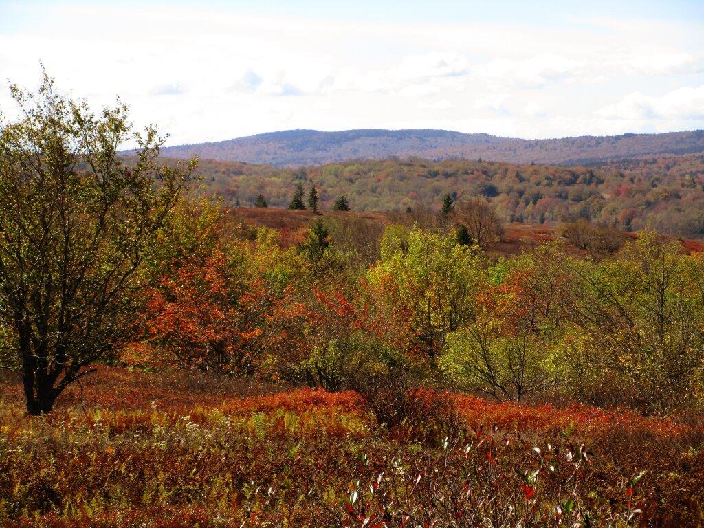
An interactive map and listing of the 280 peaks over 3,000 feet elevation listed in the Open Street Map database for New York State.
Here is a brief chart that shows the climate normals, sunset times, and length of day for next four months in Albany, NY…
| Week | Date | Dawn | Sun- rise |
Sun- set |
Dusk | Day | Noon Sun Angle | Avg High | Avg Low | Record Hi | Record Low |
|---|---|---|---|---|---|---|---|---|---|---|---|
| 0 | Aug 10 | 5:25 am | 5:55 am | 8:05 pm | 8:35 pm | 14:10 | 62.9° | 83 | 62 | 96 (1949) | 48 (1955) |
| 1 | Aug 17 | 5:33 am | 6:02 am | 7:55 pm | 8:24 pm | 13:52 | 60.7° | 82 | 61 | 97 (1913) | 40 (1979) |
| 2 | Aug 24 | 5:42 am | 6:10 am | 7:44 pm | 8:12 pm | 13:34 | 58.4° | 81 | 60 | 95 (1947) | 42 (1971) |
| 3 | Aug 31 | 5:50 am | 6:17 am | 7:32 pm | 8:00 pm | 13:15 | 56° | 80 | 58 | 93 (1953) | 37 (1965) |
| 4 | Sep 7 | 5:57 am | 6:25 am | 7:20 pm | 7:48 pm | 12:55 | 53.4° | 78 | 56 | 96 (1945) | 36 (1962) |
| 5 | Sep 14 | 6:05 am | 6:32 am | 7:08 pm | 7:35 pm | 12:35 | 50.7° | 75 | 53 | 93 (1931) | 32 (1963) |
| 6 | Sep 21 | 6:13 am | 6:40 am | 6:55 pm | 7:22 pm | 12:15 | 48° | 72 | 51 | 95 (1895) | 29 (1973) |
| 7 | Sep 28 | 6:21 am | 6:47 am | 6:43 pm | 7:10 pm | 11:55 | 45.3° | 69 | 48 | 83 (2014) | 24 (1947) |
| 8 | Oct 5 | 6:28 am | 6:55 am | 6:31 pm | 6:57 pm | 11:35 | 42.6° | 66 | 45 | 91 (1941) | 26 (1965) |
| 9 | Oct 12 | 6:36 am | 7:03 am | 6:19 pm | 6:46 pm | 11:15 | 39.9° | 63 | 42 | 85 (1954) | 22 (1964) |
| 10 | Oct 19 | 6:44 am | 7:11 am | 6:08 pm | 6:35 pm | 10:56 | 37.3° | 60 | 40 | 79 (1963) | 20 (1974) |
| 11 | Oct 26 | 6:52 am | 7:20 am | 5:57 pm | 6:25 pm | 10:37 | 34.9° | 58 | 38 | 78 (1963) | 20 (1952) |
| 12 | Nov 2 | 7:01 am | 7:28 am | 5:48 pm | 6:16 pm | 10:19 | 32.6° | 55 | 36 | 82 (1950) | 19 (2002) |
| 13 | Nov 9 | 6:09 am | 6:37 am | 4:39 pm | 5:08 pm | 10:02 | 30.5° | 52 | 34 | 71 (1975) | 11 (1971) |
| 14 | Nov 16 | 6:17 am | 6:46 am | 4:33 pm | 5:02 pm | 9:46 | 28.6° | 49 | 32 | 71 (2006) | 7 (1972) |
| 15 | Nov 23 | 6:25 am | 6:55 am | 4:27 pm | 4:57 pm | 9:32 | 27° | 46 | 29 | 72 (1931) | 4 (2018) |
| 16 | Nov 30 | 6:33 am | 7:02 am | 4:24 pm | 4:54 pm | 9:21 | 25.7° | 43 | 27 | 67 (1933) | -10 (1875) |
Good morning! Happy April 15th, which is normally tax day. 💰 ! But this year for some reason, the pandemic or maybe because people don’t like to be rushed to do taxes, they put it off. But I got my federal refund back. Next Thursday is Earth Day 🌎 . I am sure all the coal rollers are well aware of that fact. Rain showers and 52 degrees in Delmar, NY. ☔ There is a east-southeast breeze at 7 mph. 🍃. The dew point is 45 degrees. The skies will clear Monday around 5 am. Going to be a rather rainy next two days, then fairly cloudy come the weekend. Maybe some snow in the mountains, especially the Green Mountains but I don’t expect it to last long at this point.
That COVID vaccine really knocked me out yesterday, 💉 at least for a few hours. Then I took a full-dose of sleeping medication, and I slept like a baby but this morning I am in a bit of a haze between the dark and cloudy skies and my general inability to get going. So I skipped my morning walk, and I doubt I’ll do my evening walk but maybe I’ll do laps around the apartment later.
Today will rain. 🌧 High of 53 degrees at 11am. Five degrees below normal, which is similar to a typical day around April 4th. Maximum dew point of 47 at 10am. 🏖️ Southeast wind 7 to 9 mph. Chance of precipitation is 100%. New precipitation amounts between a half and three quarters of an inch possible. A year ago, we had light snow in the morning, which became partly cloudy by afternoon. The high last year was 48 degrees. The record high of 86 was set in 2003. 2.4 inches of snow fell back in 2014.❄
Solar noon 🌞 is at 12:56 pm with sun having an altitude of 57.3° from the due south horizon (-13.5° vs. 6/21). A six foot person will cast a 3.9 foot shadow today compared to 2.2 feet on the first day of summer. The golden hour 🏅 starts at 7:00 pm with the sun in the west (278°). 📸 The sunset is in the west-northwest (284°) with the sun dropping below the horizon at 7:38 pm after setting for 2 minutes and 59 seconds with dusk around 8:06 pm, which is one minute and 8 seconds later than yesterday. 🌇 At dusk you’ll see the Waxing Crescent 🌒 Moon in the west (270°) at an altitude of 33° from the horizon, 251,336 miles away. 🚀 The best time to look at the stars is after 8:42 pm. At sunset, look for rain 🌧 and temperatures around 47 degrees. There will be a north breeze at 6 mph. Today will have 13 hours and 24 minutes of daytime, an increase of 2 minutes and 45 seconds over yesterday.
Tonight will rain before 4am, then rain and snow. 🌧 Low of 37 degrees at 6am. One degrees below normal, which is similar to a typical night around April 14th. North wind around 5 mph. Chance of precipitation is 90%. Little or no snow accumulation expected. In 2020, we had mostly clear skies in the evening, which became cloudy by the early hours of the morning. It got down to 33 degrees. The record low of 22 occurred back in 1981.
Not a particularly nice weekend on tap. 😞 Saturday, mostly cloudy, with a high near 54. North wind 6 to 8 mph. Sunday, a chance of showers after 2pm. Mostly cloudy, with a high near 58. Chance of precipitation is 30%. Typical average high for the weekend is 59 degrees. As thought, not going to be a really sunny weekend but might be good for fishing. 🎣 I still think I want to get out of town, although plans could change. Next weekend almost looks nice, but I am not sure if next weekend will otherwise work for my schedule and I kind of want to get out of town before the black flies take over the woods.
As previously noted, next Thursday is Earth Day 🌎 when the sun will be setting at 7:45 pm with dusk at 8:15 pm. On that day in 2020, we had cold, partly sunny, snow showers and temperatures between 46 and 30 degrees. Typically, the high temperature is 61 degrees. We hit a record high of 86 back in 1985.