Map: Whitaker Swamp State Forest
Download a High Resolution JPEG Image of the Whitaker Swamp State Forest or an Adobe Acrobat Printable PDF of the Whitaker Swamp State Forest.

Bookmark my free Interactive GPS Map for your phone:
https://andyarthur.org/ny
... shows your location as a blue dot in relationship to campsites, trails, state land. This online map requires cell service, won't work in remote country, so also bring a paper map.
Free Download of New & Historical USGS 1:24k Topograpic Maps
Interactive maps with backcountry and roadside camping: New York, Pennsylvania, West Virginia & Vermont. List of NYS DEC Lean-Tos and Firetowers.
Google Spreadsheet with Roadside, Primitive and Pay Campsites
More about Whitaker Swamp State Forest...
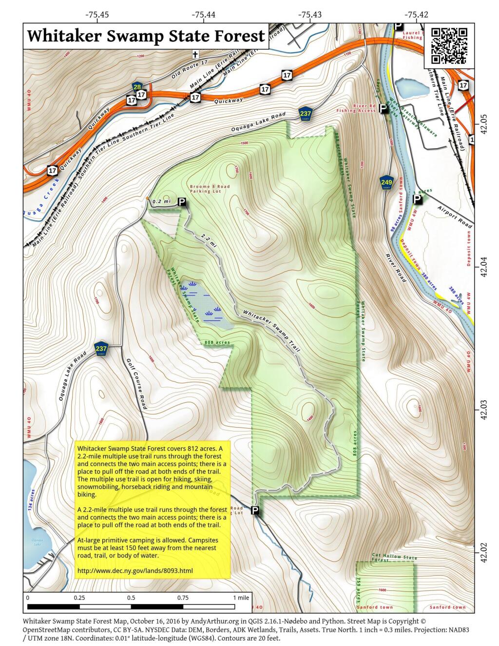
Whitacker Swamp State Forest covers 812 acres near Deposit, NY. A 2.2-mile multiple use trail runs through the forest and connects the two main access points; there is a place to pull off the road at both ends of the trail. The multiple use trail is open for hiking, skiing, snowmobiling, horseback riding and mountain biking.
https://www.youtube.com/watch?v=VmL_D6f6P2E
http://www.dec.ny.gov/lands/8093.html
... photos, maps and other content from from Whitaker Swamp State Forest.