| Name | Address | Latitude | Longitude |
|---|---|---|---|
| Mohawk Hudson Bike Hike Trail (Albany to Peebles Island State Park) – 10.8 miles | |||
| Riverfront Garage | 2 Columbia St, Albany, NY 12207 | 42.65149 | -73.74890 |
| Corning Preserve Parking Area | Quay St, Albany, NY 12207 | 42.65346 | -73.74496 |
| Corning Preserve Boat Launch Parking | Water St, Albany, NY 12207 | 42.65612 | -73.74286 |
| Mohawk Hudson Bike Hike Trail | 330 Broadway, Watervliet, NY 12189 | 42.70950 | -73.70495 |
| Peebles Island State Park | 1 Delaware Ave North, Cohoes, NY 12047 | 42.78469 | -73.68042 |
| Waterford Parking Lot | Front St, Waterford, NY 12188 | 42.78592 | -73.67788 |
| Hudson Shores Park | 23rd Street, Watervliet, NY 12189 | 42.73216 | -73.69710 |
| Green Island Trail Parking | 260 Cannon St, Green Island, NY 12183 | 42.75824 | -73.68804 |
| Champlain Canalway Trail (Peebles Island State Park to Halfmoon) – 5.6 miles | |||
| Waterford Harbor Visitor Center | 1 Tugboat Alley, Waterford, NY 12188 | 42.78741 | -73.67902 |
| Park at the Point | 61 South St, Waterford, NY 12188 | 42.78823 | -73.68159 |
| Town of Halfmoon Trailhead Parking | Brookwood Rd, Waterford, NY 12188 | 42.83700 | -73.67586 |
| Town of Halfmoon Trailhead | Upper Newtown Rd, Mechanicville, NY 12118 | 42.86098 | -73.68230 |
| Lighthouse Park Halfmoon | 597 Hudson River Rd, Waterford, NY 12188 | 42.83821 | -73.67215 |
| CCT Parking | Schoolhouse Ln @ Bells Ln, Waterford, NY 12188 | 42.81920 | -73.67628 |
| On-Road Section (Halfmoon to Schuylerville) – 18.7 miles | |||
| Zim Smith East Trailhead | 1044 Elizabeth St Exd, Mechanicville, NY 12118 | 42.90909 | -73.70276 |
| Champlain Canalway Trail (Schuylerville to Fort Miller) – 6.7 miles | |||
| Old Schuylerville Junction Lock | County Rt 42, Schuylerville, NY 12871 | 43.11263 | -73.57849 |
| Hudson Crossing Park | Co Rd 42, Schuylerville, NY 12871 | 43.11456 | -73.57742 |
| Schuylerville Visitor Center | 30 Ferry St, Schuylerville, NY 12871 | 43.10001 | -73.57954 |
| Fort Hardy Park | Reds Rd, Schuylerville, NY 12871 | 43.10025 | -73.57857 |
| Champlain Canalway Trail (Fort Edward to Fort Ann) – 11.9 miles | |||
| Fort Edward Adult Exercise Park | 39 Mc Intyre St, Fort Edward, NY 12828 | 43.27362 | -73.57990 |
| Feeder Canal Trail Parking | Towpath Ln, Fort Edward, NY 12828 | 43.28390 | -73.56889 |
| Champlain Canalway Trail Parking | Baldwin Corners Rd, Fort Ann, NY 12827 | 43.39027 | -73.48666 |
| Champlain Canal Lock C-9 | 2450 NY-149, Fort Ann, NY 12827 | 43.35247 | -73.49676 |
| Champlain Canalway Trail | New Swamp Rd, Hudson Falls, NY 12839 | 43.33236 | -73.51177 |
| Feeder Canal Trail Parking | 2425 Burgoyne Ave, Hudson Falls, NY 12839 | 43.29780 | -73.56977 |
| Champlain Canalway Trail (Fort Ann to Comstock) – 5.1 miles | |||
| Fort Ann Canal Park | Ann St, Fort Ann, NY 12827 | 43.41416 | -73.48546 |
| Champlain On-Road Bicycle Route (Whitehall to Ticonderoga) – 25.5 miles | |||
| TR41-Whitehall NEW | Skenesborough Dr, Whitehall, NY 12887 | 43.55176 | -73.40285 |
| Champlain On-Road Bicycle Route (Ticonderoga to Westport) – 26.8 miles | |||
| Bicentennial Park | McCormick St, Ticonderoga, NY 12883 | 43.84908 | -73.42144 |
| Westport Trailhead | Main St (Route 9N), Westport, NY 12993 | 44.18174 | -73.43264 |
| Champlain On-Road Bicycle Route (Westport to Keeseville) – 30.8 miles | |||
| Keeseville Trailhead | Front St, Keeseville, NY12944 | 44.50545 | -73.48007 |
| Champlain On-Road Bicycle Route (Keeseville to Plattsburgh) – 14.1 miles | |||
| Terry Gordon Bike Path | Nevada Oval, Plattsburgh, NY 12901 | 44.67275 | -73.44310 |
| Champlain On-Road Bicycle Route (Plattsburgh to Rouses Point) – 25.8 miles | |||
| Plattsburgh Public Parking | Green St, Plattsburgh, NY 12901 | 44.69910 | -73.44864 |
| Terry Gordon Bike Path | Hamilton & Jay St, Plattsburgh, NY 12901 | 44.69380 | -73.44494 |
| Rouses Point Trailhead | 39 Lake St, Rouses Point, NY 12979 | 44.99658 | -73.36542 |
| Shoreline Trail – 8 miles | |||
| Fishing and Kayaking | South St, Buffalo, NY 14204 | 42.86554 | -78.86801 |
| Buffalo Harbor State Park Boat Launch | 1111 Fuhrmann Boulevard, Buffalo, NY 14203 | 42.84629 | -78.86315 |
| Tifft Nature Preserve | 1200 Fuhrmann Boulevard, Buffalo, NY 14203 | 42.84627 | -78.85944 |
| Buffalo Harbor State Park | 1111 Fuhrmann Boulevard, Buffalo, NY 14203 | 42.84517 | -78.86158 |
| Shoreline Trail (Buffalo) – 8 miles | |||
| Lasalle Park | DAR Drive, Buffalo, NY 14202 | 42.89368 | -78.89556 |
| Erie Canalway Trail (Tonawanda to Amherst) – 9.4 miles | |||
| Tonawanda EST Gateway | 72 E Niagara St, Tonawanda, NY 14150 | 43.02244 | -78.87073 |
| Shoreline Trail (Buffalo to Tonawanda) – 9.4 miles | |||
| Riverwalk Parking | 200 Niagara St, Tonawanda, NY 14150 | 43.01935 | -78.88756 |
| Niawanda Park | 200 Niagara St, Tonawanda, NY 14150 | 43.01781 | -78.88921 |
| Riverwalk Parking | 200 Niagara St, Tonawanda, NY 14150 | 43.01549 | -78.89387 |
| Niawanda Park | Shoreline Trail, Tonawanda, NY 14150 | 43.01300 | -78.90021 |
| Niawanda Park | 600 Niagara St, Tonawanda, NY 14150 | 43.01111 | -78.90557 |
| Niawanda Park | 600 Niagara St, Tonawanda, NY 14150 | 43.00952 | -78.91018 |
| Niawanda Park | 600 Niagara St, Tonawanda, NY 14150 | 43.00837 | -78.91334 |
| Niawanda Park | 600 Niagara St, Tonawanda, NY 14150 | 43.00715 | -78.91629 |
| Isle View County Park | 796 Niagara St, Tonawanda, NY 14150 | 43.00175 | -78.92581 |
| Aqua Lane Park | 128 Aqua Ln, Tonawanda, NY 14150 | 42.96398 | -78.92198 |
| Black Rock Harbor Road | Fort Ontario, Buffalo, NY 14207 | 42.94669 | -78.90924 |
| Black Rock Canal Park | Aqua Ln, Buffalo, NY 14207 | 42.94531 | -78.90952 |
| Ontario Boat Launch Dog Park | Fort Ontario, Buffalo, NY 14207 | 42.94442 | -78.90943 |
| Shoreline Trail – 9.4 miles | |||
| Towpath Park | Hertel Ave, Buffalo, NY 14207 | 42.93993 | -78.90773 |
| Erie Canalway Trail (Tonawanda to Amherst) – 10 miles | |||
| Buffalo Niagara Heritage Village | 3755 Tonawanda Creek Rd, Amherst, NY 14228 | 43.08452 | -78.72916 |
| Nature View Park Entrance | 1087 Tonawanda Creek Rd, Buffalo, NY 14228 | 43.06125 | -78.80003 |
| Creekside Drive Picnic Area | Creekside Dr, Tonawanda, NY 14150 | 43.02968 | -78.82829 |
| Creekside Drive Picnic Area | Creekside Dr, Tonawanda, NY 14150 | 43.02484 | -78.83238 |
| Amherst Veterans Canal Park | Tonawanda Creek Rd, Amherst, NY 14228 | 43.06492 | -78.80158 |
| Erie Canalway Trail (Amherst to Lockport) – 7.2 miles | |||
| Lockport Canal Bike Trail | 151-217 State Rd, Lockport, NY 14094 | 43.16407 | -78.70088 |
| East Canal Road Parking | E Canal Rd, Lockport, NY 14094 | 43.13259 | -78.72467 |
| Erie Canalway Trail Parking | 5557-5599 Feigle Rd, Lockport, NY 14094 | 43.11317 | -78.73737 |
| Erie Canalway Trail (Lockport to Middleport) – 12 miles | |||
| Erie Canalway Trail | Day Rd & N Canal Rd, Lockport, NY 14094 | 43.19173 | -78.64967 |
| Erie Canalway Trail Parking | 7839 LA-57, Lockport, NY 14094 | 43.18668 | -78.66616 |
| Erie Canalway Trail Parking | Peet St, Middleport, NY 14105 | 43.21479 | -78.50538 |
| Erie Canalway Trail Parking | Hartland Rd, Gasport, NY 14067 | 43.19985 | -78.57615 |
| Lockport Gateway Parking | Canal St, Lockport, NY 14094 | 43.17069 | -78.69381 |
| Erie Canalway Trail (Middleport to Albion) – 18.8 miles | |||
| Erie Canalway Trail Parking | Bates Rd, Medina, NY 14103 | 43.23052 | -78.37135 |
| Erie Canalway Trail Parking | Horan Rd, Medina, NY 14103 | 43.22577 | -78.38031 |
| Erie Canalway Trail Parking | North Gravel Rd, Medina, NY 14103 | 43.22573 | -78.39221 |
| Middleport Trailhead | Front St, Middleport, NY 14105 | 43.21348 | -78.47537 |
| Erie Canalway Trail Parking | N Main St, Albion, NY 14411 | 43.24927 | -78.19254 |
| Erie Canalway Trail (Albion to Brockport) – 11.4 miles | |||
| Sans Souci Canal Park | 4159 County Line Rd, Brockport, NY 14420 | 43.22226 | -77.99676 |
| Erie Canalway Trail Parking | 1 Holley Falls Park Rd, Holley, NY 14470 | 43.22795 | -78.02189 |
| Erie Canalway Trail Parking | Densmore Rd, Albion, NY 14411 | 43.25000 | -78.13532 |
| Brockport Trailhead | Redman Rd (Rt 31), Brockport, NY 14420 | 43.21436 | -77.96716 |
| Erie Canalway Trail Parking | N Main St, Brockport, NY 14420 | 43.21703 | -77.93834 |
| Erie Canalway Trail (Brockport to Rochester) – 19.2 miles | |||
| Erie Canalway Trail | N Union St (Rt 259), Spencerport, NY 14559 | 43.19388 | -77.80052 |
| Erie Canalway Trail Access | Lee Rd, Rochester, NY 14606 | 43.17123 | -77.68022 |
| Greece Canal Park | 343 Elmgrove Rd, Rochester, NY 14626 | 43.19127 | -77.73625 |
| Greece Canal Park | 343 Elmgrove Rd, Rochester, NY 14626 | 43.19877 | -77.73751 |
| Henpeck Park | 2901 Ridgeway Ave, Rochester, NY 14626 | 43.18833 | -77.73134 |
| Genesee Valley Park | 149 Elmwood Ave, Rochester, NY 14611 | 43.12358 | -77.64017 |
| Erie Canalway Trail (Rochester to Fairport) – 14.7 miles | |||
| Erie Canalway Trail Parking | Marsh Rd, Pittsford, NY 14534 | 43.07433 | -77.49283 |
| Great Embankment Park | Marsh Rd, Pittsford, NY 14534 | 43.07355 | -77.49023 |
| Lock 32 Canal Park | 2759 Clover St, Pittsford, NY 14534 | 43.09300 | -77.54798 |
| Meridian Centre Park | 2025 Meridian Centre Blvd, Rochester, NY 14618 | 43.10523 | -77.59538 |
| Erie Canalway Trail Parking | S Clinton St, Rochester, NY 14618 | 43.10621 | -77.59950 |
| Erie Canalway Trail Parking | 3 Schoen Pl, Pittsford, NY 14534 | 43.09200 | -77.51250 |
| Genesee Valley Park | Hawthorne Dr, Rochester, NY 14620 | 43.11628 | -77.63802 |
| Lock 33 Canal Park Trailhead | 1159-1175 Edgewood Ave, Rochester, NY 14618 | 43.09616 | -77.56898 |
| Perinton Community Park | 99 O’Connor Rd, Fairport, NY 14450 | 43.10078 | -77.45640 |
| Genesee Valley Park Gateway | Moore Rd, Rochester, NY 14620 | 43.11977 | -77.63706 |
| Erie Canalway Trail (Fairport to Palmyra) – 10.2 miles | |||
| Erie Canalway Trail Parking | Wayneport Rd, Macedon, NY 14502 | 43.07609 | -77.36101 |
| Erie Canalway Trail Parking | Cobb’s Ln, Fairport, NY 14450 | 43.09620 | -77.43081 |
| Macedon Bridge Parking | O’Neil Rd, Macedon, NY 14502 | 43.07035 | -77.28931 |
| Erie Canalway Trail (Palmyra to Newark) – 10.2 miles | |||
| Pal-Mac Park | 555 W Main St, Palmyra, NY 14522 | 43.06407 | -77.24792 |
| Erie Canalway Trail (Palmyra to Newark) – 9.6 miles | |||
| Harder Canal Park | West Shore Rd, Newark, NY 14513 | 43.05272 | -77.12667 |
| On-Street Parking | Van Buren St, Newark, NY 14513 | 43.04786 | -77.09380 |
| Swift Landing County Park | Hogback Hill Rd, Palmyra, NY 14522 | 43.06683 | -77.18848 |
| Palmyra Marina | Division St, Palmyra, NY 14522 | 43.06573 | -77.22933 |
| Erie Canalway Trail (Newark to Savannah) – 20.4 miles | |||
| Galen Boat Launch | Water St, Clyde, NY 14433 | 43.08016 | -76.87079 |
| Abbey Park Trailhead | 177 Water St, Lyons, NY 14489 | 43.06384 | -77.00222 |
| Erie Canalway Trail Parking | Old Lyons Rd, Newark, NY 14513 | 43.06357 | -77.02061 |
| Lock 28B Canal Park | 106 N Clinton St, Newark, NY 14513 | 43.04724 | -77.08449 |
| Empire State Bicycle Route (Savannah to Port Byron) – 10.2 miles | |||
| Old Erie Canal Heritage Park | 1575 Rooker Dr, Port Byron, NY 13140 | 43.03579 | -76.63501 |
| Erie Canalway Trail (Port Byron to Camillus) – 20.2 miles | |||
| Nancy Brown Wildlife Sanctuary | Warners Rd, Camillus, NY 13031 | 43.06302 | -76.26889 |
| Lock 51 Parking | Route 31, Jordan, NY 13080 | 43.06668 | -76.49592 |
| Erie Canalway Trail Parking | Route 31 (Erie Dr), Weedsport, NY 13166 | 43.04336 | -76.57577 |
| Nine Mile Creek Aqueduct | Thompson Rd, Camillus, NY 13031 | 43.05869 | -76.28733 |
| Erie Canal Park | 5750 Devoe Rd, Camillus, NY 13031 | 43.05262 | -76.30320 |
| Warners Park | Newport Rd, Warners, NY 13164 | 43.07605 | -76.32720 |
| Schasel Park Trailhead | 20-28 Utica St, Port Byron, NY 13140 | 43.03748 | -76.61930 |
| Empire State Trail (Camillus to Syracuse) – 9.2 miles | |||
| Inner Harbor Creekwalk | W Kirkpatrick St, Syracuse, NY 13204 | 43.05922 | -76.16602 |
| Gere Lock Parking | Horan Rd, Syracuse, NY 13209 | 43.06878 | -76.23436 |
| Loop the Lake Trail | 280 Restoration Way, Syracuse, NY 13209 | 43.06680 | -76.19696 |
| Creekwalk Parking | Bear St W, Syracuse, NY 13204 | 43.06129 | -76.16960 |
| State Fairgrounds Trailhead | Gate 2 State Fair Blvd, Syracuse, NY 13209 | 43.07324 | -76.21563 |
| Reed Webster Park | Warners Rd, Camillus, NY 13031 | 43.06405 | -76.26878 |
| Erie Canalway Trail (DeWitt to Chittenango) – 10.6 miles | |||
| Cedar Bay Park | Lyndon Rd, Fayetteville, NY 13066 | 43.04328 | -76.03750 |
| Old Erie Canal State Park – Minoa | Green Lakes Rd, Fayetteville, NY 13066 | 43.05389 | -76.00029 |
| Old Erie Canal State Park | N Burdick St, East Syracuse, NY 13057 | 43.04350 | -76.02227 |
| Old Erie Canal State Park | Kirkville Rd N, Kirkville, NY 13082 | 43.07030 | -75.94932 |
| Old Erie Canal State Park – Poolsbrook | Andrus Rd, Kirkville, NY 13082 | 43.07335 | -75.92142 |
| DeWitt – Old Erie Canal State Park | Butternut Dr, East Syracuse, NY 13057 | 43.04440 | -76.05074 |
| Erie Canalway Trail (Chittenango to Erie Canal Lock 21) – 19.6 miles | |||
| Old Erie Canal State Park | Beebe Bridge Rd, Canastota, NY 13032 | 43.07399 | -75.78531 |
| Old Erie Canal State Park | N Court St, Canastota, NY 13032 | 43.08891 | -75.71069 |
| Old Erie Canal State Park – Chittenango | Lakeport Rd, Chittenango, NY 13037 | 43.06041 | -75.87072 |
| Erie Canalway Trail (Erie Canal Lock 21 to Rome) – 9.3 miles | |||
| Empire State Heritage Park | NY-46, Rome, NY 13440 | 43.22640 | -75.50188 |
| Erie Canalway Trail (Rome to Utica) – 16.5 miles | |||
| Erie Canalway Trail | Mohawk St, Marcy, NY 13403 | 43.13433 | -75.27838 |
| Lock 20 Trailhead | 5842 NY-291, Marcy, NY 13403 | 43.14433 | -75.29771 |
| Oriskany Flats Wildlife Management Area | Oriskany Rd (Rt 32), Oriskany, NY 13424 | 43.16634 | -75.32525 |
| Erie Canalway Trail Parking | NY-69, Oriskany, NY 13424 | 43.16014 | -75.33278 |
| Erie Canalway Trail Parking | Rome Oriskany Road, Rome, NY 13440 | 43.19383 | -75.43258 |
| Bellmay Harbor Park | 139 E Whitesboro St #111, Rome, NY 13440 | 43.20229 | -75.44865 |
| Erie Canalway Trial Parking | E Whitesboro St, Rome, NY 13440 | 43.20200 | -75.45406 |
| Gyziec Field Parking | S James St & Muck Rd, Rome, NY 13440 | 43.20253 | -75.46768 |
| NYSCC-Utica | 39-99 Harbor Lock Rd E, Utica, NY 13502 | 43.11242 | -75.21740 |
| Erie Canalway Trail (Frankfort to Little Falls) – 10.8 miles | |||
| Mohawk Boat Launch | 102 E Main St, Mohawk, NY 13407 | 43.01485 | -74.99466 |
| Ilion Marina | 190 Central Ave, Ilion, NY 13357 | 43.02058 | -75.03039 |
| German Flatts Town Park | 575 NY-5S, Mohawk, NY 13407 | 43.01797 | -74.95521 |
| Erie Canalway Trail Parking | W Shore St, Little Falls, NY 13365 | 43.03757 | -74.86073 |
| Erie Canal Lock E-18 | State Route 5S, Mohawk, NY 13407 | 43.01600 | -74.91772 |
| Erie Canalway Trail (Little Falls to Canajoharie) – 18.7 miles | |||
| Erie Canalway Trail Parking | Bridge St @ S Saint Johnsville Rd, Fort Plain, NY 13339 | 42.99223 | -74.68075 |
| Canajoharie Trailhead | Old Fort Plain Rd, Canajoharie, NY 13317 | 42.90505 | -74.58544 |
| Herkimer Home SHS | 200 NY-169, Little Falls, NY 13365 | 43.02756 | -74.81748 |
| Erie Canalway Trail (Canajoharie to Amsterdam) – 22.9 miles | |||
| Canalway Bike Parking Lot | Bridge St, Amsterdam, NY 12010 | 42.93480 | -74.19961 |
| Auriesville Pilgrimage Lunch Area | Queen Anne Road, Amsterdam, NY 12010 | 42.95260 | -74.23838 |
| Schoharie Crossing State Historic Site | 129 Schoharie St, Fort Hunter, NY 12069 | 42.93994 | -74.28280 |
| Erie Canalway Trail (Amsterdam to Schenectady) – 16.9 miles | |||
| Erie Canalway Trail Parking | Rice Rd, Schenectady, NY 12306 | 42.81765 | -73.98462 |
| Lock 8 Park | 106 Rice Rd, Schenectady, NY 12306 | 42.82872 | -73.99157 |
| Rotterdam Kiwanis Park | Route 5S, Rotterdam, NY 12306 | 42.84652 | -74.01414 |
| Erie Canalway Trail Parking | Route 5S (River Rd), Pattersonville, NY 12137 | 42.89111 | -74.08159 |
| Mohawk River Gateway | 1 Bridge St, Amsterdam, NY 12010 | 42.93520 | -74.19560 |
| Erie Canalway Trail (Schenectady to Niskayuna) – 10.9 miles | |||
| Lions Park | 3439 Rosendale Rd, Niskayuna, NY 12309 | 42.77743 | -73.82407 |
| Lock 7 Park | Lock 7 Rd, Schenectady, NY 12309 | 42.80253 | -73.84749 |
| Jeff Blatnick Park | River Rd, Schenectady, NY 12309 | 42.81600 | -73.86341 |
| Erie Canalway Trail (Niskayuna to Green Island) – 10.5 miles | |||
| MHBHT Parking | 27 Alexander St, Cohoes, NY 12047 | 42.76083 | -73.70414 |
| Erie Canalway Trail (Niskayuna to Cohoes) – 10.5 miles | |||
| MHBHT Parking | Loudon Rd, Cohoes, NY 12047 | 42.79801 | -73.73423 |
| Colonie Mohawk River Park | 71 Schermerhorn Rd, Cohoes, NY 12047 | 42.79498 | -73.74503 |
| Mohawk Riverside Landing Park | 4071 River Rd, Schenectady, NY 12309 | 42.77184 | -73.81475 |
| Manhattan Greenway Trail (The Battery to Inwood Hill) – 13 miles | |||
| Riverside Park (limited parking) | Henry Hudson Pkway Northbound @ W 96th St, Manhattan, NY 10025 | 40.79789 | -73.97613 |
| NYC On-Road Section (Inwood Hill to Van Cortlandt Park) – 3 miles | |||
| Manhattan Greenway Trail On-Street Parking | 348 Dyckman St, New York, NY 10034 | 40.86824 | -73.93033 |
| Bronx and Westchester South County Trail (Van Cortlandt Park to Elmsford) – 13.6 miles | |||
| HF Redmond Park | Redmond Park, Yonkers, NY 10701 | 40.93827 | -73.86921 |
| South County Trail Parking | 132 Tuckahoe Rd, Yonkers, NY 10701 | 40.95519 | -73.86624 |
| South County Trail Parking | Farragut Ave, Hastings-On-Hudson, NY 10706 | 40.98298 | -73.86601 |
| Great Hunger Memorial (VE Macy Park) | Saw Mill River Parkway, Elmsford, NY 10523 | 41.02507 | -73.84579 |
| Tibbets Brook Park | 355 Midland Ave, Yonkers, NY 10704 | 40.92976 | -73.87722 |
| Van Cortlandt Park | Van Cortlandt Park S, The Bronx, NY 10463 | 40.88900 | -73.89336 |
| Tibbets Brook Park | 355 Midland Ave, Yonkers, NY 10704 | 40.93049 | -73.87427 |
| South County Trail Parking | Grey Oaks Ave, Yonkers, NY 10710 | 40.97597 | -73.86766 |
| On-Street Parking | Broadway @ W 242nd St, Bronx, NY 10471 | 40.88919 | -73.89824 |
| Westchester North County Trail (Elmsford to New Castle) – 9.8 miles | |||
| South County Trail Parking | Old Saw Mill River Rd (Route 303), Elmsford, NY 10523 | 41.08039 | -73.82943 |
| Tarrytown Lakes Park | 209 Neperan Rd, Tarrytown, NY 10591 | 41.07811 | -73.84834 |
| Park and Ride Lot | Old Saw Mill River Rd (Route 303), Elmsford, NY 10523 | 41.08239 | -73.83067 |
| North County Trail Parking | Bedford Rd (Route 117), Pleasantville, NY 10570 | 41.12339 | -73.81113 |
| Walter Law Memorial Park | Library Rd, Briarcliff Manor, NY 10510 | 41.14573 | -73.82451 |
| North County Trail Parking | Route 100/N State Rd, Ossining, NY 10562 | 41.17522 | -73.81163 |
| Westchester Landing (Gov. Mario M. Cuomo Bridge) | 333 S Broadway, Tarrytown, NY 10591 | 41.06540 | -73.86343 |
| Rockland Landing (Gov. Mario M. Cuomo Bridge) | 267 S Broadway, Nyack, NY 10960 | 41.08169 | -73.92205 |
| Westchester North County Trail & Putnam Trailway (New Castle to Mahopac) – 16.1 miles | |||
| Mahopac Park and Ride | Bucks Hollow Rd, Mohopac, NY 10541 | 41.37285 | -73.73082 |
| Putnam Trailway Parking | Mt Hope Rd, Mahopac, NY 10541 | 41.37291 | -73.72876 |
| North County Trail Parking | Station Rd (Route 133), Chappaqua, NY 10514 | 41.18680 | -73.80079 |
| Millwood Municipal Parking | Route 133/Station Rd, Chappaqua, NY 10514 | 41.18968 | -73.79717 |
| North County Trail Parking | Route 118 (Saw Mill River Rd), Yorktown Heights, NY 10598 | 41.23136 | -73.77910 |
| Yorktown Municipal Parking | Kear St, Yorktown Heights, NY 10598 | 41.27055 | -73.77999 |
| Yorktown Heights Parking | 363 Underhill Ave, Yorktown Heights, NY 10598 | 41.26911 | -73.78163 |
| Junior Lake Park | 1939 Edgewater St, Yorktown Heights, NY 10598 | 41.27637 | -73.77495 |
| North County Trail Parking | Route 118-Tomahawk St, Baldwin Place, NY 10505 | 41.34469 | -73.75518 |
| Bucks Hollow Rd Parking | Bucks Hollow Rd (Off Route 6), Mahopac, NY 10541 | 41.36744 | -73.73981 |
| Putnam Trailway (Mahopac to Brewster) – 8 miles | |||
| Putnam Trailway Parking | Mud Pond Rd, Mohapac, NY 10541 | 41.37876 | -73.72301 |
| Putnam Trailway Parking | Willow Rd, Carmel Hamlet, NY 10512 | 41.41461 | -73.68627 |
| Putnam Trailway Parking | 30 Tilly Foster Rd, Brewster, NY 10509 | 41.41327 | -73.63908 |
| Carmel Hamlet Parking | 1808 US-6 (Stoneleigh Ave), Carmel Hamlet, NY 10512 | 41.41868 | -73.67240 |
| Maybrook Trailway (Brewster to Pawling) – 9.3 miles | |||
| Maybrook Trailway Parking – Lake Tonetta | 146 Pumphouse Rd, Brewster, NY 10509 | 41.41778 | -73.61374 |
| Maybrook Trailway (Pawling to Hopewell Junction) – 14.8 miles | |||
| Maybrook Trailway Parking | South Green Haven Rd, Poughquag, NY 12570 | 41.57587 | -73.70843 |
| Maybrook Trailway Parking | 237 NY-292, Pawling, NY 12531 | 41.52423 | -73.64727 |
| Dutchess Rail Trail (Hopewell Junction to Poughkeepsie) – 13.6 miles | |||
| Dutchess Rail Trail Parking | Diddell Rd, Wappingers Falls, NY 12590 | 41.62286 | -73.85113 |
| Dutchess Rail Trail Parking | Van Wyck Lane, Wappingers Falls, NY 12590 | 41.60340 | -73.83655 |
| Dutchess Rail Trail Parking | Railroad Ave, Hopewell Junction, NY 12533 | 41.58550 | -73.80697 |
| Victor Waryas Park | 75 N Water St, Poughkeepsie, NY 12601 | 41.70748 | -73.94009 |
| Waryas Park | 75 N Water St, Poughkeepsie, NY 12601 | 41.70700 | -73.93943 |
| Morgan Lake Park | 51 Creek Rd, Poughkeepsie, NY 12601 | 41.71728 | -73.90699 |
| Overocker Rd Parking Area | Overocker Rd, Arlington, NY 12603 | 41.69363 | -73.88423 |
| Old Manchester Rd Trail Parking | Old Manchester Rd, Poughkeepsie, NY 12603 | 41.68336 | -73.86533 |
| LaGrange Trail Parking | Old Machester Rd, Poughkeepsie, NY 12603 | 41.68297 | -73.86347 |
| Dutchess Rail Trail Parking | 258 Titusville Rd, Poughkeepsie, NY 12603 | 41.65609 | -73.85640 |
| Dutchess Rail Trail Parking | Lake Walton Rd, Hopewell Junction, NY 12533 | 41.60174 | -73.83602 |
| Walkway Over the Hudson | 61 Parker Ave, Poughkeepsie, NY 12601 | 41.71244 | -73.92491 |
| Love Rd Parking Area | 35-99 Love Rd, Arlington, NY 12603 | 41.69878 | -73.88619 |
| Hudson Valley Rail Trail (Lloyd to New Paltz) – 10.5 miles | |||
| Hudson Valley Rail Trail | Haviland Rd Lot, Highland, NY 12528 | 41.71032 | -73.95717 |
| Hudson Valley Rail Trail | Commercial Ave, Highland, NY 12528 | 41.71906 | -73.96886 |
| Hudson Valley Rail Trail | New Paltz Rd, Highland, NY 12528 | 41.73418 | -73.97483 |
| Tony Williams Park | S Riverside Rd, Highland, NY 12528 | 41.73595 | -74.00204 |
| HRVT South St Parking | 565-557 NY-299, Highland, NY 12528 | 41.73749 | -74.03449 |
| Walkway Over the Hudson | 87 Haviland Rd, Highland, NY 12528 | 41.71027 | -73.95510 |
| Sojourner Truth Park | 55 Plains Rd, New Paltz, NY 12561 | 41.74322 | -74.09299 |
| Wallkill Valley Rail Trail (New Paltz to South Kingston) – 13.2 miles | |||
| DEC Wallkill Boat Launch | 395 Springtown Rd, New Paltz, NY 12561 | 41.80199 | -74.08566 |
| WVRT Binnewater Parking | 720 Binnewater Rd, Rosendale, NY 12472 | 41.84813 | -74.08809 |
| Ulster County Municipal Parking | North Chestnut St, New Paltz, NY 12561 | 41.75464 | -74.08436 |
| Wallkill Valley Rail Trail | Rt 32 and Rockwell Ln, Kingston, NY 12401 | 41.91026 | -74.02140 |
| WVRT Parking | Coffey Rd, New Paltz, NY 12561 | 41.78143 | -74.09244 |
| Municipal Parking Lot | Huguenot St, New Paltz, NY 12561 | 41.75075 | -74.08973 |
| Kingston Section (South Kingston – East Kingston) – 6.7 miles | |||
| City of Kingston Public Parking | Dock St, Kingston, NY 12401 | 41.91696 | -73.98465 |
| West Strand Park Parking | E Strand St, Kingston, NY 12401 | 41.91834 | -73.98221 |
| Rondout Landing Street Parking | Rondout Lndg, Kingston, NY 12401 | 41.91917 | -73.98089 |
| Kingston Pt Rail Trail Parking | East Chestnut St, Kingston, NY 12401 | 41.92687 | -73.99380 |
| Kingston Point Beach | Delaware Ave Parking Lot, Kingston, NY 12401 | 41.92991 | -73.96511 |
| Hudson Valley On-Road Section (East Kingston to Tivoli) – 11.9 miles | |||
| Poets Walk Park | 776 River Rd, Red Hook, NY 12571 | 41.98197 | -73.91851 |
| Tivoli Community Lot | Broadway, Tivoli, NY 12583 | 42.05881 | -73.91215 |
| Tivoli Bays Wildlife Management Area | Off Kidd Lane, Tivoli, NY 12583 | 42.03886 | -73.91442 |
| Hudson Brickyard Trail | John St, Kingston, NY 12401 | 41.95186 | -73.96395 |
| Tivoli Bays Wildlife Management Area | Kidd Lane, Tivoli, NY 12583 | 42.04595 | -73.90676 |
| Kingston-Rhinecliff Bridge Toll Plaza | State Route 199 (NY-199), Kingston, NY 12402 | 41.98025 | -73.96296 |
| Kingston-Rhinecliff Bridge East Approach Parking | State Route 199 (NY-199), Kingston, NY 12402 | 41.97267 | -73.92535 |
| Hudson Valley On-Road Section (Tivoli to Olana) – 16.1 miles | |||
| Clermont State Historic Site | 1 Clermont Ave, Germantown, NY 12526 | 42.08409 | -73.91881 |
| Germantown Municipal Parking | 189 Main St, Germantown, NY 12526 | 42.13217 | -73.88266 |
| Hudson Valley On-Road Section (Olana to Hudson) – 6.7 miles | |||
| Hudson Trailhead | N 2nd St & Dock St, Hudson, NY 12534 | 42.25761 | -73.78941 |
| Hudson Skywalk Trailhead | Routes 9G and 23, Hudson, NY 12534 | 42.21932 | -73.83254 |
| Albany-Hudson Electric Trail (Hudson to Kinderhook) – 10.5 miles | |||
| Stottville Park Trailhead | Atlantic Ave, Stottville, NY 12172 | 42.28591 | -73.73847 |
| Stuyvesant Falls Trailhead | CR 25A (Hudson Ave), Stuyvesant, NY 12174 | 42.35813 | -73.73331 |
| Stuyvesant Falls Park | Lindenwald Ave, Stuyvesant, NY 12174 | 42.35723 | -73.73241 |
| Albany-Hudson Electric Trail (Kinderhook to Nassau) – 11.1 miles | |||
| Kinderhook Village Playground Park | Rothermel Ave, Kinderhook, NY 12106 | 42.39639 | -73.70419 |
| Kinderhook / Valatie Trailhead | Routes 9 & 9H, Valatie, NY 12184 | 42.40878 | -73.69047 |
| Niverville Trailhead | Rt 203 and Main St (CR 28), Niverville, NY 12130 | 42.43335 | -73.65889 |
| Albany-Hudson Electric Trail (Nassau to East Greenbush) – 10.5 miles | |||
| Village of Nassau Trailhead | John Street, Nassau, NY 12123 | 42.51454 | -73.61221 |
| Nassau Lake Trailhead | County Route 7, Nassau, NY 12123 | 42.53585 | -73.60887 |
| North Chatham Trailhead | Depot Street, North Chatham, NY 12132 | 42.47592 | -73.63326 |
| On-Road Section (East Greenbush to Albany) – 3.5 miles | |||
| Riverfront Park Trailhead | Broadway, Rensselaer, NY 12144 | 42.64291 | -73.74536 |
| Clinton Street Trailhead | Clinton St. and Columbia Turnpike (Rt 20), East Greenbush, NY 12061 | 42.61908 | -73.73343 |
| East Greenbush Trailhead | Southern Avenue (at the intersection with Hudson Ave West), Rensselaer, NY 12144 | 42.61742 | -73.73073 |
Search Results for: map west mill brook trail
USGS Topographic Maps – Putnam to Suffolk
Counties: Albany to Delaware / Dutchess to Livingston / Madison to Otsego / Putnam to Suffolk / Sullivan to Yates
Browse Topographic Maps: Full State / Historical USGS Topographic Maps
Putnam County


Queens County


Rensselaer County


Richmond County


Rockland County


Saratoga County


Schenectady County


Schoharie County


Schuyler County


Seneca County


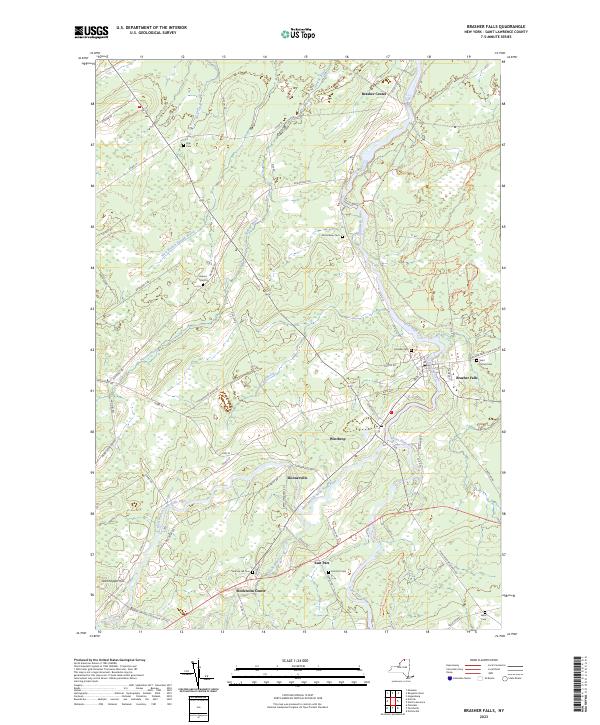
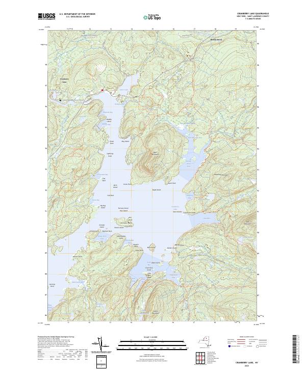
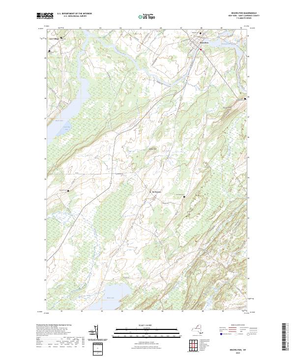
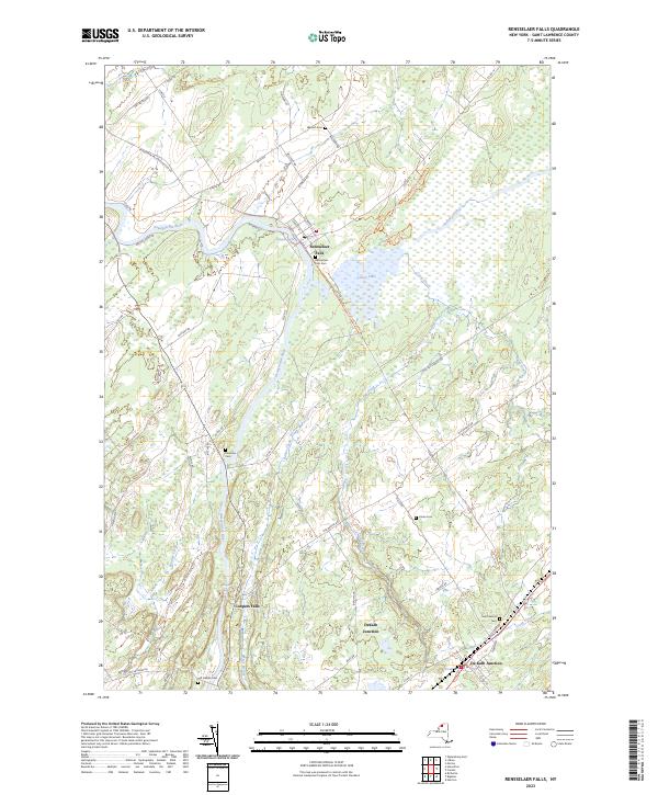
St. Lawrence County


Steuben County


Suffolk County


USGS Topographic Maps – Albany to Delaware Counties
Counties: Albany to Delaware / Dutchess to Livingston / Madison to Otsego / Putnam to Suffolk / Sullivan to Yates
Browse Topographic Maps: Full State / Historical USGS Topographic Maps
Albany County


Allegany County


Bronx County


Broome County


Cattaraugus County


Cayuga County


Chautauqua County


Chemung County


Chenango County


Clinton County


Columbia County


Cortland County


Delaware County


USGS Topographic Maps – Dutchess to Livingston Counties
Counties: Albany to Delaware / Dutchess to Livingston / Madison to Otsego / Putnam to Suffolk / Sullivan to Yates
Browse Topographic Maps: Full State / Historical USGS Topographic Maps
Dutchess County


Erie County


Essex County


Franklin County


Fulton County


Genesee County


Greene County


Hamilton County


Herkimer County


Jefferson County


Kings County
Lewis County


Livingston County


USGS Topographic Maps – Madison to Otsego Counties
Counties: Albany to Delaware / Dutchess to Livingston / Madison to Otsego / Putnam to Suffolk / Sullivan to Yates
Browse Topographic Maps: Full State / Historical USGS Topographic Maps
Madison County


Monroe County


Montgomery County
Nassau County


New York County
Niagara County


Oneida County


Onondaga County


Ontario County


Orange County


Orleans County


Oswego County


Otsego County


USGS Topographic Maps – Sullivan to Yates County
Counties: Albany to Delaware / Dutchess to Livingston / Madison to Otsego / Putnam to Suffolk / Sullivan to Yates
Browse Topographic Maps: Full State / Historical USGS Topographic Maps
Sullivan County


Tioga County


Tompkins County


Ulster County


Warren County


Washington County


Wayne County


Westchester County


Wyoming County


Yates County


State Truck Trails and Forest Preserve Roads Over A Half Mile
Looking for state land to wheel on? This list shows all of the conservation department-maintained DEC truck trails and public access roads that are more then a 1/2 mile long. This roads are varied, but most of them are dirt roads that take you through the back country. Town maintained roads through state forests are generally not shown on in this listing.
| State Land | Road | Miles |
|---|---|---|
| Albert J. Woodford Memorial State Forest | Truck Trail | 0.7 |
| Albert J. Woodford Memorial State Forest | Janis Road | 1.1 |
| Aldrich Pond Wild Forest | Powell Road | 0.5 |
| Aldrich Pond Wild Forest | Mullins Flow Road | 0.6 |
| Aldrich Pond Wild Forest | Little River Road | 0.7 |
| Aldrich Pond Wild Forest | Silver Dawn Road | 0.7 |
| Aldrich Pond Wild Forest | Jackworks Trail | 1.1 |
| Aldrich Pond Wild Forest | South Creek Lake Road | 1.6 |
| Aldrich Pond Wild Forest | Tyler Road | 3.7 |
| Aldrich Pond Wild Forest | Streeter Lake Road | 4.8 |
| Allen Lake State Forest | George Forest Road | 1.5 |
| Ambler State Forest | Truck Trail | 1.8 |
| Ampersand Primitive Area | Ampersand Park Road | 3.2 |
| Andersen Hill State Forest | Big Pine Public Forest Acess Road | 1.5 |
| Arctic China State Forest | China Public Forest Access Road | 1.1 |
| Arctic China State Forest | Shears Public Forest Access Road | 2 |
| Arctic China State Forest | Dunbar Public Forest Access Road | 2.1 |
| Armlin Hill State Forest | Truck Trail | 1.1 |
| Arnold Lake State Forest | Public Forest Access Road | 0.9 |
| Arnold Lake State Forest | Hartwick Forest Access Road | 1 |
| Ashland Pinnacle State Forest | Ashland Pinnacle Access Road #2 | 0.5 |
| Ashland Pinnacle State Forest | Haul Road #1/Long Path Hiking Trail | 1.4 |
| Avon Regional Office | Goodlake Year Entrance Road | 0.7 |
| Baker School House State Forest | Baker School House Public Forest Acess Road | 1.8 |
| Bald Mountain State Forest | Howe Forest Road | 2.4 |
| Balsam Creek State Forest | Briar Hill Road | 1.5 |
| Barbour Brook State Forest | Barbour Brook Public Forest Access Road | 2 |
| Basswood State Forest | Burlington Public Forest Access Road | 0.5 |
| Basswood State Forest | Basswood Pond Public Forest Access Road | 1 |
| Basswood State Forest | Dr. Crouch Truck Trail | 1.3 |
| Bates State Forest | Pucker Street | 1 |
| Bates State Forest | Bates Forest Road | 2.6 |
| Battle Hill State Forest | Unnamed | 1.3 |
| Bear Pond Primitive Area | Bear Pond Road | 0.8 |
| Bear Swamp State Forest | Karsch Haul Road | 0.5 |
| Bear Swamp State Forest | Joe Chamberlin Public Forest Access Road | 1.6 |
| Bear Swamp State Forest | Roseboom Public Facility Truck Trail | 1.8 |
| Bear Swamp State Forest | Snowmobile Trail | 8.3 |
| Bearpen Mountain State Forest | Ski Run Road | 2.1 |
| Beartown State Forest | Town Road | 0.7 |
| Beartown State Forest | Cotton Road | 0.8 |
| Beartown State Forest | Steam Mill Road | 0.8 |
| Beartown State Forest | Aspen Hollow Road | 2.4 |
| Beaver Creek State Forest | Public Forest Access Road 2, Madison 11 | 0.5 |
| Beaver Creek State Forest | Truck Trail -2-12 | 0.7 |
| Beaver Creek State Forest | Public Forest Access Road 1, Madison 11 | 1.3 |
| Beaver Creek State Forest | Truck Trail -1-12 | 3.6 |
| Beaver Dam State Forest | Sears Public Forest Acess Road | 1.4 |
| Beaver Meadow State Forest | Weir Dam Truck Trail | 0.5 |
| Beebe Hill State Forest | Barrett Pond Road | 1.4 |
| Beebe Hill State Forest | Loop Road | 2.3 |
| Big Brook State Forest | County Line Road Spur | 0.6 |
| Big Brook State Forest | Walasek Mulcoy Road | 0.8 |
| Big Brook State Forest | Hanifin Road | 0.9 |
| Big Brook State Forest | County Line Road | 1.4 |
| Birdseye Hollow State Forest | Sanford Lake Access Road | 0.5 |
| Black Creek State Forest | Stanley Road | 1.1 |
| Black River Wild Forest | Remsen Falls Trail | 0.5 |
| Black River Wild Forest | Woods Lake Road | 0.5 |
| Black River Wild Forest | Gull Lake Road | 0.6 |
| Black River Wild Forest | Flansburg Road | 0.7 |
| Black River Wild Forest | Party Road | 0.7 |
| Black River Wild Forest | Black Creek Road | 0.8 |
| Black River Wild Forest | Cohen Road | 1.7 |
| Black River Wild Forest | Flansberg Road | 2.6 |
| Black River Wild Forest | Black Creek Lake Road | 3 |
| Black River Wild Forest | Haskell Road | 3 |
| Black River Wild Forest | Mill Creek Road | 3.4 |
| Black River Wild Forest | Nicks Lake Campground Roads | 3.5 |
| Black River Wild Forest | Wolf Lake Landing Road | 4.8 |
| Black River Wild Forest | West Creek Road | 6.3 |
| Blenheim Hill State Forest | Ward Allen Road | 1.1 |
| Blenheim Hill State Forest | Quarry Road | 1.2 |
| Blue Mountain Wild Forest | Deer Pond Road | 1.1 |
| Blue Mountain Wild Forest | Chain Lakes Road North | 1.3 |
| Blue Mountain Wild Forest | Polaris Road | 1.3 |
| Bombay State Forest | Cross Haul Road | 0.7 |
| Bombay State Forest | Railroad Bed Public Forest Acess Road | 1.2 |
| Bombay State Forest | Pike Brook Haul Road | 3.1 |
| Bonaparte’s Cave State Forest | Corbine Road | 0.8 |
| Bonaparte’s Cave State Forest | Mud Pond Road | 0.8 |
| Boutwell Hill State Forest | Arab Hill Forest Road, Cha 1 Section | 0.8 |
| Boutwell Hill State Forest | Arab Hill Forest Road, Cha 7 Section | 2.1 |
| Boyce Hill State Forest | Jackson Forest Road | 0.6 |
| Brasher State Forest | Route 53 Haul Road | 0.5 |
| Brasher State Forest | Beaver Pond Trail | 0.6 |
| Brasher State Forest | Kennehan Haul Road | 0.8 |
| Brasher State Forest | Bush Road | 1.1 |
| Brasher State Forest | Buckley Haul Road | 1.2 |
| Brasher State Forest | Cc Dam Public Forest Access Road | 1.2 |
| Brasher State Forest | Mccarthy Public Forest Access Road | 1.6 |
| Brasher State Forest | Liberty Public Forest Access Road | 1.7 |
| Brasher State Forest | Hastings Falls Haul Road | 2.1 |
| Brasher State Forest | Wilson Public Forest Access Road | 2.1 |
| Brasher State Forest | Camp / Larue Public Forest Access Road | 2.2 |
| Brasher State Forest | Pascal Haul Road | 2.4 |
| Brasher State Forest | Bush Public Forest Access Road | 2.9 |
| Brasher State Forest | Railroad Bed Public Forest Access Road | 3.6 |
| Brokenstraw State Forest | Brokenstraw Forest Road | 1.7 |
| Bryant Hill State Forest | Hawk Forest Road | 1.4 |
| Buck Hill State Forest | Hertz Road | 0.7 |
| Buck Hill State Forest | Truck Trail | 1.5 |
| Buck Hill State Forest | Buck Hill Road | 3.1 |
| Bucks Brook State Forest | Access Trail | 0.6 |
| Buckton State Forest | Buckton Haul Road | 0.8 |
| Bucktooth State Forest | Baily Hollow Forest Road | 0.6 |
| Bucktooth State Forest | Manley Hill Forest Road | 1 |
| Bully Hill State Forest | Dixon Forest Road | 1 |
| Bully Hill State Forest | Connection Forest Road | 1.6 |
| Bully Hill State Forest | Stearns Forest Road | 2.1 |
| Burnt-Rossman Hills State Forest | Koenig Road | 0.5 |
| Burnt-Rossman Hills State Forest | Betty Brook Haul Road | 0.6 |
| Burnt-Rossman Hills State Forest | Eminence Dead End Truck Trail | 0.7 |
| Burnt-Rossman Hills State Forest | Duck Pond Road | 1.2 |
| Burnt-Rossman Hills State Forest | Monkey Run Truck Trail East | 1.3 |
| Burnt-Rossman Hills State Forest | Yankee Street Truck Trail | 1.3 |
| Burnt-Rossman Hills State Forest | Betty Brook Road | 1.4 |
| Burnt-Rossman Hills State Forest | Betty Brook Truck Trail | 1.5 |
| Burnt-Rossman Hills State Forest | Duck Pond Truck Trail | 1.5 |
| Burnt-Rossman Hills State Forest | Morey Road Truck Trail | 1.7 |
| Burnt-Rossman Hills State Forest | Eminence Road Truck Trail | 2.6 |
| Burnt-Rossman Hills State Forest | Burnt Hill Road | 2.9 |
| Bush Hill State Forest | Fox Cross Forest Road | 2 |
| California Hill State Forest | Wayawanda Road | 0.7 |
| Canacadea State Forest | Macduff Road | 2.3 |
| Canadaway Creek Wma | Dibble Hill Forest Road | 2 |
| Canaseraga State Forest | Ringelberg Truck Trail | 0.5 |
| Canaseraga State Forest | Right Fork Truck Trail | 1 |
| Canaseraga State Forest | Stanley Road | 1.1 |
| Canaseraga State Forest | Left Fork Truck Trail | 1.4 |
| Caroga Lake Campground | Campground Road | 2 |
| Catherineville State Forest | Santamont Access Trail | 1.1 |
| Catherineville State Forest | Circle Public Forest Access Road | 1.8 |
| Charles E. Baker State Forest | Truck Trail 5 | 0.6 |
| Charles E. Baker State Forest | Truck Trail 2 | 0.9 |
| Charles E. Baker State Forest | Truck Trail 6 | 0.9 |
| Charles E. Baker State Forest | Truck Trail 4 | 1.4 |
| Charles E. Baker State Forest | Truck Trail 12 | 1.5 |
| Charles E. Baker State Forest | Truck Trail 8 | 1.9 |
| Charles E. Baker State Forest | Truck Trail 7 | 2.1 |
| Charles E. Baker State Forest | Truck Trail 1 | 3 |
| Charles E. Baker State Forest | Truck Trail 13 | 3.2 |
| Chazy Highlands State Forest | Spring Road | 0.6 |
| Cherry Valley State Forest | Kniskern Public Access Road | 1.2 |
| Cherry Valley State Forest | Mosse Public Forest Access Road | 1.9 |
| Cinnamon Lake State Forest | Hornby Road Haul Road | 0.7 |
| Clapper Hollow State Forest | Clapper Hollow Truck Trail | 1 |
| Clark Hill State Forest | Abandoned Town Road | 0.8 |
| Clark Hill State Forest | Truck Trail | 0.9 |
| Clark Hill State Forest | Access Road North Of Buck Hill Road | 0.9 |
| Clark Hill State Forest | Class A Truck Trail | 1.2 |
| Clark Hill State Forest | Haul Road | 1.3 |
| Cliffside State Forest | Railroad Haul Road | 1.3 |
| Cobb Brook State Forest | Unnamed Truck Trail | 0.6 |
| Cold Creek State Forest | Headwaters Forest Road | 1.4 |
| Cold Spring Brook State Forest | Cold Spring Brook Public Forest Access Road | 1.9 |
| Cole Hill State Forest | Cr 2 Access Road | 0.8 |
| Coyle Hill State Forest | Warner Spur Forest Road | 0.5 |
| Coyle Hill State Forest | Slawson Forest Road | 0.8 |
| Coyle Hill State Forest | Warner Forest Road | 1.8 |
| Cranberry Lake Campground | Campground Road | 2.5 |
| Cranberry Lake Wild Forest | Grass River Railroad | 6.1 |
| Cuyler Hill State Forest | Jipson Hill Public Forest Acess Road | 1.3 |
| Cuyler Hill State Forest | Cuyler Hill Public Forest Acess Road | 5.1 |
| David A. Sarnoff Preserve | Field Access Road | 0.8 |
| Debar Mountain Wild Forest | Debar Game Refuge Road | 0.5 |
| Debar Mountain Wild Forest | Debar Meadow Road | 0.6 |
| Debar Mountain Wild Forest | Vanderwalker Road | 0.9 |
| Debar Mountain Wild Forest | 4 Mile Road Riffle Season Access Corridor | 1.1 |
| Debar Mountain Wild Forest | Ny Centrail Railroad Bed | 2.2 |
| Deer River State Forest | Ccc Road | 0.6 |
| Deer River State Forest | Hogsback Road | 0.6 |
| Deer River State Forest | Willow Road | 0.6 |
| Deer River State Forest | Glaze Road | 0.7 |
| Deer River State Forest | Avery Lot Road | 0.9 |
| Deer River State Forest | Esseltine Hill Road | 0.9 |
| Deer River State Forest | Ricky’s Number Trail | 1 |
| Deer River State Forest | Horse Barn Road | 1.2 |
| Deer River State Forest | Laramie Road | 1.3 |
| Deer River State Forest | Beanville Road | 1.4 |
| Deer River State Forest | Spruce Road | 1.6 |
| Deer River State Forest | Loope Road | 2 |
| Deer River State Forest | Firewood Road | 2.6 |
| Degrasse State Forest | Burns Flats Road | 0.5 |
| Degrasse State Forest | Loop Road | 1.2 |
| Deruyter State Forest | Tromp Road | 1.5 |
| Dobbins Memorial State Forest | Snowmobile Trail | 3.5 |
| Dog Hollow State Forest | Brewer Public Forest Acess Road | 0.9 |
| Downerville State Forest | River Public Forest Access Road | 1 |
| Dry Run State Forest | Wildcat Hollow | 0.8 |
| Dunkin’s Reserve State Forest | Access Road | 3.5 |
| Dutch Settlement State Forest | Haul Road #1 | 0.6 |
| Dutton Ridge State Forest | Dutton Ridge Access Road | 1.5 |
| Earlville State Forest | Mad 2 Forest Access Road | 1.5 |
| East Osceola State Forest | Malloy Brook Road | 1.1 |
| East Otto State Forest | Kriedeman Forest Road | 1.7 |
| Edgewood Oak Brush Plains Preserve | Edgewood Oak Brush Plains Preserve | 0.5 |
| Edgewood Oak Brush Plains Preserve | Unpaved Forest Road | 0.5 |
| Edgewood Oak Brush Plains Preserve | Old Commack Road | 1.6 |
| English Hill State Forest | Ricketts Forest Road | 0.9 |
| Exeter State Forest | Exeter Public Forest Access Road | 1.3 |
| Fairfield State Forest | Jenksville Hill Public Forest Acess Road | 2 |
| Fall Brook State Forest | Gossner Road | 0.6 |
| Fall Brook State Forest | Haul Road To B-45 Wetland | 0.9 |
| Fall Brook State Forest | Access Road From Co. Rt 67A | 1 |
| Fall Brook State Forest | Forest Access Roaad | 1.2 |
| Ferris Lake Wild Forest | Meco Lake Trail | 0.9 |
| Ferris Lake Wild Forest | Sheriff Lake Trail | 0.9 |
| Ferris Lake Wild Forest | Mud Lake Road | 5.5 |
| Fish Creek State Forest | Forward Road | 0.5 |
| Fish Creek State Forest | Trestle Road | 0.6 |
| Fish Creek Wma | State Highway 184 Access Road | 0.9 |
| Five Rivers Education Center | Goose Lane | 0.5 |
| Flat Rock State Forest | Pedobo Road | 0.8 |
| Flat Rock State Forest | Karsch Haul Road | 0.9 |
| Flat Rock State Forest | Ampersand Park Road | 1.9 |
| Florence Hill State Forest | Florence Hill Road | 1.9 |
| Fort Jackson State Forest | Sheldon Public Forest Access Road | 0.5 |
| Frank E. Jadwin Memorial State Forest | Keesler Road | 0.6 |
| Frank E. Jadwin Memorial State Forest | Old Croghan Road | 0.7 |
| Frank E. Jadwin Memorial State Forest | Henry Road | 0.8 |
| Frank E. Jadwin Memorial State Forest | Nelson Road | 0.8 |
| Frank E. Jadwin Memorial State Forest | Wahalula Road | 0.8 |
| Frank E. Jadwin Memorial State Forest | Q- Road | 1.5 |
| Frank E. Jadwin Memorial State Forest | Patchin Road | 1.7 |
| Frank E. Jadwin Memorial State Forest | Blanchard Creek Road | 2.7 |
| Frank E. Jadwin Memorial State Forest | Wisner Road | 2.7 |
| Frank E. Jadwin Memorial State Forest | Judy Cole Road | 2.8 |
| Frank E. Jadwin Memorial State Forest | Loop Road | 3.2 |
| Fulton Chain Wild Forest | Cary Lake Road | 1.8 |
| Furnace Creek State Forest | Miller Road East | 0.7 |
| Furnace Creek State Forest | Powerline Row | 0.7 |
| Furnace Creek State Forest | Sheehan Road | 1.2 |
| Furnace Creek State Forest | B-29 Road | 1.4 |
| Gates Hill State Forest | Coons Den Truck Trail | 0.6 |
| Gates Hill State Forest | Eviann Road | 1.2 |
| Genegantslet State Forest | South Loomis Road | 0.7 |
| Gillies Hill State Forest | Abbey Forest Road | 0.9 |
| Gillies Hill State Forest | Pettit Forest Road | 1.4 |
| Golden Hill State Forest | Firelane Forest Road | 1.6 |
| Goundry Hill State Forest | Guiren Road | 1 |
| Goundry Hill State Forest | Corbett Hollow Access Road | 1.1 |
| Grant Powell State Forest | Huck Berry Road | 2.1 |
| Grass River Wild Forest | Spruce Mountain Road | 0.8 |
| Grass River Wild Forest | Hollywood Road | 2.5 |
| Grass River Wild Forest | Railroad Grade Road | 2.9 |
| Greenwood Creek State Forest | Grass Pond Public Forest Access Road | 0.9 |
| Grigg’s Gulf State Forest | Grigg’s Gulf Public Forest Acess Road | 1.5 |
| Gulf Unique Area | Gulf R.O.W. Road | 0.5 |
| Gulf Unique Area | Old Skid Road | 1.1 |
| Hall Island State Forest | Unnamed Public Forest Acess Road | 0.7 |
| Hammond Hill State Forest | Redman Run Public Forest Acess Road | 1.1 |
| Hammond Hill State Forest | Cannan Public Forest Acess Road | 1.3 |
| Hammond Pond Wild Forest | Paynes Way | 0.7 |
| Harris Hill State Forest | Sprague Forest Road | 0.8 |
| Harvey Mountain State Forest | Harvey Mt Access Road | 0.9 |
| Harvey Mountain State Forest | East Hill Access Road | 2.4 |
| Hatch Creek State Forest | Hodge Forest Road | 0.6 |
| Hatch Creek State Forest | North Forest Road | 0.8 |
| Hatch Creek State Forest | South Forest Road | 0.9 |
| Hemlock-Canadice State Forest | South Hemlock Access Road | 0.7 |
| Henderson Shores Unique Area | Radar Road | 0.8 |
| Hewitt State Forest | Hewitt Rd | 1.1 |
| Hickok Brook Multiple Use Area | Spur Road | 0.7 |
| Hickok Brook Multiple Use Area | Main Road | 1.1 |
| High Flats State Forest | Chapel Hill Access Trail | 0.5 |
| High Flats State Forest | Crowley Access Trail | 0.5 |
| High Flats State Forest | Close Pond Access Trail | 0.7 |
| High Flats State Forest | Donovan Public Forest Access Road | 1.1 |
| High Knob State Forest | Shale Pit Road | 1.9 |
| High Peaks Wilderness | Northville-Placid Trail-Northern Terminus | 1.1 |
| Hill Higher State Forest | Hill Higher Forest Road | 1.1 |
| Hinckley State Forest | Elm Flats Road | 0.5 |
| Hinckley State Forest | Roberts Road | 0.5 |
| Hinckley State Forest | Lanning Road | 0.8 |
| Hinckley State Forest | Access Road | 1.6 |
| Hinckley State Forest | Black Creek Road | 2 |
| Hogsback State Forest | Forest Access Road | 3 |
| Honey Hill State Forest | Edwards Public Forest Access Road | 1.4 |
| Hooker Mountain State Forest | Norton Public Forest Access Road | 0.8 |
| Horseshoe Lake Wild Forest | Cut Off Road | 0.6 |
| Horseshoe Lake Wild Forest | Lower Dam Road | 0.7 |
| Horseshoe Lake Wild Forest | Otter Brook Trail | 0.9 |
| Horseshoe Lake Wild Forest | Grass River Railroad | 1.7 |
| Horseshoe Lake Wild Forest | Otter Brook Road | 2.2 |
| Hoxie Gorge State Forest | Russel Hill Public Forest Acess Road | 2.5 |
| Huntersfield State Forest | Huntersfield Access Road #2 | 0.7 |
| Huntersfield State Forest | Huntersfield Access Road #1 | 1.9 |
| Hunts Pond State Forest | Truck Trail | 1.7 |
| Independence River State Forest | Assembly Road | 1 |
| Independence River Wild Forest | Blue Jog Road | 0.5 |
| Independence River Wild Forest | Sunday Lake Road | 0.5 |
| Independence River Wild Forest | Evies Pond Road | 0.7 |
| Independence River Wild Forest | Burnt Creek Road | 0.7 |
| Independence River Wild Forest | Elbow Rd | 0.7 |
| Independence River Wild Forest | Shortcut Road | 0.8 |
| Independence River Wild Forest | Fish Pond Road | 1 |
| Independence River Wild Forest | Halfmoon Lake Rd | 1 |
| Independence River Wild Forest | Little Otter Creek Road | 1 |
| Independence River Wild Forest | Long Pond Spur | 1 |
| Independence River Wild Forest | East Loop Road | 1.1 |
| Independence River Wild Forest | Copper Lake Road | 1.2 |
| Independence River Wild Forest | Necessary Dam Road | 1.2 |
| Independence River Wild Forest | Pitcher Pond Road | 1.3 |
| Independence River Wild Forest | Hinchings Pond Road | 1.8 |
| Independence River Wild Forest | Basket Factory Road | 2.1 |
| Independence River Wild Forest | Catspaw Lake Road | 2.4 |
| Independence River Wild Forest | Confusion Flats Road | 2.6 |
| Independence River Wild Forest | Big Otter Lake Road | 3.1 |
| Independence River Wild Forest | Stony Lake Road | 3.1 |
| Independence River Wild Forest | Florence Pond Road | 3.1 |
| Independence River Wild Forest | Steam Mill Road | 3.5 |
| Independence River Wild Forest | Smith Road | 3.7 |
| Indian Pipe State Forest | Dunes Road | 0.7 |
| Indian River Wma | Red Lake Road | 2 |
| Jackson Hill State Forest | Forest Access Road | 2.1 |
| Jersey Hill State Forest | Scholes Forest Road | 1.6 |
| Jessup River Wild Forest | Lake Colby Camp Road | 0.7 |
| Karr Valley Creek State Forest | Frungillo Forest Road | 0.8 |
| Karr Valley Creek State Forest | Norton Forest Road | 1.3 |
| Karr Valley Creek State Forest | Davison Forest Road | 1.4 |
| Keeney Swamp State Forest | Fitch Hill Spur Forest Road | 0.7 |
| Keeney Swamp State Forest | C3D | 0.8 |
| Keeney Swamp State Forest | Fitch Hill Forest Road | 1.2 |
| Keeney Swamp State Forest | Gordon Forest Road | 1.4 |
| Kennedy State Forest | Courtney Hill Public Forest Acess Road | 0.7 |
| Kennedy State Forest | Cotton-Hanlon Public Forest Acess Road | 1 |
| Kennedy State Forest | Kennedy Public Forest Acess Road | 2.5 |
| Kenneth Wilson Campground | Campground Road | 9.7 |
| Ketchumville State Forest | Ketchumville Public Forest Acess Road | 1 |
| Keyserkill State Forest | Guinea Road Truck Trail | 1 |
| Keyserkill State Forest | Keyserkill Truck Trail #1 | 1.3 |
| Klipnocky State Forest | Emery Forest Road | 1.2 |
| Klipnocky State Forest | Marble Forest Road | 1.6 |
| Klondike State Forest | Klondike Public Forest Acess Road | 1.7 |
| Lafayetteville Multiple Use Area | Wilbur Flats Road | 0.9 |
| Lake Durant Campground | Scott Public Forest Acess Road | 0.9 |
| Lake George Wild Forest | Jabe Pond Road | 1 |
| Lake George Wild Forest | Dacy Clearing Road | 1.6 |
| Lake George Wild Forest | Lily Pond Road | 2.1 |
| Lake George Wild Forest | Gay Pond Road | 4 |
| Lake Harris Campground | Campground Road | 0.9 |
| Lakeview Marsh Wma | Skinner Road | 0.7 |
| Leonard Hill State Forest | Leonard Hill Access Road #1 | 0.7 |
| Leonard Hill State Forest | Leonard Hill Access Road #3 | 1.2 |
| Leonard Hill State Forest | Leonard Hill Access Road #2 | 1.6 |
| Lesser Wilderness State Forest | Gomer Hill Road | 0.5 |
| Lesser Wilderness State Forest | Toole Road | 0.6 |
| Lesser Wilderness State Forest | Alguire Road | 0.7 |
| Lesser Wilderness State Forest | Smith Road | 0.8 |
| Lesser Wilderness State Forest | Nob Road | 0.9 |
| Lesser Wilderness State Forest | Seelman Road | 1.3 |
| Lesser Wilderness State Forest | Mcgoldrick Road | 3 |
| Lesser Wilderness State Forest | #9 Road | 4.7 |
| Limekiln Lake Campground | Lime Kiln Lake Campground Trails | 3.9 |
| Linda Gronlund Memorial At Barcelona Neck | Trustee Road West | 1 |
| Linda Gronlund Memorial At Barcelona Neck | Trustee Road East | 1.7 |
| Lonesome Bay State Forest | Alamogin Public Forest Access Road | 2.2 |
| Long Pond State Forest | Access Road | 0.5 |
| Long Pond State Forest | Truck Trail | 0.7 |
| Long Pond State Forest | Long Pond Snowmobile Trail | 0.8 |
| Lookout State Forest | Ball Road | 0.6 |
| Lost Nation State Forest | Brookdale Road / Jenkins Corners Rd / Red Barn Rd | 2.5 |
| Lost Valley State Forest | Lost Valley Haul Road | 1.2 |
| Lowville Demonstration Area | Dadville Road | 0.6 |
| Ludlow Creek State Forest | Trail Road | 1.3 |
| Lutheranville State Forest | Access Road #1 | 0.5 |
| Lutheranville State Forest | Access Road #2 | 1.2 |
| Lyon Brook State Forest | Lyon Brook Truck Trail | 1.2 |
| Mad River State Forest | Thompson Corners Florence Road | 0.5 |
| Mad River State Forest | Bartlett Road | 0.6 |
| Mad River State Forest | Rehm Road | 0.6 |
| Mad River State Forest | Phalen Road South | 1.9 |
| Mad River State Forest | Mcspirit Road | 2.1 |
| Madawaska Flow – Quebec Brook Primitive Area | Benz Pond Road | 2.2 |
| Mallet Pond State Forest | Cemetery Road Truck Trail | 2 |
| Maxon Creek State Forest | Pease Hill Public Forest Acess Road | 1 |
| Mccarthy Hill State Forest | Main Access Road | 0.5 |
| Mccarty Hill State Forest | Ccc Forest Road | 1.5 |
| Mccarty Hill State Forest | Mccarty Hill East Forest Road | 2 |
| Mcdonough State Forest | Ccc Trail | 1 |
| Mcdonough State Forest | Truck Trail 4 | 1.1 |
| Mcdonough State Forest | Finger Lakes Trail | 1.8 |
| Mcdonough State Forest | Truck Trail 3 | 2 |
| Melondy Hill State Forest | Public Forest Access Road | 2.5 |
| Montrose Point State Forest | Through Trail | 0.6 |
| Moose River Plains Wild Forest | Loop Road | 1.2 |
| Moose River Plains Wild Forest | Indian Lake Road | 3.4 |
| Moose River Plains Wild Forest | Otter Brook Road | 3.4 |
| Moose River Plains Wild Forest | Rock Dam Road | 4.2 |
| Moose River Plains Wild Forest | Lime Kiln Lake – Cedar River Road | 16.9 |
| Morgan Hill State Forest | Herlihy Haul Road | 0.6 |
| Morgan Hill State Forest | Keith Gutchess Haul Road | 0.7 |
| Morrow Mountain State Forest | Mollie Road | 2.8 |
| Mount Hunger State Forest | Whalen Road | 0.6 |
| Mount Pisgah State Forest | Mt Pisgah Access Road #1 | 1.3 |
| Mount Pleasant State Forest | Beck Forest Road | 0.6 |
| Mount Pleasant State Forest | Brumagin Forest Road | 0.7 |
| Mount Pleasant State Forest | Spruce Forest Road | 0.8 |
| Mount Tom State Forest | Notch Lane Access Road | 1.4 |
| Mount Tom State Forest | Shaker Hollow Access Trail | 1.4 |
| Muller Hill State Forest | Davenport Road | 1.4 |
| Muller Hill State Forest | Bliss Road | 1.5 |
| New Forge State Forest | New Forge Access Road #2 | 0.5 |
| New Forge State Forest | New Forge Access Road #3 | 0.6 |
| New Forge State Forest | New Forge Access Road | 1.5 |
| Newfield State Forest | Irish Hill Haul Road | 0.8 |
| Nicks Lake Campground | Nicks Lake Campground Roads | 0.6 |
| Nimham Mountain Multiple Use Area | Coles Mills Road | 0.7 |
| Nimham Mountain Multiple Use Area | Tower Road | 0.7 |
| Nine Mile Creek State Forest | North Nine Mile Town Road | 0.5 |
| Nine Mile Creek State Forest | Phearsdorf Forest Road | 0.5 |
| Nine Mile Creek State Forest | North Nine Mile Forest Road | 2.2 |
| North Harmony State Forest | Snake Forest Road | 0.9 |
| North South Lake Campground | South Lake Road | 1.3 |
| North South Lake Campground | North Lake Campground Road | 1.8 |
| Northhampton Beach Campground | Campground Road | 5.5 |
| Oakley Corners State Forest | Oakley Corners North Public Forest Acess Road | 1.6 |
| Ohissa State Forest | Cramers Corner Road | 0.8 |
| Onjebonge State Forest | Lime Quarry Road | 1.3 |
| Onjebonge State Forest | Alice Coffey Road | 2.5 |
| Orebed Creek State Forest | Ritz Road | 1.3 |
| Ossian State Forest | Back Road To Rattlesnake | 0.7 |
| Ossian State Forest | Scoville Access Road | 1 |
| Ossian State Forest | Linzy Road Truck Trail | 1.8 |
| Otselic State Forest | Truck Trail | 3.1 |
| Otsquago State Forest | Wagner Hill Road | 0.8 |
| Otter Creek State Forest | Eatonville Road | 0.6 |
| Otter Creek State Forest | Mikes Road | 1.2 |
| Otter Creek State Forest | Otter Creek Road | 1.5 |
| Palmer’s Pond State Forest | Geitner Forest Road | 0.7 |
| Palmer’s Pond State Forest | Palmer’s Pond Forest Road | 1.5 |
| Palmer’s Pond State Forest | 6 | 2.4 |
| Partridge Run Wma | Boys Camp Road Ext | 2 |
| Patria State Forest | Pleasant Valley Road | 0.6 |
| Patria State Forest | Barkman Road Access | 0.6 |
| Patria State Forest | Hardscrabble Road Access | 0.8 |
| Peck Hill State Forest | Swamp Road | 0.5 |
| Peck Hill State Forest | West Boundary Trail | 0.6 |
| Peck Hill State Forest | Beaver Vly | 0.7 |
| Peck Hill State Forest | Dam Road | 0.7 |
| Penn Mountain State Forest | Star Hill Road | 1 |
| Penn Mountain State Forest | West Gate Road | 2.6 |
| Penn Mountain State Forest | South Gate Road | 3.6 |
| Penn Mountain State Forest | East Gate Road | 3.8 |
| Perch River Wma | Perch Lake Road | 0.5 |
| Perch River Wma | Buckminster Road | 0.9 |
| Perch River Wma | Cook Road | 1.4 |
| Perch River Wma | Allen Road | 2.1 |
| Perch River Wma | State Route 12 | 2.6 |
| Perch River Wma | Vaadi Road | 3 |
| Perch River Wma | Dog Hill Road | 4 |
| Pharsalia Woods State Forest | Nine Mile Truck Trail Snowmobile Trail | 1.6 |
| Piermont Marsh Tidal Wetland | Piermont Pier Access Road | 0.9 |
| Pine Hill State Forest | Bundy Hollow Public Forest Access Road | 1 |
| Pittstown State Forest | State Fire Lane | 2.2 |
| Plainfield State Forest | Hughes Public Forest Access Road | 1.3 |
| Plattekill State Forest | Mountain Brook Road | 1 |
| Plumbottom State Forest | Reddy Forest Road | 3 |
| Point Peninsula Wma | Pine Woods Road | 1.5 |
| Point Peninsula Wma | Beach Road | 2.1 |
| Point Peninsula Wma | Shore Road | 8 |
| Point Rock State Forest | Egger Brrok Raod | 1.3 |
| Popple Pond State Forest | Smith Road | 0.7 |
| Popple Pond State Forest | Haul Road Shared By Oneida 6 And County Forest | 1.6 |
| Popple Pond State Forest | Truck Trail | 3 |
| Potato Hill State Forest | Blackman Hill Rd | 1.1 |
| Potato Hill State Forest | Level Green Rd | 1.2 |
| Pulpit Rock State Forest | Watson Road | 0.6 |
| Punkeyville State Forest | Irish Settlement Road | 0.7 |
| Punkeyville State Forest | River Road | 0.9 |
| R Milton Hick Memorial State Forest | Lafleuer Road | 1.2 |
| Relay State Forest | Relay Public Forest Access Road | 1.2 |
| Rensselaerville State Forest | Kenyon Road Access | 2.4 |
| Ridge Conservation Area And Maintenance Center | Mid-Island Access Road | 0.5 |
| Rock City State Forest | Salamanca Forest Road | 0.8 |
| Rock City State Forest | Eckert Forest Road | 0.9 |
| Rock City State Forest | Little Rock City Forest Road | 2 |
| Rock Creek State Forest | Admin Access Road | 1.3 |
| Rockwood State Forest | Spring Road | 0.5 |
| Rockwood State Forest | B Road | 0.6 |
| Rocky Point Pine Barrens State Forest | Accessible | 0.5 |
| Rocky Point Pine Barrens State Forest | Firestone Road | 1.7 |
| Rural Grove State Forest | Rural Grove Access Road (Shibley Road) | 3.1 |
| Rush Creek State Forest | C2-C | 1.2 |
| Rush Creek State Forest | Russell Forest Road | 3 |
| Sacandaga Campground | Sacandaga Campground | 1.4 |
| Salmon River State Forest | Harpers Ferry Public Forest Acess Road | 0.9 |
| Sand Flats State Forest | Bucks Corners Road | 0.9 |
| Sand Flats State Forest | Obrian Road | 0.9 |
| Sand Flats State Forest | Water Hole Road | 1 |
| Sand Flats State Forest | Y Road | 1.5 |
| Sand Flats State Forest | Powell Road | 1.7 |
| Sand Flats State Forest | Fall Brook Road | 2.2 |
| Saranac Lakes Wild Forest | Horseshoe Pond Trail | 0.5 |
| Saranac Lakes Wild Forest | Little Clear Pond Road | 0.5 |
| Saranac Lakes Wild Forest | Connery Pond Road | 0.6 |
| Saranac Lakes Wild Forest | Little Green Pond Road | 0.6 |
| Saranac Lakes Wild Forest | Rollins Pond Access Road | 0.8 |
| Saranac Lakes Wild Forest | Medow Pond Truck Trail | 0.9 |
| Saranac Lakes Wild Forest | Bartlett Carry Road | 1.2 |
| Saranac Lakes Wild Forest | Floodwood Mountain Road | 1.2 |
| Saranac Lakes Wild Forest | Rat Pond Road | 1.5 |
| Saranac Lakes Wild Forest | Sunday Pond Road | 1.6 |
| Scott Patent State Forest | Scott Patent Access Road | 1.4 |
| Shawangunk Ridge State Forest | Woods Road | 1 |
| Shindagin Hollow State Forest | Ekroos Public Forest Acess Road | 1.4 |
| Skyline Drive State Forest | Skyline Drive Public Forest Acess Road | 2.2 |
| Slader Creek State Forest | Oberdorf Forest Road | 2.1 |
| Sonyea State Forest | Shaker Access Road | 1.9 |
| South Bradford State Forest | Ccc Road | 1.6 |
| South Hill State Forest | South Hill Truck Trail | 0.5 |
| South Hill State Forest | Public Forest Access Road Extension | 0.9 |
| South Hill State Forest | South Hill Public Forest Access Road | 0.9 |
| South Hill State Forest | Kotary Road Extension | 1 |
| South Hill State Forest | Powerline Road | 1 |
| South Mountain State Forest | Ashland Pinnacle Access Road #2 | 0.5 |
| South Mountain State Forest | South Mountain Access Road | 0.9 |
| South Mountain State Forest | Bluebird Road | 1.1 |
| South Valley State Forest | Phillips Brook Fr First Section | 0.7 |
| South Valley State Forest | Phillips Brook Forest Road | 1.2 |
| St. Regis River State Forest | Old Railroad Bed | 1.6 |
| Stammer Creek State Forest | Sugar Bush Haul Road | 1.1 |
| Steam Mill State Forest | Zion Public Forest Access Road #2 | 0.5 |
| Steam Mill State Forest | Glass House Hill Road | 1 |
| Steam Mill State Forest | Assembly Road | 1.1 |
| Steam Mill State Forest | Steammill Rd | 1.4 |
| Steam Mill State Forest | Carroll Hill Public Forest Access Road #2 | 1.9 |
| Steam Mill State Forest | Zion Public Forest Access Road #1 | 2 |
| Steam Mill State Forest | Carroll Hill Public Forest Access Road #3 | 2.5 |
| Stewart State Forest | Great Swamp Road | 0.5 |
| Stewart State Forest | Drakes Ln | 0.6 |
| Stewart State Forest | Orlando Dr | 0.6 |
| Stewart State Forest | Ridge Road South | 0.6 |
| Stewart State Forest | Scofield Lane | 0.7 |
| Stewart State Forest | Armstrong Lane Trail | 0.9 |
| Stewart State Forest | Giles Road | 0.9 |
| Stewart State Forest | Pittman Robertson Pond Road | 0.9 |
| Stewart State Forest | Weed Road | 1.2 |
| Stewart State Forest | Beaver Pond Road | 1.3 |
| Stewart State Forest | Barron Road | 1.8 |
| Stewart State Forest | Barron Road South 208 | 1.8 |
| Stewart State Forest | Ridge Road | 2.8 |
| Stewart State Forest | Maple Ave | 3.1 |
| Stewart State Forest | New Road | 3.4 |
| Stockton State Forest | Blackman Forest Road | 1.4 |
| Stone Store State Forest | Fawn Ridge Road | 2.7 |
| Sugar Hill State Forest | Firetower Access Road | 0.5 |
| Sugar Hill State Forest | Old Westerfield Road | 0.5 |
| Sugar Hill State Forest | A Trail | 1 |
| Sugar Hill State Forest | Pine Knob Road | 1 |
| Sugar Hill State Forest | Maple Lane | 2.1 |
| Summer Hill State Forest | Snowmobile Trail | 5 |
| Sundown Wild Forest | South Mountain Extension | 1 |
| Swancott Hill State Forest | Tower Road | 2.3 |
| Swancott Mill State Forest | Swancott Mill Road | 0.9 |
| Taconic Hereford Multiple Use Area | Pirate Crrek | 0.5 |
| Taconic Hereford Multiple Use Area | Whatchamacallit | 0.5 |
| Taconic Hereford Multiple Use Area | Camp | 0.6 |
| Taconic Hereford Multiple Use Area | Mercury | 0.6 |
| Taconic Hereford Multiple Use Area | Border Trail | 0.8 |
| Taconic Hereford Multiple Use Area | Mustang | 0.8 |
| Taconic Hereford Multiple Use Area | Outer Gut | 0.8 |
| Taconic Hereford Multiple Use Area | Brockway Road | 0.9 |
| Taconic Hereford Multiple Use Area | Green Acres | 1.2 |
| Taconic Hereford Multiple Use Area | Tsp Road | 1.2 |
| Taconic Hereford Multiple Use Area | Pond Gut Road | 1.3 |
| Taconic Hereford Multiple Use Area | Timbuktu | 1.3 |
| Taconic Hereford Multiple Use Area | Fong’s Way | 1.4 |
| Taconic Hereford Multiple Use Area | Getaway | 1.9 |
| Taconic Hereford Multiple Use Area | Upper Snowmobile Trail | 1.9 |
| Taconic Ridge State Forest | Rounds Mountain Rd. | 0.8 |
| Taconic Ridge State Forest | Robinson’s Hollow Road | 0.9 |
| Taconic Ridge State Forest | Green Hollow Access Road | 1.1 |
| Taylor Creek State Forest | T Road Public Forest Access Road | 1 |
| Taylor Valley State Forest | Seacord Hill Spur Public Forest Acess Road | 0.9 |
| Taylor Valley State Forest | Seacord Hill Public Forest Acess Road | 2.1 |
| Taylor Valley State Forest | Mount Roderick Public Forest Acess Road | 4.3 |
| Terry Mountain State Forest | Lynch Mt Road Trail | 1 |
| Terry Mountain State Forest | Red Road | 1.7 |
| Terry Mountain State Forest | Mud Pond Road Trail | 2 |
| Terry Mountain State Forest | Tower Road | 2 |
| Texas Hill State Forest | M8 Access Trail | 0.6 |
| Texas Hill State Forest | Texas Hill Truck Trail | 0.7 |
| Texas School House State Forest | New Lisbon Public Forest Access Road | 1.2 |
| Three Springs State Forest | Three Springs Access Road | 1.6 |
| Tied Lake Primitive Area | Tied Lake Road | 1.2 |
| Titusville Mountain State Forest | Lee Road | 2 |
| Tomannex State Forest | Tomannex Public Forest Access Road | 1 |
| Tomannex State Forest | Haul Road #1 | 4.7 |
| Toothaker Creek State Forest | Garrison Access Trail | 1.1 |
| Tri-County State Forest | Flanagan Road | 0.5 |
| Trout Lake State Forest | Cedar Lake Public Forest Access Road | 0.5 |
| Tug Hill State Forest | Home Run Road | 0.6 |
| Tug Hill State Forest | Babbit Road | 0.8 |
| Tug Hill State Forest | Gruntley Road | 1.3 |
| Tug Hill State Forest | Mile Strip Road | 2.5 |
| Tug Hill State Forest | Denning (West) Road | 2.8 |
| Tug Hill State Forest | Willams Road | 2.9 |
| Tug Hill State Forest | Horace Forward Road | 3.3 |
| Tug Hill Wma | Alphabet Lane Road | 0.8 |
| Tug Hill Wma | Runing George Road | 1.3 |
| Tug Hill Wma | Beech Street Road | 1.7 |
| Tug Hill Wma | Running George Road | 3.8 |
| Tuller Hill State Forest | Snyder Hill Public Forest Acess Road | 1.6 |
| Tuller Hill State Forest | Pipeline Public Forest Acess Road | 1.6 |
| Tuller Hill State Forest | Vinnedge Public Forest Acess Road | 1.7 |
| Turkey Hill State Forest | Turkey Hill Public Forest Acess Road | 1.3 |
| Turkey Ridge State Forest | Turkey Road | 0.7 |
| Turnpike State Forest | Turnpike Forest Road | 2.2 |
| Turnpike State Forest | Stewart Forest Road | 3.1 |
| Upper And Lower Lakes Wma | Canton Access Road | 0.5 |
| Upper And Lower Lakes Wma | Logging Access Road | 0.5 |
| Upper And Lower Lakes Wma | Corning Access Road | 1 |
| Upper And Lower Lakes Wma | Middle Access Road | 1.2 |
| Vandermark State Forest | Allen Forest Road | 1.1 |
| Vandermark State Forest | Bird Forest Road | 1.5 |
| Vanderwhacker Mountain Wild Forest | Cheney Pond Road | 0.5 |
| Vanderwhacker Mountain Wild Forest | Thilo Road | 1.7 |
| Vanderwhacker Mountain Wild Forest | Vanderwhacker Road | 2.6 |
| Watson’s East Triangle Wild Forest | Wolf Creek Road West | 0.5 |
| Watson’s East Triangle Wild Forest | Deep Cuts Road | 0.6 |
| Watson’s East Triangle Wild Forest | Tunnel Road | 0.7 |
| Watson’s East Triangle Wild Forest | Number 1 Road | 2.1 |
| Watson’s East Triangle Wild Forest | Bear Pond Road | 8.4 |
| Webster Hill State Forest | Webster Hill Forest Access Road | 0.8 |
| West Canada Lake Wilderness | Northville-Placid Trail | 2.2 |
| West Parishville State Forest | Scotch Pine Access Trail | 0.5 |
| West Parishville State Forest | Red Pine Access Trail | 0.7 |
| West Parishville State Forest | Kidney Killer Access Trail | 0.9 |
| Whalen Memorial State Forest | Whalen Forest Road | 1.6 |
| Whaupaunaucau State Forest | Haul Road #4 | 0.5 |
| Whaupaunaucau State Forest | Alguire Road | 1 |
| Whaupaunaucau State Forest | C8 – B15 Road | 1.3 |
| Whippoorwill Corners State Forest | Loop Access Road | 1.3 |
| Whiskey Flats State Forest | Capell Access Road | 0.5 |
| Whiskey Flats State Forest | Sochia Pond Public Forest Access Road | 0.5 |
| Whiskey Flats State Forest | Sandy Public Forest Access Road | 0.7 |
| White Pond Multiple Use Area | Farmers Mills Road | 0.9 |
| White Pond Multiple Use Area | White Pond Road | 1 |
| Wilcox Lake Wild Forest | Dorr Road | 0.5 |
| Wilcox Lake Wild Forest | Lizard Pond Road | 0.6 |
| Wilcox Lake Wild Forest | Mud Pond Road | 0.7 |
| Wilcox Lake Wild Forest | Fish Ponds Road | 0.8 |
| Wilcox Lake Wild Forest | Harrisburg Lake Road | 1.5 |
| Wilcox Lake Wild Forest | Pumpkin Hollow Road | 1.5 |
| Wilcox Lake Wild Forest | Oregon Road | 1.7 |
| Wilcox Lake Wild Forest | West Stony Creek Road | 5.4 |
| Wiley Brook State Forest | Finger Lakes Trail | 0.7 |
| William C. Whitney Wilderness | Lake Lila Road | 5.8 |
| Wilson Hill Wma | Sand Road | 0.6 |
| Wilson Hill Wma | Northern Access Road | 1.9 |
| Winona State Forest | Blood Road | 0.7 |
| Winona State Forest | Hessel Road | 0.9 |
| Winona State Forest | Remington | 1.1 |
| Winona State Forest | Hawley Road | 1.5 |
| Winona State Forest | Tucker Road | 2.6 |
| Winona State Forest | Bargy (Main) Road | 3.2 |
| Wolf Lake State Forest | Orbegezo Row | 1.4 |
| Woodland Valley Campground | Woodland Valley Road | 0.5 |
| Woodland Valley Campground | Camping Trail Road | 0.8 |
| Yatesville Falls State Forest | Yatesville Falls Access Road | 1.2 |
Looking for state land to wheel on? This list shows all of the conservation department-maintained DEC truck trails and public access roads that are more then a 1/2 mile long. This roads are varied, but most of them are dirt roads that take you through the back country. Town maintained roads through state forests are generally not shown on in this listing.