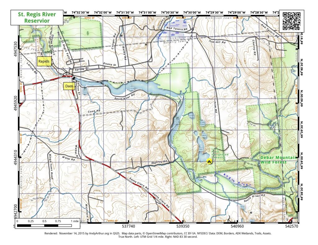
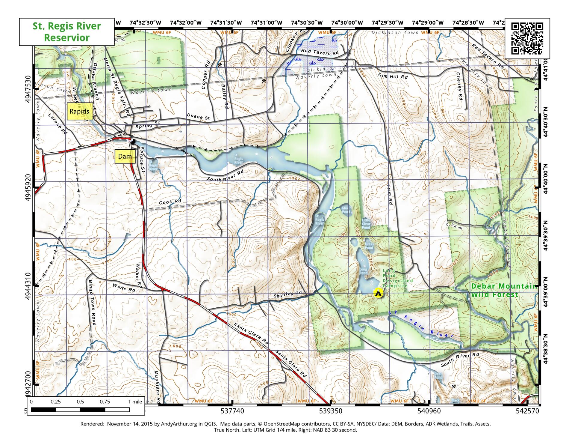
Map: St. Regis River Reservior
Download a High Resolution JPEG Image of the St. Regis River Reservior or an Adobe Acrobat Printable PDF of the St. Regis River Reservior.
About Map: St. Regis River Reservior ....
The St. Regis Canoe route consists of several navigable stretches of the St. Regis River, including the reservoir just east of the hamlet of St. Regis Falls. Parking to access this reservoir and a boat launch is located downtown and is found off of South River Road via a large sign on NY 458 aka Santa Clara Road.

Bookmark my free Interactive GPS Map for your phone:
https://andyarthur.org/ny
... shows your location as a blue dot in relationship to campsites, trails, state land. This online map requires cell service, won't work in remote country, so also bring a paper map.
Free Download of New & Historical USGS 1:24k Topograpic Maps
Interactive maps with backcountry and roadside camping: New York, Pennsylvania, West Virginia & Vermont. List of NYS DEC Lean-Tos and Firetowers.
Google Spreadsheet with Roadside, Primitive and Pay Campsites
More about Deer River State Forest...
Nestled within the sprawling 12,273-acre expanse of Deer River State Forest is a rugged outdoor haven, boasting minimal developed amenities. The defining feature of this forest is the Deer River itself, weaving through a captivating network of interconnected wetlands and tributaries. Its rapids, waterfalls, open flat waters, and expansive marshes bestow upon the state forest an untamed allure.
Deer River State Forest provides nine designated campsites, each marked with distinctive yellow and black "Camp Here" indicators. These sites, strategically positioned along public forest access roads and the Deer River, offer a primitive and undeveloped character. Typically consisting of a cleared area and a stone fire ring, these sites are accessible by vehicle, facilitating convenient parking. However, it's important to note that amenities such as bathroom facilities, running water, and electricity are not available at these sites. The campsites, scattered across Conservation PFAR and Avery Lot PFAR, invite visitors to embrace the simplicity of nature.
One notable trail is the 0.6-mile Beaneville Trail, commencing at the Webster Mills PFAR and tracing the scenic path along the Deer River. Additionally, a network of unpaved roadways and unmarked trails offers opportunities for recreation in a pristine, undeveloped setting.
https://www.dec.ny.gov/lands/107513.html
Maps and Interactives
Deer River State Forest
St. Regis River Reservior
... photos, maps and other content from from Deer River State Forest.