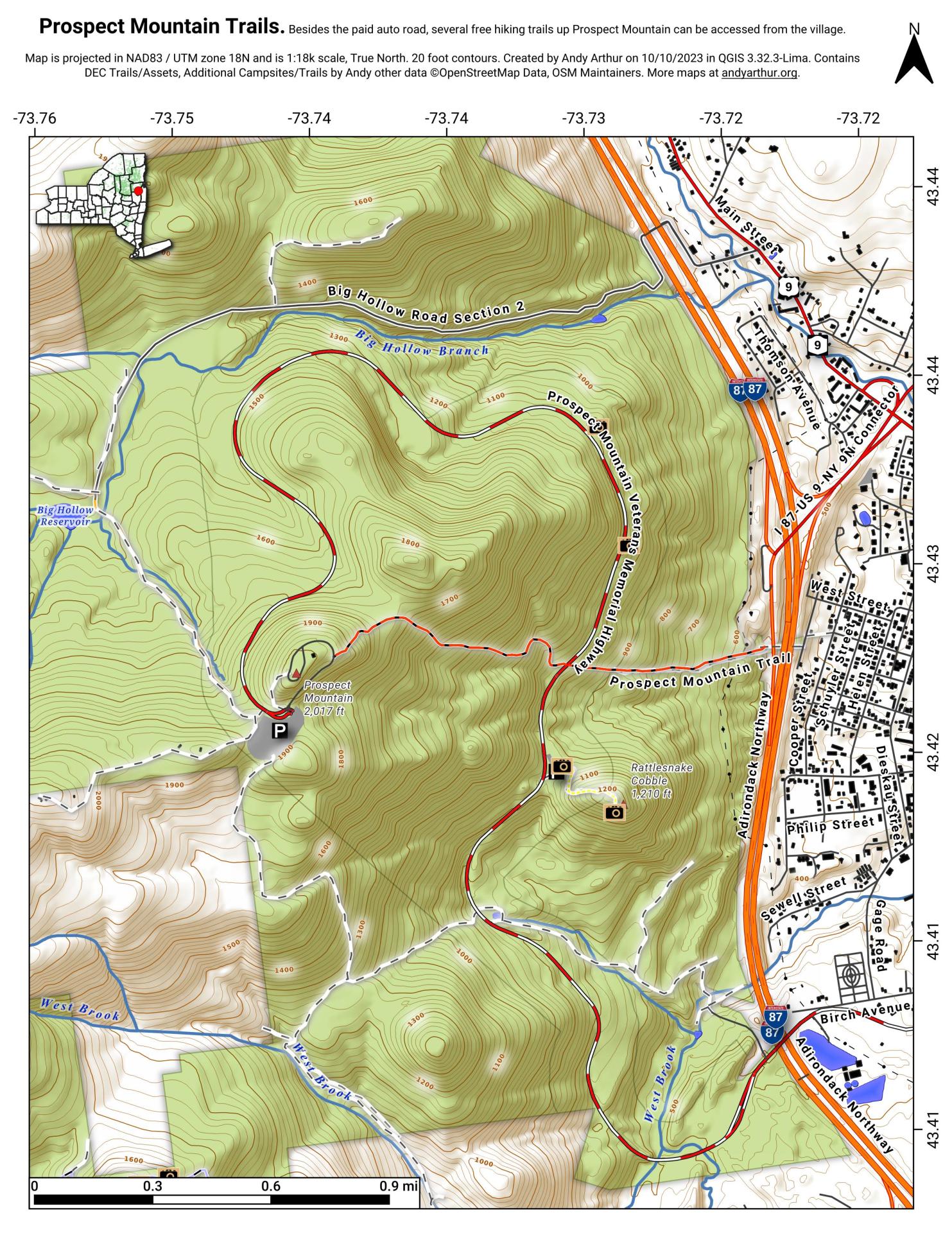
Map: Prospect Mountain Hiking Trail

Download a High Resolution JPEG Image of the Prospect Mountain Hiking Trail or an Adobe Acrobat Printable PDF of the Prospect Mountain Hiking Trail.
About Map: Prospect Mountain Hiking Trail ....
"The red DEC marked Prospect Mountain Trail is 1.5 miles long, leads steeply at times to the 2021 foot summit of Prospect Mountain. To reach the trail from Lake George Village, turn left on Montcalm Street to Smith Street. At Smith Street, turn south a half block to the sign indicating the start of the trail, where it crosses the Northway on a pedestrian bridge. The climb to the summit is difficult but rewarding."
http://www.cnyhiking.com/ProspectMountain.htm

Bookmark my free Interactive GPS Map for your phone:
https://andyarthur.org/ny
... shows your location as a blue dot in relationship to campsites, trails, state land. This online map requires cell service, won't work in remote country, so also bring a paper map.
Free Download of New & Historical USGS 1:24k Topograpic Maps
Interactive maps with backcountry and roadside camping: New York, Pennsylvania, West Virginia & Vermont. List of NYS DEC Lean-Tos and Firetowers.
Google Spreadsheet with Roadside, Primitive and Pay Campsites
More about Prospect Mountain...
Maps and Interactives
Prospect Mountain
Before Prospect Mountain Parkway (1965/1966)
Prospect Mountain Hiking Trail
... photos, maps and other content from from Prospect Mountain.