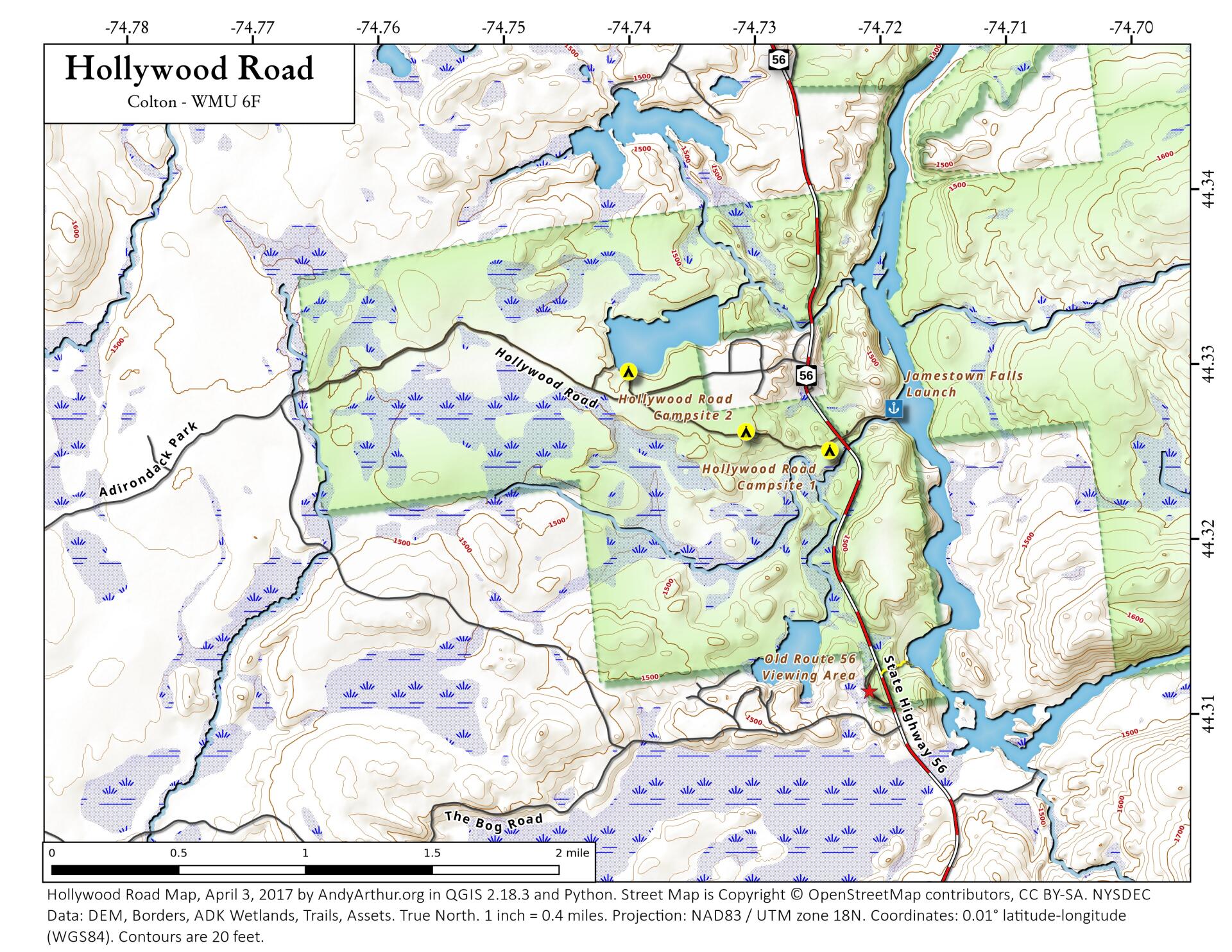
Map: Hollywood Road
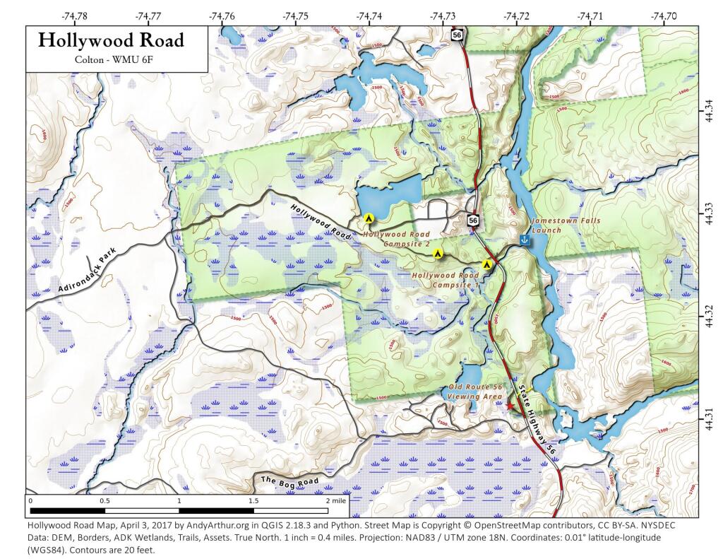
Download a High Resolution JPEG Image of the Hollywood Road or an Adobe Acrobat Printable PDF of the Hollywood Road.

Bookmark my free Interactive GPS Map for your phone:
https://andyarthur.org/ny
... shows your location as a blue dot in relationship to campsites, trails, state land. This online map requires cell service, won't work in remote country, so also bring a paper map.
Free Download of New & Historical USGS 1:24k Topograpic Maps
Interactive maps with backcountry and roadside camping: New York, Pennsylvania, West Virginia & Vermont. List of NYS DEC Lean-Tos and Firetowers.
Google Spreadsheet with Roadside, Primitive and Pay Campsites
More about Raquette River Wild Forest...
The Raquette River Wild Forest consists of lands laying west of the Lassiter Main Haul
Road and several smaller detached parcels. These detached parcels include; Garlough,
Stark, Catamount and Parameter, all lands acquired from Niagara Mohawk.
The Raquette-Jordan Boreal Primitive Area includes State lands laying east and south of
the Lassiter Main Haul Road and west of the St. Lawrence-Franklin County line. The
State owned lands comprising the Raquette River Corridor from the Colton-Piercefield
town line to the dam at Piercefield Flow are also part of this Primitive Area. The corridor
is generally 500 feet wide from the high water line on both banks of the river.
http://www.dec.ny.gov/lands/22573.html
Maps and Interactives
Racquette River Campsites
Hollywood Road
... photos, maps and other content from from Raquette River Wild Forest.