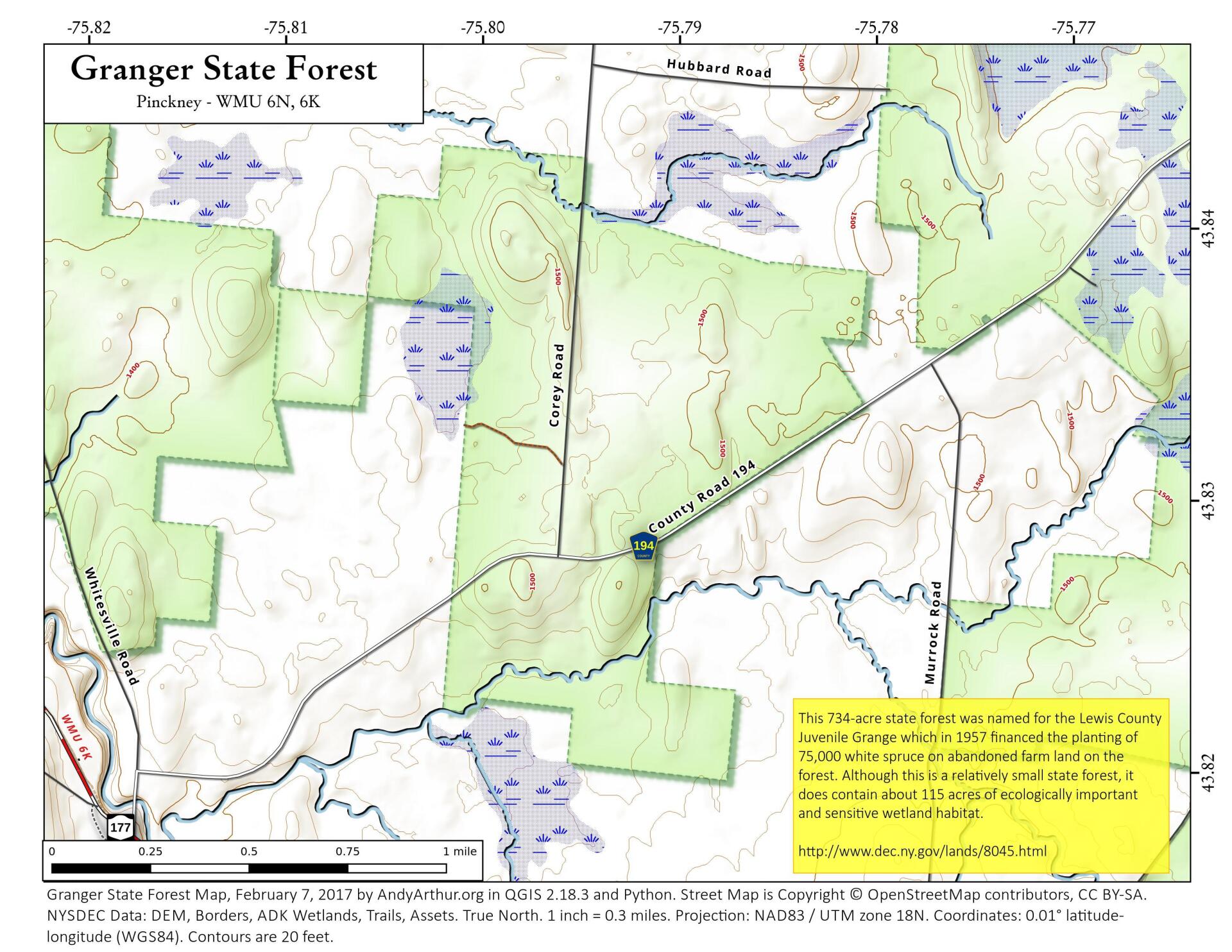
Map: Granger State Forest

Download a High Resolution JPEG Image of the Granger State Forest or an Adobe Acrobat Printable PDF of the Granger State Forest.

Bookmark my free Interactive GPS Map for your phone:
https://andyarthur.org/ny
... shows your location as a blue dot in relationship to campsites, trails, state land. This online map requires cell service, won't work in remote country, so also bring a paper map.
Free Download of New & Historical USGS 1:24k Topograpic Maps
Interactive maps with backcountry and roadside camping: New York, Pennsylvania, West Virginia & Vermont. List of NYS DEC Lean-Tos and Firetowers.
Google Spreadsheet with Roadside, Primitive and Pay Campsites
More about Delmar, NY...
Aerial Photos
Fuera Bush 1952
Greenville 1952
Lackawanna Steel (1963 vs. 2018)
Maps and Interactives
Year Built – City of Beacon
Warrensburg, NY 1895
Wade Road Extension
Verrazano Bridge Bay Ridge Ramp Chages
US 219 —NY Thruway Split in West Seneca
Tropical Storm Fred kind of kept us in the clouds today
Tribes Hill Bridge Dam
Traffic Counts – Saranac Lake
Traffic Counts in Greenville
Traffic Counts – Delmar
Traffic Counts Area Around Trans Manhattan Expressway
Tionesta Scenic Area
The Normans Kill Collapse and Rerouting in Early 2000s
Terra – September 11, 2021
Terra – August 30, 2021
Suomi National Polar-Orbiting Partnership VIIRS – July 19, 2023
Style Bridges Highway in Franconia Notch
State Fairgrounds and Solvay 1939
Roughly half of Middleburgh is in the flood plain
Renovo – West Branch Susquehanna River
Pulpit Rock
Past two days have been rather cloudy – May 7/8, 2021
Normansville 1927
NOAA Radar
Night of March 22, 2021
... photos, maps and other content from from Delmar, NY.