Map: Franklin Falls Pond - Saranac River Campsites
Download a High Resolution JPEG Image of the Franklin Falls Pond - Saranac River Campsites or an Adobe Acrobat Printable PDF of the Franklin Falls Pond - Saranac River Campsites.
About Map: Franklin Falls Pond - Saranac River Campsites ....
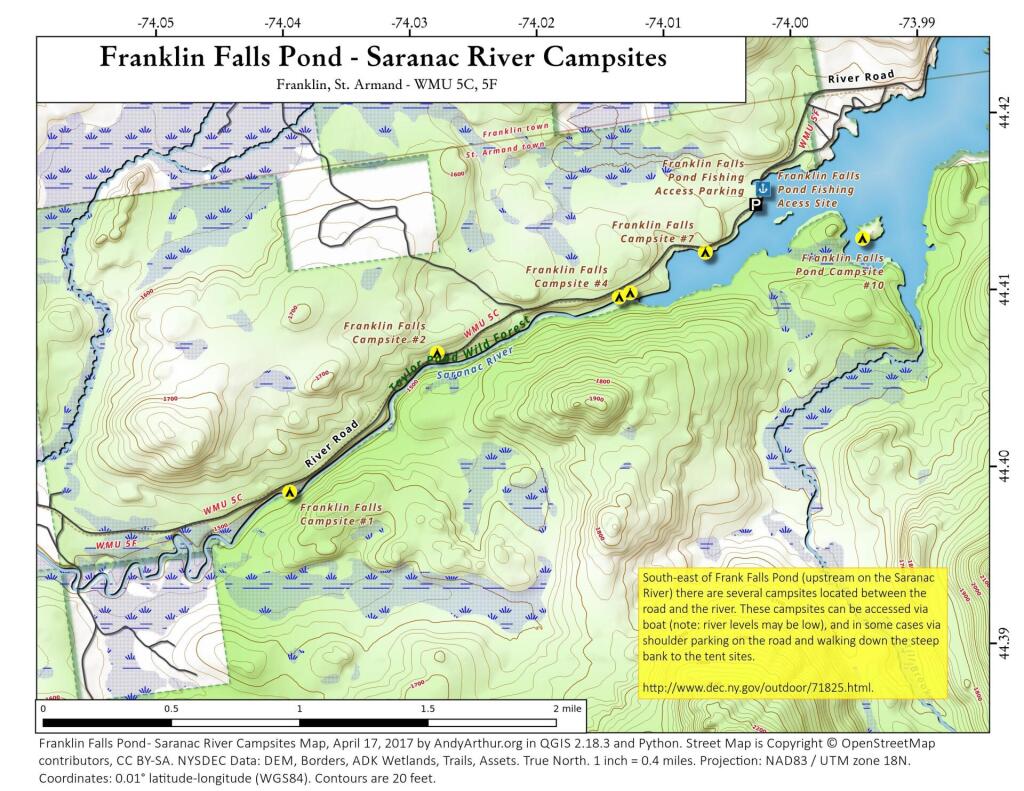
This shows the campsites south-west of the Franklin Falls Pond/Reservoir. The Saranac River at this point is mostly navigable at higher level flows but it is shallow with lots of big boulders and some rapids. You will be hoping in out of your canoe. Most of the campsites can also be accessed by parking on the shoulder of the road and climbing down a steep bank to campsites along the shoreline.

Bookmark my free Interactive GPS Map for your phone:
https://andyarthur.org/ny
... shows your location as a blue dot in relationship to campsites, trails, state land. This online map requires cell service, won't work in remote country, so also bring a paper map.
Free Download of New & Historical USGS 1:24k Topograpic Maps
Interactive maps with backcountry and roadside camping: New York, Pennsylvania, West Virginia & Vermont. List of NYS DEC Lean-Tos and Firetowers.
Google Spreadsheet with Roadside, Primitive and Pay Campsites
More about Franklin Falls Pond...
Franklin Falls Pond is a 439-acre (178 ha), 2.7-mile (4.3 km) long pond created by damming the Saranac River three miles (5 km) northeast of Saranac Lake in the Adirondack Mountains of northern New York State, USA.
http://en.wikipedia.org/wiki/Franklin_Falls_Pond
Maps and Interactives
Franklin Falls Reservior
Franklin Falls Pond – Saranac River Campsites
Franklin Falls Pond
... photos, maps and other content from from Franklin Falls Pond.
1 Comment
Actually I just wanted to ask you if you know how to reserve a camp site on Franklyn Falls Pond?
Appreciate your insights, thanks!
You don’t reserve a campsite. Just show up there, first come, first serve.