Map: Downerville State Forest (Trails)

Download a High Resolution JPEG Image of the Downerville State Forest (Trails) or an Adobe Acrobat Printable PDF of the Downerville State Forest (Trails).

Bookmark my free Interactive GPS Map for your phone:
https://andyarthur.org/ny
... shows your location as a blue dot in relationship to campsites, trails, state land. This online map requires cell service, won't work in remote country, so also bring a paper map.
Free Download of New & Historical USGS 1:24k Topograpic Maps
Interactive maps with backcountry and roadside camping: New York, Pennsylvania, West Virginia & Vermont. List of NYS DEC Lean-Tos and Firetowers.
Google Spreadsheet with Roadside, Primitive and Pay Campsites
More about Downersville State Forest...
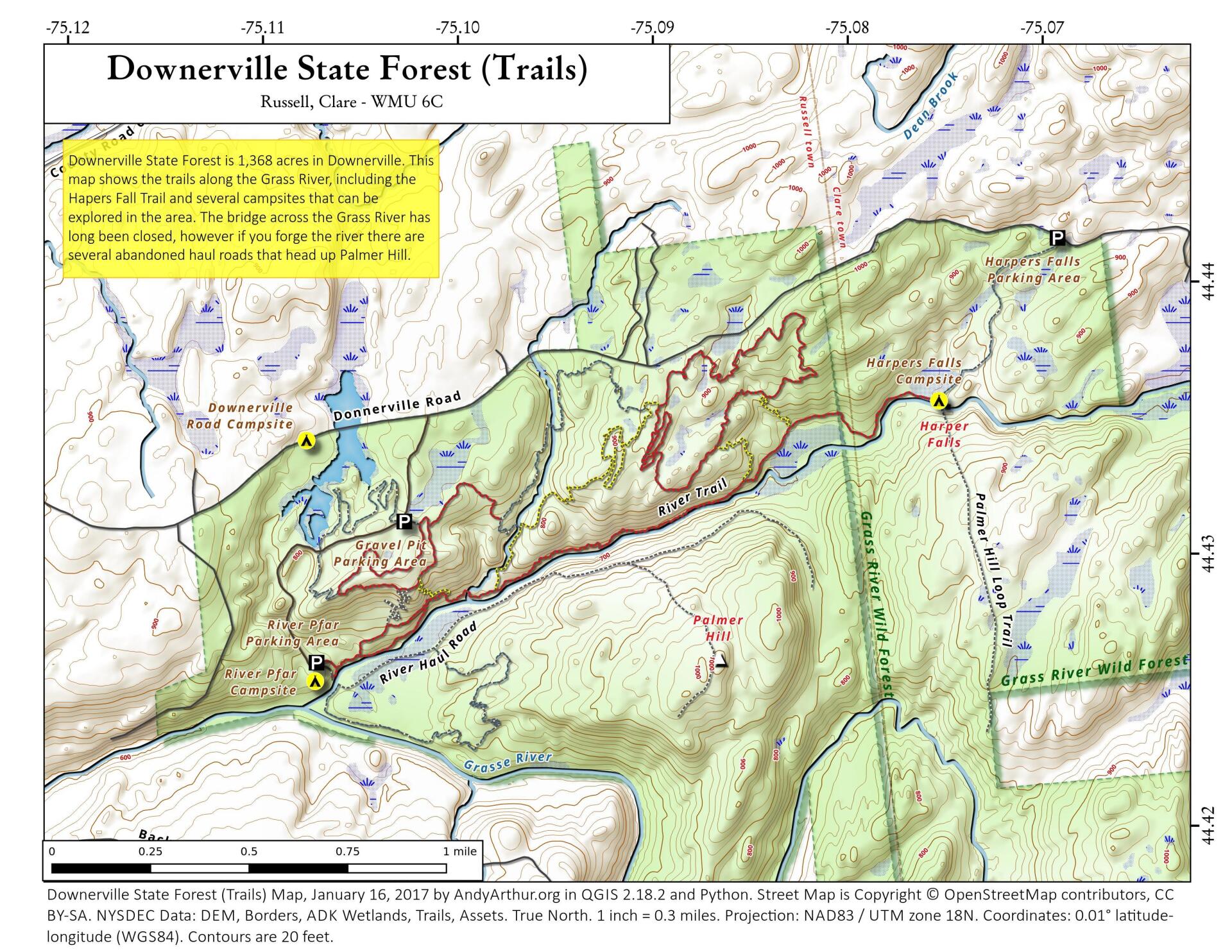
The Downersville or Donnersville State Forest is located in the Town of Russell on the banks of the Grass River, just outside of the Adirondack Park's Grass River Wild Forest.
It is 1,638 acres, has one roadside campsite along a swampy pond, and several miles of trails to explore the gorge and Grass River. The trails south of Grass River can be difficult to access depending on the water levels (see DEC website for details).
http://www.dec.ny.gov/lands/97736.html
Maps and Interactives
Downerville State Forest
Downerville State Forest (Trails)
... photos, maps and other content from from Downersville State Forest.