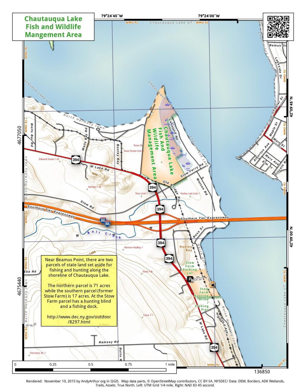
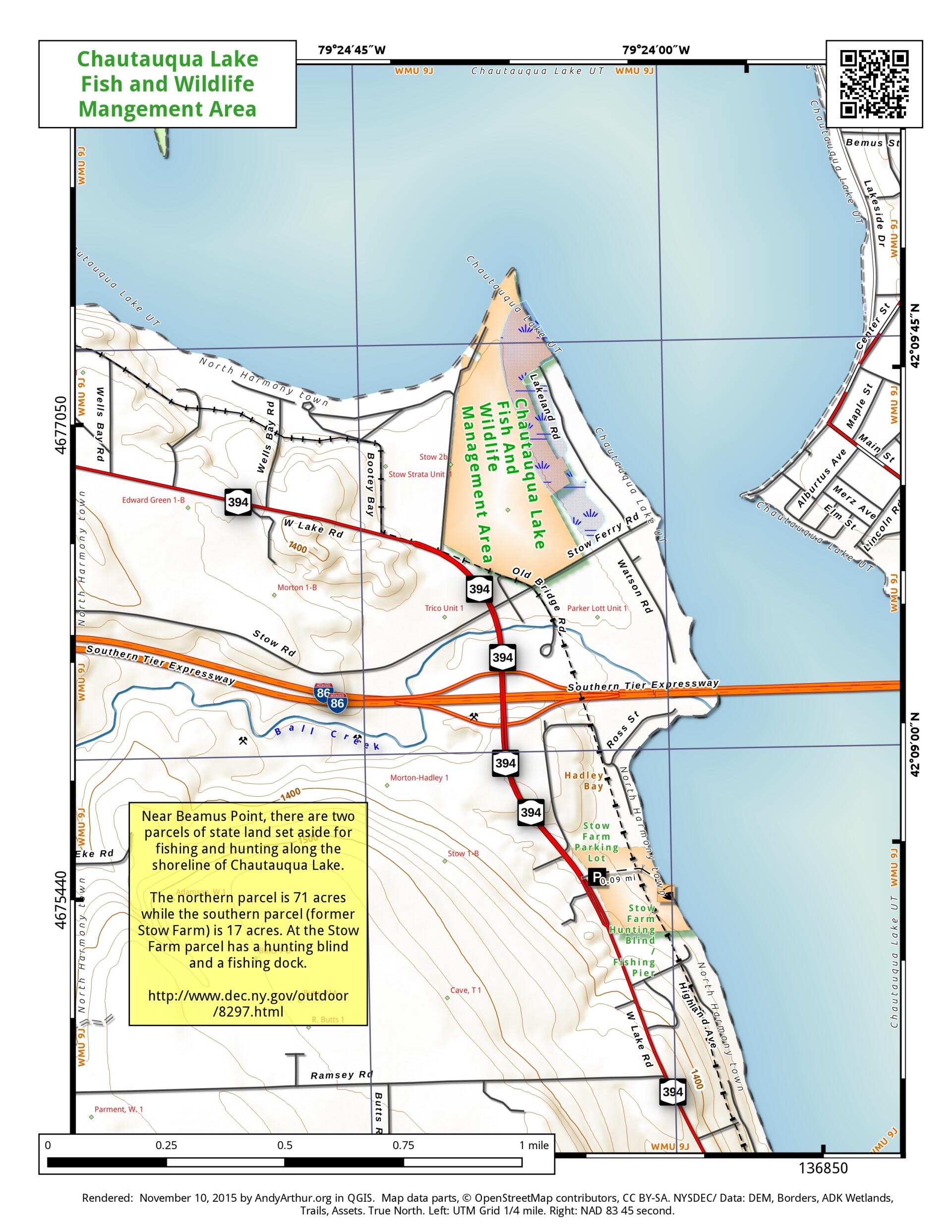
Map: Chautauqua Lake Fish and Wildlife Mangement Areas
Download a High Resolution JPEG Image of the Chautauqua Lake Fish and Wildlife Mangement Areas or an Adobe Acrobat Printable PDF of the Chautauqua Lake Fish and Wildlife Mangement Areas.

Bookmark my free Interactive GPS Map for your phone:
https://andyarthur.org/ny
... shows your location as a blue dot in relationship to campsites, trails, state land. This online map requires cell service, won't work in remote country, so also bring a paper map.
Free Download of New & Historical USGS 1:24k Topograpic Maps
Interactive maps with backcountry and roadside camping: New York, Pennsylvania, West Virginia & Vermont. List of NYS DEC Lean-Tos and Firetowers.
Google Spreadsheet with Roadside, Primitive and Pay Campsites
More about Chautauqua County...
Maps and Interactives
North Harmony State Forest
Land Use in Chautauqua County
Jamestown, New York 1941/42
Chadakoin River
Bemus Point Bridge
Chautauqua County
Stockton State Forest
Panama State Forest
North Harmony – Whalen Memorial State Forest
Mount Pleasant State Forest
Hill Higher State Forest
Harris Hill State Forest
Clay Pond Wildlife Management Area
Chautauqua Lake Fish and Wildlife Mangement Areas
Chautauqua Gorge State Forest
Canadaway Creek Wildlife Management Area
Boutwell Hill State Forest
Alder Bottom WMA
Alder Bottom Wildlife Management Area
... photos, maps and other content from from Chautauqua County.