Map: Buck Mountain

Download a High Resolution JPEG Image of the Buck Mountain or an Adobe Acrobat Printable PDF of the Buck Mountain.

Bookmark my free Interactive GPS Map for your phone:
https://andyarthur.org/ny
... shows your location as a blue dot in relationship to campsites, trails, state land. This online map requires cell service, won't work in remote country, so also bring a paper map.
Free Download of New & Historical USGS 1:24k Topograpic Maps
Interactive maps with backcountry and roadside camping: New York, Pennsylvania, West Virginia & Vermont. List of NYS DEC Lean-Tos and Firetowers.
Google Spreadsheet with Roadside, Primitive and Pay Campsites
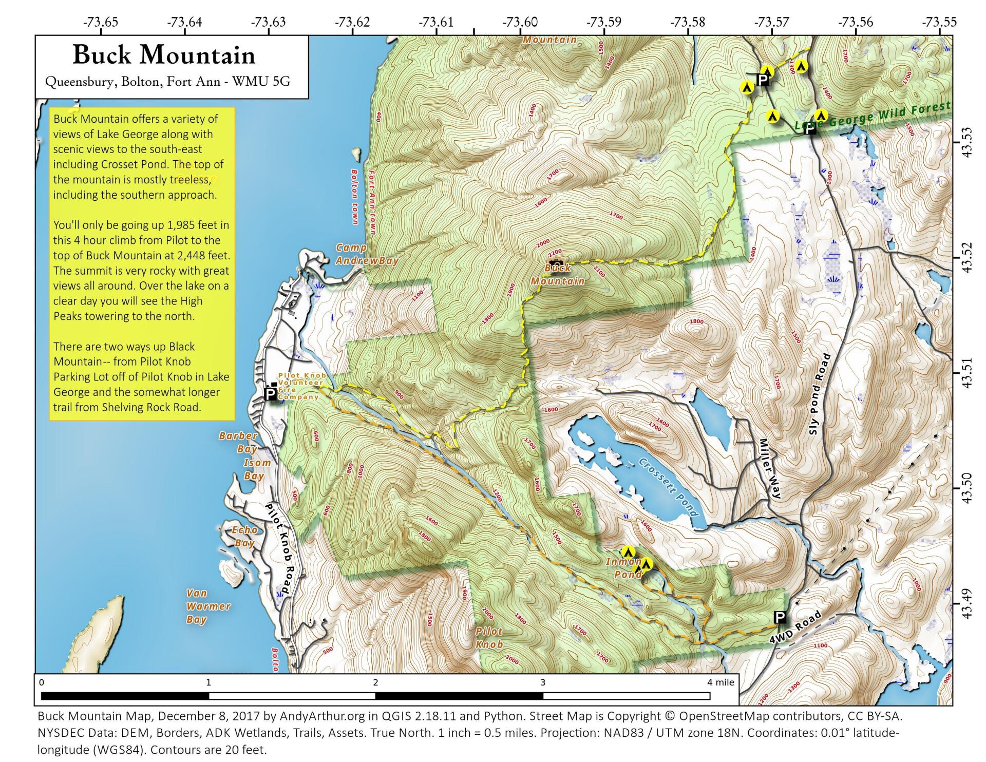
More about Buck Mountain...
You'll only be going up 1,985 feet in this 4 hour climb from Pilot to the top of Buck Mountain at 2,448 feet. The summit is very rocky with great views all around. Over the lake on a clear day you will see the High Peaks towering to the north.
... photos, maps and other content from from Buck Mountain.