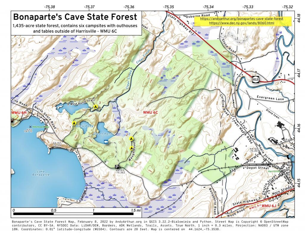
Map: Bonaparte's Cave State Forest
Download a High Resolution JPEG Image of the Bonaparte's Cave State Forest or an Adobe Acrobat Printable PDF of the Bonaparte's Cave State Forest.

Bookmark my free Interactive GPS Map for your phone:
https://andyarthur.org/ny
... shows your location as a blue dot in relationship to campsites, trails, state land. This online map requires cell service, won't work in remote country, so also bring a paper map.
Free Download of New & Historical USGS 1:24k Topograpic Maps
Interactive maps with backcountry and roadside camping: New York, Pennsylvania, West Virginia & Vermont. List of NYS DEC Lean-Tos and Firetowers.
Google Spreadsheet with Roadside, Primitive and Pay Campsites
More about Bonaparte's Cave State Forest...
s it's name would indicate, this 1,435-acre state forest and the surrounding countryside have historical roots tied to Napoleon Bonaparte. Local legend, along with some historical fact, has it that Napoleon Bonaparte's brother and his family escaped from Europe to this area after his famous brother was arrested. It is said that they eluded hired assassins by hiding out in the rocky ledges and small caves on the northwest edge of what is today known as Green Pond. Most of this forest is natural hard maple, red maple, hemlock, basswood and a small but unique component of black ash. Black ash is harvested locally and is used by artisans in the making of baskets.
http://www.dec.ny.gov/lands/8060.html
Maps and Interactives
Bonaparte’s Cave State Forest
Bonapartes Cave State Forest – New Camping Opporunties
... photos, maps and other content from from Bonaparte's Cave State Forest.