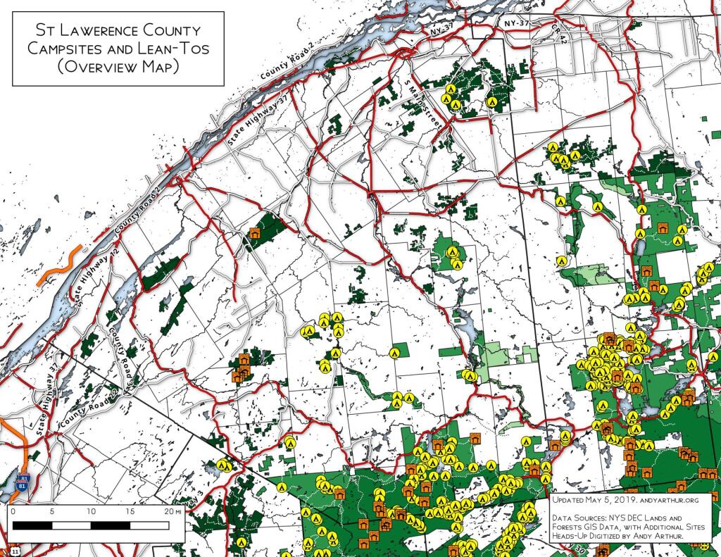
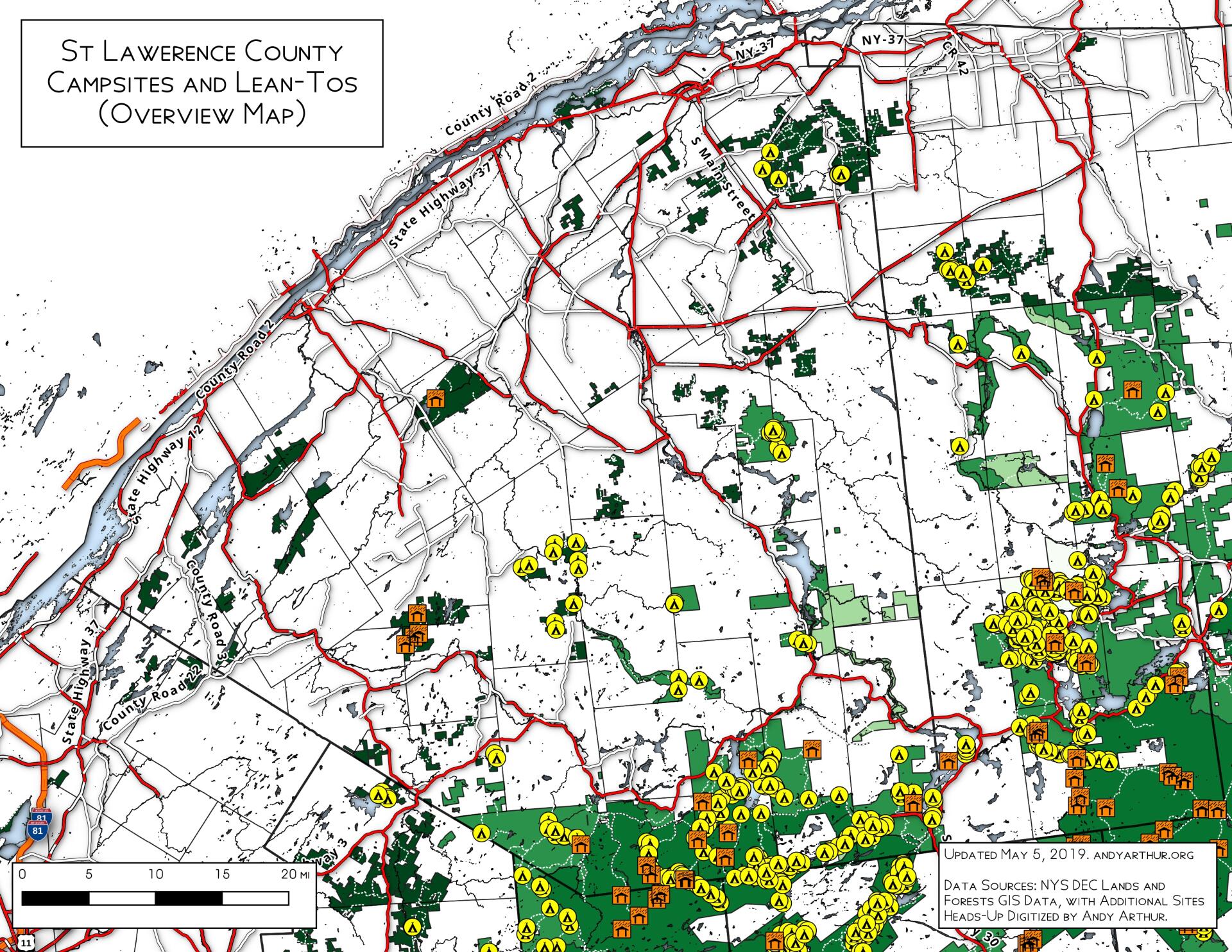
Map: St Lawerence County Primative Campsites And Lean Tos
Download a High Resolution JPEG Image of the St Lawerence County Primative Campsites And Lean Tos or an Adobe Acrobat Printable PDF of the St Lawerence County Primative Campsites And Lean Tos.
About Map: St Lawerence County Primative Campsites And Lean Tos ....
This map shows the locations of campsites on the St. Lawerence Flat Lands and surrounding areas in the north-western Adirondacks. I believe this is a fairly complete map for state land up that way, please see individual state forests for details.

Bookmark my free Interactive GPS Map for your phone:
https://andyarthur.org/ny
... shows your location as a blue dot in relationship to campsites, trails, state land. This online map requires cell service, won't work in remote country, so also bring a paper map.
Free Download of New & Historical USGS 1:24k Topograpic Maps
Interactive maps with backcountry and roadside camping: New York, Pennsylvania, West Virginia & Vermont. List of NYS DEC Lean-Tos and Firetowers.
Google Spreadsheet with Roadside, Primitive and Pay Campsites
More about Camping...
Camping. Spending time in the woods. Having a fire. What can go wrong?
Maps and Interactives
Slate Run Road / Gamble Run Road Campsites
Places I Camped in 2022
Places I Camped in 2020
Places I Camped in 2021
St Lawerence County Primative Campsites And Lean Tos
... photos, maps and other content from from Camping.