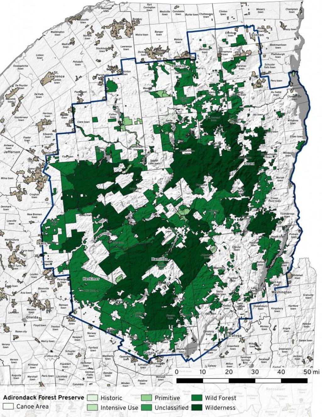
Adirondack Forest Preserve
A look at the forest preserve based on the latest GIS data from the DEC, September 2021.
A look at the forest preserve based on the latest GIS data from the DEC, September 2021.
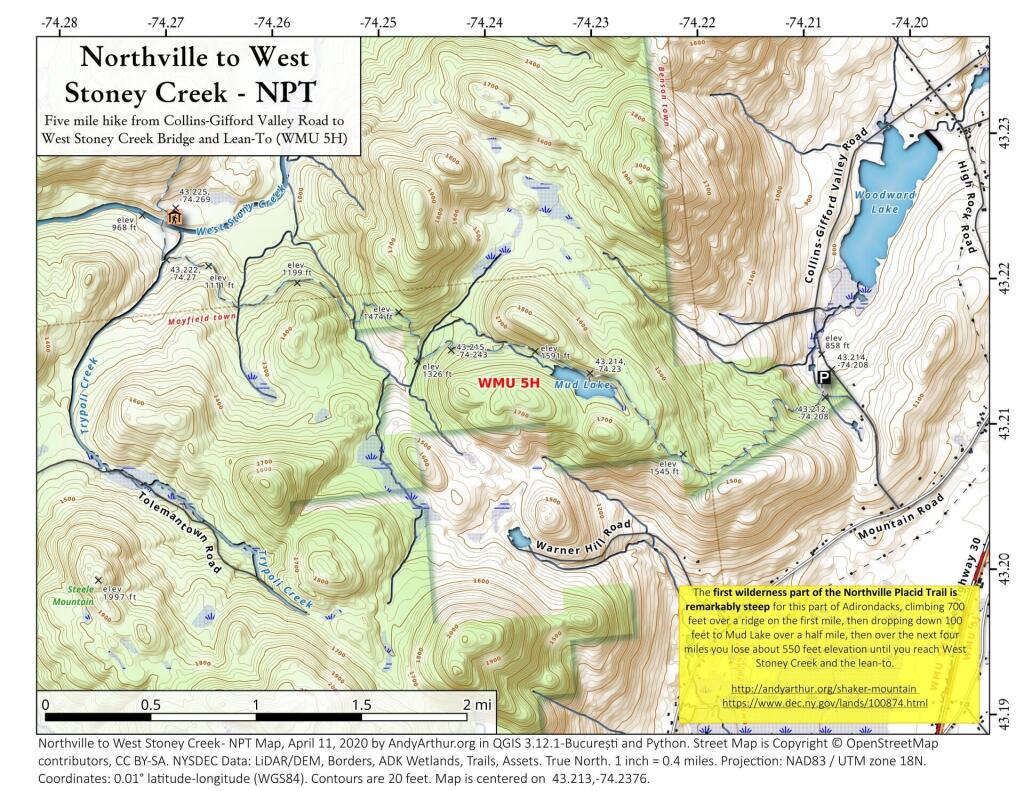
The first wilderness part of the Northville Placid Trail is remarkably steep for this part of Adirondacks, climbing 700 feet over a ridge on the first mile, then dropping down 100 feet to Mud Lake over a half mile, then over the next four miles you lose about 550 feet elevation until you reach West Stoney Creek and the lean-to.
https://andyarthur.org/shaker-mountain
https://www.dec.ny.gov/lands/100874.html

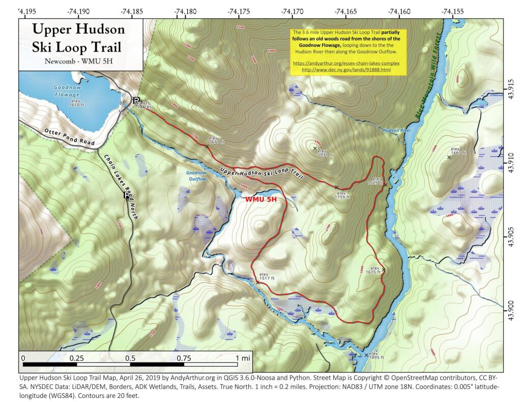
The Upper Hudson Ski Loop trail is 4.2 miles and parallels the Goodnow River (north-side) to the Hudson River. The trail heads north along the Hudson for a short distance before looping back and reconnecting with itself 0.5 mile from the trailhead