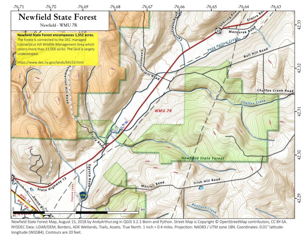
Search Results for: map field
South Buffalo Brownfield Remediation Sites
TSDR Hazardous Waste Sites on National Priorities List (NPL) represents georeferenced data for 1,572 NPL Superfund sites. The purpose is to provide an easily accessible data set of polygons for hazardous waste sites in the United States which can be used to identify nearby populations and assess their potential risk. Dataset Summary The Agency for Toxic Substances and Disease Registry (ATSDR) Hazardous Waste Sites on National Priorities List (NPL) is a database providing georeferenced data for 1,572 National Priorities List (NPL) Superfund sites. Data Source: NYS Department of State. http://opdgig.dos.ny.gov/arcgis/rest/services/NYOPDIG/PhysicalData/MapServer/41
West Winsfield
That little village in very southern-most Herkimer County that I often drive through thinking, Charles Baker State Forest can't be that far away, and it's getting dark out and I need to set up camp.
Brownfield Remediation Sites on Albany
Earlier in the week we looked at South Buffalo, and now a bit closer in the Albany area.
Data Source: NYS Department of State. https://opdgig.dos.ny.gov/
General Electric – Pittsfield
Brownfields in Schenectady
I-91 Riverdale Street Interchange in Springfield
Compact. Check. Creative. Check. With a dangerous weave condition. Check.