The fire helped pass the time on the cold and damp evenings
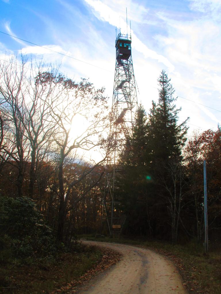
Back in the 1963, the Forest Service ran into a problem with their 60-foot Backbone Mountain Firetower, constructed in 1922 by State of West Virginia.The trees had grown too tall around the tower, and it was decided to scrap the 40-year old tower and replace it with a 100 foot Aermotor tower, with the ability to climb to the roof of the tower via a ladder for even better views (!!) Aermotor offered towers up to 175 feet.
The Forest Service bought a 100 foot tower, name Olson Firetower, to put on the mountain, which is still an impressive height as the tallest fire-tower in New York State is only 70 foot (Wakely Mountain). It's a good climb for sure at 30 feet higher then Wakely and is 133 steps to the cabin.
The circa-1963 Olson Tower is named after Ernst B. Olson in recognition of 28 years of fire control and conservation program service to Monongahela National Forest.
Taken on Thursday October 26, 2023 at Olson Firetower.

Farm country in hills north of Parsons, near an area known as Lead Mine, WV.
This area is famous as it was where several photos of the Vagabonds -- Thomas Edison, John Burroughs, Henry Ford, and Harvey Firestone -- were taken in 1918 of them camping in hills. About two decades later this area was home to a large CCC Camp that worked on reforestation projects in the area.
As seen from the Olson Fire Tower.
Taken on Thursday October 26, 2023 at Monongahela National Forest.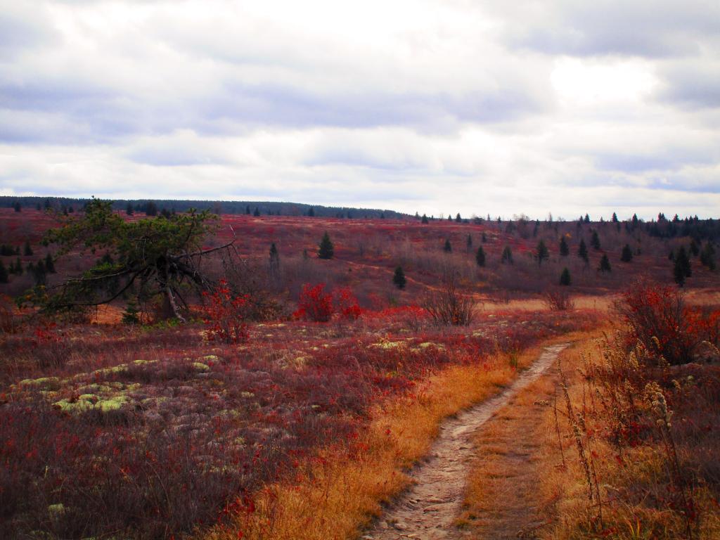
The heath barrens of Dolly Sods. Once an old-growth forest, after it was logged at the turn of century, it became ravaged by decades of fires and became over time permanently huckleberry plains or heath barrens.
The cold and wind, along with loss of organic matter made it impossible for full forests to regrow, giving it the characteristic landscape of Northern Canada or Alaska tundra.
Taken on Friday October 27, 2023 at Dolly Sods Wilderness.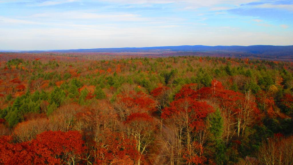
You might think the this area looks remarkably flat, but looks can be deceiving from the Olson Firetower which is on Backbone Mountain at 3,650 feet.
The range in the distance is the Allegheny Front (the Eastern Continental Divide), indeed it tops out at above 4,200 feet elevation with Petersburgh on the east side beyond it only about 1,000-1,500 feet elevation. The west side of Allegheny Front isn't as big of a drop, but the Canaan Valley is still only 3,200-3,500 feet elevation.
In the middle you can see the smoke stacks of the Mount Storm Coal Power Plant, the largest in the northeastern West Virginia which is a major electricity source for the Greater Washington DC area.
Taken on Thursday October 26, 2023 at Monongahela National Forest.