Search Results for: moon pond state forest

It’s unofficially summer 2023 πŸ–

Heading up to the mid 90s by mid-week to kick off dairy month then cooling down by the weekend after thunderstorms on Friday. But in the mean time beautiful weather for the work week and that freshly cut hay smells amazing.

Good morning! Happy Tuesday. Sunny and 56 degrees in Delmar, NY. 🌞 There is a south-southeast breeze at 5 mph. πŸƒ.

Out walking 🚢 bright an early right around 6 o’clock 6⃣ but truth he told with the sunrise this early these days it ain’t that early. I have my doctors appointment at 8:30 and I plan to walk there after breakfast and a shower πŸ§‘‍βš•οΈπŸ©Ί so I wanted to make sure I had sufficient time this morning. Health-wise I feel great but I figured getting checked out isn’t a bad thing especially as it’s free and I’m doing a lot more exercise and healthy activity.

Today will be sunny 🌞, with a high of 79 degrees at 3pm. Four degrees above normal, which is similar to a typical day around June 12th. South wind 5 to 7 mph. A year ago, we had cloudy skies. It was somewhat humid. The high last year was 88 degrees. The record high of 92 was set in 1987.

I’m thinking today would be a good morning for eggs, spinach and feta 🍳 to start out the day with a good punch. I also found some younger garlic mustard in the woods I foraged that I want to add to the meal 🍴. With summer and eating healthy I’m going to try to forage more food. It’s surprising how much is out there if you look. πŸ‘€ Wild Juneberries soon are a delicious treat. πŸ“ Soon!

Solar noon 🌞 is at 12:54 pm with sun having an altitude of 69.1° from the due south horizon (-1.7° vs. 6/21). A six foot person will cast a 2.3 foot shadow today compared to 2.2 feet on the first day of summer. The golden hour πŸ… starts at 7:43 pm with the sun in the west-northwest (294°). πŸ“Έ

The sunset is in the west-northwest (301°) with the sun dropping below the horizon at 8:25 pm after setting for 3 minutes and 23 seconds with dusk around 8:58 pm, which is 50 seconds later than yesterday. πŸŒ‡ At dusk you’ll see the Waxing Gibbous πŸŒ” Moon in the south (170°) at an altitude of 41° from the horizon, 244,204 miles away. πŸš€ The best time to look at the stars is after 9:43 pm. At sunset, look for clear skies πŸŒ„ and temperatures around 73 degrees. There will be a south breeze at 6 mph. Today will have 15 hours and 6 minutes of daytime, an increase of one minute and 24 seconds over yesterday.

Tonight will have patchy smoke between 11pm and 1am. Mostly clear πŸŒƒ, with a low of 49 degrees at 6am. Four degrees below normal, which is similar to a typical night around May 19th. South wind 6 to 9 mph. In 2022, we had mostly clear skies. It was humid. It got down to 65 degrees. The record low of 34 occurred back in 1961.

A picture perfect weekend on tap. 😎 Not super warm but still very summer like. Saturday, a chance of showers after 2pm. Partly sunny, with a high near 78. Chance of precipitation is 30%. Maximum dew point of 59 at 7am. Sunday, mostly sunny, with a high near 77. Maximum dew point of 51 at 8pm. Typical average high for the weekend is 76 degrees.

I’m heading out of town this weekend πŸ• but how far I go is yet to be decided. Hammock Camping offers more options close to home. I’ve thought about paddling Lilly Lake in the Adirondacks or maybe Rensslearville State Forest and spending at least one night hammock camping at the new Hillcross Parcel to watch the stars over the Catskills from the pond.

As previously noted, there are 3 weeks until Primary Day πŸ—³οΈ when the sun will be setting at 8:38 pm with dusk at 9:11 pm. On that day in 2022, we had mostly sunny and temperatures between 82 and 47 degrees. Typically, the high temperature is 81 degrees. We hit a record high of 97 back in 1953.

Canastota Railroad Bridge

Memorial Day Weekend, Day Two 2023 πŸ‡ΊπŸ‡Έ β›Ί 🌲

While it would have been nice to get out of town for the Memorial Day Weekend, I’m enjoying the light breeze camping in the back country of Cole Hill, eating good healthy and delicious meals cooked over the fire and enjoying the light of a fire, the moon and candles in the evening. I’m sure if I had gone to the Adirondacks I would have been dealing with a lot more black flies to say nothing of the long drive, traffic and probably not getting my dream campsite. Onwards to Juneteenth Weekend, lol.

Good morning! Happy Sunday. Sunny and 68 degrees at the Cole Hill State Forest. 🌞 Calm wind. The dew point is 46 degrees. Warming up quickly after a somewhat cool night. I probably could have used another blanket for hammock camping last night.

Today will be sunny 🌞, with a high of 82 degrees at 4pm. Seven degrees above normal, which is similar to a typical day around June 24th. Maximum dew point of 47 at 11am. Calm wind becoming northwest 5 to 8 mph in the afternoon. That breeze is nice and it’s not expected to be real humid. A year ago, we had partly cloudy skies in the morning, which became cloudy by afternoon. The high last year was 80 degrees. The record high of 93 was set in 2016. I think that year I was camping in the Green Mountain National Forest and spending much of the day at the beach at Grout Pond. There was a dusting of snow in 1902.❄

Solar noon 🌞 is at 12:55 pm with sun having an altitude of 68.8Β° from the due south horizon (-2Β° vs. 6/21). A six foot person will cast a 2.3 foot shadow today compared to 2.2 feet on the first day of summer. The golden hour πŸ… starts at 7:43 pm with the sun in the west-northwest (294Β°). πŸ“Έ The sunset is in the west-northwest (301Β°) with the sun dropping below the horizon at 8:24 pm after setting for 3 minutes and 21 seconds with dusk around 8:57 pm, which is 52 seconds later than yesterday. πŸŒ‡ At dusk you’ll see the Waxing Gibbous πŸŒ” Moon in the south-southwest (199Β°) at an altitude of 51Β° from the horizon, 248,997 miles away. πŸš€ The best time to look at the stars is after 9:41 pm. At sunset, look for clear skies πŸŒ„ and temperatures around 71 degrees. The dew point will be 51 degrees. There will be a west-northwest breeze at 7 mph. Today will have 15 hours and 3 minutes of daytime, an increase of one minute and 30 seconds over yesterday.

Tonight will be mostly clear πŸŒƒ, with a low of 51 degrees at 4am. One degrees below normal, which is similar to a typical night around May 26th. Maximum dew point of 51 at 8pm. Northwest wind around 7 mph. In 2022, we had partly cloudy skies. It got down to 51 degrees. The record low of 34 occurred back in 1956.

I took my bike to Downtube and they told me that they didn’t think it warranted a professional rebuild 🚲 due to numerous components needing replacement to get it up and running well. They were more than happy to show me the latest 2023 models which run about $800 after tax and destination charges, but suggested my bicycle might still be a fun project to rebuild myself even if there are some components – namely the gas suspension which is bad and will fail catastrophically at some point in the future. They pointed me in the direction of the Albany Bicycle Rescue which offers free classes on bicycle repair on Tuesday.

Looking ahead, there are 2 weeks until the Gas Up Day 2 🚜 when the sun will be setting at 8:35 pm with dusk at 9:08 pm. On that day in 2022, we had partly sunny and temperatures between 78 and 50 degrees. Typically, the high temperature is 78 degrees. We hit a record high of 94 back in 1947.

Brief Rainshower On A Hot Day

May 6, 2023 Morning

Good morning! Happy Saturday. β›Ί

Made it to the May camping trip, the first quote unquote summer camping season. The black flies are swarming but as far as I can tell they aren’t biting. I’m glad I’m not getting eaten alive in the Adirondacks and truth be told it’s a lot quieter than camping on NY 8 East Branch Sacandaga River with all the road traffic.

Kind of a chilly start to the weekend, especially with the wind. Mostly sunny and 47 degrees at the Burnt-Rossman State Forest. There is a northwest breeze at 6 mph. πŸƒ.

I kind of played hookie and snuck out of work at 1 pm on Friday, that is with the big directors permission, β›Ί I wanted to get up to camp early so I could ensure I could get the Duck Pond campsite which sometimes is taken, and then have time to do some hiking before dark. Plus I had the time I would otherwise loose come next Wednesday so I made the leap.

I managed to forget my day pack πŸŽ’ at home. I realized it yesterday when I was in Middleburgh. What to use for hiking to have food and carrying water? πŸ’¦ I figured out a chair bag would work for that slung over my shoulder. It looks a bit odd but works okay. I think I need to update my packing list – things have changed but my packing list hasn’t kept up with the changes. πŸ“ƒ

Today will be sunny 🌞, with a high of 63 degrees at 5pm. Five degrees below normal, which is similar to a typical day around April 24th. Northwest wind 6 to 11 mph. A year ago, we had mostly sunny skies. The high last year was 63 degrees. The record high of 89 was set in 1930. There was a dusting of snow in 1994.❄

Black flies are out and swarming 🐜 but they aren’t biting. If it’s anything like yesterday, get into the darker parts of the woods away from water or come dusk they’ll be gone. I’m sure it would be worse in the Adirondacks.

But regardless it’s a nice morning. πŸŒ… I woke up at six o’clock like usual but decided after peeing to get some more sleep. Then it was coffee β˜• and oatmeal – banana pancake πŸ₯ž mix topped with blueberries. Going to read πŸ“– and listen to a podcast until around 10:30 then start a road hike, heading back to the woods 🌲🌳 after spring turkey πŸ¦ƒ closes at noontime. I want to check out the Rossman Hill Leanto and Looking Glass Pond 🎣 and then maybe head down to Panther Hollow along the Long Path.

Solar noon 🌞 is at 12:55 pm with sun having an altitude of 64Β° from the due south horizon (-6.9Β° vs. 6/21). A six foot person will cast a 2.9 foot shadow today compared to 2.2 feet on the first day of summer. The golden hour πŸ… starts at 7:24 pm with the sun in the west-northwest (287Β°). πŸ“Έ

Hsd a loose connection on the inverter last night πŸ”‹ which kept it tripping out due to under voltage. Tightened it up and now it seems great. After all these years I’m really figuring out the system working out all the bugs. πŸ› That said, I’m already considering what I might do different on a future truck. πŸ›» I was thinking about how much I miss having the little truck for navigating the back roads – I’m always careful about where I take Big Red as he’s tough to navigate on the narrow roads and sways a lot on the rough roads which I don’t want to break my big expensive truck on.

The sunset is in the west-northwest (294Β°) with the sun dropping below the horizon at 8:03 pm after setting for 3 minutes and 9 seconds with dusk around 8:34 pm, which is one minute and 6 seconds later than yesterday. πŸŒ‡ The best time to look at the stars is after 9:13 pm. At sunset, look for mostly clear skies πŸŒ„ and temperatures around 55 degrees. There will be a west-northwest breeze at 7 mph. Today will have 14 hours and 19 minutes of daytime, an increase of 2 minutes and 21 seconds over yesterday.

When I get back I want to do a wrap 🌯 with chicken πŸ” rice 🍚 tomato πŸ… and fresh spinach. Maybe include some tofu, mushrooms πŸ„ and hot sauce. Already my mouth is watering. πŸ˜‹ I was going to go that last night but I ended up doing fish with asparagus and tomato πŸ…. Also good. Next time I might bring more beer 🍻 and I might get a small package of cookies. πŸͺ I’m really trying to improve my diet but I think I can make exceptions in moderation especially if I’m planning a high activity day. 🦡That said in general I’m not going back on my now healthier and often more delicious eating habits.

Tonight will be mostly clear πŸŒƒ, with a low of 39 degrees at 5am. Six degrees below normal, which is similar to a typical night around April 21st. Southwest wind 3 to 7 mph. In 2022, we had mostly clear skies in the evening, which became partly cloudy by the early hours of the morning. It got down to 45 degrees. The record low of 29 occurred back in 1874.

Last night I did a nice hike πŸ‘£ down into Cole Hollow along the Long Path. Strangely enough I had never done much hiking down there. That Cole Hollow campsite β›Ί is pretty nice, I should keep it in mind especially if I’m going to Mine Kill Pool or planning to bicycle 🚲 ride in the Schoharie Valley. I feel like I could potentially ride right from there as the elevation is relatively low. Deep hollow though, no cell service or likely much radio service. Kind of like Betty Brook.

Too bad it was so cloudy yesterday night for the full πŸŒ• moon. It cleared out late but not until very late when I was in bed for the night. Maybe I can enjoy the moonlight tonight. I do enjoy how much quieter it is up here compared to what it would be on NY 8. Plus far less black flies, or maybe not they were really swarming last night when the sun was still up. It’s May everywhere.

Trying to upload some pictures this morning πŸ“Έ but the internet up here is a bit temperamental though at least I now have a card reader that allows me to upload photos taken by my good camera on the phone. πŸ“± But even that is a bit tricky as my phone doesn’t like the uppercase JPG extensions which force me to rename the files πŸ“‚ before I can even preview them on my phone.

Looking ahead, there are 7 weeks until Latest Sunset πŸŒ† when the sun will be setting at 8:40 pm with dusk at 9:13 pm. On that day in 2022, we had partly cloudy and temperatures between 86 and 61 degrees. Typically, the high temperature is 82 degrees. We hit a record high of 96 back in 1943.

 White Tulips

April 9, 2023 Night

To imagine I was angry that I forgot to buy tofu this week while shopping. πŸ›’

I realized how much I’ve changed in my forties. I’ve always been a bit on the dour side of things but I can’t imagine half the ways I’ve changed in my forties. The world is changing quickly but so am I too.

Good evening! Clear πŸŒƒ and 49 degrees in Delmar, NY. Calm wind. Just saw a shooting star 🌟.

That shooting star was bright as it burned on up in the atmosphere. πŸ’« Things are changing in the world today 🌎, although not all things are bad like the preservation of the lands off Cheese Hill Road as forever wild as an addition to Rennselearville State Forest. Found some more ticks on me after exploring more of the Hillcross Farm Parcel but I think I got them all off. 🐜

Tonight will be clear πŸŒƒ, with a low of 28 degrees at 5am. Seven degrees below normal, which is similar to a typical night around March 23rd. Calm wind. In 2022, we had mostly clear skies in the evening, which became cloudy by the early hours of the morning. It got down to 36 degrees. The record low of 21 occurred back in 1974.

I was thinking once it warms up and gets green out, I want to hammock camp β›Ί at the Hillcross Farm Parcel, now that it’s state land and sit down by the pond one summer evening and look at the stars over the Catskill Mountains.

Tonight will have a Waining Gibbous πŸŒ– Moon with 84% illuminated. The moon will rise at 11:48 pm. The Pink 🌸 Moon is on Wednesday, April 26. The darkest hour is at 12:58 am, followed by dawn at 5:56 am, and sun starting to rise at 6:25 am in the east (79Β°) and last for 2 minutes and 57 seconds. Sunrise is one minute and 41 seconds earlier than yesterday. πŸŒ„ The golden hour ends at 7:03 am with sun in the east (85Β°). Tonight will have 10 hours and 49 minutes of darkness, a decrease of 2 minutes and 49 seconds over last night.

Going to be a very mild week coming up, 🌸 first real preview of spring. Should be nice, so excited about sleeping with the windows open but not until tomorrow night. πŸ”³ Now that the evenings are longer it will be nice in the park, 🏞 to say nothing about sitting out back.

Tomorrow will be sunny 🌞, with a high of 65 degrees at 4pm. Eight degrees above normal, which is similar to a typical day around April 27th. Calm wind becoming northwest around 6 mph in the morning. A year ago, we had light rain in the morning, which became light rain by afternoon. The high last year was 49 degrees. The record high of 86 was set in 1922. 5.7 inches of snow fell back in 1961.❄

Tomorrow my truck gets serviced πŸ”§ with a whole bunch of stuff due for 100k. It’s running decently well this year and I want to get more years out of it if at all possible. πŸ›» Going to paint or at least prime over the really rusted parts of the undercarriage and wheel wells probably next weekend.

Already giving a little thought about my next vehicle, once again thinking about a small car or Prisus for easier parking πŸ…Ώ and saving money on longer trips but mostly because I don’t want to spend a fortune on a new vehicle and may want to switch over to more tent camping and backpacking as my health improves. πŸ• Big trucks are so expenses these days, or maybe I’ve just grown more cost sensitive in my advanced age. Priorities in your forties are different and a decade really is just a blink of an eye πŸ‘β€πŸ—¨.

In four weeks on May 7 the sun will be setting in the west-northwest (294Β°) at 8:03 pm,πŸŒ„ which is 31 minutes and 48 seconds later then tonight. In 2022 on that day, we had mostly cloudy and temperatures between 59 and 45 degrees. Typically, you have temperatures between 69 and 45 degrees. The record high of 92 degrees was set back in 1930.

Looking ahead, Average High is 60 🌷 is Next Sunday, 8 PM Sunset πŸŒ‡ is in 4 weeks, Mothers Day πŸ‘©β€ is in 5 weeks, Fathers Day πŸ‘¨ is in 9 weeks, Last Sunset After 8:30 PM πŸŒ† is in 14 weeks, 6:30 Sunrise πŸŒ‡ is in 22 weeks, Constitution Day πŸ“œ is in 23 weeks, October πŸŽƒ is in 25 weeks, Average High is 65 πŸ‚ is in 26 weeks, Average High is 40 🌨 is in 8 months, Earliest Sunset of the Year βŒ›οΈ is in 8 months, 7:15 AM Sunrise βŒ›οΈ is in 35 weeks and Christmas Eve πŸŽ… is in 37 weeks.

Across the Gulf

USGS Topographic Maps – Putnam to Suffolk

Counties: Albany to Delaware / Dutchess to Livingston / Madison to Otsego / Putnam to Suffolk / Sullivan to Yates

Browse Topographic Maps: Full State / Historical USGS Topographic Maps

Putnam County

PDF (50-60 MB Download) Historical USGS Topo Maps State Lands (Links to DEC Website) Towns (Percent of Town’s Area)
Current Brewster GeoPDF Map
1943 Map No. 123002, 1958 Map No. 123007, 1958 Map No. 123008, 1958 Map No. 123009, 1958 Map No. 137128, 1958 Map No. 137129 Great Swamp WMA, Bog Brook Unique Area, Cranberry Mountain WMA Patterson (52%), Southeast (62%)
Current Croton Falls GeoPDF Map
1944 Map No. 137748, 1960 Map No. 137197, 1960 Map No. 137749, 1960 Map No. 137750, 1960 Map No. 137751 NA Bedford (20%), Carmel (20%), Lewisboro (22%), North Salem (32%), Somers (74%), Southeast (6%)
Current Hopewell Junction GeoPDF Map
1957 Map No. 129768, 1957 Map No. 129769, 1957 Map No. 129770, 1981 Map No. 129767 NA Beekman (1%), East Fishkill (74%), Fishkill (14%), Kent (2%), Wappinger (27%)
Current Lake Carmel GeoPDF Map
1943 Map No. 130161, 1960 Map No. 130165, 1960 Map No. 130166, 1960 Map No. 130167, 1960 Map No. 130168 White Pond Multiple Use Area, Nimham Mountain Multiple Use Area, Big Buck Mountain Multiple Use Area Carmel (50%), Kent (53%), Patterson (17%), Southeast (21%)
Current Mohegan Lake GeoPDF Map
1956 Map No. 130593, 1956 Map No. 130594, 1956 Map No. 130595, 1956 Map No. 130596, 1956 Map No. 137454 Salt Hill State Forest Carmel (13%), Cortlandt (12%), Putnam Valley (25%), Somers (23%), Yorktown (67%)
Current Oscawana Lake GeoPDF Map
1956 Map No. 135907, 1956 Map No. 135908, 1956 Map No. 135909, 1956 Map No. 137493 California Hill State Forest Carmel (17%), East Fishkill (0%), Fishkill (1%), Kent (35%), Philipstown (13%), Putnam Valley (62%)
Current Pawling GeoPDF Map
1945 Map No. 135979, 1958 Map No. 135980, 1958 Map No. 135981, 1958 Map No. 135982, 1958 Map No. 136773, 1998 Map No. 136774 West Mountain State Forest, Great Swamp WMA, Cranberry Mountain WMA Dover (7%), Patterson (26%), Pawling (70%)
Current Peach Lake GeoPDF Map
1945 Map No. 135984, 1958 Map No. 135985, 1958 Map No. 135986, 1958 Map No. 135987, 1958 Map No. 135988, 1958 Map No. 135989, 1958 Map No. 136775, 1958 Map No. 136776, 1998 Map No. 136777 NA Bedford (1%), Lewisboro (56%), North Salem (68%), Pound Ridge (7%), Southeast (10%)
Current Peekskill GeoPDF Map
1947 Map No. 128944, 1957 Map No. 128946, 1957 Map No. 128948, 1957 Map No. 128949, 1957 Map No. 136783, 1957 Map No. 136784, 1957 Map No. 136785 NA Cortlandt (40%), Highlands (20%), Peekskill city (100%), Philipstown (24%), Putnam Valley (6%), Stony Point (28%)
Current Poughquag GeoPDF Map
1948 Map No. 129160, 1948 Map No. 129161, 1960 Map No. 129162, 1960 Map No. 129163, 1960 Map No. 129164, 1960 Map No. 136833 White Pond Multiple Use Area, Depot Hill Multiple Use Area, West Mountain State Forest, Big Buck Mountain Multiple Use Area, Sylvan Lake Waterway Access Beekman (72%), Dover (0%), East Fishkill (24%), Kent (10%), Patterson (5%), Pawling (30%)
Current West Point GeoPDF Map
1941 Map No. 140199, 1947 Map No. 140198, 1957 Map No. 137014, 1957 Map No. 140200, 1957 Map No. 140201, 1957 Map No. 140202 NA Beacon city (36%), Cornwall (8%), Fishkill (29%), Highlands (21%), New Windsor (0%), Newburgh city (4%), Philipstown (63%), Putnam Valley (7%)

Queens County

PDF (50-60 MB Download) Historical USGS Topo Maps State Lands (Links to DEC Website) Towns (Percent of Town’s Area)
Current Brooklyn GeoPDF Map
1947 Map No. 123124, 1956 Map No. 123127, 1956 Map No. 123128, 1967 Map No. 123129, 1967 Map No. 123130, 1967 Map No. 123131, 1967 Map No. 123132, 1995 Map No. 137132 NA Brooklyn borough (47%), Manhattan borough (18%), Queens borough (10%)
Current Central Park GeoPDF Map
1947 Map No. 122894, 1956 Map No. 122895, 1956 Map No. 122896, 1966 Map No. 122897, 1966 Map No. 122898, 1966 Map No. 122899, 1966 Map No. 122900, 1995 Map No. 137165 Bronx River Trail Bronx borough (31%), Manhattan borough (68%), Queens borough (7%)
Current Coney Island GeoPDF Map
1947 Map No. 137694, 1955 Map No. 137695, 1966 Map No. 137182, 1966 Map No. 137183, 1966 Map No. 137696, 1966 Map No. 137698, 1995 Map No. 137185 NA Brooklyn borough (29%), Queens borough (3%)
Current Far Rockaway GeoPDF Map
1947 Map No. 138136, 1954 Map No. 138137, 1969 Map No. 138139, 1969 Map No. 138140 Norton Basin Natural Resource Area Brooklyn borough (7%), Hempstead (1%), Queens borough (11%)
Current Flushing GeoPDF Map
1947 Map No. 138246, 1947 Map No. 138247, 1955 Map No. 138248, 1955 Map No. 138249, 1966 Map No. 137330, 1966 Map No. 138250, 1966 Map No. 138251, 1966 Map No. 138252, 1995 Map No. 137332 Bronx River Trail Bronx borough (42%), North Hempstead (2%), Queens borough (17%)
Current Jamaica GeoPDF Map
1947 Map No. 129963, 1957 Map No. 129966, 1966 Map No. 129967, 1966 Map No. 137279, 1979 Map No. 129968, 1994 Map No. 137282 NA Brooklyn borough (6%), Hempstead (0%), Queens borough (41%)
Current Lawrence GeoPDF Map
1947 Map No. 130229, 1954 Map No. 130230, 1966 Map No. 130231, 1966 Map No. 130232, 1966 Map No. 130233 NA Hempstead (11%), Long Beach city (100%), Queens borough (1%)
Current Lynbrook GeoPDF Map
1947 Map No. 130380, 1954 Map No. 130381, 1954 Map No. 130382, 1969 Map No. 130383, 1969 Map No. 191791 Oceanside Landing Waterway Access Site, Inwood Bay State Tidal Wetland Hempstead (30%), North Hempstead (7%), Queens borough (9%)
Current Sea Cliff GeoPDF Map
1947 Map No. 136120, 1954 Map No. 136115, 1954 Map No. 136116, 1968 Map No. 136117, 1968 Map No. 136118 Udall’s Cove And Ravine Natural Resource Area, Udall’s Cove And Ravine Natural Resource Area Glen Cove city (36%), North Hempstead (70%), Oyster Bay (2%), Queens borough (2%)

Rensselaer County

PDF (50-60 MB Download) Historical USGS Topo Maps State Lands (Links to DEC Website) Towns (Percent of Town’s Area)
Current Averill Park GeoPDF Map
1953 Map No. 136750, 1953 Map No. 136751, 1953 Map No. 136752, 1953 Map No. 136753 Poesten Kill Fishing Access Brunswick (30%), Grafton (10%), North Greenbush (9%), Poestenkill (65%), Sand Lake (39%)
Current Berlin GeoPDF Map
1944 Map No. 123255, 1960 Map No. 123261, 1960 Map No. 123262, 1973 Map No. 123263, 1973 Map No. 123264, 1973 Map No. 350003, 1997 Map No. 137103 Berlin State Forest, Taconic Ridge State Forest Berlin (46%), Petersburgh (27%)
Current Delmar GeoPDF Map
1953 Map No. 137861, 1953 Map No. 137862, 1953 Map No. 137863, 1953 Map No. 137865, 1953 Map No. 137866, 1978 Map No. 137864 Coeymans Creek WMA, Onesquethaw Creek Fishing Access Albany city (2%), Bethlehem (81%), Coeymans (19%), East Greenbush (5%), New Scotland (0%), Rensselaer city (8%), Schodack (4%)
Current Eagle Bridge GeoPDF Map
1944 Map No. 137939, 1944 Map No. 137940, 1944 Map No. 137987 Hoosick River Waterway Access Cambridge (46%), Easton (1%), Hoosick (25%), Pittstown (24%), Schaghticoke (2%), White Creek (10%)
Current East Chatham GeoPDF Map
1953 Map No. 137998, 1953 Map No. 137999, 1953 Map No. 138000 NA Canaan (13%), Chatham (76%), Nassau (12%), New Lebanon (11%), Schodack (0%), Stephentown (0%)
Current East Greenbush GeoPDF Map
1953 Map No. 138003, 1953 Map No. 138004, 1953 Map No. 138006, 1953 Map No. 138007, 1978 Map No. 138005 NA East Greenbush (67%), Rensselaer city (5%), Sand Lake (4%), Schodack (58%)
Current Grafton GeoPDF Map
1954 Map No. 129593, 1954 Map No. 129594, 1954 Map No. 129596, 1978 Map No. 129595 Pittstown State Forest Grafton (60%), Hoosick (13%), Petersburgh (6%), Pittstown (25%)
Current Hancock MA-NY GeoPDF Map
NA Taconic Ridge State Forest Berlin (4%), New Lebanon (2%), Stephentown (27%)
Current Hoosick Falls GeoPDF Map
1943 Map No. 129760, 1943 Map No. 129761, 1943 Map No. 129762, 1943 Map No. 129763, 1995 Map No. 137261 Chestnut Woods State Forest, Mount Tom State Forest Hoosick (38%), White Creek (42%)
Current Kinderhook GeoPDF Map
1953 Map No. 130032, 1953 Map No. 130033, 1980 Map No. 130034 NA Chatham (14%), Kinderhook (81%), Nassau (1%), Schodack (18%), Stuyvesant (37%)
Current Mechanicville GeoPDF Map
1954 Map No. 130513, 1954 Map No. 130514, 1954 Map No. 130515, 1954 Map No. 137440 NA Easton (1%), Halfmoon (27%), Malta (1%), Mechanicville city (100%), Schaghticoke (22%), Stillwater (75%)
Current Nassau GeoPDF Map
1953 Map No. 130763, 1953 Map No. 130764, 1953 Map No. 130765, 1953 Map No. 130766 Kinderhook Creek Fishing Access Nassau (76%), Sand Lake (33%), Schodack (13%), Stephentown (0%)
Current North Pownal GeoPDF Map
1954 Map No. 128766, 1954 Map No. 128767 Tibbitts State Forest, Taconic Ridge State Forest Grafton (0%), Hoosick (23%), Petersburgh (62%)
Current Ravena GeoPDF Map
1953 Map No. 136024, 1953 Map No. 136025, 1953 Map No. 136026 Bronck Island, Hannacroix Unique Area, Van Schaak Unique Area, New Baltimore FP Detached Parcel, Nutten Hook State Tidal Wetland, Coeymans Creek WMA Coeymans (25%), Coxsackie (3%), New Baltimore (61%), Schodack (7%), Stuyvesant (38%)
Current Schaghticoke GeoPDF Map
1954 Map No. 129418, 1954 Map No. 129419, 1954 Map No. 136897, 1954 Map No. 136898 NA Cambridge (5%), Easton (35%), Pittstown (15%), Schaghticoke (38%), Stillwater (3%)
Current Stephentown Center GeoPDF Map
1945 Map No. 136935, 1945 Map No. 136936, 1945 Map No. 139895, 1945 Map No. 139896 Capital District WMA Berlin (8%), Nassau (11%), New Lebanon (3%), Sand Lake (7%), Stephentown (72%)
Current Taborton GeoPDF Map
1946 Map No. 139966, 1946 Map No. 139967, 1946 Map No. 139968 Cowee State Forest, Capital District WMA Berlin (42%), Grafton (22%), Petersburgh (5%), Poestenkill (35%), Sand Lake (16%)
Current Tomhannock GeoPDF Map
1954 Map No. 139329, 1954 Map No. 139330 Pittstown State Forest Brunswick (45%), Grafton (8%), Pittstown (36%), Schaghticoke (15%)
Current Troy North GeoPDF Map
1954 Map No. 139377, 1954 Map No. 139378, 1954 Map No. 139379, 1954 Map No. 139381, 1978 Map No. 139380 NA Brunswick (12%), Cohoes city (100%), Colonie (12%), Green Island (42%), Halfmoon (45%), Schaghticoke (23%), Troy city (30%), Waterford (100%)
Current Troy South GeoPDF Map
1953 Map No. 139382, 1953 Map No. 139383, 1953 Map No. 139384, 1953 Map No. 139386, 1953 Map No. 139387, 1978 Map No. 139385 NA Albany city (8%), Brunswick (12%), Colonie (18%), East Greenbush (28%), Green Island (58%), North Greenbush (91%), Rensselaer city (84%), Sand Lake (1%), Troy city (70%), Watervliet city (100%)

Richmond County

Rockland County

PDF (50-60 MB Download) Historical USGS Topo Maps State Lands (Links to DEC Website) Towns (Percent of Town’s Area)
Current Haverstraw GeoPDF Map
1938 Map No. 139675, 1955 Map No. 129836, 1955 Map No. 129837, 1967 Map No. 129835, 1979 Map No. 129834 Minisceongo Creek Err, Montrose Point State Forest Clarkstown (45%), Cortlandt (36%), Haverstraw (31%), Mount Pleasant (0%), Ossining (20%), Stony Point (15%)
Current Nyack GeoPDF Map
1937 Map No. 128835, 1940 Map No. 128836, 1957 Map No. 128843, 1957 Map No. 128844, 1967 Map No. 128833, 1967 Map No. 128845, 1967 Map No. 128846 Piermont Marsh State Tidal Wetland Clarkstown (31%), Greenburgh (13%), Mount Pleasant (10%), Orangetown (87%)
Current Park Ridge GeoPDF Map
NA NA Clarkstown (13%), Orangetown (13%), Ramapo (25%)
Current Peekskill GeoPDF Map
1947 Map No. 128944, 1957 Map No. 128946, 1957 Map No. 128948, 1957 Map No. 128949, 1957 Map No. 136783, 1957 Map No. 136784, 1957 Map No. 136785 NA Cortlandt (40%), Highlands (20%), Peekskill city (100%), Philipstown (24%), Putnam Valley (6%), Stony Point (28%)
Current Popolopen Lake GeoPDF Map
1946 Map No. 129072, 1947 Map No. 129074, 1957 Map No. 129075, 1957 Map No. 129076, 1957 Map No. 129077, 1957 Map No. 129078, 1957 Map No. 129079, 1994 Map No. 136820 NA Cornwall (1%), Highlands (47%), Stony Point (30%), Tuxedo (11%), Woodbury (69%)
Current Ramsey GeoPDF Map
NA NA Ramapo (5%)
Current Sloatsburg GeoPDF Map
1955 Map No. 136181, 1955 Map No. 136182 NA Haverstraw (7%), Ramapo (31%), Tuxedo (62%), Warwick (1%)
Current Thiells GeoPDF Map
1955 Map No. 136954, 1955 Map No. 140002, 1955 Map No. 140003, 1955 Map No. 140004 NA Clarkstown (11%), Haverstraw (62%), Ramapo (38%), Stony Point (27%), Tuxedo (4%)

Saratoga County

PDF (50-60 MB Download) Historical USGS Topo Maps State Lands (Links to DEC Website) Towns (Percent of Town’s Area)
Current Burnt Hills GeoPDF Map
1954 Map No. 123058, 1954 Map No. 123059, 1954 Map No. 123060, 1954 Map No. 123061, 1954 Map No. 137138 Saratoga FP Detached Parcel Ballston (56%), Charlton (63%), Clifton Park (4%), Galway (4%), Glenville (24%), Milton (3%)
Current Conklingville GeoPDF Map
1966 Map No. 137186, 1966 Map No. 137699 Stewarts Bridge Reservoir Fishing Access, Wilcox Lake Wild Forest Corinth (14%), Day (30%), Edinburg (1%), Hadley (61%), Lake Luzerne (0%)
Current Corinth GeoPDF Map
1935 Map No. 137818, 1968 Map No. 137819 Hudson River Waterway Access, Saratoga FP Detached Parcel, Warren FP Detached Parcel, Daniels Road State Forest, Lincoln Mountain State Forest Corinth (37%), Greenfield (32%), Lake Luzerne (5%), Moreau (2%), Wilton (22%)
Current Edinburg GeoPDF Map
1945 Map No. 138037, 1946 Map No. 138038, 1970 Map No. 138039, 1970 Map No. 138040, 1997 Map No. 137350 Wilcox Lake Wild Forest Broadalbin (1%), Edinburg (59%), Northampton (0%), Providence (32%)
Current Fort Miller GeoPDF Map
1935 Map No. 139555 Washington County Grasslands Argyle (16%), Fort Edward (65%), Greenwich (23%), Moreau (10%), Northumberland (38%)
Current Galway GeoPDF Map
1945 Map No. 138100, 1970 Map No. 138101 Saratoga FP Detached Parcel, Wilcox Lake Wild Forest Broadalbin (15%), Galway (59%), Perth (3%), Providence (48%)
Current Gansevoort GeoPDF Map
1935 Map No. 138104, 1968 Map No. 137217, 1968 Map No. 137218, 1968 Map No. 138106 Saratoga Sand Plains State Forest, Saratoga Sand Plains WMA Corinth (0%), Lake Luzerne (0%), Moreau (44%), Northumberland (48%), Wilton (54%)
Current Glens Falls GeoPDF Map
1966 Map No. 129551 NA Glens Falls city (94%), Lake George (0%), Lake Luzerne (2%), Moreau (29%), Queensbury (54%)
Current Harrisburg GeoPDF Map
NA Wilcox Lake Wild Forest Day (4%), Hadley (0%), Stony Creek (44%), Thurman (17%)
Current Hope Falls GeoPDF Map
NA Silver Lake Wilderness, Shaker Mountain Wild Forest, Wilcox Lake Wild Forest Benson (3%), Day (9%), Edinburg (7%), Hope (83%), Northampton (1%), Stony Creek (0%), Wells (3%)
Current Hudson Falls GeoPDF Map
1966 Map No. 129932, 1966 Map No. 129933, 1966 Map No. 129934 Hudson River Boat Launch, Washington County Grasslands Argyle (9%), Fort Edward (35%), Glens Falls city (6%), Kingsbury (69%), Moreau (14%), Queensbury (8%)
Current Lake Luzerne GeoPDF Map
1968 Map No. 130177, 1968 Map No. 137309, 1968 Map No. 137310 Ralph Road State Forest, Wilcox Lake Wild Forest, Hudson River Special Management Area, Lake George Wild Forest, Upper Hudson River Boat Launch, Luzerne Campground Corinth (7%), Hadley (22%), Lake George (0%), Lake Luzerne (73%), Queensbury (3%)
Current Mechanicville GeoPDF Map
1954 Map No. 130513, 1954 Map No. 130514, 1954 Map No. 130515, 1954 Map No. 137440 NA Easton (1%), Halfmoon (27%), Malta (1%), Mechanicville city (100%), Schaghticoke (22%), Stillwater (75%)
Current Middle Grove GeoPDF Map
1935 Map No. 130544, 1967 Map No. 130545, 1967 Map No. 137443 Kayaderosseras Creek Fishing Access, Daketown State Forest, Middle Grove State Forest Galway (25%), Greenfield (20%), Milton (68%), Providence (12%)
Current Niskayuna GeoPDF Map
1954 Map No. 128733, 1954 Map No. 128734, 1954 Map No. 128735, 1954 Map No. 137464 NA Clifton Park (58%), Colonie (22%), Halfmoon (17%), Niskayuna (48%)
Current Northville GeoPDF Map
1945 Map No. 128798, 1946 Map No. 128799, 1970 Map No. 128800, 1970 Map No. 128801 Shaker Mountain Wild Forest, Wilcox Lake Wild Forest, Sacandaga River State Boat Launch, Northampton Beach Campground Benson (3%), Broadalbin (9%), Edinburg (3%), Hope (0%), Mayfield (18%), Northampton (99%)
Current Ohmer Mountain GeoPDF Map
NA Wilcox Lake Wild Forest, Great Sacandaga Lake Boat Launch Day (57%), Edinburg (22%), Stony Creek (0%)
Current Pattersonville GeoPDF Map
1954 Map No. 135974, 1954 Map No. 135975 NA Amsterdam (30%), Charlton (37%), Duanesburg (0%), Florida (5%), Galway (13%), Glenville (40%), Perth (6%), Princetown (7%), Rotterdam (5%)
Current Porter Corners GeoPDF Map
1968 Map No. 129132, 1968 Map No. 129133 Saratoga FP Detached Parcel, Lake Desolation State Forest, Wilcox Lake Wild Forest Corinth (43%), Edinburg (8%), Greenfield (30%), Providence (8%)
Current Quaker Springs GeoPDF Map
1934 Map No. 135998, 1967 Map No. 135999, 1967 Map No. 136000 Parcel 48 WMA, Saratoga Sand Plains Archery Range, Saratoga Sand Plains WMA Malta (5%), Northumberland (8%), Saratoga Springs city (30%), Saratoga (66%), Stillwater (16%), Wilton (18%)
Current Round Lake GeoPDF Map
1954 Map No. 129231, 1954 Map No. 129232, 1954 Map No. 129233 Ushers Road State Forest Ballston (43%), Clifton Park (34%), Halfmoon (11%), Malta (62%), Milton (0%), Stillwater (3%)
Current Saratoga Springs GeoPDF Map
1934 Map No. 129387, 1967 Map No. 129388, 1967 Map No. 129389 Saratoga Nursery, Kayaderosseras Creek Fishing Access, Daniels Road State Forest Ballston (0%), Greenfield (17%), Malta (32%), Milton (29%), Saratoga Springs city (70%), Stillwater (0%), Wilton (6%)
Current Schaghticoke GeoPDF Map
1954 Map No. 129418, 1954 Map No. 129419, 1954 Map No. 136897, 1954 Map No. 136898 NA Cambridge (5%), Easton (35%), Pittstown (15%), Schaghticoke (38%), Stillwater (3%)
Current Schenectady GeoPDF Map
1954 Map No. 129430, 1954 Map No. 129431, 1954 Map No. 129433, 1954 Map No. 129434 Albany Pine Bush Preserve Clifton Park (4%), Colonie (4%), Glenville (32%), Guilderland (3%), Niskayuna (52%), Princetown (0%), Rotterdam (36%), Schenectady city (100%)
Current Schuylerville GeoPDF Map
1935 Map No. 136111, 1967 Map No. 136112 Victory Mills Easton (50%), Greenwich (12%), Northumberland (6%), Saratoga (34%), Stillwater (3%)
Current Stony Creek GeoPDF Map
1968 Map No. 139902 Wilcox Lake Wild Forest, Hudson River Special Management Area, Lake George Wild Forest Day (0%), Hadley (18%), Lake Luzerne (0%), Stony Creek (41%), Thurman (13%), Warrensburg (1%)
Current Troy North GeoPDF Map
1954 Map No. 139377, 1954 Map No. 139378, 1954 Map No. 139379, 1954 Map No. 139381, 1978 Map No. 139380 NA Brunswick (12%), Cohoes city (100%), Colonie (12%), Green Island (42%), Halfmoon (45%), Schaghticoke (23%), Troy city (30%), Waterford (100%)

Schenectady County

PDF (50-60 MB Download) Historical USGS Topo Maps State Lands (Links to DEC Website) Towns (Percent of Town’s Area)
Current Altamont GeoPDF Map
1944 Map No. 136597, 1944 Map No. 136598, 1944 Map No. 136599, 1944 Map No. 136602 Margaret Burke WMA Berne (12%), Duanesburg (3%), Guilderland (30%), Knox (60%), New Scotland (4%), Princetown (1%)
Current Burnt Hills GeoPDF Map
1954 Map No. 123058, 1954 Map No. 123059, 1954 Map No. 123060, 1954 Map No. 123061, 1954 Map No. 137138 Saratoga FP Detached Parcel Ballston (56%), Charlton (63%), Clifton Park (4%), Galway (4%), Glenville (24%), Milton (3%)
Current Duanesburg GeoPDF Map
1954 Map No. 137906, 1954 Map No. 137907, 1954 Map No. 137909 Featherstonhaugh State Forest Duanesburg (59%), Esperance (0%), Florida (24%)
Current Esperance GeoPDF Map
1943 Map No. 138118, 1943 Map No. 138120 Lost Valley State Forest, Charleston State Forest Carlisle (9%), Charleston (72%), Duanesburg (3%), Esperance (54%), Florida (7%), Glen (11%)
Current Gallupville GeoPDF Map
1944 Map No. 137216, 1944 Map No. 138096, 1944 Map No. 138097 Dutch Settlement State Forest Berne (3%), Duanesburg (16%), Knox (40%), Schoharie (2%), Wright (83%)
Current Niskayuna GeoPDF Map
1954 Map No. 128733, 1954 Map No. 128734, 1954 Map No. 128735, 1954 Map No. 137464 NA Clifton Park (58%), Colonie (22%), Halfmoon (17%), Niskayuna (48%)
Current Pattersonville GeoPDF Map
1954 Map No. 135974, 1954 Map No. 135975 NA Amsterdam (30%), Charlton (37%), Duanesburg (0%), Florida (5%), Galway (13%), Glenville (40%), Perth (6%), Princetown (7%), Rotterdam (5%)
Current Rotterdam Junction GeoPDF Map
1954 Map No. 129227, 1954 Map No. 129228, 1954 Map No. 129229, 1954 Map No. 129230 Featherstonhaugh State Forest Duanesburg (12%), Glenville (5%), Guilderland (0%), Princetown (92%), Rotterdam (59%)
Current Schenectady GeoPDF Map
1954 Map No. 129430, 1954 Map No. 129431, 1954 Map No. 129433, 1954 Map No. 129434 Albany Pine Bush Preserve Clifton Park (4%), Colonie (4%), Glenville (32%), Guilderland (3%), Niskayuna (52%), Princetown (0%), Rotterdam (36%), Schenectady city (100%)
Current Schoharie GeoPDF Map
1943 Map No. 129442, 1943 Map No. 129443, 1943 Map No. 129452, 1943 Map No. 136900 Cotton Hill State Forest, Dutch Settlement State Forest, Schoharie Creek Parking Fishing Access Carlisle (4%), Cobleskill (1%), Duanesburg (7%), Esperance (46%), Middleburgh (15%), Schoharie (95%), Wright (12%)

Schoharie County

PDF (50-60 MB Download) Historical USGS Topo Maps State Lands (Links to DEC Website) Towns (Percent of Town’s Area)
Current Ashland GeoPDF Map
1945 Map No. 136704, 1945 Map No. 136705, 1945 Map No. 136707, 1946 Map No. 136706 Huntersfield State Forest, Ashland Pinnacle State Forest, South Mountain State Forest, Mount Pisgah State Forest Ashland (91%), Conesville (13%), Jewett (21%), Lexington (6%), Prattsville (7%), Windham (24%)
Current Breakabeen GeoPDF Map
1943 Map No. 122989, 1943 Map No. 122990, 1943 Map No. 122992, 1943 Map No. 137126, 1943 Map No. 137127 Gates Hill State Forest, Keyserkill State Forest, Patria State Forest, Petersburg State Forest, Mallet Pond State Forest, Burnt-Rossman Hills State Forest Blenheim (13%), Broome (0%), Fulton (73%), Gilboa (0%), Middleburgh (3%), Richmondville (4%)
Current Carlisle GeoPDF Map
1943 Map No. 122809, 1943 Map No. 122810 Rural Grove State Forest, Yatesville Falls State Forest Carlisle (36%), Charleston (28%), Glen (5%), Root (56%)
Current Charlotteville GeoPDF Map
1943 Map No. 122912, 1943 Map No. 122913, 1943 Map No. 122916, 1943 Map No. 137167 Schenevus Creek Fishing Access, Lutheranville State Forest, Clapper Hollow State Forest Decatur (1%), Harpersfield (6%), Jefferson (17%), Summit (38%), Worcester (65%)
Current Cobleskill GeoPDF Map
1943 Map No. 137179, 1943 Map No. 137794, 1943 Map No. 137795, 1943 Map No. 137798, 1996 Map No. 137181 Petersburg State Forest Carlisle (41%), Cobleskill (92%), Fulton (4%), Middleburgh (13%), Richmondville (10%), Schoharie (3%)
Current Durham GeoPDF Map
1945 Map No. 137938, 1946 Map No. 137933, 1946 Map No. 137934, 1967 Map No. 137937 Catskill Creek Fishing Access, Mount Hayden State Forest, Mount Pisgah State Forest, Scott Patent State Forest, Rensselaerville State Forest Broome (4%), Conesville (0%), Durham (36%), Rensselaerville (57%), Windham (0%)
Current Esperance GeoPDF Map
1943 Map No. 138118, 1943 Map No. 138120 Lost Valley State Forest, Charleston State Forest Carlisle (9%), Charleston (72%), Duanesburg (3%), Esperance (54%), Florida (7%), Glen (11%)
Current Gallupville GeoPDF Map
1944 Map No. 137216, 1944 Map No. 138096, 1944 Map No. 138097 Dutch Settlement State Forest Berne (3%), Duanesburg (16%), Knox (40%), Schoharie (2%), Wright (83%)
Current Gilboa GeoPDF Map
1945 Map No. 129526, 1945 Map No. 129527, 1945 Map No. 129530, 1945 Map No. 129532, 1945 Map No. 129533 Keyserkill State Forest, Blenheim Hill State Forest, Burnt-Rossman Hills State Forest Blenheim (47%), Broome (0%), Conesville (18%), Gilboa (54%), Roxbury (0%)
Current Harpersfield GeoPDF Map
1945 Map No. 129799, 1945 Map No. 129800, 1982 Map No. 129798 NA Harpersfield (81%), Jefferson (19%), Kortright (15%), Stamford (6%)
Current Livingstonville GeoPDF Map
1945 Map No. 130298, 1945 Map No. 130301, 1946 Map No. 130299, 1962 Map No. 130300 South Mountain State Forest, Mount Pisgah State Forest, Stone Store State Forest, Keyserkill State Forest, Scott Patent State Forest, High Knob State Forest, Leonard Hill State Forest, Dutton Ridge State Forest, Bates State Forest Broome (42%), Conesville (64%), Durham (0%), Gilboa (13%), Rensselaerville (2%), Windham (0%)
Current Middleburgh GeoPDF Map
1944 Map No. 130551, 1944 Map No. 130552, 1944 Map No. 130555, 1944 Map No. 137444 Vroman’s Nose Unique Area, Stone Store State Forest, Armlin Hill State Forest, Gates Hill State Forest, Keyserkill State Forest, Dutton Ridge State Forest, Cotton Hill State Forest, Dutch Settlement State Forest, Franklinton Vlaie WMA Broome (45%), Fulton (8%), Middleburgh (57%), Wright (0%)
Current Prattsville GeoPDF Map
1945 Map No. 129181, 1945 Map No. 129182, 1945 Map No. 129183, 1946 Map No. 129184 Huntersfield State Forest, Bearpen Mountain State Forest Ashland (9%), Conesville (5%), Gilboa (4%), Halcott (12%), Lexington (13%), Prattsville (93%), Roxbury (18%)
Current Rensselaerville GeoPDF Map
1946 Map No. 136056, 1946 Map No. 136057 Dutch Settlement State Forest, Rensselaerville State Forest, Partridge Run State Forest, Partridge Run WMA Berne (42%), Broome (9%), Middleburgh (12%), Rensselaerville (26%), Wright (5%)
Current Richmondville GeoPDF Map
1944 Map No. 136070, 1944 Map No. 136071, 1944 Map No. 136072, 1944 Map No. 136858 NA Carlisle (2%), Cobleskill (7%), Richmondville (62%), Seward (83%), Sharon (7%), Summit (0%)
Current Schoharie GeoPDF Map
1943 Map No. 129442, 1943 Map No. 129443, 1943 Map No. 129452, 1943 Map No. 136900 Cotton Hill State Forest, Dutch Settlement State Forest, Schoharie Creek Parking Fishing Access Carlisle (4%), Cobleskill (1%), Duanesburg (7%), Esperance (46%), Middleburgh (15%), Schoharie (95%), Wright (12%)
Current Sharon Springs GeoPDF Map
1943 Map No. 136148, 1943 Map No. 136149, 1943 Map No. 136150 NA Canajoharie (39%), Carlisle (8%), Root (23%), Seward (0%), Sharon (61%)
Current South Valley GeoPDF Map
1943 Map No. 136210, 1943 Map No. 136211, 1943 Map No. 136212, 1943 Map No. 136929 Bear Swamp State Forest, Cherry Valley State Forest, Decatur State Forest, Honey Hill State Forest, Maple Valley State Forest, R. Milton Hick Memorial State Forest Decatur (95%), Richmondville (4%), Roseboom (58%), Seward (17%), Sharon (6%), Summit (0%), Worcester (13%)
Current Sprout Brook GeoPDF Map
1943 Map No. 136932, 1943 Map No. 139853, 1943 Map No. 139854 Cherry Valley State Forest, Honey Hill State Forest Canajoharie (24%), Cherry Valley (66%), Minden (9%), Roseboom (9%), Sharon (26%)
Current Stamford GeoPDF Map
1945 Map No. 136933, 1945 Map No. 139862, 1945 Map No. 139863, 1945 Map No. 139864 Stamford Regional Sub-Office, Stamford FP Detached Parcel, Blenheim Hill State Forest, Burnt-Rossman Hills State Forest Blenheim (26%), Gilboa (30%), Harpersfield (1%), Jefferson (38%), Roxbury (4%), Stamford (16%)
Current Summit GeoPDF Map
1943 Map No. 136941, 1943 Map No. 136942, 1943 Map No. 139927, 1943 Map No. 139928 Lutheranville State Forest, Mallet Pond State Forest, Burnt-Rossman Hills State Forest Blenheim (15%), Fulton (15%), Jefferson (25%), Richmondville (20%), Summit (62%)

Schuyler County

PDF (50-60 MB Download) Historical USGS Topo Maps State Lands (Links to DEC Website) Towns (Percent of Town’s Area)
Current Alpine GeoPDF Map
1950 Map No. 136593, 1950 Map No. 136594, 1969 Map No. 136595, 1969 Map No. 136596, 1969 Map No. 137064 Newfield State Forest, Cliffside State Forest, Connecticut Hill WMA Catharine (45%), Cayuta (82%), Newfield (36%), Veteran (7%)
Current Beaver Dams GeoPDF Map
1953 Map No. 123229, 1953 Map No. 123230, 1953 Map No. 137095 Beaver Dams State Forest, Sugar Hill State Forest, Coon Hollow State Forest Catlin (33%), Dix (74%), Hornby (8%), Orange (22%)
Current Bradford GeoPDF Map
1953 Map No. 123380, 1953 Map No. 123381, 1953 Map No. 137123 Goundry Hill State Forest, Beaver Dams State Forest, Sugar Hill State Forest, South Bradford State Forest, Meads Creek State Forest, Birdseye Hollow State Forest, Cinnamon Lake State Forest, Dry Run State Forest, Coon Hollow State Forest Bradford (33%), Campbell (5%), Hornby (22%), Orange (66%)
Current Burdett GeoPDF Map
1950 Map No. 123054, 1950 Map No. 123055, 1950 Map No. 123056, 1950 Map No. 137136 Texas Hollow State Forest, Catharine Creek WMA Catharine (6%), Dix (3%), Hector (44%), Montour (10%), Reading (0%)
Current Dundee GeoPDF Map
1942 Map No. 137916, 1942 Map No. 137917, 1942 Map No. 137918 Seneca Lake Boat Launch Barrington (5%), Hector (3%), Lodi (14%), Milo (37%), Starkey (68%), Torrey (2%)
Current Erin GeoPDF Map
1954 Map No. 138116, 1969 Map No. 137327, 1969 Map No. 138117 NA Baldwin (5%), Cayuta (14%), Elmira (1%), Erin (91%), Horseheads (18%), Van Etten (2%), Veteran (9%)
Current Lodi GeoPDF Map
1942 Map No. 130322, 1942 Map No. 130323 NA Covert (10%), Hector (17%), Lodi (81%)
Current Mecklenburg GeoPDF Map
1950 Map No. 130516, 1950 Map No. 130517, 1950 Map No. 130518, 1969 Map No. 130519, 1969 Map No. 130520, 1969 Map No. 137441 Cayuta Lake Boat Launch, Connecticut Hill WMA Catharine (10%), Enfield (54%), Hector (21%), Newfield (6%), Ulysses (14%)
Current Montour Falls GeoPDF Map
1950 Map No. 130637, 1950 Map No. 130638, 1950 Map No. 130640, 1950 Map No. 130641, 1961 Map No. 130639 Catharine Creek Fishing Access, Catharine Creek WMA Catharine (39%), Catlin (11%), Dix (17%), Montour (90%), Veteran (40%)
Current Reading Center GeoPDF Map
1950 Map No. 136032, 1950 Map No. 136033, 1950 Map No. 136034, 1950 Map No. 136035 Sugar Hill State Forest Barrington (1%), Dix (6%), Hector (7%), Orange (2%), Reading (100%), Starkey (32%), Tyrone (11%)
Current Trumansburg GeoPDF Map
1942 Map No. 139388, 1970 Map No. 136969, 1970 Map No. 139391 NA Covert (79%), Genoa (0%), Hector (8%), Lansing (6%), Ulysses (32%)
Current Wayne GeoPDF Map
1953 Map No. 140089, 1953 Map No. 140090 Sugar Hill State Forest, Waneta Lamoka WMA Barrington (16%), Bradford (4%), Jerusalem (0%), Orange (10%), Tyrone (89%), Wayne (33%)
Current West Danby GeoPDF Map
1950 Map No. 140144, 1950 Map No. 140145, 1969 Map No. 140146, 1969 Map No. 140147 Danby State Forest Cayuta (3%), Danby (23%), Newfield (48%), Spencer (8%), Van Etten (23%)

Seneca County

PDF (50-60 MB Download) Historical USGS Topo Maps State Lands (Links to DEC Website) Towns (Percent of Town’s Area)
Current Cayuga GeoPDF Map
1954 Map No. 122871, 1954 Map No. 122872 Northern Montezuma WMA Aurelius (81%), Fayette (0%), Fleming (3%), Montezuma (40%), Seneca Falls (14%), Springport (26%), Throop (35%), Tyre (10%)
Current Dresden GeoPDF Map
1943 Map No. 137338, 1943 Map No. 137895, 1943 Map No. 137897 NA Benton (9%), Lodi (1%), Milo (5%), Ovid (10%), Romulus (28%), Torrey (90%), Varick (0%)
Current Dundee GeoPDF Map
1942 Map No. 137916, 1942 Map No. 137917, 1942 Map No. 137918 Seneca Lake Boat Launch Barrington (5%), Hector (3%), Lodi (14%), Milo (37%), Starkey (68%), Torrey (2%)
Current Geneva North GeoPDF Map
1953 Map No. 129490, 1953 Map No. 129491, 1953 Map No. 129492, 1953 Map No. 129493 Junius Pond Unique Area Fayette (6%), Geneva city (29%), Geneva (12%), Junius (65%), Phelps (19%), Waterloo (81%)
Current Geneva South GeoPDF Map
1953 Map No. 129495, 1953 Map No. 129496, 1953 Map No. 129497, 1953 Map No. 129498, 1953 Map No. 129499 NA Benton (6%), Fayette (34%), Geneva city (56%), Geneva city (100%), Geneva (36%), Romulus (0%), Varick (39%), Waterloo (1%)
Current Lodi GeoPDF Map
1942 Map No. 130322, 1942 Map No. 130323 NA Covert (10%), Hector (17%), Lodi (81%)
Current Ludlowville GeoPDF Map
1942 Map No. 130370, 1942 Map No. 130371, 1942 Map No. 130372, 1971 Map No. 130374, 1971 Map No. 137423 Myers Point Boat Launch Covert (4%), Genoa (1%), Lansing (57%), Ulysses (36%)
Current Lyons GeoPDF Map
1953 Map No. 130403, 1953 Map No. 130404, 1953 Map No. 130405 Galen WMA Galen (56%), Junius (18%), Lyons (38%), Phelps (3%), Rose (1%)
Current Montezuma GeoPDF Map
1954 Map No. 130619, 1954 Map No. 130620, 1954 Map No. 130621 Northern Montezuma WMA Conquest (41%), Mentz (61%), Montezuma (60%), Savannah (39%), Throop (7%), Tyre (8%)
Current Ovid GeoPDF Map
1942 Map No. 135941, 1942 Map No. 135942, 1970 Map No. 135943, 1970 Map No. 136762 Willard WMA Covert (1%), Lodi (4%), Ovid (59%), Romulus (59%)
Current Romulus GeoPDF Map
1953 Map No. 136106, 1953 Map No. 136107, 1953 Map No. 136871 NA Fayette (43%), Romulus (2%), Varick (55%)
Current Savannah GeoPDF Map
1953 Map No. 129406, 1953 Map No. 129407, 1953 Map No. 129408, 1953 Map No. 136895 Northern Montezuma WMA Galen (43%), Junius (4%), Savannah (55%), Tyre (24%)
Current Seneca Falls GeoPDF Map
1943 Map No. 136137, 1953 Map No. 136138, 1953 Map No. 136139, 1953 Map No. 136140, 1953 Map No. 136141 Northern Montezuma WMA Fayette (6%), Junius (13%), Seneca Falls (86%), Tyre (58%), Waterloo (18%)
Current Sheldrake GeoPDF Map
1942 Map No. 136151, 1971 Map No. 136152, 1971 Map No. 136912 NA Covert (7%), Genoa (23%), Ledyard (51%), Ovid (31%), Romulus (11%)
Current Trumansburg GeoPDF Map
1942 Map No. 139388, 1970 Map No. 136969, 1970 Map No. 139391 NA Covert (79%), Genoa (0%), Hector (8%), Lansing (6%), Ulysses (32%)
Current Union Springs GeoPDF Map
1955 Map No. 139440, 1955 Map No. 139441, 1955 Map No. 139442 Canoga Marsh WMA Fayette (10%), Fleming (4%), Ledyard (48%), Romulus (0%), Scipio (3%), Springport (74%), Varick (5%), Venice (0%)

St. Lawrence County

PDF (50-60 MB Download) Historical USGS Topo Maps State Lands (Links to DEC Website) Towns (Percent of Town’s Area)
Current Albert Marsh GeoPDF Map
1970 Map No. 136560 Grass River Wild Forest, Taylor Creek State Forest Clare (20%), Colton (11%), Pierrepont (11%)
Current Augerhole Falls GeoPDF Map
1970 Map No. 136744 Raquette-Jordan Boreal Primitive Area Hopkinton (13%), Tupper Lake (2%), Waverly (20%)
Current Bigelow GeoPDF Map
1956 Map No. 123289, 1956 Map No. 137106 Wolf Lake State Forest, Fire-Fall State Forest De Kalb (33%), Hermon (48%)
Current Brasher Falls GeoPDF Map
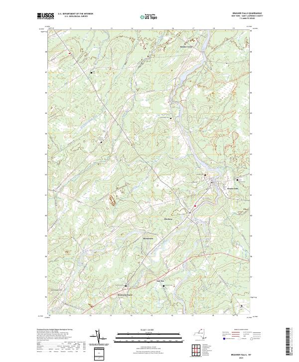
1946 Map No. 122986, 1964 Map No. 122987, 1964 Map No. 122988 Brasher State Forest, Buckton State Forest, Knapp Station State Forest, Lost Nation State Forest Brasher (19%), Lawrence (4%), Norfolk (7%), Stockholm (31%)
Current Brother Ponds GeoPDF Map
1970 Map No. 123133 Unclassified, Cranberry Lake Wild Forest, Grass River Wild Forest Clifton (13%), Colton (13%)
Current Brushton GeoPDF Map
1964 Map No. 123031, 1964 Map No. 123032 Deer River State Forest, Bombay State Forest Brasher (0%), Dickinson (26%), Lawrence (3%), Moira (89%)
Current Canton GeoPDF Map
1964 Map No. 122793, 1964 Map No. 122794 Upper And Lower Lakes WMA Canton (48%), De Kalb (0%), Russell (2%)
Current Carry Falls Reservoir GeoPDF Map
NA Raquette River Wild Forest, Raquette-Jordan Boreal Primitive Area, White Hill Wild Forest Colton (6%), Hopkinton (17%), Parishville (6%)
Current Chase Mills GeoPDF Map
1942 Map No. 122917, 1964 Map No. 122920 Sodom State Forest Louisville (16%), Madrid (44%), Norfolk (16%), Potsdam (4%), Waddington (10%)
Current Childwold GeoPDF Map
1968 Map No. 122976 Cranberry Lake Wild Forest, Grass River Wild Forest, Raquette River Wild Forest, Raquette-Jordan Boreal Primitive Area Colton (12%), Hopkinton (3%), Piercefield (15%)
Current Chippewa Bay GeoPDF Map
1948 Map No. 122977, 1948 Map No. 122978, 1958 Map No. 122980, 1958 Map No. 122981, 1958 Map No. 122982 NA Alexandria (6%), Hammond (38%)
Current Colton GeoPDF Map
1943 Map No. 137685, 1964 Map No. 137688, 1964 Map No. 137689 High Flats State Forest, West Parishville State Forest Colton (7%), Parishville (15%), Pierrepont (30%), Potsdam (1%)
Current Cranberry Lake GeoPDF Map
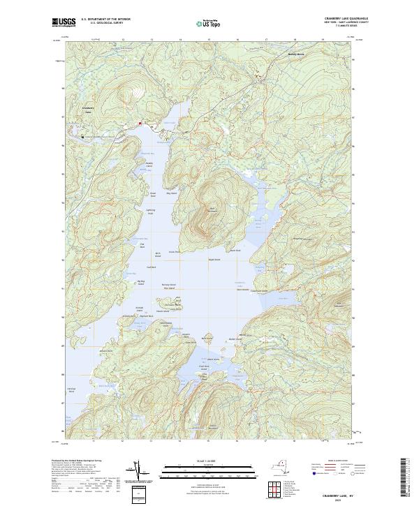
1968 Map No. 137741, 1968 Map No. 137742, 1999 Map No. 137195 Unclassified, Cranberry Lake Wild Forest, Five Ponds Wilderness, Grass River Wild Forest, Cranberry Lake Boat Launch, Cranberry Lake Campground Clifton (25%), Colton (6%)
Current Degrasse GeoPDF Map
1969 Map No. 137974, 1969 Map No. 137975, 1969 Map No. 137976 Grass River Wild Forest, Degrasse State Forest, Orebed Creek State Forest, Silver Hill State Forest Clare (25%), Clifton (1%), Fine (8%), Russell (15%)
Current Edwards GeoPDF Map
1956 Map No. 138048, 1956 Map No. 138050 Trout Lake State Forest, Wolf Lake State Forest, Fire-Fall State Forest Edwards (54%), Fowler (21%), Gouverneur (0%), Hermon (23%)
Current Edwardsville GeoPDF Map
1963 Map No. 137352, 1963 Map No. 138047 De Peyster FP Detached Parcel, Fish Creek WMA De Peyster (13%), Macomb (15%), Morristown (34%), Oswegatchie (24%)
Current Fine GeoPDF Map
1966 Map No. 138147, 1966 Map No. 138148, 1966 Map No. 138149 Cold Spring Brook State Forest, Grass River Wild Forest, Aldrich Pond Wild Forest, Sucker Lake Water Access, Greenwood Creek State Forest Diana (0%), Edwards (2%), Fine (18%), Pitcairn (38%)
Current Five Ponds GeoPDF Map
1969 Map No. 138155, 1969 Map No. 138156, 1999 Map No. 137329 Cranberry Lake Wild Forest, Buck Pond Primitive Area, Five Ponds Wilderness, Wanakena Primitive Area Clifton (2%), Fine (14%), Webb (6%)
Current Gouverneur GeoPDF Map
1956 Map No. 129586, 1956 Map No. 129587, 1982 Map No. 129588 Gouverneur FP Detached Parcel Fowler (52%), Gouverneur (29%), Hermon (2%)
Current Hammond GeoPDF Map
1951 Map No. 129700, 1951 Map No. 129701, 1961 Map No. 129702, 1961 Map No. 129703 South Hammond State Forest, Lonesome Bay State Forest, Black Lake Waterway Access Hammond (50%), Macomb (5%), Morristown (12%), Rossie (11%)
Current Harrisville GeoPDF Map
1951 Map No. 129808, 1951 Map No. 129809, 1951 Map No. 129810, 1951 Map No. 137245 Diana FP Detached Parcel, Pitcairn FP Detached Parcel, St. Lawrence FP Detached Parcel, Cold Spring Brook State Forest, Toothaker Creek State Forest, Aldrich Pond Wild Forest, Frank E. Jadwin Memorial State Forest, Bonaparte’s Cave State Forest, California Road State Forest Diana (10%), Edwards (6%), Fine (0%), Fowler (4%), Pitcairn (56%)
Current Hermon GeoPDF Map
1966 Map No. 129910, 1966 Map No. 137248 Whippoorwill Corners State Forest Canton (3%), De Kalb (1%), Hermon (23%), Russell (38%)
Current Heuvelton GeoPDF Map
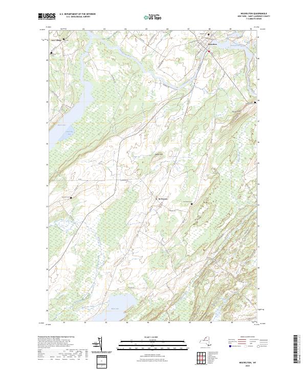
1963 Map No. 129911, 1963 Map No. 129912 Beaver Creek State Forest, Fish Creek WMA De Kalb (7%), De Peyster (81%), Macomb (0%), Oswegatchie (15%)
Current Hogansburg GeoPDF Map
1964 Map No. 129877, 1964 Map No. 129878, 1964 Map No. 137253 Bombay State Forest, Brasher State Forest Bombay (17%), Brasher (32%), Massena (7%), Moira (0%), St. Regis Mohawk Reservation (61%)
Current Lake Bonaparte GeoPDF Map
1951 Map No. 130158, 1951 Map No. 130159, 1951 Map No. 130160, 1951 Map No. 137301, 1951 Map No. 137302 St. Lawrence FP Detached Parcel, Sand Bay State Forest, Bonaparte’s Cave State Forest, California Road State Forest Antwerp (7%), Diana (21%), Fowler (19%), Pitcairn (6%)
Current Lake Ozonia GeoPDF Map
1964 Map No. 130178, 1964 Map No. 130179 Debar Mountain Wild Forest, Lake Ozonia Fishing Access Site Hopkinton (9%), Waverly (29%)
Current Lisbon GeoPDF Map
1963 Map No. 130271, 1963 Map No. 130272 Lisbon FP Detached Parcel, Upper And Lower Lakes WMA Canton (1%), Lisbon (45%), Oswegatchie (0%)
Current Little Tupper Lake GeoPDF Map
NA Sargent Ponds Wild Forest, Horseshoe Lake Wild Forest, Round Lake Wilderness, William C. Whitney Wilderness, Winding Falls Primitive Area Long Lake (9%), Piercefield (8%), Tupper Lake (2%)
Current Long Tom Mountain GeoPDF Map
NA Dead Creek Primitive Area, Cranberry Lake Wild Forest, Eastern Five Ponds Access Primitive Area, Five Ponds Wilderness, Horseshoe Lake Wild Forest, Round Lake Wilderness Colton (15%), Piercefield (14%)
Current Louisville GeoPDF Map
1946 Map No. 130358, 1964 Map No. 130359 Wilson Hill WMA Louisville (39%), Waddington (1%)
Current Massena GeoPDF Map
1942 Map No. 130474, 1964 Map No. 130477, 1964 Map No. 130478, 1964 Map No. 130479 Louisville FP Detached Parcel, Grantville State Forest Brasher (0%), Louisville (42%), Massena (26%), Norfolk (10%)
Current Morley GeoPDF Map
1964 Map No. 130672, 1964 Map No. 130673 Lisbon FP Detached Parcel, Upper And Lower Lakes WMA Canton (15%), Lisbon (14%), Madrid (23%), Potsdam (9%)
Current Morrisburg GeoPDF Map
1964 Map No. 130678 NA Louisville (1%), Waddington (8%)
Current Morristown GeoPDF Map
1942 Map No. 130682, 1963 Map No. 130683, 1963 Map No. 130684, 1963 Map No. 130685 NA Hammond (6%), Morristown (47%)
Current Mount Matumbla GeoPDF Map
1968 Map No. 130710, 1968 Map No. 130711 Raquette-Jordan Boreal Primitive Area Hopkinton (3%), Piercefield (25%), Tupper Lake (16%)
Current Muskellunge Lake GeoPDF Map
1961 Map No. 130739, 1961 Map No. 130740 Lake Of The Woods Waterway Access, Moon Lake Fishing Access, South Hammond State Forest, Pulpit Rock State Forest, Indian River WMA, Grass Lake Fishing Access Antwerp (14%), Hammond (4%), Macomb (0%), Rossie (47%), Theresa (23%)
Current Natural Dam GeoPDF Map
1951 Map No. 130771, 1961 Map No. 130772, 1961 Map No. 130773, 1961 Map No. 130774 Pleasant Lake State Forest, Yellow Lake State Forest, Oswegatchie River At Oxbow Fishing Access, Yellow Lake Waterway Access Antwerp (8%), Fowler (3%), Gouverneur (30%), Macomb (8%), Rossie (42%)
Current Newton Falls GeoPDF Map
1968 Map No. 130853, 1968 Map No. 130854, 1999 Map No. 137415 Cranberry Lake Wild Forest, Alice Brook Primitive Area, Five Ponds Wilderness, Wanakena Primitive Area Clifton (28%), Fine (7%)
Current Nicholville GeoPDF Map
1964 Map No. 128721, 1964 Map No. 137421 Fort Jackson State Forest, Catherineville State Forest, Whiskey Flats State Forest Hopkinton (19%), Lawrence (33%), Stockholm (3%)
Current Norfolk GeoPDF Map
1942 Map No. 128736, 1964 Map No. 128738 Louisville FP Detached Parcel, Raymondville State Forest, Grantville State Forest, Knapp Station State Forest, Lost Nation State Forest Louisville (2%), Norfolk (66%), Potsdam (0%), Stockholm (14%)
Current North Lawrence GeoPDF Map
1964 Map No. 128754, 1964 Map No. 137467 Bombay State Forest, Brasher State Forest Brasher (29%), Lawrence (53%), Moira (1%), Stockholm (0%)
Current Ogdensburg East GeoPDF Map
1963 Map No. 128854, 1963 Map No. 128855 NA Lisbon (16%), Ogdensburg city (87%), Oswegatchie (33%)
Current Ogdensburg West GeoPDF Map
1963 Map No. 128857, 1963 Map No. 128858 NA Morristown (0%), Ogdensburg city (13%), Oswegatchie (21%)
Current Oswegatchie GeoPDF Map
1966 Map No. 135923, 1966 Map No. 137496, 1966 Map No. 137497 Alice Brook Primitive Area, Buck Pond Primitive Area, Five Ponds Wilderness, Aldrich Pond Wild Forest, Sucker Lake Water Access, Tamarack Creek Primitive Area Clifton (8%), Fine (24%)
Current Oswegatchie SE GeoPDF Map
1966 Map No. 135918, 1966 Map No. 135920 Buck Pond Primitive Area, Five Ponds Wilderness, Pepperbox Wilderness, Aldrich Pond Wild Forest, Watson’s East Triangle Wild Forest Fine (17%), Webb (5%)
Current Oswegatchie SW GeoPDF Map
1966 Map No. 135921 Five Ponds Wilderness, Aldrich Pond Wild Forest, Watson’s East Triangle Wild Forest Croghan (8%), Diana (13%), Fine (5%), Webb (2%)
Current Parishville GeoPDF Map
1943 Map No. 135966, 1964 Map No. 135967, 1964 Map No. 135968, 1964 Map No. 136772 Buckton State Forest, Fort Jackson State Forest, Southville State Forest, Whiskey Flats State Forest Hopkinton (5%), Parishville (15%), Stockholm (30%)
Current Piercefield GeoPDF Map
NA Dead Creek Primitive Area, Horseshoe Lake Wild Forest, Raquette-Jordan Boreal Primitive Area Piercefield (35%), Tupper Lake (11%)
Current Pierrepont GeoPDF Map
1964 Map No. 128994, 1964 Map No. 128995, 1964 Map No. 136800 Crary Mills State Forest, Glenmeal State Forest Canton (13%), Pierrepont (40%), Potsdam (11%), Russell (4%)
Current Pope Mills GeoPDF Map
1951 Map No. 129068, 1961 Map No. 129069, 1961 Map No. 129070, 1961 Map No. 129071 Hickory Lake State Forest, Pleasant Lake State Forest, Beaver Creek State Forest, Fish Creek WMA Gouverneur (8%), Macomb (68%), Morristown (7%)
Current Potsdam GeoPDF Map
1943 Map No. 129140, 1964 Map No. 129144, 1964 Map No. 129145, 1964 Map No. 129146 Southville State Forest Norfolk (0%), Parishville (6%), Pierrepont (0%), Potsdam (26%), Stockholm (22%)
Current Rainbow Falls GeoPDF Map
1964 Map No. 136005, 1964 Map No. 136006, 1964 Map No. 136844 High Flats State Forest, White Hill Wild Forest, Whiskey Flats State Forest Colton (4%), Hopkinton (3%), Parishville (37%)
Current Raquette River GeoPDF Map
1946 Map No. 136017, 1964 Map No. 136019, 1964 Map No. 136021 Indian Meadows FP Detached Parcel, Brasher State Forest Brasher (19%), Massena (67%), Norfolk (1%)
Current Red Mills GeoPDF Map
1963 Map No. 136038 NA Lisbon (4%)
Current Redwood GeoPDF Map
1958 Map No. 136044, 1958 Map No. 136045, 1958 Map No. 136046 Hyde Lake Fishing Access, Millsite Lake Fishing Access, Butterfield Lake Waterway Access, Sixberry Lake Fishing Access, Indian River WMA Alexandria (43%), Hammond (2%), Theresa (21%)
Current Rensselaer Falls GeoPDF Map
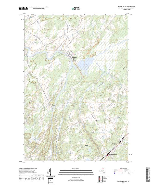
1963 Map No. 136055 Dekalb FP Detached Parcel, Upper And Lower Lakes WMA Canton (20%), De Kalb (30%), De Peyster (0%), Lisbon (3%), Oswegatchie (6%)
Current Richville GeoPDF Map
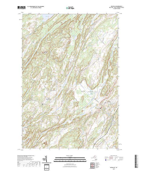
1956 Map No. 136073, 1956 Map No. 136074, 1956 Map No. 136859 Beaver Creek State Forest De Kalb (29%), De Peyster (6%), Gouverneur (32%), Hermon (1%), Macomb (4%)
Current Sabattis GeoPDF Map
NA Eastern Five Ponds Access Primitive Area, Five Ponds Wilderness, Horseshoe Lake Wild Forest, Nehasane Primitive Area, Round Lake Wilderness, William C. Whitney Wilderness Colton (5%), Long Lake (8%), Piercefield (3%)
Current Saint Regis Falls GeoPDF Map
NA Deer River State Forest, St. Regis River State Forest, Debar Mountain Wild Forest Dickinson (59%), Hopkinton (3%), Lawrence (7%), Waverly (15%)
Current South Edwards GeoPDF Map
1969 Map No. 136194, 1969 Map No. 136927 Trout Lake State Forest, Silver Hill State Forest, Stammer Creek State Forest, Bonner Lake State Forest Edwards (38%), Fine (7%), Hermon (2%), Russell (21%)
Current Sparrowhawk Point GeoPDF Map
1963 Map No. 139823, 1963 Map No. 139824 Swallow Bluffs WMA Lisbon (19%), Waddington (18%)
Current Stark GeoPDF Map
1968 Map No. 139876 Grass River Wild Forest, Raquette River Wild Forest, White Hill Wild Forest, Snow Bowl State Forest Colton (16%), Parishville (11%)
Current Sylvan Falls GeoPDF Map
1964 Map No. 139936 Lake Ozonia Fishing Access Site, White Hill Wild Forest, Catherineville State Forest Hopkinton (24%), Parishville (9%)
Current Tooley Pond GeoPDF Map
1969 Map No. 139349 Grass River Wild Forest Clare (31%), Clifton (10%), Colton (3%)
Current Waddington GeoPDF Map
1942 Map No. 139508, 1964 Map No. 139512, 1964 Map No. 139513 Waddington FP Detached Parcel Lisbon (0%), Madrid (28%), Waddington (63%)
Current West Pierrepont GeoPDF Map
1969 Map No. 137013, 1969 Map No. 140195 Grass River Wild Forest, Taylor Creek State Forest, Degrasse State Forest, Glenmeal State Forest, Downerville State Forest, Whippoorwill Corners State Forest Clare (24%), Pierrepont (18%), Russell (20%)
Current West Potsdam GeoPDF Map
1964 Map No. 140216 NA Canton (0%), Madrid (4%), Potsdam (49%)
Current Wolf Mountain GeoPDF Map
1968 Map No. 140367, 1968 Map No. 140368, 1999 Map No. 137042 Eastern Five Ponds Access Primitive Area, Five Ponds Wilderness, Partlow Lake Primitive Area, Nehasane Primitive Area, William C. Whitney Wilderness Clifton (12%), Colton (1%), Long Lake (6%), Webb (1%)

Steuben County

PDF (50-60 MB Download) Historical USGS Topo Maps State Lands (Links to DEC Website) Towns (Percent of Town’s Area)
Current Addison GeoPDF Map
1953 Map No. 136532, 1953 Map No. 136533, 1969 Map No. 136534, 1969 Map No. 136535, 1969 Map No. 137053 Mccarthy Hill State Forest, Erwin Mountain State Forest Addison (23%), Erwin (24%), Lindley (64%), Tuscarora (43%)
Current Arkport GeoPDF Map
1965 Map No. 136691, 1965 Map No. 136692, 1965 Map No. 136693 NA Almond (4%), Burns (22%), Dansville (62%), Fremont (24%), Hornell city (10%), Hornellsville (14%), Ossian (7%)
Current Avoca GeoPDF Map
1953 Map No. 136754, 1953 Map No. 136755, 1953 Map No. 136756, 1953 Map No. 136757 Cohocton River Fishing Access Avoca (86%), Bath (0%), Cohocton (15%), Howard (4%), Prattsburgh (3%), Wheeler (25%)
Current Bath GeoPDF Map
1953 Map No. 123205, 1953 Map No. 123206, 1953 Map No. 123207 Mount Washington Multiple Use Area, Moss Hill State Forest, Bath Fish Hatchery Bath (46%), Cameron (6%), Thurston (20%), Urbana (3%)
Current Beaver Dams GeoPDF Map
1953 Map No. 123229, 1953 Map No. 123230, 1953 Map No. 137095 Beaver Dams State Forest, Sugar Hill State Forest, Coon Hollow State Forest Catlin (33%), Dix (74%), Hornby (8%), Orange (22%)
Current Big Flats GeoPDF Map
1953 Map No. 123273, 1953 Map No. 123274, 1969 Map No. 123275, 1969 Map No. 123276, 1969 Map No. 123277 Catlin State Forest Big Flats (53%), Catlin (42%), Corning (24%), Hornby (16%)
Current Borden GeoPDF Map
1953 Map No. 123363, 1953 Map No. 123364, 1953 Map No. 123365 NA Addison (13%), Rathbone (31%), Tuscarora (57%), Woodhull (35%)
Current Bradford GeoPDF Map
1953 Map No. 123380, 1953 Map No. 123381, 1953 Map No. 137123 Goundry Hill State Forest, Beaver Dams State Forest, Sugar Hill State Forest, South Bradford State Forest, Meads Creek State Forest, Birdseye Hollow State Forest, Cinnamon Lake State Forest, Dry Run State Forest, Coon Hollow State Forest Bradford (33%), Campbell (5%), Hornby (22%), Orange (66%)
Current Cameron GeoPDF Map
1953 Map No. 123171, 1953 Map No. 123172, 1953 Map No. 137144 Cameron Mills State Forest, Cameron State Forest, West Cameron WMA Cameron (65%), Canisteo (15%), Jasper (20%), Rathbone (8%), Woodhull (6%)
Current Campbell GeoPDF Map
1953 Map No. 123071, 1953 Map No. 123072, 1969 Map No. 123073, 1969 Map No. 123074, 1969 Map No. 123075 Meads Creek State Forest, Erwin Mountain State Forest, Erwin WMA, NA Addison (39%), Campbell (59%), Erwin (40%), Thurston (15%)
Current Canisteo GeoPDF Map
1954 Map No. 122780, 1954 Map No. 122781, 1954 Map No. 122782 Burt Hill Multiple Use Area Canisteo (25%), Fremont (15%), Hartsville (0%), Hornellsville (11%), Howard (52%)
Current Caton GeoPDF Map
1953 Map No. 122853, 1953 Map No. 122854, 1969 Map No. 122855, 1969 Map No. 137159 NA Caton (71%), Corning (27%), Erwin (13%), Lindley (36%)
Current Corning GeoPDF Map
1953 Map No. 137825, 1953 Map No. 137826, 1969 Map No. 137827, 1969 Map No. 137828, 1969 Map No. 137829 West Hill State Forest, Meads Creek State Forest, Dry Run State Forest, Erwin Hollow State Forest, NA Campbell (16%), Corning city (100%), Corning (39%), Erwin (23%), Hornby (54%)
Current Dansville GeoPDF Map
1942 Map No. 137198, 1942 Map No. 137957, 1942 Map No. 137958, 1942 Map No. 137961 NA Dansville (20%), North Dansville (100%), Ossian (17%), Sparta (44%), Springwater (8%), Wayland (20%), West Sparta (13%)
Current Greenwood GeoPDF Map
1965 Map No. 129641, 1965 Map No. 129642, 1978 Map No. 129643 Rock Creek State Forest, Greenwood State Forest Alfred (6%), Andover (4%), Canisteo (0%), Greenwood (67%), Hartsville (66%)
Current Hammondsport GeoPDF Map
1953 Map No. 129688, 1953 Map No. 129689, 1953 Map No. 129690, 1953 Map No. 129691 Urbana State Forest, Mount Washington Multiple Use Area, Birdseye Hollow State Forest, Cold Brook WMA Bradford (8%), Jerusalem (1%), Prattsburgh (1%), Pulteney (30%), Urbana (60%), Wayne (66%)
Current Haskinville GeoPDF Map
1965 Map No. 129833, 1978 Map No. 129832 NA Avoca (7%), Cohocton (18%), Dansville (17%), Fremont (56%), Howard (13%), Wayland (21%)
Current Hornell GeoPDF Map
1965 Map No. 129772, 1965 Map No. 129773, 1978 Map No. 129771 Canacadea State Forest, Bully Hill State Forest Alfred (4%), Almond (11%), Fremont (4%), Hartsville (33%), Hornell city (90%), Hornellsville (75%)
Current Naples GeoPDF Map
1942 Map No. 130756, 1942 Map No. 130761, 1942 Map No. 137395 High Tor WMA Cohocton (47%), Naples (49%), Prattsburgh (15%), Springwater (3%)
Current Prattsburg GeoPDF Map
1942 Map No. 129177, 1942 Map No. 129178 Italy Hill State Forest, High Tor WMA – Parrish Gully, High Tor WMA Italy (50%), Naples (4%), Prattsburgh (65%)
Current Pulteney GeoPDF Map
1942 Map No. 129195, 1942 Map No. 129196 Italy Hill State Forest Italy (3%), Jerusalem (40%), Prattsburgh (4%), Pulteney (70%)
Current Rathbone GeoPDF Map
1953 Map No. 136022, 1953 Map No. 136023 Tracy Creek State Forest, Cameron Mills State Forest, Helmer Creek WMA Addison (24%), Cameron (16%), Rathbone (55%), Thurston (60%)
Current Rexville GeoPDF Map
1965 Map No. 136058, 1965 Map No. 136059 NA Andover (1%), Greenwood (25%), Independence (2%), Troupsburg (5%), West Union (100%)
Current Rheims GeoPDF Map
1953 Map No. 136060, 1953 Map No. 136061 Urbana State Forest, Pigtail Hollow State Forest, Keuka Lake Inlet Parking Area, Bath Fish Hatchery Avoca (0%), Bath (3%), Prattsburgh (12%), Urbana (26%), Wheeler (75%)
Current Savona GeoPDF Map
1953 Map No. 129409, 1953 Map No. 129410, 1953 Map No. 129411, 1953 Map No. 129412 South Bradford State Forest, Mount Washington Multiple Use Area, Moss Hill State Forest, Meads Creek State Forest, Birdseye Hollow State Forest Bath (27%), Bradford (56%), Campbell (20%), Thurston (5%), Urbana (12%)
Current Seeley Creek GeoPDF Map
1953 Map No. 136130, 1953 Map No. 136131, 1969 Map No. 136132, 1969 Map No. 136133, 1969 Map No. 136134 Big Flats WMA Big Flats (34%), Caton (29%), Corning (11%), Southport (52%)
Current South Canisteo GeoPDF Map
1954 Map No. 136193, 1954 Map No. 136926 Turkey Ridge State Forest Canisteo (51%), Greenwood (6%), Hartsville (0%), Jasper (48%)
Current Towlesville GeoPDF Map
1953 Map No. 139354, 1953 Map No. 139355 Cameron State Forest Avoca (7%), Bath (24%), Cameron (13%), Canisteo (9%), Howard (31%)
Current Troupsburg GeoPDF Map
1954 Map No. 139364, 1954 Map No. 139365, 1954 Map No. 139366 NA Greenwood (2%), Jasper (22%), Troupsburg (70%)
Current Wayland GeoPDF Map
1943 Map No. 140081, 1953 Map No. 140079 Mill Creek Fishing Access Cohocton (20%), Dansville (1%), Springwater (38%), Wayland (59%)
Current Wayne GeoPDF Map
1953 Map No. 140089, 1953 Map No. 140090 Sugar Hill State Forest, Waneta Lamoka WMA Barrington (16%), Bradford (4%), Jerusalem (0%), Orange (10%), Tyrone (89%), Wayne (33%)
Current Woodhull GeoPDF Map
1953 Map No. 140369, 1953 Map No. 140370 NA Jasper (10%), Rathbone (6%), Troupsburg (25%), Woodhull (60%)

Suffolk County

PDF (50-60 MB Download) Historical USGS Topo Maps State Lands (Links to DEC Website) Towns (Percent of Town’s Area)
Current Amityville GeoPDF Map
1947 Map No. 136609, 1954 Map No. 136610, 1969 Map No. 136611, 1969 Map No. 136612, 1994 Map No. 137067 Babylon Marsh-Elder And Petteanger Isl Stw Babylon (34%), Hempstead (4%), Oyster Bay (23%)
Current Bay Shore East GeoPDF Map
NA Ludlow Creek State Tidal Wetland, Pepperidge Hall Marsh State Tidal Wetland, Pickman-Rimmer State Tidal Wetland, Timber Point State Tidal Wetland Brookhaven (2%), Islip (34%)
Current Bay Shore West GeoPDF Map
NA Isbrandtsen Marsh State Tidal Wetland Babylon (51%), Islip (15%)
Current Bellport GeoPDF Map
1947 Map No. 123237, 1956 Map No. 123238, 1967 Map No. 123239, 1967 Map No. 137099, 1967 Map No. 137100 Carmans River Pine Barrens State Forest, East Bartlett Pine Barrens State Forest, Longwood Pine Barrens State Forest, Bellport Bay State Tidal Wetland, Fireplace Neck State Tidal Wetland Brookhaven (17%)
Current Central Islip GeoPDF Map
1947 Map No. 122885, 1956 Map No. 122886, 1956 Map No. 122887, 1967 Map No. 122888, 1967 Map No. 122889, 1967 Map No. 122890, 1967 Map No. 122892 Kings Park, Lake Ronkonkoma Boat Launch Brookhaven (0%), Islip (25%), Smithtown (40%)
Current East Hampton GeoPDF Map
1947 Map No. 138012, 1956 Map No. 138013, 1956 Map No. 138014, 1956 Map No. 138015, 1956 Map No. 138016 NA East Hampton (29%), Southampton (0%)
Current Eastport GeoPDF Map
1947 Map No. 138028, 1956 Map No. 138029, 1956 Map No. 138030 Eastport Pine Barrens State Forest, Westhampton Dwarf Pine Plains Pine Barrens State Forest, Otis Pike Pine Barrens State Forest – Toppings Path, Moriches Bay Marine Waterway Access, David A. Sarnoff Pine Barrens State Forest, Havens Point State Tidal Wetland, Moneyboque Bay State Tidal Wetland Brookhaven (3%), Southampton (16%)
Current Gardiners Island East GeoPDF Map
NA Napeague Harbor State Tidal Wetland East Hampton (12%)
Current Gardiners Island West GeoPDF Map
NA Accabonac Marsh State Tidal Wetland, Northwest Harbor State Tidal Wetland East Hampton (22%)
Current Greenlawn GeoPDF Map
1947 Map No. 129614, 1954 Map No. 129615, 1954 Map No. 129616, 1967 Map No. 129617, 1967 Map No. 137231, 1967 Map No. 137232, 1979 Map No. 129618 Edgewood Oak Brush Plains State Forest Babylon (10%), Huntington (31%), Islip (7%), Smithtown (19%)
Current Greenport GeoPDF Map
1947 Map No. 129619, 1956 Map No. 129620, 1956 Map No. 129622, 1956 Map No. 129623 Linda A. Gronlund Memorial Nature State Forest At Barcelona Neck, Little Northwest Creek State Tidal Wetland, North Haven State Tidal Wetland, Shelter Island State Tidal Wetland East Hampton (5%), Shelter Island (94%), Southampton (5%), Southold (5%)
Current Howells Point GeoPDF Map
1947 Map No. 129797, 1956 Map No. 129793, 1956 Map No. 129794, 1967 Map No. 129791, 1967 Map No. 129795, 1967 Map No. 129796 Lymans Marsh State Tidal Wetland Brookhaven (6%)
Current Huntington GeoPDF Map
1947 Map No. 129952, 1954 Map No. 129954, 1954 Map No. 129955, 1967 Map No. 130047, 1967 Map No. 137270 NA Babylon (3%), Huntington (33%), Oyster Bay (20%)
Current Lloyd Harbor GeoPDF Map
1954 Map No. 130306, 1954 Map No. 130307, 1967 Map No. 130308, 1967 Map No. 137367 NA Huntington (21%), Oyster Bay (1%)
Current Mattituck GeoPDF Map
1947 Map No. 130485, 1956 Map No. 130486, 1956 Map No. 130487, 1956 Map No. 130488, 1956 Map No. 130489 Henry’s Hollow Pine Barrens State Forest, David A. Sarnoff Pine Barrens State Forest, Laurel Lake Waterway Access Riverhead (22%), Southampton (12%), Southold (18%)
Current Mattituck Hills GeoPDF Map
1947 Map No. 130482, 1956 Map No. 130483, 1956 Map No. 130484 Mattituck Creek Waterway Access Site, Oregon Marsh State Tidal Wetland Southold (8%)
Current Middle Island GeoPDF Map
1947 Map No. 130546, 1947 Map No. 130547, 1956 Map No. 130548, 1967 Map No. 130550 East Bartlett Pine Barrens State Forest, Brookhaven Pine Barrens State Forest, Longwood Pine Barrens State Forest, Rocky Point Pine Barrens State Forest, Ridge Pine Barrens State Forest And Maintenance Center Brookhaven (12%)
Current Montauk Point GeoPDF Map
1942 Map No. 130612, 1956 Map No. 130613, 1956 Map No. 130614 NA East Hampton (20%)
Current Moriches GeoPDF Map
1957 Map No. 130668, 1967 Map No. 130669, 1967 Map No. 130671 Eastport Pine Barrens State Forest, Otis Pike Pine Barrens State Forest – West, Mastic-Shirley Conservation Area, Johns Neck State Tidal Wetland, Tuthill Cove State Tidal Wetland Brookhaven (17%), Poospatuck Reservation (100%)
Current Mystic GeoPDF Map
NA NA Southold (3%)
Current Napeague Beach GeoPDF Map
1947 Map No. 130747, 1956 Map No. 130748, 1956 Map No. 130749, 1956 Map No. 130750 Napeague Harbor State Tidal Wetland East Hampton (6%)
Current New London GeoPDF Map
NA NA Southold (2%)
Current Northport GeoPDF Map
1947 Map No. 128792, 1954 Map No. 128793, 1954 Map No. 128794, 1967 Map No. 128795, 1967 Map No. 128797 Kings Park Huntington (15%), Smithtown (12%)
Current Orient GeoPDF Map
1947 Map No. 135892, 1956 Map No. 135893, 1956 Map No. 135894, 1956 Map No. 137489 Oyster Ponds Waterway Access Site, Long Beach Bay State Tidal Wetland Southold (8%)
Current Patchogue GeoPDF Map
1947 Map No. 135969, 1956 Map No. 135970, 1956 Map No. 135971, 1967 Map No. 135972, 1967 Map No. 135973 NA Brookhaven (12%), Islip (14%), Smithtown (0%)
Current Pattersquash Island GeoPDF Map
1956 Map No. 135976, 1967 Map No. 135977, 1967 Map No. 135978 Johns Neck State Tidal Wetland Brookhaven (1%)
Current Plum Island GeoPDF Map
1947 Map No. 129053, 1954 Map No. 129055, 1954 Map No. 129056 Long Beach Bay State Tidal Wetland Southold (2%)
Current Port Jefferson GeoPDF Map
1947 Map No. 129090, 1955 Map No. 129091, 1955 Map No. 129092, 1967 Map No. 129093 Patriots Hollow State Forest, Little Bay State Tidal Wetland, Mount Sinai State Tidal Wetland Brookhaven (13%)
Current Quogue GeoPDF Map
1947 Map No. 136001, 1956 Map No. 136002, 1956 Map No. 136003 Henry’s Hollow Pine Barrens State Forest, Westhampton Dwarf Pine Plains Pine Barrens State Forest, David A. Sarnoff Pine Barrens State Forest Southampton (13%)
Current Riverhead GeoPDF Map
1947 Map No. 136077, 1956 Map No. 136078, 1956 Map No. 136079, 1956 Map No. 136080 Otis Pike Pine Barrens State Forest – Canoe Lake, Otis Pike Pine Barrens State Forest – East, Otis Pike Pine Barrens State Forest – Nugent Drive, Otis Pike Pine Barrens State Forest – South River Road, Otis Pike Pine Barrens State Forest – Toppings Path, David A. Sarnoff Pine Barrens State Forest, Wildwood Lake Waterway Access Brookhaven (2%), Riverhead (40%), Southampton (6%)
Current Sag Harbor GeoPDF Map
1946 Map No. 129284, 1956 Map No. 129285, 1956 Map No. 129286 Linda A. Gronlund Memorial Nature State Forest At Barcelona Neck, Little Northwest Creek State Tidal Wetland, Sag Harbor State Tidal Wetland East Hampton (6%), Southampton (21%)
Current Saint James GeoPDF Map
1955 Map No. 129287, 1967 Map No. 129288, 1967 Map No. 129289 Kings Park, Flax Pond State Tidal Wetland, Stony Brook Harbor State Tidal Wetland, Youngs Island State Tidal Wetland Brookhaven (2%), Smithtown (29%)
Current Sayville GeoPDF Map
1947 Map No. 129415, 1955 Map No. 129416, 1967 Map No. 129417, 1967 Map No. 136896 Browns River State Tidal Wetland, Ludlow Creek State Tidal Wetland, Namkee Creek State Tidal Wetland, Pepperidge Hall Marsh State Tidal Wetland, Stillman Creek State Tidal Wetland Brookhaven (9%), Islip (6%)
Current Shinnecock Inlet GeoPDF Map
1955 Map No. 136159, 1955 Map No. 136160, 1955 Map No. 136161 Shinnecock Bay State Tidal Wetland Shinnecock Reservation (56%), Southampton (5%)
Current Southampton GeoPDF Map
1947 Map No. 136213, 1956 Map No. 136214, 1956 Map No. 136215 NA Shinnecock Reservation (44%), Southampton (21%), Southold (16%)
Current Southold GeoPDF Map
1947 Map No. 136216, 1956 Map No. 136217, 1956 Map No. 136218, 1956 Map No. 136219 Hashamomuck Pond Waterway Access Shelter Island (6%), Southampton (1%), Southold (37%)
Current Wading River GeoPDF Map
1957 Map No. 139515, 1967 Map No. 139516 Panamoka Pine Barrens State Forest, Calverton Pine Barrens State Forest, Otis Pike Pine Barrens State Forest – Canoe Lake, Otis Pike Pine Barrens State Forest – East, Otis Pike Pine Barrens State Forest – Fresh Pond, Otis Pike Pine Barrens State Forest – Toppings Path, Otis Pike Pine Barrens State Forest – West, Baiting Hollow State Tidal Wetland Brookhaven (4%), Riverhead (38%)
Current West Gilgo Beach GeoPDF Map
NA Babylon Marsh-Elder And Petteanger Isl Stw Babylon (2%), Hempstead (1%), Oyster Bay (4%)

USGS Topographic Maps – Dutchess to Livingston Counties

Counties: Albany to Delaware / Dutchess to Livingston / Madison to Otsego / Putnam to Suffolk / Sullivan to Yates

Browse Topographic Maps: Full State / Historical USGS Topographic Maps

Dutchess County

PDF (50-60 MB Download) Historical USGS Topo Maps State Lands (Links to DEC Website) Towns (Percent of Town’s Area)
Current Amenia GeoPDF Map
1958 Map No. 136605, 1958 Map No. 136606, 1958 Map No. 136607, 1958 Map No. 136608, 1958 Map No. 137065 Wassaic Multiple Use Area, Wassaic Creek Fishing Access Amenia (91%), Dover (2%), Stanford (3%), Washington (18%)
Current Ancram GeoPDF Map
1948 Map No. 136625, 1948 Map No. 710141, 1960 Map No. 136626, 1960 Map No. 136627, 1960 Map No. 137076, 1960 Map No. 710139 Roeliff Jansenkill Multiple Use Area, New Forge State Forest, Doodletown Wildlife Management Area Ancram (16%), Gallatin (80%), Milan (3%), Pine Plains (3%), Taghkanic (36%)
Current Clermont GeoPDF Map
1963 Map No. 137177, 1963 Map No. 137654, 1963 Map No. 137655, 1963 Map No. 137656 NA Clermont (63%), Gallatin (19%), Germantown (21%), Livingston (31%), Milan (21%), Red Hook (30%), Taghkanic (2%)
Current Copake GeoPDF Map
1953 Map No. 137709, 1953 Map No. 137710, 1953 Map No. 137711, 1953 Map No. 137712 Doodletown Wildlife Management Area Ancram (71%), Copake (46%), North East (14%), Taghkanic (3%)
Current Dover Plains GeoPDF Map
1944 Map No. 137886, 1958 Map No. 137890, 1958 Map No. 137891, 1958 Map No. 137892, 1958 Map No. 137893, 1998 Map No. 137336 Swamp River Fishing Access, Swamp River Waterway Access, West Mountain State Forest Amenia (0%), Dover (85%), Washington (1%)
Current Hopewell Junction GeoPDF Map
1957 Map No. 129768, 1957 Map No. 129769, 1957 Map No. 129770, 1981 Map No. 129767 NA Beekman (1%), East Fishkill (74%), Fishkill (14%), Kent (2%), Wappinger (27%)
Current Hyde Park GeoPDF Map
1963 Map No. 130048, 1963 Map No. 130049, 1980 Map No. 130050, 1980 Map No. 130051 Black Creek Waterway Access, Chodikee Lake Wetlands, Crum Elbow Creek Waterway Access, Black Creek State Forest, Crum Elbow Creek Fishing Access Clinton (2%), Esopus (44%), Hyde Park (79%), Lloyd (14%), Rhinebeck (0%)
Current Kingston East GeoPDF Map
1963 Map No. 130035, 1963 Map No. 130036, 1963 Map No. 130037, 1963 Map No. 137296, 1963 Map No. 137298 NA Clinton (0%), Esopus (16%), Hyde Park (1%), Kingston city (52%), Red Hook (15%), Rhinebeck (71%), Ulster (35%)
Current Millbrook GeoPDF Map
1947 Map No. 130580, 1960 Map No. 130583, 1960 Map No. 130584, 1960 Map No. 137450, 1960 Map No. 137451 Wappinger Creek Fishing Access Pleasant Valley (0%), Stanford (28%), Washington (70%)
Current Millerton GeoPDF Map
1955 Map No. 130590, 1955 Map No. 130591, 1955 Map No. 137452, 1955 Map No. 137453 NA Amenia (9%), Ancram (12%), North East (86%), Pine Plains (31%), Stanford (3%)
Current Pawling GeoPDF Map
1945 Map No. 135979, 1958 Map No. 135980, 1958 Map No. 135981, 1958 Map No. 135982, 1958 Map No. 136773, 1998 Map No. 136774 West Mountain State Forest, Great Swamp WMA, Cranberry Mountain WMA Dover (7%), Patterson (26%), Pawling (70%)
Current Pine Plains GeoPDF Map
1948 Map No. 129004, 1960 Map No. 129005, 1960 Map No. 129006, 1960 Map No. 136805, 1960 Map No. 136806 Shekomeko Creek Parking Fishing Access, Lafayetteville Multiple Use Area, Stissing Mountain Multiple Use Area Ancram (1%), Gallatin (1%), Milan (20%), North East (0%), Pine Plains (66%), Stanford (54%)
Current Pleasant Valley GeoPDF Map
1957 Map No. 129049, 1957 Map No. 129050, 1957 Map No. 129051 Taconic Hereford Multiple Use Area Beekman (2%), East Fishkill (1%), Hyde Park (3%), LaGrange (94%), Pleasant Valley (26%), Poughkeepsie (13%), Wappinger (11%)
Current Poughkeepsie GeoPDF Map
1957 Map No. 129158, 1957 Map No. 129159, 1957 Map No. 136830, 1995 Map No. 136831 NA Hyde Park (8%), LaGrange (0%), Lloyd (43%), Marlborough (39%), Poughkeepsie city (100%), Poughkeepsie (70%), Wappinger (2%)
Current Poughquag GeoPDF Map
1948 Map No. 129160, 1948 Map No. 129161, 1960 Map No. 129162, 1960 Map No. 129163, 1960 Map No. 129164, 1960 Map No. 136833 White Pond Multiple Use Area, Depot Hill Multiple Use Area, West Mountain State Forest, Big Buck Mountain Multiple Use Area, Sylvan Lake Waterway Access Beekman (72%), Dover (0%), East Fishkill (24%), Kent (10%), Patterson (5%), Pawling (30%)
Current Rock City GeoPDF Map
1963 Map No. 136098, 1963 Map No. 136099, 1963 Map No. 136866 NA Clinton (35%), Hyde Park (0%), Milan (55%), Red Hook (15%), Rhinebeck (29%), Stanford (8%)
Current Salt Point GeoPDF Map
1963 Map No. 129336, 1963 Map No. 129337, 1963 Map No. 136881 Taconic Hereford Multiple Use Area Clinton (63%), Hyde Park (10%), Pleasant Valley (73%), Stanford (4%), Washington (2%)
Current Saugerties GeoPDF Map
1963 Map No. 129404, 1963 Map No. 136889, 1963 Map No. 136890, 1963 Map No. 136891, 1963 Map No. 136892, 1997 Map No. 136893 Turkey Point State Forest, Tivoli Bays WMA Clermont (33%), Germantown (15%), Red Hook (39%), Saugerties (41%), Ulster (12%)
Current Verbank GeoPDF Map
1946 Map No. 139478, 1960 Map No. 136984, 1960 Map No. 139482, 1960 Map No. 139483 West Mountain State Forest, Taconic Hereford Multiple Use Area Beekman (25%), Dover (5%), LaGrange (6%), Pleasant Valley (1%), Union Vale (100%), Washington (9%)
Current Wappingers Falls GeoPDF Map
1956 Map No. 140039, 1956 Map No. 140040, 1956 Map No. 140041 Stonykill Environmental Education Center, Baxtertown Woods WMA Beacon city (64%), Fishkill (56%), Marlborough (24%), Newburgh city (3%), Newburgh (12%), Poughkeepsie (17%), Wappinger (60%)
Current West Point GeoPDF Map
1941 Map No. 140199, 1947 Map No. 140198, 1957 Map No. 137014, 1957 Map No. 140200, 1957 Map No. 140201, 1957 Map No. 140202 NA Beacon city (36%), Cornwall (8%), Fishkill (29%), Highlands (21%), New Windsor (0%), Newburgh city (4%), Philipstown (63%), Putnam Valley (7%)

Erie County

PDF (50-60 MB Download) Historical USGS Topo Maps State Lands (Links to DEC Website) Towns (Percent of Town’s Area)
Current Akron GeoPDF Map
1949 Map No. 136539, 1951 Map No. 136540, 1951 Map No. 710097 Onondaga Escarpment Unique Area, John White WMA, Tonawanda WMA Alabama (46%), Newstead (17%), Pembroke (24%), Royalton (6%), Tonawanda Reservation (100%), Tonawanda Reservation (100%), Tonawanda Reservation (100%)
Current Angola GeoPDF Map
1960 Map No. 136649, 1960 Map No. 136650 NA Evans (39%)
Current Arcade GeoPDF Map
1966 Map No. 136682, 1966 Map No. 136683 NA Arcade (57%), Freedom (12%), Holland (7%), Java (12%), Sardinia (19%), Yorkshire (14%)
Current Ashford Hollow GeoPDF Map
1964 Map No. 136700, 1964 Map No. 136701, 1964 Map No. 136702, 1964 Map No. 710169 NA Ashford (64%), Concord (9%), East Otto (36%), Ellicottville (2%)
Current Buffalo NE GeoPDF Map
1948 Map No. 123033, 1950 Map No. 123034, 1965 Map No. 123035 NA Amherst (23%), Buffalo city (52%), Cheektowaga (43%), Tonawanda (37%)
Current Buffalo NW GeoPDF Map
1950 Map No. 123036, 1950 Map No. 123038, 1965 Map No. 123039, 1965 Map No. 123040 Motor Island WMA Buffalo city (22%), Grand Island (25%), Tonawanda city (3%), Tonawanda (47%)
Current Buffalo SE GeoPDF Map
1948 Map No. 123041, 1950 Map No. 123042, 1965 Map No. 123043 NA Buffalo city (26%), Cheektowaga (2%), Hamburg (34%), Lackawanna city (100%), Orchard Park (22%), West Seneca (53%)
Current Clarence GeoPDF Map
1950 Map No. 137629, 1965 Map No. 137630 Tillman Road WMA Alden (63%), Clarence (14%), Lancaster (35%), Newstead (24%)
Current Clarence Center GeoPDF Map
1950 Map No. 137625, 1950 Map No. 137626, 1965 Map No. 137627 Great Baehre Swamp WMA Amherst (28%), Clarence (41%), Lockport (21%), Pendleton (29%)
Current Colden GeoPDF Map
1955 Map No. 137679, 1955 Map No. 137680, 1955 Map No. 137681, 1955 Map No. 137806 NA Aurora (38%), Boston (37%), Colden (49%), Orchard Park (26%)
Current Collins Center GeoPDF Map
1963 Map No. 137682, 1963 Map No. 137683, 1963 Map No. 137684 Cattaraugus Creek Waterway Access, Zoar Valley Multiple Use Area, Zoar Valley Unique Area, East Otto State Forest Collins (35%), Concord (5%), East Otto (37%), Otto (61%)
Current Corfu GeoPDF Map
1950 Map No. 137814, 1950 Map No. 137815 NA Alden (29%), Darien (53%), Newstead (11%), Pembroke (33%)
Current Cowlesville GeoPDF Map
1949 Map No. 137726, 1951 Map No. 137727 NA Alden (3%), Bennington (62%), Darien (5%), Marilla (14%), Sheldon (20%), Wales (11%)
Current East Aurora GeoPDF Map
1950 Map No. 137994, 1965 Map No. 137996, 1965 Map No. 137997 NA Alden (5%), Aurora (15%), Elma (40%), Lancaster (5%), Marilla (86%), Wales (24%)
Current Eden GeoPDF Map
1949 Map No. 138035, 1965 Map No. 138036 Eighteen Mile Creek Access Eden (43%), Evans (40%), Hamburg (31%)
Current Farnham GeoPDF Map
1960 Map No. 138142, 1960 Map No. 138143 NA Brant (61%), Cattaraugus Reservation (54%), Cattaraugus Reservation (49%), Cattaraugus Reservation (100%), Evans (13%), Hanover (20%), Perrysburg (17%)
Current Gowanda GeoPDF Map
1963 Map No. 129589, 1963 Map No. 129590 Zoar Valley Multiple Use Area, Zoar Valley Unique Area Cattaraugus Reservation (39%), Cattaraugus Reservation (8%), Collins (25%), Dayton (33%), Otto (11%), Perrysburg (30%), Persia (69%)
Current Hamburg GeoPDF Map
1948 Map No. 129666, 1965 Map No. 129667, 1965 Map No. 129668, 1965 Map No. 129669 Hampton Brook Woods WMA Boston (45%), Eden (38%), Hamburg (36%), Orchard Park (23%)
Current Holland GeoPDF Map
1955 Map No. 129880, 1955 Map No. 129881, 1979 Map No. 129879 NA Aurora (25%), Colden (30%), Holland (53%), Wales (44%)
Current Lancaster GeoPDF Map
1950 Map No. 130212, 1965 Map No. 130213 Reinstein Woods Nature Preserve And Environmental Education Center Amherst (17%), Cheektowaga (47%), Clarence (21%), Lancaster (54%)
Current Langford GeoPDF Map
1960 Map No. 130218, 1960 Map No. 130219 Clear Lake WMA Boston (10%), Collins (23%), Concord (18%), Eden (9%), North Collins (57%)
Current Niagara Falls GeoPDF Map
1949 Map No. 128711, 1965 Map No. 128712 NA Grand Island (9%), Niagara Falls city (67%), Niagara (10%)
Current North Collins GeoPDF Map
1960 Map No. 128742, 1960 Map No. 128743 NA Brant (39%), Cattaraugus Reservation (7%), Cattaraugus Reservation (41%), Collins (17%), Eden (10%), Evans (8%), North Collins (43%), Perrysburg (4%)
Current Orchard Park GeoPDF Map
1950 Map No. 128935, 1965 Map No. 128936, 1965 Map No. 128937, 1965 Map No. 137486, 1965 Map No. 137487 Cazenovia Creek Fwma Aurora (22%), Cheektowaga (7%), Elma (60%), Lancaster (7%), Orchard Park (29%), West Seneca (47%)
Current Sardinia GeoPDF Map
1957 Map No. 129402, 1957 Map No. 129403, 1957 Map No. 136888 Cattaraugus Creek Fishing Access Parking Ashford (2%), Colden (8%), Holland (15%), Sardinia (80%), Yorkshire (14%)
Current Silver Creek GeoPDF Map
1943 Map No. 136171, 1960 Map No. 136168, 1960 Map No. 136172 NA Brant (0%), Cattaraugus Reservation (3%), Hanover (22%), Sheridan (27%)
Current Springville GeoPDF Map
1954 Map No. 139842, 1954 Map No. 139843 NA Ashford (0%), Boston (8%), Colden (12%), Concord (68%), Sardinia (1%)
Current Strykersville GeoPDF Map
1957 Map No. 139925, 1957 Map No. 139926 NA Holland (25%), Java (45%), Sheldon (37%), Wales (20%)
Current Tonawanda East GeoPDF Map
1950 Map No. 139339, 1950 Map No. 139340, 1965 Map No. 139341, 1980 Map No. 139342 NA Amherst (31%), North Tonawanda city (64%), Pendleton (57%), Tonawanda city (41%), Tonawanda (13%), Wheatfield (39%)
Current Tonawanda West GeoPDF Map
1948 Map No. 139343, 1948 Map No. 139344, 1950 Map No. 139345, 1965 Map No. 139347 Spicer Creek WMA Grand Island (66%), Niagara Falls city (30%), Niagara (65%), North Tonawanda city (36%), Tonawanda city (57%), Tonawanda (3%), Wheatfield (51%)
Current Wolcottsville GeoPDF Map
1950 Map No. 140363, 1965 Map No. 140364 Tonawanda WMA, Tonawanda Creek Fishing Access Clarence (25%), Lockport (2%), Newstead (47%), Royalton (23%)

Essex County

PDF (50-60 MB Download) Historical USGS Topo Maps State Lands (Links to DEC Website) Towns (Percent of Town’s Area)
Current Ampersand Lake GeoPDF Map
NA Saranac Lakes Wild Forest, High Peaks Wilderness Harrietstown (24%), Newcomb (1%)
Current Au Sable Forks GeoPDF Map
NA Taylor Pond Wild Forest, Wilmington Wild Forest Au Sable (2%), Black Brook (17%), Chesterfield (1%), Jay (43%), Wilmington (0%)
Current Bad Luck Mountain GeoPDF Map
NA Unclassified, Hudson Gorge Wilderness, Blue Mountain Wild Forest, Jessup River Wild Forest, Vanderwhacker Mountain Wild Forest, Siamese Ponds Wilderness, Essex Chain Lakes Primitive Area, Pine Lake Primitive Area Indian Lake (12%), Minerva (10%), Newcomb (3%)
Current Bloomingdale GeoPDF Map
NA Mckenzie Mountain Wilderness, Taylor Pond Wild Forest, Debar Mountain Wild Forest, Saranac Lakes Wild Forest, Buck Pond Campground Franklin (21%), St. Armand (30%)
Current Blue Ridge GeoPDF Map
NA Hammond Pond Wild Forest, Vanderwhacker Mountain Wild Forest, Hoffman Notch Primitive Area, Hoffman Notch Wilderness, High Peaks Wilderness North Hudson (19%), Schroon (13%)
Current Charlotte GeoPDF Map
NA Split Rock Wild Forest Essex (35%), Westport (1%), Willsboro (11%)
Current Cheney Pond GeoPDF Map
NA Vanderwhacker Mountain Wild Forest, Hoffman Notch Wilderness, High Peaks Wilderness Minerva (11%), Newcomb (2%), North Hudson (15%), Schroon (3%)
Current Clintonville GeoPDF Map
NA Taylor Pond Wild Forest, Poke-O-Moonshine Day Use Area Au Sable (26%), Chesterfield (35%), Jay (4%), Lewis (3%)
Current Colchester Point GeoPDF Map
NA Schuyler Island Primitive Area Au Sable (4%), Chesterfield (8%), Peru (0%)
Current Crown Point GeoPDF Map
1950 Map No. 137752, 1950 Map No. 137753, 1950 Map No. 137754, 1950 Map No. 137755 Putnam Creek Access, Putnam Creek Fishing Access, Sheepshead Island, Signal Buoy Island, Hammond Pond Wild Forest, Putts Creek WMA Crown Point (32%), Ticonderoga (18%)
Current Dix Mountain GeoPDF Map
NA High Peaks Wilderness Keene (12%), North Hudson (19%)
Current Dun Brook Mountain GeoPDF Map
NA Blue Mountain Wild Forest, High Peaks Wilderness, Essex Chain Lakes Primitive Area Indian Lake (5%), Long Lake (5%), Minerva (11%), Newcomb (1%)
Current Dutton Mountain GeoPDF Map
NA Hudson Gorge Primitive Area, Hudson Gorge Wilderness, Ok Slip Pond Primitive Area, Vanderwhacker Mountain Wild Forest, Vanderwhacker Mountain Wild Forest, Siamese Ponds Wilderness Chester (0%), Indian Lake (5%), Minerva (25%)
Current Eagle Lake GeoPDF Map
1973 Map No. 137988 Pharaoh Lake Wilderness, Hammond Pond Wild Forest Crown Point (54%), Moriah (2%), North Hudson (0%), Ticonderoga (9%)
Current Elizabethtown GeoPDF Map
NA Giant Mountain Wilderness, Taylor Pond Wild Forest, Hammond Pond Wild Forest, Pauline Murdock WMA, Lincoln Pond Campground Elizabethtown (45%), Lewis (6%), Westport (16%)
Current Franklin Falls GeoPDF Map
NA Mckenzie Mountain Wilderness, Taylor Pond Wild Forest, Wilmington Wild Forest, Whiteface Mountain Ski Center Black Brook (7%), Franklin (12%), St. Armand (25%), Wilmington (12%)
Current Gabriels GeoPDF Map
NA Debar Mountain Wild Forest, Saranac Lakes Wild Forest Brighton (37%), Franklin (4%), Harrietstown (6%), St. Armand (3%)
Current Gore Mountain GeoPDF Map
NA Vanderwhacker Mountain Wild Forest, Chatiemac Lake Primitive Area, Siamese Ponds Wilderness, North Creek Parking Fishing Access, Gore Mountain Ski Center Chester (3%), Indian Lake (1%), Johnsburg (24%), Minerva (0%)
Current Graphite GeoPDF Map
1973 Map No. 129606, 1973 Map No. 129607 Bald Ledge Primitive Area, Gooseneck Pond Primitive Area, Pharaoh Lake Wilderness, Hammond Pond Wild Forest, Lake George Wild Forest, Putnam Pond Campground Hague (23%), Schroon (1%), Ticonderoga (39%)
Current Jay Mountain GeoPDF Map
NA Hurricane Mountain Primitive Area, Hurricane Mountain Wilderness, Taylor Pond Wild Forest, Wilmington Wild Forest, Jay Mountain Wilderness Chesterfield (3%), Elizabethtown (1%), Jay (39%), Keene (5%), Lewis (19%)
Current Juniper Island GeoPDF Map
NA Schuyler Island Primitive Area Chesterfield (8%), Willsboro (30%)
Current Keene GeoPDF Map
NA Hurricane Mountain Primitive Area, Hurricane Mountain Wilderness, Bartlett Primitive Area, Sentinel Range Wilderness, Mckenzie Mountain Wilderness, Hammond Pond Wild Forest, Wilmington Wild Forest, High Peaks Wilderness, Wilmington Notch Campground, Whiteface Mountain Ski Center Jay (12%), Keene (15%), Wilmington (33%)
Current Keene Valley GeoPDF Map
NA Giant Mountain Wilderness, Sentinel Range Wilderness, Hammond Pond Wild Forest, High Peaks Wilderness, Johns Brook Primitive Area Keene (34%), North Elba (0%)
Current Keeseville GeoPDF Map
1966 Map No. 130007, 1966 Map No. 130008 Unclassified, Valcour Island Primitive Area, Garden Island, Schuyler Island Primitive Area, Taylor Pond Wild Forest, Peru Dock Boat Launch, Ausable Marsh WMA, Wickham Marsh WMA, Ausable Point Campground Au Sable (24%), Chesterfield (12%), Peru (31%), Plattsburgh (0%)
Current Kempshall Mountain GeoPDF Map
NA Sargent Ponds Wild Forest, High Peaks Wilderness Harrietstown (1%), Long Lake (9%), Newcomb (4%)
Current Lake Placid GeoPDF Map
NA Sentinel Range Wilderness, Mckenzie Mountain Wilderness, Saranac Lakes Wild Forest, Wilmington Wild Forest, John Browns Farm Historic Site, Mirror Lake Boat Launch, Whiteface Mountain Ski Center Keene (1%), North Elba (22%), St. Armand (11%), Wilmington (16%)
Current Lewis GeoPDF Map
NA Taylor Pond Wild Forest, Jay Mountain Wilderness Chesterfield (2%), Lewis (60%)
Current Mckenzie Mountain GeoPDF Map
NA Unclassified, Mckenzie Mountain Wilderness, Saranac Lakes Wild Forest, High Peaks Wilderness, Meadowbrook Campground Harrietstown (1%), North Elba (22%), St. Armand (30%)
Current Minerva GeoPDF Map
NA Vanderwhacker Mountain Wild Forest, Hoffman Notch Wilderness Chester (3%), Minerva (25%), Schroon (7%)
Current Mount Adams GeoPDF Map
NA Vanderwhacker Mountain Wild Forest, High Peaks Wilderness, Macintyre Primitive Area, Tahawas Primitive Area Newcomb (23%)
Current Mount Marcy GeoPDF Map
NA Vanderwhacker Mountain Wild Forest, Boreas Ponds Primitive Area, High Peaks Wilderness Keene (11%), Newcomb (7%), North Hudson (11%)
Current Newcomb GeoPDF Map
NA Hudson Gorge Wilderness, Blue Mountain Wild Forest, Vanderwhacker Mountain Wild Forest, Camp Santanoni Historic Area, High Peaks Wilderness, Essex Chain Lakes Primitive Area, Lake Harris Campground Minerva (1%), Newcomb (22%)
Current North Elba GeoPDF Map
NA Mount Van Hoevenberg Winter Recreation Area, Sentinel Range Wilderness, Saranac Lakes Wild Forest, High Peaks Wilderness Keene (5%), Newcomb (1%), North Elba (29%)
Current Paradox Lake GeoPDF Map
1973 Map No. 135965, 1973 Map No. 136771 Pharaoh Lake Wilderness, Hammond Pond Wild Forest, Vanderwhacker Mountain Wild Forest, Hoffman Notch Wilderness, High Peaks Wilderness, Paradox Lake Campground Crown Point (7%), North Hudson (14%), Schroon (16%), Ticonderoga (0%)
Current Pharaoh Mountain GeoPDF Map
1973 Map No. 128968 Pharaoh Lake Wilderness, Hammond Pond Wild Forest, Lake George Wild Forest Hague (2%), Horicon (16%), Schroon (29%), Ticonderoga (1%)
Current Port Douglass GeoPDF Map
NA Unclassified, Schuyler Island Primitive Area, Taylor Pond Wild Forest, Port Douglass Boat Launch, Willsboro Bay Boat Launch Au Sable (1%), Chesterfield (32%), Lewis (0%), Willsboro (26%)
Current Port Henry GeoPDF Map
NA Crown Point Historic Area, Port Henry Boat Launch, Crown Point Campground Crown Point (7%), Moriah (34%), Westport (7%)
Current Rock Lake GeoPDF Map
NA Unclassified, Blue Ridge Wilderness, Blue Mountain Wild Forest, Jessup River Wild Forest, Essex Chain Lakes Primitive Area, Pine Lake Primitive Area Indian Lake (20%), Minerva (1%)
Current Rocky Peak Ridge GeoPDF Map
NA Giant Mountain Wilderness, Hurricane Mountain Fire Tower Historic Area, Hurricane Mountain Primitive Area, Hurricane Mountain Wilderness, Hammond Pond Wild Forest, High Peaks Wilderness Elizabethtown (38%), Keene (13%), Lewis (3%)
Current Santanoni Peak GeoPDF Map
NA Vanderwhacker Mountain Wild Forest, Camp Santanoni Historic Area, High Peaks Wilderness Harrietstown (0%), Newcomb (23%)
Current Saranac Lake GeoPDF Map
NA Saranac Lakes Wild Forest, Saranac Lakes Wild Forest, High Peaks Wilderness, Lake Flower Boat Launch, Lower Saranac Lake Boat Launch, Saranac Lake Islands Campground Harrietstown (25%), North Elba (0%), St. Armand (2%)
Current Schroon Lake GeoPDF Map
NA Pharaoh Lake Wilderness, Hammond Pond Wild Forest, Vanderwhacker Mountain Wild Forest, Scaroon Manor Campground, Lake George Wild Forest, Hoffman Notch Wilderness, Eagle Point Campground Chester (6%), Horicon (4%), Minerva (1%), Schroon (31%)
Current Street Mountain GeoPDF Map
NA Saranac Lakes Wild Forest, High Peaks Wilderness Harrietstown (4%), Newcomb (2%), North Elba (26%)
Current Ticonderoga GeoPDF Map
1950 Map No. 136965, 1950 Map No. 140023, 1950 Map No. 140024, 1950 Map No. 140025, 1950 Map No. 140026, 1950 Map No. 140027, 1950 Map No. 140028, 1950 Map No. 140029, 1950 Map No. 140030 Pharaoh Lake Wilderness, Lake George Wild Forest, Mossy Point State Boat Launch, Lake George Islands Campground, Rogers Rock Campground Hague (9%), Putnam (52%), Ticonderoga (33%)
Current Underwood GeoPDF Map
NA Boquet River Primtive Area, Giant Mountain Wilderness, Hammond Pond Wild Forest, High Peaks Wilderness, Sharp Bridge Campground Elizabethtown (8%), Keene (4%), Moriah (1%), North Hudson (21%)
Current Vanderwhacker Mountain GeoPDF Map
NA Vanderwhacker Mountain Wild Forest, High Peaks Wilderness, Lake Harris Campground Minerva (14%), Newcomb (13%), North Hudson (0%)
Current Vergennes West GeoPDF Map
NA Split Rock Wild Forest Westport (6%)
Current Westport GeoPDF Map
NA Cole Island, Hammond Pond Wild Forest, Split Rock Wild Forest, Westport Boat Launch Essex (3%), Lewis (1%), Westport (68%)
Current Willsboro GeoPDF Map
NA Wilsboro Dam Fish Dam, Boquet River Fishing Access, Taylor Pond Wild Forest, Split Rock Wild Forest Essex (62%), Lewis (7%), Westport (0%), Willsboro (33%)
Current Wilmington GeoPDF Map
NA Taylor Pond Wild Forest, Wilmington Wild Forest, Taylor Pond Campground, Whiteface Mountain Ski Center Black Brook (20%), Jay (2%), Wilmington (39%)
Current Witherbee GeoPDF Map
NA Hammond Pond Wild Forest Crown Point (0%), Elizabethtown (9%), Moriah (63%), North Hudson (0%), Westport (2%)

Franklin County

PDF (50-60 MB Download) Historical USGS Topo Maps State Lands (Links to DEC Website) Towns (Percent of Town’s Area)
Current Alder Brook GeoPDF Map
1968 Map No. 136574 Taylor Pond Wild Forest, Chazy Highlands Wild Forest Black Brook (12%), Franklin (16%), Saranac (8%)
Current Ampersand Lake GeoPDF Map
NA Saranac Lakes Wild Forest, High Peaks Wilderness Harrietstown (24%), Newcomb (1%)
Current Augerhole Falls GeoPDF Map
1970 Map No. 136744 Raquette-Jordan Boreal Primitive Area Hopkinton (13%), Tupper Lake (2%), Waverly (20%)
Current Bangor GeoPDF Map
1964 Map No. 123403, 1964 Map No. 123404 Deer River State Forest, Little Salmon River Access Bangor (82%), Brandon (33%), Dickinson (4%), Moira (5%)
Current Bay Pond GeoPDF Map
NA Debar Mountain Wild Forest, Madawaska Flow – Quebec Brook Primitive Area, Saint Regis Canoe Area Santa Clara (14%), Tupper Lake (3%), Waverly (17%)
Current Bloomingdale GeoPDF Map
NA Mckenzie Mountain Wilderness, Taylor Pond Wild Forest, Debar Mountain Wild Forest, Saranac Lakes Wild Forest, Buck Pond Campground Franklin (21%), St. Armand (30%)
Current Bombay GeoPDF Map
1964 Map No. 123356, 1964 Map No. 137121 Bombay State Forest Bombay (83%), Fort Covington (33%), Moira (5%), St. Regis Mohawk Reservation (39%)
Current Brainardsville GeoPDF Map
1964 Map No. 123115, 1964 Map No. 123116 Chazy Highlands Wild Forest Bellmont (29%), Burke (0%), Chateaugay (6%), Ellenburg (1%)
Current Brushton GeoPDF Map
1964 Map No. 123031, 1964 Map No. 123032 Deer River State Forest, Bombay State Forest Brasher (0%), Dickinson (26%), Lawrence (3%), Moira (89%)
Current Burke GeoPDF Map
1964 Map No. 123057, 1993 Map No. 137137 NA Burke (89%), Chateaugay (6%), Constable (15%), Malone (2%)
Current Chasm Falls GeoPDF Map
1964 Map No. 122921, 1964 Map No. 137168 Chazy Highlands Wild Forest Bellmont (19%), Burke (11%), Malone (16%)
Current Chateaugay GeoPDF Map
1964 Map No. 122927, 1964 Map No. 122928, 1964 Map No. 137169, 1993 Map No. 137170 Valley View State Forest, Chateaugay Fish Hatchery Burke (0%), Chateaugay (88%), Clinton (10%), Ellenburg (0%)
Current Constable GeoPDF Map
1964 Map No. 137702, 1964 Map No. 137703, 1993 Map No. 137187 Salmon River Waterway Access, Trout River State Forest Bangor (0%), Constable (85%), Malone (8%), Westville (38%)
Current Debar Mountain GeoPDF Map
1968 Map No. 137199, 1968 Map No. 137200, 1968 Map No. 137941 Debar Mountain Wild Forest, Chazy Highlands Wild Forest Brighton (20%), Duane (23%), Franklin (11%)
Current Derrick GeoPDF Map
NA Saranac Lakes Wild Forest, Saint Regis Canoe Area, Fish Creek Pond Campground, Rollins Pond Campground Harrietstown (0%), Santa Clara (10%), Tupper Lake (27%)
Current Ellenburg Center GeoPDF Map
1964 Map No. 138065 Chazy Highlands Wild Forest, Chazy Highlands State Forest, Upper Chateaugay Lake Boat Launch Bellmont (0%), Dannemora (8%), Ellenburg (44%)
Current Fort Covington GeoPDF Map
1993 Map No. 137210 NA Bangor (12%), Bombay (0%), Fort Covington (67%), Moira (0%), Westville (62%)
Current Franklin Falls GeoPDF Map
NA Mckenzie Mountain Wilderness, Taylor Pond Wild Forest, Wilmington Wild Forest, Whiteface Mountain Ski Center Black Brook (7%), Franklin (12%), St. Armand (25%), Wilmington (12%)
Current Gabriels GeoPDF Map
NA Debar Mountain Wild Forest, Saranac Lakes Wild Forest Brighton (37%), Franklin (4%), Harrietstown (6%), St. Armand (3%)
Current Grampus Lake GeoPDF Map
NA Sargent Ponds Wild Forest, High Peaks Wilderness Harrietstown (0%), Long Lake (10%), Tupper Lake (5%)
Current Hogansburg GeoPDF Map
1964 Map No. 129877, 1964 Map No. 129878, 1964 Map No. 137253 Bombay State Forest, Brasher State Forest Bombay (17%), Brasher (32%), Massena (7%), Moira (0%), St. Regis Mohawk Reservation (61%)
Current Kempshall Mountain GeoPDF Map
NA Sargent Ponds Wild Forest, High Peaks Wilderness Harrietstown (1%), Long Lake (9%), Newcomb (4%)
Current Lake Ozonia GeoPDF Map
1964 Map No. 130178, 1964 Map No. 130179 Debar Mountain Wild Forest, Lake Ozonia Fishing Access Site Hopkinton (9%), Waverly (29%)
Current Lake Titus GeoPDF Map
1964 Map No. 130203, 1964 Map No. 130204 Deer River State Forest, Franklin FP Detached Parcel, Lake Titus Boat Launch, Titusville Mountain State Forest, Debar Mountain Wild Forest, Deer River Primitive Area, Chazy Highlands Wild Forest Brandon (10%), Duane (30%), Malone (18%), Santa Clara (4%)
Current Little Tupper Lake GeoPDF Map
NA Sargent Ponds Wild Forest, Horseshoe Lake Wild Forest, Round Lake Wilderness, William C. Whitney Wilderness, Winding Falls Primitive Area Long Lake (9%), Piercefield (8%), Tupper Lake (2%)
Current Loon Lake GeoPDF Map
1968 Map No. 130357, 1968 Map No. 137380 Taylor Pond Wild Forest, Debar Mountain Wild Forest, Chazy Highlands Wild Forest, Buck Pond Campground Bellmont (0%), Franklin (30%)
Current Lyon Mountain GeoPDF Map
1968 Map No. 130400 Chazy Highlands Wild Forest, Chazy Highlands WMA Bellmont (7%), Dannemora (27%), Franklin (0%), Saranac (19%)
Current Malone GeoPDF Map
1964 Map No. 130433, 1964 Map No. 130434, 1964 Map No. 137426, 1964 Map No. 137427 Deer River State Forest Bangor (6%), Brandon (5%), Malone (47%)
Current Mckenzie Mountain GeoPDF Map
NA Unclassified, Mckenzie Mountain Wilderness, Saranac Lakes Wild Forest, High Peaks Wilderness, Meadowbrook Campground Harrietstown (1%), North Elba (22%), St. Armand (30%)
Current Meacham Lake GeoPDF Map
1964 Map No. 130509, 1964 Map No. 130510, 1964 Map No. 130511 Debar Mountain Wild Forest, Madawaska Flow – Quebec Brook Primitive Area, Meacham Lake Campground Brighton (16%), Duane (28%), Santa Clara (9%)
Current Meno GeoPDF Map
1964 Map No. 130535, 1964 Map No. 137442 Debar Mountain Wild Forest, Madawaska Flow – Quebec Brook Primitive Area Santa Clara (18%), Waverly (14%)
Current Mount Matumbla GeoPDF Map
1968 Map No. 130710, 1968 Map No. 130711 Raquette-Jordan Boreal Primitive Area Hopkinton (3%), Piercefield (25%), Tupper Lake (16%)
Current Owls Head GeoPDF Map
1968 Map No. 135953, 1968 Map No. 135954, 1968 Map No. 136758 Titusville Mountain State Forest, Debar Mountain Wild Forest, Chazy Highlands Wild Forest Bellmont (14%), Duane (20%), Franklin (3%), Malone (8%)
Current Piercefield GeoPDF Map
NA Dead Creek Primitive Area, Horseshoe Lake Wild Forest, Raquette-Jordan Boreal Primitive Area Piercefield (35%), Tupper Lake (11%)
Current Ragged Lake GeoPDF Map
1968 Map No. 136004, 1968 Map No. 136843 Chazy Highlands Wild Forest Bellmont (29%), Franklin (2%)
Current Saint Regis Falls GeoPDF Map
NA Deer River State Forest, St. Regis River State Forest, Debar Mountain Wild Forest Dickinson (59%), Hopkinton (3%), Lawrence (7%), Waverly (15%)
Current Saint Regis Mountain GeoPDF Map
NA Debar Mountain Wild Forest, Madawaska Flow – Quebec Brook Primitive Area, Saranac Lakes Wild Forest, Saint Regis Canoe Area, Saint Regis Mountain Fire Tower Historic Area Brighton (27%), Harrietstown (2%), Santa Clara (14%)
Current Santa Clara GeoPDF Map
1964 Map No. 129356, 1964 Map No. 136882 Deer River State Forest, Unclassified, Debar Mountain Wild Forest, Deer River Primitive Area Brandon (52%), Dickinson (12%), Santa Clara (10%), Waverly (5%)
Current Saranac Lake GeoPDF Map
NA Saranac Lakes Wild Forest, Saranac Lakes Wild Forest, High Peaks Wilderness, Lake Flower Boat Launch, Lower Saranac Lake Boat Launch, Saranac Lake Islands Campground Harrietstown (25%), North Elba (0%), St. Armand (2%)
Current Stony Creek Mountain GeoPDF Map
NA Saranac Lakes Wild Forest, Ampersand Primitive Area, High Peaks Wilderness, Middle Saranac Lake Boat Launch Harrietstown (25%)
Current Street Mountain GeoPDF Map
NA Saranac Lakes Wild Forest, High Peaks Wilderness Harrietstown (4%), Newcomb (2%), North Elba (26%)
Current Tupper Lake GeoPDF Map
NA Tupper Lake Boat Launch, Saranac Lakes Wild Forest, Horseshoe Lake Wild Forest, Raquette River Boat Launch Harrietstown (5%), Tupper Lake (34%)
Current Upper Saranac Lake GeoPDF Map
NA Saranac Lakes Wild Forest, Saranac Lakes Wild Forest, Saint Regis Canoe Area, Fish Creek Pond Campground, Saranac Lake Boat Launch Harrietstown (7%), Santa Clara (20%)

Fulton County

PDF (50-60 MB Download) Historical USGS Topo Maps State Lands (Links to DEC Website) Towns (Percent of Town’s Area)
Current Amsterdam GeoPDF Map
1954 Map No. 136622, 1954 Map No. 136623, 1954 Map No. 136624, 1954 Map No. 137071 NA Amsterdam city (100%), Amsterdam (56%), Duanesburg (0%), Florida (47%), Perth (28%), Princetown (0%)
Current Broadalbin GeoPDF Map
1945 Map No. 123095, 1946 Map No. 123096, 1970 Map No. 123099 Wilcox Lake Wild Forest, Broadalbin Boat Launch Broadalbin (76%), Mayfield (22%), Perth (38%)
Current Canada Lake GeoPDF Map
1945 Map No. 123087, 1945 Map No. 123088, 1945 Map No. 123089, 1945 Map No. 123090, 1946 Map No. 123091, 1946 Map No. 123092, 1997 Map No. 137147 Unclassified, Silver Lake Wilderness, Shaker Mountain Wild Forest, Ferris Lake Wild Forest Arietta (1%), Caroga (37%), Stratford (39%)
Current Canajoharie GeoPDF Map
1944 Map No. 123405, 1944 Map No. 123406 NA Canajoharie (28%), Ephratah (9%), Minden (1%), Palatine (84%), Root (3%), St. Johnsville (9%)
Current Caroga Lake GeoPDF Map
1945 Map No. 122816, 1945 Map No. 122817, 1970 Map No. 122818, 1997 Map No. 137156 Silver Lake Wilderness, Shaker Mountain Wild Forest, Ferris Lake Wild Forest, Caroga Lake Campground Arietta (1%), Benson (5%), Bleecker (49%), Caroga (34%)
Current Galway GeoPDF Map
1945 Map No. 138100, 1970 Map No. 138101 Saratoga FP Detached Parcel, Wilcox Lake Wild Forest Broadalbin (15%), Galway (59%), Perth (3%), Providence (48%)
Current Gloversville GeoPDF Map
1945 Map No. 129557, 1946 Map No. 129558, 1963 Map No. 129563, 1970 Map No. 129564 Johnstown FP Detached Parcel, Shaker Mountain Wild Forest Bleecker (5%), Gloversville city (100%), Johnstown city (47%), Johnstown (31%), Mayfield (27%), Perth (16%)
Current Jackson Summit GeoPDF Map
1945 Map No. 129959, 1946 Map No. 129960, 1970 Map No. 129961, 1970 Map No. 129962 Silver Lake Wilderness, Shaker Mountain Wild Forest Benson (12%), Bleecker (39%), Mayfield (33%)
Current Lassellsville GeoPDF Map
1945 Map No. 130223, 1945 Map No. 130224, 1945 Map No. 130225, 1946 Map No. 130228 Fulton FP Detached Parcel, Shaker Mountain Wild Forest, Rockwood State Forest, Lassellsville State Forest, Ferris Lake Wild Forest, Zimmerman Creek Fishing Access Caroga (13%), Ephratah (88%), Johnstown (0%), Oppenheim (11%), Palatine (0%), St. Johnsville (3%), Stratford (8%)
Current Little Falls GeoPDF Map
1943 Map No. 130279, 1943 Map No. 130280 NA Danube (27%), Fairfield (6%), Little Falls city (95%), Little Falls (14%), Manheim (97%), Oppenheim (8%), Salisbury (3%), St. Johnsville (1%)
Current Morehouse Lake GeoPDF Map
NA Ferris Lake Wild Forest Arietta (6%), Morehouse (11%), Salisbury (5%), Stratford (9%)
Current Northville GeoPDF Map
1945 Map No. 128798, 1946 Map No. 128799, 1970 Map No. 128800, 1970 Map No. 128801 Shaker Mountain Wild Forest, Wilcox Lake Wild Forest, Sacandaga River State Boat Launch, Northampton Beach Campground Benson (3%), Broadalbin (9%), Edinburg (3%), Hope (0%), Mayfield (18%), Northampton (99%)
Current Oppenheim GeoPDF Map
1945 Map No. 128927, 1945 Map No. 128928 Fulton FP Detached Parcel, Lassellsville State Forest, Ferris Lake Wild Forest Danube (0%), Manheim (3%), Oppenheim (75%), Salisbury (0%), St. Johnsville (62%), Stratford (1%)
Current Pattersonville GeoPDF Map
1954 Map No. 135974, 1954 Map No. 135975 NA Amsterdam (30%), Charlton (37%), Duanesburg (0%), Florida (5%), Galway (13%), Glenville (40%), Perth (6%), Princetown (7%), Rotterdam (5%)
Current Peck Lake GeoPDF Map
1946 Map No. 135991, 1962 Map No. 135992, 1970 Map No. 135993 Shaker Mountain Wild Forest, Peck Hill State Forest, Rockwood State Forest, Caroga Lake Campground Bleecker (7%), Caroga (16%), Ephratah (2%), Gloversville city (0%), Johnstown city (17%), Johnstown (56%)
Current Randall GeoPDF Map
1944 Map No. 136007, 1944 Map No. 136008, 1944 Map No. 136009 Yatesville Falls State Forest Ephratah (1%), Glen (28%), Johnstown city (27%), Johnstown (7%), Mohawk (62%), Palatine (14%), Root (18%)
Current Stratford GeoPDF Map
1945 Map No. 139921, 1945 Map No. 139922, 1945 Map No. 139923, 1945 Map No. 139924 Herkimer FP Detached Parcel, Ferris Lake Wild Forest, North Creek Fishing Access Oppenheim (6%), Salisbury (16%), Stratford (43%)
Current Tribes Hill GeoPDF Map
1944 Map No. 139361, 1944 Map No. 139363 NA Amsterdam (13%), Florida (17%), Glen (56%), Johnstown city (8%), Johnstown (6%), Mohawk (38%), Perth (8%)

Genesee County

PDF (50-60 MB Download) Historical USGS Topo Maps State Lands (Links to DEC Website) Towns (Percent of Town’s Area)
Current Akron GeoPDF Map
1949 Map No. 136539, 1951 Map No. 136540, 1951 Map No. 710097 Onondaga Escarpment Unique Area, John White WMA, Tonawanda WMA Alabama (46%), Newstead (17%), Pembroke (24%), Royalton (6%), Tonawanda Reservation (100%), Tonawanda Reservation (100%), Tonawanda Reservation (100%)
Current Albion GeoPDF Map
1950 Map No. 136565, 1950 Map No. 136566, 1950 Map No. 137062, 1952 Map No. 136570 NA Albion (64%), Barre (64%), Elba (7%), Oakfield (1%)
Current Alexander GeoPDF Map
1949 Map No. 136585, 1949 Map No. 136586, 1951 Map No. 136587 NA Alexander (47%), Batavia (18%), Darien (40%), Pembroke (24%)
Current Attica GeoPDF Map
1949 Map No. 136721, 1949 Map No. 136725, 1951 Map No. 136724 NA Alexander (3%), Attica (49%), Bennington (38%), Darien (3%), Orangeville (18%), Sheldon (15%)
Current Batavia North GeoPDF Map
1950 Map No. 123190, 1950 Map No. 123192, 1951 Map No. 123191 NA Batavia city (45%), Batavia (33%), Elba (84%), Oakfield (21%), Stafford (4%)
Current Batavia South GeoPDF Map
1950 Map No. 123193, 1950 Map No. 123194, 1950 Map No. 710214 Groveland Secondary Trailway Alexander (47%), Batavia city (55%), Batavia (30%), Bethany (54%), Stafford (4%)
Current Brockport GeoPDF Map
1934 Map No. 123100, 1952 Map No. 123101, 1952 Map No. 123102, 1952 Map No. 123103, 1971 Map No. 123104, 1971 Map No. 123106 NA Bergen (9%), Clarendon (2%), Clarkson (38%), Murray (1%), Ogden (11%), Riga (1%), Sweden (99%)
Current Byron GeoPDF Map
1950 Map No. 123063, 1950 Map No. 123065, 1950 Map No. 123134, 1952 Map No. 123064 NA Bergen (17%), Byron (93%), Elba (7%), Le Roy (11%), Stafford (40%)
Current Churchville GeoPDF Map
1935 Map No. 122736, 1950 Map No. 122738, 1950 Map No. 122739 NA Bergen (72%), Le Roy (32%), Riga (48%), Wheatland (13%)
Current Corfu GeoPDF Map
1950 Map No. 137814, 1950 Map No. 137815 NA Alden (29%), Darien (53%), Newstead (11%), Pembroke (33%)
Current Cowlesville GeoPDF Map
1949 Map No. 137726, 1951 Map No. 137727 NA Alden (3%), Bennington (62%), Darien (5%), Marilla (14%), Sheldon (20%), Wales (11%)
Current Dale GeoPDF Map
1949 Map No. 137942, 1949 Map No. 137944, 1949 Map No. 137945, 1951 Map No. 137943 Carlton Hill Mua Alexander (3%), Attica (51%), Bethany (3%), Middlebury (56%), Orangeville (19%), Warsaw (21%)
Current Holley GeoPDF Map
1950 Map No. 129882, 1950 Map No. 129883, 1950 Map No. 137254 NA Albion (5%), Barre (5%), Bergen (2%), Byron (7%), Clarendon (98%), Elba (1%), Murray (43%)
Current Knowlesville GeoPDF Map
1950 Map No. 130142, 1950 Map No. 130143, 1950 Map No. 255469 Oak Orchard WMA Alabama (3%), Albion (26%), Barre (31%), Oakfield (6%), Ridgeway (17%), Shelby (42%)
Current Le Roy GeoPDF Map
1950 Map No. 130235, 1950 Map No. 130236, 1950 Map No. 130237, 1950 Map No. 137314 Groveland Secondary Trailway Caledonia (24%), Le Roy (40%), Pavilion (39%), Wheatland (5%), York (23%)
Current Leicester GeoPDF Map
1951 Map No. 130247, 1951 Map No. 130248, 1951 Map No. 130249 Groveland Secondary Trailway Covington (37%), Leicester (50%), Pavilion (5%), Perry (22%), York (37%)
Current Medina GeoPDF Map
1949 Map No. 130524, 1951 Map No. 130527 Tonawanda WMA Alabama (4%), Hartland (9%), Ridgeway (20%), Royalton (16%), Shelby (58%)
Current Oakfield GeoPDF Map
1950 Map No. 128850, 1952 Map No. 128851 Oak Orchard WMA, Oak Orchard WMA Alabama (47%), Batavia (19%), Oakfield (72%), Pembroke (19%)
Current Stafford GeoPDF Map
1950 Map No. 139858, 1950 Map No. 139859, 1950 Map No. 139860 Groveland Secondary Trailway Bethany (41%), Le Roy (16%), Pavilion (48%), Stafford (52%)
Current Wyoming GeoPDF Map
1951 Map No. 137048, 1951 Map No. 137049, 1951 Map No. 140389, 1951 Map No. 140390 NA Bethany (2%), Covington (63%), Middlebury (44%), Pavilion (8%), Perry (37%), Warsaw (16%)

Greene County

PDF (50-60 MB Download) Historical USGS Topo Maps State Lands (Links to DEC Website) Towns (Percent of Town’s Area)
Current Alcove GeoPDF Map
1953 Map No. 136571, 1953 Map No. 136572, 1953 Map No. 136573 Coxsackie FP Detached Parcel, Greenville FP Detached Parcel Coeymans (33%), Coxsackie (6%), Greenville (30%), New Baltimore (39%), Westerlo (12%)
Current Ashland GeoPDF Map
1945 Map No. 136704, 1945 Map No. 136705, 1945 Map No. 136707, 1946 Map No. 136706 Huntersfield State Forest, Ashland Pinnacle State Forest, South Mountain State Forest, Mount Pisgah State Forest Ashland (91%), Conesville (13%), Jewett (21%), Lexington (6%), Prattsville (7%), Windham (24%)
Current Bearsville GeoPDF Map
1945 Map No. 123225, 1945 Map No. 123226, 1945 Map No. 137092, 1946 Map No. 123228, 1997 Map No. 137094 Overlook Mountain Wild Forest, Phoenicia – Mt. Tobias Wild Forest, Indian Head Wilderness, Mink Hollow Primitive Bicycle Corridor, Kenneth L. Wilson Campground Hunter (10%), Hurley (8%), Olive (2%), Woodstock (62%)
Current Cementon GeoPDF Map
1963 Map No. 122882, 1963 Map No. 122883, 1963 Map No. 122884, 1963 Map No. 137143 Seward’s Island, Catskill FP Detatched Parcel, Great Vly WMA Athens (0%), Cairo (0%), Catskill (68%), Germantown (29%), Saugerties (12%)
Current Durham GeoPDF Map
1945 Map No. 137938, 1946 Map No. 137933, 1946 Map No. 137934, 1967 Map No. 137937 Catskill Creek Fishing Access, Mount Hayden State Forest, Mount Pisgah State Forest, Scott Patent State Forest, Rensselaerville State Forest Broome (4%), Conesville (0%), Durham (36%), Rensselaerville (57%), Windham (0%)
Current Fleischmanns GeoPDF Map
1945 Map No. 138238, 1945 Map No. 138239, 1945 Map No. 138241, 1945 Map No. 138242, 1946 Map No. 138240 Belleayre Mountain Ski Center, Greene County FP Detached Parcel, Big Indian Wilderness, Dry Brook Ridge Wild Forest Halcott (19%), Hardenburgh (0%), Middletown (36%), Roxbury (15%), Shandaken (2%)
Current Freehold GeoPDF Map
1943 Map No. 138174, 1943 Map No. 138175, 1945 Map No. 138177 Cairo Lockwood State Forest, Colgate Lake Wild Forest, Windham-Blackhead Range Wilderness Cairo (57%), Durham (21%), Greenville (14%), Jewett (5%), Windham (6%)
Current Greenville GeoPDF Map
1945 Map No. 129624, 1945 Map No. 129625, 1946 Map No. 129626, 1980 Map No. 129627 NA Durham (16%), Greenville (42%), Rensselaerville (11%), Westerlo (41%)
Current Hensonville GeoPDF Map
1945 Map No. 129900, 1946 Map No. 129902, 1946 Map No. 129904, 1980 Map No. 129898, 1980 Map No. 129899 Mount Hayden State Forest, Mount Pisgah State Forest, Colgate Lake Wild Forest, Elm Ridge Wild Forest, Windham-Blackhead Range Wilderness Cairo (1%), Durham (27%), Jewett (20%), Windham (69%)
Current Hudson North GeoPDF Map
1953 Map No. 129935, 1953 Map No. 129936, 1953 Map No. 129937, 1980 Map No. 129938 Brandow Point Unique Area, Charles Flood WMA At The Empire Brickyard, Middle Ground Flats Unique Area, Stockport Flats Estuarine Sanctuary, Nutten Hook State Tidal Wetland, Stockport WMA, Vosburgh Swamp WMA, Athens State Boat Launch Athens (59%), Claverack (1%), Coxsackie (56%), Greenport (17%), Hudson city (58%), Stockport (56%), Stuyvesant (15%)
Current Hudson South GeoPDF Map
1963 Map No. 129939, 1963 Map No. 129940, 1963 Map No. 129942, 1980 Map No. 129941 Brandow Point Unique Area, Livingston State Forest, Rogers Island WMA Athens (5%), Catskill (8%), Claverack (3%), Clermont (4%), Germantown (34%), Greenport (82%), Hudson city (42%), Livingston (61%), Taghkanic (0%)
Current Hunter GeoPDF Map
1945 Map No. 129946, 1945 Map No. 129947, 1946 Map No. 129949, 1980 Map No. 129950, 1997 Map No. 137269 Colgate Lake Wild Forest, Kaaterskill Wild Forest, Rusk Mountain Wild Forest, Phoenicia – Mt. Tobias Wild Forest, Hunter-West Kill Wilderness, Indian Head Wilderness, Mink Hollow Primitive Bicycle Corridor, Windham-Blackhead Range Wilderness, Devil’s Tombstone Campground Hunter (49%), Jewett (21%), Lexington (1%)
Current Kaaterskill Clove GeoPDF Map
1946 Map No. 130114, 1997 Map No. 130115 Colgate Lake Wild Forest, Kaaterskill Wild Forest, Indian Head Wilderness, Overlook Turnpike Primitive Bicycle Corridor, Dutcher Notch Primitive Bicycle Corridor, Windham-Blackhead Range Wilderness, North/South Lake Campground Cairo (7%), Catskill (16%), Hunter (32%), Jewett (9%), Saugerties (11%)
Current Leeds GeoPDF Map
1953 Map No. 130243, 1953 Map No. 130244, 1953 Map No. 130245, 1953 Map No. 137315 Athens FP Detached Parcel Athens (36%), Cairo (35%), Catskill (8%), Coxsackie (34%), Greenville (14%)
Current Lexington GeoPDF Map
1946 Map No. 130258, 1960 Map No. 130260, 1960 Map No. 130261, 1960 Map No. 130262 Rusk Mountain Wild Forest, Shandaken Wild Forest, Phoenicia – Mt. Tobias Wild Forest, Diamond Notch Primitive Bicycle Corridor, Hunter-West Kill Wilderness Hunter (2%), Jewett (24%), Lexington (50%), Shandaken (1%)
Current Phoenicia GeoPDF Map
1946 Map No. 128986, 1960 Map No. 128990, 1960 Map No. 128991, 1960 Map No. 128992, 1960 Map No. 128993, 1960 Map No. 136793, 1997 Map No. 136794 Simpson Ski Slope, Unclassified, Esopus Creek Fishing Access, Woodland Valley Stream Parking, Shandaken Wild Forest, Phoenicia – Mt. Tobias Wild Forest, Hunter-West Kill Wilderness, Slide Mountain Wilderness, Woodland Valley Campground Hunter (2%), Lexington (2%), Olive (5%), Shandaken (36%), Woodstock (8%)
Current Prattsville GeoPDF Map
1945 Map No. 129181, 1945 Map No. 129182, 1945 Map No. 129183, 1946 Map No. 129184 Huntersfield State Forest, Bearpen Mountain State Forest Ashland (9%), Conesville (5%), Gilboa (4%), Halcott (12%), Lexington (13%), Prattsville (93%), Roxbury (18%)
Current Ravena GeoPDF Map
1953 Map No. 136024, 1953 Map No. 136025, 1953 Map No. 136026 Bronck Island, Hannacroix Unique Area, Van Schaak Unique Area, New Baltimore FP Detached Parcel, Nutten Hook State Tidal Wetland, Coeymans Creek WMA Coeymans (25%), Coxsackie (3%), New Baltimore (61%), Schodack (7%), Stuyvesant (38%)
Current West Kill GeoPDF Map
1945 Map No. 140167, 1960 Map No. 137008, 1960 Map No. 140169, 1960 Map No. 140170 Belleayre Mountain Ski Center, Belleayre Mountain Day Use Area, Greene County FP Detached Parcel, Halcott Mountain Wild Forest, Bearpen Mountain State Forest, Rusk Mountain Wild Forest, Shandaken Wild Forest, Hunter-West Kill Wilderness, Vinegar Hill WMA Halcott (69%), Lexington (28%), Middletown (4%), Shandaken (11%)
Current Woodstock GeoPDF Map
1945 Map No. 140378, 1945 Map No. 140379, 1945 Map No. 140380, 1945 Map No. 140381 High Woods Multiple Use Area, Kaaterskill Wild Forest, Overlook Mountain Wild Forest, Bluestone Wild Forest, Indian Head Wilderness, Overlook Turnpike Primitive Bicycle Corridor Hunter (6%), Hurley (7%), Kingston (11%), Saugerties (36%), Ulster (11%), Woodstock (28%)

Hamilton County

PDF (50-60 MB Download) Historical USGS Topo Maps State Lands (Links to DEC Website) Towns (Percent of Town’s Area)
Current Bad Luck Mountain GeoPDF Map
NA Unclassified, Hudson Gorge Wilderness, Blue Mountain Wild Forest, Jessup River Wild Forest, Vanderwhacker Mountain Wild Forest, Siamese Ponds Wilderness, Essex Chain Lakes Primitive Area, Pine Lake Primitive Area Indian Lake (12%), Minerva (10%), Newcomb (3%)
Current Blue Mountain Lake GeoPDF Map
NA Blue Ridge Wilderness, Blue Mountain Wild Forest, West Canada Lake Wilderness, Sargent Ponds Wild Forest, Jessup River Wild Forest, Lake Durant Campground Indian Lake (19%), Lake Pleasant (1%)
Current Brandreth Lake GeoPDF Map
NA Pigeon Lake Wilderness, Sargent Ponds Wild Forest, William C. Whitney Wilderness Long Lake (12%)
Current Bullhead Mountain GeoPDF Map
NA Jessup River Wild Forest, Siamese Ponds Wilderness Indian Lake (6%), Johnsburg (15%), Wells (4%)
Current Canada Lake GeoPDF Map
1945 Map No. 123087, 1945 Map No. 123088, 1945 Map No. 123089, 1945 Map No. 123090, 1946 Map No. 123091, 1946 Map No. 123092, 1997 Map No. 137147 Unclassified, Silver Lake Wilderness, Shaker Mountain Wild Forest, Ferris Lake Wild Forest Arietta (1%), Caroga (37%), Stratford (39%)
Current Caroga Lake GeoPDF Map
1945 Map No. 122816, 1945 Map No. 122817, 1970 Map No. 122818, 1997 Map No. 137156 Silver Lake Wilderness, Shaker Mountain Wild Forest, Ferris Lake Wild Forest, Caroga Lake Campground Arietta (1%), Benson (5%), Bleecker (49%), Caroga (34%)
Current Cathead Mountain GeoPDF Map
NA Cathead Mountain Primitive Area, Sacandaga Primitive Area, Silver Lake Wilderness, Shaker Mountain Wild Forest, Jessup River Wild Forest, Wilcox Lake Wild Forest, Sacandaga Campground Benson (42%), Hope (17%), Wells (7%)
Current Deerland GeoPDF Map
NA Blue Mountain Wild Forest, Sargent Ponds Wild Forest, High Peaks Wilderness, Lake Eaton Campground, Long Lake State Boat Launch Arietta (1%), Indian Lake (6%), Long Lake (8%)
Current Dun Brook Mountain GeoPDF Map
NA Blue Mountain Wild Forest, High Peaks Wilderness, Essex Chain Lakes Primitive Area Indian Lake (5%), Long Lake (5%), Minerva (11%), Newcomb (1%)
Current Dutton Mountain GeoPDF Map
NA Hudson Gorge Primitive Area, Hudson Gorge Wilderness, Ok Slip Pond Primitive Area, Vanderwhacker Mountain Wild Forest, Vanderwhacker Mountain Wild Forest, Siamese Ponds Wilderness Chester (0%), Indian Lake (5%), Minerva (25%)
Current Eagle Bay GeoPDF Map
NA Pigeon Lake Wilderness, Moose River Plains Wild Forest, Fulton Chain Wild Forest, Fourth Lake Boat Launch Inlet (13%), Long Lake (5%), Webb (5%)
Current Forked Lake GeoPDF Map
NA Sargent Ponds Wild Forest, William C. Whitney Wilderness, Forked Lake Campground Arietta (3%), Indian Lake (0%), Long Lake (10%)
Current Gore Mountain GeoPDF Map
NA Vanderwhacker Mountain Wild Forest, Chatiemac Lake Primitive Area, Siamese Ponds Wilderness, North Creek Parking Fishing Access, Gore Mountain Ski Center Chester (3%), Indian Lake (1%), Johnsburg (24%), Minerva (0%)
Current Grampus Lake GeoPDF Map
NA Sargent Ponds Wild Forest, High Peaks Wilderness Harrietstown (0%), Long Lake (10%), Tupper Lake (5%)
Current Griffin GeoPDF Map
NA Jessup River Wild Forest, Wilcox Lake Wild Forest, Forks Mountain Primitive Area, Siamese Ponds Wilderness Stony Creek (14%), Thurman (8%), Wells (19%)
Current Hoffmeister GeoPDF Map
NA West Canada Lake Wilderness, West Canada Mountain Primitive Area, Wilmurt Club Road Primitive Area, Ferris Lake Wild Forest Arietta (1%), Morehouse (25%)
Current Honnedaga Lake GeoPDF Map
NA West Canada Lake Wilderness, West Canada Mountain Primitive Area, Moose River Plains Wild Forest, Black River Wild Forest Morehouse (8%), Ohio (13%)
Current Hope Falls GeoPDF Map
NA Silver Lake Wilderness, Shaker Mountain Wild Forest, Wilcox Lake Wild Forest Benson (3%), Day (9%), Edinburg (7%), Hope (83%), Northampton (1%), Stony Creek (0%), Wells (3%)
Current Indian Lake GeoPDF Map
NA West Canada Lake Wilderness, Jessup River Wild Forest, Siamese Ponds Wilderness Indian Lake (17%), Lake Pleasant (2%), Wells (2%)
Current Jackson Summit GeoPDF Map
1945 Map No. 129959, 1946 Map No. 129960, 1970 Map No. 129961, 1970 Map No. 129962 Silver Lake Wilderness, Shaker Mountain Wild Forest Benson (12%), Bleecker (39%), Mayfield (33%)
Current Jerseyfield Lake GeoPDF Map
NA Ferris Lake Wild Forest Morehouse (11%), Ohio (2%), Salisbury (25%)
Current Kempshall Mountain GeoPDF Map
NA Sargent Ponds Wild Forest, High Peaks Wilderness Harrietstown (1%), Long Lake (9%), Newcomb (4%)
Current Kunjamuk River GeoPDF Map
NA Jessup River Wild Forest, Dug Mountain Primitive Area, Siamese Ponds Wilderness Indian Lake (0%), Lake Pleasant (12%), Wells (17%)
Current Lake Pleasant GeoPDF Map
NA Silver Lake Wilderness, Jessup River Wild Forest, Moffitt Beach Campground Arietta (2%), Lake Pleasant (22%), Wells (2%)
Current Limekiln Lake GeoPDF Map
NA West Canada Lake Wilderness, Moose River Plains Camping Area, Moose River Plains Wild Forest, Fulton Chain Wild Forest, Alger Island Campground, Limekiln Lake Campground Inlet (27%), Morehouse (2%), Ohio (8%), Webb (2%)
Current Little Tupper Lake GeoPDF Map
NA Sargent Ponds Wild Forest, Horseshoe Lake Wild Forest, Round Lake Wilderness, William C. Whitney Wilderness, Winding Falls Primitive Area Long Lake (9%), Piercefield (8%), Tupper Lake (2%)
Current Morehouse Lake GeoPDF Map
NA Ferris Lake Wild Forest Arietta (6%), Morehouse (11%), Salisbury (5%), Stratford (9%)
Current Morehouseville GeoPDF Map
NA West Canada Lake Wilderness, West Canada Mountain Primitive Area, Ferris Lake Wild Forest, Black River Wild Forest Morehouse (13%), Ohio (10%)
Current Mount Tom GeoPDF Map
NA West Canada Lake Wilderness, Little Moose Wilderness, Moose River Plains Camping Area, Moose River Plains Wild Forest, Fulton Chain Boat Launch Arietta (5%), Inlet (39%), Long Lake (0%), Morehouse (6%)
Current Nehasane Lake GeoPDF Map
NA Pigeon Lake Wilderness, Five Ponds Wilderness, Partlow Lake Primitive Area, Independence River Wild Forest, Nehasane Primitive Area, William C. Whitney Wilderness Long Lake (8%), Webb (3%)
Current Northville GeoPDF Map
1945 Map No. 128798, 1946 Map No. 128799, 1970 Map No. 128800, 1970 Map No. 128801 Shaker Mountain Wild Forest, Wilcox Lake Wild Forest, Sacandaga River State Boat Launch, Northampton Beach Campground Benson (3%), Broadalbin (9%), Edinburg (3%), Hope (0%), Mayfield (18%), Northampton (99%)
Current Page Mountain GeoPDF Map
NA West Canada Lake Wilderness, Jessup River Wild Forest, Siamese Ponds Wilderness Arietta (0%), Lake Pleasant (27%)
Current Piseco Lake GeoPDF Map
NA Silver Lake Wilderness, West Canada Lake Wilderness, Ferris Lake Wild Forest, Jessup River Wild Forest, Little Sand Point Campground, Point Comfort Campground, Poplar Point Day Use Area Arietta (16%)
Current Raquette Lake GeoPDF Map
NA Blue Ridge Wilderness, Pigeon Lake Wilderness, Sargent Ponds Wild Forest, Moose River Plains Wild Forest, Brown Tract Pond Campground, Eighth Lake Campground, Tioga Point Campground Arietta (0%), Inlet (21%), Long Lake (9%)
Current Rock Lake GeoPDF Map
NA Unclassified, Blue Ridge Wilderness, Blue Mountain Wild Forest, Jessup River Wild Forest, Essex Chain Lakes Primitive Area, Pine Lake Primitive Area Indian Lake (20%), Minerva (1%)
Current Sabattis GeoPDF Map
NA Eastern Five Ponds Access Primitive Area, Five Ponds Wilderness, Horseshoe Lake Wild Forest, Nehasane Primitive Area, Round Lake Wilderness, William C. Whitney Wilderness Colton (5%), Long Lake (8%), Piercefield (3%)
Current Sargent Ponds GeoPDF Map
NA Blue Ridge Wilderness, Sargent Ponds Wild Forest, Moose River Plains Wild Forest, Golden Beach Campground Arietta (10%), Indian Lake (3%), Lake Pleasant (3%), Long Lake (1%)
Current Snowy Mountain GeoPDF Map
NA Blue Ridge Wilderness, West Canada Lake Wilderness, Jessup River Wild Forest, Moose River Plains Camping Area, Moose River Plains Wild Forest, Indian Lake Islands Campground, Lewey Lake Campground Indian Lake (5%), Lake Pleasant (21%)
Current South Pond Mountain GeoPDF Map
NA Wilcox Lake Wild Forest, Siamese Ponds Wilderness Johnsburg (11%), Thurman (5%), Wells (15%)
Current Spruce Lake GeoPDF Map
NA West Canada Lake Wilderness, Jessup River Wild Forest Arietta (16%), Lake Pleasant (1%)
Current Spruce Lake Mountain GeoPDF Map
NA West Canada Lake Wilderness, West Canada Mountain Primitive Area, Moose River Plains Wild Forest Arietta (3%), Morehouse (23%)
Current Tomany Mountain GeoPDF Map
NA Silver Lake Wilderness, Ferris Lake Wild Forest Arietta (16%), Stratford (1%)
Current Wakely Mountain GeoPDF Map
NA Blue Ridge Wilderness, Wakely Mountain Primitive Area, West Canada Lake Wilderness, Little Moose Wilderness, Moose River Plains Camping Area, Moose River Plains Wild Forest Arietta (14%), Lake Pleasant (4%), Long Lake (0%)
Current Wells GeoPDF Map
NA Silver Lake Wilderness, Jessup River Wild Forest, Wilcox Lake Wild Forest, Forks Mountain Primitive Area, Siamese Ponds Wilderness Lake Pleasant (7%), Wells (23%)
Current Whitehouse GeoPDF Map
NA Sacandaga Primitive Area, Silver Lake Wilderness Arietta (4%), Benson (34%), Wells (7%)
Current Wolf Mountain GeoPDF Map
1968 Map No. 140367, 1968 Map No. 140368, 1999 Map No. 137042 Eastern Five Ponds Access Primitive Area, Five Ponds Wilderness, Partlow Lake Primitive Area, Nehasane Primitive Area, William C. Whitney Wilderness Clifton (12%), Colton (1%), Long Lake (6%), Webb (1%)

Herkimer County

PDF (50-60 MB Download) Historical USGS Topo Maps State Lands (Links to DEC Website) Towns (Percent of Town’s Area)
Current Beaver River GeoPDF Map
NA Pigeon Lake Wilderness, Five Ponds Wilderness, Independence River Wild Forest Webb (11%)
Current Big Moose GeoPDF Map
NA Pigeon Lake Wilderness, Twitchell Lake Primitive Area, Independence River Wild Forest, Fulton Chain Wild Forest, Ha-De-Ron-Dah Wilderness Webb (11%)
Current Bisby Lakes GeoPDF Map
NA West Canada Lake Wilderness, Black River Wild Forest Ohio (12%), Webb (3%)
Current Black Creek Lake GeoPDF Map
NA Ferris Lake Wild Forest, Black River Wild Forest Ohio (18%)
Current Eagle Bay GeoPDF Map
NA Pigeon Lake Wilderness, Moose River Plains Wild Forest, Fulton Chain Wild Forest, Fourth Lake Boat Launch Inlet (13%), Long Lake (5%), Webb (5%)
Current East Springfield GeoPDF Map
1943 Map No. 138023, 1943 Map No. 138024 NA Cherry Valley (34%), Middlefield (19%), Minden (1%), Otsego (0%), Roseboom (4%), Springfield (57%), Stark (3%)
Current Five Ponds GeoPDF Map
1969 Map No. 138155, 1969 Map No. 138156, 1999 Map No. 137329 Cranberry Lake Wild Forest, Buck Pond Primitive Area, Five Ponds Wilderness, Wanakena Primitive Area Clifton (2%), Fine (14%), Webb (6%)
Current Fort Plain GeoPDF Map
1944 Map No. 138157, 1944 Map No. 138280 NA Canajoharie (9%), Danube (4%), Manheim (0%), Minden (87%), Palatine (2%), St. Johnsville (25%)
Current Herkimer GeoPDF Map
1943 Map No. 129905, 1943 Map No. 129906 Plantation Island WMA, West Canada Creek Fishing Access Fairfield (43%), German Flatts (17%), Herkimer (55%), Little Falls city (5%), Little Falls (55%), Newport (1%)
Current Hinckley GeoPDF Map
1946 Map No. 129856, 1946 Map No. 129857, 1946 Map No. 137252 Hinckley State Forest, Ferris Lake Wild Forest, Black River Wild Forest, Hinckley Day Use Area Norway (2%), Ohio (2%), Remsen (23%), Russia (66%), Trenton (1%)
Current Honnedaga Lake GeoPDF Map
NA West Canada Lake Wilderness, West Canada Mountain Primitive Area, Moose River Plains Wild Forest, Black River Wild Forest Morehouse (8%), Ohio (13%)
Current Ilion GeoPDF Map
1943 Map No. 130052, 1982 Map No. 130056 Steuben Hill State Forest Frankfort (37%), German Flatts (12%), Herkimer (43%), Litchfield (0%), Newport (0%), Schuyler (58%)
Current Jerseyfield Lake GeoPDF Map
NA Ferris Lake Wild Forest Morehouse (11%), Ohio (2%), Salisbury (25%)
Current Jordanville GeoPDF Map
1943 Map No. 130104, 1943 Map No. 130105 Herkimer FP Detached Parcel Columbia (13%), German Flatts (48%), Little Falls (23%), Springfield (1%), Stark (7%), Warren (67%)
Current Limekiln Lake GeoPDF Map
NA West Canada Lake Wilderness, Moose River Plains Camping Area, Moose River Plains Wild Forest, Fulton Chain Wild Forest, Alger Island Campground, Limekiln Lake Campground Inlet (27%), Morehouse (2%), Ohio (8%), Webb (2%)
Current Little Falls GeoPDF Map
1943 Map No. 130279, 1943 Map No. 130280 NA Danube (27%), Fairfield (6%), Little Falls city (95%), Little Falls (14%), Manheim (97%), Oppenheim (8%), Salisbury (3%), St. Johnsville (1%)
Current Mckeever GeoPDF Map
NA Black River Wild Forest Forestport (11%), Lyonsdale (1%), Ohio (6%), Webb (5%)
Current Middleville GeoPDF Map
1943 Map No. 130565, 1943 Map No. 130566, 1943 Map No. 130567 Former Dairy Hill Firetower Site, Black Creek State Forest, Ferris Lake Wild Forest Fairfield (47%), Newport (14%), Norway (83%), Ohio (0%), Salisbury (0%)
Current Millers Mills GeoPDF Map
1943 Map No. 130585, 1943 Map No. 130586 Herkimer FP Detached Parcel Columbia (86%), Frankfort (3%), German Flatts (23%), Litchfield (24%), Richfield (19%), Winfield (9%)
Current Morehouse Lake GeoPDF Map
NA Ferris Lake Wild Forest Arietta (6%), Morehouse (11%), Salisbury (5%), Stratford (9%)
Current Morehouseville GeoPDF Map
NA West Canada Lake Wilderness, West Canada Mountain Primitive Area, Ferris Lake Wild Forest, Black River Wild Forest Morehouse (13%), Ohio (10%)
Current Nehasane Lake GeoPDF Map
NA Pigeon Lake Wilderness, Five Ponds Wilderness, Partlow Lake Primitive Area, Independence River Wild Forest, Nehasane Primitive Area, William C. Whitney Wilderness Long Lake (8%), Webb (3%)
Current Newport GeoPDF Map
1943 Map No. 130848, 1943 Map No. 130849, 1943 Map No. 130850, 1982 Map No. 130852 West Canada Creek Fishing Access Deerfield (24%), Herkimer (2%), Newport (85%), Norway (0%), Russia (14%), Schuyler (24%)
Current North Wilmurt GeoPDF Map
1946 Map No. 128775, 1946 Map No. 128777 Forestport FP Detached Parcel, Woodhull Detached Parcel, Black River Wild Forest, Black River Fishing Access Forestport (14%), Ohio (10%), Remsen (12%), Russia (11%)
Current Number Four GeoPDF Map
NA Pepperbox Wilderness, Independence River Wild Forest Greig (7%), Watson (37%), Webb (1%)
Current Ohio GeoPDF Map
NA Black Creek State Forest, Ferris Lake Wild Forest, Black River Wild Forest Norway (14%), Ohio (16%), Salisbury (0%)
Current Old Forge GeoPDF Map
NA Fourth Lake Day Use Area, Fulton Chain Wild Forest, Black River Wild Forest, Ha-De-Ron-Dah Wilderness, Alger Island Campground, Nicks Lake Campground Ohio (4%), Webb (9%)
Current Oppenheim GeoPDF Map
1945 Map No. 128927, 1945 Map No. 128928 Fulton FP Detached Parcel, Lassellsville State Forest, Ferris Lake Wild Forest Danube (0%), Manheim (3%), Oppenheim (75%), Salisbury (0%), St. Johnsville (62%), Stratford (1%)
Current Oswegatchie SE GeoPDF Map
1966 Map No. 135918, 1966 Map No. 135920 Buck Pond Primitive Area, Five Ponds Wilderness, Pepperbox Wilderness, Aldrich Pond Wild Forest, Watson’s East Triangle Wild Forest Fine (17%), Webb (5%)
Current Oswegatchie SW GeoPDF Map
1966 Map No. 135921 Five Ponds Wilderness, Aldrich Pond Wild Forest, Watson’s East Triangle Wild Forest Croghan (8%), Diana (13%), Fine (5%), Webb (2%)
Current Remsen GeoPDF Map
1955 Map No. 136052, 1955 Map No. 136053, 1955 Map No. 136054, 1955 Map No. 136855 Cincinnati Creek Waterway Access, Penn Mountain State Forest Floyd (1%), Remsen (41%), Russia (9%), Steuben (29%), Trenton (48%)
Current Richfield Springs GeoPDF Map
1943 Map No. 136062, 1943 Map No. 136063 Maumee Swamp Columbia (0%), Middlefield (2%), Otsego (34%), Richfield (15%), Springfield (35%), Warren (33%)
Current Salisbury GeoPDF Map
1945 Map No. 129330, 1945 Map No. 129331, 1945 Map No. 129332 Herkimer FP Detached Parcel, Ferris Lake Wild Forest Fairfield (4%), Norway (0%), Salisbury (49%)
Current Soft Maple Reservoir GeoPDF Map
NA Alder Creek Primitive Area, Pepperbox Wilderness, Independence River Wild Forest, Watson’s East Triangle Wild Forest Croghan (11%), New Bremen (1%), Watson (19%), Webb (2%)
Current South Trenton GeoPDF Map
1955 Map No. 136206, 1955 Map No. 136207, 1983 Map No. 136208 NA Deerfield (72%), Marcy (31%), Russia (0%), Schuyler (4%), Trenton (41%), Utica city (2%)
Current Stillwater GeoPDF Map
NA Alder Creek Primitive Area, Bear Pond Primitive Area, Five Ponds Wilderness, Pepperbox Wilderness, Raven Lake Road Primitive Area, Tied Lake Primitive Area, Independence River Wild Forest, Watson’s East Triangle Wild Forest, Stillwater Boat Launch Webb (11%)
Current Stillwater Mountain GeoPDF Map
NA Independence River Wild Forest, Ha-De-Ron-Dah Wilderness Webb (11%)
Current Stratford GeoPDF Map
1945 Map No. 139921, 1945 Map No. 139922, 1945 Map No. 139923, 1945 Map No. 139924 Herkimer FP Detached Parcel, Ferris Lake Wild Forest, North Creek Fishing Access Oppenheim (6%), Salisbury (16%), Stratford (43%)
Current Thendara GeoPDF Map
NA Independence River Wild Forest, Black River Wild Forest, Ha-De-Ron-Dah Wilderness Greig (1%), Lyonsdale (2%), Webb (11%)
Current Unadilla Forks GeoPDF Map
1943 Map No. 139435, 1943 Map No. 139436 Plainfield State Forest, Basswood Pond State Forest Bridgewater (0%), Brookfield (1%), Burlington (18%), Edmeston (16%), Exeter (15%), Plainfield (97%), Richfield (2%), Winfield (19%)
Current Utica East GeoPDF Map
1943 Map No. 139462, 1955 Map No. 139464, 1955 Map No. 139465, 1983 Map No. 139466 Herkimer FP Detached Parcel, Utica Marsh WMA Deerfield (3%), Frankfort (60%), Litchfield (12%), Marcy (2%), New Hartford (24%), Paris (8%), Schuyler (15%), Utica city (74%)
Current Van Hornesville GeoPDF Map
1943 Map No. 139474, 1943 Map No. 139475 Otsquago State Forest, Ohisa State Forest, Van Hornesville Fish Hatchery Danube (69%), Little Falls (7%), Minden (2%), Springfield (6%), Stark (90%), Warren (0%)
Current West Winfield GeoPDF Map
1943 Map No. 137017, 1943 Map No. 140225, 1943 Map No. 140226 NA Bridgewater (41%), Litchfield (63%), Paris (27%), Plainfield (1%), Richfield (0%), Winfield (72%)
Current Wolf Mountain GeoPDF Map
1968 Map No. 140367, 1968 Map No. 140368, 1999 Map No. 137042 Eastern Five Ponds Access Primitive Area, Five Ponds Wilderness, Partlow Lake Primitive Area, Nehasane Primitive Area, William C. Whitney Wilderness Clifton (12%), Colton (1%), Long Lake (6%), Webb (1%)

Jefferson County

PDF (50-60 MB Download) Historical USGS Topo Maps State Lands (Links to DEC Website) Towns (Percent of Town’s Area)
Current Adams GeoPDF Map
1959 Map No. 136529, 1959 Map No. 136530, 1959 Map No. 136531 NA Adams (60%), Ellisburg (22%), Henderson (12%), Lorraine (13%)
Current Alexandria Bay GeoPDF Map
1958 Map No. 136582, 1958 Map No. 136583 Collins Landing WMA, Cranberry Creek WMA Alexandria (45%), Orleans (11%)
Current Antwerp GeoPDF Map
1949 Map No. 136656, 1949 Map No. 136662, 1951 Map No. 136661 NA Antwerp (44%), Diana (1%), Fowler (0%), Philadelphia (1%), Rossie (0%), Wilna (5%)
Current Barnes Corners GeoPDF Map
1943 Map No. 123178, 1959 Map No. 123183, 1959 Map No. 123184, 1959 Map No. 137090 Tug Hill State Forest, Sears Pond State Forest, Pinckney State Forest, Lookout State Forest, Granger State Forest Montague (7%), Pinckney (69%), Rodman (20%), Worth (29%)
Current Black River GeoPDF Map
1948 Map No. 123314, 1958 Map No. 123315, 1958 Map No. 123316, 1958 Map No. 123317, 1958 Map No. 137112 NA Le Ray (64%), Pamelia (9%), Philadelphia (0%), Rutland (7%)
Current Boylston Center GeoPDF Map
1959 Map No. 123366, 1959 Map No. 123367, 1959 Map No. 123368 Winona State Forest, Littlejohn WMA Boylston (67%), Lorraine (40%), Redfield (7%), Worth (13%)
Current Brownville GeoPDF Map
1958 Map No. 123028, 1958 Map No. 123029, 1958 Map No. 123030 Perch River WMA Brownville (27%), Clayton (1%), Hounsfield (0%), Orleans (11%), Pamelia (79%), Watertown (0%)
Current Cape Vincent North GeoPDF Map
NA NA Cape Vincent (30%)
Current Cape Vincent South GeoPDF Map
NA Eastern Ontario Waterway Access, Lake Ontario Waterway Access, Point Peninsula WMA Cape Vincent (34%), Lyme (13%)
Current Carthage GeoPDF Map
1943 Map No. 122823, 1943 Map No. 122824, 1943 Map No. 137157 Beartown State Forest, Black River Fishing Access, Black River Waterway Access Champion (2%), Croghan (10%), Denmark (51%), New Bremen (0%), Wilna (10%)
Current Chaumont GeoPDF Map
1958 Map No. 122935, 1958 Map No. 122937 Lake Ontario Waterway Access, Ashland Flats WMA, Point Peninsula WMA Brownville (3%), Cape Vincent (5%), Lyme (52%)
Current Chippewa Bay GeoPDF Map
1948 Map No. 122977, 1948 Map No. 122978, 1958 Map No. 122980, 1958 Map No. 122981, 1958 Map No. 122982 NA Alexandria (6%), Hammond (38%)
Current Clayton GeoPDF Map
1942 Map No. 137649, 1958 Map No. 137651, 1958 Map No. 137653 French Creek WMA Clayton (50%), Lyme (1%), Orleans (2%)
Current Copenhagen GeoPDF Map
1942 Map No. 137713, 1942 Map No. 137714 Pinckney State Forest Champion (72%), Denmark (38%), Harrisburg (0%), Pinckney (1%), Rutland (3%), Wilna (0%)
Current Deferiet GeoPDF Map
1949 Map No. 137971, 1949 Map No. 137973, 1950 Map No. 137972 NA Champion (24%), Le Ray (20%), Philadelphia (21%), Rutland (3%), Wilna (23%)
Current Dexter GeoPDF Map
1958 Map No. 137883, 1958 Map No. 137884, 1958 Map No. 137885 Brownville WMA, Dexter Marsh WMA, Perch River WMA Brownville (51%), Clayton (11%), Hounsfield (1%), Lyme (18%)
Current Ellisburg GeoPDF Map
1958 Map No. 137320, 1958 Map No. 138208 North Pond Sandy Creek Waterway Access, Little Sandy Creek Fishing Access, Lakeview WMA Ellisburg (23%), Sandy Creek (29%)
Current Galloo Island GeoPDF Map
1958 Map No. 138094, 1958 Map No. 138095 Lake Ontario Islands WMA Hounsfield (7%)
Current Gananoque GeoPDF Map
1958 Map No. 138103 NA Clayton (5%)
Current Henderson GeoPDF Map
1959 Map No. 129890, 1959 Map No. 129891, 1959 Map No. 129892 Ontario Lake Boat Launch, Stony Creek Fishing Access, Crystal Lake Waterway Access, Black Pond WMA, Lakeview WMA Ellisburg (24%), Henderson (59%)
Current Henderson Bay GeoPDF Map
1959 Map No. 129895, 1980 Map No. 129894 Point Peninsula WMA, Lake Ontario Islands WMA Brownville (15%), Henderson (8%), Hounsfield (2%), Lyme (3%)
Current La Fargeville GeoPDF Map
1958 Map No. 130144, 1982 Map No. 130145 Coyote Flats State Forest, Perch River WMA Alexandria (3%), Clayton (0%), Le Ray (0%), Orleans (61%), Pamelia (4%), Theresa (2%)
Current Lake Bonaparte GeoPDF Map
1951 Map No. 130158, 1951 Map No. 130159, 1951 Map No. 130160, 1951 Map No. 137301, 1951 Map No. 137302 St. Lawrence FP Detached Parcel, Sand Bay State Forest, Bonaparte’s Cave State Forest, California Road State Forest Antwerp (7%), Diana (21%), Fowler (19%), Pitcairn (6%)
Current Muskellunge Lake GeoPDF Map
1961 Map No. 130739, 1961 Map No. 130740 Lake Of The Woods Waterway Access, Moon Lake Fishing Access, South Hammond State Forest, Pulpit Rock State Forest, Indian River WMA, Grass Lake Fishing Access Antwerp (14%), Hammond (4%), Macomb (0%), Rossie (47%), Theresa (23%)
Current Natural Bridge GeoPDF Map
1951 Map No. 130767, 1951 Map No. 130768, 1951 Map No. 130769, 1951 Map No. 130770 Onjebonge State Forest, Frank E. Jadwin Memorial State Forest, Hogsback State Forest, Beartown State Forest Croghan (9%), Diana (26%), Wilna (1%)
Current Natural Dam GeoPDF Map
1951 Map No. 130771, 1961 Map No. 130772, 1961 Map No. 130773, 1961 Map No. 130774 Pleasant Lake State Forest, Yellow Lake State Forest, Oswegatchie River At Oxbow Fishing Access, Yellow Lake Waterway Access Antwerp (8%), Fowler (3%), Gouverneur (30%), Macomb (8%), Rossie (42%)
Current North Wilna GeoPDF Map
1949 Map No. 128781, 1949 Map No. 128783, 1951 Map No. 128782 Onjebonge State Forest Antwerp (0%), Croghan (1%), Diana (3%), Wilna (60%)
Current Philadelphia GeoPDF Map
1949 Map No. 128975, 1949 Map No. 128976, 1949 Map No. 128978, 1951 Map No. 128977 NA Antwerp (25%), Philadelphia (65%), Theresa (2%), Wilna (1%)
Current Point Peninsula GeoPDF Map
1958 Map No. 129059, 1958 Map No. 129060 Point Peninsula WMA Henderson (1%), Hounsfield (5%), Lyme (5%)
Current Redwood GeoPDF Map
1958 Map No. 136044, 1958 Map No. 136045, 1958 Map No. 136046 Hyde Lake Fishing Access, Millsite Lake Fishing Access, Butterfield Lake Waterway Access, Sixberry Lake Fishing Access, Indian River WMA Alexandria (43%), Hammond (2%), Theresa (21%)
Current Rodman GeoPDF Map
1959 Map No. 136100, 1959 Map No. 136101, 1959 Map No. 136868 South Sandy Creek Fishing Access, Tug Hill State Forest, Gould’s Corners State Forest, Winona State Forest, Honeyville WMA Adams (15%), Lorraine (37%), Rodman (65%), Worth (13%)
Current Rutland Center GeoPDF Map
1959 Map No. 129268, 1959 Map No. 129269 Pinckney State Forest, Black River At Huntingtonville Waterway Access Champion (2%), Denmark (0%), Le Ray (2%), Pamelia (3%), Pinckney (5%), Rodman (3%), Rutland (87%), Watertown city (5%), Watertown (20%)
Current Sackets Harbor GeoPDF Map
1959 Map No. 129277, 1959 Map No. 129278 Dexter Marsh WMA Adams (20%), Brownville (5%), Henderson (6%), Hounsfield (71%)
Current Saint Lawrence GeoPDF Map
1958 Map No. 129291, 1958 Map No. 129292 Ashland Flats WMA, French Creek WMA Cape Vincent (31%), Clayton (15%), Lyme (9%)
Current Sandy Creek GeoPDF Map
1942 Map No. 129339, 1958 Map No. 129341, 1958 Map No. 129342, 1958 Map No. 129343, 1958 Map No. 129344 Lindsey Creek Fishing Access, Little Sandy Creek Fishing Access, Winona State Forest Boylston (16%), Ellisburg (31%), Lorraine (10%), Sandy Creek (37%)
Current Stony Point GeoPDF Map
1958 Map No. 139914, 1958 Map No. 139915 Henderson Shores Unique Area Henderson (15%), Hounsfield (0%)
Current Theresa GeoPDF Map
1948 Map No. 139992, 1958 Map No. 139990, 1958 Map No. 139991 Hyde Lake Fishing Access, Coyote Flats State Forest, Indian River Fishing Access Alexandria (2%), Antwerp (0%), Le Ray (13%), Pamelia (0%), Philadelphia (14%), Theresa (52%)
Current Thousand Island Park GeoPDF Map
NA NA Clayton (18%), Orleans (15%)
Current Watertown GeoPDF Map
1959 Map No. 140051, 1959 Map No. 140052, 1959 Map No. 140053 NA Adams (5%), Brownville (0%), Hounsfield (14%), Pamelia (5%), Rodman (12%), Watertown city (95%), Watertown (80%)
Current Worth Center GeoPDF Map
1960 Map No. 137044, 1960 Map No. 137045, 1960 Map No. 140382, 1960 Map No. 140383 Tug Hill State Forest, Sears Pond State Forest, Littlejohn WMA Montague (14%), Osceola (1%), Redfield (26%), Worth (44%)

Kings County

Lewis County

PDF (50-60 MB Download) Historical USGS Topo Maps State Lands (Links to DEC Website) Towns (Percent of Town’s Area)
Current Antwerp GeoPDF Map
1949 Map No. 136656, 1949 Map No. 136662, 1951 Map No. 136661 NA Antwerp (44%), Diana (1%), Fowler (0%), Philadelphia (1%), Rossie (0%), Wilna (5%)
Current Barnes Corners GeoPDF Map
1943 Map No. 123178, 1959 Map No. 123183, 1959 Map No. 123184, 1959 Map No. 137090 Tug Hill State Forest, Sears Pond State Forest, Pinckney State Forest, Lookout State Forest, Granger State Forest Montague (7%), Pinckney (69%), Rodman (20%), Worth (29%)
Current Belfort GeoPDF Map
1966 Map No. 123234, 1966 Map No. 123235 Frank E. Jadwin Memorial State Forest, Balsam Creek State Forest Croghan (24%), New Bremen (17%), Watson (0%)
Current Brantingham GeoPDF Map
1966 Map No. 122985, 1966 Map No. 137124, 1966 Map No. 137125 Greig FP Detached Parcel, Lyonsdale FP Detached Parcel, Independence River Wild Forest, Otter Creek State Forest, Independence River State Forest, High Towers State Forest, Burdicks Crossing Fishing Access Greig (45%), Lyonsdale (13%), Turin (4%), Watson (1%), West Turin (0%)
Current Carthage GeoPDF Map
1943 Map No. 122823, 1943 Map No. 122824, 1943 Map No. 137157 Beartown State Forest, Black River Fishing Access, Black River Waterway Access Champion (2%), Croghan (10%), Denmark (51%), New Bremen (0%), Wilna (10%)
Current Constableville GeoPDF Map
1966 Map No. 137700, 1966 Map No. 137701 Mohawk Springs State Forest, Lesser Wilderness State Forest Lewis (0%), Leyden (39%), Turin (2%), West Turin (39%)
Current Copenhagen GeoPDF Map
1942 Map No. 137713, 1942 Map No. 137714 Pinckney State Forest Champion (72%), Denmark (38%), Harrisburg (0%), Pinckney (1%), Rutland (3%), Wilna (0%)
Current Copper Lake GeoPDF Map
NA Independence River Wild Forest, Ha-De-Ron-Dah Wilderness Greig (44%), Lyonsdale (18%), Webb (0%)
Current Croghan GeoPDF Map
1966 Map No. 137196, 1966 Map No. 137743 Beartown State Forest Croghan (26%), Denmark (1%), New Bremen (11%)
Current Crystal Dale GeoPDF Map
1966 Map No. 137756, 1966 Map No. 137757, 1966 Map No. 137758 Independence River Wild Forest, Indian Pipe State Forest, Crystal Creek Fishing Access, Independence River State Forest, Crystal Creek Fishing Access Greig (0%), New Bremen (33%), Watson (31%)
Current Florence GeoPDF Map
1955 Map No. 138243, 1955 Map No. 138244, 1955 Map No. 138245 Lewis FP Detached Parcel, Lot 127 FP Detached Parcel, Lot 134 FP Detached Parcel, Salmon River Fishing Access, Big Brook State Forest, Swancott Hill State Forest, Tri-County State Forest, Fall Brook State Forest, Furnace Creek State Forest, Mad River State Forest, West Osceola State Forest, Swancott Mill State Forest, East Osceola State Forest, Salmon River East Branch Fishing Access Annsville (10%), Camden (0%), Florence (51%), Lewis (13%), Osceola (13%)
Current Glenfield GeoPDF Map
1966 Map No. 129534, 1966 Map No. 129535, 1966 Map No. 129536 Gomer Hill Radio Facility, Turin FP Detached Parcel, Lesser Wilderness State Forest, Black River At Glenfield Fishing Access, Black River Fishing Access Greig (3%), Martinsburg (25%), Turin (94%), Watson (1%), West Turin (2%)
Current Harrisville GeoPDF Map
1951 Map No. 129808, 1951 Map No. 129809, 1951 Map No. 129810, 1951 Map No. 137245 Diana FP Detached Parcel, Pitcairn FP Detached Parcel, St. Lawrence FP Detached Parcel, Cold Spring Brook State Forest, Toothaker Creek State Forest, Aldrich Pond Wild Forest, Frank E. Jadwin Memorial State Forest, Bonaparte’s Cave State Forest, California Road State Forest Diana (10%), Edwards (6%), Fine (0%), Fowler (4%), Pitcairn (56%)
Current High Market GeoPDF Map
1943 Map No. 129921, 1943 Map No. 129922, 1943 Map No. 137249 Lewis FP Detached Parcel, East Br Fish/Big Alder Creek Fishing Access, East Branch Fish Creek Fishing Access, Lesser Wilderness State Forest, East Branch Fish Creek State Forest Lewis (22%), Osceola (6%), West Turin (34%)
Current Lake Bonaparte GeoPDF Map
1951 Map No. 130158, 1951 Map No. 130159, 1951 Map No. 130160, 1951 Map No. 137301, 1951 Map No. 137302 St. Lawrence FP Detached Parcel, Sand Bay State Forest, Bonaparte’s Cave State Forest, California Road State Forest Antwerp (7%), Diana (21%), Fowler (19%), Pitcairn (6%)
Current Lowville GeoPDF Map
1966 Map No. 130369, 1966 Map No. 137381 Lowville Office, Indian Pipe State Forest, Lowville Demonstration Area, Black River At Beeches Bridge Fishing Access, Black River At Lowville Fishing Access Denmark (1%), Lowville (30%), Martinsburg (10%), New Bremen (38%), Watson (11%)
Current Mckeever GeoPDF Map
NA Black River Wild Forest Forestport (11%), Lyonsdale (1%), Ohio (6%), Webb (5%)
Current Natural Bridge GeoPDF Map
1951 Map No. 130767, 1951 Map No. 130768, 1951 Map No. 130769, 1951 Map No. 130770 Onjebonge State Forest, Frank E. Jadwin Memorial State Forest, Hogsback State Forest, Beartown State Forest Croghan (9%), Diana (26%), Wilna (1%)
Current New Boston GeoPDF Map
1943 Map No. 130798, 1943 Map No. 130799, 1943 Map No. 137406 Sears Pond State Forest, Pinckney State Forest, Lookout State Forest, Grant Powell State Forest, Cobb Creek State Forest Denmark (1%), Harrisburg (70%), Martinsburg (3%), Montague (20%), Pinckney (26%)
Current North Osceola GeoPDF Map
1943 Map No. 128758, 1943 Map No. 128759, 1943 Map No. 128760 Lewis FP Detached Parcel, Lot 38 FP Detached Parcel, Lot 50 FP Detached Parcel, Lot 69 FP Detached Parcel, Lot 74 FP Detached Parcel, Lot 98 FP Detached Parcel, West Osceola State Forest, Line Brook State Forest, East Osceola State Forest Lewis (2%), Osceola (61%), West Turin (0%)
Current North Wilna GeoPDF Map
1949 Map No. 128781, 1949 Map No. 128783, 1951 Map No. 128782 Onjebonge State Forest Antwerp (0%), Croghan (1%), Diana (3%), Wilna (60%)
Current Number Four GeoPDF Map
NA Pepperbox Wilderness, Independence River Wild Forest Greig (7%), Watson (37%), Webb (1%)
Current Oswegatchie SW GeoPDF Map
1966 Map No. 135921 Five Ponds Wilderness, Aldrich Pond Wild Forest, Watson’s East Triangle Wild Forest Croghan (8%), Diana (13%), Fine (5%), Webb (2%)
Current Page GeoPDF Map
1943 Map No. 135958, 1943 Map No. 136768 West Martinsburg Radio Facility, Lesser Wilderness State Forest, Grant Powell State Forest, East Branch Fish Creek State Forest Martinsburg (43%), Turin (1%), West Turin (21%)
Current Point Rock GeoPDF Map
1955 Map No. 129062, 1955 Map No. 129063, 1955 Map No. 136814, 1955 Map No. 136815 Lewis FP Detached Parcel, East Branch Fish Creek Fishing Access, Fish Creek Fishing Access, Fall Brook State Forest, Point Rock State Forest, Raywood Unique Area, Swancott Mill State Forest, East Branch Fish Creek State Forest, Cottrell State Forest, Kotary Road Fishing Access Annsville (23%), Ava (21%), Lee (4%), Lewis (47%)
Current Port Leyden GeoPDF Map
1966 Map No. 129118, 1966 Map No. 129119 Boonville FP Detached Parcel, Lyonsdale FP Detached Parcel, Popple Pond State Forest, Independence River Wild Forest, Black River Wild Forest, Sand Flats State Forest, Black River Fishing Access Boonville (14%), Leyden (48%), Lyonsdale (38%), West Turin (1%)
Current Redfield GeoPDF Map
1942 Map No. 136039, 1960 Map No. 136040, 1960 Map No. 136041, 1960 Map No. 136042, 1960 Map No. 136854 Stave Mill State Forest, Salmon River North Branch Fishing Access, Salmon River Fishing Access, Battle Hill State Forest, Hall Island State Forest, O’hara State Forest, Salmon River State Forest, West Osceola State Forest, Line Brook State Forest, Mill Stream Fishing Access, Mill Stream Fishing Access Osceola (6%), Redfield (52%)
Current Remington Corners GeoPDF Map
1951 Map No. 136047, 1951 Map No. 136048, 1951 Map No. 136049, 1951 Map No. 136051 Aldrich Pond Wild Forest, Frank E. Jadwin Memorial State Forest Croghan (10%), Diana (25%)
Current Rutland Center GeoPDF Map
1959 Map No. 129268, 1959 Map No. 129269 Pinckney State Forest, Black River At Huntingtonville Waterway Access Champion (2%), Denmark (0%), Le Ray (2%), Pamelia (3%), Pinckney (5%), Rodman (3%), Rutland (87%), Watertown city (5%), Watertown (20%)
Current Sears Pond GeoPDF Map
1943 Map No. 136127, 1943 Map No. 136128, 1943 Map No. 136129, 1943 Map No. 136906 Sears Pond State Forest, Grant Powell State Forest, Tug Hill WMA Martinsburg (4%), Montague (60%), Osceola (12%), West Turin (1%)
Current Soft Maple Reservoir GeoPDF Map
NA Alder Creek Primitive Area, Pepperbox Wilderness, Independence River Wild Forest, Watson’s East Triangle Wild Forest Croghan (11%), New Bremen (1%), Watson (19%), Webb (2%)
Current Thendara GeoPDF Map
NA Independence River Wild Forest, Black River Wild Forest, Ha-De-Ron-Dah Wilderness Greig (1%), Lyonsdale (2%), Webb (11%)
Current West Leyden GeoPDF Map
1955 Map No. 137009, 1955 Map No. 140171 Buck Hill State Forest, Webster Hill State Forest, Point Rock State Forest, Jackson Hill State Forest, Mohawk Springs State Forest Ava (77%), Boonville (4%), Lee (3%), Lewis (16%), Leyden (13%), West Turin (0%), Western (10%)
Current West Lowville GeoPDF Map
1943 Map No. 137010, 1943 Map No. 140178 Grant Powell State Forest Denmark (7%), Harrisburg (30%), Lowville (70%), Martinsburg (15%)
Current Westdale GeoPDF Map
1946 Map No. 140228, 1959 Map No. 137018, 1959 Map No. 140230, 1959 Map No. 140231 West Branch Fish Creek Fishing Access, Florence Hill State Forest, Tri-County State Forest, Mad River State Forest, O’hara State Forest, Orton Hollow State Forest, West Osceola State Forest Amboy (5%), Camden (12%), Florence (46%), Osceola (1%), Redfield (7%), Williamstown (33%)
Current Woodgate GeoPDF Map
NA Boonville FP Detached Parcel, Hogsback State Forest, Popple Pond State Forest, Black River Wild Forest, Sand Flats State Forest Boonville (8%), Forestport (36%), Lyonsdale (28%)
Current Worth Center GeoPDF Map
1960 Map No. 137044, 1960 Map No. 137045, 1960 Map No. 140382, 1960 Map No. 140383 Tug Hill State Forest, Sears Pond State Forest, Littlejohn WMA Montague (14%), Osceola (1%), Redfield (26%), Worth (44%)

Livingston County

PDF (50-60 MB Download) Historical USGS Topo Maps State Lands (Links to DEC Website) Towns (Percent of Town’s Area)
Current Arkport GeoPDF Map
1965 Map No. 136691, 1965 Map No. 136692, 1965 Map No. 136693 NA Almond (4%), Burns (22%), Dansville (62%), Fremont (24%), Hornell city (10%), Hornellsville (14%), Ossian (7%)
Current Bristol Springs GeoPDF Map
1943 Map No. 123020, 1943 Map No. 123021, 1943 Map No. 123022, 1943 Map No. 123023 Honeoye Inlet WMA, High Tor WMA, Stid Hill Mua Canadice (2%), Naples (44%), Richmond (13%), South Bristol (69%), Springwater (3%)
Current Caledonia GeoPDF Map
1950 Map No. 123137, 1950 Map No. 123138, 1950 Map No. 123139, 1950 Map No. 123142 Caledonia Fish Hatchery Avon (22%), Caledonia (68%), Rush (0%), Wheatland (17%), York (21%)
Current Canaseraga GeoPDF Map
1964 Map No. 122771 Ossian State Forest, Canaseraga State Forest, Hiltonville State Forest, Klipnocky State Forest, Gas Springs State Forest, Slader Creek State Forest, Rattlesnake Hill WMA, Keeney Swamp WMA Almond (21%), Birdsall (21%), Burns (78%), Grove (24%), Ossian (22%)
Current Conesus GeoPDF Map
1957 Map No. 137692, 1964 Map No. 137693 Hemlock-Canadice State Forest, Conesus Inlet WMA Conesus (70%), Groveland (26%), Sparta (52%), Springwater (9%), West Sparta (0%)
Current Dansville GeoPDF Map
1942 Map No. 137198, 1942 Map No. 137957, 1942 Map No. 137958, 1942 Map No. 137961 NA Dansville (20%), North Dansville (100%), Ossian (17%), Sparta (44%), Springwater (8%), Wayland (20%), West Sparta (13%)
Current Geneseo GeoPDF Map
1950 Map No. 129485, 1950 Map No. 129486, 1950 Map No. 129487, 1950 Map No. 129488 NA Avon (14%), Geneseo (73%), Groveland (2%), Leicester (19%), Mount Morris (0%), York (19%)
Current Honeoye GeoPDF Map
1951 Map No. 129741, 1951 Map No. 129742, 1951 Map No. 129743 Hemlock-Canadice State Forest, Honeoye Creek WMA Canadice (14%), Conesus (2%), Lima (17%), Livonia (29%), Richmond (65%), West Bloomfield (15%)
Current Honeoye Falls GeoPDF Map
1934 Map No. 129754, 1951 Map No. 129752, 1951 Map No. 129753, 1971 Map No. 129750, 1971 Map No. 129751, 1971 Map No. 137256 NA Lima (49%), Mendon (58%), Rush (4%), West Bloomfield (57%)
Current Le Roy GeoPDF Map
1950 Map No. 130235, 1950 Map No. 130236, 1950 Map No. 130237, 1950 Map No. 137314 Groveland Secondary Trailway Caledonia (24%), Le Roy (40%), Pavilion (39%), Wheatland (5%), York (23%)
Current Leicester GeoPDF Map
1951 Map No. 130247, 1951 Map No. 130248, 1951 Map No. 130249 Groveland Secondary Trailway Covington (37%), Leicester (50%), Pavilion (5%), Perry (22%), York (37%)
Current Livonia GeoPDF Map
1951 Map No. 130303, 1951 Map No. 130304, 1951 Map No. 130305, 1951 Map No. 137366 Hemlock-Canadice State Forest, Conesus Lake Waterway Access Avon (11%), Conesus (12%), Geneseo (27%), Groveland (1%), Lima (12%), Livonia (71%)
Current Mount Morris GeoPDF Map
1943 Map No. 130712, 1943 Map No. 130713, 1972 Map No. 130716, 1972 Map No. 130717 NA Castile (28%), Leicester (29%), Mount Morris (57%), Perry (16%)
Current Naples GeoPDF Map
1942 Map No. 130756, 1942 Map No. 130761, 1942 Map No. 137395 High Tor WMA Cohocton (47%), Naples (49%), Prattsburgh (15%), Springwater (3%)
Current Nunda GeoPDF Map
1943 Map No. 128828, 1972 Map No. 128834, 1972 Map No. 137474 Rattlesnake Hill WMA Castile (1%), Granger (9%), Grove (15%), Mount Morris (12%), Nunda (70%), Portage (54%)
Current Ossian GeoPDF Map
1943 Map No. 135910, 1972 Map No. 135911 Ossian State Forest, Canaseraga State Forest, Rattlesnake Hill WMA Grove (6%), Mount Morris (3%), Nunda (30%), Ossian (54%), West Sparta (55%)
Current Portageville GeoPDF Map
1943 Map No. 129125, 1972 Map No. 129128, 1972 Map No. 129129, 1972 Map No. 129131 East Koy Creek Fishing Access, Wiscoy Creek Fishing Access, Genesee Valley WMA Castile (11%), Gainesville (8%), Genesee Falls (100%), Granger (10%), Hume (15%), Mount Morris (0%), Pike (36%), Portage (46%)
Current Rush GeoPDF Map
1931 Map No. 148375, 1934 Map No. 129251, 1934 Map No. 129252, 1951 Map No. 129253, 1951 Map No. 129254, 1971 Map No. 129255, 1971 Map No. 129256, 1971 Map No. 136877 Avon Regional Office, Genesee River Waterway Access, Twin Cedars Environmental Area, Rush Oak Openings Unique Area Avon (52%), Caledonia (8%), Lima (22%), Mendon (1%), Rush (70%), Wheatland (3%)
Current Sonyea GeoPDF Map
1943 Map No. 136191, 1972 Map No. 136192, 1972 Map No. 136925 Sonyea State Forest Groveland (72%), Leicester (3%), Mount Morris (27%), Sparta (4%), West Sparta (32%)
Current Springwater GeoPDF Map
1942 Map No. 136931, 1942 Map No. 139848, 1942 Map No. 139849, 1942 Map No. 139850 Hemlock-Canadice State Forest, Honeoye Inlet WMA Canadice (84%), Conesus (16%), Richmond (3%), Springwater (38%)
Current Wayland GeoPDF Map
1943 Map No. 140081, 1953 Map No. 140079 Mill Creek Fishing Access Cohocton (20%), Dansville (1%), Springwater (38%), Wayland (59%)

USGS Topographic Maps – Sullivan to Yates County

Counties: Albany to Delaware / Dutchess to Livingston / Madison to Otsego / Putnam to Suffolk / Sullivan to Yates

Browse Topographic Maps: Full State / Historical USGS Topographic Maps

Sullivan County

PDF (50-60 MB Download) Historical USGS Topo Maps State Lands (Links to DEC Website) Towns (Percent of Town’s Area)
Current Callicoon GeoPDF Map
1965 Map No. 123143, 1965 Map No. 123144, 1965 Map No. 123145, 1992 Map No. 137140 Callicoon Creek North Branch Fishing Access, Crystal Lake Wild Forest, Delaware River Waterway Access Callicoon (3%), Delaware (39%), Fremont (55%), Hancock (1%)
Current Claryville GeoPDF Map
1966 Map No. 137174, 1966 Map No. 137635, 1966 Map No. 137636 Sundown Wild Forest, Willowemoc Wild Forest, Slide Mountain Wilderness, Big Indian Wilderness Denning (31%), Hardenburgh (1%), Neversink (25%)
Current Damascus GeoPDF Map
NA NA Cochecton (43%), Delaware (12%), Tusten (7%)
Current Eldred GeoPDF Map
1967 Map No. 138051, 1967 Map No. 138052 Sullivan FP Detached Parcel, Hickok Brook Multiple Use Area Bethel (3%), Cochecton (2%), Highland (43%), Tusten (61%)
Current Ellenville GeoPDF Map
1942 Map No. 138073, 1942 Map No. 138074, 1969 Map No. 137354, 1969 Map No. 137355, 1969 Map No. 138078 Ulster FP Detached Parcel, Sandburg Creek Fishing Access, Shawangunk Ridge State Forest, Roosa Gap State Forest, Painter Hill Multiple Use Area, Oak Ridge Multiple Use Area, West Branch Beerkill Fishing Access Fallsburg (0%), Mamakating (18%), Shawangunk (3%), Wawarsing (27%)
Current Grahamsville GeoPDF Map
1966 Map No. 129597, 1982 Map No. 129598 Sullivan FP Detached Parcel, Neversink River Fishing Access, Sundown Wild Forest Fallsburg (22%), Neversink (33%), Wawarsing (7%)
Current Hartwood GeoPDF Map
1966 Map No. 129830, 1966 Map No. 129831 Neversink River Unique Area Forestburgh (74%), Thompson (16%)
Current Highland Lake GeoPDF Map
1967 Map No. 129920, 1967 Map No. 137250 Sullivan FP Detached Parcel, Hickok Brook Multiple Use Area, Mongaup Valley WMA Bethel (6%), Forestburgh (15%), Highland (39%), Lumberland (38%), Thompson (3%)
Current Horton GeoPDF Map
1965 Map No. 129786, 1965 Map No. 129787, 1982 Map No. 129785 Hancock FP Detached Parcel, Crystal Lake Wild Forest Colchester (5%), Fremont (14%), Hancock (26%)
Current Jeffersonville GeoPDF Map
1965 Map No. 129990, 1965 Map No. 129991 Callicoon Creek North Branch Fishing Access Bethel (4%), Callicoon (74%), Delaware (25%), Fremont (12%), Liberty (1%)
Current Lake Huntington GeoPDF Map
1967 Map No. 130046, 1967 Map No. 137308 Lake Huntington Waterway Access Bethel (29%), Cochecton (55%), Delaware (23%), Tusten (2%)
Current Lewbeach GeoPDF Map
1965 Map No. 130250, 1965 Map No. 130251, 1965 Map No. 130253, 1965 Map No. 137316 Andes FP Detached Parcel, Murphy Hill State Forest, Delaware Wild Forest, Dry Brook Ridge Wild Forest, Little Pond Campground Andes (34%), Colchester (9%), Hardenburgh (2%), Middletown (0%), Rockland (2%)
Current Liberty East GeoPDF Map
1966 Map No. 130264, 1966 Map No. 130265 NA Fallsburg (22%), Liberty (30%), Neversink (16%)
Current Liberty West GeoPDF Map
1965 Map No. 130266, 1965 Map No. 137357, 1965 Map No. 137358 Little Beaverkill Fishing Access Bethel (3%), Callicoon (8%), Liberty (61%), Rockland (0%)
Current Livingston Manor GeoPDF Map
1965 Map No. 130296, 1965 Map No. 130297, 1965 Map No. 137365 Little Beaverkill Fishing Access, Willowemoc Creek Fishing Access, Willowemoc Creek Waterway Access, Delaware Wild Forest, Willowemoc Wild Forest, Beaverkill Campground Callicoon (3%), Colchester (2%), Liberty (3%), Rockland (51%)
Current Monticello GeoPDF Map
1966 Map No. 130634, 1966 Map No. 130635, 1966 Map No. 130636 NA Bethel (1%), Fallsburg (13%), Liberty (3%), Thompson (49%)
Current Narrowsburg GeoPDF Map
1968 Map No. 130762, 1994 Map No. 137396, 1997 Map No. 137398, 1997 Map No. 137400 NA Tusten (30%)
Current Peekamoose Mountain GeoPDF Map
1943 Map No. 128939, 1943 Map No. 128941 Sundown Wild Forest, Slide Mountain Wilderness, Big Indian Wilderness Denning (47%), Neversink (2%), Rochester (1%), Shandaken (2%), Wawarsing (0%)
Current Pond Eddy GeoPDF Map
1965 Map No. 129064, 1965 Map No. 129065, 1965 Map No. 129066, 1965 Map No. 129067, 1965 Map No. 136816, 1992 Map No. 136817, 1997 Map No. 136818 Hickok Brook Multiple Use Area, Mongaup Valley WMA Deerpark (2%), Forestburgh (0%), Highland (1%), Lumberland (56%)
Current Port Jervis North GeoPDF Map
NA Cherry Island WMA, Huckleberry Ridge State Forest, Mongaup Valley WMA Deerpark (70%), Forestburgh (3%), Greenville (3%), Port Jervis city (68%)
Current Rondout Reservoir GeoPDF Map
1969 Map No. 129207, 1969 Map No. 463445 Vernooy Kill State Forest, Sundown Wild Forest Denning (1%), Neversink (5%), Rochester (7%), Wawarsing (33%)
Current Roscoe GeoPDF Map
1965 Map No. 129208, 1965 Map No. 129209, 1965 Map No. 136874 Delaware County Scenic Resource, Colchester FP Detached Parcel, Delaware FP Detached Parcel, Beaverkill Fishing Access, Willowemoc Creek Fishing Access, Delaware Wild Forest, Willowemoc Wild Forest Callicoon (12%), Colchester (17%), Fremont (19%), Hancock (0%), Rockland (17%)
Current Shohola GeoPDF Map
NA Hickok Brook Multiple Use Area Highland (18%), Lumberland (5%)
Current White Lake GeoPDF Map
1967 Map No. 140257, 1967 Map No. 140258 NA Bethel (54%), Liberty (1%), Thompson (8%)
Current Willowemoc GeoPDF Map
1966 Map No. 137033, 1966 Map No. 140307, 1966 Map No. 140308, 1997 Map No. 137034 Willowemoc Wild Forest, Big Indian Wilderness, Mongaup Pond Campground Denning (5%), Hardenburgh (6%), Liberty (2%), Neversink (18%), Rockland (30%)
Current Woodridge GeoPDF Map
1966 Map No. 140376, 1966 Map No. 140377 Neversink River Fishing Access Fallsburg (43%), Mamakating (5%), Thompson (11%), Wawarsing (5%)
Current Wurtsboro GeoPDF Map
1943 Map No. 140385, 1943 Map No. 140386, 1969 Map No. 137046, 1969 Map No. 137047, 1969 Map No. 140387 Wurtsboro Ridge State Forest, Roosa Gap State Forest, Bashakill WMA Crawford (10%), Mamakating (36%), Mount Hope (3%), Shawangunk (1%), Wallkill (25%)
Current Yankee Lake GeoPDF Map
1966 Map No. 137050, 1966 Map No. 140391, 1966 Map No. 140392 Sullivan FP Detached Parcel, Neversink River Unique Area, Wolf Brook Multiple Use Area, Bashakill WMA Deerpark (0%), Forestburgh (7%), Mamakating (41%), Mount Hope (1%), Thompson (13%)

Tioga County

PDF (50-60 MB Download) Historical USGS Topo Maps State Lands (Links to DEC Website) Towns (Percent of Town’s Area)
Current Apalachin GeoPDF Map
1956 Map No. 136670, 1956 Map No. 136671, 1969 Map No. 136672, 1969 Map No. 136673 NA Owego (53%)
Current Barton GeoPDF Map
1953 Map No. 123188, 1969 Map No. 123189, 1969 Map No. 137091 Susquehanna River Waterway Access Barton (41%), Nichols (32%), Tioga (35%)
Current Candor GeoPDF Map
1956 Map No. 122778, 1969 Map No. 122779 NA Candor (44%), Newark Valley (0%), Owego (2%), Tioga (18%)
Current Dryden GeoPDF Map
1949 Map No. 137901, 1951 Map No. 137902, 1951 Map No. 137903, 1969 Map No. 137339, 1969 Map No. 137904, 1969 Map No. 137905 Dryden Lake Multiple Use Area, Robinson Hollow State Forest, Yellow Barn State Forest, Hammond Hill State Forest, West Branch Owego Creek Caroline (23%), Dryden (38%), Harford (6%), Richford (13%), Virgil (1%)
Current Endicott GeoPDF Map
1956 Map No. 138228, 1956 Map No. 138229, 1969 Map No. 137326, 1969 Map No. 138234, 1969 Map No. 138235 Tracy Creek State Forest Owego (7%), Union (37%), Vestal (67%)
Current Harford GeoPDF Map
1949 Map No. 129714, 1951 Map No. 129715, 1976 Map No. 129716, 1976 Map No. 129717 Beaver Dam State Forest, Griggs Gulf State Forest, Michigan Hill State Forest, Robinson Hollow State Forest, Turkey Hill State Forest, James Kennedy State Forest Harford (94%), Lapeer (34%), Lisle (0%), Richford (39%), Virgil (18%)
Current Lisle GeoPDF Map
1949 Map No. 130273, 1949 Map No. 130275, 1951 Map No. 130274 Ketchumville State Forest, Nanticoke Lake Multiple Use Area Berkshire (13%), Lisle (56%), Maine (5%), Nanticoke (73%), Newark Valley (7%), Richford (4%)
Current Maine GeoPDF Map
1956 Map No. 130418, 1956 Map No. 130419, 1969 Map No. 130420, 1969 Map No. 130421, 1969 Map No. 137425 Ketchumville State Forest, Nanticoke Creek Fishing Access Maine (69%), Nanticoke (2%), Newark Valley (18%), Owego (2%), Union (33%)
Current Newark Valley GeoPDF Map
1956 Map No. 130818, 1969 Map No. 130819, 1969 Map No. 130820, 1969 Map No. 137407 Ketchumville State Forest, Oakley Corners State Forest Candor (3%), Newark Valley (53%), Owego (24%)
Current Owego GeoPDF Map
1956 Map No. 135949, 1969 Map No. 135950, 1969 Map No. 135951, 1969 Map No. 135952 NA Nichols (68%), Owego (11%), Tioga (36%)
Current Richford GeoPDF Map
1950 Map No. 136064, 1950 Map No. 136065, 1950 Map No. 136066, 1950 Map No. 136856 East Branch Owego Creek Parking, Beaver Dam State Forest, Andersen Hill State Forest, Ketchumville State Forest, Turkey Hill State Forest, Potato Hill State Forest, Jenksville State Forest Berkshire (87%), Candor (1%), Caroline (2%), Newark Valley (22%), Richford (43%)
Current Speedsville GeoPDF Map
1949 Map No. 139827, 1951 Map No. 139828, 1969 Map No. 136930, 1969 Map No. 139829 Fairfield State Forest, Potato Hill State Forest, Shindagin Hollow State Forest Berkshire (0%), Candor (26%), Caroline (54%), Richford (1%)
Current Spencer GeoPDF Map
1956 Map No. 139830, 1969 Map No. 139831, 1969 Map No. 139832, 1969 Map No. 139833 NA Barton (10%), Candor (15%), Spencer (56%), Tioga (12%)
Current Van Etten GeoPDF Map
1954 Map No. 139471, 1969 Map No. 139472, 1969 Map No. 139473 NA Baldwin (5%), Barton (11%), Cayuta (0%), Erin (9%), Spencer (25%), Van Etten (75%)
Current Waverly GeoPDF Map
1954 Map No. 140068, 1954 Map No. 140069, 1969 Map No. 136995, 1969 Map No. 140070, 1969 Map No. 140071 Maple Hill State Forest Baldwin (13%), Barton (38%), Chemung (58%)
Current West Danby GeoPDF Map
1950 Map No. 140144, 1950 Map No. 140145, 1969 Map No. 140146, 1969 Map No. 140147 Danby State Forest Cayuta (3%), Danby (23%), Newfield (48%), Spencer (8%), Van Etten (23%)
Current Willseyville GeoPDF Map
1949 Map No. 140329, 1949 Map No. 140330, 1951 Map No. 140331, 1969 Map No. 137038, 1969 Map No. 137039, 1969 Map No. 140332, 1969 Map No. 140333 Danby State Forest Candor (10%), Caroline (13%), Danby (61%), Spencer (11%)

Tompkins County

PDF (50-60 MB Download) Historical USGS Topo Maps State Lands (Links to DEC Website) Towns (Percent of Town’s Area)
Current Alpine GeoPDF Map
1950 Map No. 136593, 1950 Map No. 136594, 1969 Map No. 136595, 1969 Map No. 136596, 1969 Map No. 137064 Newfield State Forest, Cliffside State Forest, Connecticut Hill WMA Catharine (45%), Cayuta (82%), Newfield (36%), Veteran (7%)
Current Dryden GeoPDF Map
1949 Map No. 137901, 1951 Map No. 137902, 1951 Map No. 137903, 1969 Map No. 137339, 1969 Map No. 137904, 1969 Map No. 137905 Dryden Lake Multiple Use Area, Robinson Hollow State Forest, Yellow Barn State Forest, Hammond Hill State Forest, West Branch Owego Creek Caroline (23%), Dryden (38%), Harford (6%), Richford (13%), Virgil (1%)
Current Groton GeoPDF Map
1942 Map No. 129649, 1942 Map No. 129650, 1970 Map No. 129654, 1970 Map No. 137236 NA Cortlandville (7%), Dryden (21%), Groton (58%), Locke (1%), Summerhill (4%), Virgil (4%)
Current Ithaca East GeoPDF Map
1949 Map No. 130071, 1949 Map No. 130072, 1951 Map No. 130073, 1969 Map No. 130074, 1969 Map No. 130075, 1969 Map No. 137276 Reynolds Game Farm Caroline (8%), Danby (11%), Dryden (28%), Ithaca city (38%), Ithaca (42%), Lansing (5%)
Current Ithaca West GeoPDF Map
1949 Map No. 130077, 1949 Map No. 130078, 1949 Map No. 130079, 1949 Map No. 130080, 1949 Map No. 130081, 1969 Map No. 130082, 1969 Map No. 137277, 1978 Map No. 130083 NA Danby (5%), Enfield (46%), Ithaca city (62%), Ithaca (58%), Lansing (3%), Newfield (10%), Ulysses (18%)
Current Ludlowville GeoPDF Map
1942 Map No. 130370, 1942 Map No. 130371, 1942 Map No. 130372, 1971 Map No. 130374, 1971 Map No. 137423 Myers Point Boat Launch Covert (4%), Genoa (1%), Lansing (57%), Ulysses (36%)
Current Mecklenburg GeoPDF Map
1950 Map No. 130516, 1950 Map No. 130517, 1950 Map No. 130518, 1969 Map No. 130519, 1969 Map No. 130520, 1969 Map No. 137441 Cayuta Lake Boat Launch, Connecticut Hill WMA Catharine (10%), Enfield (54%), Hector (21%), Newfield (6%), Ulysses (14%)
Current Richford GeoPDF Map
1950 Map No. 136064, 1950 Map No. 136065, 1950 Map No. 136066, 1950 Map No. 136856 East Branch Owego Creek Parking, Beaver Dam State Forest, Andersen Hill State Forest, Ketchumville State Forest, Turkey Hill State Forest, Potato Hill State Forest, Jenksville State Forest Berkshire (87%), Candor (1%), Caroline (2%), Newark Valley (22%), Richford (43%)
Current Speedsville GeoPDF Map
1949 Map No. 139827, 1951 Map No. 139828, 1969 Map No. 136930, 1969 Map No. 139829 Fairfield State Forest, Potato Hill State Forest, Shindagin Hollow State Forest Berkshire (0%), Candor (26%), Caroline (54%), Richford (1%)
Current Trumansburg GeoPDF Map
1942 Map No. 139388, 1970 Map No. 136969, 1970 Map No. 139391 NA Covert (79%), Genoa (0%), Hector (8%), Lansing (6%), Ulysses (32%)
Current West Danby GeoPDF Map
1950 Map No. 140144, 1950 Map No. 140145, 1969 Map No. 140146, 1969 Map No. 140147 Danby State Forest Cayuta (3%), Danby (23%), Newfield (48%), Spencer (8%), Van Etten (23%)
Current West Groton GeoPDF Map
1943 Map No. 140160, 1943 Map No. 140161, 1970 Map No. 140162, 1970 Map No. 140163 NA Dryden (14%), Groton (42%), Lansing (28%), Locke (6%)
Current Willseyville GeoPDF Map
1949 Map No. 140329, 1949 Map No. 140330, 1951 Map No. 140331, 1969 Map No. 137038, 1969 Map No. 137039, 1969 Map No. 140332, 1969 Map No. 140333 Danby State Forest Candor (10%), Caroline (13%), Danby (61%), Spencer (11%)

Ulster County

PDF (50-60 MB Download) Historical USGS Topo Maps State Lands (Links to DEC Website) Towns (Percent of Town’s Area)
Current Arena GeoPDF Map
1945 Map No. 136684, 1945 Map No. 136685, 1945 Map No. 136686, 1945 Map No. 136690, 1946 Map No. 136687, 1946 Map No. 136689 Delaware Wild Forest, Willowemoc Wild Forest, Big Indian Wilderness, Balsam Lake Mountain Wild Forest, Dry Brook Ridge Wild Forest, Little Pond Campground Andes (9%), Hardenburgh (33%), Middletown (19%), Rockland (0%)
Current Ashokan GeoPDF Map
1942 Map No. 136708, 1942 Map No. 136711, 1964 Map No. 136712, 1964 Map No. 136713, 1964 Map No. 137080 Ulster FP Detached Parcel, Bluestone Wild Forest, Phoenicia – Mt. Tobias Wild Forest Hurley (32%), Marbletown (38%), Olive (36%)
Current Bearsville GeoPDF Map
1945 Map No. 123225, 1945 Map No. 123226, 1945 Map No. 137092, 1946 Map No. 123228, 1997 Map No. 137094 Overlook Mountain Wild Forest, Phoenicia – Mt. Tobias Wild Forest, Indian Head Wilderness, Mink Hollow Primitive Bicycle Corridor, Kenneth L. Wilson Campground Hunter (10%), Hurley (8%), Olive (2%), Woodstock (62%)
Current Cementon GeoPDF Map
1963 Map No. 122882, 1963 Map No. 122883, 1963 Map No. 122884, 1963 Map No. 137143 Seward’s Island, Catskill FP Detatched Parcel, Great Vly WMA Athens (0%), Cairo (0%), Catskill (68%), Germantown (29%), Saugerties (12%)
Current Claryville GeoPDF Map
1966 Map No. 137174, 1966 Map No. 137635, 1966 Map No. 137636 Sundown Wild Forest, Willowemoc Wild Forest, Slide Mountain Wilderness, Big Indian Wilderness Denning (31%), Hardenburgh (1%), Neversink (25%)
Current Clintondale GeoPDF Map
1957 Map No. 137765, 1957 Map No. 137766, 1957 Map No. 137767 New Paltz Office, Ulster FP Detached Parcel, Hemlock Ridge Multiple Use Area Gardiner (8%), Lloyd (33%), Marlborough (20%), New Paltz (32%), Plattekill (71%), Shawangunk (0%)
Current Ellenville GeoPDF Map
1942 Map No. 138073, 1942 Map No. 138074, 1969 Map No. 137354, 1969 Map No. 137355, 1969 Map No. 138078 Ulster FP Detached Parcel, Sandburg Creek Fishing Access, Shawangunk Ridge State Forest, Roosa Gap State Forest, Painter Hill Multiple Use Area, Oak Ridge Multiple Use Area, West Branch Beerkill Fishing Access Fallsburg (0%), Mamakating (18%), Shawangunk (3%), Wawarsing (27%)
Current Fleischmanns GeoPDF Map
1945 Map No. 138238, 1945 Map No. 138239, 1945 Map No. 138241, 1945 Map No. 138242, 1946 Map No. 138240 Belleayre Mountain Ski Center, Greene County FP Detached Parcel, Big Indian Wilderness, Dry Brook Ridge Wild Forest Halcott (19%), Hardenburgh (0%), Middletown (36%), Roxbury (15%), Shandaken (2%)
Current Gardiner GeoPDF Map
1957 Map No. 138111, 1957 Map No. 138112, 1957 Map No. 138113 NA Gardiner (80%), New Paltz (6%), Plattekill (4%), Rochester (6%), Shawangunk (21%)
Current Grahamsville GeoPDF Map
1966 Map No. 129597, 1982 Map No. 129598 Sullivan FP Detached Parcel, Neversink River Fishing Access, Sundown Wild Forest Fallsburg (22%), Neversink (33%), Wawarsing (7%)
Current Hyde Park GeoPDF Map
1963 Map No. 130048, 1963 Map No. 130049, 1980 Map No. 130050, 1980 Map No. 130051 Black Creek Waterway Access, Chodikee Lake Wetlands, Crum Elbow Creek Waterway Access, Black Creek State Forest, Crum Elbow Creek Fishing Access Clinton (2%), Esopus (44%), Hyde Park (79%), Lloyd (14%), Rhinebeck (0%)
Current Kaaterskill Clove GeoPDF Map
1946 Map No. 130114, 1997 Map No. 130115 Colgate Lake Wild Forest, Kaaterskill Wild Forest, Indian Head Wilderness, Overlook Turnpike Primitive Bicycle Corridor, Dutcher Notch Primitive Bicycle Corridor, Windham-Blackhead Range Wilderness, North/South Lake Campground Cairo (7%), Catskill (16%), Hunter (32%), Jewett (9%), Saugerties (11%)
Current Kerhonkson GeoPDF Map
1942 Map No. 130021, 1969 Map No. 130024, 1969 Map No. 137293 Ulster FP Detached Parcel, Vernooy Kill State Forest, Sundown Wild Forest Marbletown (0%), Olive (1%), Rochester (45%), Wawarsing (11%)
Current Kingston East GeoPDF Map
1963 Map No. 130035, 1963 Map No. 130036, 1963 Map No. 130037, 1963 Map No. 137296, 1963 Map No. 137298 NA Clinton (0%), Esopus (16%), Hyde Park (1%), Kingston city (52%), Red Hook (15%), Rhinebeck (71%), Ulster (35%)
Current Kingston West GeoPDF Map
1942 Map No. 130038, 1964 Map No. 130131, 1964 Map No. 130132, 1964 Map No. 137299, 1964 Map No. 463444, 1980 Map No. 130133, 1997 Map No. 137300 Esopus Creek Waterway Access, Whiteport WMA, Bluestone Wild Forest, Rondout Creek Waterway Access Esopus (6%), Hurley (53%), Kingston city (48%), Kingston (89%), Marbletown (10%), Rosendale (19%), Ulster (43%), Woodstock (2%)
Current Lewbeach GeoPDF Map
1965 Map No. 130250, 1965 Map No. 130251, 1965 Map No. 130253, 1965 Map No. 137316 Andes FP Detached Parcel, Murphy Hill State Forest, Delaware Wild Forest, Dry Brook Ridge Wild Forest, Little Pond Campground Andes (34%), Colchester (9%), Hardenburgh (2%), Middletown (0%), Rockland (2%)
Current Lexington GeoPDF Map
1946 Map No. 130258, 1960 Map No. 130260, 1960 Map No. 130261, 1960 Map No. 130262 Rusk Mountain Wild Forest, Shandaken Wild Forest, Phoenicia – Mt. Tobias Wild Forest, Diamond Notch Primitive Bicycle Corridor, Hunter-West Kill Wilderness Hunter (2%), Jewett (24%), Lexington (50%), Shandaken (1%)
Current Mohonk Lake GeoPDF Map
1942 Map No. 130597, 1964 Map No. 130599, 1964 Map No. 137455, 1964 Map No. 137456 NA Gardiner (0%), Marbletown (47%), New Paltz (9%), Olive (0%), Rochester (30%), Rosendale (0%)
Current Napanoch GeoPDF Map
1956 Map No. 130743, 1956 Map No. 130744, 1956 Map No. 130745, 1956 Map No. 130746 Sams Point Ellensville Radio Facility, Ulster FP Detached Parcel, Witch’s Hole State Forest Crawford (1%), Gardiner (12%), Rochester (5%), Shawangunk (39%), Wawarsing (18%)
Current Newburgh GeoPDF Map
1957 Map No. 130832, 1957 Map No. 130833, 1957 Map No. 130834, 1957 Map No. 130835 Ulster FP Detached Parcel Marlborough (18%), Montgomery (0%), New Windsor (1%), Newburgh city (60%), Newburgh (83%), Plattekill (24%)
Current Peekamoose Mountain GeoPDF Map
1943 Map No. 128939, 1943 Map No. 128941 Sundown Wild Forest, Slide Mountain Wilderness, Big Indian Wilderness Denning (47%), Neversink (2%), Rochester (1%), Shandaken (2%), Wawarsing (0%)
Current Phoenicia GeoPDF Map
1946 Map No. 128986, 1960 Map No. 128990, 1960 Map No. 128991, 1960 Map No. 128992, 1960 Map No. 128993, 1960 Map No. 136793, 1997 Map No. 136794 Simpson Ski Slope, Unclassified, Esopus Creek Fishing Access, Woodland Valley Stream Parking, Shandaken Wild Forest, Phoenicia – Mt. Tobias Wild Forest, Hunter-West Kill Wilderness, Slide Mountain Wilderness, Woodland Valley Campground Hunter (2%), Lexington (2%), Olive (5%), Shandaken (36%), Woodstock (8%)
Current Pine Bush GeoPDF Map
1956 Map No. 128999, 1956 Map No. 129000, 1956 Map No. 136802 NA Crawford (88%), Mamakating (0%), Montgomery (15%), Shawangunk (12%), Wallkill (9%)
Current Poughkeepsie GeoPDF Map
1957 Map No. 129158, 1957 Map No. 129159, 1957 Map No. 136830, 1995 Map No. 136831 NA Hyde Park (8%), LaGrange (0%), Lloyd (43%), Marlborough (39%), Poughkeepsie city (100%), Poughkeepsie (70%), Wappinger (2%)
Current Rondout Reservoir GeoPDF Map
1969 Map No. 129207, 1969 Map No. 463445 Vernooy Kill State Forest, Sundown Wild Forest Denning (1%), Neversink (5%), Rochester (7%), Wawarsing (33%)
Current Rosendale GeoPDF Map
1942 Map No. 129218, 1942 Map No. 129219, 1964 Map No. 129224, 1964 Map No. 129225, 1964 Map No. 129226 Ulster FP Detached Parcel, Black Creek State Forest Esopus (34%), Lloyd (11%), Marbletown (5%), New Paltz (53%), Rosendale (81%)
Current Saugerties GeoPDF Map
1963 Map No. 129404, 1963 Map No. 136889, 1963 Map No. 136890, 1963 Map No. 136891, 1963 Map No. 136892, 1997 Map No. 136893 Turkey Point State Forest, Tivoli Bays WMA Clermont (33%), Germantown (15%), Red Hook (39%), Saugerties (41%), Ulster (12%)
Current Seager GeoPDF Map
1945 Map No. 136121, 1945 Map No. 136122, 1945 Map No. 136124, 1945 Map No. 136125, 1945 Map No. 136126, 1946 Map No. 136123 Belleayre Mountain Ski Center, Big Indian Wilderness, Balsam Lake Mountain Wild Forest, Dry Brook Ridge Wild Forest Denning (5%), Hardenburgh (53%), Middletown (5%), Shandaken (1%)
Current Shandaken GeoPDF Map
1946 Map No. 136142, 1946 Map No. 136145, 1960 Map No. 136146, 1960 Map No. 136147, 1960 Map No. 136908, 1960 Map No. 136909, 1997 Map No. 136910 Belleayre Mountain Ski Center, Belleayre Mountain Day Use Area, Unclassified, Shandaken Wild Forest, Slide Mountain Wilderness, Big Indian Wilderness Denning (4%), Hardenburgh (5%), Shandaken (39%)
Current Walden GeoPDF Map
1942 Map No. 139517, 1957 Map No. 139519, 1957 Map No. 139520 Stewart State Forest Crawford (1%), Montgomery (75%), New Windsor (6%), Newburgh (3%), Plattekill (1%), Shawangunk (24%)
Current Wappingers Falls GeoPDF Map
1956 Map No. 140039, 1956 Map No. 140040, 1956 Map No. 140041 Stonykill Environmental Education Center, Baxtertown Woods WMA Beacon city (64%), Fishkill (56%), Marlborough (24%), Newburgh city (3%), Newburgh (12%), Poughkeepsie (17%), Wappinger (60%)
Current West Kill GeoPDF Map
1945 Map No. 140167, 1960 Map No. 137008, 1960 Map No. 140169, 1960 Map No. 140170 Belleayre Mountain Ski Center, Belleayre Mountain Day Use Area, Greene County FP Detached Parcel, Halcott Mountain Wild Forest, Bearpen Mountain State Forest, Rusk Mountain Wild Forest, Shandaken Wild Forest, Hunter-West Kill Wilderness, Vinegar Hill WMA Halcott (69%), Lexington (28%), Middletown (4%), Shandaken (11%)
Current West Shokan GeoPDF Map
1942 Map No. 140217, 1942 Map No. 140218, 1969 Map No. 140219, 1969 Map No. 140220, 1969 Map No. 140221, 1997 Map No. 137015 Sundown Wild Forest, Phoenicia – Mt. Tobias Wild Forest, Slide Mountain Wilderness Denning (5%), Olive (55%), Rochester (8%), Shandaken (6%)
Current Willowemoc GeoPDF Map
1966 Map No. 137033, 1966 Map No. 140307, 1966 Map No. 140308, 1997 Map No. 137034 Willowemoc Wild Forest, Big Indian Wilderness, Mongaup Pond Campground Denning (5%), Hardenburgh (6%), Liberty (2%), Neversink (18%), Rockland (30%)
Current Woodridge GeoPDF Map
1966 Map No. 140376, 1966 Map No. 140377 Neversink River Fishing Access Fallsburg (43%), Mamakating (5%), Thompson (11%), Wawarsing (5%)
Current Woodstock GeoPDF Map
1945 Map No. 140378, 1945 Map No. 140379, 1945 Map No. 140380, 1945 Map No. 140381 High Woods Multiple Use Area, Kaaterskill Wild Forest, Overlook Mountain Wild Forest, Bluestone Wild Forest, Indian Head Wilderness, Overlook Turnpike Primitive Bicycle Corridor Hunter (6%), Hurley (7%), Kingston (11%), Saugerties (36%), Ulster (11%), Woodstock (28%)
Current Wurtsboro GeoPDF Map
1943 Map No. 140385, 1943 Map No. 140386, 1969 Map No. 137046, 1969 Map No. 137047, 1969 Map No. 140387 Wurtsboro Ridge State Forest, Roosa Gap State Forest, Bashakill WMA Crawford (10%), Mamakating (36%), Mount Hope (3%), Shawangunk (1%), Wallkill (25%)

Warren County

PDF (50-60 MB Download) Historical USGS Topo Maps State Lands (Links to DEC Website) Towns (Percent of Town’s Area)
Current Bakers Mills GeoPDF Map
NA Wilcox Lake Wild Forest, Siamese Ponds Wilderness Johnsburg (20%), Thurman (14%)
Current Bolton Landing GeoPDF Map
1966 Map No. 123346, 1966 Map No. 123347 Lake George Wild Forest, Lake George Islands Campground Bolton (56%), Fort Ann (0%), Horicon (0%), Lake George (1%), Warrensburg (7%)
Current Brant Lake GeoPDF Map
1966 Map No. 122984 First Brother Primitive Area, Pharaoh Lake Wilderness, Lake George Wild Forest Bolton (10%), Chester (0%), Hague (3%), Horicon (60%), Warrensburg (0%)
Current Bullhead Mountain GeoPDF Map
NA Jessup River Wild Forest, Siamese Ponds Wilderness Indian Lake (6%), Johnsburg (15%), Wells (4%)
Current Chestertown GeoPDF Map
1968 Map No. 122965, 1968 Map No. 122966 Vanderwhacker Mountain Wild Forest, Lake George Wild Forest, Eagle Point Campground, Horicon Boat Launch Chester (45%), Horicon (21%), Warrensburg (0%)
Current Corinth GeoPDF Map
1935 Map No. 137818, 1968 Map No. 137819 Hudson River Waterway Access, Saratoga FP Detached Parcel, Warren FP Detached Parcel, Daniels Road State Forest, Lincoln Mountain State Forest Corinth (37%), Greenfield (32%), Lake Luzerne (5%), Moreau (2%), Wilton (22%)
Current Glens Falls GeoPDF Map
1966 Map No. 129551 NA Glens Falls city (94%), Lake George (0%), Lake Luzerne (2%), Moreau (29%), Queensbury (54%)
Current Gore Mountain GeoPDF Map
NA Vanderwhacker Mountain Wild Forest, Chatiemac Lake Primitive Area, Siamese Ponds Wilderness, North Creek Parking Fishing Access, Gore Mountain Ski Center Chester (3%), Indian Lake (1%), Johnsburg (24%), Minerva (0%)
Current Graphite GeoPDF Map
1973 Map No. 129606, 1973 Map No. 129607 Bald Ledge Primitive Area, Gooseneck Pond Primitive Area, Pharaoh Lake Wilderness, Hammond Pond Wild Forest, Lake George Wild Forest, Putnam Pond Campground Hague (23%), Schroon (1%), Ticonderoga (39%)
Current Griffin GeoPDF Map
NA Jessup River Wild Forest, Wilcox Lake Wild Forest, Forks Mountain Primitive Area, Siamese Ponds Wilderness Stony Creek (14%), Thurman (8%), Wells (19%)
Current Harrisburg GeoPDF Map
NA Wilcox Lake Wild Forest Day (4%), Hadley (0%), Stony Creek (44%), Thurman (17%)
Current Hudson Falls GeoPDF Map
1966 Map No. 129932, 1966 Map No. 129933, 1966 Map No. 129934 Hudson River Boat Launch, Washington County Grasslands Argyle (9%), Fort Edward (35%), Glens Falls city (6%), Kingsbury (69%), Moreau (14%), Queensbury (8%)
Current Johnsburg GeoPDF Map
1968 Map No. 130094, 1968 Map No. 137286, 1968 Map No. 137287 Unclassified, Mill Creek Parking Area, Wilcox Lake Wild Forest, Lake George Wild Forest Chester (1%), Johnsburg (16%), Thurman (22%)
Current Lake George GeoPDF Map
1966 Map No. 130043, 1966 Map No. 130044, 1966 Map No. 130045 Lake George Wild Forest, Lake George Beach Day Use Area, Lake George Battlefield Day Use Area, Prospect Mountain Parkway, Lake George Battlefield Campground, Hearthstone Point Campground, Lake George Islands Campground Bolton (7%), Fort Ann (0%), Lake George (83%), Queensbury (31%)
Current Lake Luzerne GeoPDF Map
1968 Map No. 130177, 1968 Map No. 137309, 1968 Map No. 137310 Ralph Road State Forest, Wilcox Lake Wild Forest, Hudson River Special Management Area, Lake George Wild Forest, Upper Hudson River Boat Launch, Luzerne Campground Corinth (7%), Hadley (22%), Lake George (0%), Lake Luzerne (73%), Queensbury (3%)
Current Minerva GeoPDF Map
NA Vanderwhacker Mountain Wild Forest, Hoffman Notch Wilderness Chester (3%), Minerva (25%), Schroon (7%)
Current North Creek GeoPDF Map
1968 Map No. 128752, 1968 Map No. 128753 Mill Creek Fishing Access, Wilcox Lake Wild Forest, Vanderwhacker Mountain Wild Forest, Lake George Wild Forest, North Creek Parking Fishing Access, Gore Mountain Ski Center Chester (29%), Johnsburg (14%)
Current Pharaoh Mountain GeoPDF Map
1973 Map No. 128968 Pharaoh Lake Wilderness, Hammond Pond Wild Forest, Lake George Wild Forest Hague (2%), Horicon (16%), Schroon (29%), Ticonderoga (1%)
Current Putnam GeoPDF Map
1950 Map No. 135995, 1950 Map No. 135996, 1950 Map No. 135997, 1950 Map No. 136841, 1950 Map No. 136842 Lake George Wild Forest, Maple Bend Island WMA, Lake George Islands Campground Dresden (35%), Hague (9%), Putnam (48%)
Current Putnam Mountain GeoPDF Map
1966 Map No. 135994, 1966 Map No. 136840 Lake George Wild Forest Fort Ann (42%), Kingsbury (14%), Queensbury (4%)
Current Schroon Lake GeoPDF Map
NA Pharaoh Lake Wilderness, Hammond Pond Wild Forest, Vanderwhacker Mountain Wild Forest, Scaroon Manor Campground, Lake George Wild Forest, Hoffman Notch Wilderness, Eagle Point Campground Chester (6%), Horicon (4%), Minerva (1%), Schroon (31%)
Current Shelving Rock GeoPDF Map
1966 Map No. 136153, 1966 Map No. 136154, 1966 Map No. 136913 Lake George Wild Forest, Lake George Islands Campground Bolton (16%), Dresden (26%), Fort Ann (24%)
Current Silver Bay GeoPDF Map
1966 Map No. 136169, 1966 Map No. 136170 Pharaoh Lake Wilderness, Lake George Wild Forest, Lake George Islands Campground Bolton (12%), Dresden (3%), Hague (53%)
Current South Pond Mountain GeoPDF Map
NA Wilcox Lake Wild Forest, Siamese Ponds Wilderness Johnsburg (11%), Thurman (5%), Wells (15%)
Current Stony Creek GeoPDF Map
1968 Map No. 139902 Wilcox Lake Wild Forest, Hudson River Special Management Area, Lake George Wild Forest Day (0%), Hadley (18%), Lake Luzerne (0%), Stony Creek (41%), Thurman (13%), Warrensburg (1%)
Current The Glen GeoPDF Map
1968 Map No. 139980 Wilcox Lake Wild Forest, Lake George Wild Forest Bolton (0%), Chester (13%), Johnsburg (0%), Lake George (0%), Thurman (14%), Warrensburg (45%)
Current Ticonderoga GeoPDF Map
1950 Map No. 136965, 1950 Map No. 140023, 1950 Map No. 140024, 1950 Map No. 140025, 1950 Map No. 140026, 1950 Map No. 140027, 1950 Map No. 140028, 1950 Map No. 140029, 1950 Map No. 140030 Pharaoh Lake Wilderness, Lake George Wild Forest, Mossy Point State Boat Launch, Lake George Islands Campground, Rogers Rock Campground Hague (9%), Putnam (52%), Ticonderoga (33%)
Current Warrensburg GeoPDF Map
1966 Map No. 140042, 1966 Map No. 140043 Unclassified, Wilcox Lake Wild Forest, Hudson River Special Management Area, Lake George Wild Forest, Prospect Mountain Parkway Hadley (0%), Lake George (15%), Lake Luzerne (19%), Stony Creek (1%), Thurman (8%), Warrensburg (47%)

Washington County

PDF (50-60 MB Download) Historical USGS Topo Maps State Lands (Links to DEC Website) Towns (Percent of Town’s Area)
Current Cambridge GeoPDF Map
1944 Map No. 123153, 1944 Map No. 123154, 1944 Map No. 123155 Washington FP Detached Parcel Cambridge (49%), Easton (14%), Greenwich (18%), Jackson (48%), White Creek (3%)
Current Cossayuna GeoPDF Map
1944 Map No. 137722, 1944 Map No. 137848, 1944 Map No. 137849 Carters Pond WMA, Cossayuna Lake Waterway Access Argyle (42%), Greenwich (46%), Hebron (4%), Jackson (8%), Salem (8%)
Current Eagle Bridge GeoPDF Map
1944 Map No. 137939, 1944 Map No. 137940, 1944 Map No. 137987 Hoosick River Waterway Access Cambridge (46%), Easton (1%), Hoosick (25%), Pittstown (24%), Schaghticoke (2%), White Creek (10%)
Current Fort Ann GeoPDF Map
1944 Map No. 137209, 1944 Map No. 138275, 1944 Map No. 138276 Dolph Pond State Forest Fort Ann (29%), Hartford (32%), Kingsbury (3%), Whitehall (12%)
Current Fort Miller GeoPDF Map
1935 Map No. 139555 Washington County Grasslands Argyle (16%), Fort Edward (65%), Greenwich (23%), Moreau (10%), Northumberland (38%)
Current Granville GeoPDF Map
1944 Map No. 129599, 1944 Map No. 129600 Mettawee River Fishing Access Fort Ann (1%), Granville (82%), Hampton (9%), Hartford (3%), Whitehall (7%)
Current Hartford GeoPDF Map
1944 Map No. 129814, 1944 Map No. 129815, 1944 Map No. 129816 NA Argyle (32%), Hartford (56%), Hebron (10%), Kingsbury (15%)
Current Hoosick Falls GeoPDF Map
1943 Map No. 129760, 1943 Map No. 129761, 1943 Map No. 129762, 1943 Map No. 129763, 1995 Map No. 137261 Chestnut Woods State Forest, Mount Tom State Forest Hoosick (38%), White Creek (42%)
Current Hudson Falls GeoPDF Map
1966 Map No. 129932, 1966 Map No. 129933, 1966 Map No. 129934 Hudson River Boat Launch, Washington County Grasslands Argyle (9%), Fort Edward (35%), Glens Falls city (6%), Kingsbury (69%), Moreau (14%), Queensbury (8%)
Current Mechanicville GeoPDF Map
1954 Map No. 130513, 1954 Map No. 130514, 1954 Map No. 130515, 1954 Map No. 137440 NA Easton (1%), Halfmoon (27%), Malta (1%), Mechanicville city (100%), Schaghticoke (22%), Stillwater (75%)
Current Putnam GeoPDF Map
1950 Map No. 135995, 1950 Map No. 135996, 1950 Map No. 135997, 1950 Map No. 136841, 1950 Map No. 136842 Lake George Wild Forest, Maple Bend Island WMA, Lake George Islands Campground Dresden (35%), Hague (9%), Putnam (48%)
Current Putnam Mountain GeoPDF Map
1966 Map No. 135994, 1966 Map No. 136840 Lake George Wild Forest Fort Ann (42%), Kingsbury (14%), Queensbury (4%)
Current Salem GeoPDF Map
1944 Map No. 129326, 1944 Map No. 129327, 1995 Map No. 136880 Washington FP Detached Parcel, Battenkill River Fishing Access Hebron (18%), Jackson (4%), Salem (73%)
Current Schaghticoke GeoPDF Map
1954 Map No. 129418, 1954 Map No. 129419, 1954 Map No. 136897, 1954 Map No. 136898 NA Cambridge (5%), Easton (35%), Pittstown (15%), Schaghticoke (38%), Stillwater (3%)
Current Schuylerville GeoPDF Map
1935 Map No. 136111, 1967 Map No. 136112 Victory Mills Easton (50%), Greenwich (12%), Northumberland (6%), Saratoga (34%), Stillwater (3%)
Current Shelving Rock GeoPDF Map
1966 Map No. 136153, 1966 Map No. 136154, 1966 Map No. 136913 Lake George Wild Forest, Lake George Islands Campground Bolton (16%), Dresden (26%), Fort Ann (24%)
Current Shushan GeoPDF Map
1944 Map No. 136162, 1944 Map No. 136163, 1944 Map No. 136164, 1995 Map No. 136919 Chestnut Woods State Forest, Eldridge Swamp State Forest, Batten Kill State Forest, Goose Egg State Forest, Mount Tom State Forest, Battenkill River Fishing Access Jackson (40%), Salem (19%), White Creek (45%)
Current Silver Bay GeoPDF Map
1966 Map No. 136169, 1966 Map No. 136170 Pharaoh Lake Wilderness, Lake George Wild Forest, Lake George Islands Campground Bolton (12%), Dresden (3%), Hague (53%)
Current Thorn Hill GeoPDF Map
1946 Map No. 136960, 1946 Map No. 140017, 1948 Map No. 140016 East Bay WMA Hampton (91%), Whitehall (43%)
Current Ticonderoga GeoPDF Map
1950 Map No. 136965, 1950 Map No. 140023, 1950 Map No. 140024, 1950 Map No. 140025, 1950 Map No. 140026, 1950 Map No. 140027, 1950 Map No. 140028, 1950 Map No. 140029, 1950 Map No. 140030 Pharaoh Lake Wilderness, Lake George Wild Forest, Mossy Point State Boat Launch, Lake George Islands Campground, Rogers Rock Campground Hague (9%), Putnam (52%), Ticonderoga (33%)
Current West Pawlet GeoPDF Map
1944 Map No. 140190, 1944 Map No. 140191, 1995 Map No. 137011 NA Granville (18%), Hartford (10%), Hebron (67%)
Current Whitehall GeoPDF Map
1950 Map No. 137027, 1950 Map No. 140282, 1950 Map No. 140283, 1950 Map No. 140284 Dolph Pond State Forest, The Saddles State Forest, Lake George Wild Forest, South Bay State Boat Launch, East Bay WMA Dresden (36%), Fort Ann (4%), Whitehall (37%)

Wayne County

PDF (50-60 MB Download) Historical USGS Topo Maps State Lands (Links to DEC Website) Towns (Percent of Town’s Area)
Current Fair Haven GeoPDF Map
1943 Map No. 138121, 1954 Map No. 138123, 1954 Map No. 138124, 1954 Map No. 138125 Lake Shore Marshes WMA Sterling (76%), Victory (1%), Wolcott (25%)
Current Furnaceville GeoPDF Map
1952 Map No. 138088, 1952 Map No. 138089, 1952 Map No. 138090, 1952 Map No. 138091 NA Ontario (38%), Williamson (1%)
Current Lyons GeoPDF Map
1953 Map No. 130403, 1953 Map No. 130404, 1953 Map No. 130405 Galen WMA Galen (56%), Junius (18%), Lyons (38%), Phelps (3%), Rose (1%)
Current Macedon GeoPDF Map
1951 Map No. 130414, 1951 Map No. 130415, 1951 Map No. 130416, 1951 Map No. 130417 NA Farmington (37%), Macedon (98%), Marion (0%), Penfield (0%), Perinton (3%), Victor (1%), Walworth (2%)
Current Montezuma GeoPDF Map
1954 Map No. 130619, 1954 Map No. 130620, 1954 Map No. 130621 Northern Montezuma WMA Conquest (41%), Mentz (61%), Montezuma (60%), Savannah (39%), Throop (7%), Tyre (8%)
Current Newark GeoPDF Map
1952 Map No. 130822, 1952 Map No. 130823, 1952 Map No. 130824, 1952 Map No. 130825 NA Arcadia (67%), Lyons (37%), Phelps (9%)
Current North Wolcott GeoPDF Map
1953 Map No. 128785, 1953 Map No. 128786, 1953 Map No. 137468 Lake Shore Marshes WMA Huron (18%), Wolcott (44%)
Current Ontario GeoPDF Map
1952 Map No. 128924, 1952 Map No. 128925, 1952 Map No. 128926 NA Marion (2%), Ontario (62%), Penfield (0%), Walworth (98%), Williamson (1%)
Current Palmyra GeoPDF Map
1952 Map No. 135960, 1952 Map No. 135961 NA Arcadia (8%), Farmington (1%), Macedon (2%), Manchester (42%), Marion (0%), Palmyra (98%), Phelps (1%)
Current Pultneyville GeoPDF Map
1952 Map No. 129204, 1952 Map No. 129205, 1952 Map No. 129206 NA Sodus (1%), Williamson (40%)
Current Rose GeoPDF Map
1953 Map No. 129212, 1953 Map No. 129213, 1953 Map No. 129214, 1953 Map No. 129215 Lake Shore Marshes WMA Galen (0%), Huron (39%), Lyons (13%), Rose (64%), Sodus (16%)
Current Salmon Creek GeoPDF Map
1952 Map No. 129335 NA Sodus (18%)
Current Savannah GeoPDF Map
1953 Map No. 129406, 1953 Map No. 129407, 1953 Map No. 129408, 1953 Map No. 136895 Northern Montezuma WMA Galen (43%), Junius (4%), Savannah (55%), Tyre (24%)
Current Sodus GeoPDF Map
1952 Map No. 136189, 1952 Map No. 136190 NA Arcadia (22%), Lyons (13%), Sodus (55%)
Current Sodus Point GeoPDF Map
1953 Map No. 136186, 1953 Map No. 136187, 1953 Map No. 136188, 1953 Map No. 136924 Lake Shore Marshes WMA Huron (24%), Sodus (4%)
Current Victory GeoPDF Map
1954 Map No. 139502 Northern Montezuma WMA Butler (35%), Conquest (30%), Savannah (3%), Sterling (0%), Victory (75%), Wolcott (10%)
Current Williamson GeoPDF Map
1952 Map No. 140299, 1952 Map No. 140300, 1952 Map No. 140301 NA Arcadia (3%), Marion (98%), Palmyra (2%), Sodus (5%), Williamson (59%)
Current Wolcott GeoPDF Map
1953 Map No. 140359, 1953 Map No. 140360, 1953 Map No. 140361 Lake Shore Marshes WMA, Northern Montezuma WMA Butler (65%), Galen (1%), Huron (19%), Rose (35%), Savannah (3%), Wolcott (21%)

Westchester County

PDF (50-60 MB Download) Historical USGS Topo Maps State Lands (Links to DEC Website) Towns (Percent of Town’s Area)
Current Croton Falls GeoPDF Map
1944 Map No. 137748, 1960 Map No. 137197, 1960 Map No. 137749, 1960 Map No. 137750, 1960 Map No. 137751 NA Bedford (20%), Carmel (20%), Lewisboro (22%), North Salem (32%), Somers (74%), Southeast (6%)
Current Glenville GeoPDF Map
NA NA Harrison (69%), Mount Pleasant (1%), North Castle (26%), Rye (69%), White Plains city (28%)
Current Haverstraw GeoPDF Map
1938 Map No. 139675, 1955 Map No. 129836, 1955 Map No. 129837, 1967 Map No. 129835, 1979 Map No. 129834 Minisceongo Creek Err, Montrose Point State Forest Clarkstown (45%), Cortlandt (36%), Haverstraw (31%), Mount Pleasant (0%), Ossining (20%), Stony Point (15%)
Current Mamaroneck GeoPDF Map
1947 Map No. 130436, 1955 Map No. 130438, 1955 Map No. 130439, 1967 Map No. 130440, 1967 Map No. 137428 NA Glen Cove city (27%), Harrison (30%), Mamaroneck (52%), Rye city (100%), Rye (31%), Scarsdale (3%), White Plains city (9%)
Current Mohegan Lake GeoPDF Map
1956 Map No. 130593, 1956 Map No. 130594, 1956 Map No. 130595, 1956 Map No. 130596, 1956 Map No. 137454 Salt Hill State Forest Carmel (13%), Cortlandt (12%), Putnam Valley (25%), Somers (23%), Yorktown (67%)
Current Mount Kisco GeoPDF Map
1955 Map No. 130695, 1955 Map No. 130696, 1955 Map No. 130697, 1955 Map No. 130698, 1955 Map No. 137387, 1982 Map No. 463434, 1998 Map No. 137389 NA Bedford (67%), Mount Kisco (100%), Mount Pleasant (1%), New Castle (31%), North Castle (63%), Somers (1%)
Current Mount Vernon GeoPDF Map
1956 Map No. 130718, 1956 Map No. 130719, 1966 Map No. 130720, 1966 Map No. 130721, 1966 Map No. 130722, 1966 Map No. 130723, 1995 Map No. 137393 Titus Mill Pond State Tidal Wetland Bronx borough (13%), Eastchester (100%), Greenburgh (11%), Mamaroneck (48%), Mount Vernon city (100%), New Rochelle city (100%), Pelham (100%), Scarsdale (74%), White Plains city (2%), Yonkers city (60%)
Current Nyack GeoPDF Map
1937 Map No. 128835, 1940 Map No. 128836, 1957 Map No. 128843, 1957 Map No. 128844, 1967 Map No. 128833, 1967 Map No. 128845, 1967 Map No. 128846 Piermont Marsh State Tidal Wetland Clarkstown (31%), Greenburgh (13%), Mount Pleasant (10%), Orangetown (87%)
Current Ossining GeoPDF Map
1936 Map No. 135912, 1955 Map No. 135913, 1955 Map No. 135914, 1967 Map No. 135915, 1967 Map No. 135916, 1967 Map No. 135917, 1967 Map No. 137495 Salt Hill State Forest, Croton Gorge Unique Area Cortlandt (12%), Mount Kisco (0%), Mount Pleasant (26%), New Castle (69%), Ossining (78%), Somers (2%), Yorktown (33%)
Current Peach Lake GeoPDF Map
1945 Map No. 135984, 1958 Map No. 135985, 1958 Map No. 135986, 1958 Map No. 135987, 1958 Map No. 135988, 1958 Map No. 135989, 1958 Map No. 136775, 1958 Map No. 136776, 1998 Map No. 136777 NA Bedford (1%), Lewisboro (56%), North Salem (68%), Pound Ridge (7%), Southeast (10%)
Current Peekskill GeoPDF Map
1947 Map No. 128944, 1957 Map No. 128946, 1957 Map No. 128948, 1957 Map No. 128949, 1957 Map No. 136783, 1957 Map No. 136784, 1957 Map No. 136785 NA Cortlandt (40%), Highlands (20%), Peekskill city (100%), Philipstown (24%), Putnam Valley (6%), Stony Point (28%)
Current Pound Ridge GeoPDF Map
1947 Map No. 129165, 1951 Map No. 129166, 1960 Map No. 129171, 1960 Map No. 129172, 1960 Map No. 129173, 1960 Map No. 129174 NA Bedford (12%), Lewisboro (22%), North Castle (4%), Pound Ridge (93%)
Current White Plains GeoPDF Map
1932 Map No. 144024, 1947 Map No. 140271, 1957 Map No. 140270, 1957 Map No. 140272, 1967 Map No. 140273, 1967 Map No. 140274, 1967 Map No. 140275 NA Greenburgh (72%), Harrison (1%), Mount Pleasant (62%), North Castle (7%), Ossining (2%), Scarsdale (23%), White Plains city (61%)
Current Yonkers GeoPDF Map
1966 Map No. 140393, 1966 Map No. 140394, 1998 Map No. 137051 NA Bronx borough (14%), Greenburgh (5%), Manhattan borough (1%), Orangetown (0%), Yonkers city (40%)

Wyoming County

PDF (50-60 MB Download) Historical USGS Topo Maps State Lands (Links to DEC Website) Towns (Percent of Town’s Area)
Current Arcade GeoPDF Map
1966 Map No. 136682, 1966 Map No. 136683 NA Arcade (57%), Freedom (12%), Holland (7%), Java (12%), Sardinia (19%), Yorkshire (14%)
Current Attica GeoPDF Map
1949 Map No. 136721, 1949 Map No. 136725, 1951 Map No. 136724 NA Alexander (3%), Attica (49%), Bennington (38%), Darien (3%), Orangeville (18%), Sheldon (15%)
Current Bliss GeoPDF Map
1966 Map No. 123318, 1966 Map No. 123319 Lost Nation State Forest Arcade (43%), Centerville (13%), Eagle (50%), Freedom (12%), Java (9%), Wethersfield (10%)
Current Castile GeoPDF Map
1943 Map No. 122836, 1972 Map No. 122839, 1972 Map No. 137158 Silver Lake Outlet WMA Castile (60%), Gainesville (35%), Perry (26%), Warsaw (27%)
Current Cowlesville GeoPDF Map
1949 Map No. 137726, 1951 Map No. 137727 NA Alden (3%), Bennington (62%), Darien (5%), Marilla (14%), Sheldon (20%), Wales (11%)
Current Dale GeoPDF Map
1949 Map No. 137942, 1949 Map No. 137944, 1949 Map No. 137945, 1951 Map No. 137943 Carlton Hill Mua Alexander (3%), Attica (51%), Bethany (3%), Middlebury (56%), Orangeville (19%), Warsaw (21%)
Current Johnsonburg GeoPDF Map
1966 Map No. 130096 Tonawanda Creek Fishing Access Parking Java (34%), Orangeville (31%), Sheldon (27%), Wethersfield (40%)
Current Leicester GeoPDF Map
1951 Map No. 130247, 1951 Map No. 130248, 1951 Map No. 130249 Groveland Secondary Trailway Covington (37%), Leicester (50%), Pavilion (5%), Perry (22%), York (37%)
Current Mount Morris GeoPDF Map
1943 Map No. 130712, 1943 Map No. 130713, 1972 Map No. 130716, 1972 Map No. 130717 NA Castile (28%), Leicester (29%), Mount Morris (57%), Perry (16%)
Current Pike GeoPDF Map
1943 Map No. 128996, 1972 Map No. 128998, 1972 Map No. 136801 Wiscoy Creek Fishing Access, Lost Nation State Forest, Cold Creek State Forest Centerville (13%), Eagle (50%), Gainesville (10%), Hume (13%), Pike (64%), Wethersfield (9%)
Current Portageville GeoPDF Map
1943 Map No. 129125, 1972 Map No. 129128, 1972 Map No. 129129, 1972 Map No. 129131 East Koy Creek Fishing Access, Wiscoy Creek Fishing Access, Genesee Valley WMA Castile (11%), Gainesville (8%), Genesee Falls (100%), Granger (10%), Hume (15%), Mount Morris (0%), Pike (36%), Portage (46%)
Current Strykersville GeoPDF Map
1957 Map No. 139925, 1957 Map No. 139926 NA Holland (25%), Java (45%), Sheldon (37%), Wales (20%)
Current Warsaw GeoPDF Map
1943 Map No. 140044, 1972 Map No. 136990, 1972 Map No. 140045 NA Gainesville (46%), Orangeville (32%), Warsaw (35%), Wethersfield (41%)
Current Wyoming GeoPDF Map
1951 Map No. 137048, 1951 Map No. 137049, 1951 Map No. 140389, 1951 Map No. 140390 NA Bethany (2%), Covington (63%), Middlebury (44%), Pavilion (8%), Perry (37%), Warsaw (16%)

Yates County

PDF (50-60 MB Download) Historical USGS Topo Maps State Lands (Links to DEC Website) Towns (Percent of Town’s Area)
Current Canandaigua Lake GeoPDF Map
1951 Map No. 122751, 1951 Map No. 122752, 1951 Map No. 122753, 1951 Map No. 122754 Bare Hill Unique Area, Skenoh Island WMA, Canandaigua Lake Access Bristol (5%), Canandaigua city (11%), Canandaigua (58%), East Bloomfield (1%), Gorham (21%), Middlesex (8%), South Bristol (4%)
Current Dresden GeoPDF Map
1943 Map No. 137338, 1943 Map No. 137895, 1943 Map No. 137897 NA Benton (9%), Lodi (1%), Milo (5%), Ovid (10%), Romulus (28%), Torrey (90%), Varick (0%)
Current Dundee GeoPDF Map
1942 Map No. 137916, 1942 Map No. 137917, 1942 Map No. 137918 Seneca Lake Boat Launch Barrington (5%), Hector (3%), Lodi (14%), Milo (37%), Starkey (68%), Torrey (2%)
Current Geneva South GeoPDF Map
1953 Map No. 129495, 1953 Map No. 129496, 1953 Map No. 129497, 1953 Map No. 129498, 1953 Map No. 129499 NA Benton (6%), Fayette (34%), Geneva city (56%), Geneva city (100%), Geneva (36%), Romulus (0%), Varick (39%), Waterloo (1%)
Current Keuka Park GeoPDF Map
1942 Map No. 130027, 1942 Map No. 137294, 1942 Map No. 137295 NA Barrington (77%), Jerusalem (18%), Milo (32%), Wayne (1%)
Current Middlesex GeoPDF Map
1942 Map No. 130556, 1942 Map No. 130558, 1942 Map No. 130559 Bare Hill Unique Area, Italy Hill State Forest, High Tor WMA – Clark Gully, High Tor WMA – Parrish Gully, High Tor WMA, Woodville Boat Launch Italy (45%), Middlesex (80%), Naples (3%), Potter (1%), South Bristol (19%)
Current Penn Yan GeoPDF Map
1942 Map No. 128952, 1942 Map No. 128953, 1942 Map No. 136786 NA Benton (72%), Jerusalem (13%), Milo (26%), Potter (2%), Torrey (8%)
Current Potter GeoPDF Map
1942 Map No. 129147, 1942 Map No. 136829 Italy Hill State Forest Italy (2%), Jerusalem (28%), Middlesex (10%), Potter (86%)
Current Prattsburg GeoPDF Map
1942 Map No. 129177, 1942 Map No. 129178 Italy Hill State Forest, High Tor WMA – Parrish Gully, High Tor WMA Italy (50%), Naples (4%), Prattsburgh (65%)
Current Pulteney GeoPDF Map
1942 Map No. 129195, 1942 Map No. 129196 Italy Hill State Forest Italy (3%), Jerusalem (40%), Prattsburgh (4%), Pulteney (70%)
Current Reading Center GeoPDF Map
1950 Map No. 136032, 1950 Map No. 136033, 1950 Map No. 136034, 1950 Map No. 136035 Sugar Hill State Forest Barrington (1%), Dix (6%), Hector (7%), Orange (2%), Reading (100%), Starkey (32%), Tyrone (11%)
Current Rushville GeoPDF Map
1952 Map No. 129258, 1952 Map No. 129259, 1952 Map No. 129260 NA Canandaigua (1%), Gorham (78%), Hopewell (22%), Middlesex (2%), Potter (12%), Seneca (1%)
Current Stanley GeoPDF Map
1952 Map No. 139873, 1952 Map No. 139874 NA Benton (13%), Geneva city (13%), Geneva (40%), Gorham (1%), Potter (0%), Seneca (79%)
Current Wayne GeoPDF Map
1953 Map No. 140089, 1953 Map No. 140090 Sugar Hill State Forest, Waneta Lamoka WMA Barrington (16%), Bradford (4%), Jerusalem (0%), Orange (10%), Tyrone (89%), Wayne (33%)