Search Results for: map t lake trail 2
Big Pond Trail
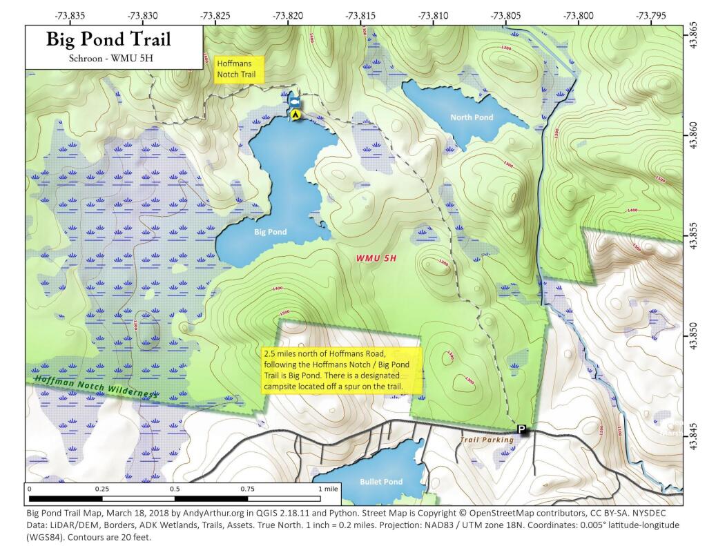
2.5 miles North of Hoffman's Road, following the Hoffmans Notch Trail aka Big Pond Trail there is a designated campsite located a spur of the trail going down to the lake.
Elephant Head Trail
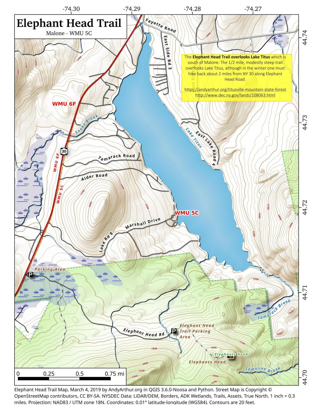
The Elephant Head Trail overlooks Lake Titus which is south of Malone. The 1/2 mile, modestly steep trail overlooks Lake Titus, although in the winter one must hike back about 2 miles from NY 30 along Elephant Head Road. There is a nice description of the hike with many photos over at All Trails. https://www.alltrails.com/trail/us/new-york/elephants-head-trail
Meco Lake Trail (Piseco-Powley Road)
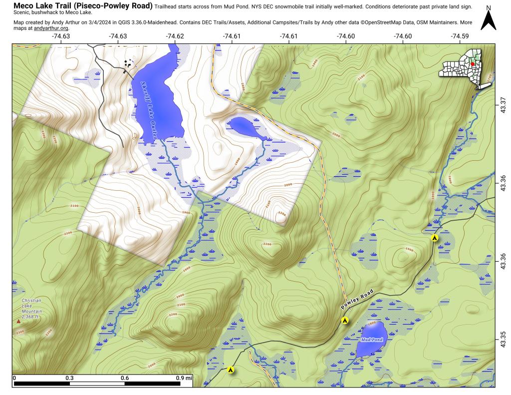
The Meco Lake Snowmobile Trail can be found near Mud Lake on Piseco-Powley Road. It is walkable in the summer months, and is easy to follow the 1.4 miles to the end of state land, however a somewhat harder to follow trail continues beyond that with views of Meco Lake about a 1/2 mile further. The private land is not posted, however there is a sign requesting you remain on the trail.
Bridgebrook Pond Trail
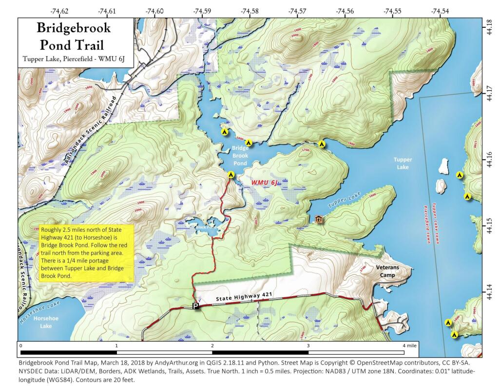
Bridge Brook Pond is located west of Tupper Lake. You can access it via a 1/4 mile portage from Tupper Lake or via the Bridge Brook Pond Trail, which runs from the northerly beginning of the forest preserve on NY 421 (Horseshoe Lake Road), 2 miles to Bridge Brook Pond. Black Pond is on the way up to Bridge Brook Pond, you will pass it one mile to the north of NY 421.
More information can be found the Tupper Lake website: https://www.tupperlake.com/hiking/black-and-bridge-brook-ponds
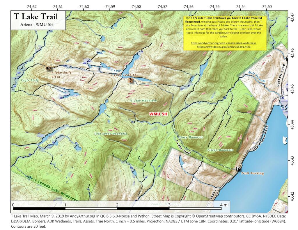
T Lake Trail
Debar Mountain Trail
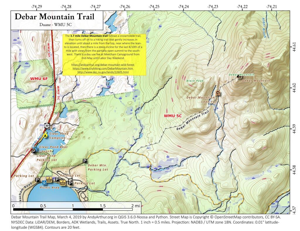
Debar Mountain Trail (3,305 feet) extends 3.7 miles and ascends 1,725 feet from the trailhead within Meacham Lake Campground to the summit of the mountain. The trail ascends only 170 feet in the first 1.9 miles and ascends 755 feet in the next 1.3 miles. The last portion of the trail is steep, climbing 800 feet in the 0.5 mile to the summit. A lean-to is located along the trail just before the last steep section to the summit. Views at the top are limited by the trees growing on the summit but include the High Peaks to the south. When the campground is open, hikers are required to pay a day-use fee.