Search Results for: map giant mountain 2

High Peaks Wilderness Parking ๐Ÿ—ป

High Peaks Wilderness Parking ๐Ÿ—ป

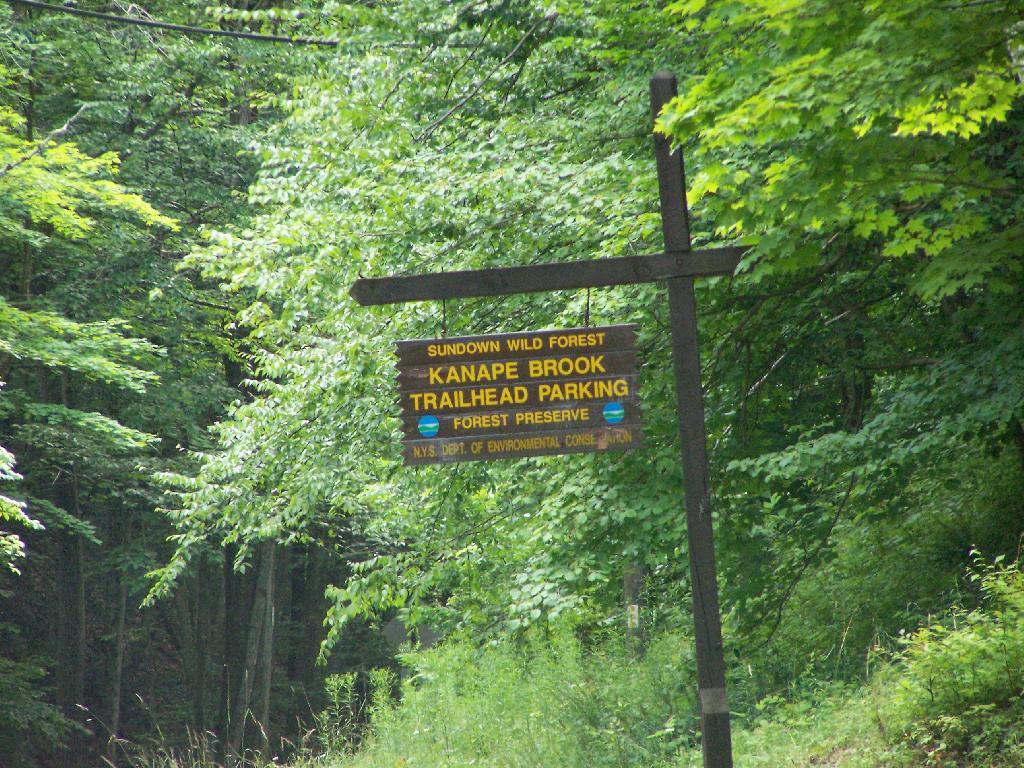
Below is a list of DEC parking areas in the High Peaks Wilderness.

Parking Area Description Nearby Trail Road On Lat Lng
Ampersand Parking Lot   Blueberry Horse Trail Amperstand Road 44.1916605216101 -74.2634384334002
Amr Parking Lot Maintained By Dot, 20 Vehicle Capacity Roaring Brook Trailto Giant Mtn. Ausable Club Road 44.1497419915036 -73.7679950097098
West Mill Brook Parking Lot Maintained By Dot, 6 Vehicle Capacity Courtney Pond Trail Dix Wilderness Trail 44.0249442519573 -73.7047623540544
Elk Lake Parking Lot 12 Vehicle Capacity Elk Lake To Marcy Trail Elk Lake Road 44.0196996395741 -73.8266783528032
Cascade Mountain Parking Paved, Roadside Pull-Off Casade Mountain Trail NY 73 44.2196728508921 -73.8858798087473
Cascade Lakes Picnic Parking   Pitchoff Mountain Trail NY 73 44.2255447838164 -73.8751811579178
Cascade Mountain Parking Paved, Roadside Pull-Off Pitchoff Mountain Trail NY 73 44.2189443167024 -73.8874781553099
Cascade Mountain Parking Paved, Roadside Pull-Off Pitchoff Mountain Trail NY 73 44.2183931807012 -73.8894370872999
Zander Scott Trail Head Parking Lot Paved, Maintained By Dot, 40 Vehicle Capacity Ridge Trail To Giant Mountain NY 73 44.138255933091 -73.7436978674947
Pull Off   Round Pond Trail NY 73 44.1368895741045 -73.7422824389762
Round Pond Parking Lot Paved, 8 Vehicle Capacity Round Pond Trail NY 73 44.1320077972245 -73.7319715371644
Chapel Pond Parking Lot Paved, Maintained By Dot, 10 Vehicle Capacity Round Pond Trail NY 73 44.1403322479409 -73.7463981627774
South Branch Bouquet River Parking Lot Maintained By Dot, 11 Vehicle Capacity Round Pond Trail Spur To Campsite NY 73 44.1040542341833 -73.6929545851725
North Branch Bouquet River Parking Lot Maintained By Dot, 10 Vehicle Capacity Round Pond Trail Spur To Campsite NY 73 44.1141894890601 -73.7097647324262
Beerwalls Parking Lot Paved, Maintained By Dot, 24 Vehicle Capacity Weston Trail NY 73 44.1456023560885 -73.7560857515608
Marcy Dam Parking Lot   Marcy Dam Truck Trail South Meadows Road 44.1896114889394 -73.9385542601212
East River Trail Parking   East River Trail Upper Works Road 44.0812112121921 -74.0551293402588
Upper Works Trail Parking   Indian Pass Trail Upper Works Road 44.0891639549695 -74.0564019659383
Walker Brook Parking Lot Maintained By Dot, 6 Vehicle Capacity Bass Lake Trail US 9 43.9994562009087 -73.7090410772457
King Phillips Spring Parking Lot Paved, Maintained By Dot, 25 Vehicle Capacity Deadwater Road US 9 At Northway 44.077412279315 -73.6652084506369

Catskill Trailhead Parking Coordinates ๐Ÿ…ฟ๏ธ ๐Ÿ” ๐Ÿ‘ฃ

Below is a listing of DEC parking areas in the Catskill Park with coordinates and addresses, nearby trails and the roads they are located on.

Trailhead Parking Lot Sign

TrailRoadNameNotesStreetCityStZIPLatitudeLongitude
Ashokan High PointWatson Hollow RoadKanape Valley Parking Lot 826 Watson Hollow RdWest ShokanNY1249441.9357923141228-74.3281141901214
Beaverkill RoadBeaverkill RoadBeaverkill Road Parking Lot 2795 Beaverkill RdLivingston ManorNY1275842.0117166110155-74.6223767934834
Beaverkill RoadTurnwood RoadBeaverkill Road Parking Lot 2952 Beaverkill RdLivingston ManorNY1275842.0233290355646-74.5995306115641
Becker Hollow TrailLane RoadBecker Hollow Parking Lot6 Vehicle Capacity3940 Route 214Elka ParkNY1242742.1816084527769-74.1969812784753
Bengle Hill TrailPeekamoose RoadEastern Upper Field Parking Lot 359 Peekamoose RdGrahamsvilleNY1274041.9166423616552-74.4377863112221
Bengle Hill TrailPeekamoose RoadLower Field Parking Lot 194 Peekamoose RdGrahamsvilleNY1274041.9101942400042-74.452852499381
Bengle Hill TrailPeekamoose RoadMiddle Field Parking Lot 304 Peekamoose RdGrahamsvilleNY1274041.9158997405029-74.443422031256
Bengle Hill TrailPeekamoose RoadNorth Middle Field Parking Lot 304 Peekamoose RdGrahamsvilleNY1274041.9164180048779-74.4416441135141
Bengle Hill TrailPeekamoose RoadTrailer Feild Parking Lot 359 Peekamoose RdGrahamsvilleNY1274041.9162603251141-74.4346555497984
Bengle Hill TrailPeekamoose RoadWestern Upper Field 359 Peekamoose RdGrahamsvilleNY1274041.9169982073948-74.4396463051141
Big Pond – Alder LakeBarkaboom RoadBarkaboom Road Parking LotLocated On Barkaboom Road, 6 Cars288 Barkaboom RdAndesNY1373142.0426860004001-74.7267519998891
Big Pond – Alder LakeCross Mountain RoadAlder Lake Parking Lot 2 Cross Mountain RdLivingston ManorNY1275842.0497953211373-74.6827571604492
Black Dome TrailBig Hollow RoadBig Hollow Road Parking Lot7 Vehicle Capacity947 Route 56MaplecrestNY1245442.2889033425096-74.1151262941519
Campbell Mountain TrailCat Hollow RoadRoute 206 Parking Lot5 Vehicle Capacity1611 County Road 7RoscoeNY1277642.051659649187-74.9147231839428
Cic – Esopus TrailState Route 28Parking Area For Esopus Creek Fishing AccessParking Area For Esopus Creek Fishing Access – Cic5067 Route 28Mount TremperNY1245742.0254799892217-74.2717292519349
Cic Hill TrailWittenberg RoadWittenberg Road Parking Lot 1298 Wittenberg RdMount TremperNY1245742.0279684988885-74.2620571929729
Colgate Lake Trail To Dutcher NotchColgate RoadColgate Lake Lower Parking Lot50 Vehicle Capacity525 Colgate RdEast JewettNY1242442.2384696568264-74.1233979344461
Colgate Lake Trail To Dutcher NotchColgate RoadColgate Lake Parking Lot2 Vehicle Capacity524 Colgate RdEast JewettNY1242442.2385040003097-74.1206960003026
Colgate Lake Trail To Dutcher NotchColgate RoadColgate Lake Trail Parking Lot8 Vehicle Capacity653 Colgate RdEast JewettNY1242442.2384599994304-74.1163269993959
Condon Hollow Rd.Condon Hollow RoadCondon Hollow Road Parking Lot3 Vehicle Capacity139 Condon Hollow RdWest KillNY1249242.2161010059593-74.4163349850283
Condon Hollow Rd.Elk Creek RoadElk Creek Road Parking Lot5 Vehicle Capacity734 Elk Creek RdFleischmannsNY1243042.1996047835286-74.4451315908425
Condon Hollow Rd.South Beech Ridge RoadBeech Road Parking Lot4 Vehicle Capacity291 S Beech Ridge RdWest KillNY1249242.2139020709257-74.4012095700882
Condon Hollow Rd.State Highway 42Rte 42 Parking Lot3 Vehicle Capacity1088 Route 42ShandakenNY1248042.1851525975488-74.4149115068685
Denman Mountain Snowmobile TrailGlade Hill RoadDenman Parking Lot 327 Glade Hill RdGrahamsvilleNY1274041.8853341886314-74.5320280123605
Denman Mountain Snowmobile TrailMoore Hill RoadHogs Roack Plot Parking Lot 578 Alpha RdGrahamsvilleNY1274041.9003387815796-74.5274487605523
Devil’s PathBroadstreet Hollow RoadBroadstreer Hollow Parking Lot2 Vehicle Capacity619 Broadstreet Hollow RdShandakenNY1248042.1394450770105-74.3308357356817
Devil’s PathSpruceton RoadSpruceton Road Parking Lot5 Vehicle Capacity1518 Spruceton RdWest KillNY1249242.1920191641918-74.3238474073796
Devil’s PathPrediger RoadPrediger Road 75 Prediger RdElka ParkNY1242742.1338909995054-74.1042720006852
Diamond Notch TrailDiamond Notch RoadSouth Diamond Notch Parking Lot2 Vehicle Capacity508 Diamond Notch RdWest KillNY1249242.147861770123-74.2646596008456
Diamond Notch TrailSpruceton RoadDiamond Notch Parking Lot8 Vehicle Capacity2778 Spruceton RdWest KillNY1249242.1823740001994-74.2695430002389
Dry Brook Ridge TrailMill Brook RoadDry Brook Ridge Parking Lot 12 Balsam Mountain Camp RdMargaretvilleNY1245542.0715022570921-74.5738756337513
Dry Brook Ridge TrailSouth Side SpurNorth End Of Dry Brook Ridge Parking Lot 301 Southside SpurMargaretvilleNY1245542.1446292458628-74.649333317932
Elm Ridge TrailPeck RoadPeck Road Parking Lot10 Vehicle Capacity189 Peck RdMaplecrestNY1245442.2965789997488-74.1693680002929
Fluggertown Road Long Pond TrailFluggertown RoadFlugertown Road Parking Lot 191 Flugertown RdLivingston ManorNY1275841.9347657909639-74.649696950272
Flynn TrailMongaup RoadMongaup Road Parking Lot 1 Beech Mountain RdLivingston ManorNY1275841.9467974587868-74.7052771774711
Giant Ledge-Panther Mountian-Fox Hollow TrailFox Hollow RoadFox Hollow Road Parking Lot 67 Mountain DrShandakenNY1248042.1008382907335-74.3904559601097
Giant Ledge-Panther Mountian-Fox Hollow TrailPeck Hollow RoadPeck Hollow Road Parking Lot 254 Peck Hollow RdShandakenNY1248042.1357649784827-74.3712920364471
Giant Ledge-Panther Mountian-Fox Hollow TrailPeck Hollow RoadEsopus Creek Fishing Access (Upper)Gravel7019 Route 28PheoniciaNY1246442.1065553340012-74.3519924442835
Giggle Hollow TrailNY 23 โ€“ BelleayrBelleayre Day Use Parking Lot 33 Friendship Manor RdPine HillNY1246542.1256810090987-74.4731178408634
Harding Road Spur TrailWhites RoadWhites Road Parking Lot4 Vehicle Capacity274 White RdPalenvilleNY1246342.1823951680298-74.0261906353256
Harding Road TrailHarding RoadHarding Road Parking Lot5 Vehicle Capacity3525 Route 23APalenvilleNY1246342.1762358120255-74.0304949714876
Huckleberry North TrailHill RoadHill Road Parking Lot4 Vehicle Capacity1209 Hill RdMargaretvilleNY1245542.1166129796449-74.6486105632054
Huckleberry North TrailHuckleberry Brook Spur RoadHuckleberry Brook Road Parking Lot6 Vehicle Capacity1613 Huckleberry Brook RdMargaretvilleNY1245542.1130238724914-74.6515523618233
Huckleberry South TrailHuckleberry Brook Spur RoadHuckleberry Road Parking Lot5 Vehicle Capacity1073 Huckleberry Brook RdMargaretvilleNY1245542.1152546105706-74.6636037740616
Huckleberry South TrailHull RoadPloutz Road4 Vehicle Capacity1634 Ploutz RdMargaretvilleNY1245542.0938719675255-74.6204457323272
Huggins Lake TrailBerry Brook RoadHuggins Lake Road Parking Lot4 Vehicle Capacity2414 Holiday And Berry Brook RdRoscoeNY1277642.0157959909969-74.8436914198853
Jockey Hill Bicycle TrailWood RoadWood Road Parking Lot 334 Woods RdKingstonNY1240141.9777439980953-74.0501113306995
Kaaterskill Falls TrailState Highway 23aMolly Smith Parking LotDot Facility, 20 Vehicles4729 Route 23AElka ParkNY1242742.1898508772368-74.074111945438
Kaaterskill Rail TrailLaurel House RdLaurel House Rd 103 Laurel House RdTannersvilleNY1248542.1956250050266-74.063093393786
Kelly Hollow Long Loop TrailMill Brook RoadEast Kelly Hollow Parking Lot 5163 Mill Brook RdMargaretvilleNY1245542.078800277463-74.6497556922038
Kelly Hollow Long Loop TrailMill Brook RoadWest Kelly Hollow Parking Lot 5163 Mill Brook RdMargaretvilleNY1245542.0795848697519-74.6545040693769
Long PathSteenburg RoadSteenburgh Road 2425 Platte Clove RdElka ParkNY1242742.1337889994516-74.0819709994867
Long PathRoute 23Route 23 Parking Lot20 Vehicle Capacity3 Cross RdWindhamNY1249642.312706999584-74.1904309994766
Long Pond South LoopWillowemock RoadWild Meadow Road Parking Lot 136 Round Pond RdClaryvilleNY1272541.9435338737706-74.5864488816452
Lost Clove TrailLost Clove RoadLost Clove Parking Lot 343 Lost Clove RdBig IndianNY1241042.1054379266455-74.4700849794812
Mary Smith TrailHolliday Brook RoadHoliday And Berry Brook Road Parking Lot5 Vehicle Capacity3851 Holiday And Berry Brook RdRoscoeNY1277642.0386999995498-74.8473909994493
Mckinley Hollow TrailMc Kinley Hollow RoadMckinly Hollow Parking Lot 200 McKinley Hollow RdBig IndianNY1241042.0704132895809-74.4740296153462
Mckinley Hollow TrailRider Hollow RoadRider Hollow Parking Lot 12 Warren Todd Subdivision DrArkvilleNY1240642.1018368545182-74.5170339246663
Mckinley Hollow TrailBurnham Hollow RoadBurnham Hollow Parking Lot 17 Sagmore TrlBig IndianNY1241042.05564157218-74.4669789486585
Middle Mountain TrailMary Smith Hill RoadMary Smith Hill Road Parking Lot3 Vehicle Capacity865 Mary Smith Hill RdAndesNY1373142.0401290003224-74.8089319993063
Mink Hollow TrailMink Hollow RoadLake Hill 599 Mink Hollow RdBearsvilleNY1244842.1051314008054-74.1735651990356
Mount Pleasant-Romer MountainState Highway 28Sawmill Lot50×50 Parking Area – Trailless6331 Route 28PhoeniciaNY1246442.1008585056075-74.3445327399439
Mud Pond TrailCounty Road 179aOld Rte 17 Fishing Access6 Vehicle Capacity6175 State Route 17 WRoscoeNY1277641.9497668355721-74.9281906252666
Mud Pond TrailHorton Brook RoadLittle Fuller Brook Parking Lot6 Vehicle Capacity845 Horton Brook RdRoscoeNY1277642.0159481159029-74.9790550095988
Onteora Lake Parking AccessState Highway 28Onteora Lake Trailhead Upper Lot 881 Route 28KingstonNY1240141.9807660434687-74.0853059041223
Onteora Lake Yellow TralNY 23Onteora Lake Parking 960 Route 28KingstonNY1240141.9840941553893-74.0827910535657
Overlook Spur Trail ExtensionMacdaniiel RoadMeads Meadow Parking Area 452 MacDaniel RdBearsvilleNY1240942.0756312690235-74.1276188121255
Overlook TrailMeads Mountain RoadOverlook Mountain Trailhead 334 Meads Mountain RdWoodstockNY1249842.0710794980857-74.1224765106456
Peekamoose-Table TrailPeekamoose RoadPeekamoose Road Parking Lot 415 Peekamoose RdGrahamsvilleNY1274041.9233895882109-74.4128616227944
Peekamoose-Table TrailPeekamoose RoadPeekamose Mountian Trail Head Parking Lot 415 Peekamoose RdGrahamsvilleNY1274041.9149365156904-74.4289858455429
Pelnor Hollow TrailBeaver Kill RoadWaneta Lake Parking Lot 732 Beaverkill RdLivingston ManorNY1275841.9676202925977-74.8292314401778
Phoenicia East Branch TrailDenning RoadDenning Road Parking Lot 3381 Denning RdClaryvilleNY1272541.9690314347788-74.4486958819482
Phoenicia East Branch TrailOliverea-Slide Mountain RoadOliverea Road North Parking Lot 1453 Oliverea RdBig IndianNY1241042.0265659167754-74.4038665935078
Phoenicia East Branch TrailOliverea-Slide Mountain RoadOliverea Road South Parking Lot 19 Shandaken Rod Gun ClbBig IndianNY1241042.0078280894865-74.4268762683237
Phoenicia TrailPlank RoadTremper Mountain Parking AreaGravel Lot5636 Route 28PhoeniciaNY1246442.0705625579484-74.3024012416267
Pine Hill West Branch TrailWest Branch RoadBiscuit Brook Parking Lot 1886 Frost Valley RdClaryvilleNY1272541.990833872737-74.4845571593918
PowerlineBeech Ridge Road 1Vinegar Hill Parking Area 1060 N Beech Ridge RdPrattsvilleNY1246842.2449000123037-74.4075985539776
Red Hill Fire Tower TrailRed Hill RoadRed Hill Fire Tower Parking Lot 129 Coons RdClaryvilleNY1272541.9302938486155-74.5073498606472
Roaring Kill TrailDale LaneRoaring Kill6 Vehicle Capacity155 Roaring Kill RdElka ParkNY1242742.1511360000949-74.1310779997324
Rochester HollowShaft RoadShaft 6 Parking20 Vehicle Capacity73 Shaft RdShandakenNY1248042.166173156258-74.4083342114093
Rochester HollowSpisak WayRochester Hollow Parking Lot 51 Matyas RdBig IndianNY1241042.1179698674129-74.4517651458059
Seager Big Indian TrailDry Brook RoadSeager Parking Lot 5672 Dry Brook RdArkvilleNY1240642.0578836653667-74.5396998623234
Spencer RoadTrails End RoadTrails End Parking Lot 197 Trails End RdKerhonksonNY1244641.8835868385135-74.3594081701432
Spruceton TrailSpruceton RoadSpruceton Trail Parking Lot20 Vehicle Capacity2628 Spruceton RdWest KillNY1249242.1846329998217-74.2719879999707
Touch-Me-Not-TrailBarkaboom RoadBig Pond Parking LotLocated Off Barkaboom Road, 6 Cars366 Barkaboom RdAndesNY1373142.0433679998314-74.7277000006876
Touch-Me-Not-TrailBeech Hill RoadBeech Hill Road Parking Lot3 Vehicle Capacity2054 Beech Hill RdAndesNY1373142.0506230001697-74.7789470006467
Touch-Me-Not-TrailDeerlick Brook RoadDeerlick Road Parking Lot3 Vehicle Capacity1553 Deerlick Brook RdAndesNY1373142.0814567992576-74.7365160981546
Touch-Me-Not-TrailBarkaboom RoadForest Preserve Access ParkingEast Of Barkaboom Road 3 Cars1954 Barkaboom RdAndesNY1373142.0655363440977-74.7284401046935
Trout Pond Access RouteRussell Brook RoadRussell Brook Road Parking Lot10 Vehicle Capacity4348 Russell Brook RdRoscoeNY1277641.9943949997582-74.941432999876
Trout Pond TrailCampbell Brook RoadCampbell Brook Road Parking Lot 4747 Campbell Brook RdDownsvilleNY1375542.0306374772623-74.9384473452279
Trout Pond TrailCampbell Mountain RoadCampbell Mountain Road Parking Lot5 Vehicle Capacity3693 Campbell Mountain RdDownsvilleNY1375542.0433291750688-74.9358959381363
Vernooy Kill Falls Snowmobile TrailDymond RoadDymond Road Parking Lot 498 Yeagerville RdNapanochNY1245841.8792625226568-74.4012606035291
Vernooy Kill Falls Snowmobile TrailUpper Cherrytown RoadUpper Cherry Town Road Trail Head Parking Lot 559 Upper Cherrytown RdKerhonksonNY1244641.8643822024537-74.3454535201223
Willow TrailAbbey RoadMount Toblas Parking Lot 439 Abbey RdMount TremperNY1245742.0537752508176-74.2306894602594
Willow TrailJessup RoadWillow Trailhead Parking6 Vehicle Capacity218 Jessop RdWillowNY1249542.078213053797-74.2442314353898

Gorging on Gorges, An Adventure, Day 1

About a month ago, I took a trip I gave the name โ€œGorging on Gorgesโ€. As the name would suggest, most of the trip involved visiting various gorges, taking photographs of them, and otherwise exploring them. About half of them I had previously been to, while the rest were new. I also visited several other state parks, state forests, and national forests โ€“ and did something I havenโ€™t done in a long time โ€“ camped one night in a developed campground.
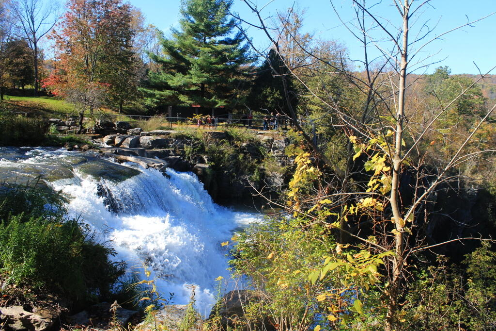
Towards the Park

I started out my trip from Albany, taking US Route 20 West from I-88. I really wanted to avoid expressways for the bulk of my trip, is my general view is that expressways are the best way to get across America without really seeing anything. Itโ€™s more then a philosophical argument for me โ€“ whatโ€™s the purpose of a vacation if your rushing from point โ€œAโ€ to point โ€œBโ€.

The first part of the trip, I drove to Chittenango Falls State Park via Nelson and beautiful farm country so high above. I walked down into the gorge, and up and around the falls. The color was somewhat muted, but it still was quite pretty. Then I headed off, taking some side roads as recommended by my GPSโ€™s most direct route, and ended up passing a few miles from Labrador Hollow and the beautiful Labrador Pond, and said, heck, I got to stop on by there.

I drove down to Labrador Pond parking area, and hiked down to the pond. The colors were still not fully-turned on Jones Hill, but on Labrador Mountain were well past peak. Despite the crowds of fall foliage peepers from Syracuse, crowding the area, there were adequate opportunities for solitude. I walked down to the lake, snapped a few photos, then hiked the nature trail/boardwalk. It was nice. It also was great to see the boardwalk being used by a disabled man โ€“ he could get out and enjoy nature, despite his difficulties he had walking. One of the large dairies in the area was spreading something on fields nearby, and it sure stunk โ€“ it seemed nastier then fermented grain, although thatโ€™s probably what it was. Didnโ€™t stick around too long, as I had places to go.
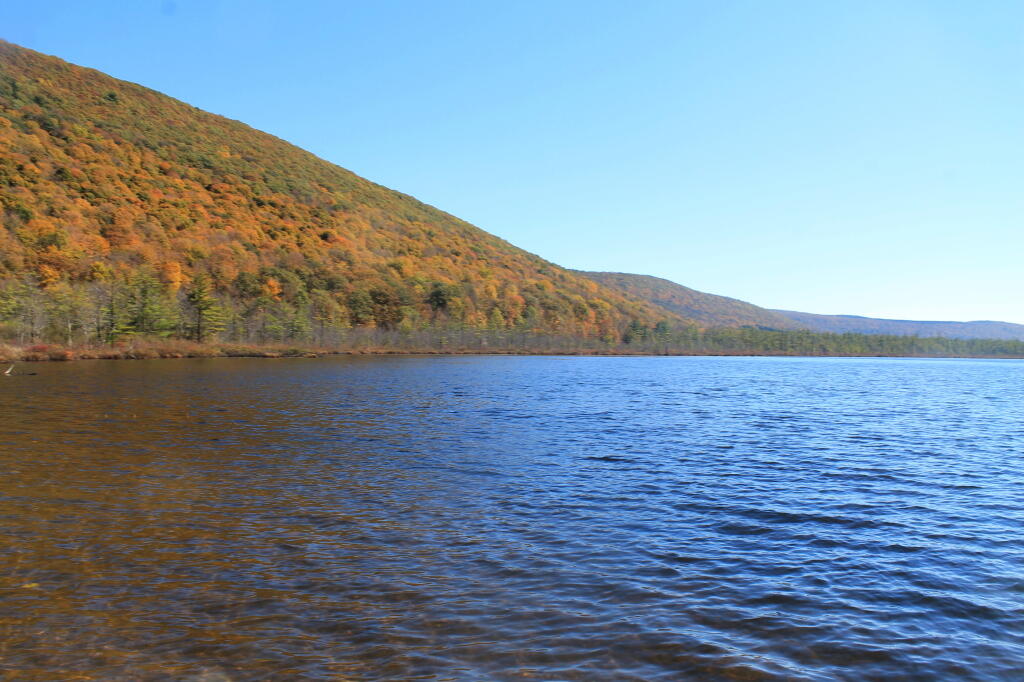
Somewhat Faded Colors

Drove down through Prebles, another deep, rich agricultural valley, dotted by large dairies that take advantage of the areaโ€™s rich soils for producing many bushels of corn on each acre. Got held up for about 5 minutes during a paving job, where they had the road restricted to one lane, for what had to been a half mile or so. Noticed how most of remaining trash burning barrels had disappeared from the landscape, that might have only been there 3 or 4 years ago.

Then it was off to Homer, where I passed a moose, made out of welded scrap metal along the road. It was kind of a neat roadside attraction, and I really should have stopped and got a picture, but I had a tight schedule and was burning daylight. I would come to later regret not getting that picture, but heck, I figure I can probably find a picture of it on the Internet using Google Images or Flickr. If not, it will certainly be there, the next time I find myself going through this roadside wilderness.
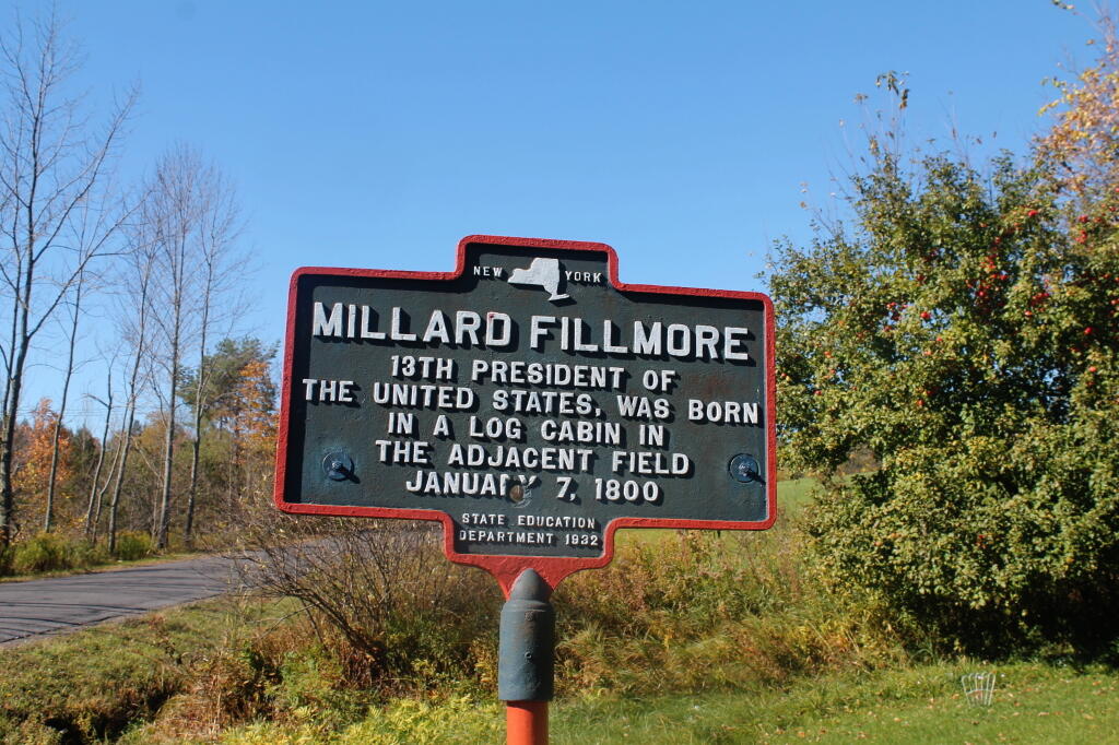
Millard Fillmore Historic Marker

I got lost on my way to Moravia. Not really lost, because I was following the GPS, but because I had programmed the โ€œmost direct routeโ€ rather then โ€œfastest routeโ€, the GPS.decided to take me up a rough dirt road through Hewitt State Forest. I declined, and eventually the GPS found a new route, that happened to take me past Milton Fillmoreโ€™s birthplace. There is now a picnic pavilion and a some landscaping in that location. I turned around, snapped a few pictures, and explored it briefly. I wanted to a get a picture for dad for his historical markers collection.

Then it was off to Fillmore Glen. I was running a bit late at this point, but itโ€™s a pleasant drive down to Filmore. The landscape is pretty rural until you drop, rather quickly into Moravia. Moravia is a pretty, small rural town; the glen is located at far southernly end of the town. There was a bridge being replaced in town, and you had to wait, for what seemed like an eternity for the light to green on the on-one lane bridge.

Finally, I got to the park entrance. The older guy there, grumbled when I said I had an Empire Pass. He was like โ€œwhere is it โ€“ I canโ€™t see itโ€. The rear window on my truck where the Empire Pass is tinted, but not that dark. I was slightly annoyed that the park entrance guy wasnโ€™t friendly, and I forgot to ask for a map. I was kind of rushing. Got parked, and there was a big wedding going on, complete with horse drawn carriage. Crossed the โ€œDry Creekโ€ and started up the trail, first to the Cow Shed falls, then decided to take the Northern Rim Trail. It wasnโ€™t apparent at first that it was the rim trail, but I didnโ€™t have a map. I actually printed up a map, and had it my truck, but I of course forgot it.
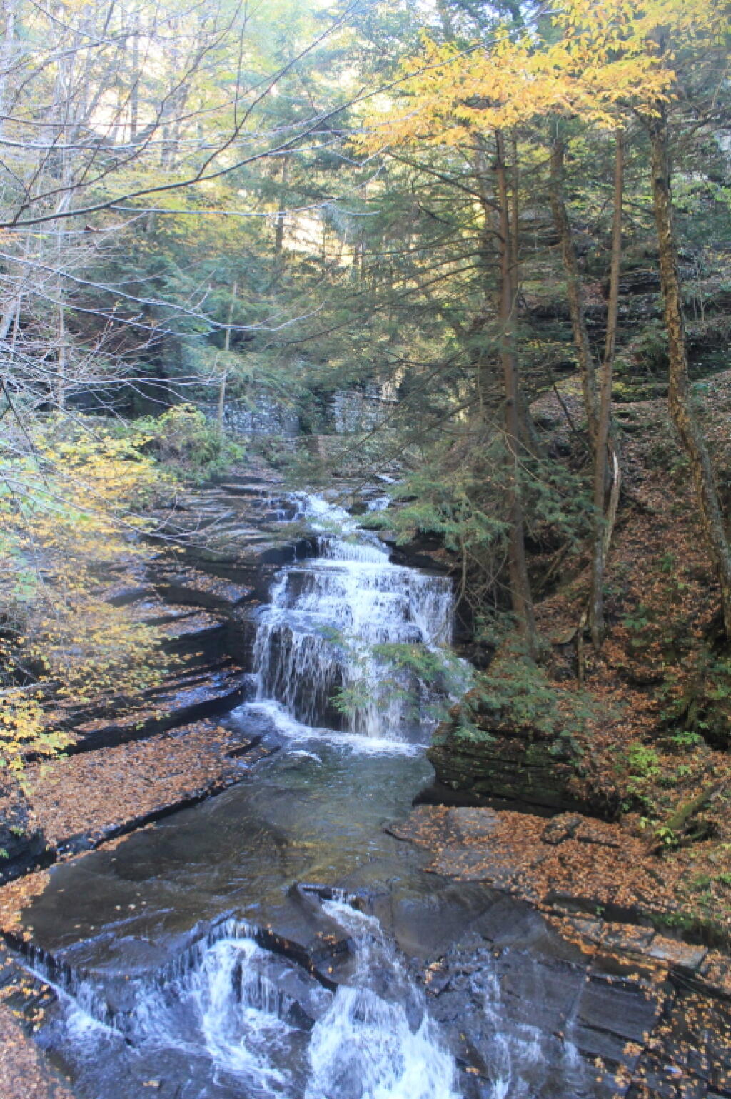
Small Waterfall in Gorge

The Northern Rim climbs a fair bit, then runs along the rim, with very limited and occasional views. It crosses a pretty little creek that tumbles down the gorge, and eventually leads to a path down to the gorge trail, three-quarters the way up the gorge. I decided to hike down to the gorge trail, and then head back down the gorge towards the parking area. I missed a bit of the gorge trail, and the overlook, but so be it, time was tight.

The Gorge trail was scenic, but certainly not the most scenic of gorges. There were several small waterfalls, and some stairs and bridges, although most of the trail was gravel along the edge. The โ€œDry Creekโ€ had plenty of water, but in general, the gorges was smaller then other Finger Lake gorges. There were several glens of interest, but the most beautiful portion of the glen was the Cow Sheds in the button of the gorge. Cow Sheds falls, are the wider portion of the gorge, where at one time, historically, cows would gather for shelter in severe or cold weather.
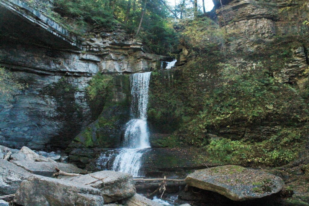
Cow Sheds Falls

Snapped a few more pictures of Fillmore Glen, and it was off to Ithaca. I made pretty good time to Ithaca, although I admit I certainly wasnโ€™t poking along. I really should have stopped more places, but I wanted to get to the Finger Lakes National Forest relatively early so I could set up camp and/or make alternative plans should my desired campsite on Chicken Coop Road be unavailable. Passed a giant bull statue on a farm, along NY 38, a few miles south of Moravia. I really should have stopped for a picture, but I was burning daylight, and the Finger Lakes National Forest, was over an hour away. I think this is the one, that the farmer paid like $10,000 to haul from an abandoned Steakhouse in Binghamton to the farm. I am sure the bull will be there for a long time โ€“ in case anybody forgot what is raised on farms.

Then it was down to Freeville.. The only thing real remarkable about that town, was the pine barrens and swamps, consisting of heading into it. When you think of the Finger Lakes, you tend to think open landscapes and farms, at least until you get mostly south of them of them, or in the highest points to the west. But not here. The Finger Lakes Trust owns some land, on the north side, where it the land is mostly the backwaters of the Oswaco Inlet.

Finally made it to Ithaca by 4:45 PM. I was lucky at this hour that traffic wasnโ€™t too much of a slog by Ithaca standards, then I was off heading up Trumansberg Road. It seemed like an endless drive. Finally made it to Perry City, and then to the Finger Lakes National Forest. There was no sign of the government closure when I got there, but a bit disappointed, my favorite campsite on Chicken Coop Road was already taken. It was off to campsite on Potamac Road, just past the hunting camp.

I wasnโ€™t thrilled by campsite, a big field campsite, but it had some trees along one edge for hanging the flag and lights. It was pretty good site for observing the stars, although there was a hunting camp down the road a little ways, so I had to keep the music down. I really donโ€™t want to piss off the hunters. I gathered up some firewood from the woods, and got a fire started. The sun was fading fast, but so be it. I wired up my lights, some Christmas lights, and got the spot light on the flag.

It got dark, and I tuned into the Ithaca Progressive Radio Station, and gazed on the stars for a couple of hours. Nibbled on some snacks, cracked open a beer or two. Tossed some more wood on fire, and was happy to finally be on vacation.

It was a good first day… more adventures to come.
Delightful Fall Hikes

Pillsbury Mountain (Central Adirondacks).

Located in the Jessup River Wild Forest, North of Spectulator, offers great views of West Canada Wilderness, Cedar River Flow, Moose River Plains, Spectulator Tree Farm, Siamese Pond Wilderness. Should be close to peak foliage now. Consider camping at the roadside/tent campsites along Mason Lake to the North on Jessup River Road / NY 30. Take NY 30 to Jessup River Road to Military Road to Parking Area to get there. You may want to park at the start of Military Road if you have a low-clearance vehicle.

Snowy Mountain

Click on map to download and print.

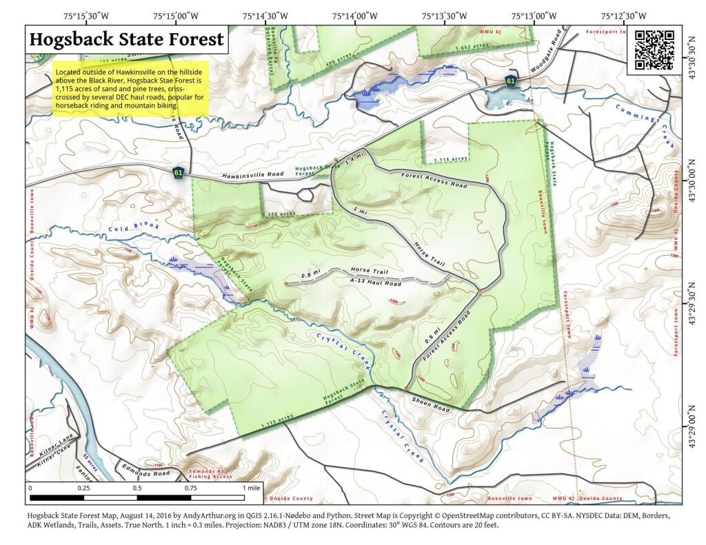
 Hogsback State Forest

Hadley Mountain (Southern Adirondacks).

Located near Stony Creek, NY, it offers some great views of the Wilcox Lake Wild Forest and the Great Scanadaga Lake. I’ve never been there in the fall, but I suspect it offers many great views this time of year, with peak foliage being not far away.

Looking North

Click on map to download and print.

Gully

Buck Mountain (West Shore Lake George, Adirondacks)

This is one of my most recent hikes, but definately offers really good views of Lake George and elsewheres, especially now that the fall colors are starting to set on in. One of the more difficult hikes on the list, it’s not really that difficult, but if you go from Pilot Knob, expect a 3.1 mile hike, and gaining around 2,100 feet in elevation. Regardless, a very nice hike.

2022 NY Congress Results Map

Click on map to download and print.

Route 9 & 20 in Rensselaer

Kaaterskill Clove (Haines Falls, Catskills).

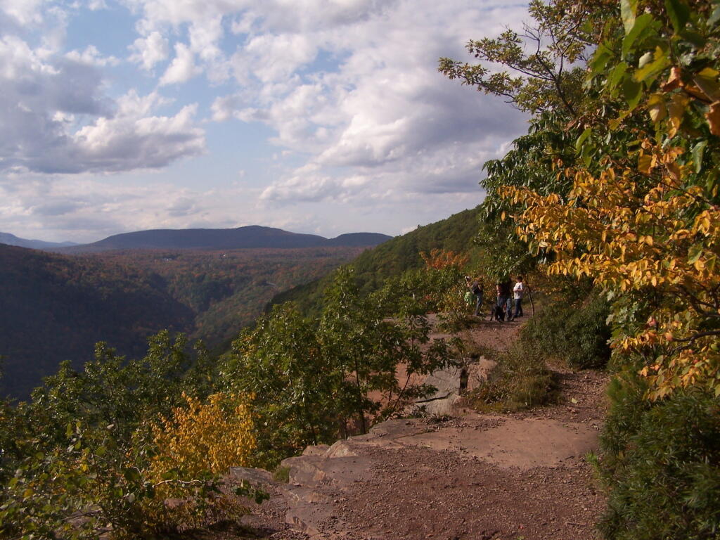
Located near the North South Lake Campground, offers great views of the Clove, Hunter Mountain, Palenville, Hudson River, and farms and other lands near Catskill. Park on Scutt Road for free, which is last right before campground. Take Escarpment Trail all the way around to the Catskill Mountain House Ruins, then walk past North-South Lake.

* Area may be temporarily be closed due to Irene.

Inspiration Point

Click on map to download and print.

 Ferns Covered Woods

Giant Ledge (High Peaks, Catskills).

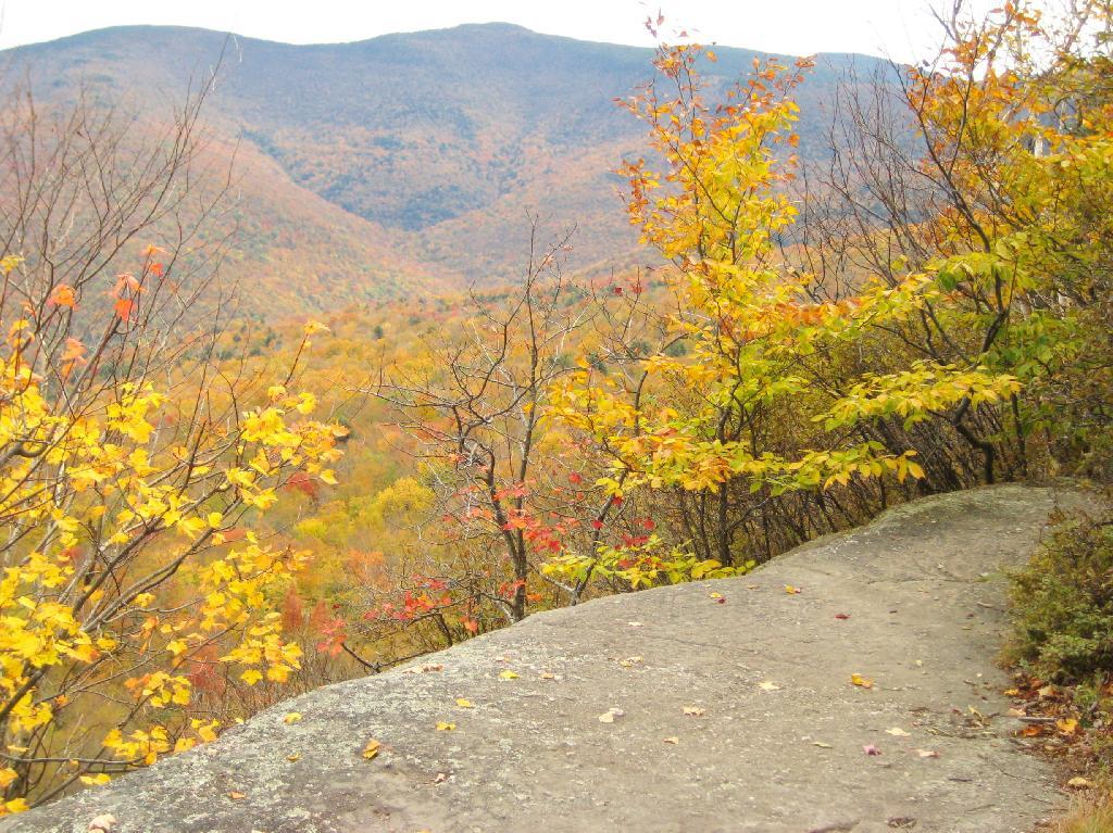
Located on the ledge between Slide Mountain and Panther Mountain, a relatively easy hike, with a relatively brief but not scary scramble onto the ledge that runs for 3/4 mile. Colorful views of vast Woodland Valley with Mount Tremper and other mountains in the distance, along with good views of Slide Mountain, Cornell Mountain, and other hike peaks.

* Slide Mountain Road was severely damaged by Irene. Area may be temporarily be closed due to Irene.

Untitled

Click on map to download and print.

When Thanksgiving Falls, 2000 to 2099