Search Results for: Map
Mattydale
NY 5 Westvale Stub
The east end of this expressway (right) is located in the Westvale neighborhood of the Town of Geddes. The expressway was planned to continue across West Genesee Street as a southwestern bypass of Syracuse, and would have connected with the junction of Interstates 81 and 481 in southern Syracuse. A spur from this beltway would have carried NY 5 into the downtown district. Today, the expressway stub shows a partially-built folded diamond interchange (with a loop in the northeast quadrant), where today NY 5 turns east onto West Genesee Street towards Solvay. The cleared right-of-way is largely intact along the highway's planned path through the Towns of Geddes and Onondaga, although new development can already be seen on the south side of Genesee Street.
Nedrow Interchange
The interchange between Interstate 81 and 481 on the south-side of Syracuse.
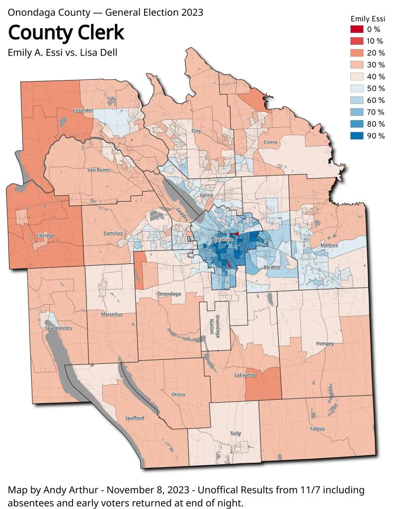
Onondoga County Clerk 2023 – Emily A. Essi vs. Lisa Dell
Otisco Lake Causeway
The bridge was washed out by high water and wind in 1929 and never replaced, according to Tony Geiss, deputy director of the Onondaga County Water Authority. The 100-yard area where people fish is located on the western side of the lake and is accessible from West Valley Road.
More: https://www.syracuse.com/outdoors/2012/06/cny_shoreline_hot_spots_the_ca.html
Onondaga County Presidential Election 2020
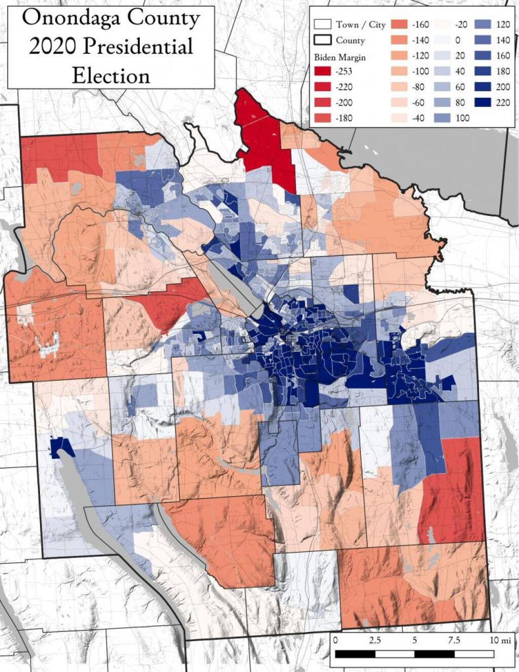
While I have made several maps of presidential and local elections in Albany County, I thought I should take a look at other counties now that I have figured out how to get this data from the Arc MapServer.