Empire State GIS/Mapping DIYer Phenom: Andy Arthur | eSpatially New York
Search Results for: map the empire state map
Map | Empire State Trail
Thinking about exploring this later today.
Ezra Price Apartments and Mount Hope Development
It looks like Ezra Price was constructed around 1967, while the Mount Hope Development row houses were built from 1964-1970. Probably a subsidized development to make up for losses to downtown's residential core when the Empire State Plaza was built. I'm interested and trying to dig more into details.
Some history about Ezra Price and his estate in Mount Hope during the 1830s: https://friendsofalbanyhistory.wordpress.com/2019/10/23/albanys-mount-hope-and-ezra-prentice/
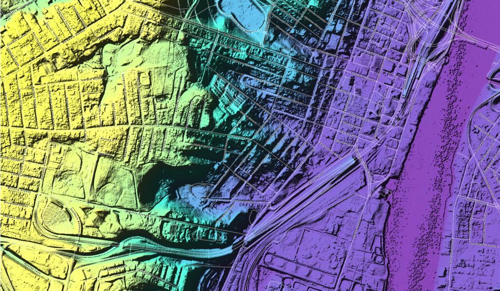
NY 5 Westvale Stub
The east end of this expressway (right) is located in the Westvale neighborhood of the Town of Geddes. The expressway was planned to continue across West Genesee Street as a southwestern bypass of Syracuse, and would have connected with the junction of Interstates 81 and 481 in southern Syracuse. A spur from this beltway would have carried NY 5 into the downtown district. Today, the expressway stub shows a partially-built folded diamond interchange (with a loop in the northeast quadrant), where today NY 5 turns east onto West Genesee Street towards Solvay. The cleared right-of-way is largely intact along the highway's planned path through the Towns of Geddes and Onondaga, although new development can already be seen on the south side of Genesee Street.
Hydrofracked Natural Gas Well, versus Empire Plaza
I knew some of the well pads were pretty big, but I was curious how they compared to the Empire State Plaza in size.
Albany’s South End, Historic Dumping Grounds
This colorized LiDAR Hillshade of elevation of the South End shows the filled in gorges in Albany South End that were used until the late 1960s for dumping trash and debris from the Empire State Plaza demolition.
Downtown Albany Take Area
Empire State Plaza take area, Albany, NY
This is a stitch of ten sheets of a Sanborn fire insurance map showing the area demolished for the Empire State Plaza in 1962 in Albany, NY Uploaded by Dave Hochfelder to Map Warper, showing his beautiful work as an overlay here. Get the original warped map here: https://mapwarper.net/maps/31269