Search Results for: map state forests
Ash Stands On State Forests
For this map I queried the NYS DEC STANDS database to make a map of state reforestation lands that ash are the dominant tree species on. Ash you can see, there are ash stands on most state lands, with white ash most common in the southern part of the state, with a mix of green and black ash on state lands primarily north of the Adirondack Park. For viewing of the polygon layer, you may want to switch to satellite view.
Purple/White = White Ash Stand
Green/Green = Green Ash Stand
Blue/Dark Gray = Black Ash Stand
Data Source: DEC State Land Forest Stands. DEC State Land Forest Stands Polygon data showing forest cover types delineated by state foresters on DEC state land. Balloons added to make easier to see. http://gis.ny.gov/gisdata/inventories/details.cfm?DSID=1356
State Forests With Pitch Pine Stands
This map shows state forests that contain pitch pine either as a dominant species, or as a secondary or tertiary species. Zoom in on a green balloon, and then you can see the a green polygon shows the identified area that contains pitch pine trees.
Data Source: NYS DEC State Land Forest Stands Polygon data showing forest cover types delineated by state foresters on DEC state land.
PA State Forests
This map shows the current lands that are part of the Pennsylvania State Forest system, operated by the Penna. Department of Conservation and Natural Resources. Each forest region is colored a different color. It is one of several types of public lands in Pennsylvania, including DCNR's State Park System, the Penna. Game Commission's State Game Lands, and the Allegheny National Forest. The state forest system is concentrated in the Pennsylvania Wilds Region of the state -- the north-central region of Pennsylvania.
State Forests
This map shows the boundaries of all of the state forests in New York State, along with a balloon showing the center point for each state forest, along with the associated DEC website on the forest.
St Lawerence County Primative Campsites And Lean Tos
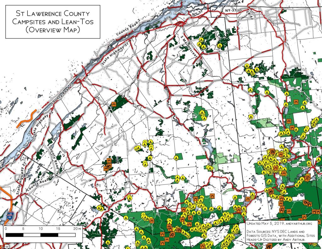
This map shows the locations of campsites on the St. Lawerence Flat Lands and surrounding areas in the north-western Adirondacks. I believe this is a fairly complete map for state land up that way, please see individual state forests for details.
Percent of Town Landmass Developed
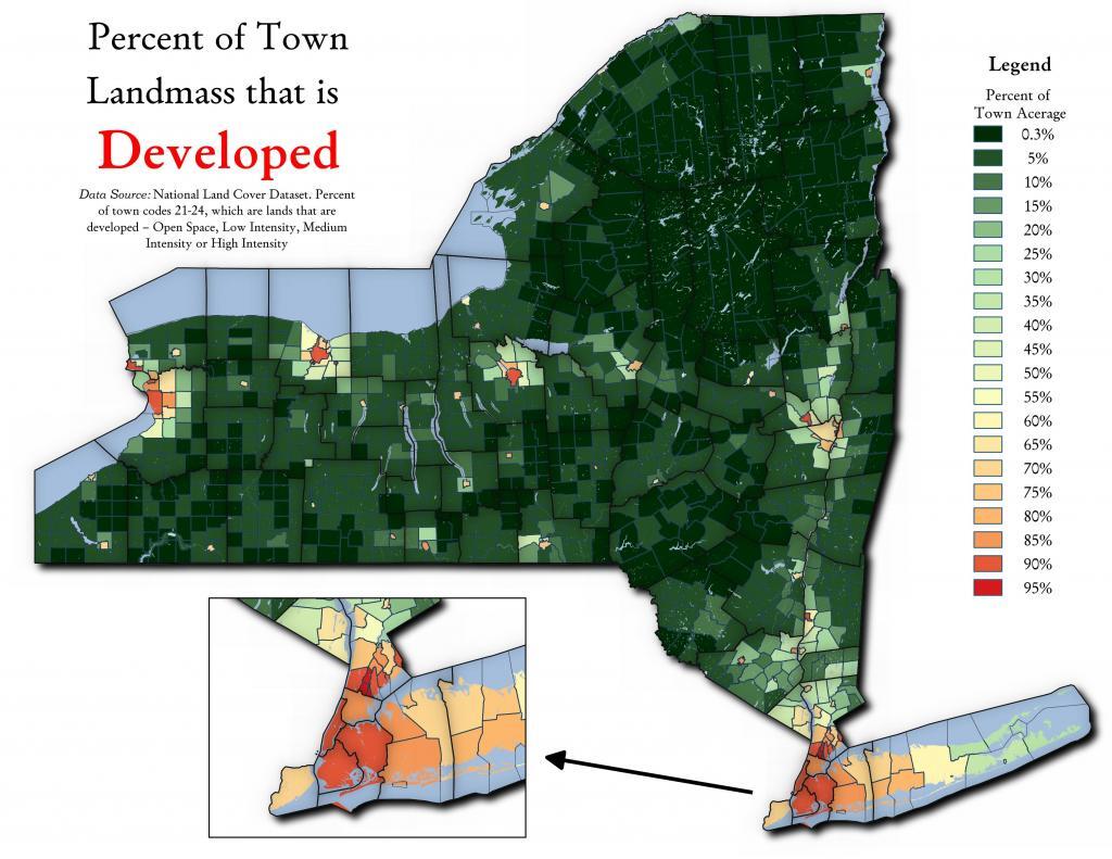
It varies a lot by town, by many of the Upstate towns are largely open space consisting of farms and forests. This analysis using NLCD 2016, includes only landmass and excludes waterways.