Search Results for: map map 9
Modern Route 10 overlaid on the old Arietta – Piseco Road (1954)
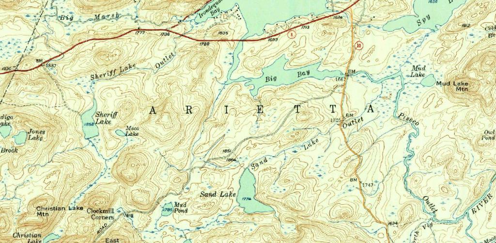
New York Route 10 is often said to be the last paved state highway in New York when the Glen Harris Highway was paved north of Arietta up through Piseco Lake in the early 1980s.
Due to constitutional constraints relating to the road running through forest preserve, with few exceptions, almost all of modern asphalt road follows the path of the dirt road, although during construction they did bank the curves and widen the road slightly from the horse and buggy road that existed in almost the same form since the 1800s.
I have the 1904 topographic maps of the area too but due to issues with the original map survey, the overlay is more difficult to do accurately compared to the more modern 1954 survey.
The modern alignment is shown in orange while the topographic map below is from 1954.
Dunn Bridge 1952
Kenwood 1893
After hiking in the Normans Kill Gorge, I was curious about the old routing of Glenmont Road and South Pearl Street.
Downtown Schenectady 1995-2021
A series of aerial photos showing changes to downtown Schenectady over 8 different time periods.
Milltowne Development in Bethlehem Center, 1994-2021
A series of 9 aerial photos that show the development over the the past 25 years or so.
Railroad Mileage Map 1910 – Rand McNally and Company
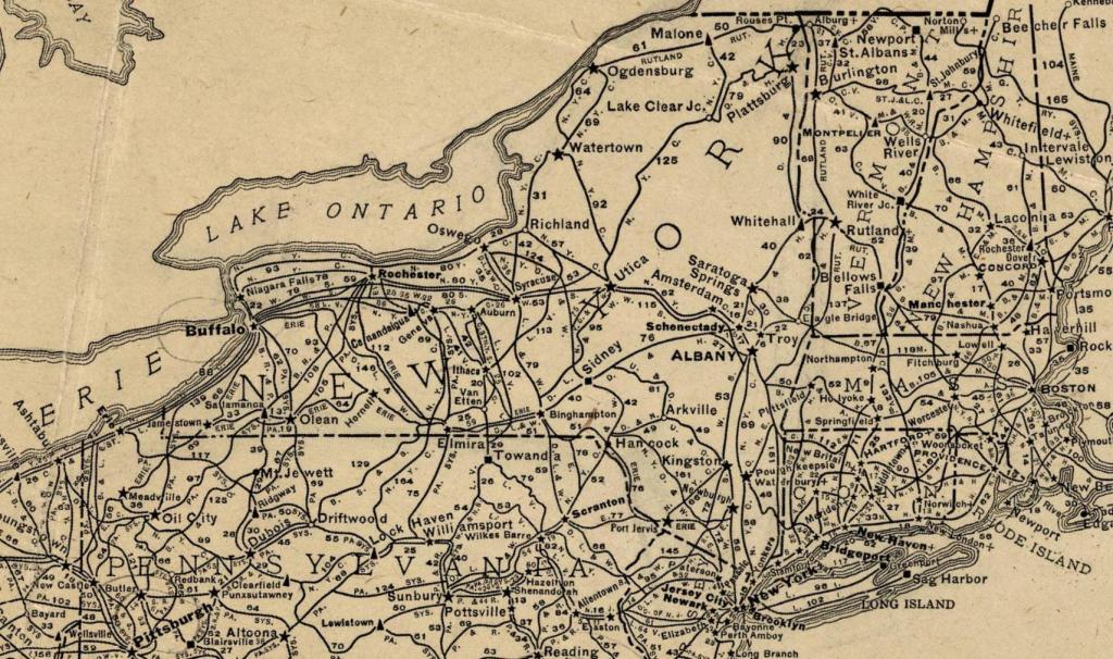
There used to be an impressive amount of railroad mileage in New York State in 1910, as seen in on this old Rand McNally map of railroads in the state.