Point 42, -74
The spot on the map you end up in Eastern NY when you are using unprojected coordinates in Eastern NY and forget to cast as a float. I wonder how many people end up at Glenhurst Stock Farm when their GPS or mapping program goes nutty.
The spot on the map you end up in Eastern NY when you are using unprojected coordinates in Eastern NY and forget to cast as a float. I wonder how many people end up at Glenhurst Stock Farm when their GPS or mapping program goes nutty.
New York Route 10 is often said to be the last paved state highway in New York when the Glen Harris Highway was paved north of Arietta up through Piseco Lake in the early 1980s.
Due to constitutional constraints relating to the road running through forest preserve, with few exceptions, almost all of modern asphalt road follows the path of the dirt road, although during construction they did bank the curves and widen the road slightly from the horse and buggy road that existed in almost the same form since the 1800s.
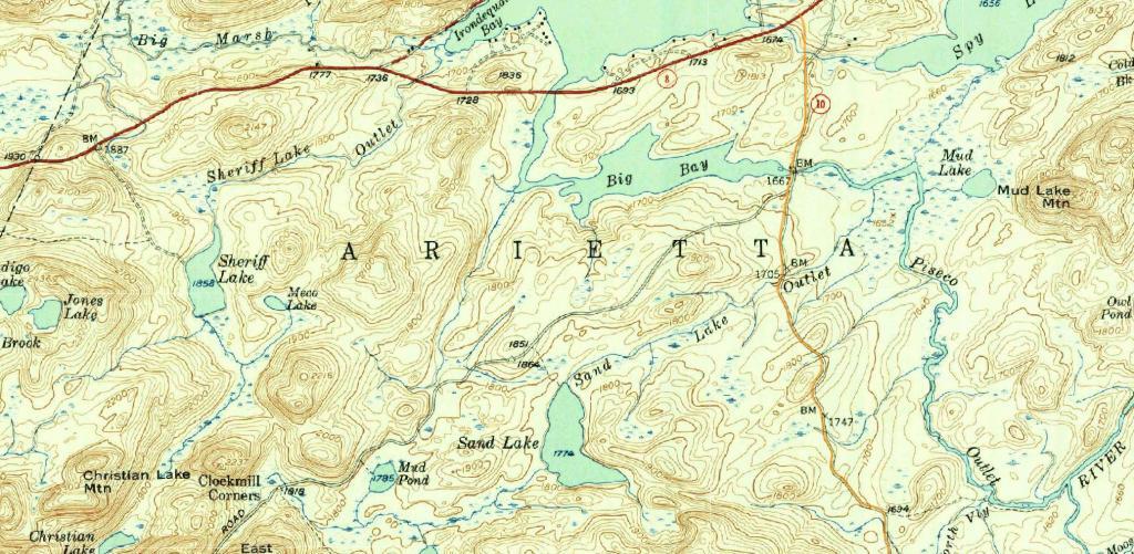
I have the 1904 topographic maps of the area too but due to issues with the original map survey, the overlay is more difficult to do accurately compared to the more modern 1954 survey.
The modern alignment is shown in orange while the topographic map below is from 1954.
The end of Interstate 684 which becomes NY 22 north of the expressway.
Continue to watch the green up locally.
A series of 9 aerial photos that show the development over the the past 25 years or so.
Watching as things green up locally.
A look at changes at the state office campus over the past 25 years.