Search Results for: map branch pond 2
USGS Topographic Maps – Albany to Delaware Counties
Counties: Albany to Delaware / Dutchess to Livingston / Madison to Otsego / Putnam to Suffolk / Sullivan to Yates
Browse Topographic Maps: Full State / Historical USGS Topographic Maps
Albany County


Allegany County


Bronx County


Broome County


Cattaraugus County


Cayuga County


Chautauqua County


Chemung County


Chenango County


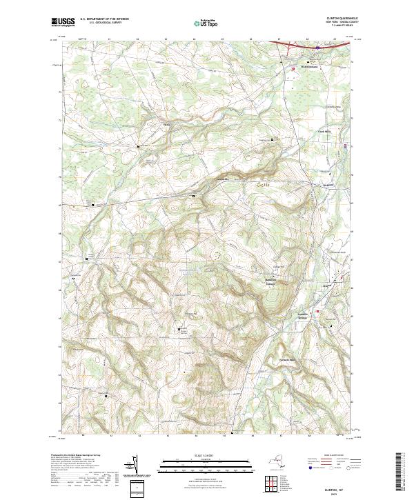
Clinton County


Columbia County


Cortland County


Delaware County


USGS Topographic Maps – Dutchess to Livingston Counties
Counties: Albany to Delaware / Dutchess to Livingston / Madison to Otsego / Putnam to Suffolk / Sullivan to Yates
Browse Topographic Maps: Full State / Historical USGS Topographic Maps
Dutchess County


Erie County


Essex County


Franklin County


Fulton County


Genesee County


Greene County


Hamilton County


Herkimer County


Jefferson County


Kings County


Lewis County


Livingston County


USGS Topographic Maps – Madison to Otsego Counties
Counties: Albany to Delaware / Dutchess to Livingston / Madison to Otsego / Putnam to Suffolk / Sullivan to Yates
Browse Topographic Maps: Full State / Historical USGS Topographic Maps
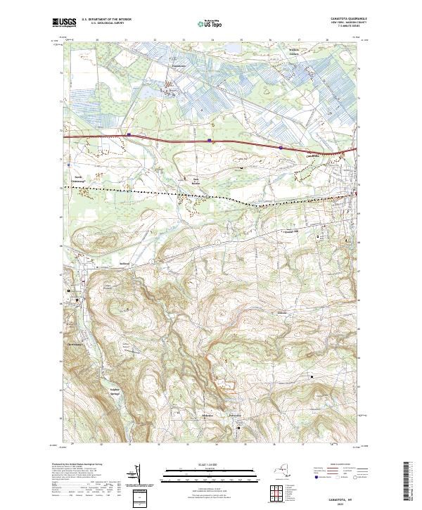
Madison County


Monroe County


Montgomery County
| PDF (50-60 MB Download) | Historical USGS Topo Maps | State Lands (Links to DEC Website) | Towns (Percent of Town’s Area) |
|---|---|---|---|
Current Amsterdam GeoPDF Map |
1954 Map No. 136622, 1954 Map No. 136623, 1954 Map No. 136624, 1954 Map No. 137071 | NA | Amsterdam city (100%), Amsterdam (56%), Duanesburg (0%), Florida (47%), Perth (28%), Princetown (0%) |
Current Canajoharie GeoPDF Map |
1944 Map No. 123405, 1944 Map No. 123406 | NA | Canajoharie (28%), Ephratah (9%), Minden (1%), Palatine (84%), Root (3%), St. Johnsville (9%) |
Current Carlisle GeoPDF Map |
1943 Map No. 122809, 1943 Map No. 122810 | Rural Grove State Forest, Yatesville Falls State Forest | Carlisle (36%), Charleston (28%), Glen (5%), Root (56%) |
Current Duanesburg GeoPDF Map |
1954 Map No. 137906, 1954 Map No. 137907, 1954 Map No. 137909 | Featherstonhaugh State Forest | Duanesburg (59%), Esperance (0%), Florida (24%) |
Current East Springfield GeoPDF Map |
1943 Map No. 138023, 1943 Map No. 138024 | NA | Cherry Valley (34%), Middlefield (19%), Minden (1%), Otsego (0%), Roseboom (4%), Springfield (57%), Stark (3%) |
Current Esperance GeoPDF Map |
1943 Map No. 138118, 1943 Map No. 138120 | Lost Valley State Forest, Charleston State Forest | Carlisle (9%), Charleston (72%), Duanesburg (3%), Esperance (54%), Florida (7%), Glen (11%) |
Current Fort Plain GeoPDF Map |
1944 Map No. 138157, 1944 Map No. 138280 | NA | Canajoharie (9%), Danube (4%), Manheim (0%), Minden (87%), Palatine (2%), St. Johnsville (25%) |
Current Oppenheim GeoPDF Map |
1945 Map No. 128927, 1945 Map No. 128928 | Fulton FP Detached Parcel, Lassellsville State Forest, Ferris Lake Wild Forest | Danube (0%), Manheim (3%), Oppenheim (75%), Salisbury (0%), St. Johnsville (62%), Stratford (1%) |
Current Pattersonville GeoPDF Map |
1954 Map No. 135974, 1954 Map No. 135975 | NA | Amsterdam (30%), Charlton (37%), Duanesburg (0%), Florida (5%), Galway (13%), Glenville (40%), Perth (6%), Princetown (7%), Rotterdam (5%) |
Current Randall GeoPDF Map |
1944 Map No. 136007, 1944 Map No. 136008, 1944 Map No. 136009 | Yatesville Falls State Forest | Ephratah (1%), Glen (28%), Johnstown city (27%), Johnstown (7%), Mohawk (62%), Palatine (14%), Root (18%) |
Current Sharon Springs GeoPDF Map |
1943 Map No. 136148, 1943 Map No. 136149, 1943 Map No. 136150 | NA | Canajoharie (39%), Carlisle (8%), Root (23%), Seward (0%), Sharon (61%) |
Current Sprout Brook GeoPDF Map |
1943 Map No. 136932, 1943 Map No. 139853, 1943 Map No. 139854 | Cherry Valley State Forest, Honey Hill State Forest | Canajoharie (24%), Cherry Valley (66%), Minden (9%), Roseboom (9%), Sharon (26%) |
Current Tribes Hill GeoPDF Map |
1944 Map No. 139361, 1944 Map No. 139363 | NA | Amsterdam (13%), Florida (17%), Glen (56%), Johnstown city (8%), Johnstown (6%), Mohawk (38%), Perth (8%) |
Current Van Hornesville GeoPDF Map |
1943 Map No. 139474, 1943 Map No. 139475 | Otsquago State Forest, Ohisa State Forest, Van Hornesville Fish Hatchery | Danube (69%), Little Falls (7%), Minden (2%), Springfield (6%), Stark (90%), Warren (0%) |
Nassau County


New York County
| PDF (50-60 MB Download) | Historical USGS Topo Maps | State Lands (Links to DEC Website) | Towns (Percent of Town’s Area) |
|---|---|---|---|
Current Brooklyn GeoPDF Map |
1947 Map No. 123124, 1956 Map No. 123127, 1956 Map No. 123128, 1967 Map No. 123129, 1967 Map No. 123130, 1967 Map No. 123131, 1967 Map No. 123132, 1995 Map No. 137132 | NA | Brooklyn borough (47%), Manhattan borough (18%), Queens borough (10%) |
Current Central Park GeoPDF Map |
1947 Map No. 122894, 1956 Map No. 122895, 1956 Map No. 122896, 1966 Map No. 122897, 1966 Map No. 122898, 1966 Map No. 122899, 1966 Map No. 122900, 1995 Map No. 137165 | Bronx River Trail | Bronx borough (31%), Manhattan borough (68%), Queens borough (7%) |
Current Jersey City GeoPDF Map |
NA | NA | Brooklyn borough (7%), Manhattan borough (12%), Staten Island borough (7%) |
Niagara County
| PDF (50-60 MB Download) | Historical USGS Topo Maps | State Lands (Links to DEC Website) | Towns (Percent of Town’s Area) |
|---|---|---|---|
Current Akron GeoPDF Map |
1949 Map No. 136539, 1951 Map No. 136540, 1951 Map No. 710097 | Onondaga Escarpment Unique Area, John White WMA, Tonawanda WMA | Alabama (46%), Newstead (17%), Pembroke (24%), Royalton (6%), Tonawanda Reservation (100%), Tonawanda Reservation (100%), Tonawanda Reservation (100%) |
Current Barker GeoPDF Map |
1949 Map No. 123175, 1965 Map No. 123176 | Hartland Swamp WMA | Hartland (45%), Somerset (73%) |
Current Cambria GeoPDF Map |
1949 Map No. 123146, 1965 Map No. 123148 | NA | Cambria (92%), Lockport (3%), Newfane (1%), Pendleton (8%), Wheatfield (5%), Wilson (25%) |
Current Clarence Center GeoPDF Map |
1950 Map No. 137625, 1950 Map No. 137626, 1965 Map No. 137627 | Great Baehre Swamp WMA | Amherst (28%), Clarence (41%), Lockport (21%), Pendleton (29%) |
Current Fort Niagara GeoPDF Map |
NA | NA | Porter (13%) |
Current Gasport GeoPDF Map |
1950 Map No. 129475, 1965 Map No. 129476 | NA | Hartland (27%), Lockport (4%), Royalton (55%) |
Current Lewiston GeoPDF Map |
1950 Map No. 130254, 1965 Map No. 130255 | NA | Lewiston (37%), Niagara Falls city (3%), Niagara (10%), Porter (17%) |
Current Lockport GeoPDF Map |
1950 Map No. 130317, 1965 Map No. 130318 | NA | Hartland (2%), Lockport city (100%), Lockport (69%), Newfane (24%), Pendleton (5%) |
Current Lyndonville GeoPDF Map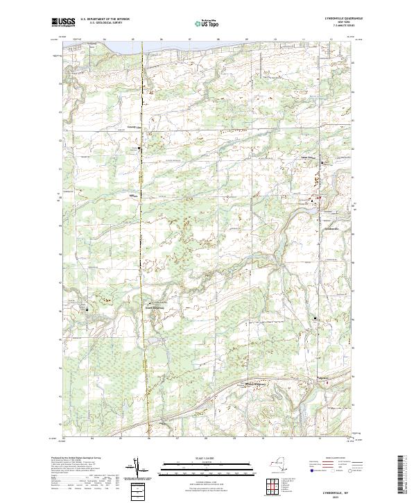 |
1951 Map No. 130384, 1951 Map No. 130385 | NA | Hartland (13%), Ridgeway (34%), Somerset (22%), Yates (59%) |
Current Medina GeoPDF Map |
1949 Map No. 130524, 1951 Map No. 130527 | Tonawanda WMA | Alabama (4%), Hartland (9%), Ridgeway (20%), Royalton (16%), Shelby (58%) |
Current Newfane GeoPDF Map |
1950 Map No. 130845, 1965 Map No. 130846 | NA | Hartland (4%), Newfane (73%), Somerset (5%) |
Current Niagara Falls GeoPDF Map |
1949 Map No. 128711, 1965 Map No. 128712 | NA | Grand Island (9%), Niagara Falls city (67%), Niagara (10%) |
Current Ransomville GeoPDF Map |
1950 Map No. 136015, 1965 Map No. 136016 | NA | Cambria (8%), Lewiston (63%), Niagara (15%), Porter (31%), Tuscarora Nation Reservation (100%), Wheatfield (6%), Wilson (5%) |
Current Sixmile Creek GeoPDF Map |
1949 Map No. 136173, 1965 Map No. 136174, 1973 Map No. 136175 | NA | Porter (38%), Wilson (10%) |
Current Tonawanda East GeoPDF Map |
1950 Map No. 139339, 1950 Map No. 139340, 1965 Map No. 139341, 1980 Map No. 139342 | NA | Amherst (31%), North Tonawanda city (64%), Pendleton (57%), Tonawanda city (41%), Tonawanda (13%), Wheatfield (39%) |
Current Tonawanda West GeoPDF Map |
1948 Map No. 139343, 1948 Map No. 139344, 1950 Map No. 139345, 1965 Map No. 139347 | Spicer Creek WMA | Grand Island (66%), Niagara Falls city (30%), Niagara (65%), North Tonawanda city (36%), Tonawanda city (57%), Tonawanda (3%), Wheatfield (51%) |
Current Wilson GeoPDF Map |
1949 Map No. 140342, 1965 Map No. 140343 | NA | Newfane (3%), Wilson (60%) |
Current Wolcottsville GeoPDF Map |
1950 Map No. 140363, 1965 Map No. 140364 | Tonawanda WMA, Tonawanda Creek Fishing Access | Clarence (25%), Lockport (2%), Newstead (47%), Royalton (23%) |
Oneida County


Onondaga County


Ontario County


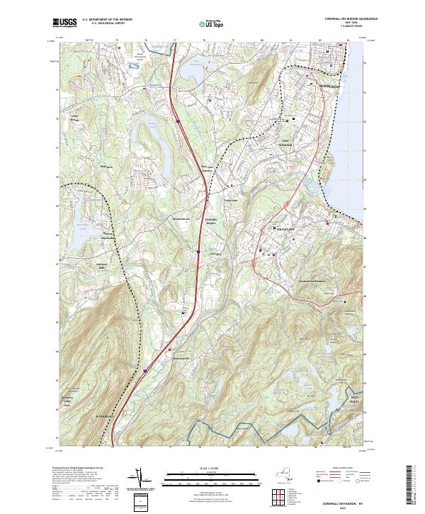
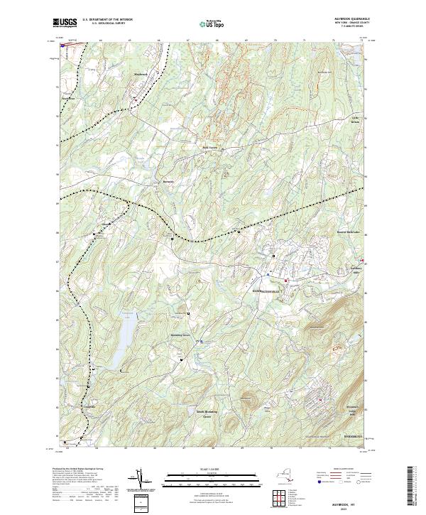
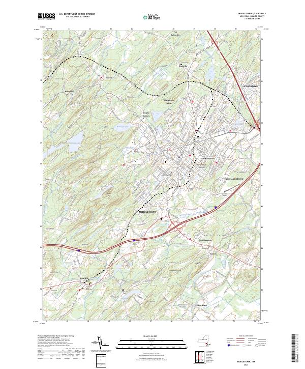
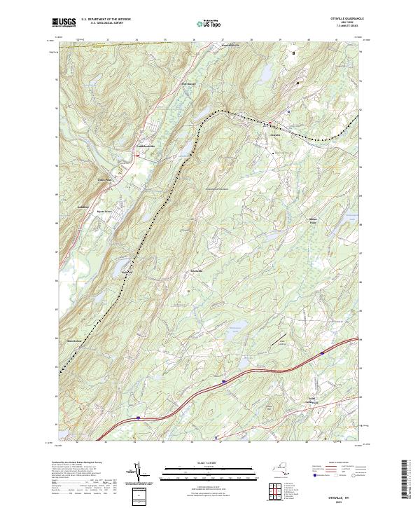
Orange County


Orleans County


Oswego County


Otsego County


USGS Topographic Maps – Sullivan to Yates County
Counties: Albany to Delaware / Dutchess to Livingston / Madison to Otsego / Putnam to Suffolk / Sullivan to Yates
Browse Topographic Maps: Full State / Historical USGS Topographic Maps
Sullivan County


Tioga County


Tompkins County


Ulster County


Warren County


Washington County


Wayne County


Westchester County


Wyoming County


Yates County


Locations and Maps of Lean-Tos in NYS
Interactive Map of Lean-Tos
You can get a downloadable, more detailed map with campsites, lean-tos, scenic vistas and trails.
Note: This list is sorted from North to South, and West to East in New York, therefore the farthest North Lean-To in NY State is in the Debar Mountain Wild Forest, and the farthest south one is in David A. Sarnoff Pine Barrens Preserve in Long Island. Location links take you to aerial photos of the Lean-Tos on the free ACME Mapper.
Download or View this Chart on Google Sheets
| State Forest Land | Name | Type | Description | Location |
|---|---|---|---|---|
| Debar Mtn. Wild Forest | Debar Mountian Lean-To | Lean-To | 44.598926, -74.228592 | |
| Debar Mtn. Wild Forest | Grass Pond Lean-To | Lean-To | 44.493389, -74.251194 | |
| Taylor Pond Wild Forest | North Shore Taylor Pond Lean-To | Lean-To | Managed By Operations | 44.4897, -73.861427 |
| Taylor Pond Wild Forest | South East Taylor Pond Lean-To | Lean-To | Managed By Operations | 44.482888, -73.853777 |
| Taylor Pond Wild Forest | Northwest Shore Taylor Pond Lean-To | Lean-To | Managed By Operations | 44.477689, -73.881283 |
| Taylor Pond Wild Forest | Poke-O-Moonshine Summit Lean-To | Lean-To | 44.399797, -73.514557 | |
| Saint Regis Canoe Area | Fish Pond Campsite 2 | Lean-To | 44.396133, -74.370421 | |
| Saint Regis Canoe Area | Fish Pond Campsite 5 | Lean-To | 44.391301, -74.365807 | |
| Saint Regis Canoe Area | St. Regis Pond South Shore Lean-To | Lean-To | Within The Adopt A Lean-To System | 44.380642, -74.320299 |
| Saint Regis Canoe Area | St. Regis Pond Campsite 19 | Lean-To | 44.380626, -74.320423 | |
| Wolf Lake State Forest | Beaver Flow Lean-To | Lean-To | 44.357822, -75.316001 | |
| Mckenzie Mtn. Wilderness | Loch Bonnie Lean-To | Lean-To | 44.347347, -73.995669 | |
| Mckenzie Mtn. Wilderness | White Face Brook Lean-To | Lean-To | 44.344217, -73.928647 | |
| Wolf Lake State Forest | Wolf Lake Lean-To | Lean-To | 44.336323, -75.313886 | |
| Saranac Lakes Wild Forest | Lake Placid Campsite 3 | Lean-To | 44.332595, -73.95668 | |
| Saranac Lakes Wild Forest | Lake Placid Campsite 2 | Lean-To | 44.332296, -73.956626 | |
| Wolf Lake State Forest | Moon Pond Lean-To | Lean-To | 44.332276, -75.321172 | |
| Saranac Lakes Wild Forest | Follensby Clear | Lean-To | 44.325095, -74.349897 | |
| Wolf Lake State Forest | Huckleberry Lake Lean-To | Lean-To | 44.324272, -75.333738 | |
| Mckenzie Mtn. Wilderness | Placid Lean-To | Lean-To | 44.321456, -74.030786 | |
| Saranac Lakes Wild Forest | Lean-To | 44.309124, -74.18053 | ||
| Saranac Lakes Wild Forest | Lean-To | 44.302887, -74.302634 | ||
| Saranac Lakes Wild Forest | Lean-To | 44.289835, -74.216869 | ||
| Saranac Lakes Wild Forest | Lean-To | 44.286942, -74.289775 | ||
| Saranac Lakes Wild Forest | Lean-To | 44.286657, -74.162602 | ||
| Saranac Lakes Wild Forest | Lean-To | 44.271712, -74.273283 | ||
| Saranac Lakes Wild Forest | Lean-To | 44.265599, -74.24293 | ||
| Hurricane Mountain Primitive Area | Lost Pond/Biesemeyer | Lean-To | 44.26073, -73.710011 | |
| Hurricane Mountain Primitive Area | Gulf Brook Lean-To | Lean-To | 44.253097, -73.71796 | |
| Saranac Lakes Wild Forest | Lean-To | 44.228772, -74.375533 | ||
| High Peaks Wilderness | Lean-To | 44.198805, -74.31831 | ||
| Horseshoe Lake Wild Forest | Eagle Landing Lean-To | Lean-To | 44.19683, -74.512309 | |
| High Peaks Wilderness | Lean-To | 44.177317, -74.321808 | ||
| Giant Mountain Wilderness | Giant Mtn. Lean-To | Lean-To | 44.175641, -73.722171 | |
| Giant Mountain Wilderness | Giant Mtn. Lean-To | Lean-To | 44.175641, -73.722171 | |
| Horseshoe Lake Wild Forest | Lean-To | 44.158907, -74.560725 | ||
| High Peaks Wilderness | Lean-To | 44.15683, -74.313308 | ||
| Cranberry Lake Wild Forest | Lean-To | 44.1534, -74.884029 | ||
| High Peaks Wilderness | Lean-To | 44.147236, -74.318105 | ||
| Dix Mountain Wilderness | Bouquet Lean-To | Lean-To | 44.110904, -73.774043 | |
| High Peaks Wilderness | Lean-To | 44.105829, -74.312037 | ||
| Sargent Ponds Wild Forest | Lean-To | 44.102744, -74.321863 | ||
| Sargent Ponds Wild Forest | Lean-To | 44.082504, -74.333915 | ||
| Sargent Ponds Wild Forest | Lean-To | 44.081407, -74.335829 | ||
| High Peaks Wilderness | Lean-To | 44.065927, -74.326697 | ||
| Dix Mountain Wilderness | Lilian Brook Lean-To | Lean-To | 44.058989, -73.806533 | |
| Dix Mountain Wilderness | Slide Brook Lean-To | Lean-To | 44.044126, -73.805858 | |
| High Peaks Wilderness | Lean-To | 44.042977, -74.349335 | ||
| High Peaks Wilderness | Lean-To | 44.041409, -74.350149 | ||
| High Peaks Wilderness | Lean-To | 44.02862, -74.366763 | ||
| High Peaks Wilderness | Lean-To | 44.002655, -74.38648 | ||
| William C. Whitney Wilderness | Lake Lila # 7 | Lean-To | 44.002145, -74.775682 | |
| High Peaks Wilderness | Lean-To | 43.998164, -74.392741 | ||
| Independence River Wild Forest | Trout Pond Lean To | Lean-To | 43.928489, -74.94487 | |
| Independence River Wild Forest | Trout Pond Lean To | Lean-To | 43.928489, -74.94487 | |
| Sargent Ponds Wild Forest | Deerland Carry Lean-To 2 | Lean-To | Fair Condition | 43.926218, -74.475396 |
| Sargent Ponds Wild Forest | Deerland Carry Lean-To 1 | Lean-To | Fair Condition | 43.925781, -74.475846 |
| Sargent Ponds Wild Forest | Pinebrook Lean-To | Lean-To | Fair Condition | 43.906646, -74.50259 |
| Sargent Ponds Wild Forest | Lean-To | 43.902847, -74.548063 | ||
| Blue Mountain Wild Forest | North End Tirrel Pond Lean-To | Lean-To | 43.887378, -74.377739 | |
| Sargent Ponds Wild Forest | Lean-To | 43.879414, -74.606052 | ||
| Blue Mountain Wild Forest | O’neil Lean-To | Lean-To | 43.875096, -74.367316 | |
| Sargent Ponds Wild Forest | Lean-To | 43.871006, -74.628108 | ||
| Sargent Ponds Wild Forest | Lean-To | 43.870772, -74.628507 | ||
| Sargent Ponds Wild Forest | Lean-To | 43.87072, -74.629172 | ||
| Sargent Ponds Wild Forest | Lower Sargents Pond Lean-To | Lean-To | Fair Condition | 43.859331, -74.562695 |
| Blue Ridge Wilderness | Boulder | Lean-To | 43.841564, -74.472689 | |
| Sargent Ponds Wild Forest | Lean-To | 43.836898, -74.535266 | ||
| Moose River Plains Wild Forest | Lean-To | 43.831671, -74.661756 | ||
| Moose River Plains Wild Forest | Lean-To | 43.831605, -74.661511 | ||
| Moose River Plains Wild Forest | Lean-To | 43.831434, -74.660902 | ||
| Blue Ridge Wilderness | Cascade Pond Lean-To | Lean-To | 43.829744, -74.436618 | |
| Independence River Wild Forest | Panther Pond Lean-To | Lean-To | 43.823535, -75.169312 | |
| Blue Ridge Wilderness | Wilson Pond | Lean-To | 43.820192, -74.46868 | |
| Blue Ridge Wilderness | Stephens Pond | Lean-To | 43.818674, -74.420524 | |
| Blue Ridge Wilderness | Stephens Pond | Lean-To | 43.818674, -74.420524 | |
| Blue Ridge Wilderness | Stephens Pond | Lean-To | 43.818674, -74.420524 | |
| Blue Ridge Wilderness | Stephens Pond | Lean-To | 43.818674, -74.420524 | |
| Blue Ridge Wilderness | Stephens Pond | Lean-To | 43.818674, -74.420524 | |
| Blue Ridge Wilderness | Stephens Pond | Lean-To | 43.818674, -74.420525 | |
| Sargent Ponds Wild Forest | Lean-To | 43.817134, -74.64378 | ||
| Sargent Ponds Wild Forest | Lean-To | 43.81709, -74.643251 | ||
| Sargent Ponds Wild Forest | Lean-To | 43.8162, -74.644668 | ||
| Blue Ridge Wilderness | Blue Ridge Lean-To | Lean-To | 43.80014, -74.610139 | |
| Moose River Plains Wild Forest | 8thlake East Shore Lean-To | Lean-To | 43.789783, -74.698592 | |
| Moose River Plains Wild Forest | 8th Lake North Shore Lean-To | Lean-To | 43.780115, -74.704439 | |
| Moose River Plains Wild Forest | 8th Lake Island Lean-To | Lean-To | 43.779025, -74.704429 | |
| Moose River Plains Wild Forest | Lean-To | 43.75639, -74.717817 | ||
| Moose River Plains Wild Forest | Lean-To | 43.750767, -74.734643 | ||
| Moose River Plains Wild Forest | Lean-To | 43.747805, -74.744199 | ||
| Independence River Wild Forest | Pine Lake Lean-To | Lean-To | 43.708394, -75.146453 | |
| Haderondah | Middle Branch Lake | Lean-To | 43.702926, -75.096002 | |
| Siamese Ponds Wilderness | Hour Pond Lean-To | Lean-To | 43.70112, -74.158221 | |
| Haderondah | Cedar Pond Lean To | Lean-To | 43.69597, -75.082602 | |
| Haderondah | Middle Settlement Lake | Lean-To | 43.685949, -75.098614 | |
| West Canada Lakes Wilderness | Colvin Brook Lean-To | Lean-To | 43.652414, -74.49038 | |
| Lake George Wild Forest | Five Mile Mountain Lean-To | Lean-To | Lean-To W/ Privy And Firering | 43.647336, -73.574534 |
| Black River Wild Forest | Remsen Falls Lean-To | Lean-To | 43.629925, -75.036288 | |
| Lake George Wild Forest | Fifth Peak Lean-To | Lean-To | Lean-To W/ Privy And Firering | 43.619313, -73.584112 |
| Black River Wild Forest | Woodhull Lake Lean-To | Lean-To | 43.599885, -75.020382 | |
| Lake George Wild Forest | Black Mountain Ponds Lean-To | Lean-To | Lean-To With Privy And Firering | 43.59966, -73.533064 |
| West Canada Lakes Wilderness | Pillsbury Lake Lean-To | Lean-To | 43.596898, -74.531665 | |
| Lake George Wild Forest | Lean-To | Campsite With Lean-To 13-27 | 43.595821, -73.517951 | |
| Lake George Wild Forest | Lean-To | Campsite With Lean-To 5-10 | 43.587168, -73.527759 | |
| Lake George Wild Forest | Greenland Pond Leanto | Lean-To | Leanto With Privy, Picnic Table And Fire Ring | 43.577804, -73.51684 |
| Lake George Wild Forest | Fishbrook Pond North Leanto | Lean-To | Leanto With Privy, Picnic Table And Fire Ring | 43.576039, -73.536103 |
| Lake George Wild Forest | Fishbrook Pond South Leanto | Lean-To | Leanto With Privy, Picnic Table And Fire Ring | 43.573872, -73.538477 |
| Black River Wild Forest | Sand Lake Falls Lean-To | Lean-To | 43.558914, -75.003058 | |
| Black River Wild Forest | Gull Lake Lean-To | Lean-To | 43.553747, -75.059378 | |
| Black River Wild Forest | Chub Pond Lean-To #2 | Lean-To | 43.529823, -75.042494 | |
| Black River Wild Forest | Chub Pond Lean-To #1 | Lean-To | 43.524598, -75.043801 | |
| West Canada Lakes Wilderness | T Lake Leant-To | Lean-To | 43.452718, -74.582282 | |
| Silver Lake Wilderness | Hamilton Lake Stream Lean-To 1 | Lean-To | 43.39716, -74.455046 | |
| Silver Lake Wilderness | Hamilton Lake Stream Lean-To 2 | Lean-To | 43.397156, -74.455065 | |
| Cobb Brook State Forest | Leanto | Lean-To | 43.344545, -75.67222 | |
| Silver Lake Wilderness | Mud Lake Lean-To | Lean-To | 43.342671, -74.456291 | |
| Deruyter State Forest | Deruyter Lean-To | Lean-To | 42.820185, -75.859105 | |
| Morgan Hill State Forest | Morgan Hill Lean-To | Lean-To | 42.767202, -76.011256 | |
| Perkins Pond State Forest | Flt Lean-To | Lean-To | 42.642307, -75.743766 | |
| Dutch Settlement State Forest | Lean-To | Lean-To | 42.629438, -74.267543 | |
| Whaupaunaucau State | Leanto | Lean-To | 42.606063, -75.467114 | |
| Burnt-Rossman Hills State Forest | Eminence Lean-To | Lean-To | 42.543304, -74.488595 | |
| Clapper Hollow State Forest | Clapper Hollow Lean-To | Lean-To | 42.528201, -74.642004 | |
| Tuller Hill State Forest | Tuller Hill Lean-T0 | Lean-To | Rebuilt In 2002 From Local State Forest Red Pine, Built By Volunteers From Suny Cortland | 42.512201, -76.120824 |
| Kennedy State Forest | Foxfire Leanto | Lean-To | 42.472853, -76.178732 | |
| Ludlow Creek State Forest | Ludlow Creek Lean-To | Lean-To | 8′ X 10′ | 42.445802, -75.701507 |
| Genegantslet State Forest | Top Ten Lean-To | Lean-To | 20′ X 20′ | 42.422887, -75.767435 |
| Robinson Hollow State Forest | Kimme Lean-To | Lean-To | 42.390596, -76.271801 | |
| Sugar Hill State Forest | Vanzandt Lean-To | Lean-To | 42.389935, -76.972601 | |
| Sugar Hill State Forest | The Twin Lean-To’s | Lean-To | Two Lean-To At This Location | 42.382253, -77.00268 |
| Sugar Hill State Forest | Templar Rd Lean-To | Lean-To | 42.373082, -76.95548 | |
| Sugar Hill State Forest | Parks Hollow Lean-To | Lean-To | 42.369463, -77.012608 | |
| Huntersfield State Forest | Lean-To | Lean-To | 42.355041, -74.346067 | |
| Beebe Hill State Forest | Beebe Hill Lean-To | Lean-To | 42.335425, -73.484181 | |
| Shindagin Hollow State Forest | Shindagin Lean-T0 | Lean-To | Scheduled For Replacement In 2004 | 42.327644, -76.329036 |
| Danby State Forest | Bald Hill Lean-To | Lean-To | 42.327042, -76.490061 | |
| Danby State Forest | Travor Rd Lean-To | Lean-To | 42.317642, -76.422544 | |
| Harvey Mountain State Forest | Harvey Mountain Lean-To | Lean-To | 42.313988, -73.441495 | |
| Burt Hill State Forest | On Finger Lake Trail Lean-To | Lean-To | 42.313213, -77.566373 | |
| Elm Ridge Wild Forest | On Elm Ridge Trail Lean-To | Lean-To | 42.306134, -74.173598 | |
| South Bradford State Forest | Moss Hill Lean-To | Lean-To | 42.289116, -77.118881 | |
| Windham Blackhead Range Wilderness | Batavia Kill Lean-To | Lean-To | 42.278839, -74.102579 | |
| Rusk Mountain Wild Forest | John Robb Leanto Lean-To | Lean-To | 42.189374, -74.238696 | |
| Rusk Mountain Wild Forest | Diamond Notch Lean-To | Lean-To | 42.16917, -74.256848 | |
| Hunter-West Kill Mountain Wilderness | Devil’s Acre Lean-To | Lean-To | Good Condition | 42.165955, -74.229624 |
| Arctic China State Forest | A-40 Lean-To | Lean-To | 42.158491, -75.362027 | |
| Barbour Brook State Forest | A-41 Lean To | Lean-To | 42.152807, -75.31021 | |
| Lean-To | 42.135655, -74.16269 | |||
| Dry Brook Ridge Wild Forest | German Hollow Road Lean-To | Lean-To | 42.134527, -74.616198 | |
| Lean-To | 42.119518, -74.086575 | |||
| Lean-To | 42.117719, -74.503199 | |||
| Lean-To | 42.115031, -74.49075 | |||
| Lean-To | 42.102787, -74.394826 | |||
| Lean-To | 42.098467, -74.09079 | |||
| Big Indian Wildernes Area | Rider Hollow Lean-To | Lean-To | 42.092012, -74.505713 | |
| Lean-To | 42.082185, -74.586611 | |||
| Big Indian Wildernes Area | Mckinly Hollow Lean-To | Lean-To | 42.075339, -74.485857 | |
| Lean-To | 42.071935, -74.28035 | |||
| Lean-To | 42.069751, -74.287449 | |||
| Lean-To | 42.067368, -74.586988 | |||
| Lean-To | 42.066913, -74.654635 | |||
| Big Indian Wildernes Area | Shandaken Brook Lean-To | Lean-To | 42.050274, -74.5106 | |
| Delaware Wild Forest | Campbell Mountain Trail Lean-To | Lean-To | 42.048989, -74.927363 | |
| Lean-To | 42.048641, -74.645056 | |||
| Lean-To | 42.039437, -74.594017 | |||
| Lean-To | 42.027316, -74.335645 | |||
| Delaware Wild Forest | Trout Pond Trail North Lean-To | Lean-To | Built For Ada | 42.012942, -74.946392 |
| Delaware Wild Forest | Trout Pond Trail South Lean-To | Lean-To | Built For Ada | 42.011758, -74.947566 |
| Big Indian Wildernes Area | Biscuit Brook Lean-To | Lean-To | 42.009105, -74.483852 | |
| Delaware Wild Forest | Pelnor Hollow Trail Lean-To | Lean-To | 42.005744, -74.867403 | |
| Big Indian Wildernes Area | Fall Brook Lean-To | Lean-To | 41.998075, -74.560392 | |
| Lean-To | 41.959182, -74.406877 | |||
| Lean-To | 41.94006, -74.632055 | |||
| David A. Sarnoff Pine Barrens Preserve | Interior Lean- To | Lean-To | 40.89774, -72.660615 |

East Branch of Sacandaga River and NY 8
Interactive Map
Here is an interactive map of the campsites and trails along the East Branch of Sacandaga River.
Printable Map
Here are several helpful printable maps.
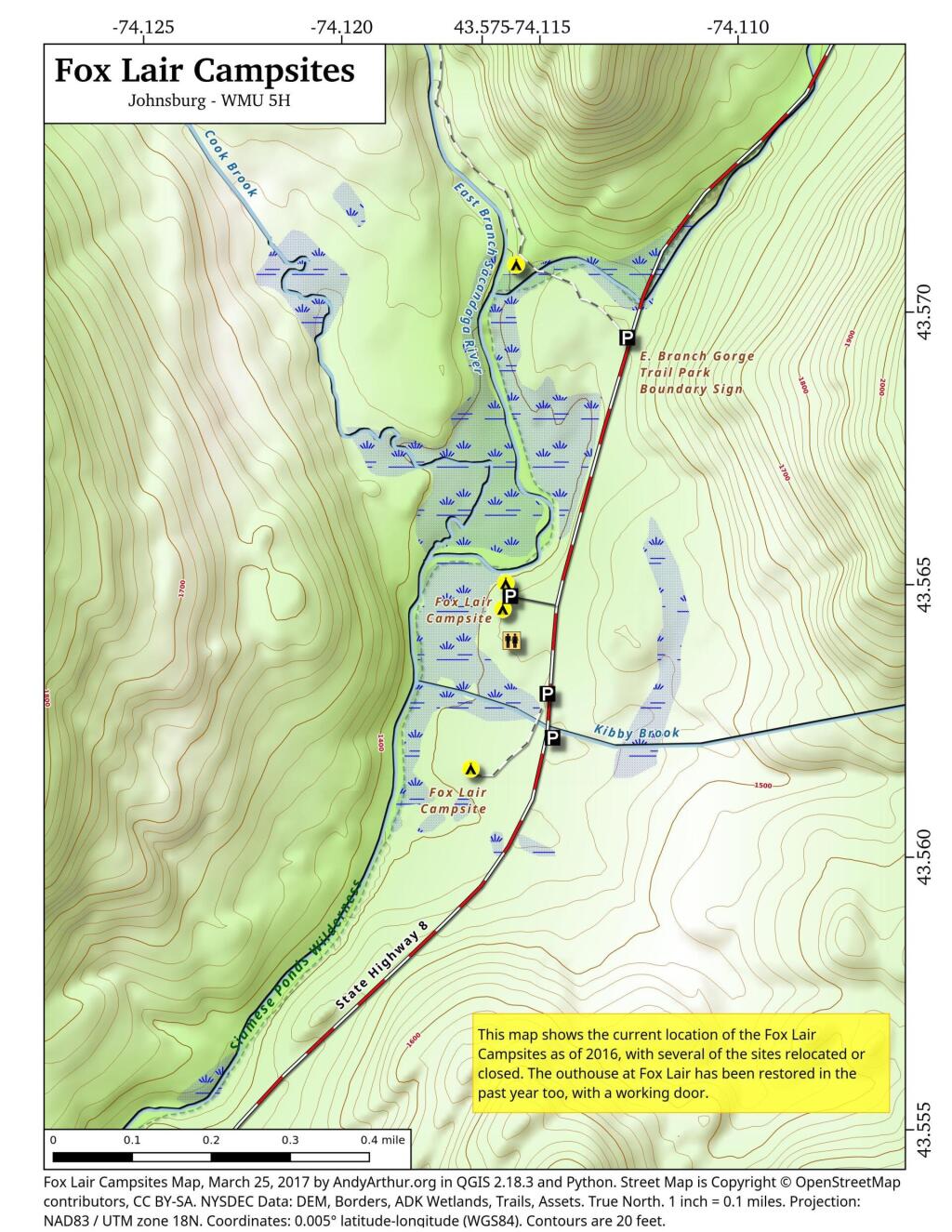
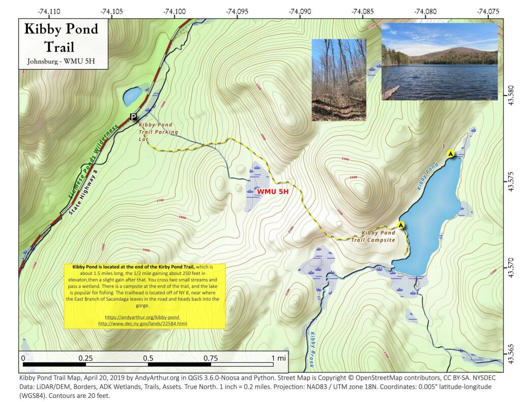
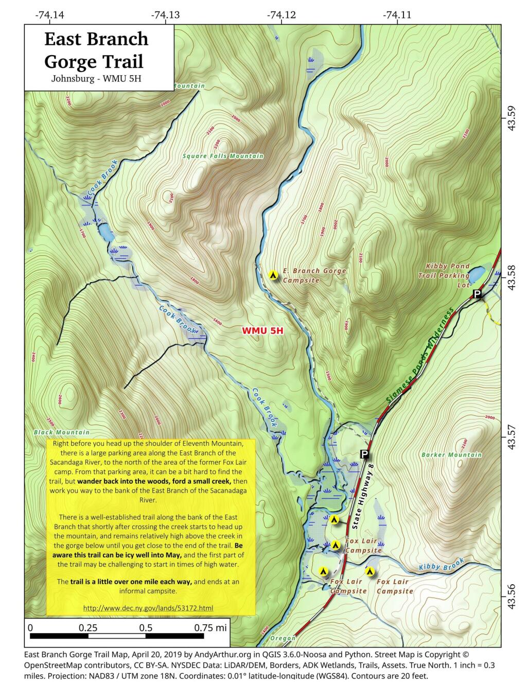
List and Coordinates for Campsites and Trailheads
Here is a list of campsites, trailheads and other destinations along NY 8 and East Branch Sacandaga River. You can also get this as a Google Sheets.
| Name | Details | Latitude | Longitude |
| 11th Mountain Parking Lot | Large > 20 Cars | 43.5903782 | -74.0900314 |
| 11th Mountain Trailhead Campsite | Near large parking area for 11th Mountain | 43.5901834 | -74.0910822 |
| Boulder Rock Campsite | Cave-Like Site Against Large Erratic | 43.5384607 | -74.1215703 |
| Cod Pond Parking Lot | Medium 5 – 20 Cars, across from campsite 7 and 8 | 43.5301580 | -74.1455890 |
| Cod Pond Trail Campsite | At end of Cod Pond trail on pond | 43.5176969 | -74.1437559 |
| County Line Brook Trail Campsite | Along County Line Trail | 43.5242772 | -74.1892664 |
| County Line Campsite | End of County Line Trail | 43.5022688 | -74.1828085 |
| E. Branch Gorge Campsite | End of East Branch George, near Waterfalls | 43.5803187 | -74.1209517 |
| E. Branch Gorge Trail Parking Area | Small < 5 Cars | 43.5690250 | -74.1132232 |
| Eagle Pond Campsite | Near Eagle Pond | 43.5401509 | -74.1167243 |
| East Sacandaga River Parking Picnic Area | DOT Maintained Roadside Parking And Picnic Area | 43.4783862 | -74.2010766 |
| Forks Mountain Trail – Bushwhack to Auger Falls | 43.4685687 | -74.2457562 | |
| Georgia Creek Parking Lot | Medium 5 – 20 Cars | 43.4915171 | -74.1892866 |
| Girrad Sugarbush Trailhead | 43.4764458 | -74.2043731 | |
| Griffin Connector Parking Lot At Route 8 | Medium 5 – 20 Cars | 43.4703209 | -74.2248680 |
| Kibby Pond Campsite #3 | Far End of Lake | 43.5766649 | -74.0781098 |
| Kibby Pond Trail #2 | End of Trail | 43.5725581 | -74.0821443 |
| Kibby Pond Trail Parking Lot | Small <5 Cars | 43.5789951 | -74.1033601 |
| Little Joe Pond Campsite | At Little Joe Pond | 43.5055662 | -74.1423052 |
| Little Joe Pond Picnic Site | 43.5039558 | -74.1422817 | |
| Mud Ponds Campsite | At Mud Point | 43.5650797 | -74.1739273 |
| NY 8 Campsite 1 | Old Routing of 8, Near Kibby Pond Area | 43.5771279 | -74.1054574 |
| NY 8 Campsite 2 | Overlooks Cliff | 43.5650960 | -74.1160232 |
| NY 8 Campsite 3 | Long dirt road to open area | 43.5616391 | -74.1169664 |
| NY 8 Campsite 4 | Dirt road to campsite above Kibby Brook | 43.5612062 | -74.1138524 |
| NY 8 Campsite 5 | Old home site, sits on ledge above NY 8 | 43.5542527 | -74.1234025 |
| NY 8 Campsite 7 | 1/4 mile north of Cod Pond Parking | 43.5328656 | -74.1440210 |
| NY 8 Campsite 8 | Near Cod Pond Parking | 43.5316564 | -74.1459341 |
| NY 8 Campsite 9 (Seasonal Use) | Route 8 Near Little Joe Trail Pulloff With Fire Ring (Campsite Removed During Winter) | 43.5149220 | -74.1583197 |
| NY 8 Campsite 10 | Gravel Pit 1/4 mile south of Girrad Sugarbush Trailhead | 43.4761691 | -74.2072253 |
| Oregon Trail Primitive Campsite | Beyond Stewart Creek Snomwobile Bridge | 43.5194607 | -74.1339532 |
| Parking Lot | Medium 5 – 20 Cars | 43.5355769 | -74.1414217 |
| Shanty Brook Trail Campsite | Along Shanty Brook Trail | 43.5460737 | -74.1459537 |
| Shanty Falls Parking Lot | Small <5 | 43.5376556 | -74.1409559 |
| Square Falls | 43.5814233 | -74.1218099 | |
| Stewart Creek Bridge | 43.5204188 | -74.1356239 | |
| Stewart Creek Flume | 43.5204188 | -74.1356239 | |
| Stewart Creek Lower Falls | 43.5225332 | -74.1365675 | |
| Teachout Road Bridge Over Griffin Falls | 43.4733545 | -74.2236654 | |
| Teachout Road Parking at Griffin Falls | 43.4737995 | -74.2238438 |