State Office Campus – 1995, 2001, 2004, 2007, 2011, 2014, 2017, 2021
A look at changes at the state office campus over the past 25 years.
A look at changes at the state office campus over the past 25 years.
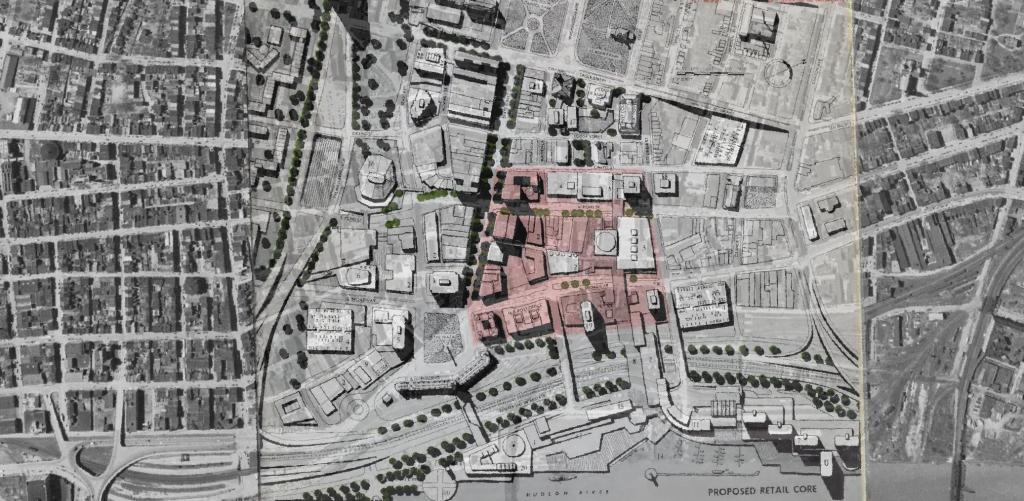
I was experimenting with QGIS and old maps from the 1963 Plan for the Capital City and overlaid the proposed development plan over an aerial photo of the city from 1952. While overall this plan didn't come to fruition, many elements did and can be seen in the contemporary downtown.
This map shows highly detailed contours for the East Barrens of the Albany Pine Bush.
Data Source: NYS GIS Program Office. NYS LIDAR Coverage. http://gis.ny.gov/elevation/lidar-coverage.htm
It looks like Ezra Price was constructed around 1967, while the Mount Hope Development row houses were built from 1964-1970. Probably a subsidized development to make up for losses to downtown's residential core when the Empire State Plaza was built. I'm interested and trying to dig more into details.
Some history about Ezra Price and his estate in Mount Hope during the 1830s: https://friendsofalbanyhistory.wordpress.com/2019/10/23/albanys-mount-hope-and-ezra-prentice/
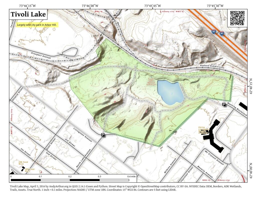
A high resolution, LiDAR contour map of Tivoli Lake Preserve. This shows the current land forms, including fill and cuts of the preserve in recent decades, not reflected on many other maps of this preserve.