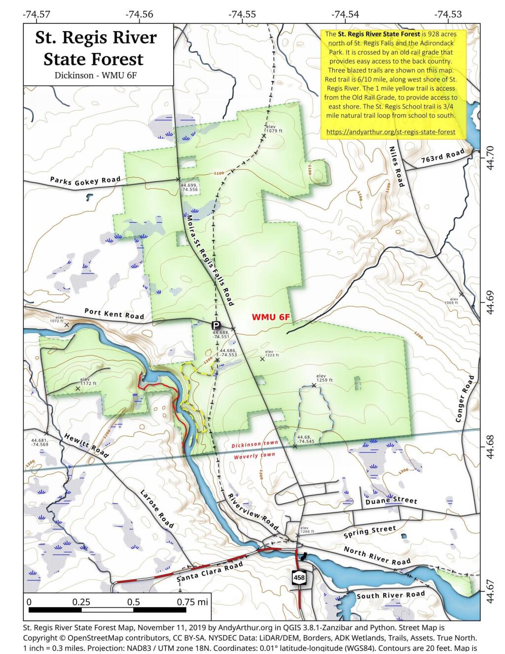
The St. Regis River State Forest is 928 acres north of St. Regis Falls and the Adirondack Park. It is crossed by an old rail grade that provides easy access to the back country. Three blazed trails are shown on this map. Red trail is 6/10 mile, along west shore of St. Regis River. The 1 mile yellow trail is access from the Old Rail Grade, to provide access to east shore. The St. Regis School trail is 3/4 mile natural trail loop from school to south.
More details from NYS DEC on St Regis State Forest.
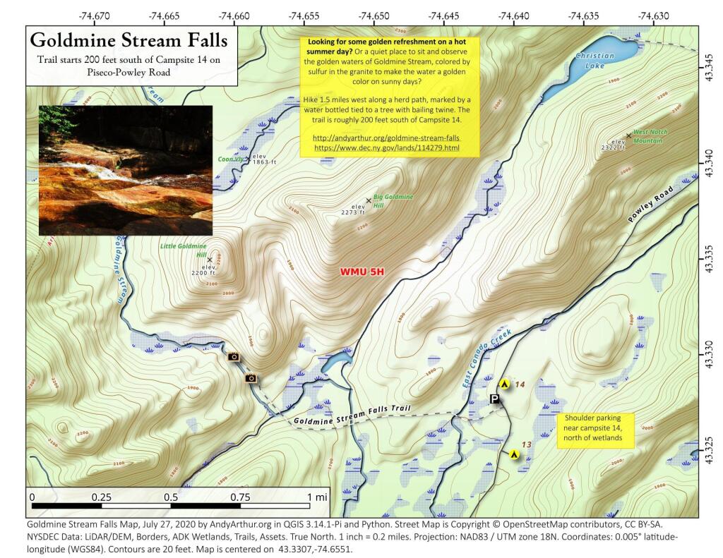
43.33072545558804,-74.6550531605912
Looking for some golden refreshment on a hot summer day? Or a quiet place to sit and observe the golden waters of Goldmine Stream, colored by sulfur in the granite to make the water a golden color on sunny days?
Hike 1.5 miles west along a herd path, marked by a water bottled tied to a tree with bailing twine. The trail is roughly 200 feet south of Campsite 14.
https://andyarthur.org/goldmine-stream-falls
https://www.dec.ny.gov/lands/114279.html
Portageville is a hamlet located in the town of Genesee Falls in Wyoming County, New York. Its name derives from the Native American canoeists who would withdraw their craft from the river to avoid going over three waterfalls in the Genesee River gorge now known as Portage Falls. They had to portage several miles to the site of present-day Mount Morris, where they could embark for the rest of the journey downriver.
Past Auger Falls is quite visible on the aerial photography as the road remains cleared as a grass covered snowmobile trail with most of the pre-1968 routing still visible.