Search Results for: "Map:" Summit Lake
Glidden Marsh To Pharaoh Lake Trail
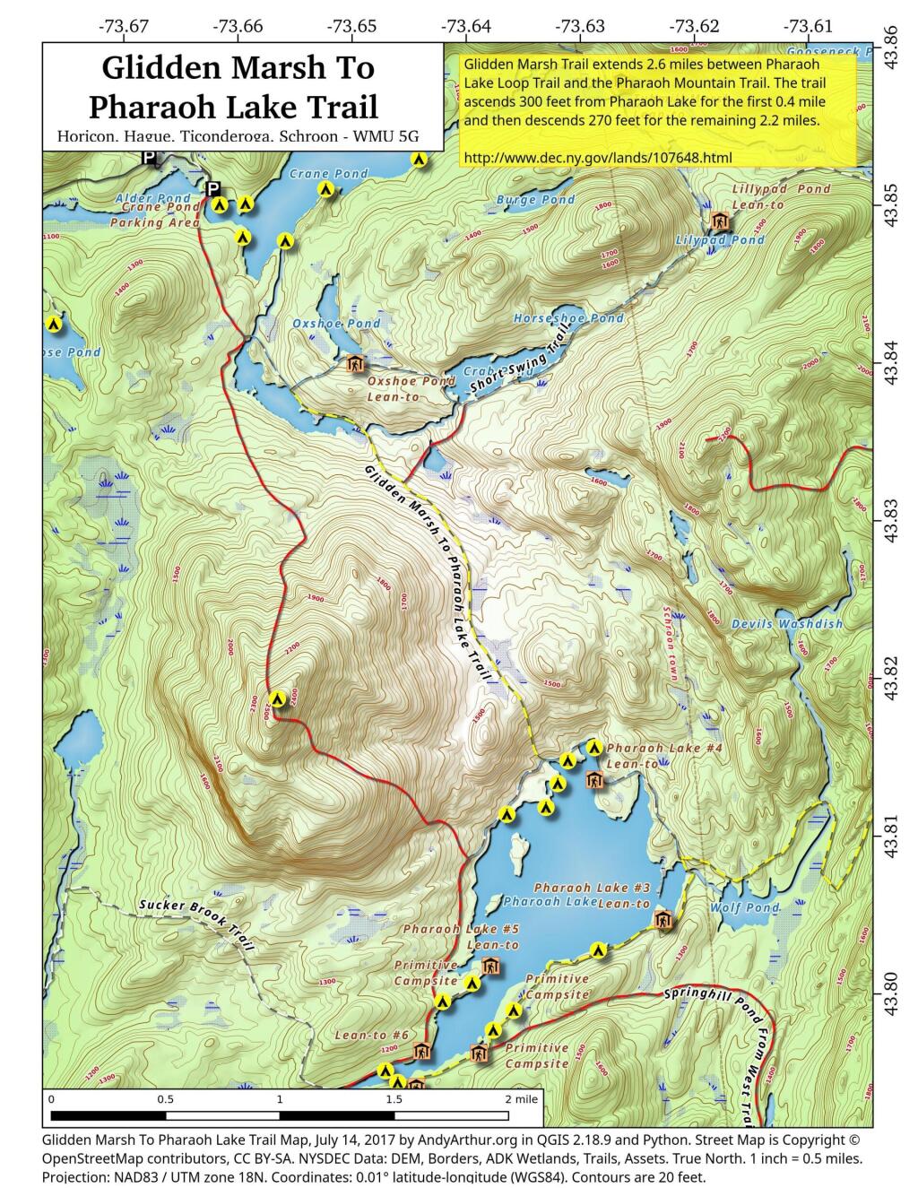
There are two ways to get between Crane Pond and Pharaoh Lake. One brings you over Pharoah Mountain, which has great views but it's a much bigger climb, especially on the southern side.
Pharaoh Mountain Trail (2,556 feet) extends 3.8 miles between the Pharaoh Lake Trail and Crane Pond Trail. The trails ascends 1,355 feet in 1.2 miles to the summit and then descends 1,405 feet in 2.6 miles to Crane Pond.
Glidden Marsh Trail extends 2.6 miles between Pharaoh Lake Loop Trail and the Pharaoh Mountain Trail. The trail ascends 300 feet from Pharaoh Lake for the first 0.4 mile and then descends 270 feet for the remaining 2.2 miles.
Debar Mountain Trail
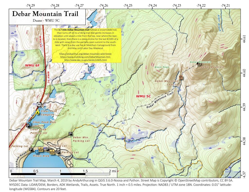
Debar Mountain Trail (3,305 feet) extends 3.7 miles and ascends 1,725 feet from the trailhead within Meacham Lake Campground to the summit of the mountain. The trail ascends only 170 feet in the first 1.9 miles and ascends 755 feet in the next 1.3 miles. The last portion of the trail is steep, climbing 800 feet in the 0.5 mile to the summit. A lean-to is located along the trail just before the last steep section to the summit. Views at the top are limited by the trees growing on the summit but include the High Peaks to the south. When the campground is open, hikers are required to pay a day-use fee.
Prospect Mountain Hiking Trail
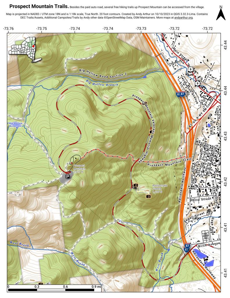
"The red DEC marked Prospect Mountain Trail is 1.5 miles long, leads steeply at times to the 2021 foot summit of Prospect Mountain. To reach the trail from Lake George Village, turn left on Montcalm Street to Smith Street. At Smith Street, turn south a half block to the sign indicating the start of the trail, where it crosses the Northway on a pedestrian bridge. The climb to the summit is difficult but rewarding."
Hoye-Crest Trail
The trail to Maryland's highest point on Backbone Mountain can be accessed from US 219 in Silver Lake, West Virigina. Only the summit is in Maryland.
Black Mountain
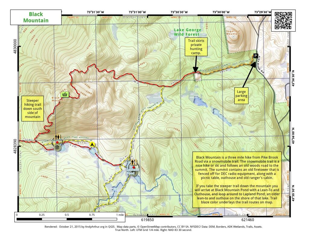
Black Mountain is a three mile hike from Pike Brook Road via a snowmobile trail. The snowmobile trail is a nice hike or ski and follows an old woods road to the summit. The summit contains an old firetower this is fenced off for DEC radio equipment, along with a picnic table, outhouse, and old ranger's cabin.
If you take the steeper trail down the mountain you will arrive at Black Mountain Pond with a Lean-To and Outhouse, and loop around to Lapland Pond, an older lean-to and outhouse on the shore of the lake. Trail blaze color underlays the trail routes on the map.
Texas Hollow State Forest – Finger Lakes Trail
Been exploring this today. Really nice views of the Connecticut Hill WMA and Cayuta Lake from Carlie Road just past the summit.